Hybrid Survey methodology using. Aerial Photography and Ground Truthing with TS/DGPS. in Bihar
|
|
|
- Dorothy Sutton
- 7 years ago
- Views:
Transcription


1 Hybrid Survey methodology using Aerial Photography and Ground Truthing with TS/DGPS in Bihar Mithilesh Mishra (IAS) Director, Land Records & Survey, Revenue & Land Reforms Dept, Govt of Bihar
2 Land Survey of Bihar had been earlier carried out in the year In the last hundred years, actual picture on the ground has changed a lot. Old cadastral maps face critical preservation issues. Many new Districts/Circles and Village Panchayats and Municipal bodies have been created since the last survey which poses great difficulties in today s revenue administration.
3 1. Hybrid Method Aerial Photography Ground thruthing (with TS + DGPS) Generation of Map 2. Collection of Plot ownership information 3. Integration of Map with ROR
4 Old Technique vs. Modern Technology Complex, tiresome and time taking and labour oriented. Change of scale in the map is a very complicated and difficult process. Plot wise map for holders/ farmers from the Mauza map is very cumbersome. Updation is not possible. Solution of land disputes becomes difficult in absence of updated land records. Map of approx. 100 sq. km area can be prepared in one hour using Aerial Photography method. Change of scale in the digital map is easily done with full accuracy. Generation of plot map is easy. Updation is very much possible. No issue in updation. Contd
5 Permission for Aerial Photography Setting up the Ground Control Network - Primary, Secondary and Tertiary Control Points. Aerial data acquisition through aerial photography with Ground Sampling Distance (GSD) of 10 cm or better. Generation of land parcel maps in 1:4000 scale and 1:1000 scale for Abadi area. Alignment of map with ground realities Comparison of new re-survey maps with CS/RS Map and map based plot area with chalu khatiyan / khesra panji. The Survey & Settlement Office shall verify boundaries of the land parcel on the hardcopy in the presence of the owner(s) /enjoyer(s) of the adjacent land parcel. In case any variation is found with respect to ground realities, maps to be re-generated with the revised land parcel map based on their TS reading and obtain acknowledgement / objection.
6 Aerial photography is the taking of photographs of the ground from an elevated position. The term usually refers to images in which the camera is not supported by a ground-based structure. Platforms for aerial photography include fixed-wing aircraft, helicopters, multirotor Unmanned Aircraft Systems (UAS), balloons, blimps and dirigibles, rockets, kites, parachutes, stand-alone telescoping and vehicle mounted poles.
7 Flight, acquiring of images Image processing Processing of GPS/IMU (Inertial Measuring Unit) Aerial Triangulation Digital Terrain Model Ortho-rectification and mosaicking process Delivery of final data in.shp format

8 16 Districts Overview NEW PATHS. NEW APPROACHES
9 PGCP - Supaul PGCP - Saharsa Madhepura PGCP
10
11 BASE
12 Aircraft Used for Flying from CAE Aviation D-FCAE (Delta Fox Charlie Alfa Eco)
13 Camera - UtlraCam XP
14 Aircraft Aerial Camera ZEISS RMK TOP 30 Aerial Camera ZEISS RMK TOP Film Magazine with FMC CCNS Navigation Unit with Airborne GPS Beechcraft KING AIR C90 (Pressurized Cabin Aircraft) Max.Flight Duration: 5 hours, Ceiling: feet, Speed : Knots AEROCONTROL II (Inertial Measurement Unit) Gyro Stabilised Mount Omnistar FUGRO Airborne DGPS Ashtech Z Ssurveyor GPS Base Receiver Two Pilots along with two navigators and one security officer are crew members in flight.

15 Camera Fitted 60% forward overlap and 30% side lap
 Almost 100 Sq.")
16 Digital Photogrammetry ( GPS Geodetic cadastral control + Image + Topographic features + map) Almost 100 Sq. Km survey in one hour with aircraft GPS Satellites GPS Receivers Base Station
17 Camer a Temporary Mass Storage Raw Data process Archive System Aerial photo capturing Plotter Digital WorkStation
18 Base station at Biharsharif 25 10'11.60"N 85 30'53.06"E Base Station Patna Airport PCP Flight Path For accuracy Global Navigation Satellite System (GNSS) will be used with ground reference stations. Two or three of ground stations will be established on safe locations. One station will be set up close to the Airport. The other 1 or 2 stations will be placed in such a way that the distance to the aircraft is max. 70 km for high accuracy of the airborne GNSS data.
19 Plot C Plot E Plot D Plot A Plot B Aerial Survey Aerial Survey + DGPS Aerial view of plot with tree Crops on Field Land Parcel boundary
20 To Katrisarai N Giriak Sakri River Land Parcel

21
22
23 Primary Control Point Madhepura
24 NOTIFICATION BOUNDARY IDENTIFICATION ON FIELD GOVT LAND VERIFICATION ON FIELD EXPLAINING KISTWAR TO DEPT SURVEYORS Reconciliation Report INTIAL SUBMISSION MAP FOR KISTWAR KISTWAR COMPLETED & UPDATED MAP NEW PATHS. NEW APPROACHES
25 GRAMSABHA GRAMSABHA RECORD FIELD WORK NOTIFICATION DEMARCATION OF PLOTS ROR DATA PREPARATION NEW PATHS. NEW APPROACHES


26 ETS SURVEY SURVEY TEAMS FIELD VISITING
27

28 Aerial Flying inaugurated by Shri Nitish Kumar, Hon ble Chief Minister of Bihar NEW PATHS. NEW APPROACHES


29 Begusarai Lab. Bihar Survey Off., Gulzarbagh Khagaria Lab. NEW PATHS. NEW APPROACHES
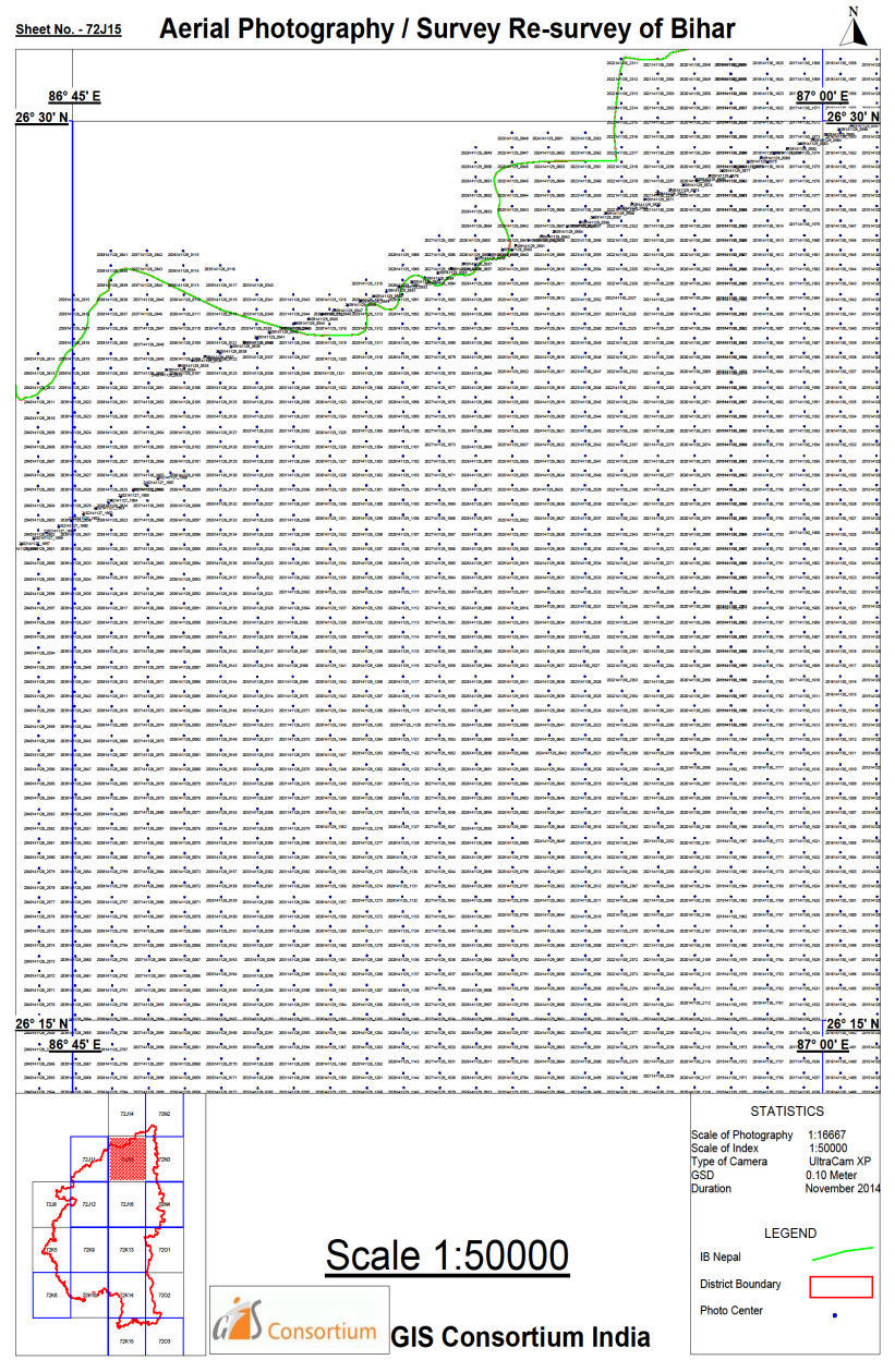
30 Total area of survey of Bihar is 93,358.8 sq. km. Aerial photography was launched by Hon ble Chief Minister Shri Nitish Kumar at Suryagarha in Lakhisarai district on May 22, Three agencies are selected for aerial survey M/s IIC Technologies Ltd, Hyderabad M/s GIS Consortium India (P) Ltd M/sIL&FS Environmental Infrastructure & Services Ltd., Gurgaon
31 Sl No Company Name Agencywise progress of generation of Revenue Maps through Aerial Photography Alloted Districts Date of Aggrement Aerial photography completed Work done by company Security vetting completed Supply of Revenue Maps IIC Technology Ltd Hydrabad Begusarai, Lakhisarai, Khagariya, Muzafarpur, Sitamarhi, Vaishali, Sheohar, Purnea, Katihar, Kishanganj, Arraria, Motihari Gaya, Jehanabad, Arwal, Aurgangabad 12 District District Begusarai, Lakhisarai, Khagaria, Purnea, Katihar, Kishanganj, Arraia Work completed Date Gaya,Jahanabad,Arwa l,aurgangabad Flying completed Begusarai, Lakhisarai, Khagaria, Purnea, Katihar, Kishanganj, Arraia Begusarai,Lakhis arai,khagariya 2 GIS Consoetium India Pvt Ltd New Delhi Madhepura,Saharsa and supaul Banka, Betiah, Jamaui, Nawada 03 District District Madhepura, Saharsa and supaul work completed Madhepura,Sahars a and supaul completed Madhepura 3 IL&FS(E) Ltd, New Delhi Siwan, Patna, Bhojpur, Buxar, Rohtas, Kaimur, Gopalganj, Darbhanga, Madhubani, Samastipur 10 District Not yet started. Got Flying permisstion from GOI for Aerial Flying in Nov 2014 Nalanda, Saran, Bhagalpur, Munger, Shekhpura 10 District
32 Thank You
BIHAR STATE LEVEL BANKERS'COMMITTEE DATA RELATED TO ACCOUNT OPENING/RUPAY CARD ISSUANCE /AADHAR SEEDING AS ON 26.01.2015
 BIHAR STATE LEVEL BANKERS'COMMITTEE DATA RELATED TO ACCOUNT OPENING/RUPAY CARD ISSUANCE /AADHAR SEEDING AS ON 26.01.2015 SL.NO. NAME OF BANK Name of Districts No.of account Opened under PMJDY RUPAY CARD
DOEACC SOCIETY Regional Office Patna
 DOEACC SOCIETY Regional Office Patna (CCAC) DOEACC DOEACC CCAC www.doeaccpatna.edu.in DOEACC Society DOEACC Society Regional Office Patna (Objective) www.doeaccpatna.edu.in 0612-2219134 Annexure I Training
Dr. (Capt.) S. R. Jha, Sadar Hospital Araria 854 311(Bihar) Mob: 09431269122
 S. R. Jha, Sadar Hospital Araria 854 311(Bihar) Mob: 09431269122") LIIST OF LOCAL BRANCH SECRETARIIES FOR THE YEAR 2013--14 SECRETARIIES 1. ARARIIA Dr. (Capt.) S. R. Jha, Sadar Hospital Araria 854 311(Bihar) Mob: 09431269122 7. BEGUSSARAII Dr. A. K. Jha Modulab, Pokharia
LIIST OF LOCAL BRANCH SECRETARIIES FOR THE YEAR 2013--14 SECRETARIIES 1. ARARIIA Dr. (Capt.) S. R. Jha, Sadar Hospital Araria 854 311(Bihar) Mob: 09431269122 7. BEGUSSARAII Dr. A. K. Jha Modulab, Pokharia
CARE Family Health. Integrated Family Health Initiative: Catalysing change for healthy communities PROGRAM SUMMARY
 CARE Family Health Integrated Family Health Initiative: Catalysing change for healthy communities PROGRAM SUMMARY Background Bihar is one of India s largest and poorest states with over 100 million people.
Presentation On Cadastral Survey Projects
 Presentation On Cadastral Survey Projects at Ghana Geospatial Forum, Hotel Movenpick Accra 04 Mar 2015 Agenda Introduction About the Company About the NLRMP Project Scope Cadastral Survey (Ground Method)
MULTI HAZARD RESISTANT NEW CONSTRUCTION OR RECONSTRUCTION OF. (Bihar in particular and India in general)
") MULTI HAZARD RESISTANT NEW CONSTRUCTION OR RECONSTRUCTION OF (Bihar in particular and India in general) Prepared Under GoI UNDP DISASTER RISK MANAGEMENT PROGRAMME NEW DELHI Multi-Hazard Resistant New Construction
MULTI HAZARD RESISTANT NEW CONSTRUCTION OR RECONSTRUCTION OF (Bihar in particular and India in general) Prepared Under GoI UNDP DISASTER RISK MANAGEMENT PROGRAMME NEW DELHI Multi-Hazard Resistant New Construction
How To Improve Education In Bihar
 INDIA SARVA SIKSHA ABHIYAN (SSA) 20 th JOINT REVIEW MISSION STATE REPORT: BIHAR (October 7-17, 2014) Introduction On behalf of the 20 th Joint Review Mission (JRM) of the SarvaShikshaAbhiyan (SSA) ManjuNarula
MULTIPURPOSE USE OF ORTHOPHOTO MAPS FORMING BASIS TO DIGITAL CADASTRE DATA AND THE VISION OF THE GENERAL DIRECTORATE OF LAND REGISTRY AND CADASTRE
 MULTIPURPOSE USE OF ORTHOPHOTO MAPS FORMING BASIS TO DIGITAL CADASTRE DATA AND THE VISION OF THE GENERAL DIRECTORATE OF LAND REGISTRY AND CADASTRE E.ÖZER, H.TUNA, F.Ç.ACAR, B.ERKEK, S.BAKICI General Directorate
How To Make An Orthophoto
 ISSUE 2 SEPTEMBER 2014 TSA Endorsed by: CLIENT GUIDE TO DIGITAL ORTHO- PHOTOGRAPHY The Survey Association s Client Guides are primarily aimed at other professionals such as engineers, architects, planners
Department of Revenue & Disaster Management. Govt. of Haryana. Expression of Interest Invited for
 Department of Revenue & Disaster Management Govt. of Haryana Expression of Interest Invited for Digitization & Updating of Cadastral Maps(Mussavis) and Complete Document Management of Old Records. Phone:
BSc (Hons) in Geomatics (Surveying & Mapping) DT112
 in Geomatics (Surveying & Mapping) DT112") School of Spatial Planning DEPARTMENT OF SPATIAL INFORMATION SCIENCES BSc (Hons) in Geomatics (Surveying & Mapping) How Sat-Nav systems work? December 2011 geekanoids.co.uk Imagery by baboom.ie How the
School of Spatial Planning DEPARTMENT OF SPATIAL INFORMATION SCIENCES BSc (Hons) in Geomatics (Surveying & Mapping) How Sat-Nav systems work? December 2011 geekanoids.co.uk Imagery by baboom.ie How the
BSc (Hons) in Geomatics (Surveying & Mapping) DT112
 in Geomatics (Surveying & Mapping) DT112") School of Spatial Planning DEPARTMENT OF SPATIAL INFORMATION SCIENCES BSc (Hons) in Geomatics (Surveying & Mapping) December 2011 HAVE YOU EVER WONDERED? How Sat-Nav systems work? geekanoids.co.uk Imagery
School of Spatial Planning DEPARTMENT OF SPATIAL INFORMATION SCIENCES BSc (Hons) in Geomatics (Surveying & Mapping) December 2011 HAVE YOU EVER WONDERED? How Sat-Nav systems work? geekanoids.co.uk Imagery
4.03 Vertical Control Surveys: 4-1
 4. HORIZONTAL AND VERTICAL CONTROL 4.01 General: Sufficient horizontal and, if applicable, vertical control surveys shall be established by the Contractor for all photogrammetric mapping purposes. Prior
Development of Large-Scale Land Information System (LIS) by Using Geographic Information System (GIS) and Field Surveying
 by Using Geographic Information System (GIS) and Field Surveying") Engineering, 2012, 4, 107-118 http://dx.doi.org/10.4236/eng.2012.42014 Published Online February 2012 (http://www.scirp.org/journal/eng) Development of Large-Scale Land Information System (LIS) by Using
Engineering, 2012, 4, 107-118 http://dx.doi.org/10.4236/eng.2012.42014 Published Online February 2012 (http://www.scirp.org/journal/eng) Development of Large-Scale Land Information System (LIS) by Using
Opportunities for the generation of high resolution digital elevation models based on small format aerial photography
 Opportunities for the generation of high resolution digital elevation models based on small format aerial photography Boudewijn van Leeuwen 1, József Szatmári 1, Zalán Tobak 1, Csaba Németh 1, Gábor Hauberger
Table of Contents 1. INTRODUCTION 2 2. DEFINITION 4 3. UAS CLASSIFICATION 6 4. REGULATORY PRINCIPLES 16 5. INTERACTION WITH AIR TRAFFIC CONTROL 16
 FOREWORD Table of Contents 1. INTRODUCTION 2 2. DEFINITION 4 3. UAS CLASSIFICATION 6 4. REGULATORY PRINCIPLES 16 5. INTERACTION WITH AIR TRAFFIC CONTROL 16 6. SENSE AND AVOID ( required for applicants
STATE OF NEVADA Department of Administration Division of Human Resource Management CLASS SPECIFICATION
 STATE OF NEVADA Department of Administration Division of Human Resource Management CLASS SPECIFICATION TITLE PHOTOGRAMMETRIST/CARTOGRAPHER V 39 6.102 PHOTOGRAMMETRIST/CARTOGRAPHER II 33 6.110 PHOTOGRAMMETRIST/CARTOGRAPHER
PLOTTING SURVEYING DATA IN GOOGLE EARTH
 PLOTTING SURVEYING DATA IN GOOGLE EARTH D M STILLMAN Abstract Detail surveys measured with a total station use local coordinate systems. To make the data obtained from such surveys compatible with Google
UNITED NATIONS E/CONF.97/5/CRP. 13
 UNITED NATIONS E/CONF.97/5/CRP. 13 ECONOMIC AND SOCIAL COUNCIL Seventeenth United Nations Regional Cartographic Conference for Asia and the Pacific Bangkok, 18-22 September 2006 Item 6 (b) of the provisional
CHAPTER-III PERFORMANCE AUDIT. 3.1 NUTRITIONAL SUPPORT TO PRIMARY EDUCATION (Mid-day Meal Scheme) Highlights
 Highlights") CHAPTER-III PERFORMANCE AUDIT HUMAN RESOURCES DEVELOPMENT DEPARTMENT 3.1 NUTRITIONAL SUPPORT TO PRIMARY EDUCATION (Mid-day Meal Scheme) Highlights Nutritional Support to Primary Education (NSPE), a Centrally
CHAPTER-III PERFORMANCE AUDIT HUMAN RESOURCES DEVELOPMENT DEPARTMENT 3.1 NUTRITIONAL SUPPORT TO PRIMARY EDUCATION (Mid-day Meal Scheme) Highlights Nutritional Support to Primary Education (NSPE), a Centrally
Bihar Children Reports on their rights
 Bihar Children Reports on their rights Duration : 2008-2009 Bihar Children Reports on Their Rights AN ALTERNATIVE REPORT PREPARED BY THE CHILDREN OF BIHAR ON THE ACTUAL RIGHTS GRANTED TO THEM WITH RESPECT
COUNTRY REPORT GEOSPATIAL INFORMATION MANAGEMENT IN NEPAL
 COUNTRY REPORT ON GEOSPATIAL INFORMATION MANAGEMENT IN NEPAL Government of Nepal Ministry of Land Reform and Management SURVEY DEPARTMENT PO Box 9435 Min Bhavan, Kathmandu Nepal Tel : + 977 1 4622713 +
The YellowScan system: A test on the oppida of Nages/Roque de Viou (Languedoc, France) Tristan Allouis, PhD Research and Development, L'Avion Jaune
 Tristan Allouis, PhD Research and Development, L'Avion Jaune") The YellowScan system: A test on the oppida of Nages/Roque de Viou (Languedoc, France) Tristan Allouis, PhD Research and Development, L'Avion Jaune L'Avion Jaune : Earth observation data provider UAVs
The YellowScan system: A test on the oppida of Nages/Roque de Viou (Languedoc, France) Tristan Allouis, PhD Research and Development, L'Avion Jaune L'Avion Jaune : Earth observation data provider UAVs
Fisheries Development in Bihar: An Action Plan
 Fisheries Development in Bihar: An Action Plan INDIAN COUNCIL OF AGRICULTURAL RESEARCH New Delhi 110 001 Fisheries Development in Bihar: An Action Plan 1. Introduction Despite abundant aquatic resources
Request For Proposal 2012 Digital Orthophotography
 1. RFP Purpose Request For Proposal 2012 Digital Orthophotography The South Mississippi Aerial Photography (SMAPI) is seeking proposals from qualified firms to acquire color, six-inch for 1 :100 scale
A Survey of Public Health Administration in Bihar
 Ind. J. of Applied & Clinical Sociology 10 (4), 2015, 5-12 ISSN: 2230-9772 (Print); 2347-5927 (Online) : Human Development & Welfare Institute A Survey of Public Health Administration in Bihar Dr. Krishna
CNS/ATM SYSTEMS IN INDIA
 CNS/ATM SYSTEMS IN INDIA Presentation at ICG02 4 th Sept-7 th Sept 2007, Bangalore M.IRULAPPAN General Manager (GNSS) Over Indian Airspace (AAI) provides Air navigation services (ANS) infrastructure Air
Franklin County Location Based Response System GIS Project
 Franklin County Location Based Response System GIS Project NOTICE: In order to allow two weeks from the time of the publication of the legal notice of the RFP s availability until the proposal due date,
The Status of Geospatial Information Management in China
 The Status of Geospatial Information Management in China Submitted by the National Administration of Surveying, Mapping and Geoinformation of China 1. Administration System The National Administration
Total Program's Units
 Associate Degree Program Department of Civil and Architectural Technology Major : Survey Technology First Semester NO 5 6 Code SRV 0 SRV 0 SRV 0 ENG 0 MTH 7 CMT 0 Course Title Land survey Survey drawing
RS platforms. Fabio Dell Acqua - Gruppo di Telerilevamento
 RS platforms Platform vs. instrument Sensor Platform Instrument The remote sensor can be ideally represented as an instrument carried by a platform Platforms Remote Sensing: Ground-based air-borne space-borne
TAMU-CC UAS Program 1
 TAMU-CC UAS Program 1 TAMU-CC Major Research Initiatives Coastal & Marine Economic & environmental sustainability Ecosystem evaluation Shoreline mapping Water supply studies Policy Engineering Science
VISIONMAP A3 - SUPER WIDE ANGLE MAPPING SYSTEM BASIC PRINCIPLES AND WORKFLOW
 VISIONMAP A3 - SUPER WIDE ANGLE MAPPING SYSTEM BASIC PRINCIPLES AND WORKFLOW Michael Pechatnikov, Erez Shor, Yuri Raizman VisionMap Ltd., www.visionmap.com 13 Mozes St., Tel-Aviv, 67442, Israel michael@visionmap.com,
GHANA S LAND ADMINISTRATION PROJECT: ACCOMPLISHMENTS, IMPACT, AND THE WAY AHEAD. W. ODAME LARBI (PhD, FGhIS) CHIEF EXECUTIVE OFFICER LANDS COMMISSION
 CHIEF EXECUTIVE OFFICER LANDS COMMISSION") GHANA S LAND ADMINISTRATION PROJECT: ACCOMPLISHMENTS, IMPACT, AND THE WAY AHEAD W. ODAME LARBI (PhD, FGhIS) CHIEF EXECUTIVE OFFICER LANDS COMMISSION PRESENTATION OUTLINE Background The National Land Policy
GHANA S LAND ADMINISTRATION PROJECT: ACCOMPLISHMENTS, IMPACT, AND THE WAY AHEAD W. ODAME LARBI (PhD, FGhIS) CHIEF EXECUTIVE OFFICER LANDS COMMISSION PRESENTATION OUTLINE Background The National Land Policy
High Resolution Digital Surface Models and Orthoimages for Telecom Network Planning
 Renouard, Lehmann 241 High Resolution Digital Surface Models and Orthoimages for Telecom Network Planning LAURENT RENOUARD, S ophia Antipolis FRANK LEHMANN, Berlin ABSTRACT DLR of Germany and ISTAR of
WHAT IS GIS - AN INRODUCTION
 WHAT IS GIS - AN INRODUCTION GIS DEFINITION GIS is an acronym for: Geographic Information Systems Geographic This term is used because GIS tend to deal primarily with geographic or spatial features. Information
18.0 Flying Training Authorisation on an AOC
 18.1 Introduction Flying training, is a commercial purpose as defined by CAR 206(1)(a)(vi), and it is required by s27(9) of the Act to be conducted under the authorisation of an AOC. CAR 206(1)(a)(vi)
RAPDRP GSP - Challenges & Key Learnings
 RAPDRP GSP - Challenges & Key Learnings Anup Jindal Chief Operating Officer, RMSI February, 2013 1 Implementation Agencies MINISTRY OF POWER (MOP) Funding ministry POWER FINANCE CORPORATION (PFC) Nodal
Photogrammetric Point Clouds
 Photogrammetric Point Clouds Origins of digital point clouds: Basics have been around since the 1980s. Images had to be referenced to one another. The user had to specify either where the camera was in
Technology Trends In Geoinformation
 Technology Trends In Geoinformation Dato Prof. Sr Dr. Abdul Kadir Bin Taib Department of Survey and Mapping Malaysia (JUPEM) Email: drkadir@jupem.gov.my www.jupem.gov.my NGIS 2008 3 rd. National GIS Conference
Cost-Effective Collection of a Network-Level Asset Inventory. Michael Nieminen, Roadware
 Cost-Effective Collection of a Network-Level Asset Inventory Michael Nieminen, Roadware Introduction This presentation is about using a mobile vehicle to collect roadway asset (feature) data. Asset/Feature
EVALUATION OF AIRBORNE LIDAR DIGITAL TERRAIN MAPPING FOR HIGHWAY CORRIDOR PLANNING AND DESIGN
 Waheed Uddin Director, Center for Advanced Infrastructure Technology, Carrier Hall 203 The University of Mississippi, University, MS 38677-1848, USA cvuddin@olemiss.edu KEY WORDS: Terrain, mapping, airborne,
The X100. Safe and fully automatic. Fast and with survey accuracy. revolutionary mapping. create your own orthophotos and DSMs
 The X100 revolutionary mapping Safe and fully automatic create your own orthophotos and DSMs Fast and with survey accuracy operates even in harsh weather conditions (up to 65 km/h wind & light rain) Image
See Appendix A for the petition submitted to the FAA describing the proposed operations and the regulations that the petitioner seeks an exemption.
 October 30, 2015 Exemption No. 13453 Regulatory Docket No. FAA 2015 2819 Ms. Joanne Williamson Hawaiian Electric Companies 820 Ward Avenue Honolulu, HI 96814 Dear Ms. Williamson: This letter is to inform
Henry H. Perritt, Jr. Attorney at Law 1131 Carol Lane Glencoe, IL 60022 hperritt@gmail.com (312) 504-5001 12 August 2014
 504-5001 12 August 2014") Henry H. Perritt, Jr. Attorney at Law 1131 Carol Lane Glencoe, IL 60022 hperritt@gmail.com (312) 504-5001 12 August 2014 Hon. Michael Huerta Administrator Federal Aviation Administration U. S. Department
Henry H. Perritt, Jr. Attorney at Law 1131 Carol Lane Glencoe, IL 60022 hperritt@gmail.com (312) 504-5001 12 August 2014 Hon. Michael Huerta Administrator Federal Aviation Administration U. S. Department
Education in Aerial Remote Sensing for Archaeology
 ISSN 2040-526X Education in Aerial Remote Sensing for Archaeology Edited by Dave Cowley & Rog Palmer Collected papers and report of the AARG/EAC Working Party on Aerial Archaeology Occasional Publication
SEISMIC ASSESSMENT OF BRICK MASONRY BUILDING Situated Anywhere In Seismic Zone IV of India
 SEISMIC ASSESSMENT OF BRICK MASONRY BUILDING Situated Anywhere In Seismic Zone IV of India 1. Introduction If you live in a house constructed using brick walls, without reinforced concrete columns, any
ACCURACY OF UAV PHOTOGRAMMETRY COMPARED WITH NETWORK RTK GPS
 ACCURACY OF UAV PHOTOGRAMMETRY COMPARED WITH NETWORK RTK GPS P. Barry, R. Coakley Baseline Surveys Ltd Mount Desert Lodge, Lee Road, Cork, Co. Cork - Ireland paudie@baselinesurveys.ie KEY WORDS: UAV, UAS,
The Accuracy of the Original. GLO Surveys. And Their Relationship to Modern Surveying Technology. Milton Denny, PLS
 The Accuracy of the Original GLO Surveys And Their Relationship to Modern Surveying Technology Milton Denny, PLS 66 foot Survey Chain A. Contract Surveyor Given Instructions for their Area of Work B. C.
Survey and Mapping Activities in Vietnam *
 UNITED NATIONS E/CONF.100/CRP.1 ECONOMIC AND SOCIAL COUNCIL Eighteenth United Nations Regional Cartographic Conference for Asia and the Pacific Bangkok, 26-29 October 2009 Item 7(a) of the provisional
(3) CATEGORY III means a permanent heliport facility. (4) COMMISSION means the City of Austin Airport Advisory Commission.
 CATEGORY III means a permanent heliport facility. (4) COMMISSION means the City of Austin Airport Advisory Commission.") 13-1-171 DEFINITIONS. (A) Terms not otherwise defined in this article have the meaning prescribed by applicable aviation law, including Federal Aviation Administration Advisory Circular 150/5390-2A (Heliport
13-1-171 DEFINITIONS. (A) Terms not otherwise defined in this article have the meaning prescribed by applicable aviation law, including Federal Aviation Administration Advisory Circular 150/5390-2A (Heliport
INDONESIA - LAW ON WATER RESOURCES,
 Environment and Development Journal Law LEAD INDONESIA - LAW ON WATER RESOURCES, 2004 VOLUME 2/1 LEAD Journal (Law, Environment and Development Journal) is a peer-reviewed academic publication based in
E-mail ID of all S.P, D.M And D.D.C Posted in Different Districts of Bihar State
 E-mail ID of all, D.M And Posted in Different Districts of State DISTRICT DESIGNATION Email-ID ARARIA D.M dm-araria.bih@nic.in sp-araria-bih@nic.in ddc-araria-bih@nic.in ARWAL D.M dm-arwal.bih@nic.in sp-arwal-bih@nic.in
Chapter Contents Page No
 Chapter Contents Page No Preface Acknowledgement 1 Basics of Remote Sensing 1 1.1. Introduction 1 1.2. Definition of Remote Sensing 1 1.3. Principles of Remote Sensing 1 1.4. Various Stages in Remote Sensing
GENERAL INFORMATION ON GNSS AUGMENTATION SYSTEMS
 GENERAL INFORMATION ON GNSS AUGMENTATION SYSTEMS 1. INTRODUCTION Navigation technologies with precision approach and landing systems, for civilian and military purposes, enable aircrafts to perform their
VIRGINIASCAN OFFICE BUILDING DATA SHEET
 VIRGINIASCAN OFFICE BUILDING DATA SHEET To be included on VirginiaScan, the building must have at least 10,000 sq. ft. available and all the fields in blue must be provided. A sale/lease price or price
GAGAN-FOP/PMR-05. Indian SBAS System - GAGAN
 GAGAN-FOP/PMR-05 Indian SBAS System - GAGAN GAGAN GPS Aided GEO Augmented Navigation (GAGAN) is India s regional Satellite Based Augmentation System (SBAS) India is working towards attaining APV 1 capability
AP Series Autopilot System. AP-202 Data Sheet. March,2015. Chengdu Jouav Automation Tech Co.,L.t.d
 AP Series Autopilot System AP-202 Data Sheet March,2015 Chengdu Jouav Automation Tech Co.,L.t.d AP-202 autopilot,from Chengdu Jouav Automation Tech Co., Ltd, provides complete professional-level flight
AERIAL PHOTOGRAPHS. For a map of this information, in paper or digital format, contact the Tompkins County Planning Department.
 AERIAL PHOTOGRAPHS What are Aerial Photographs? Aerial photographs are images of the land taken from an airplane and printed on 9 x9 photographic paper. Why are Aerial Photographs Important? Aerial photographs
FACT SHEET UNMANNED AIRCRAFT SYSTEMS (UAS)
") FAA News Federal Aviation Administration, Washington, DC 20591 Updated February 2015 Contact: Les Dorr or Alison Duquette Phone: (202) 267-3883 FACT SHEET UNMANNED AIRCRAFT SYSTEMS (UAS) Unmanned aircraft
FAA News Federal Aviation Administration, Washington, DC 20591 Updated February 2015 Contact: Les Dorr or Alison Duquette Phone: (202) 267-3883 FACT SHEET UNMANNED AIRCRAFT SYSTEMS (UAS) Unmanned aircraft
SYSTEM GLOBAL NAVIGATION SATELLITE SYSTEM LANDING TECHNOLOGY/PRODUCT DEVELOPMENT
 GLOBAL NAVIGATION SATELLITE SYSTEM LANDING SYSTEM The aviation industry is developing a new positioning and landing system based on the Global Navigation Satellite System (GNSS). The GNSS landing system
Engineers from Geodetics select KVH for versatile high-performance inertial sensors. White Paper. kvh.com
 White Paper Overcoming GNSS Vulnerability by Applying Inertial Data Integration in Multi-Sensor Systems for High Accuracy Navigation, Pointing, and Timing Solutions Engineers from Geodetics select KVH
ELEMENTS OF SURVEYING FOR CADASTRAL MAPPING
 ELEMENTS OF SURVEYING FOR CADASTRAL MAPPING Chapter 4 2015 Cadastral Mapping Manual 4-0 Elements of Surveying and Mapping Utah's system of land surveying is the rectangular survey system as set forth on
Application for Special Flight Operations Certificate File # ABC123. Company Name Address Phone Email
 Application for Special Flight Operations Certificate File # ABC123 Company Name Address Phone Email NOTE: This sample is provided as is by flitelab.com It is meant for reference only. It should only be
Format for scrutinising the Hill Station Building Applications ( Current File No. 24911/2001-HSBA) The application shall be accompanied by
 The application shall be accompanied by") Format for scrutinising the Hill Station Building Applications ( Current File No. 24911/2001-HSBA) 1 2 3 4 5 I. Tamil Nadu Districts Municipalities (Hill Stations) Building Rules 1993. Rules Required Available
Format for scrutinising the Hill Station Building Applications ( Current File No. 24911/2001-HSBA) 1 2 3 4 5 I. Tamil Nadu Districts Municipalities (Hill Stations) Building Rules 1993. Rules Required Available
From Pixel to Info-Cloud News at Leica Geosystems JACIE Denver, 31 March 2011 Ruedi Wagner Hexagon Geosystems, Geospatial Solutions Division.
 From Pixel to Info-Cloud News at Leica Geosystems JACIE Denver, 31 March 2011 Ruedi Wagner Hexagon Geosystems, Geospatial Solutions Division What else can I do with my sensor/data? Earth to Image Image
TP 308 IMPACT STUDY TORONTO BILLY BISHOP/TORONTO CITY AIRPORT. for
 TP 308 IMPACT STUDY TORONTO BILLY BISHOP/TORONTO CITY AIRPORT for May, 2013 TABLE OF CONTENTS Report TAB 1 Map1: Runway 08-26 Extension TAB 2 Maps 2 & 3: Runway 08-26 Obstacle Assessment TAB 3 Canada Air
IP-S2 Compact+ 3D Mobile Mapping System
 IP-S2 Compact+ 3D Mobile Mapping System 3D scanning of road and roadside features Delivers high density point clouds and 360 spherical imagery High accuracy IMU options without export control Simple Map,
MobileMapper 6 White Paper
 MobileMapper 6 White Paper Meter-Level Mapping Accuracy With Post-Processing Introduction Since its introduction in February 2008, the Magellan MobileMapper 6 has been welcomed by the market as the only
Learning about GPS and GIS
 Learning about GPS and GIS Standards 4.4 Understand geographic information systems (G.I.S.). B12.1 Understand common surveying techniques used in agriculture (e.g., leveling, land measurement, building
Management Efficiency Assessment on Aviation Activities in the USDA Forest Service. Executive Summary
 Management Efficiency Assessment on Aviation Activities in the USDA Forest Service The Department of the Interior (DOI) has reviewed this assessment and concurs with the findings and recommendations. Executive
Hospital Heliport Inspection Basics
 Hospital Heliport Inspection Basics Eric Peltier Aviation Representative Office of Aeronautics 222 E Plato Blvd St. Paul, MN 55107 651 234 7184 eric.peltier@state.mn.us Sources FAA AC 150/5390 2C Heliport
INTEGRATED GEOPHYSICAL AND REMOTE SENSING STUDIES ON GROTTA GIGANTE SHOW CAVE (TRIESTE ITALY) P. Paganini, A. Pavan, F. Coren, A.
 P. Paganini, A. Pavan, F. Coren, A.") INTEGRATED GEOPHYSICAL AND REMOTE SENSING STUDIES ON GROTTA GIGANTE SHOW CAVE (TRIESTE ITALY) P. Paganini, A. Pavan, F. Coren, A. Fabbricatore Aerial lidar survey - strumentation Piper Seneca II - PA34
INTEGRATED GEOPHYSICAL AND REMOTE SENSING STUDIES ON GROTTA GIGANTE SHOW CAVE (TRIESTE ITALY) P. Paganini, A. Pavan, F. Coren, A. Fabbricatore Aerial lidar survey - strumentation Piper Seneca II - PA34
A Sub-Scheme under AMRUT
 1 A Sub-Scheme under AMRUT TITLE Sub-Mission under AMRUT - Formulation of GIS-Based Master Plans for AMRUT Cities 1. OBJECTIVES The objective is to develop common digital geo-referenced base maps and land
Greg Colley, Suave Aerial Photographers
 Greg Colley, Suave Aerial Photographers Use of UAVs and low cost software for surveys of heritage sites 1. Introduction 2. Case Study: Chester Amphitheatre 3. Case Study: Chester Walls 4. Project and Equipment
INDIVIDUAL COURSE DETAILS
 INDIVIDUAL COURSE DETAILS A. Name of Institution NATIONAL INSTITUTE OF TECHNICAL TEACHERS TRAINING AND RESEARCH TARAMANI CHENNAI 600 113 [An Autonomous Institute under Ministry of Human Resource Development,
LIDAR and Digital Elevation Data
 LIDAR and Digital Elevation Data Light Detection and Ranging (LIDAR) is being used by the North Carolina Floodplain Mapping Program to generate digital elevation data. These highly accurate topographic
Bi-Directional DGPS for Range Safety Applications
 Bi-Directional DGPS for Range Safety Applications Ranjeet Shetty 234-A, Avionics Engineering Center, Russ College of Engineering and Technology, Ohio University Advisor: Dr. Chris Bartone Outline Background
The future of range instrumentation.
 ROCKWELL COLLINS Common Range Integrated Instrumentation System (CRIIS) The future of range instrumentation. A proven solution for accurately testing next-generation weapon systems. The speed and accuracy
Beechcraft 1900D: Fuel, Emissions & Cost Savings Operational Analysis
 Specific Range Solutions Ltd. Your partner in flight operations optimization omer.majeed@srs.aero / 1.613.883.5045 www.srs.aero Beechcraft 1900D: Fuel, Emissions & Cost Savings Operational Analysis by
MOBILE SIGNS 5.2.6 CLASS
 5.2.6 CLASS 6 MOBILE SIGNS This class contains signs attached to vehicles on land, water and in the air. Also included are signs carried by pedestrians for the purpose of advertising. It may be assumed
Pima Regional Remote Sensing Program
 Pima Regional Remote Sensing Program Activity Orthophoto GIS Mapping and Analysis Implementing Agency Pima Association of Governments (Tucson, Arizona area Metropolitan Planning Organization) Summary Through
DFS Deutsche Flugsicherung GmbH
 International Symposium on Global Navigation Satellite Systems, Space-based and Ground-based Augmentation Systems and Applications Gabriele Zaki 14.11.2008 Seite 1 Outline Why GBAS How it works DFS Project
Photogram metric Education
 XIV Congress of the International Society for Photogrammetry, Hamburg, 13-25 july, 1980. COMMISSION VI Working Group 1 INVITED PAPER Photogram metric Education and Curricula in Developing Countries By
Ministry of Food Production Land and Marine Affairs Lands and Surveys Division
 Ministry of Food Production Land and Marine Affairs Lands and Surveys Division THE PARCEL INDEX MAP Cadastral Records and Cadastral Management at the Lands and Surveys Division, Trinidad and Tobago Alicia
October 16, 2015. Exemption No. 11175A Regulatory Docket No. FAA-2014-0846
 October 16, 2015 Mr. Todd Binion Innovation Manager State Farm Mutual Automobile Insurance Company 1 State Farm Plaza Bloomington, IL 61710 Dear Mr. Binion: Exemption No. 11175A Regulatory Docket No. FAA-2014-0846
Responses to Comments from Joe Peterson (November 11, 1999)
") Responses to Comments from Joe Peterson (November 11, 1999) I31-1. California water law allows beneficial use of groundwater on overlying land. The project will only use a small amount of water for domestic
Responses to Comments from Joe Peterson (November 11, 1999) I31-1. California water law allows beneficial use of groundwater on overlying land. The project will only use a small amount of water for domestic
See Appendix A for the petition submitted to the FAA describing the proposed operations and the regulations that the petitioner seeks an exemption.
 September 2, 2015 Exemption No. 12732 Regulatory Docket No. FAA 2015 1831 Mr. Ed Wilke Lockheed Martin 16020 Empire Grade Road Santa Cruz, CA 95060 Dear Mr. Wilke: This letter is to inform you that we
Data Review and Analysis Program (DRAP) Flight Data Visualization Program for Enhancement of FOQA
 Flight Data Visualization Program for Enhancement of FOQA") 86 Data Review and Analysis Program (DRAP) Flight Data Visualization Program for Enhancement of FOQA Koji MURAOKA and Noriaki OKADA, Flight Systems Research Center, E-mail: muraoka@nal.go.jp Keywords:
86 Data Review and Analysis Program (DRAP) Flight Data Visualization Program for Enhancement of FOQA Koji MURAOKA and Noriaki OKADA, Flight Systems Research Center, E-mail: muraoka@nal.go.jp Keywords:
The work reported in this technical note has a number of objectives.
 Investigation of the accuracy of hand held GPS for desert locust control operations Introduction The use of hand held GPS has become increasingly common in desert locust control and survey organisations
Submitted to: Submitted by: Department of Geology and Mineral Industries 800 NE Oregon Street, Suite 965 Portland, OR 97232
 LIDAR REMOTE SENSING DATA COLLECTION DEPARTMENT OF F GEOLOGY AND MINERAL INDUSTRIES CRATER LAKE, OREGON NOVEMBER 30, 2010 Submitted to: Department of Geology and Mineral Industries 800 NE Oregon Street,
SAFETY ADVISOR UAS IN THE USA MANNED & UNMANNED AIRCRAFT FLYING TOGETHER SAFELY
 AIR SAFETY INSTITUTE 421 AVIATION WAY, FREDERICK, MD 21701 800.638.3103 AIRSAFETYINSTITUTE.ORG SAFETY ADVISOR A DIVISION OF THE AOPA FOUNDATION UAS IN THE USA MANNED & UNMANNED AIRCRAFT FLYING TOGETHER
Lesson 2: The Nature of Real Property. Real Property. Real Property. Real Estate Principles of Georgia. vs. Personal Property.
 Real Estate Principles of Georgia Lesson 2: The Nature of Real Property 1 of 53 23 Real Property vs. Personal Property Two types of property: Real property, ( realty ), real estate Personal property (
October 6, 2015. Exemption No. 13100 Regulatory Docket No. FAA 2015 2920
 October 6, 2015 Exemption No. 13100 Regulatory Docket No. FAA 2015 2920 Ms. Denise Martin President and Owner Night Hawk Security and Consulting, LLC 3901 Barrett Drive, Suite 100 Raleigh, NC 27622 Dear
February 4, 2016. Exemption No. 14672 Regulatory Docket No. FAA 2015 3613
 February 4, 2016 Exemption No. 14672 Regulatory Docket No. FAA 2015 3613 Mr. Phil Case Public Surveyor Gourdie-Fraser, Inc. 123 West Front Street Traverse City, MI 49684 Dear Mr. Case: This letter is to
Position Descriptions. Aerospace
 Position Descriptions Aerospace Aerospace Engineering? Aeromechanics / Flight Control / Flight Qualities Engineer Predict, analyze, and verify air vehicle flight dynamics including aircraft aerodynamics,
Oklahoma Geographic Information Council
 Oklahoma State University Agriculture Cooperative Extension Service Presentation To: Oklahoma Geographic Information Council For McCurtain County GIS Pilot Project Project Overview & Project Results Proposed
Spatially Enabling an Asset Management Database
 Spatially Enabling an Asset Management Database John Woollett, GIS Manager (Operations) Tube Lines Ralph Diment Intergraph UK Helen Neaves Intergraph UK Bruce Aquila Intergraph Introduction Background
Technical and innovative tools and methods in support of CAP Geo referencing methods/lpis Polish experience Padova, May 27th 2015
 Technical and innovative tools and methods in support of CAP Geo referencing methods/lpis Polish experience This event is supported by the European Union Programme Hercule III (2014 2020). This programme
PREPARATION OF BASE MAPS FOR MASTER PLANS
 Bangalore Metropolitan Region Developm ent Authority PREPARATION OF BASE MAPS FOR MASTER PLANS A case study of Bangalore Metropolitan Region Shantappa B. Honnur Additional Director of Town and Country