'Enriching our geospatial data for analytic applications'
|
|
|
- Cody Pierce
- 7 years ago
- Views:
Transcription
1 'Enriching our geospatial data for analytic applications' SLA Sarah Gibbons & Mark Stileman Ordnance Survey 23 October 2012 Unclassified

2 Drivers The last 2-3 years have seen a sea-change in capability, capacity and demand within the GI market in terms of data, software/systems and from users requirements As technological constraints recede, customers are demanding much more not only of content in its own right but also in terms of how it is structured to better model (rather than simply depict) the real world
 the real")
3 OS changes New OS geospatial infrastructure means we now have improved capacity and capability to focus on content We have a more coherent sense of users current needs with regard to better representation of features and also what our users may need in the future And as a result Our Product Strategy includes a substantial focus on improving our most detailed (large-scale) content
")
4 What are our customers looking for? Customer feedback over the last year has remained consistent and given us strong guiding principles for: Consistency of content between legacy scales Increased cartographic flexibility Structural representation of topographic features - greater emphasis on what a feature is in addition to what it looks like from above More feature attribution and maintenance requirements A shift from a 2D data structure to one which is 3D-ready Greater usability especially in ordering, order fulfilment and consumption Unclassified


5 Greater simplicity in our portfolio Products which add context to user information and for which cartographic design is essential Data products which provide structure and descriptive information and to which users can add their own reference information Services which enable ease of access and greater usability across our portfolio of products

6 Geographic Content Improvement Unclassified
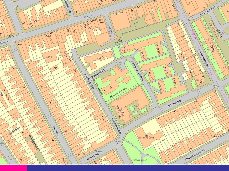
7 Evolution of the large scale specification There has been a number of decisions/policies made throughout the evolution of large scales data in relation to capturing against specification and frequency of update for certain feature types Historically surveying technical limitations have meant that change has had to be prioritised in order to produce the volumes required to reflect the most significant topographic changes throughout GB The more minor change (category b and c) in urban areas has not been systematically swept before
 in urban areas has not been systematically")
8 Enhancing our most detailed content 1. Deliver consistency of content. Ensure that real-world objects are captured, modelled and maintained in a consistent fashion, and reduce the legacy of paper-based map scales. 2. Maintain what we capture. Remove disparities between what we survey on construction and those subsequent real-world changes that are not always maintained. 3. Improve the way we describe features. Improve the attribution associated with a feature, particularly in terms of its form and function, in addition to what it looks like from above. 4. Shift from a purely 2D data structure to one which is 3Dready. Put in place the basic enhancements that will allow large-scale topographic products to be utilised in a 3D context. Unclassified

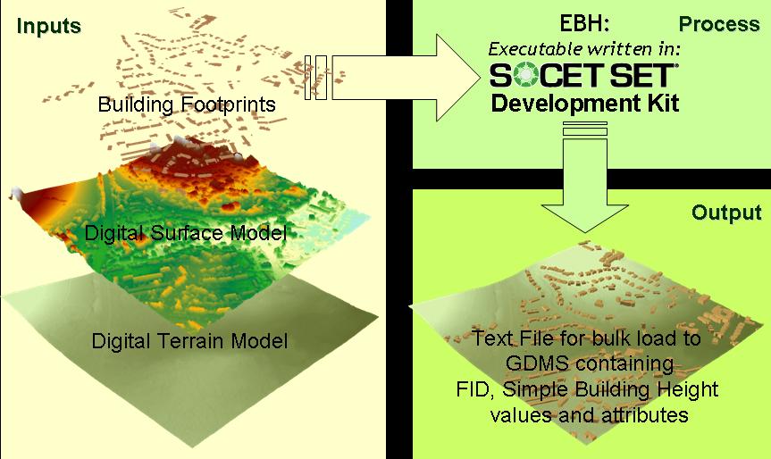
9 Current development components Content improvement Content enhancement Urban data consistency Functional sites Simple building heights Rural data currency Open land classification Moorland data consistency Unclassified

10
11
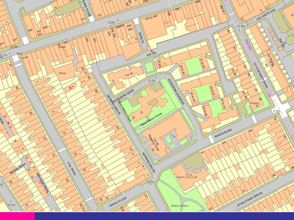
12 Descriptive term enhancements Before Unclassified

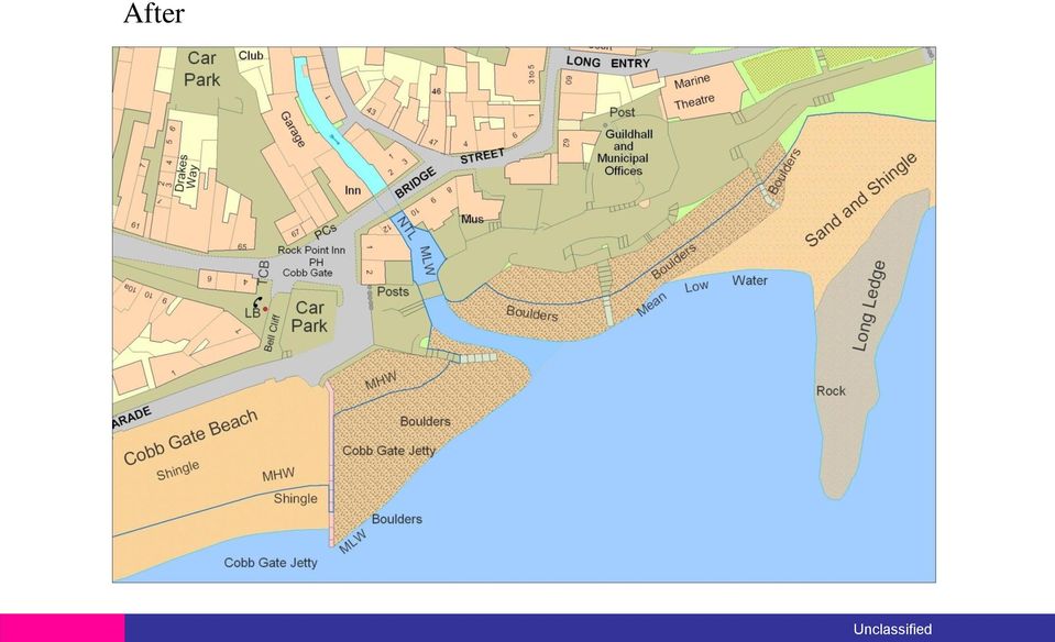
13 After Unclassified
14 Functional Site Extents Protected - Commercial

15 Real world view Protected - Commercial

16 Functional Sites Extents: school as depicted in Topo Protected - Commercial

17 Functional Sites Extents: the building blocks Protected - Commercial

18 The finished Functional Sites Extent of the school Protected - Commercial

19 Functional Sites Extents: Capturing the Access points Protected - Commercial


20 Functional Sites Extents: road network referencing Protected - Commercial

21 Functional Sites Extents Phase 1 Air Transport Airfield Airport Helicopter Station Heliport Education First School Further Education Higher Education Infant School Junior School Middle School Non State Primary or Preparatory School Non State Secondary School Primary School School for Special Needs Secondary School University Medical Care Hospice Hospital Medical Care Accommodation Rail Transport Railway Station Vehicular Rail Terminal Road Transport Bus Station Coach Station Road User Services Water Transport Vehicle Ferry Terminal Passenger Ferry Terminal Port consisting of Docks and Nautical Berthing Utility & Industrial Sites Chemical Works Electricity Distribution Electricity Production Gas Distribution or Storage Oil Distribution Or Storage Oil Refining Oil Terminal Slide 21
22 The third dimension, part 1 New Digital Terrain Model - OS Terrain 5
23 Vision: 3D-enabled portfolio Heighted elevated features Grounded spatial features Digital Terrain Model Slide 23
24 OS Terrain OS Terrain is the family name for Ordnance Survey s new DTM products The first products to be released will be: OS Terrain 5 DTM & Contours OS Terrain 50 DTM & Contours Release planned before the end of Q Data created from integrated data capture at release will contain over 80% new data (with more to follow in subsequent updates) OS Terrain will be the first fully maintained height product from Ordnance Survey.
25 OS Terrain products 5m grid
26 OS Terrain products Contours
27 OS Terrain products Combined grid surface & contours
28 OS Terrain products Terrain and imagery
29 OS Terrain products Terrain and topographic features
30 Consistent specification
31 OS Terrain products Height data is captured with large-scale revision Superior feature modelling Height data integrated throughout our products Maintained contours Foundation for future 3D products 2 new products: OS Terrain 5 (designed for largescale synchronicity) OS Terrain 50 (free-to-use, low resolution) Insert protective marking - see QSP 032
32 The third dimension, part 2 Introducing simple building heights to OS MasterMap Topography Layer Unclassified

33 Production COMMERCIAL - Protect
34 Simple Building Heights extruded on OS MasterMap Topography Layer Unclassified
35 Simple Building Heights a 3D evolutionary step in Ordnance Survey s product roadmap Unclassified
36 The third dimension, part 3 Towards 3D Topographic data Unclassified
37 Two centuries of learned behaviour We carefully survey urban landscapes and model them in 2D and many of our customers then use this 2D data to help make decisions which are inherently 3-dimensional. Slide 37
38 Buildings and what else? Buildings only Buildings plus DTM 3D topography Slide 38

39 Topography in 2D and 3D Common maintenance and shared architecture 3D topography product National Geographic Database Aspired common characteristics: Shared geometry Common IDs Synchronised maintenance OSMM Topography Layer 3D topography as an upgrade from OS MasterMap Topography Layer Slide 39

40 Towards 3D: Sheffield illustrative data only Slide 40
41 Next stages in 3D We are committed to accelerating our 3D development activity with an emphasis on understanding customer use cases and associated business value We are clearer in our vision of what our 3D topography product could be: an upgrade to Topography Layer, focused on urban areas and including all major topographic feature classes built using a bottom-up approach where feasible in order to ensure interoperability with Topography Layer in terms of both geometry and TOIDs Simple building height data has recently been published via OS Insight; illustrative 3D topographic data to follow soon We want to work closely with technology suppliers, partners and users to ensure that 3D can be accessed and consumed as easily as possible Slide 41
42 Sharing our product development plans Unclassified
43 For more information on any of the following summary slides, please get involved in our OS Insight programme. Early development plans User questionnaires Illustrative data Alpha/Beta data It s free. Sign up today! Unclassified
44 Questions and discussion Feedback is always welcome! please follow up any developments that are of interest.. Thank you Unclassified
DATA VISUALIZATION GABRIEL PARODI STUDY MATERIAL: PRINCIPLES OF GEOGRAPHIC INFORMATION SYSTEMS AN INTRODUCTORY TEXTBOOK CHAPTER 7
 DATA VISUALIZATION GABRIEL PARODI STUDY MATERIAL: PRINCIPLES OF GEOGRAPHIC INFORMATION SYSTEMS AN INTRODUCTORY TEXTBOOK CHAPTER 7 Contents GIS and maps The visualization process Visualization and strategies
Cadastre in the context of SDI and INSPIRE
 Cadastre in the context of SDI and INSPIRE Dr. Markus Seifert Bavarian Administration for Surveying and Cadastre Cadastre in the digital age the approach in Germany 3 rd CLGE Conference, Hanover, 11.10.2012
1 in 30 year 1 in 75 year 1 in 100 year 1 in 100 year plus climate change (+30%) 1 in 200 year
 1 in 200 year") Appendix C1 Surface Water Modelling 1 Overview 1.1 The Drain London modelling was designed to analyse the impact of heavy rainfall events across each London borough by assessing flow paths, velocities
Appendix C1 Surface Water Modelling 1 Overview 1.1 The Drain London modelling was designed to analyse the impact of heavy rainfall events across each London borough by assessing flow paths, velocities
Urban Flood Modelling
 Urban Flood Modelling Adrian J Saul Pennine Water Group Department of Civil and Structural Engineering University of Sheffield a.j.saul@sheffield.ac.uk 1 Need for Integrated Urban Drainage within an integrated
Section 2: Ordnance Survey Large Scales Map Data
 Section 2: Ordnance Survey Large Scales Map Data The Quality of Ordnance Survey Large Scales Data How good is an Ordnance Survey map? How much can it be relied upon to show what is really on the ground?
WHAT IS GIS - AN INRODUCTION
 WHAT IS GIS - AN INRODUCTION GIS DEFINITION GIS is an acronym for: Geographic Information Systems Geographic This term is used because GIS tend to deal primarily with geographic or spatial features. Information
Evolution of Partnership and the Geospatial Liaison Network at the USGS
 Evolution of Partnership and the Geospatial Liaison Network at the USGS Vicki Lukas September 13, 2012 NSGIC Annual Conference U.S. Department of the Interior U.S. Geological Survey An Abridged History
INDIVIDUAL COURSE DETAILS
 INDIVIDUAL COURSE DETAILS A. Name of Institution NATIONAL INSTITUTE OF TECHNICAL TEACHERS TRAINING AND RESEARCH TARAMANI CHENNAI 600 113 [An Autonomous Institute under Ministry of Human Resource Development,
Mapping and geolocation technology for waste collection services West Suffolk and Northamptonshire.
 Mapping and geolocation technology for waste collection services West Suffolk and Northamptonshire. Summary In the face of budget cuts, increased tax burdens for landfill, and challenging targets to improve
Requirements Analysis Concepts & Principles. Instructor: Dr. Jerry Gao
 Requirements Analysis Concepts & Principles Instructor: Dr. Jerry Gao Requirements Analysis Concepts and Principles - Requirements Analysis - Communication Techniques - Initiating the Process - Facilitated
Geographical Information Systems (GIS) and Economics 1
 and Economics 1") Geographical Information Systems (GIS) and Economics 1 Henry G. Overman (London School of Economics) 5 th January 2006 Abstract: Geographical Information Systems (GIS) are used for inputting, storing,
Geographical Information Systems (GIS) and Economics 1 Henry G. Overman (London School of Economics) 5 th January 2006 Abstract: Geographical Information Systems (GIS) are used for inputting, storing,
Enterprise Content Management (ECM)
") Business Assessment: A Quick-Reference Summary Intro to MIKE2 methodology and phase 1 The methodology that will be used throughout the specialist track is based on the MIKE2 methodology. MIKE stands for
Business Assessment: A Quick-Reference Summary Intro to MIKE2 methodology and phase 1 The methodology that will be used throughout the specialist track is based on the MIKE2 methodology. MIKE stands for
AN ONTOLOGY BASED APPROACH FOR GEOSPATIAL DATA INTEGRATION OF AUTHORITATIVE AND CROWD SOURCED DATASETS
 CO-118 AN ONTOLOGY BASED APPROACH FOR GEOSPATIAL DATA INTEGRATION OF AUTHORITATIVE AND CROWD SOURCED DATASETS DU H.(1), JIANG W.(1), ANAND S.(1), MORLEY J.(1), HART G.(2), LEIBOVICI D.(1), JACKSON M.(1)
Stanfords For Business. Price List. Stanfords For Business Price List - 1 -
 - 1 - Stanfords For Business Price List Stanfords Digital 29 Corn Street, BS1 1HT CONTENTS - Stanfords For Business Price List - 2 - OS Master Map in dxf/ dwg/ shp format 3 Planning Application Maps 4
Pipeline Routing using GIS and Remote Sensing Tobenna Opara Ocean Engineering Department University of Rhode Island Tobennaopara@my.uri.
 Pipeline Routing using GIS and Remote Sensing Tobenna Opara Ocean Engineering Department University of Rhode Island Tobennaopara@my.uri.edu Pipelines are utilized by the oil and gas industry to transport
VISION FOR SMART ENERGY IN DENMARK Research, Development and Demonstration
 VISION FOR SMART ENERGY IN DENMARK Research, Development and Demonstration Smart Energy Networks Research, Development and Demonstration Vision for Smart Energy in Denmark - Research, Development and Demonstration
MANAGING USER DATA IN A DIGITAL WORLD
 MANAGING USER DATA IN A DIGITAL WORLD AIRLINE INDUSTRY CHALLENGES AND SOLUTIONS WHITE PAPER OVERVIEW AND DRIVERS In today's digital economy, enterprises are exploring ways to differentiate themselves from
ROADS ALLIANCE ASSET MANAGEMENT COMMUNIQUÉ AUGUST 2010 LOCAL GOVERNMENT ASSOCIATION OF QUEENSLAND LTD
 ROADS ALLIANCE ASSET MANAGEMENT COMMUNIQUÉ AUGUST 2010 LOCAL GOVERNMENT ASSOCIATION OF QUEENSLAND LTD Contents 4 Glossary 6 Background 9 Purpose of Communiqué 9 Australian and State Government Drivers
Digital Cadastral Maps in Land Information Systems
 LIBER QUARTERLY, ISSN 1435-5205 LIBER 1999. All rights reserved K.G. Saur, Munich. Printed in Germany Digital Cadastral Maps in Land Information Systems by PIOTR CICHOCINSKI ABSTRACT This paper presents
Ellipse + Fieldreach Network Rail, AMT-Sybex Case Study
 Ellipse + Fieldreach Network Rail, AMT-Sybex Case Study Keeping services on track with accurate asset information Summary In 2013, Network Rail launched a major initiative, called ORBIS, to boost the safety
Future Landscapes. Research report CONTENTS. June 2005
 Future Landscapes Research report June 2005 CONTENTS 1. Introduction 2. Original ideas for the project 3. The Future Landscapes prototype 4. Early usability trials 5. Reflections on first phases of development
London Infrastructure Plan Response from Peabody 31 October 2014
 London Infrastructure Plan Response from Peabody 31 October 2014 About Peabody Peabody has been creating opportunities for people in London since 1862. Peabody was established in 1862 by the American banker
www.germanrailgroup.eu
 www.germanrailgroup.eu German RailGroup Engineering & Consulting GbR Hilpertstraße 20 64295 Darmstadt, Germany Phone + 49 (6151) 8 85-300 Fax + 49 (6151) 8 85-244 info@germanrailgroup.eu Your network for
Emissions and Modelling Remapping London s Air pollution
 Emissions and Modelling Remapping s Air pollution David Dajnak Environmental Research Group, King s College Main Objectives 1. What is King s recipe for mapping s Air pollution? 2. Are Others responsible
Spatially Enabling an Asset Management Database
 Spatially Enabling an Asset Management Database John Woollett, GIS Manager (Operations) Tube Lines Ralph Diment Intergraph UK Helen Neaves Intergraph UK Bruce Aquila Intergraph Introduction Background
Primer on Transportation Funding and Governance in Canada s Large Metropolitan Areas
 Transportation Association of Canada Primer on Transportation Funding and Governance in Canada s Large Metropolitan Areas The transportation funding and governance frameworks of Canada s metropolitan regions
Data access and management
 B Data access and management CONTENTS B.1 Introduction... B-1 B.2 Data requirements and availability... B-1 B.3 Data access... B-2 B.4 Overall procedures... B-2 B.5 Data tools and management... B-4 Appendix
3D City Models for Simulation & Training Requirements on Next Generation 3D City Models
 3D City Models for Simulation & Training Requirements on Next Generation 3D City Models Frank Bildstein Rheinmetall Defence Electronics Rheinmetall Defence Electronics GmbH, Bremen, 07/2005 Contents Applications
in collaboration with: Maximising Where are my assets? Adding the Spatial Dimension
 in collaboration with: Maximising ROI on your Assets Where are my assets? Adding the Spatial Dimension Maximising Your RoI The ability to share accurate and up-to-date information has become the defining
APPLY EXCEL VBA TO TERRAIN VISUALIZATION
 APPLY EXCEL VBA TO TERRAIN VISUALIZATION 1 2 Chih-Chung Lin( ), Yen-Ling Lin ( ) 1 Secretariat, National Changhua University of Education. General Education Center, Chienkuo Technology University 2 Dept.
WELCOME PROPOSALS FOR PENTAVIA RETAIL PARK WELCOME TO OUR EXHIBITION WHICH SETS OUT OUR PLANS TO DEVELOP THE PENTAVIA RETAIL PARK SITE.
 WELCOME WELCOME TO OUR EXHIBITION WHICH SETS OUT OUR PLANS TO DEVELOP THE PENTAVIA RETAIL PARK SITE. The purpose of the exhibition is to provide the community with the opportunity to view our initial ideas
Chapter 5 Topographic Maps Bengt Rystedt, Sweden
 Chapter 5 Topographic Maps Bengt Rystedt, Sweden 5.1 Introduction A topographic map describes a place (topos is Greek for place). For a long time, they have been used for military purposes but are now
Designing a Metrics Dashboard for the Sales Organization By Mike Rose, Management Consultant.
 Designing a Metrics Dashboard for the Sales Organization By Mike Rose, Management Consultant. Metrics can serve as critical measures of success for any organization and, in particular, the sales force
THE PROVISIONAL CENTRAL PRODUCT CLASSIFICATION
 THE PROVISIONAL CENTRAL PRODUCT CLASSIFICATION GROUP 867 ARCHITECTURAL, ENGINEERING AND OTHER TECHNICAL SERVICES Excerpt from CPCprov-en-Publication.doc - United Nation Statistic Division Group Class Subclass
Strategic Activities to Support Sustainability of Canada s Geospatial Data Infrastructure
 Strategic Activities to Support Sustainability of Canada s Geospatial Data Infrastructure Paula McLeod Canada Centre for Mapping and Earth Observation United Nations 10 th Regional Cartographic Conference
College of Agriculture, Engineering and Science INSPIRING GREATNESS
 School of Engineering College of Agriculture, Engineering and Science INSPIRING GREATNESS Don t accept what is, always ask what if. The School of Engineering is one of five Schools that form UKZN s College
This high level land planning and design system will replace the land
 Performance Planning System () The following is a v1.3 feature analysis, which clarifies differences, between and American Planning Association (APA) Land Based Classification Standards (LBCS) for color
Files Used in this Tutorial
 Generate Point Clouds Tutorial This tutorial shows how to generate point clouds from IKONOS satellite stereo imagery. You will view the point clouds in the ENVI LiDAR Viewer. The estimated time to complete
National Solutions with Experienced End Users
 National Solutions with Experienced End Users Great Britain Malahide, 6 th May 2004 Nick Macready - Ordnance Survey Niall Tyler Ordnance Survey Martin Rivas British Waterways Positional Accuracy Improvement
Understanding Raster Data
 Introduction The following document is intended to provide a basic understanding of raster data. Raster data layers (commonly referred to as grids) are the essential data layers used in all tools developed
360 Appraisal for Project Staff
 www.projectagency.co.uk 360 Appraisal for Project Staff Project management appraisal by a project management company The most successful project managers have perfected the skill of being comfortable being
ABN 85 082 464 622 AURORA DISTRIBUTION BUSINESS CUSTOMER STRATEGY
 ABN 85 082 464 622 AURORA DISTRIBUTION BUSINESS CUSTOMER STRATEGY DOCUMENT NUMBER: NW-#30170677-V1 DATE: 28 FEBRUARY 2011 This page is intentionally blank. 2 Table of Contents AURORA DISTRIBUTION BUSINESS
Microsoft Dynamics AX 2012 A New Generation in ERP
 A New Generation in ERP Mike Ehrenberg Technical Fellow Microsoft Corporation April 2011 Microsoft Dynamics AX 2012 is not just the next release of a great product. It is, in fact, a generational shift
NEW DIGITAL TERRAIN MODELING (DTM) TOOLS FOR CABLE ROUTE PLANNING by Dr. Jose M. Andres Makai Ocean Engineering Inc.
 TOOLS FOR CABLE ROUTE PLANNING by Dr. Jose M. Andres Makai Ocean Engineering Inc.") NEW DIGITAL TERRAIN MODELING (DTM) TOOLS FOR CABLE ROUTE PLANNING by Dr. Jose M. Andres Makai Ocean Engineering Inc. EXISTING CABLE ROUTE PLANNING TOOLS In recent years, methods used for submarine cable
NEW DIGITAL TERRAIN MODELING (DTM) TOOLS FOR CABLE ROUTE PLANNING by Dr. Jose M. Andres Makai Ocean Engineering Inc. EXISTING CABLE ROUTE PLANNING TOOLS In recent years, methods used for submarine cable
The elearning Competency Framework for Teachers and Trainers
 The elearning Competency Framework for Teachers and Trainers Produced by ettnet TWG 2 Based on EIfEL standards The elearning Competency Framework for Teachers and Trainers...1 Introduction 4 elearning
Certification in Humanitarian Supply Chain Management (CHSCM) Competence Model. Final Version 2007
 Competence Model. Final Version 2007") Certification in Humanitarian Supply Chain Management (CHSCM) Competence Model Final Version 2007 Contents Competence Model Context... 3 Functional Map... 6 UNIT 1 Supply Chain Planning... 7 UNIT 2 Supply
Certification in Humanitarian Supply Chain Management (CHSCM) Competence Model Final Version 2007 Contents Competence Model Context... 3 Functional Map... 6 UNIT 1 Supply Chain Planning... 7 UNIT 2 Supply
Adaptation of High Resolution Ikonos Images to Googleearth for Zonguldak Test Field
 Adaptation of High Resolution Ikonos Images to Googleearth for Zonguldak Test Field Umut G. SEFERCIK, Murat ORUC and Mehmet ALKAN, Turkey Key words: Image Processing, Information Content, Image Understanding,
Passenger Transport Statistic
 Passenger Transport Statistic Methodological note May 2016 Index 1. Purpose 2. Scope 2.1. Population scope 2.2. Time scope 2.3. Geographical scope 3. Statistical unit 4. Definition of the variables 5.
Representing Geography
 3 Representing Geography OVERVIEW This chapter introduces the concept of representation, or the construction of a digital model of some aspect of the Earth s surface. The geographic world is extremely
Shareholder Presentation
 Shareholder Presentation 30 June 2016 Shareholder Presentation June 2016 1 Agenda 1. Introduction 2. Strategy revisited 3. Fleet Systems: Further consolidation 4. Passenger Systems: Update on Region Services
SULTANATE OF OMAN SPECIAL ECONOMIC ZONE AUTHORITY AT DUQM
 SULTANATE OF OMAN SPECIAL ECONOMIC ZONE AUTHORITY AT DUQM www.duqm.gov.om 1. INTRODUCTION 2. ACCESSIBILITY TO DUQM 3. SEZAD PREVIOUS MASTERPLAN 4. DUQM URBAN PLANNING 5. SPECIAL ECONOMIC ZONE DISTRICTS
Guide on Developing a HRM Plan
 Guide on Developing a HRM Plan Civil Service Branch June 1996 Table of Contents Introduction What is a HRM Plan? Critical Success Factors for Developing the HRM Plan A Shift in Mindset The HRM Plan in
Asset Data: A New Beginning, A New AURIZON. OmniSurveyor3D - The one source of truth
 Asset Data: A New Beginning, A New AURIZON OmniSurveyor3D - The one source of truth Gerard Buckett Program Manager, Asset Management Improvement, Aurizon Network 30 years experience in rail engineering
MAP GENERALIZATION FOR OSMASTERMAP DATA IN LOCATION BASED SERVICES & MOBILE GIS APPLICATIONS
 Geoinformatics 2004 Proc. 12th Int. Conf. on Geoinformatics Geospatial Information Research: Bridging the Pacific and Atlantic University of Gävle, Sweden, 7-9 June 2004 MAP GENERALIZATION FOR OSMASTERMAP
Description of Simandou Archaeological Potential Model. 13A.1 Overview
 13A Description of Simandou Archaeological Potential Model 13A.1 Overview The most accurate and reliable way of establishing archaeological baseline conditions in an area is by conventional methods of
Internet of Things (IoT): A vision, architectural elements, and future directions
: A vision, architectural elements, and future directions") SeoulTech UCS Lab 2014-2 st Internet of Things (IoT): A vision, architectural elements, and future directions 2014. 11. 18 Won Min Kang Email: wkaqhsk0@seoultech.ac.kr Table of contents Open challenges
SeoulTech UCS Lab 2014-2 st Internet of Things (IoT): A vision, architectural elements, and future directions 2014. 11. 18 Won Min Kang Email: wkaqhsk0@seoultech.ac.kr Table of contents Open challenges
REVISITING THE PROCEDURES FOR THE VECTOR DATA QUALITY ASSURANCE IN PRACTICE
 REVISITING THE PROCEDURES FOR THE VECTOR DATA QUALITY ASSURANCE IN PRACTICE M. Erdoğan, *, A. Torun, D. Boyacı General Command of Mapping, Photogrammetry Department, 06100 Dikimevi Ankara, Turkey, - (mustafa.erdogan,
Publishing Hosted 3D Feature Layers. An Esri White Paper September 2015
 An Esri White Paper September 2015 Copyright 2015 Esri All rights reserved. Printed in the United States of America. The information contained in this document is the exclusive property of Esri. This work
CIESIN Columbia University
 Conference on Climate Change and Official Statistics Oslo, Norway, 14-16 April 2008 The Role of Spatial Data Infrastructure in Integrating Climate Change Information with a Focus on Monitoring Observed
Computer aided programs in landscape design
 The Sustainable City VIII, Vol. 1 389 Computer aided programs in landscape design S. Okasha 1 & R. Okasha 2 1 Faculty of Architecture, Design and Planning, Qassim University, Saudi Arabia 2 Zagazig University,
Solid Edge ST3 Advances the Future of 3D Design
 SUMMARY AND OPINION Solid Edge ST3 Advances the Future of 3D Design A Product Review White Paper Prepared by Collaborative Product Development Associates, LLC for Siemens PLM Software The newest release
A Method Using ArcMap to Create a Hydrologically conditioned Digital Elevation Model
 A Method Using ArcMap to Create a Hydrologically conditioned Digital Elevation Model High resolution topography derived from LiDAR data is becoming more readily available. This new data source of topography
REGULATIONS FOR THE DEGREE OF MASTER OF SCIENCE IN URBAN PLANNING (MSc[UrbanPlanning])
![REGULATIONS FOR THE DEGREE OF MASTER OF SCIENCE IN URBAN PLANNING (MSc[UrbanPlanning])](/thumbs/27/9938136.jpg "REGULATIONS FOR THE DEGREE OF MASTER OF SCIENCE IN URBAN PLANNING (MSc[UrbanPlanning])") REGULATIONS FOR THE DEGREE OF MASTER OF SCIENCE IN URBAN PLANNING (MSc[UrbanPlanning]) To be applicable to all students enrolled for 2012-13 academic year and thereafter. (See also General Regulations)
REGULATIONS FOR THE DEGREE OF MASTER OF SCIENCE IN URBAN PLANNING (MSc[UrbanPlanning]) To be applicable to all students enrolled for 2012-13 academic year and thereafter. (See also General Regulations)
Ranks Action Plan 2015
 Section 1 Text Ranks Action Plan 2015 MAYOR OF LONDON 2 Foreword The Capital s taxis are iconic, recognised by Londoners and visitors alike as being part of the city s fabric. Around 70 million taxi journeys
Smart Grid Different Flavors for Different Tastes
 By Jeff Buxton, Executive Consultant, and Mehrdod Mohseni, Senior Vice President and General Manager of Smart Grid Practice, Black & Veatch Published in Intelligent Utility Magazine, May/June 2010 Smart
ERDAS PRO600. A state-of-the-art package for 3D feature collection and editing
 ERDAS PRO600 A state-of-the-art package for 3D feature collection and editing MicroStation design file graphics are displayed by PRO600 in full 3D stereo. PRO600 PRO600 is a highly sophisticated, function-rich
CITY OF SUFFOLK, VIRGINIA GIS DATA DISTRIBUTION AND PRICING POLICY
 CITY OF SUFFOLK, VIRGINIA GIS DATA DISTRIBUTION AND PRICING POLICY 1 The City of Suffolk has invested a large amount of effort into the development of a Citywide Geographic Information System (GIS). The
Cartographic and Geospatial Materials
 LIBRARY OF CONGRESS COLLECTIONS POLICY STATEMENTS ±² Collections Policy Statement Index Cartographic and Geospatial Materials This document consolidates and replaces the former Maps, Atlases, and Remote
BEST PRACTICE NOTE LANDSCAPE ASSESSMENT AND SUSTAINABLE MANAGEMENT 10.1 NZILA. Members Documentation
 BEST PRACTICE NOTE LANDSCAPE ASSESSMENT AND SUSTAINABLE MANAGEMENT 10.1 NZILA Members Documentation Background In August 2008, the New Zealand Institute of Landscape Architects (NZILA) Education Foundation
What is GIS? Why Geography?
 Geographic Information System (GIS), What is GIS? contributed by the Spatial Data Management Division, secretariat of the Land Information Council of Jamaica (LICJ), Ministry of Agriculture. Contact Ms.
11. Monitoring. 11.1 Performance monitoring in LTP2
 178 11. Monitoring 11.1 Performance monitoring in LTP2 Performance against the suite of indicators adopted for LTP2 is shown in the following table. This shows progress between 2005/06 and 2009/10 (the
John F. Cotton College of Architecture & Environmental Design California Polytechnic State University San Luis Obispo, California JOHN F.
 SO L I DMO D E L I N GAS A TO O LFO RCO N S T RU C T I N SO G LA REN V E LO PE S by John F. Cotton College of Architecture & Environmental Design California Polytechnic State University San Luis Obispo,
BC HYDRO. Reducing revenue loss with advanced theft detection and energy analytics ESSENTIALS SMART METERING & INFRASTRUCTURE
 BC HYDRO Reducing revenue loss with advanced theft detection and energy analytics ESSENTIALS Challenge Detect electricity theft sooner and on a larger scale to reduce revenue loss EMC Solutions and Services
Customer relationship management MB-104. By Mayank Kumar Pandey Assistant Professor at Noida Institute of Engineering and Technology
 Customer relationship management MB-104 By Mayank Kumar Pandey Assistant Professor at Noida Institute of Engineering and Technology University Syllabus UNIT-1 Customer Relationship Management- Introduction
EPIC 1.08 Distribution System Safety and Reliability through New Data Analytics Techniques. John Carruthers, PG&E
 EPIC 1.08 Distribution System Safety and Reliability through New Data Analytics Techniques John Carruthers, PG&E EPIC Innovation Symposium December 3, 2015 STAR What is it? STAR = System Tool for Asset
ElegantJ BI. White Paper. Making the Choice: Commercial Open Source (COS) vs. Proprietary Business Intelligence (BI)
 vs. Proprietary Business Intelligence (BI)") ElegantJ BI White Paper Making the Choice: Commercial Open Source (COS) vs. Proprietary Business Intelligence (BI) Integrated Business Intelligence and Reporting for Performance Management, Operational
ElegantJ BI White Paper Making the Choice: Commercial Open Source (COS) vs. Proprietary Business Intelligence (BI) Integrated Business Intelligence and Reporting for Performance Management, Operational
06 - NATIONAL PLUVIAL FLOOD MAPPING FOR ALL IRELAND THE MODELLING APPROACH
 06 - NATIONAL PLUVIAL FLOOD MAPPING FOR ALL IRELAND THE MODELLING APPROACH Richard Kellagher 1, Mike Panzeri 1, Julien L Homme 1, Yannick Cesses 1, Ben Gouldby 1 John Martin 2, Oliver Nicholson 2, Mark
Cartographic Design Process: Artistic Interpretation With the Geodatabase
 Cartographic Design Process: Artistic Interpretation With the Geodatabase An ESRI White Paper July 2004 ESRI 380 New York St., Redlands, CA 92373-8100, USA TEL 909-793-2853 FAX 909-793-5953 E-MAIL info@esri.com
GIS DESIGN AND IMPLEMENTATION SERVICES
 22-1 21 24 23 22 30 32 25 33 29 34 28 35 28 GIS DESIGN AND IMPLEMENTATION SERVICES Croswell-Schulte provides a full range of services for GIS design and implementation support. We are active in GIS industry
TravelOAC: development of travel geodemographic classifications for England and Wales based on open data
 TravelOAC: development of travel geodemographic classifications for England and Wales based on open data Nick Bearman *1 and Alex D. Singleton 1 1 Department of Geography and Planning, School of Environmental
INSTRUCTIONS FOR MAKING 3D,.DWG CONTOUR LINES
 INSTRUCTIONS FOR MAKING 3D,.DWG CONTOUR LINES A TUTORIAL FROM SPATIAL AND NUMERIC DATA SERVICES NICOLE SCHOLTZ AND GEOFF IVERSON Overview... 2 A. Get a Digital Elevation Model (DEM)... 3 B. Open ArcMap,
ERDAS ADE Enterprise Suite Products Overview and Position
 ERDAS ADE Enterprise Suite Products Overview and Position ERDAS ADE Suite Technical Overview Iryna Wetzel ERDAS Inc Switzerland Introduction to Products and Target Market what we will cover in this module
Drop the B in BIM. Clay Hickling, GHD. Class Description
 Class Description Don t let the B in BIM, ie the Building, limit your ideas on how to deliver non building related projects. Information Modelling (IM) covers more then just buildings. Large infrastructure
FUNDAMENTALS OF LANDSCAPE TECHNOLOGY GSD Harvard University Graduate School of Design Department of Landscape Architecture Fall 2006
 FUNDAMENTALS OF LANDSCAPE TECHNOLOGY GSD Harvard University Graduate School of Design Department of Landscape Architecture Fall 2006 6106/ M2 BASICS OF GRADING AND SURVEYING Laura Solano, Lecturer Name
Network Rail Consultation on Draft West Coast Main Line Route Utilisation Strategy Consultation Response by Birmingham International Airport Limited
 Network Rail Consultation on Draft West Coast Main Line Route Utilisation Strategy Consultation Response by Birmingham International Airport Limited Introduction This is the consultation response by Birmingham
Implementing Geospatial Data in Parametric Environment Elçin ERTUĞRUL*
 Proceedings of the International Association for Shell and Spatial Structures (IASS) Symposium 2015, Amsterdam 17-20 August 2015, Amsterdam, The Netherlands Implementing Geospatial Data in Parametric Environment
Appendix B Data Quality Dimensions
 Appendix B Data Quality Dimensions Purpose Dimensions of data quality are fundamental to understanding how to improve data. This appendix summarizes, in chronological order of publication, three foundational
SESSION 8: GEOGRAPHIC INFORMATION SYSTEMS AND MAP PROJECTIONS
 SESSION 8: GEOGRAPHIC INFORMATION SYSTEMS AND MAP PROJECTIONS KEY CONCEPTS: In this session we will look at: Geographic information systems and Map projections. Content that needs to be covered for examination
ITU / BDT- COE workshop. Network Planning. Supporting Network Planning Tools. Lecture NP- 5.5. Nairobi, Kenya, 7 11 October 2002
 ITU / BDT- COE workshop Nairobi, Kenya, 7 11 October 2002 Network Planning Lecture NP- 5.5 Supporting Network Planning Tools October 10th ITU/BDT-COE Network Planning/ Supporting Tools - O.G.S. Lecture
@DanSSenter. Business Intelligence Centre of Excellence Manager. daniel.senter@nationalgrid.com. +44 (0) 7805 162092 dansenter.co.
 7805 162092 dansenter.co.") Dan Senter Business Intelligence Centre of Excellence Manager daniel.senter@nationalgrid.com @DanSSenter +44 (0) 7805 162092 dansenter.co.uk Agenda National Grid Evolution of BI The BICC Empowerment Learnings
Dan Senter Business Intelligence Centre of Excellence Manager daniel.senter@nationalgrid.com @DanSSenter +44 (0) 7805 162092 dansenter.co.uk Agenda National Grid Evolution of BI The BICC Empowerment Learnings
The AIR Inland Flood Model for the United States In Spring 2011, heavy rainfall and snowmelt produced massive flooding along the Mississippi River,
 The AIR Inland Flood Model for the United States In Spring 2011, heavy rainfall and snowmelt produced massive flooding along the Mississippi River, inundating huge swaths of land across seven states. As
Why build the Silvertown Tunnel?
 Why build the Silvertown Tunnel? Over the last 30 years east London has changed with the redevelopment of former industrial areas into major commercial and residential districts. The development of Canary
Key Steps to a Management Skills Audit
 Key Steps to a Management Skills Audit COPYRIGHT NOTICE PPA Consulting Pty Ltd (ACN 079 090 547) 2005-2013 You may only use this document for your own personal use or the internal use of your employer.
NSW Government Standard Approach to Information Architecture. December 2013 v.1.0
 NSW Government Standard Approach to Information Architecture December 2013 v.1.0 DOCUMENTATION AND ENDORSEMENT Document history Date Version No. Description Author October 2013 0.1 IM Framework Roadmap
GEOGRAPHIC INFORMATION SYSTEMS CERTIFICATION
 GEOGRAPHIC INFORMATION SYSTEMS CERTIFICATION GIS Syllabus - Version 1.2 January 2007 Copyright AICA-CEPIS 2009 1 Version 1 January 2007 GIS Certification Programme 1. Target The GIS certification is aimed
CONDIS. IT Service Management and CMDB
 CONDIS IT Service and CMDB 2/17 Table of contents 1. Executive Summary... 3 2. ITIL Overview... 4 2.1 How CONDIS supports ITIL processes... 5 2.1.1 Incident... 5 2.1.2 Problem... 5 2.1.3 Configuration...
Civil Engineering and Architecture (CEA) Detailed Outline
 Detailed Outline") Civil Engineering and Architecture (CEA) Detailed Outline Unit 1: Overview of Civil Engineering and Architecture (23 days) Lesson 1.1: History of Civil Engineering and Architecture 1. Many features of
Civil Engineering and Architecture (CEA) Detailed Outline Unit 1: Overview of Civil Engineering and Architecture (23 days) Lesson 1.1: History of Civil Engineering and Architecture 1. Many features of
Connected Services. New Manufacturing Models Increase Revenue Growth. Authors Kevin Sullivan Ram Muthukrishnan. April 2013
 Connected Services New Manufacturing Models Increase Revenue Growth Authors Kevin Sullivan Ram Muthukrishnan April 2013 Cisco Internet Business Solutions Group (IBSG) Cisco IBSG 2013 Cisco and/or its affiliates.
Questions and Answers
 AutoCAD Raster Design 2012 Questions and Answers Make the most of rasterized scanned drawings, maps, aerial photos, satellite imagery, and digital elevation models. Get more out of your raster data and
aaca NCSA 01 The National Competency Standards in Architecture aaca Architects Accreditation Council of Australia PO Box 236 Civic Square ACT 2608
 aaca NCSA 01 The National Competency Standards in Architecture aaca Architects Accreditation Council of Australia PO Box 236 Civic Square ACT 2608 NCSA 01 Competency Based Assessment in Architecture THE