METHODS FOR ECOLOGICAL MONITORING OF CORAL REEFS
|
|
|
- Sandra Owens
- 8 years ago
- Views:
Transcription
1 METHODS FOR ECOLOGICAL MONITORING OF CORAL REEFS JOS HILL AND CLIVE WILKINSON VERSION 1 A RESOURCE FOR MANAGERS

2 This compendium of methods contains those known to be in common use for coral reef monitoring or were provided by coral reef resource managers and researchers from around the world. Much of the information is based on questionnaires distributed widely and from the coral reef literature. This should not be considered as a definitive list. Interested persons are invited to contact the authors for information or to indicate errors and omissions. Australian Institute of Marine Science, 2004 Australian Institute of Marine Science PMB No 3 Townsville MC Qld 4810 Australia Telephone Facsimile bookshop@aims.gov.au Reef Check C/o Institute of the Environment 1362 Hershey Hall, Box University of California at Los Angeles Los Angeles, CA USA Telephone Facsimile rcheck@ucla.edu ISBN Acknowledgements Special thanks go to those people who provided method descriptions and assessments from a management perspective through discussions and responses to questionnaires. We are particularly grateful to those who provided financial support for the GCRMN and this publication: the US Department of State, the National Oceanographic and Atmospheric Administration, the Department of Environment, Food and Rural Affairs of the UK, through the International Coral Reef Initiative, IUCN The World Conservation Union, CRC Reef Research Centre, the Total Foundation and the International Coral Reef Action Network. Scientific and technical advice was received from AIMS, AGRRA (Atlantic Gulf Rapid Reef Assessment), CARICOMP, NOAA, ReefBase, Reef Check, CORAL The Coral Reef Alliance, The Nature Conservancy and the GCRMN Management Group (UNEP, IOC-UNESCO, IUCN, the World Bank, The Secretariat of the Convention on Biological Diversity). Personnel from IMPAC (International Marine Project Activities Centre), CRC Reef Research Centre and Alison Green provided advice and support. Tim Prior, Michael Phelan and Madeleine Nowak are thanked for their suggestions and proof reading. Finally special thanks go to the production staff at AIMS, Wendy Ellery and Tim Simmonds; again a very professional job under a tight schedule. Cover photographs were provided by Jos Hill, Dean Miller and Katerina Kupcikova. Contact Jos Hill at jos.hill@jcu.edu.au ii

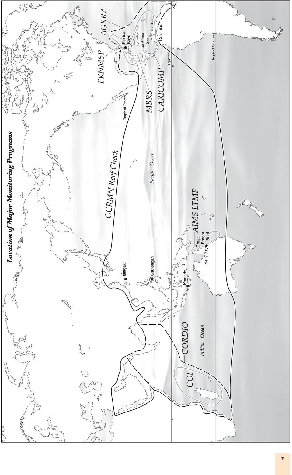
3 CONTENTS Preface : Introduction to monitoring : What type of monitoring to use? : General monitoring methods : Mapping and Site Selection Manta tow Video towed diver (video manta tow) Random swim : Benthic communities General observations Timed swims Line intercept transect Point intercept transect (PIT) Video transect Visual quadrat Permanent photo quadrat Coral health general observations Bleaching general observations Bleaching belt transect Disease belt transect Line transect (Bleaching, Disease) Tagging coral colonies Chain intercept transect Coral recruitment tiles Coral recruitment quadrats : Macro-invertebrates Belt transect Diadema belt transect Collection of Diadema : Fishes Towed diver (manta tow) Fish roving diver technique Fish belt transect Fish stationary plot survey Fish rapid visual census Butterfly fish method Fish spawning aggregations methods : Monitoring physical parameters Water quality Sedimentation traps : Monitoring programs How do you put a monitoring program together? Major programs Global Coral Reef Monitoring Program Reef Check Atlantic and Gulf Rapid Reef Assessment Caribbean Coastal Marine Productivity Program Coral Reef Degradation in the Indian Ocean Commission de l Ocean Indien/Indian Ocean Commission Mesoamerican Barrier Reef System Synoptic Monitoring Program Reef Condition (RECON) Monitoring Program Appendices : How to do a pilot study? : Generic monitoring equipment References Glossary of terms iii

4 v
5 Preface Potential methods to use for monitoring disturbance impacts. It is recommended that monitoring is done of the damage sites and control sites, preferably before the damage, during and after damaging impacts have ceased. Monitoring sites for success of recovery is a measure of the success of management intervention. Threat Impacts What to monitor (few resources) Pages Over-exploitation of marine resources Over-fishing Hunting e.g. turtles & dugong m Fisheries - catch per unit effort fishery dependent monitoring; 51, 64, 78, m Impacts on populations of target species: abundance & size - fishery independent monitoring m For suspected ecosystem over-fishing, monitor impacts on non-target species - cover of algae, coral, prey species etc. 79, 86, 88 Destructive fishing practices m Physical damage to habitat - broken coral; live and dead coral cover; m Impacts of over-fishing - see above. 22, 31, 33 Coral mining See habitat destruction below Habitat destruction: coastal development; dredging & filling; coral mining m Area of habitat lost; 22, 27, 31, m Impacts on adjacent coral communities - cover, diversity, and health. 33 Land based impacts Point source pollution: e.g. sewage, industry outfalls etc. m Water quality - measure relevant pollutant e.g. sediments, nutrients, fertilisers, pesticides at source and receiving waters; 22, 31, 33, m Impacts on coral communities - cover, diversity, and health. 95 Non-point source pollution: land clearing, agriculture, septic systems etc. m Water quality - measure relevant pollutant e.g. sediments, nutrients, fertilisers, pesticides in delivery mechanism (rivers/ 22, 31, 33, streams during floods) and receiving waters; m Impacts on coral communities - cover, diversity, and health. 95 Pollution e.g. fuel spills m Type, quantity and distribution of pollutant; m Impacts on benthic communities, particularly cover of coral and algae, diversity and health of coral communities and other indicator species e.g. clams, urchins. 33, 36, 51, 64 Shipping based impacts Groundings/wrecks Introduced species in ballast water etc. m Physical damage to habitat - area of broken/smashed coral; changes to hydrology of area e.g. new channels; m Type, quantity and distribution of pollutants e.g. oil, diesel, antifouling paint & and impacts on benthic communities (see above). 22, 31, 51 m Diversity, size and abundance of introduced species; m Impacts on native species e.g. due to competition or predation; 31, 64, 68 m Physical damage to habitat - area of broken/smashed coral; area of habitat lost; changes to local hydrology; and Navigation aids: lighthouses etc. 22, 31, 33 m Impact on adjacent coral communities. Tourism & Recreation Coastal development: resorts, marinas, jetties etc. Offshore structures e.g. pontoons See habitat destruction above m Physical damage to coral communities - broken coral; area of habitat lost; 22, 31, 33, m Impacts on adjacent coral reef communities from shading - coral cover, diversity, and health; m Impacts from fish feeding fish abundance, size and diversity. 79 Large scale disturbances Diving and snorkelling m Broken coral and coral cover at key sites. 33 m Sea surface temperatures; m Extent, severity and recovery of coral communities - cover, diversity, size structure, changes in relative abundance of growth 22, 33, 51, Coral bleaching forms; 95 m Identify bleaching resilient species and sites. Major storms, cyclones, hurricanes and m Physical damage - broken coral; and changes to coral communities - cover, diversity and relative abundance of growth forms. 22, 33 typhoons m Abundance and size of corallivores; Population outbreaks of corallivores: m COTs, Drupella etc. Impacts of coral community - coral cover, diversity, and relative abundance of growth forms. 22, 33, 51,64, 68 m Area of habitat lost or destroyed e.g. buried by lava and ash; Geologic activity: earthquakes, m Physical damage - broken coral in coral communities; 22, 27, 33, volcanoes, tsunamis m Type, quantity and distribution of pollutants e.g. lava, ash, pumice and impacts on coral reef communities - coral cover, diversity and 51 relative abundance of growth forms. vi
 Page")
6 PREFACE The aim of this book is to help managers of coral reefs select appropriate ecological monitoring programs, protocols and methods for your coral reef management needs. This book was written in response to requests from coral reef managers for advice on monitoring, especially: m How monitoring can help management; m How to choose the best methods to suit your needs; and m The good and bad points and associated costs of a wide range of monitoring methods. Monitoring can be specific or general. There are different management information needs for each coral reef area, so monitoring programs must be designed to include a selection of protocols and methods to meet those needs. The protocols and methods outlined in this book represent the ones most commonly used on coral reefs around the world. Our advice is to use the standard and frequently used methods to monitor your reefs because these have been extensively tested. Using standard methods also means that you will be able to compare the status of your coral reefs with other reefs at regional and global scales. SOME IMPORTANT DEFINITIONS There are lots of terms used when talking about monitoring. We use the same definitions throughout the book to make it simple to follow. m A survey is collecting data and information about a coral reef site; m Monitoring is when surveys (or parts of them) are repeated; m A monitoring program consists of series of monitoring protocols that together provide a manager with the information needed to manage their reefs; m Protocols are the selections of methods and how they are used to gain information at a site. This will include numbers of replicates, lengths of transect lines, specific information gathered, e.g. animals or plants to be counted or measured; m A method is the description of how the information is collected, e.g. line or point intercept transect or how to lay the transect; m Ecological monitoring is monitoring the natural environment, e.g. the fish or coral. This includes both biological and physical monitoring; m Socio-economic monitoring is monitoring the way humans use the natural resources, e.g. the methods used to catch fish; m A monitoring site is the area of coral reef selected for monitoring; m A sample is the area where you count the animals and plants e.g. along a transect or inside a quadrat. The sample areas selected for monitoring will depend upon the type of information needed and the type of things you want to count. You will need to use a number of separate samples to survey one site. These are called replicates. Preface Coral reef managers around the world have similar problems and questions that monitoring can answer. For example, managers need to know if: m Coral reefs are healthy and improving; m Threats are damaging the corals or other organisms; m Fish populations are increasing in a protected area; m Management actions have been successful; m Economies of local communities are maintained or improved; m Communities understand the need for management and want to assist; m Tourism is a positive or negative benefit for the coral reef area. These questions and many others can be answered with an effective monitoring program, which will consist of a number of monitoring methods, often at a mix of scales from the whole reef to a small area. This reference book should be kept current. We invite you to recommend additional methods to be included as well as other suggested updates. Please write to us at c.wilkinson@aims.gov.au. 1

7 1: INTRODUCTION TO MONITORING What is monitoring? Monitoring is the gathering of data and information on coral reef ecosystems or on those people who use coral reef resources. Monitoring should be repeated on a regular basis, preferably over an extended period of time. Ideally a coral reef manager will perform a detailed baseline survey that includes many measures or parameters that may or may not change over time. These include: m Mapping the extent and location of major habitats, particularly coral reefs; m Understanding the status of coral communities, fish populations and fishing practises; m Measuring the size and structure of the human population using these resources; m Understanding government rules and regulations on coral reefs and conservation; and m Determining the decision making process in local communities. The coral reef manager has to select which variables (things to measure) to be included into a monitoring program. In this book, the term monitoring includes both the initial baseline survey and continued monitoring. Introduction How can monitoring help you? A major goal of a coral reef monitoring program is to provide the data to support effective management. As more Marine Protected Areas (MPAs) are established, it is becoming increasingly important to monitor whether they are achieving their management goals. Monitoring can assist with the effective management of coral reefs through the following tasks: 1. Resource assessment and mapping what and where are the resources in your coral reef area that should be managed; 2. Resource status and long-term trends what is the status of these resources and how are they changing over time (Monitoring large areas: Great Barrier Reef Marine Park, p 9; 3. Status and long-term trends of user groups who are the major users and stakeholders of your coral reefs, what are their patterns of use and attitudes towards management, and how they are changing; 4. Impacts of large-scale disturbances - how do impacts like coral bleaching, crown-of-thorns starfish (Acanthaster planci or commonly known as COTS) outbreaks and tropical storms affect your coral reefs, p 63; 5. Impacts of human activities how do the activities of people affect the coral reef and its resources. This includes fishing, land use practices, coastal developments, and tourism (see reactive monitoring at Nelly Bay Harbour, Magnetic Island, North Queensland, Australia, p 7); 6. Performance evaluation & adaptive management - how can monitoring be used to measure success of management goals and assist in adaptive management (Monitoring broad scale impacts on coral reefs: how monitoring demonstrated effective control of blast fishing in Komodo National Park, p 7); 7. Education and awareness raising how to provide support for coral reef management through raising awareness and education of user communities, government, other stakeholders and management staff ( Using Reef Check to stimulate community management of Gilutongan, Central Philippines, p 6 and How monitoring demonstrated effective control of blast fishing in Komodo National Park, p 7); 8. Building resilience into MPAs - how to design MPAs so they are more resilient to large scale disturbances such as coral bleaching or outbreaks of COTS; 9. Contributing to regional and global networks how to link up with and learn from other coral reef managers around the world and assist others manage their coral reefs (see Global and regional programs, p 98. For more detail on how monitoring can help conserve reefs see Wilkinson et al. (2003). Ecological and socio-economic monitoring There are two main types of monitoring: m Ecological monitoring; and m Socio-economic monitoring. Ecological and socio-economic parameters are often closely linked; therefore ecological monitoring and socioeconomic monitoring should be done in the same place at the same time. For example, monitoring of fish populations should be directly linked to surveys of fish markets, fishermen and their catches. Similarly ecological parameters describe the natural state of the coral reef, which will have impacts on socio-economic factors such as income and employment. 2

8 Ecological monitoring includes the natural environment (biological and physical) e.g. the fish, coral or sedimentation. Biological parameters measure the status and trends in the organisms on coral reefs. Biological parameters focus on the major resources, and these parameters can be used to assess the extent of damage to coral reefs from natural and human disturbances. The most frequently measured ecological parameters include: m Percentage cover of corals (both live and dead) and sponges, algae and non-living material; m Species or genus composition and size structure of coral communities; m Presence of newly settled corals and juveniles; m Numbers, species composition, size (biomass) and structure of fish populations; m Juvenile fishes, especially target species; populations of organisms of special interest such as giant clams, COTS, sea urchins etc.; m Extent and nature of coral bleaching; and m Extent and type of coral disease. Physical parameters measure the physical environment on and around the reefs. This provides a physical description of the environment surrounding reefs which assists in making maps, as well as measuring the change in the environment. Parameters include: m Depth, bathymetry and reef profiles; m Currents; m Temperature; m Water quality; m Visibility; and m Salinity. Socio-economic monitoring: This aims to understand how people use, understand and interact with coral reefs. It is not possible to separate human activities and ecosystem health, especially when coral reefs are important to the livelihoods of local community members. Socio-economic monitoring can measure the motivations of resource users as well as the social, cultural, and economic conditions in communities near coral reefs. Socio-economic data can help mangers determine which stakeholder and community attributes provide the basis for successful management. Introduction The most frequently used socio-economic parameters include: m Community populations, employment levels and incomes; m Proportion of fishers, and where and how they fish; m Catch and price statistics for reef fisheries; m Decision making structures in communities; m Community perceptions of reef management; m Tourist perceptions of the value of MPAs and willingness to pay for management etc. This book is only about ecological monitoring methods. See Bunce et al. (2000); Wilkinson et al. (2003) for information on socio-economic methods The ecological monitoring methods listed in this book fall under the following categories: Section 4: Mapping and site selection, p 21; Section 5: Benthic communities, p 27; Section 6: Invertebrates, p 63; Section 7: Fishes, p 73; Section 8: Physical parameters, p
 and sponges, algae and non-living material; m Species or genus composition and size")
9 2: WHAT TYPE OF MONITORING TO USE? Your choice of monitoring program will depend on a number of factors. Our aim is to guide you through the following issues: 1. What information do you need to know? Is your question general or specific? (p 4); 2. What do you need to monitor? (p 4); 3. What resources do you have available? (p 5); 4. What scale of monitoring program do you want? (p 6); 5. What types of reef do you have in the area? (p 8); 6. What methods should you use? (p 8); 7. How often should you monitor? (p 12); 8. Quality control and training? (p 13); 9. Data handling and communicating results (p 14); 10. The need to involve the public (p 14). Questions What information do you need to know? What is your question? The information you need to manage your reef will determine which monitoring protocols you use (see how can monitoring help you, p 2). If you want to determine the effect of particular impacts on your coral reef see table on page vi. Threats to coral reefs can be categorised as human, natural or climate-related, although some natural impacts may be exacerbated by human impacts. For example, global climate change may increase the severity and frequency of coral bleaching, while COTS outbreaks may be influenced by increased fertiliser pollution. What do you need to monitor? You will need to consider the following: 1. What biological and physical variables (things on the reef) do you need to monitor? 2. In what detail (taxonomic resolution for biological parameters) do you need to monitor these variables? 3. At what scale do you want to collect information? m Broad-scale (wide area); m Medium-scale (medium area); m Fine-scale (small area). WHAT ARE THE MAIN ECOLOGICAL MONITORING CATEGORIES? 1. Physical parameters; 2. Biological parameters; m Benthic communities (living and non-living components); m Invertebrates; m Fishes. What variables should you measure? A variable is a component of the ecosystem, physical or biological, that has an effect on other components of the ecosystem. For monitoring, the variables are the components or species that we collect data on, e.g. percentage cover of hard coral. We cannot measure every variable on a coral reef, therefore we use indicators to detect change or impacts, or show reef health. Indicators used for coral reef monitoring are either ecologically or economically important. Examples of ecological indicators include percent hard coral cover, which is an indicator of coral reef health because many other organisms rely on hard coral for their survival; and abundance of COTS, other predators or disease, because disease and predators may reduce coral cover and tourism potential. Most managers use percent coral cover, and particularly changes over time in cover, as their main indicator of coral reef health. Scientists usually want to know the coral species and how these change with time to understand changes in coral cover, but this is not essential information for decision making by coral reef managers. 4
; 10. The need to involve the public (p 14). Questions What information do you need to know? What is your question?")
10 Economic indicators are species harvested by humans and important to the local economy e.g. conch, giant clams, trochus shells. Monitoring the abundance of these organisms and those that are closely linked to them is important for managing their sustainable use. Examples of economic indicators include percent hard coral cover (because tourists like to see beautiful coral), and size and abundance of fishery species e.g. grouper and snapper and because tourists also like to see lots of colourful or large fish. What detail to measure (e.g. taxonomic resolution)? Three levels of monitoring programs can be defined. These are: m Level 1 - Community monitoring is at a lower detail level, i.e. you cover a larger area in less time, for less cost; m Level 2 - Management monitoring adds more detail, is more expensive, takes more time and covers less area, but aims to provide the best information for MPA management; and m Level 3 - Research monitoring provides very detailed data, but it is expensive, takes more time, requires more expertise to assess a smaller area, and is usually designed to answer a specific question. Detail can be added by recording family, genus and species or sizes of animal groups. The highest level of detail (genus and species) usually requires Level 3 - research monitoring. Also more detail can be added to provide more accurate measures and reduce the uncertainty (i.e. reducing the variance in the estimate in sample design ). It is important that the monitoring team only collect information at the level of detail that matches their training. You may wish to combine level 2 or 3 monitoring at a small number of sites with level 1 monitoring over a larger area (see Monitoring large areas: Great Barrier Reef Marine Park, p 9). What resources do you have available? Monitoring costs can vary on the basis of: m Expertise of the people to do the monitoring; m Cost of equipment and time. Coral reef managers at a meeting in Manila in 2003 (ITMEMS2), recognised that monitoring programs should be designed in the context of limited resources and competition with other elements of management. Managers suggested that between 5 and 10% of the budget for the total coral reef or MPA management should be put into monitoring. Questions Costs will also be affected by the size of the reef area to be monitored, and therefore how many surveys are needed. You need to consider the resources available before you decide which monitoring program level you want to implement. Expertise Who will do the monitoring? The task will include data collection as well as data analysis and interpretation. Monitoring staff could include: m Community members or volunteers (Level 1 program Community monitoring); m Staff with some scientific training (tertiary or learned through work experience) (Level 1 or 2 programs - Community or Management monitoring); m Staff with some tertiary scientific training (Level 2 program Management monitoring); m Scientific researchers (Level 3 program Research monitoring); Level 1 Community monitoring relies on using lesser-trained people (volunteers and community members) with some scientific supervision to gather broad-scale data at lower resolution. These data provide a cost-effective early warning system of environmental changes over larger areas than is possible with more expensive level 2 or 3 programs. A Level 1 program will usually consist of: m Some broad scale surveys, e.g. random swims; m Point intercept transects assessing corals and other benthos using low detail categories; m Fish transects to count major target fishes on the same transect line as the corals. The most commonly used community monitoring program is Reef Check, which involves rapid and cost-effective collection of data by people without extensive training or experience. Reef Check provides a low level of detail, but useful information on reef status and the causes of reef degradation. It is particularly useful as an early warning system for managers of changes in coral reef resources. Reef Check is recommended for people with the lowest level of expertise and funding, and is particularly useful for monitoring programs aimed at community education and awareness-raising by rewarding government agencies, companies and NGOs for their support, p
? Three levels of monitoring programs can be defined.")
11 Community monitoring builds public support for management initiatives and ensures that the community understands the status of the resources and what is happening to them. Community monitoring methods, such as the Reef Check methods or REEF fish census methods, are not sufficient to provide a complete picture of coral reef health, but they can illustrate long-term trends and indicate where more detailed monitoring is needed. Advantages of community monitoring m Cost effective to cover large areas; m Very useful as an early warning system of changes in the coral reef; m Enhances education, awareness and local stewardship of resources through the participation of community members. Limitations of community monitoring m Data precision tends to be low; m A large amount of time must be spent on training (ongoing) to ensure reliable data; m Reduced detail but managers often only use low detail information e.g. percent coral cover. USING REEF CHECK TO STIMULATE COMMUNITY MANAGEMENT OF GILUTONGAN, CENTRAL PHILIPPINES Questions Fishing pressure on the reefs was high around Cebu when an MPA was established in 1991 at Gilutongan, a small island near Cebu. However the fishery regulations were not enforced, and the reefs continued to decline from overuse. What was done? In 1998, a team of 20 local divers was trained to do Reef Check. The results were presented to the community and the poor condition of the reef was widely discussed. The active participation of community members in the surveys was considered to be an important factor in the community decision to start active management in the marine sanctuary. Previous monitoring had been carried out by trained scientists, however little of the data or information was being presented to the local communities. Since the community became involved, the corals and fish stocks have improved and tourism is a major income source for the community. Gilutongan marine sanctuary has been an outstanding success (Wilkinson et al. 2003). Contact Mike Ross, mikeross@mozcom.com or Gregor Hodgson, gregorh@ucla.edu Ideally, a long-term monitoring program should include both community monitoring, such as Reef Check, and some more detailed surveys, such as identifying the major species (p 4 what do you need to monitor? ). Unfortunately, detailed surveys require teams of highly trained scientists and are more time consuming and costly than community programs. In many countries, the initial goal of setting up a network of community monitoring sites at a few areas is a major challenge. Therefore, we recommend starting with a network of Reef Check-type sites as the first step towards a local or national monitoring program, and then if this is successful, level 2 and 3 programs can be added later. Level 2 Management monitoring relies on staff with scientific training (tertiary or through work experience), e.g. environment or fisheries government staff, to gather medium-scale data at medium to high resolution. A level 2 program will usually consist of: m Broad scale surveys to select monitoring sites and assess large areas using manta tow or timed swims; m Point intercept or line intercept transects. These methods assess corals and other benthos at a chosen level of detail, e.g. shape categories or corals at genus level; m Fish transects to count fishes on the same transect line as the corals with emphasis on size measurements of target species. The Global Coral Reef Monitoring Network (GCRMN) was specifically developed to assist managers gather useful data and requires a low to moderate level of funding and expertise. Further information is on (p 99.) Other level 2 programs are CARICOMP (p 102), AGRRA (p 101) and MBRS SMP (p 105). Level 3 Research monitoring relies on experienced scientists (university researchers, experienced environment or fisheries government staff) to gather specific, small-scale, high detail data. This level is often used to assess impacts of developments, e.g. building of a tourist resort. 6

12 MONITORING BROAD SCALE IMPACTS ON CORAL REEFS: HOW MONITORING DEMONSTRATED EFFECTIVE CONTROL OF BLAST FISHING IN KOMODO NATIONAL PARK (KNP) The coral reef communities of KNP were seriously threatened by blast fishing, reef gleaning and over- fishing putting the Park s function as a replenishment source for surrounding fishing grounds at risk. The Nature Conservancy set up a conservation program to reduce blast fishing within the park. The indicators of blast fishing are rubble and hard coral cover, which is low detail information. KNP is 219,322 ha and resources limited, therefore low detail, broad-scale methods were appropriate. What was done? Park staff were trained to conduct simple timed swim surveys (p 31) to estimate the percentage of live coral and blast scars. This method enabled useful information to be obtained over a large area at low cost. Surveys were repeated every 2 nd year and provided broad scale information on coral cover and damage from blast fishing. The results suggested that the conservation program successfully reduced blast fishing and that coral recovery was most rapid near protection and enforcement areas. The sharing of monitoring results with the community helped to build support for the park management. Contact: Peter Mous, pmous@tnc.org A Level 3 program will usually consist of: m Broad scale surveys to select monitoring sites and assess impacts using manta tow or timed swims; m Line intercept transects or video transects to assess coral and other benthos at genus or species level; m Fish transects to count all fishes on the same transect line as the corals with emphasis on size measurements of target species. These programs tend to be the most expensive and require high levels of scientific expertise. The Australian Institute of Marine Science Long Term Monitoring Program provides a good example of a research monitoring program on the Great Barrier Reef ( A similar program is operated for the Florida Keys National Marine Sanctuary ( Research monitoring programs are only recommended where managers have a high level of technical expertise and adequate financial resources. Questions REACTIVE MONITORING AT NELLY BAY HARBOUR, MAGNETIC ISLAND, AUSTRALIA TO MANAGE MARINE CONSTRUCTION ACTIVITIES The fringing reef at Nelly Bay is highly valued by residents and tourists for diving, fishing and snorkelling. Construction plans for Nelly Bay raised concern that the coral reefs would be damaged. The development within Nelly Bay lasted 2 years and involved the construction of a commercial ferry terminal, barge ramp, a canal/harbour estate with residential and tourism developments, a public boat ramp and public areas. What was done? Risks were identified as sedimentation plumes from harbour dewatering and dredging. The monitoring program was designed to alert managers when sediment levels reached unsafe levels. This allowed managers to take action before excessive sediment levels could cause widespread damage to the Nelly Bay coral reef. Trigger levels were developed to help managers identify what unsafe levels of sediment were, or when coral health had been affected. When monitoring showed that a trigger level had been reached, managers either called for more monitoring or shut down the activity causing the problem until the sediment levels returned to safe levels. For more information contact Andrew Chin, a.chin@gbrmpa.gov.au or Paul Marshall, p.marshall@gbrmpa.gov.au 7

13 Advantages of research monitoring m Accurate and precise data collection; m Data are most reliable; m Collect high detail data, which are used by scientists to understand trends or processes at a specific site; m Used for environmental impact assessment Limitations of research monitoring m Expensive. Many governments cannot afford to employ scientists to survey large areas of reef; m Trained staff are often not available or are employed elsewhere; m Can survey only small areas at one time. Cost of equipment and time The equipment required to conduct various monitoring methods can range from snorkel gear and an underwater slate to expensive video equipment and boats. It is essential to include the cost of transport to and around the reef. To find out what equipment you will need to monitor your reefs, see Appendix 2, p 107. The time taken to monitor is also an expense. You will need to consider who you can afford to pay to monitor reefs and for how long. What scale of monitoring program do you want? Questions The program scale is the level of detail at which you want to collect information. This can be: m Broad scale; m Medium scale; or m Fine scale. These scales are illustrated in Figure 3, p 15. This is an important question. Monitoring a large area will require more resources than a small area, and so the level of monitoring will have to be considered carefully if resources are limited. Data collected from one site on a reef will not provide enough information about the entire reef; similarly data from one reef will not provide information about the reefs in the region. The sampling effort needs to be spread throughout the area of interest to be able to make general statements and conclusions about the area (Oxley 1997). You may choose to monitor a few select sites in detail and use broad-scale monitoring of the wider area (see manta tow, p 22). Coral reef managers should ask two questions as part of this balancing act to decide which level to use: m Do you want more detail over smaller areas or less detail over a larger area (or can you find more money for monitoring)? m Will more detail provide more useful information to assist in management? Also see How many samples should you take (p 11). Reactive monitoring at Nelly Bay Harbour, Magnetic Island, Australia to manage marine construction activities and Using Reef Check to stimulate community management at Gilutongan, Central Philippines). What types of reef do you have in the area? The type of reef will affect the type of monitoring method you select due to the accessibility and habitat types. Accessibility: You may wish to monitor accessible reefs more frequently than less accessible ones. Methods that require frequent site visits, e.g. sedimentation traps (p 96) or coral recruitment plates (p 56) are cheaper to do at accessible sites. Habitat type: Do you have patch reefs or continuous reefs? Long transects may not be suitable for patch reefs, but quadrats or a stationary fish census can be used (p 86). A continuous reef is better suited to most sampling methods, such as transects, which require tens of metres of area. What methods should you use? Many methods have been developed to monitor the different reef components. Several major coral reef monitoring programs have refined and integrated protocols and we recommend using the standard methods to develop your program. This will enable comparisons with data collected by other monitoring teams in your region. See page 98 for information on major coral reef monitoring programs. The first consideration: what type of reef habitat do you want to monitor? If you want to compare monitoring sites, they must be of the same habitat type. Coral reef habitats change with depth and position on the reef e.g. front reef, back reef and lagoonal reefs are distinct habitats (see figure 2). Many scientists select a particular depth at the front reef for their monitoring sites. The front reef is often easier to monitor because it is often more continuous than back reefs, which tend to be patchy. Most coral growth occurs on the front reef. However, front reefs may be difficult to get to due to rough weather, therefore you may select the side or back reef. It is usually necessary 8

14 MONITORING LARGE AREAS: GREAT BARRIER REEF MARINE PARK The Great Barrier Reef (GBR) is the world s largest series of coral reefs stretching over 2000 km with more than 3000 reefs. The challenge was to design a program to monitor the GBR to assist the management agency, the Great Barrier Reef Marine Park Authority (GBRMPA) assess localised changes and develop effective management strategies. What was done? The Australian Institute of Marine Science Long-term Monitoring Program was designed to provide both broad and medium scale information on the status of the GBR. Detailed medium scale transect- based surveys are done at permanent monitoring sites on 48 reefs to assess the status and long-term trends on the coral reefs. Information gathered includes benthic communities: coral cover, species richness, incidence and type of disease (p 38); and fishes, species richness and abundance (p 79). Broad scale manta tow (p 22) and timed swims (p 31) are done annually at another 50 reefs to provide general trend information on coral cover, COTS and bleaching. There are 2 community programs monitoring other sites on the GBR. The Eye on the Reef program (p 30) and Reef Check (p 36) provide general, early warning information to managers. Reef Check teams are supported by the dive industry, which assists with annual surveys to provide low detail, medium to broad scale information on coral reef health. Eye on the Reef is a GBRMPA/CRC Reef program with the Australian Marine Park Tourism Operators (AMPTO), the Queensland Parks and Wildlife Service (QPWS) and 10 dive operators provide weekly reports on the status and broad scale general descriptions of tourism dive sites. Both programs increase public awareness of coral reef issues and involve the public in management of the GBR. AIMS LTMP contacts: Hugh Sweatman, h.sweatman@aims.gov.au or David Wachenfeld, d.wachenfeld@gbrmpa.gov.au ; Eye on the Reef contacts: Andrew Chin, a.chin@gbrmpa.gov.au or Robin Aiello, robin.aiello@iig.com.au ; Reef Check contacts: rcheck@ucla.edu Questions Another example of a multi-tier monitoring program is the Florida Keys Marine National Marine Sanctuary Coral Reef Monitoring Program that uses detailed research-level monitoring in combination with community programs by trained recreational divers. For further information see: to conduct a broad survey, e.g. manta tow and some ground truth surveys (exploratory dives) to ensure that the selected sites are in a comparable habitat, p 21. Land Internal zone Beach Lagoon with patch reefs Back reef Reef flat Island or Cay Reef crest Reef flat Front reef or reef slope Figure 2. Cross section through a coral reef showing the major zones. 9

15 How do you select your sites? The sites you choose should be: m Representative of the area of interest; m Contain the same habitat so that the different sites can be compared through time. Site selection is a critical step in designing a monitoring program and will depend upon the objectives of your program e.g. if the objective is to determine if fish abundance is higher inside an MPA than outside, you should monitor both inside and outside your MPA (for an example, see Using Reef Check to stimulate community management at Gilutongan, Central Philippines, p 6). This is called an impact study (see Impact studies, p 13). The actual sites you choose for the surveys should be representative of the area of interest. Therefore, fish surveys should be conducted in an area of the MPA that is representative of the whole MPA and similar to the outside area. Because we cannot measure everything on a coral reef, we must measure a small part. The part of the coral reef that is measured is called a sample.. To measure a part of the environment is called sampling. To repeat sampling through time is called monitoring.. A sample is intended to be representative of the whole coral reef. The method is the description of how the information is collected, e.g. line or point intercept transect or how to lay the transect. The protocol is the size and shape of the sampling method e.g. transect length and number, duration of a timed swim or quadrat size. Questions To select a site, you may need to consider the following: m The degree of environmental degradation and/or recovery; m The level of management protection, e.g. no-take MPA; m The extent of wave exposure, i.e. can the monitoring team dive at that site under most conditions? m Which sites are representative of the coral reef area you want to monitor? How do you select which type of monitoring method to use? 1. First decide what method family to use, i.e. transects, quadrats or timed swims etc. This decision will depend upon the scale of your monitoring area, the level of detail at which you want to monitor and the type of reef habitat you want to monitor, e.g. continuous front reef, or patch back reef; 2. Second, decide what method protocol to use, i.e. line intercept or point intercept transects; or visual or photo quadrats. This will depend upon the expertise of your monitoring team, the time you have available for monitoring and the detail and precision of the data you wish to obtain; 3. Third, decide what method size should you use, i.e. transect length or quadrat size. This will depend upon the type of reef habitat you want to monitor, the size of the area of interest that you monitoring area must represent, the size and spatial abundance of the animals and plants you wish to monitor and the level of precision you want from the data collected (precision is also affected by the number of replicates you use see page 11). Broad-scale methods will use large units that are defined by the time taken to swim them, e.g. manta tow (p 22) or timed swim (p 31). Medium-scale methods may have units that are defined by a measured length of reef, e.g. line transects (p 33) or belt transects (p 64). Fine-scale methods tend to measure smaller areas in more detail e.g. quadrats (p 41). 10
. This is called an impact study (see Impact studies, p 13).")
16 To detect coral reef changes through time or to compare reefs, it is important to use standard methods with standard sample method sizes. Methods of a specific and consistent size, i.e. defined by space or time, provide quantitative information. On the other hand, qualitative information is collected where there is no control over the sample size. Quantitative information (from quantity ) is when the subject of interest (e.g. coral cover) is expressed as a number (e.g. 32% coral cover). Quantitative information is standardised and therefore comparable. Qualitative information (from quality ) is a subjective description of the object of interest (e.g. medium coral cover) and is difficult to use for comparative studies because one observer s idea of medium coral cover may be very different to that of another observer. Qualitative information can be useful to support quantitative information e.g. photographs of reef change can support trends illustrated on a graph. The general public will relate better to photographs than graphs. The sample method size you select will depend upon what you want to measure. An abundant organism can be sampled with a smaller sampling area, whereas rare organisms will need larger sample areas. It is important to realise that a very small sample area may not adequately represent your area of interest. However, a large sample area may be difficult to search carefully enough to provide accurate or precise results. The actual size of the habitat being surveyed may also determine the size of the sample method, e.g. patch reefs are not suitable for long transects. For more detailed information on ecological sampling see Kingsford (1988). How many replicates should you survey? 1. How many samples (called replicates) should you make? 2. Where should you put your replicates? Coral reefs are variable in both space and time. To understand the extent of this variability, and therefore collect information that is representative of the coral reef area of interest, you need to take more than one sample at a survey site. Additional samples are called replicates. Use of replicates is called replication. Questions The number of replicates needed to provide a representation of the area of interest is dependent upon its scale as well as the magnitude of change you want to be able to detect over time. The magnitude of change you can detect is related to how well your sample represents the coral reef area of interest, or its precision. Large-scale studies involve sampling across large areas, which are widely spaced. Within each area, replicate samples should be taken and the level of variation should be established for each area before trying to compare with other areas. This is called a nested (or hierarchical) sampling design where successively smaller spatial (or temporal) scales e.g. one reef, are nested within the scale above e.g. group of coral reefs (Oxley 1997). Precision is important if you want to be able to detect environmental change in space and time. Collecting data from enough samples is important to ensure the precision (smallest standard error SE) of the surveys because this will tell you if your sample is representative of the local area. Where should you put your replicates? You should select sites that are representative of the coral reef area. Statisticians prefer that all sites are selected randomly, but this is often logistically difficult to achieve. In the real world the best method of choosing where to put your sample methods is stratified haphazard selection. This means you first select the reef habitat (reef zone and depth) that you want to monitor, then haphazardly select suitable sample sites within this area. For repeat surveys, you can go back to the same site and haphazardly re-lay the transect in approximately the same area as on the previous visit. It is also important that replicates do not overlap with each other because the statistics used to analyse your monitoring information rely upon each replicate sample being independent of, or not associated with, the other replicates. Replicates that are not independent are called pseudoreplicates. 11
 is a subjective description of the object of interest (e.g.")
17 Permanent versus haphazard sampling units To measure change over time, you can either measure the same part of reef each time, called fixed or permanent survey sites, or you can use the stratified haphazard selection method each time you survey. When you re-survey permanent sites, differences in the results e.g. percent coral cover, between the two survey periods can be attributed to environmental change. When you re-survey random or haphazard sites, only the change beyond the variance in your sample set can be interpreted as environmental change. There are advantages and disadvantages with using either of these methods of survey site selection so you have to consider which method to use. Note that there will always be some human error when monitoring coral reefs. This means that some of the change in your results from one year to the next will be caused by human error rather than environmental change. See Quality control and training below to find out how to minimise this. Permanent or fixed survey sites Permanent sites are generally recommended for long-term monitoring because they offer the greatest amount of information, consistency, repeatability and reliability. Managers usually prefer permanent sites because they are more comfortable with comparisons of a fixed sample of the environment rather than relying upon the statistics of random sampling, which are more difficult to understand. Permanent sites should always be selected using a random or stratified haphazard selection process to ensure they are representative. Questions How do you mark permanent sites? Permanent sites must be marked so that the transect tapes, quadrats or photographic equipment can be placed as close as possible to the same position on each visit. Stainless steel stakes or reinforcing rods or star pickets should be hammered into the reef at 5 to 10 m intervals along a transect line (p 33) or to mark out the corners of a permanent quadrat (p 43). Observers can wrap the tape measure around these stakes to ensure that the transect is in the same position. SHOULD I DO A PILOT STUDY? Pilot studies can help you decide what size of sample method to use (e.g. length of transect or quadrat size) and how many replicates are needed. The monitoring methods described in section three of this book recommend the size and number of replicates. For research monitoring where you want to detect fine-scale environmental changes, you will need to conduct a pilot study. However, if you wish to reduce the number of replicates suggested by a standard monitoring method (maybe to save costs) we recommend you conduct a pilot study to determine the resolution of environmental changes you will be able to detect. For more information on pilot studies see Appendix p 112. How do you find permanent sites? Maps, global positioning systems (GPS) and surface or subsurface-buoys can help you to find these sites again. 1. Maps are rarely useful on their own and must include triangulated references (line of sight objects) both above and below the water; 2. A hand-held GPS is very useful to re-locate permanent sites and is accurate within a few tens of metres, however, they are expensive. It is essential that you record which GPS datum system you have used, e.g. WGS 84, because you will need to use the same datum system to find your monitoring location again; 3. Surface or subsurface buoys should be used to mark the start of a series of transects or quadrats. Subsurface buoys are more appropriate than surface buoys because they are less likely to be stolen or wrenched off the reef by rough weather. You must ensure they are well below the surface so that they don t get caught in boat propellers. If you don t have access to a hand-held GPS, surface buoys may be necessary. We recommend you use all 3 methods to fi nd your sites. For more information see How often should you monitor? There is a trade-off between the frequency of monitoring and the number of locations to monitor, e.g. a large monitoring effort at a small number of sites in a large reef area may give a biased picture of the overall reef health. To represent a large area, several monitoring locations will be necessary. To be useful, monitoring surveys should be carried out every year or at least every second year. However, more frequent monitoring may be required to answer some management questions, such as what is the abundance of highly mobile fish? and so quarterly surveys at one location may be better (Hodgson 2003). 12

18 PERMANENT SITES Advantages: m Once set up, repeat monitoring is easy; m Interpreting results from fixed transects is much easier for the general public and resource managers to comprehend; m More precise information is produced than for random sites because you don t have to account for spatial variability. Limitations: m Time consuming and can be expensive to set up; m Can be difficult to find, which can waste survey time; If not marked properly they are no better than random transects. NON-PERMANENT (STRATIFIED HAPHAZARD) SITES Advantages: m Quick and easy to choose the sample site if you are familiar with the habitat in the area, e.g. from maps made after previous surveys. Limitations: m Cannot compare results from one study to those at another location if different habitats (e.g. depth) are surveyed. Impact studies Human impacts on coral reefs must be distinguished from background effects that are often extremely variable in space and time. This means we need to monitor the resources many times and at many sites (with replicate samples taken at each site) both before and after an impact to control spatial variability. The Beyond Before, After, Control Impact (Beyond BACI) design should be used for impact studies. This design monitors both an impact and at least 2 control sites at many times before and after an impact. An impact is indicated by a greater environmental change at the impact site compared to the controls. Questions For further information on Beyond BACI designs see Underwood (1994); Underwood (1995); Russ (1996); Russ and Alcala (1996); Kaly and Jones (1997); Russ (2002). Quality control and training Human error in monitoring will reduce the precision of the information collected. Although human error can never be eliminated entirely, it can be reduced through regular training and testing, and knowledge reviews of team members. It is essential that initial training, ongoing training, and a review of skills, are built into the cost of the program. Training must include both how to collect precise data on surveys as well as use of equipment, e.g. how to use a GPS. Survey training and review sessions should include comparisons with known standards e.g. photographic or video reference material or collected specimens. Training will generally involve field trips dedicated to training and laboratory studies. For example, fish size estimation training can be done by asking observers to estimate the size of fish models underwater (English et al. 1997). This training should be repeated at 6 monthly intervals. Fish abundance and identification training must be done by observers together in the field. The training the team requires depends upon their previous experience and the monitoring level selected. Examples on how to train observers are provided in many of the major program manuals (See Section four: monitoring programs, p 98). GCRMN/Reef Check provide regional training workshops in recommended methods. For more information see or 13
 SITES Advantages: m Quick and easy to choose the sample site if you are familiar with the habitat in the area, e.g. from maps made after previous surveys.")
19 Data handling and communicating results After monitoring, somebody must record the data as soon as possible (e.g. entered into a spreadsheet), analyse them, interpret the analysis and report the findings. Data entry Data should be recorded in a format for easy analysis as well as stored for comparisons with data collected in later years. It is essential that data be organised in a way, which makes them easily accessible for future reference. These data should be recorded in columns as in the example below. Date Observer name Site name Pink Reef Depth Latitude Longitude Replicate No. No. of grouper No. of snapper etc Sally Smith 5 m S E Questions Data storage A database is used to store data. A computer spreadsheet is the ideal way to store your data if you have access to a computer and the relevant software. It is essential to use systematic methods to store and retrieve data using computer-based management systems. All data should be stored in two safe places immediately after collection to avoid loss. Microsoft Excel is commonly used to store information and can also be used to make graphs and to do basic statistical analysis. For more advanced databases, Microsoft Access is recommended. Data analysis Analysis of data allows interpretation of the changes that are occurring on the coral reef and may help answer questions e.g. are increasing nutrient levels correlated with decreases in coral cover. There are many ways to analyse data. It is important that you decide what level of analysis you can achieve before starting to monitor. Analysis of data essentially means calculating the numbers of each of your variables counted during surveys. For example, the average percentage cover of hard coral or the average number of target fish from replicate samples at a particular site. The average grouper count on 4 replicate transects is the total count divided by 4. Graphs or bar charts are often needed to report the analysis; these can be hand drawn or made on Excel. For more advanced statistical analysis, we recommend SPS or SPSS software and a talk with a scientist with statistical experience in analysis. Some programs, such as Reef Check, provide Excel data sheets to enter data. Once data are entered, basic statistics (e.g. averages and standard deviations) are automatically calculated. So all you have to do is make a graph! In addition, ReefBase and the GCRMN are designing a data entry and analysis package based on Access software to help managers analyse the data they collect (see For more information on statistical analyses see English et al., (1997). For advanced information on experimental design and statistical power see Cohen (1988); Kingsford (1988); Underwood (1994); Zar (1999). Data reporting After monitoring has been completed, it is important to present the results in a format that is most useful to key stakeholders. The actual monitoring data and analyses on paper are more appropriate for scientific audiences, but open meetings may be more appropriate for community groups who may communicate more by talking than reading. It is essential to involve the community leaders, as they are the ones that most people listen to (e.g. traditional owners, chiefs, religious leaders), and who can interpret the results of monitoring and explain the value of management actions to the broader community. The steps in this process should include identifying: m The target audience; m The key messages you want to get across and when; and m The communication products that will best suit your needs (many products may be required for different audiences). For example, scientists read scientific papers and reports; resource managers mostly read status report; and the general public attend meetings, use radio and television, read newspapers, read websites, look at posters etc. The need to involve the public Monitoring is a powerful tool to raise awareness of the problems facing coral reefs and the need for management among local communities, tourists and management staff. To ensure that management staff understand the resources they are managing, it is important that all managers and staff participate in some monitoring, whenever possible. Therefore, we recommend that all coral reef management staff undertake basic one day training in 14

20 monitoring, e.g. Reef Check (p 100). This ensures that managers understand monitoring methods and the data they produce, and keeps them in touch with user communities. Involving community volunteers and tourists in monitoring not only provides basic scientific data over a wider area, but also ensures that the wider community understands the need for coral reef management. It also creates a sense of awareness and stewardship for the resource amongst user groups. This is particularly true for repeat visitors who are usually interested in learning about the reef as well as in participating in its management. Volunteer monitoring programs are usually low cost, more frequent and cover a larger scale, and the data may complement research programs. They can also provide comparison data from other areas the volunteers and tourists have visited ( community monitoring, p 5). Broad Scale Monitoring Manta tow Reef flat MPA Boundary 1 Transects Transects Reef slope Questions Medium Scale Monitoring Fine Scale Monitoring Reef slope Transect Quadrat Coral recruitment tiles Figure 3. An illustration of the three scales of monitoring: broad-scale covering large areas at lower resolution, e.g. with manta tow; medium-scale for higher resolution at medium scales e.g. line transects; and fine-scale for gathering high resolution data at small scales. 15

Reef Health Incident Response System
 Reef Health Incident Response System 2011 Commonwealth of Australia 2007 Published by the Great Barrier Reef Marine Park Authority Reef Health Incident Response System. 2011 ISSN 2200-2057 (pdf) This work
GREAT BARRIER REEF. Climate Change Action Plan
 GREAT BARRIER REEF Climate Change Action Plan 2007 2011 Climate change is now recognised as the greatest long-term threat to the Great Barrier Reef. The Great Barrier Reef is internationally renowned as
ICRI Resolution on Artificial Coral Reef Restoration and Rehabilitation
 ICRI Resolution on Artificial Coral Reef Restoration and Rehabilitation This Resolution was tabled and discussed at the ICRI General Meeting in Seychelles on Wednesday, 27 April 2005. It was approved after
Climate Change and Coral Bleaching in Puerto Rico: Efforts and Challenges
 Climate Change and Coral Bleaching in Puerto Rico: Efforts and Challenges June 18-20, 2003 Oahu, Hawaii 1 2 Aileen T. Velazco-Domínguez, MS Puerto Rico Department of Natural and Environmental Resources
Reef Magic Education and Research Field trips. Links to the Australian Curriculum v6.0 Science
 Reef Magic Education and Research Field trips. Links to the Australian Curriculum v6.0 Science Year Level Biological Science Description Foundation Living things have basic needs including food and water.
Progress report on Marine and coastal resources monitoring capacity building program for Thailand MPA staff
 Progress report on Marine and coastal resources monitoring capacity building program for Thailand MPA staff สน บสน นโดย Table of content Table of content... 2 Rational of assignment... 5 Objectives...
Alan White The Nature Conservancy
 The Coral Triangle Region, The Coral Triangle Initiative, and the Development of the Six Country Marine Protected Area System Alan White The Nature Conservancy The Coral Triangle Initiative Coral Triangle
MPA NETWORKS MODULE 2 2.1 INTRODUCTION TO MPA NETWORKS. Advantages of Networks 2.2 TYPES OF MPA NETWORKS. Social Networks. Ecological Networks
 2.1 INTRODUCTION TO MPA NETWORKS Advantages of Networks 2.2 TYPES OF MPA NETWORKS Social Networks Ecological Networks Management-based Networks Case Study: A Regional Approach to MPA Development in West
Diver Impacts on coral reefs at Kealakekua Bay, Hawai i
 Diver Impacts on coral reefs at Kealakekua Bay, Hawai i by Brian N. Tissot, Ph.D. Program in Environmental Science and Regional Planning Washington State University Vancouver, WA 98686 & Leon E. Hallacher,
no-entry only research and monitoring activities no-take zones incorporates other non-extractive uses
 Seaflower Biosphere Reserve Country: COLUMBIA Project Overview Columbia declared the archipelago of San Andres, Old Providence, and Santa Catalina a biosphere reserve called the Seaflower Biosphere Reserve.
Mu Koh Chang Coral Reef Demonstration Site: Lessons Learned and Challenges
 Mu Koh Chang Coral Reef Demonstration Site: Lessons Learned and Challenges Thamasak Yeemin, Sittiporn Pengsakun, Chaipichit Saenghaisuk, Wanlaya Klinthong, Makamas Sutthacheep Marine Biodiversity Research
CORAL REEFS AND HURRICANES IN 2005. edited by Clive Wilkinson and David Souter
 STATUS STATUS OF CARIBBEAN OF CORAL REEFS OFAFTER THE WORLD: BLEACHING 2008 AND HURRICANES IN 2005 edited by Clive edited Wilkinson by Clive Wilkinson and David Souter Expert opinion i of 372 coral reef
TOURISM AND THE GREAT BARRIER REEF
 GEF International Waters Conference TOURISM AND THE GREAT BARRIER REEF Doug Baird, Environment and Compliance Manager Quicksilver Group Cairns & Port Douglas, Australia The Great Barrier Reef stretches
Hard Anemone. II. The Coral Host. Some scleractinian coral growth forms. Zooxanthallae participate In a mutualistic Association with Corals.
 Hard Anemone An exoskeleton Even though it lies Beneath the animal Some scleractinian coral growth forms massive II. The Coral Host branching plate like foliaceous encrusting columnar Free-living Algae
Environmental Compliance Questionnaire for National Oceanic and Atmospheric Administration Federal Financial Assistance Applicants
 OMB Approval No.: 0648-0538 Environmental Compliance Questionnaire for National Oceanic and Atmospheric Administration Federal Financial Assistance Applicants Instructions The National Environmental Policy
Establishing large-scale trans-boundaries MPA networks: the OSPAR example in North-East Atlantic
 Establishing large-scale trans-boundaries MPA networks: the OSPAR example in North-East Atlantic Introduction A pledge to establish a representative network of marine and coastal protected areas by 2012
7.1 How and why are some eco-systems threatened with destruction?
 Topic 7: Oceans on the Edge 7.1 How and why are some eco-systems threatened with destruction? How are human activities degrading and destroying marine ecosystems on a global scale? Mangrove removal- over
Symbiosis: Responding to Coral Bleaching in the Two Samoas
 Symbiosis: Responding to Coral Bleaching in the Two Samoas Coral reefs get their structure from calcium carbonate skeletons built by individual corals (animals) which take many shapes and their colors
The Everglades & Northern Estuaries; St. Lucie River Estuary, Indian River Lagoon & Caloosahatchee Estuary. Water Flows & Current Issues
 The Everglades & Northern Estuaries; St. Lucie River Estuary, Indian River Lagoon & Caloosahatchee Estuary Water Flows & Current Issues Florida Governor Rick Scott August 20, 2013 Upper Chain of Lakes
ACT NOW for the future of our reefs
 Do It Yourself Kit WWW.CORALWATCH.ORG ACT NOW for the future of our reefs Rising water temperatures are a major contributor to mass coral bleaching events. Get involved in CoralWatch to monitor and protect
Scientific & information management considerations (Best Practice #4 and 12# and Broader consideration #3)
") Public education, communication & awareness (Broader consideration #6) Best Practice examples Virtually the entire community (including the local communities and the wider public) are very familiar with
Public education, communication & awareness (Broader consideration #6) Best Practice examples Virtually the entire community (including the local communities and the wider public) are very familiar with
The Marine Protected Area Inventory
 The Marine Protected Area Inventory New pictures Jordan Gass, Hugo Selbie and Charlie Wahle ESRI Ocean Forum November 6, 2013 Outline What is the MPA Inventory? Purpose Data How it s used Future directions
Foreword. The Hon Andrew Powell MP Queensland Minister for Environment and Heritage Protection
 Table of contents Foreword... 3 Providing comment on this Plan... 4 Executive summary... 5 Introduction... 7 The Great Barrier Reef World Heritage Area... 7 Pressures on the Reef... 9 Current management...
The CRM Cycle. CRM plan preparation and adoption. Issue identification and baseline assessment. Action plan and project implementation
 The CRM Cycle Issue identification and baseline assessment CRM plan preparation and adoption Action plan and project implementation Information management, education and outreach Local legislation Regulation
How To Help Oceans
 The World Bank & the Ocean A Healthy & Productive Ocean to Help Reduce Poverty Why oceans matter to the World Bank NUTRITION Seafood provides 16% of the world s animal protein 1 billion people in developing
Northern Territory Fisheries Resource Sharing Framework
 Northern Territory Fisheries Resource Sharing Framework Page 1 of 11 Introduction Fishing is important in the Northern Territory (Territory). Coastal Aboriginal people recognise sea country out to the
Importance of Coral Triangle to Food Security and Livelihoods
 U.S. Support, Challenges and Opportunities Most Diverse Ecological Complexes on Earth Cooperation the Key: Regional Conservation s Amazon Congo Basin Importance of Food Security and Livelihoods 363 million
Coastal Resilience through Integrated Coastal Management. Alan T. White Indian Ocean Tsunami Warning System Program
 Coastal Resilience through Integrated Coastal Management Alan T. White Indian Ocean Tsunami Warning System Program The coastal zone:an endangered environment Overexploitation and destruction Unplanned
A Functional Classification System for Marine Protected Areas in the United States
 A Functional Classification System for Marine Protected Areas in the United States The U.S. Classification System: An Objective Approach for Understanding the Purpose and Effects of MPAs as an Ecosystem
BMP Guidelines. Environmental Impact Assessment (EIA) report for activities related to hydrocarbon exploration and exploitation offshore Greenland
 report for activities related to hydrocarbon exploration and exploitation offshore Greenland") BMP Guidelines for preparing an Environmental Impact Assessment (EIA) report for activities related to hydrocarbon exploration and exploitation offshore Greenland Danish National Environmental Research
BMP Guidelines for preparing an Environmental Impact Assessment (EIA) report for activities related to hydrocarbon exploration and exploitation offshore Greenland Danish National Environmental Research
Human Impacts on the World Ocean
 This website would like to remind you: Your browser (Safari 7) is out of date. Update your browser for more security, comfort and the best experience on this site. lesson Human Impacts on the World Ocean
How do abiotic factors and physical processes impact life in the ocean?
 This website would like to remind you: Your browser (Apple Safari 7) is out of date. Update your browser for more security, comfort and the best experience on this site. Activitydevelop Ocean Abiotic Factors
Presentation Outline
 Indonesian MPA s: : An overview, with case study on Bunaken National Park Co-Management Meity Mongdong Natural Resources Management Program, North Sulawesi Presentation Outline Overview of Indonesian MPA
Belize Coral Bleaching Response & Management Plan
 Belize Coral Bleaching Response & Management Plan 2008-2013 An Overview of the Response, Management Activities & Recommendations List of Figures List of Tables List of Acronyms Forward TABLE OF CONTENTS
Smithsonian Marine Science Network
 Smithsonian Office of the Under Secretary for Science Smithsonian Marine Science Network Michael A. Lang January 2010 1 2 Smithsonian Marine Science Network The Smithsonian Marine Science Network is a
Demonstration Site Concept
 The Sustainable Financing and Management of Eastern Caribbean Marine Ecosystems Project Demonstration Site Concept Woburn Clarkes Court Bay Marine Protected Area Improving Water Quality in Marine Protected
SUBSIDIARY LEGISLATION WILDLIFE & PROTECTED AREAS. Marine Protected Areas Order 2012. S. R. & O. No: 1 of 2012
 SUBSIDIARY LEGISLATION WILDLIFE & PROTECTED AREAS Marine Protected Areas Order 2012 S. R. & O. No: 1 of 2012 Made: 23 February 2012 Published: 29 February 2012 Coming into force: on publication IN EXERCISE
What is the Purpose of Monitoring Coral Reefs in Hawaii?
 Proceedings of the Hawaii Coral Reef Monitoring Workshop A tool for management. June 9-11, 1998. East-West Center, Honolulu, HI, USA. What is the Purpose of Monitoring Coral Reefs in Hawaii? Gregor Hodgson
Appendix A. The Marine Life Protection Act (MLPA)
") Appendix A. The Marine Life Protection Act (MLPA) THE PEOPLE OF THE STATE OF CALIFORNIA DO ENACT AS FOLLOWS: SECTION 1. Chapter 10.5 (commencing with Section 2850) is added to Division 3 of the Fish and
Appendix A. The Marine Life Protection Act (MLPA) THE PEOPLE OF THE STATE OF CALIFORNIA DO ENACT AS FOLLOWS: SECTION 1. Chapter 10.5 (commencing with Section 2850) is added to Division 3 of the Fish and
Assessing risks to ecosystems - a new global standard
 Assessing risks to ecosystems - a new global standard IUCN Ecosystem Red List Working Group David Keith et al. Major scientific challenges I. What is an ecosystem? II. When is an ecosystem extinct? disappearance
Coral Triangle Initiative (CTI) on Coral Reefs, Fisheries and Food Securities
 on Coral Reefs, Fisheries and Food Securities") 2008/MRCWG/022 Agenda Item: 10 Coral Triangle Initiative (CTI) on Coral Reefs, Fisheries and Food Securities Purpose: Information Submitted by: Indonesia 21 st Marine Resource Conservation Working Group
2008/MRCWG/022 Agenda Item: 10 Coral Triangle Initiative (CTI) on Coral Reefs, Fisheries and Food Securities Purpose: Information Submitted by: Indonesia 21 st Marine Resource Conservation Working Group
SECTOR ASSESSMENT (SUMMARY): CLIMATE CHANGE. 1. Sector Performance, Problems, and Opportunities
: CLIMATE CHANGE. 1. Sector Performance, Problems, and Opportunities") Climate Resilience Sector Project (RRP TON 46351) Sector Road Map SECTOR ASSESSMENT (SUMMARY): CLIMATE CHANGE 1. Sector Performance, Problems, and Opportunities 1. Tonga is being affected by climate change,
Climate Resilience Sector Project (RRP TON 46351) Sector Road Map SECTOR ASSESSMENT (SUMMARY): CLIMATE CHANGE 1. Sector Performance, Problems, and Opportunities 1. Tonga is being affected by climate change,
NRDA PROCEDURES AND TERMS
 NRDA PROCEDURES AND TERMS (Paraphrased from the National Oceanic and Atmospheric Administration Guidance Documents for Natural Resource Damage Assessment Under the Oil Pollution Action of 1990) INTRODUCTION
Marine Stewardship Council
 Marine Stewardship Council MSC Fishery Standard Principles and Criteria for Sustainable Fishing Version 1.1 1 st May 2010 Committees responsible for this Standard This standard is intended to be used on
EXECUTIVE SUMMARY SYNOPSIS CLIVE WILKINSON CURRENT STATUS OF CORAL REEFS
 EXECUTIVE SUMMARY CLIVE WILKINSON SYNOPSIS The assessments of more than 240 contributors from 98 countries in this Status of Coral Reefs of the World: 2004 report that: CURRENT STATUS OF CORAL REEFS Estimates
Joint Media Statement from Queensland Environment Organisations - 21 March 2012
 Joint Media Statement from Queensland Environment Organisations - 21 March 2012 Mixed response to environment at this State Election with Impacts of mining and coal seam gas left Unresolved Queensland
Effects of acoustic alarms on coastal dolphins
 Effects of acoustic alarms on coastal dolphins Supervisors: Alvaro Berg - PhD Student (JCU) Professor Helene Marsh, Dr. Ivan Lawler (JCU) Dr. Michael Noad, Dr. Guido Parra (UQ) Presentation outline The
Transforming wasted resources. for a sustainable future. The sustainable management of bycatch in Latin America and Caribbean trawl fisheries
 Transforming wasted resources for a sustainable future The sustainable management of bycatch in Latin America and Caribbean trawl fisheries REBYC-II LAC Shrimp trawling and other types of bottom trawling
RESTORATION AND ENHANCEMENT OF SOUTHERN CALIFORNIA LAGOONS
 RESTORATION AND ENHANCEMENT OF SOUTHERN CALIFORNIA LAGOONS by Hany Elwany, Ph.D. Scripps Institution of Oceanography Headwaters to Oceans Conference 25 October 2003 CE Ref #03-22 San Diego County Lagoons
Terms of Reference For First Joint Mission for the Pilot Programme on Climate Resilience (PPCR) In St. Vincent and the Grenadines
 In St. Vincent and the Grenadines") Terms of Reference For First Joint Mission for the Pilot Programme on Climate Resilience (PPCR) In St. Vincent and the Grenadines 1 Glossary of Terms and Abbreviations CIF IDB MTESP NEMO NESDC NESDP NGO
Terms of Reference For First Joint Mission for the Pilot Programme on Climate Resilience (PPCR) In St. Vincent and the Grenadines 1 Glossary of Terms and Abbreviations CIF IDB MTESP NEMO NESDC NESDP NGO
Observing and Monitoring the Visitor Use in Marine Protected Areas 1
 Observing and Monitoring the Visitor Use in Marine Protected Areas 1 Tourism as an opportunity Tourism is a source of employment and foreign currencies, and greatly contributes to economic development
case study 7: south east queensland healthy waterways partnership
 2 Australia s National Programme of Action for the Protection of the Marine Environment from Land-Based Activities introduction South-east Queensland s marine systems support large populations of dugongs
Research Advice on the Proposed Shark Mitigation Strategy using drum lines for January to April 2014. Research Division - January 2014
 Research Advice on the Proposed Shark Mitigation Strategy using drum lines for January to April 2014 File No 2475/13 Background Research Division - January 2014 In direct response to the unprecedented
AP ENVIRONMENTAL SCIENCE 2006 SCORING GUIDELINES. Question 4
 AP ENVIRONMENTAL SCIENCE 2006 SCORING GUIDELINES Question 4 (a) Identify the five-year period during which the greatest rate of decline in the fish harvest took place. For that five-year period, calculate
FROM DESIGN TO ACTION
 FROM DESIGN TO ACTION Key Elements for Implementing California s Marine Protected Area Network OUR OCEANS AND COAST: THE GOLDEN STATE S TREASURE California is leading the way in ocean and coastal conservation
Coral Reef Watch A Satellite View. AE Strong. Satellite SST Anomalies. January 2002 May 2003
 Coral Reef Watch A Satellite View AE Strong Satellite SST Anomalies January 2002 May 2003 Coral Reefs, Climate, and Coral Bleaching Workshop June 18-20, 2003 Turtle Bay, Oahu, HI NOAA s Program Leaders:
THE CORAL TRIANGLE INITIATIVE (CTI) ON CORAL REEFS, FISHERIES AND FOOD SECURITY. 1st Sulu Sulawesi Sea (SSS) Conference 18-19 November 2015
 ON CORAL REEFS, FISHERIES AND FOOD SECURITY. 1st Sulu Sulawesi Sea (SSS) Conference 18-19 November 2015") THE CORAL TRIANGLE INITIATIVE (CTI) ON CORAL REEFS, FISHERIES AND FOOD SECURITY 1st Sulu Sulawesi Sea (SSS) Conference 18-19 November 2015 1 Introduction to CTI PRESENTATION OUTLINE State of the CTI Marine
THE CORAL TRIANGLE INITIATIVE (CTI) ON CORAL REEFS, FISHERIES AND FOOD SECURITY 1st Sulu Sulawesi Sea (SSS) Conference 18-19 November 2015 1 Introduction to CTI PRESENTATION OUTLINE State of the CTI Marine
Marine Protected Areas POLICY
 Marine Protected Areas POLICY Canada March 1999 Published by: Canada Marine Ecosystems Conservation Branch Oceans Directorate Ottawa, ON K1A 0E6 DFO / 5870 Minister of Public Works and Government Service
Progress Towards the Development of the Six Country Coral Triangle Marine Protected Area System (CTMPAS)
") Progress Towards the Development of the Six Country Coral Triangle Marine Protected Area System (CTMPAS) Alan White Senior Scientist, The Nature Conservancy and Lynette Laroya MPA Technical Working Group,
Progress Towards the Development of the Six Country Coral Triangle Marine Protected Area System (CTMPAS) Alan White Senior Scientist, The Nature Conservancy and Lynette Laroya MPA Technical Working Group,
THE CORAL TRIANGLE INITIATIVE ON CORAL REEFS, FISHERIES AND FOOD SECURITY
 THE CORAL TRIANGLE INITIATIVE ON CORAL REEFS, FISHERIES AND FOOD SECURITY Designing and Operating MPA Networks and Systems in the Coral Triangle Countries Regional Exchange and Workshop in Support of the
Lesson Overview. Biodiversity. Lesson Overview. 6.3 Biodiversity
 Lesson Overview 6.3 6.3 Objectives Define biodiversity and explain its value. Identify current threats to biodiversity. Describe how biodiversity can be preserved. THINK ABOUT IT From multicolored coral
Coral Bleaching. Ann-Tin Cheng, ID#0628482 Cathy Wu, ID#0633019
 Coral Bleaching Ann-Tin Cheng, ID#0628482 Cathy Wu, ID#0633019 1. Elevated/ Decreased Sea Water Temperature Causes 2. 3. Solar Irradiance Subaerial Exposure 4. Sedimentation 5. Fresh Water Dilution 6.
Approaches to biogeographic classification of the world s oceans. Marjo Vierros United Nations University Institute of Advanced Studies
 Approaches to biogeographic classification of the world s oceans Marjo Vierros United Nations University Institute of Advanced Studies This presentation will cover International policy developments of
Impact of the 2010 mass coral bleaching event on Tobago s Reefs
 Impact of the 2010 mass coral bleaching event on Tobago s Reefs Jahson B. Alemu I Environmental Research Programme Crown Plaza, Port of Spain September 2012 What are corals? Coral reefs Coral reefs are
Introduction to protection goals, ecosystem services and roles of risk management and risk assessment. Lorraine Maltby
 Introduction to protection goals, ecosystem services and roles of risk management and risk assessment. Lorraine Maltby Problem formulation Risk assessment Risk management Robust and efficient environmental
NATIONAL PRIORITIES FOR INTRODUCED MARINE PEST RESEARCH AND DEVELOPMENT 2013 2023
 NATIONAL PRIORITIES FOR INTRODUCED MARINE PEST RESEARCH AND DEVELOPMENT 2013 2023 Developed by the Marine Pest Sectoral Committee, 2013 Commonwealth of Australia Ownership of intellectual property rights
Mangrove loss faster than land-based forests
 ESL ENGLISH LESSON (60-120 mins) 10 th August 2010 Mangrove loss faster than land-based forests Mangrove forests are disappearing faster than land-based forests according to a new United Nations report
Climate Change Adaptation Good Practice - Case Study. The Great Barrier Reef Climate Change Action Plan 2007-2012
 Climate Change Adaptation Good Practice - Case Study The Great Barrier Reef Climate Change Action Plan 2007-2012 About Adaptation Good Practice Adapting to climate change is a relatively new concept to
The concepts developed in this standard include the following: Oceans cover about 70% of the surface of the Earth.
 Name Date Grade 5 SOL 5.6 Review Oceans Made by SOLpass - www.solpass.org solpass100@comcast.net Reproduction is permitted for SOLpass subscribers only. The concepts developed in this standard include
CONSERVATION AREAS ACT
 CONSERVATION AREAS ACT CAP. 30.15 Conservation Areas Act CAP. 30.15 Arrangement of Sections CONSERVATION AREAS ACT Arrangement of Sections Section 1 Short title... 5 2 Interpretation... 5 3 Declaration
Preliminary Views on the Draft Early Restoration Programmatic Environmental Impact Statement and Phase III Early Restoration Plan
 Preliminary Views on the Draft Early Restoration Programmatic Environmental Impact Statement and Phase III Early Restoration Plan The Deepwater Horizon Natural Resource Damage Assessment Trustees (Trustees)
(1) define the objectives and intended use of the maps and spatial data and
 define the objectives and intended use of the maps and spatial data and") Mapping coastal seabed habitats in Tasmania: development and integration of remote sensing techniques within a hierarchical framework Alan Jordan Vanessa Halley Miles Lawler Richard Mount Project Planning
Mapping coastal seabed habitats in Tasmania: development and integration of remote sensing techniques within a hierarchical framework Alan Jordan Vanessa Halley Miles Lawler Richard Mount Project Planning
MPA Baseline Program. Annual Progress Report
 MPA Baseline Program Annual Progress Report Principal Investigators please use this form to submit your MPA Baseline Program project annual report, including an update on activities completed over the
Coral Reefs Lecture Notes
 Coral Reefs Lecture Notes (Topic 10D) page 1 Coral Reefs Lecture Notes Corals Polyps & Zooxanthellae Coral Polyps Are coral polyps algae or animals? Description (What do coral polyps look like? Make a
Appendix B: Monitoring Tool Matrices
 Appendix B: Monitoring Tool Matrices Content: This appendix provides a detailed description of the ISRAP matrix organization and an explanation of each field of the monitoring tool matrices (www.israp.org).
FDOU Project 26B Task 4 Our Florida Reefs Community Working Group Scenario Planning Results
 FDOU Project 26B Task 4 Our Florida Reefs Community Working Group Scenario Planning Results Florida Department of Environmental Protection Coral Reef Conservation Program Project 26B FDOU Project 26B Task
Standard 14: produce a long-term financial plan to support strategy and measures, implementation, further data development, and analyses.
 Standard 14: produce a long-term financial plan to support strategy and measures, implementation, further data development, and analyses. [plan] Rationale Long-term conservation requires sufficient resources
Protected Area Categories and Management Objectives
 Protected Area Categories and Management Objectives A protected area is defined as: An area of land and/or sea especially dedicated to the protection and maintenance of biological diversity, and of natural
Florida Sea Grant College Program
 Florida Sea Grant College Program Strategic Plan 2009 2013 Science Serving Florida s Coast Introduction Florida Sea Grant s Strategic Plan for 2009 to 2013 reflects the input of hundreds of Floridians,
Getting Involved: Cooperative Program and Grant Opportunities for Fishermen in the South Atlantic Region An Overview
 Getting Involved: Cooperative Program and Grant Opportunities for Fishermen in the South Atlantic Region An Overview Fisheries managers often receive questions from fishermen regarding opportunities to
Ecosystem perspective on ORs & OCTs
 Workshop on the Application of an Ecosystem Approach for development of Sustainable Aquaculture in Europe s Outermost Regions and Overseas Countries and Territories Session 3: Stakeholders presentations
THE BENEFITS OF MARINE PROTECTED AREAS
 THE BENEFITS OF MARINE PROTECTED AREAS Richard Kenchington RAC Marine Pty Ltd, P O Box 588, Jamison, ACT 2614 Trevor Ward Greenward Consulting, PO Box 493, Wembley, WA 6014 Eddie Hegerl Marine Ecosystem
http://video.nationalgeographic.com/video/oceans narrated by sylvia earle/oceans overview 71% is covered by the Earth's Ocean
 Chapter 13 Exploring the Oceans Section 1 Earth's Ocean List the major divisions of the global ocean. Describe the history of Earth's oceans Identify the properties of ocean water. Describe the interactions
NATURAL RESOURCE RESTORATION LESSON PLAN Fix It!
 NATURAL RESOURCE RESTORATION LESSON PLAN Fix It! Theme Repairing Damaged Resources Links to Overview Essays and Resources Needed for Student Research http://oceanservice.noaa.gov/education/corals http://oceanservice.noaa.gov/topics/coasts/restoration/
SAMOA MARINE WILDLIFE PROTECTION REGULATIONS 2009
 S.R. 2009/18 SAMOA MARINE WILDLIFE PROTECTION REGULATIONS 2009 Arrangement of Provisions PART I PRELIMINARY 1. Short title and commencement 2. Interpretation 3. Application in the Exclusive Economic Zone
Tiffany Lewis ecotlewis@asu.edu
 Tiffany Lewis ecotlewis@asu.edu EDUCATION Arizona State University PhD in Environmental Life Sciences In Process University of California Davis May 2015 Master of Science in Integrative Ecology University
Policy & Management Applications of Blue Carbon. fact SHEET
 Policy & Management Applications of Blue Carbon fact SHEET Policy & Management Applications of Blue Carbon Coastal Blue Carbon - An Important Wetland Ecosystem Service Coastal Blue Carbon refers to the
ECOLOGICAL RESTORATION A MEANS OF CONSERVING BIODIVERSITY AND SUSTAINING LIVELIHOODS
 ECOLOGICAL A MEANS OF CONSERVING BIODIVERSITY AND SUSTAINING LIVELIHOODS RESTORATION The Society for Ecological Restoration International (SER) is a non-profit organization infused with the energy of involved
Central Coast CALIFORNIA MPA MONITORING PLAN
 Central Coast CALIFORNIA MPA MONITORING PLAN OCTOBER 2014 About this Document This document was developed to guide monitoring inside and outside of marine protected areas (MPAs) in California s Central
CORPORATE POLICY STATEMENT NO. 12 MANAGEMENT OF PEST ANIMALS
 1. OBJECTIVE CORPORATE POLICY STATEMENT NO. 12 MANAGEMENT OF PEST ANIMALS August 2015 To provide direction and guidance for the management of pest animals on lands and waters managed by the Department
A Traditional Island Industry
 A Traditional Island Industry The PEI wild public fishery has remained a productive Island industry for 150 years Wild public oyster fishers still fish in the traditional methods of their ancestors, using
The benefits of MARINE PROTECTED AREAS
 The benefits of MARINE PROTECTED AREAS The benefits of MARINE PROTECTED AREAS Commonwealth of Australia 2003 ISBN 0 642 54949 4 Information contained in this document may be copied for study, research,
MEANDRINA MEANDRITES AUTUMNAL BLEACHING CYCLE on the GULF STREAM REEF SYSTEM, BOYNTON BEACH, FLORIDA
 MEANDRINA MEANDRITES AUTUMNAL BLEACHING CYCLE on the GULF STREAM REEF SYSTEM, BOYNTON BEACH, FLORIDA Prepared April 2004 By: Ed Tichenor P.O. Box 207 Boynton Beach, Florida 33425 (561) 703-3467 CONTENTS
Estuary monitoring by communities
 Estuary monitoring by communities Mangrove habitats a case study Anne-Maree Schwarz NIWA Sharon Parker, Michael Grose Waikaraka Estuary Managers Introduction Flow chart of actions Example timetable These
RECALLING Paragraph b of Article 13 of the Convention on the Protection of the Marine Environment of the Baltic Sea Area, 1974 (Helsinki Convention),
,") CONVENTION ON THE PROTECTION OF THE MARINE ENVIRONMENT OF THE BALTIC SEA AREA HELSINKI COMMISSION - Baltic Marine HELCOM 19/98 Environment Protection Commission 15/1 Annex 3 19th Meeting Helsinki, 23-27
CONVENTION ON THE PROTECTION OF THE MARINE ENVIRONMENT OF THE BALTIC SEA AREA HELSINKI COMMISSION - Baltic Marine HELCOM 19/98 Environment Protection Commission 15/1 Annex 3 19th Meeting Helsinki, 23-27
MAFAC Commerce Subcommittee Budget Prioritization
 MAFAC Commerce Subcommittee Budget Prioritization Data collection, research and surveys A. Fisheries Research and Management Programs (Ecosystem Assessment Programs *only*) B. Expand Annual Stock Assessments
Pollution Response RESPONDING TO AN OIL SPILL
 Pollution Response RESPONDING TO AN OIL SPILL Most oil spills within New Zealand waters are likely to happen close to the coast or in harbours. This makes it extremely difficult for responders to prevent
Managing Environmental Impacts In The Marine Recreation Sector SELF-ASSESSMENT CHECKLIST
 Managing Environmental Impacts In The Marine Recreation Sector SELF-ASSESSMENT CHECKLIST TABLE OF CONTENTS 1 Thirteen core questions for all marine recreation providers 5 Supplemental questions for interactive
Fisheries in Crisis and Conflict in the Coral Triangle
 Fisheries in Crisis and Conflict in the Coral Triangle Reflections on the Live Reef Fish Trade and The Coral Triangle Initiative Charles Barber Environmental Advisor Office of Environment and Science Policy
U.S. Army Corps. of Engineers. A Learning Organization
 U.S. Army Corps A Learning Organization The Corps is committed to the protection of coral reefs and the effective mitigation of any impacts. The Corps believes that there is a need to improve the understanding