GeoServer on steroids All you wanted to know about how to make GeoServer faster but you never asked (or you did and no one answered)
|
|
|
- Amos Harris
- 7 years ago
- Views:
Transcription
 Ing. Andrea Aime, GeoSolutions Ing.")
1 GeoServer on steroids All you wanted to know about how to make GeoServer faster but you never asked (or you did and no one answered) Ing. Andrea Aime, GeoSolutions Ing. Simone Giannecchini, GeoSolutions
2 GeoSolutions Founded in Italy in late 2006 Expertise Image Processing, GeoSpatial Data Fusion Java, Java Enterprise, C++, Python JPEG2000, JPIP, Advanced 2D visualization Supporting/Developing FOSS4G projects GeoTools, GeoServer GeoBatch, GeoNetwork Clients Public Agencies Private Companies
3 Preparing raster inputs
4 Raster Data CheckList Objectives Fast extraction of a subset of the data Fast extraction of overviews Check-list Avoid having to open a large number of files per request Avoid parsing of complex structures Avoid on-the-fly reprojection (if possible) Get to know your bottlenecks CPU vs Disk Access Time vs Memory Experiment with Format, compression, different color models, tile size, overviews, configuration (in GeoServer of course)
5 Problematic Formats PNG/JPEG direct serving Bad formats (especially in Java) No tiling (or rarely supported) Chew a lot of memory and CPU for decompression Mitigate with external overviews NetCDF/grib1 and similar formats Complex formats (often with many subdatasets) Often contains un-calibrated data Must usually use multiple dimensions Use ImageMosaic Must usually massage the data before serving e.g. transpose X,Y,
6 Problematic Formats Ascii Grid, GTOPO30, IDRISI and similar formats are bad ASCII formats are bad No internal tiling, no compression, no internal overviews JPEG2000 (with Kakadu) Extensible and rich, not (always) fast Can be difficult to tune for performance (might require specific encoding options) ECW and MrSID Why bother it s proprietary?
7 Choosing Formats and Layouts To remember: GeoTiff is a swiss knife But you don t want to cut a tree with it! Tremendously flexible, good fir for most (not all) use cases BigTiff pushes the GeoTiff limits farther Single File VS Mosaic VS Pyramids Use single GeoTiff when Overviews and Tiling stay within 4GB No additional dimensions Consider BigTiff for very large file (> 4 GB) Support for tiling Support for Overviews Can be inefficient with very large files + small tiling
8 Choosing Formats and Layouts Use ImageMosaic when: A single file gets too big (inefficient seeks, too much metadata to read, etc..) Multiple Dimensions (time, elevation, others..) Avoid mosaics made of many very small files Single granules can be large Use Tiling + Overviews + Compression on granules Use ImagePyramid when: Tremendously large dataset Too many files / too large files Need to serve at all scales Especially low resolution For single granules (< 2Gb) GeoTiff is generally a good fit
9 Choosing Formats and Layouts Examples: Small dataset: single 2GB GeoTiff file Medium dataset: single 40GB BigTiff Large dataset: 400GB mosaic made of 10GB BigTiff files Extra large: 4TB of imagery, built as pyramid of mosaics of BigTiff/GeoTiff files to keep the file count low

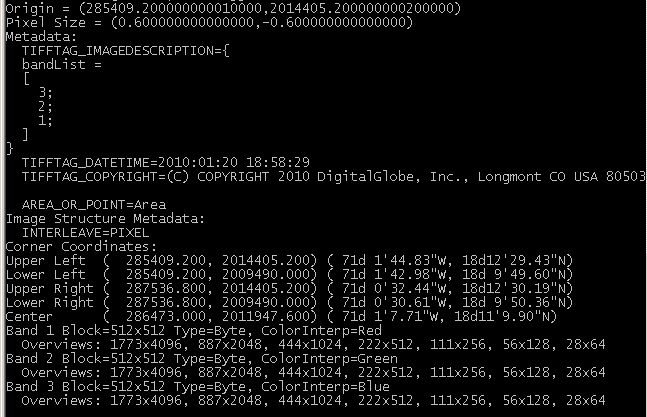
10 GeoTiff preparation STEP 0: get to know your data gdalinfo utility is your friend CheckList Missing CRS Add a.prj file Fix with gdal_translate Missing georeferencing Add a World File Fix with gdal_translate Bad Tiling Fix with gdal_translate Missing Overviews Use gdaladdo Compression Use gdal_translate
11 GeoTiff preparation STEP 1: fix and optimize with gdal_translate Inner Tiling gdal_translate -co "TILED=YES" -co "BLOCKXSIZE=512" -co "BLOCKYSIZE=512" in.tif out.tif Check also GeoTiff driver creation options here CRS and GeoReferencing gdal_translate a_srs EPSG:32619 a_ullr in.tif out.tif STEP 2: add overviews with gdal_addo Leverages on tiff support for multipage files and reduced resolution pages gdaladdo -r cubic output.tif Choose the resampling algorithm wisely Chose the tile size and compression wisely (use GDAL_TIFF_OVR_BLOCKSIZE) Consider external overviews
12 GeoTiff preparation
13 GeoTiff preparation Compression Consider when disk speed/space is an issue Control it with gdal_translate and creation options GeoTiff tiles can be compressed LZW/Deflate are good for lossless compression JPEG is good for visually lossless compression From experience Use LZW/Deflate on geophysical data (DEM, acquisitions) USE JPEG visually lossless with Photometric Interpretation to YCbCr for RGB
14 Use Cases: Time, Elevation and other dimensions MetOc data (support for time, elevation) Data with additional indipendent dimensions WorkFlow Split in multiple GeoTiff files Optimize the files individually Use ImageMosaic Use a DBMS for indexing granules Use File Name based property collectors to turn properties into DB rows attributes Filter by time, elevation and other attributes via OGC and CQL filters Check back up slides for more info!
 datastore.properties timeregex.properties stringregex.properties indexer.")
15 Time, Elevation and other dimensions Indexing multiple dimensions with DB support (video here) datastore.properties timeregex.properties stringregex.properties indexer.properties
16 Time, Elevation and other dimensions
17 Proper Mosaic Preparation ImageMosaic stitches single granules together with basic processing Filtered selection Overviews/Decimation on read Over/DownSampling in memory ColorMask (optional) Mosaic/Stitch ColorMask again (optional) Optimize files as if you were serving them individually Keep a balance between number and dimensions of granules
18 Proper Mosaic Configuration STEP 0: Configure Coverage Access (see slide 22) STEP 1: Configure Mosaic Parameters ALLOW_MULTITHREADING Load data from different granules in parallel Needs USE_JAI_IMAGE_READ set to false (Immediate Mode) Use a proper Tile Size In-memory processing, must not be too large Disk tiling should larger If memory is scarce: USE_JAI_IMAGREAD to true USE_MULTITHREADING to false* Otherwise USE_JAI_IMAGREAD to false ALLOW_MULTITHREADING to true
19 Proper Mosaic Configuration Optional (Advanced): Configure Mosaic Parameters Directly Caching Load the index in memory (using JTS SRTree) Super fast granule lookup, good for shapefiles Bad if you have additional dimension to filter on Based on Soft References, controlled via Java switch SoftRefLRUPolicyMSPerMB ExpandToRGB Expand colormapped imagery to RGB in memory Trade performance for quality SuggestedSPI Default ImageIO Decoder class to use Don t touch unless expert
20 Proper Pyramid Preparation Use gdal_retile for creating the pyramid Prepare the list of tiles to be retiled Create the pyramid with GDAL retile (grab a coffee!) Chunks should not be too small (here 2048x2048) Too many files is bad anyway Use internal Tiling for Larger chunks size If the input dataset is huge use the usedirforeachrow option Too many files in a dir is bad practice Make sure the number of level is consistent Too few bad performance at high scale
21 Proper Pyramid Configuration STEP 0: Configure Coverage Access (see slide 22) STEP 1: Configure Pyramid Parameters ImagePyramid relies on ImageMosaic ALLOW_MULTITHREADING Load data from different granules in parallel Needs USE_JAI_IMAGE_READ set to false (Immediate Mode) Use a proper Tile Size In-memory processing, must not be too large Disk tiling should larger If memory is scarce: USE_JAI_IMAGREAD to true USE_MULTITHREADING to false* Otherwise USE_JAI_IMAGREAD to false ALLOW_MULTITHREADING to true
22 Proper Pyramid Configuration Optional (Advanced): Configure Mosaic Parameters Directly Caching Load the index in memory (using JTS SRTree) Super fast granule lookup, good for shapefiles Bad if you have additional dimension to filter on Based on Soft References, controlled via Java switch SoftRefLRUPolicyMSPerMB ExpandToRGB Expand colormapped imagery to RGB in memory Trade performance for quality SuggestedSPI Default ImageIO Decoder class to use Don t touch unless expert
23 Proper GDAL Formats Configuration Fix Missing/Improper CRS with PRJ or coverage config Fix Missing GeoReferencing with World File Make sure GDAL_DATA is properly configured Use a proper Tile Size In-memory processing, must not be too large Fundamental for striped data! JNI overhead Disk tiling should larger If memory is scarce: USE_JAI_IMAGREAD to true USE_MULTITHREADING to true* Otherwise USE_JAI_IMAGREAD to false USE_MULTITHREADING is ignored
24 Proper JPEG2000 Kakadu Configuration Fix Missing/Improper CRS with PRJ or coverage config Fix Missing GeoReferencing with World File Make sure Kakadu dll/so is properly loaded Use a proper Tile Size In-memory processing Must not be too large Disk tiling should larger If memory is scarce: USE_JAI_IMAGREAD to true USE_MULTITHREADING to true* Otherwise USE_JAI_IMAGREAD to false USE_MULTITHREADING is ignored
25 Proper GeoServer Coverage Options Configuration Make sure native JAI and Image is installed Enable ImageIO native acceleration Enable JAI Mosaicking native acceleration Give JAI enough memory Don t raise JAI memory Threshold too high Rule of thumb: use 2 X #Core Tile Threads (check next slide) Enable Tile Recycling only on trunk Enable Tile Recycling if memory is not a problem
26 Proper GeoServer Coverage Options Configuration Multithreaded Granule Loading Allows to fine tuning multithreading for ImageMosaic Orthogonal to JAI Tile Threads Rule of Thumb: use 2 X #Core Tile Threads Perform testing to fine tune depending on layer configuration as well as on typical requests ImageIO Cache threshold decide when we switch to disk cache (very large WCS requests)
27 Reprojection Performance Vs Quality GeoServer 2.1.x reprojects raster data using a piecewiselinear algorithm The area is divided in rectangular blocks, each having its own affine transform The transformation between the full trigonometric expressions and the linear ones is driven by a tolerance, default value is Larger value will make reprojection faster, but lower the quality -Dorg.geotools.referencing.resampleTolerance=0.5
28 Preparing vector inputs
29 Vector data checklikst What do we want from vector data: Binary data No complex parsing of data structures Fast extraction of a geographic subset Fast filtering on the most commonly used attributes
30 Choosing a format Slow formats WFS GML DXF Good formats, local and indexable Shapefile Directory of shapefiles SDE Spatial databases: PostGIS, Oracle Spatial, DB2, MySQL*, SQL server*
31 Shapefiles vs DBMS Speed comparison vs spatial extent depicted: Shapefile very fast when rendering the full dataset Database faster when extracting a small subset of a very large data set Shapefile no attribute indexing, avoid if filtering on attribute is important (filtering == reading less data, not applying symbols) Database Rich support for complex native filters Use connection pooling (preferably via JNDI) Validate connections (with proper pooling)
32 Shapefile preparation Remove.qix file if present, let GeoServer 2.1.x rebuild it (more efficient) If there are large DBF attributes that are not in use, get rid of them using ogr2ogr, e.g.: ogr2ogr -select FULLNAME,MTFCC arealm.shp tl_2010_08013_arealm.shp If on Linux, enable memory mapping, faster, more scalable (but will kill Windows):
33 Shapefile filtering Stuck with shapefiles and have scale dependent rules like the following? Show highways first Show all streets when zoomed in Use ogr2ogr to build two shapefiles, one with just the highways, one with everything, and build two layers, e.g.: ogr2ogr -sql "SELECT * FROM tl_2010_08013_roads WHERE MTFCC in ('S1100', 'S1200')" primaryroads.shp tl_2010_08013_roads.shp
34 PostGIS specific hints PostgreSQL out of the box configured for very small hardware: Make sure to run ANALYZE after data imports (updates optimizer stats) As usual, avoid large joins in SQL views, consider materialized views If the dataset is massive, CLUSTER on the spatial index: 1.3/ch05.html Careful with prepared statements (bad performance)
35 Optimize styling


36 Use scale dependencies Never show too much data the map should be readable, not a graphic blob. Rule of thumb: 1000 features max in the display

37 Labeling Labeling conflict resolution is expensive, limit to the most inner zooms Halo is important for readability, but adds significant overhead Careful with maxdisplacement, makes for various label location attempts
, use as few as")
38 FeatureTypeStyle GeoServer uses SLD FeatureTypeStyle objects as Z layers for painting Each one allocates its own rendering surface (which can use a lot of memory), use as few as possible
39 Use translucency sparingly Translucent display is expensive, use it sparingly
40 Scale dependent rules Too often forgotten or little used, yet very important: Hide layers when too zoomed in (raster/vector example) Progressively show details Add more expensive rendering when there are less features Key to any high performance / good looking map

41 Example

42 Hide as you zoom in Add a MinScaleDenominator to the rule This will make the layer disappear at 1:75000 (towards 1:1)
43 Alternative rendering Simple rendering at low scale (up to 1:2000) More complex rendering when zoomed in (1:1999 and above)

44 Alternative rendering

45 Point symbols 600 loc for 6 different points types Painful
46 Prepare data alter table pointlm add column image varchar; update pointlm set image = 'shop_supermarket.p.16.png' where MTFCC = 'C3081' and (FULLNAME like '%Shopping%' or FULLNAME like '%Mall%'); update pointlm set image = 'peak.png' where MTFCC = 'C3022' update pointlm set image = 'amenity_prison.p.20.png' where MTFCC = 'K1236'; update pointlm set image = 'museum.p.16.png' where MTFCC = 'K2165'; update pointlm set image = 'airport.p.16.png' where MTFCC = 'K2451'; update pointlm set image = 'school.png' where MTFCC = 'K2543'; update pointlm set image = 'christian3.p.14.png' where MTFCC = 'K2582'; update pointlm set image = 'gate2.png' where MTFCC = 'K3066';
47 Dynamic symbolizers
48 Output tuning

49 WMS output formats JPEG PNG 8bit PNG 24bit 23.8KB 66KB 169.4KB 27KB 27KB Compression artifacts Color reduction Large size 64KB
50 WFS output formats Dimension MB HTTP GZip compression is transparent in GeoServer, make sure proxies keep it (or pay 10x price)
51 Tile caching
52 Tile caching with GeoWebCache Tile oriented maps, fixed zoom levels and fixed grid Useful for stable layers, backgrounds Protocols: WMTS, TMS, WMS-C, Google Maps/Earth, VE Speedup compared to dynamic WMS: 10 to 100 times, assuming tiles are already cached (whole layer preseeded) Suitable for: Mostly static layer No (or few) dynamic parameters (CQL filters, SLD params, SQL query params, time/elevation, format options)

53 Embedded GWC advantage No double encoding when using meta-tiling, faster seeding
54 Space considerations Seeding Colorado, assuming 8 cores, one layer, 0.1 sec 756x756 metatile, 15KB for each tile Do yours: Not enough disk space? Set a disk quota Zoom Time to seed Time to seed Tile count Size (MB) level (hours) (days) 13 58, , , ,713, ,855, ,396, ,584,280 3, ,273,037 14,
55 Resource control
56 WMS request limits Max memory per request: avoid large requests, allows to size the server memory (max concurrent request * max memory) Max time per request: avoid requests taking too much time (e.g., using a custom style provided with dynamic SLD in the request) Max errors: best effort renderer, but handling errors takes time

57 WFS request limits Max feature returned, configured as a global limit Return feature bbox: reduce amount of generated GML Per layer max feature count


58 WCS request limits

59 Control flow Control how many requests are executed in parallel, queue others: Increase throughput Control memory usage Enforce fairness More info here
60 Control flow 17% $GEOSERVER_DATA_DIR/controlflow.properties # don't allow more than 16 GetMap requests in parallel ows.wms.getmap=16

61 Auditing Log each and every request Log contents driven by customizable template Summarize and analyze requests with offline tools More info here
62 JVM and deploy configuration
63 Premise The options discussed here are not going to help visibly if you did not prepare the data and the styles They are finishing touches that can get performance up once the major data bottlenecks have been dealt with Check Running in production instructions here
64 JVM settings --server: enables the server JIT compiler --Xms2048m -Xmx2048m: sets the JVM use two gigabytes of memory --XX:+UseParallelOldGC -XX:+UserParallelGC: enables multi-threaded garbage collections, useful if you have more than two cores --XX:NewRatio=2: informs the JVM there will be a high number of short lived objects --XX:+AggressiveOpt: enable experimental optimizations that will be defaults in future versions of the JVM
65 Native JAI and JDK Install native JAI and use a recent Sun JDK! Benchmark over a small data set (the effect is not as visible on larger ones)
66 Setup a local cluster Java2D locks when drawing antialiased vectors Limits scalability severely Use Apache mod_proxy_balance and setup a GeoServer each 2/4 cores mod_proxy_balance GeoServer GeoServer GeoServer
67 Clustering advantage FOSS4G 2010 vector benchmarks (roads/buildings/isolines and so on, over the entire Spain) GeoServer was benchmarked without local clustering 66%
68 Benchmarking

69 Using JMeter Good benchmarking tool Allows to setup multiple thread groups, different parallelelism and request count, to ramp up the load Can use CSV files to generate semi-randomized requests Reports results in a simple table
70 Using JMeter Thread group: how many threads Loop: how many requests HTTP sampler: the request CSV: read request params from CSV Summary table
71 Generating the CSV Simple randomized generation tool built during WMS shootouts, wms_request.py Generate csv with the bbox and width/height to be used in JMeter scripts:./wms_request.py -count region minres maxres 0.1 -minsize maxsize Get it here along with a corresponding JMeter script:

72 Checking results Results table Run the benchmarks 2-3 times, let the results stabilize Save the results, check other optimizations, compare the results
73 Real world deploy

74 Deploy configuration
75 Raster data Whole Italy at 50cm per pixel Over 4TB, updated fully every 3 years (old data still available for historical access) Custom pyramid 100 m per pixel: one image 20m per pixel: mosaic of 20 tiles 4m per pixel: mosaic of few hundred tiles 0.5m per pixel: 9000 tiles Each tile is 10000x10000, with overviews
76 Vector data Cadastral data for the whole Italy, with full history (interval of validity for each parcel) 100 million polygons A query extracts a subset relative to a certain time interval and area the user is allowed to see No data from this table is ever shown below 1:50000 (SLD scale dependencies) Physical table level partitioning (Oracle style) of the table based on geographic area to parallelize and cluster data loading, plus spatial indexing and indexes on commonly filtered upon attributes

77 The End Questions?
GeoServer, The Open Source Solution for the interoperable management of geospatial data
 GeoServer, The Open Source Solution for the interoperable management of geospatial data Ing. Andrea Aime, GeoSolutions Ing. Simone Giannecchini, GeoSolutions Founded in Italy in late 2006 Expertise GeoSolutions
Choosing the right GIS framework for an informed Enterprise Web GIS Solution
 13 ANNUAL INTERNATIONAL CONFERENCE AND EXHIBITION ON GEOSPATIAL INFORMATION TECHNOLOGY AND APPLICATIONS Epicentre; Gurgaon, India; 19-21 January, 2010 Choosing the right GIS framework for an informed Enterprise
Enterprise Architectures for Large Tiled Basemap Projects. Tommy Fauvell
 Enterprise Architectures for Large Tiled Basemap Projects Tommy Fauvell Tommy Fauvell Senior Technical Analyst Esri Professional Services Washington D.C Regional Office Project Technical Lead: - Responsible
The ORIENTGATE data platform
 Seminar on Proposed and Revised set of indicators June 4-5, 2014 - Belgrade (Serbia) The ORIENTGATE data platform WP2, Action 2.4 Alessandra Nuzzo, Sandro Fiore, Giovanni Aloisio Scientific Computing and
Introduction to Imagery and Raster Data in ArcGIS
 Esri International User Conference San Diego, California Technical Workshops July 25, 2012 Introduction to Imagery and Raster Data in ArcGIS Simon Woo slides Cody Benkelman - demos Overview of Presentation
GeoNetwork, The Open Source Solution for the interoperable management of geospatial metadata
 GeoNetwork, The Open Source Solution for the interoperable management of geospatial metadata Ing. Emanuele Tajariol, GeoSolutions Ing. Simone Giannecchini, GeoSolutions GeoSolutions GeoSolutions GeoNetwork
MrSID Plug-in for 3D Analyst
 LizardTech MrSID Plug-in for 3D Analyst User Manual Copyrights Copyright 2009 2010 LizardTech. All rights reserved. Information in this document is subject to change without notice. The software described
Best Practices for Sharing Imagery using Amazon Web Services. Peter Becker
 Best Practices for Sharing Imagery using Amazon Web Services Peter Becker Objectives Making Imagery Accessible Store massive volumes of imagery on inexpensive cloud storage Use elastic compute for image
Project eharta: a collaborative initiative to digitally preserve and freely share old cartographic documents in Romania
 Vasile Crăciunescu, Ştefan Constantinescu, IonuŃ Ovejanu, Ioan Rus Project eharta: a collaborative initiative to digitally preserve and freely share old cartographic documents in Romania Keywords: geo-spatial.org;
An Introduction to Open Source Geospatial Tools
 An Introduction to Open Source Geospatial Tools by Tyler Mitchell, author of Web Mapping Illustrated GRSS would like to thank Mr. Mitchell for this tutorial. Geospatial technologies come in many forms,
ArcGIS Server Performance and Scalability Optimization and Testing. Andrew Sakowicz
 ArcGIS Server Performance and Scalability Optimization and Testing Andrew Sakowicz Objective Overview: - Key performance factors - Optimization techniques - Performance Testing Introduction Andrew Sakowicz
Oklahoma s Open Source Spatial Data Clearinghouse: OKMaps
 Oklahoma s Open Source Spatial Data Clearinghouse: OKMaps Presented by: Mike Sharp State Geographic Information Coordinator Oklahoma Office of Geographic Information MAGIC 2014 Symposium April 28-May1,
Big Data Volume & velocity data management with ERDAS APOLLO. Alain Kabamba Hexagon Geospatial
 Big Data Volume & velocity data management with ERDAS APOLLO Alain Kabamba Hexagon Geospatial Intergraph is Part of the Hexagon Family Hexagon is dedicated to delivering actionable information through
May 2012 Oracle Spatial User Conference
 1 May 2012 Oracle Spatial User Conference May 23, 2012 Ronald Reagan Building and International Trade Center Washington, DC USA Siva Ravada Director of Development New Performance Enhancements in Oracle
Performance rule violations usually result in increased CPU or I/O, time to fix the mistake, and ultimately, a cost to the business unit.
 Is your database application experiencing poor response time, scalability problems, and too many deadlocks or poor application performance? One or a combination of zparms, database design and application
In Memory Accelerator for MongoDB
 In Memory Accelerator for MongoDB Yakov Zhdanov, Director R&D GridGain Systems GridGain: In Memory Computing Leader 5 years in production 100s of customers & users Starts every 10 secs worldwide Over 15,000,000
Institute of Computational Modeling SB RAS
 Institute of Computational Modeling SB RAS ORGANIZATION OF ACCESS TO OBSERVATIONAL DATA USING WEB SERVICES FOR MONITORING SYSTEMS THE STATE OF THE ENVIRONMENT Kadochnikov Aleksey A. Russia, Krasnoyarsk
ArcGIS for Server Performance and Scalability-Testing and Monitoring Tools. Amr Wahba awahba@esri.com
 ArcGIS for Server Performance and Scalability-Testing and Monitoring Tools Amr Wahba awahba@esri.com Introductions Who are we? - ESRI Dubai Office Target audience - GIS administrators - DBAs - Architects
INTEROPERABLE IMAGE DATA ACCESS THROUGH ARCGIS SERVER
 INTEROPERABLE IMAGE DATA ACCESS THROUGH ARCGIS SERVER Qian Liu Environmental Systems Research Institute 380 New York Street Redlands, CA92373, U.S.A - qliu@esri.com KEY WORDS: OGC, Standard, Interoperability,
A Comparison of ArcIMS to MapServer
 A Comparison of ArcIMS to MapServer Brock Anderson Refractions Research www.refractions.net 1 Refractions Research Victoria, BC, Canada Spatial Systems Consulting Open Source Software PostGIS udig / GeoTools
Performance and Scalability Best Practices in ArcGIS
 2013 Europe, Middle East, and Africa User Conference October 23-25, 2013 Munich, Germany Performance and Scalability Best Practices in ArcGIS Andrew Sakowicz asakowicz@esri.com Introductions Target audience
ArcGIS ArcMap: Printing, Exporting, and ArcPress
 Esri International User Conference San Diego, California Technical Workshops July 25th, 2012 ArcGIS ArcMap: Printing, Exporting, and ArcPress Michael Grossman Jeremy Wright Workshop Overview Output in
XTM Web 2.0 Enterprise Architecture Hardware Implementation Guidelines. A.Zydroń 18 April 2009. Page 1 of 12
 XTM Web 2.0 Enterprise Architecture Hardware Implementation Guidelines A.Zydroń 18 April 2009 Page 1 of 12 1. Introduction...3 2. XTM Database...4 3. JVM and Tomcat considerations...5 4. XTM Engine...5
TESTING AND OPTIMIZING WEB APPLICATION S PERFORMANCE AQA CASE STUDY
 TESTING AND OPTIMIZING WEB APPLICATION S PERFORMANCE AQA CASE STUDY 2 Intro to Load Testing Copyright 2009 TEST4LOAD Software Load Test Experts What is Load Testing? Load testing generally refers to the
AN OPENGIS WEB MAP SERVER FOR THE ESA MULTI-MISSION CATALOGUE
 AN OPENGIS WEB MAP SERVER FOR THE ESA MULTI-MISSION CATALOGUE T. Westin a, *, C. Caspar b, L. Edgardh a, L. Schylberg c a Spacemetric AB, Tingsv 19, 19161 Sollentuna, Sweden - tw@spacemetric.se b ESA Esrin,
SharePoint 2010 Performance and Capacity Planning Best Practices
 Information Technology Solutions SharePoint 2010 Performance and Capacity Planning Best Practices Eric Shupps SharePoint Server MVP About Information Me Technology Solutions SharePoint Server MVP President,
1 How to Monitor Performance
 1 How to Monitor Performance Contents 1.1. Introduction... 1 1.2. Performance - some theory... 1 1.3. Performance - basic rules... 3 1.4. Recognizing some common performance problems... 3 1.5. Monitoring,
Open Source Geospatial Software. Bob Bruce, P.Eng Mapping and Lands Branch, Manitoba Conservation WWW.HWPS.CA Bob.Bruce@gov.mb.ca
 A Survey of Open Source Geospatial Software Bob Bruce, P.Eng Mapping and Lands Branch, Manitoba Conservation WWW.HWPS.CA Bob.Bruce@gov.mb.ca APEGM PD Breakfast Tuesday, 12 June 2007 access this presentation
Oracle Database 11g Comparison Chart
 Key Feature Summary Express 10g Standard One Standard Enterprise Maximum 1 CPU 2 Sockets 4 Sockets No Limit RAM 1GB OS Max OS Max OS Max Database Size 4GB No Limit No Limit No Limit Windows Linux Unix
ArcGIS for Server Performance and Scalability: Testing Methodologies. Andrew Sakowicz, asakowicz@esri.com Frank Pizzi, fpizzi@esri.
 ArcGIS for Server Performance and Scalability: Testing Methodologies Andrew Sakowicz, asakowicz@esri.com Frank Pizzi, fpizzi@esri.com Introductions Target audience - GIS, DB, System administrators - Testers
Geographic Web Application
 University of L Aquila Department of Electrical and Information Engineering Geographic Web Application Enrico Ippoliti Building complete web applications This section discuss how to build complete web
Liferay Portal Performance. Benchmark Study of Liferay Portal Enterprise Edition
 Liferay Portal Performance Benchmark Study of Liferay Portal Enterprise Edition Table of Contents Executive Summary... 3 Test Scenarios... 4 Benchmark Configuration and Methodology... 5 Environment Configuration...
Informatica Master Data Management Multi Domain Hub API: Performance and Scalability Diagnostics Checklist
 Informatica Master Data Management Multi Domain Hub API: Performance and Scalability Diagnostics Checklist 2012 Informatica Corporation. No part of this document may be reproduced or transmitted in any
ERDAS IMAGINE The world s most widely-used remote sensing software package
 ERDAS IMAGINE The world s most widely-used remote sensing software package ERDAS IMAGINE Geographic imaging professionals need to process vast amounts of geospatial data every day often relying on software
Web Map Service Architecture for Topographic Data in Finland
 Web Map Service Architecture for Topographic Data in Finland Teemu Sipilä National Land Survey of Finland Abstract. Since 2012 National Land Survey of Finland has been renewing its web map services and
Managing Lidar (and other point cloud) Data. Lindsay Weitz Cody Benkelman
 Data. Lindsay Weitz Cody Benkelman") (and other point cloud) Data Lindsay Weitz Cody Benkelman Presentation Context What is lidar, and how does it work? Not this presentation! What can you do with lidar in ArcGIS? What does Esri recommend
(and other point cloud) Data Lindsay Weitz Cody Benkelman Presentation Context What is lidar, and how does it work? Not this presentation! What can you do with lidar in ArcGIS? What does Esri recommend
Liferay Portal s Document Library: Architectural Overview, Performance and Scalability
 Liferay Portal s Document Library: Architectural Overview, Performance and Scalability Table of Contents EXECUTIVE SUMMARY... 1 HIGH LEVEL ARCHITECTURE... 2 User Interface Layer... 2 Service Layer....
Partitioning under the hood in MySQL 5.5
 Partitioning under the hood in MySQL 5.5 Mattias Jonsson, Partitioning developer Mikael Ronström, Partitioning author Who are we? Mikael is a founder of the technology behind NDB
Tuning Your GlassFish Performance Tips. Deep Singh Enterprise Java Performance Team Sun Microsystems, Inc.
 Tuning Your GlassFish Performance Tips Deep Singh Enterprise Java Performance Team Sun Microsystems, Inc. 1 Presentation Goal Learn tips and techniques on how to improve performance of GlassFish Application
Product Guide. Sawmill Analytics, Swindon SN4 9LZ UK sales@sawmill.co.uk tel: +44 845 250 4470
 Product Guide What is Sawmill Sawmill is a highly sophisticated and flexible analysis and reporting tool. It can read text log files from over 800 different sources and analyse their content. Once analyzed
GeoPackage, The Shapefile Of The Future
 FOSS4G 2013 GeoPackage, The Shapefile Of The Future @PirminKalberer Sourcepole AG, Switzerland www.sourcepole.com About Sourcepole > QGIS > Core dev. & Project Steering Commitee > QGIS Server, Printing,
Chapter 6: Data Acquisition Methods, Procedures, and Issues
 Chapter 6: Data Acquisition Methods, Procedures, and Issues In this Exercise: Data Acquisition Downloading Geographic Data Accessing Data Via Web Map Service Using Data from a Text File or Spreadsheet
<Insert Picture Here> Best Practices for Extreme Performance with Data Warehousing on Oracle Database
 1 Best Practices for Extreme Performance with Data Warehousing on Oracle Database Rekha Balwada Principal Product Manager Agenda Parallel Execution Workload Management on Data Warehouse
Chapter 7. Using Hadoop Cluster and MapReduce
 Chapter 7 Using Hadoop Cluster and MapReduce Modeling and Prototyping of RMS for QoS Oriented Grid Page 152 7. Using Hadoop Cluster and MapReduce for Big Data Problems The size of the databases used in
GeoMedia Smart Client
 GEOSPATIAL GeoMedia Smart Client Dynamically Jumpstart Your GIS GeoMedia Smart Client Is your geographic information system (GIS) at a gridlock, stuck in a department, limited to a few, contained and
Big Data and Analytics: Getting Started with ArcGIS. Mike Park Erik Hoel
 Big Data and Analytics: Getting Started with ArcGIS Mike Park Erik Hoel Agenda Overview of big data Distributed computation User experience Data management Big data What is it? Big Data is a loosely defined
How Express Server Software Improves Geospatial Image Delivery
 How Express Server Software Improves Geospatial Image Delivery A LIZARDTECH WHITE PAPER contact: Jon Skiffington 206-652-5211 jskiffington@lizardtech.com Written by Matt Fleagle Published June 2012 Copyright
Jozef Matula. Visualisation Team Leader IBL Software Engineering. 13 th ECMWF MetOps Workshop, 31 th Oct - 4 th Nov 2011, Reading, United Kingdom
 Visual Weather web services Jozef Matula Visualisation Team Leader IBL Software Engineering Outline Visual Weather in a nutshell. Path from Visual Weather (as meteorological workstation) to Web Server
Kentico CMS 6.0 Performance Test Report. Kentico CMS 6.0. Performance Test Report February 2012 ANOTHER SUBTITLE
 Kentico CMS 6. Performance Test Report Kentico CMS 6. Performance Test Report February 212 ANOTHER SUBTITLE 1 Kentico CMS 6. Performance Test Report Table of Contents Disclaimer... 3 Executive Summary...
Top 10 Performance Tips for OBI-EE
 Top 10 Performance Tips for OBI-EE Narasimha Rao Madhuvarsu L V Bharath Terala October 2011 Apps Associates LLC Boston New York Atlanta Germany India Premier IT Professional Service and Solution Provider
Liferay Performance Tuning
 Liferay Performance Tuning Tips, tricks, and best practices Michael C. Han Liferay, INC A Survey Why? Considering using Liferay, curious about performance. Currently implementing and thinking ahead. Running
HADOOP PERFORMANCE TUNING
 PERFORMANCE TUNING Abstract This paper explains tuning of Hadoop configuration parameters which directly affects Map-Reduce job performance under various conditions, to achieve maximum performance. The
Oracle Database In-Memory The Next Big Thing
 Oracle Database In-Memory The Next Big Thing Maria Colgan Master Product Manager #DBIM12c Why is Oracle do this Oracle Database In-Memory Goals Real Time Analytics Accelerate Mixed Workload OLTP No Changes
Cognos8 Deployment Best Practices for Performance/Scalability. Barnaby Cole Practice Lead, Technical Services
 Cognos8 Deployment Best Practices for Performance/Scalability Barnaby Cole Practice Lead, Technical Services Agenda > Cognos 8 Architecture Overview > Cognos 8 Components > Load Balancing > Deployment
Express Server: Standards-Based Image Delivery for the Geospatial Industry
 Express Server: Standards-Based Image Delivery for the Geospatial Industry Advancements in the collection of geospatial imagery in recent years have resulted in the increasing availability of greater quantities
Enterprise Manager Performance Tips
 Enterprise Manager Performance Tips + The tips below are related to common situations customers experience when their Enterprise Manager(s) are not performing consistent with performance goals. If you
Managing Imagery and Raster Data in ArcGIS
 Technical Workshops Managing Imagery and Raster Data in ArcGIS Hong Xu, Sangeet Mathew, Mark Harris Presentation Overview ArcGIS raster data models Which model to use Mosaic dataset storage and properties
Web Mapping in Archaeology
 Non-invasive methods in the contemporary archaeological practice 25th February 2014 http://www.pborycki.pl/pdf/webmapping.pdf Plan of the presentation 1 Web Mapping General Idea History of Web Mapping
SQL Server 2012 Performance White Paper
 Published: April 2012 Applies to: SQL Server 2012 Copyright The information contained in this document represents the current view of Microsoft Corporation on the issues discussed as of the date of publication.
Mark Bennett. Search and the Virtual Machine
 Mark Bennett Search and the Virtual Machine Agenda Intro / Business Drivers What to do with Search + Virtual What Makes Search Fast (or Slow!) Virtual Platforms Test Results Trends / Wrap Up / Q & A Business
Advanced Liferay Architecture: Clustering and High Availability
 Advanced Liferay Architecture: Clustering and High Availability Revision 1.1, Oct 2010 *Note: All of the configuration examples in 3 rd -party software (i.e. Apache, Sun Java) in this document are examples
SCANNING, RESOLUTION, AND FILE FORMATS
 Resolution SCANNING, RESOLUTION, AND FILE FORMATS We will discuss the use of resolution as it pertains to printing, internet/screen display, and resizing iamges. WHAT IS A PIXEL? PIXEL stands for: PICture
VISUAL INSPECTION OF EO DATA AND PRODUCTS - OVERVIEW
 WMS services from the EUMETSAT real-time Image Gallery Uwe Voges (1), Michael Schick (2), Udo Einspanier (1) (1) con terra GmbH Martin-Luther-King-Weg 24, 48155, Münster, Germany EMail: (U.Voges U.Einspanier)@conterra.de
PERFORMANCE TIPS FOR BATCH JOBS
 PERFORMANCE TIPS FOR BATCH JOBS Here is a list of effective ways to improve performance of batch jobs. This is probably the most common performance lapse I see. The point is to avoid looping through millions
Managing Large Imagery Databases via the Web
 'Photogrammetric Week 01' D. Fritsch & R. Spiller, Eds. Wichmann Verlag, Heidelberg 2001. Meyer 309 Managing Large Imagery Databases via the Web UWE MEYER, Dortmund ABSTRACT The terramapserver system is
Performance Test Report KENTICO CMS 5.5. Prepared by Kentico Software in July 2010
 KENTICO CMS 5.5 Prepared by Kentico Software in July 21 1 Table of Contents Disclaimer... 3 Executive Summary... 4 Basic Performance and the Impact of Caching... 4 Database Server Performance... 6 Web
Server GIS. What Server GIS software do we provide?
 Server GIS Distribute maps, models, and tools via the Web in a way that fits well into your workflows. SuperGeo offers numerous Server GIS solutions to fulfill the demands of corporate Intranets and the
Advanced Image Management using the Mosaic Dataset
 Esri International User Conference San Diego, California Technical Workshops July 25, 2012 Advanced Image Management using the Mosaic Dataset Vinay Viswambharan, Mike Muller Agenda ArcGIS Image Management
CURSO Inspire INSPIRE. SPEAKER: Pablo Echamendi Lorente. JEUDI 23/ THURSDAY 23 rd W S V : G E O S P A T I A L D A T A A C C E S S
 CURSO Inspire JEUDI 23/ THURSDAY 23 rd SPEAKER: Pablo Echamendi Lorente WS 5 SCHEDULE WMS OVERVIEW ACTIONS OGC SPECIFICATIONS OTHER SERVICES OVERVIEW proposal: Member States shall establish and operate
Performance Optimization Guide
 Performance Optimization Guide Publication Date: July 06, 2016 Copyright Metalogix International GmbH, 2001-2016. All Rights Reserved. This software is protected by copyright law and international treaties.
Improve Business Productivity and User Experience with a SanDisk Powered SQL Server 2014 In-Memory OLTP Database
 WHITE PAPER Improve Business Productivity and User Experience with a SanDisk Powered SQL Server 2014 In-Memory OLTP Database 951 SanDisk Drive, Milpitas, CA 95035 www.sandisk.com Table of Contents Executive
JBoss Seam Performance and Scalability on Dell PowerEdge 1855 Blade Servers
 JBoss Seam Performance and Scalability on Dell PowerEdge 1855 Blade Servers Dave Jaffe, PhD, Dell Inc. Michael Yuan, PhD, JBoss / RedHat June 14th, 2006 JBoss Inc. 2006 About us Dave Jaffe Works for Dell
In-memory Tables Technology overview and solutions
 In-memory Tables Technology overview and solutions My mainframe is my business. My business relies on MIPS. Verna Bartlett Head of Marketing Gary Weinhold Systems Analyst Agenda Introduction to in-memory
Geodatabase Tuning and Performance. Gillian Silvertand Greg Cunningham
 Geodatabase Tuning and Performance Gillian Silvertand Greg Cunningham Introduction to the Multiuser Geodatabase Workshop outline Performance and scalability Description Design Configuration Tuning and
Drupal Performance Tuning
 Drupal Performance Tuning By Jeremy Zerr Website: http://www.jeremyzerr.com @jrzerr http://www.linkedin.com/in/jrzerr Overview Basics of Web App Systems Architecture General Web
Comparison of Open Source Virtual Globes
 FOSS4G 2010 Comparison of Open Source Virtual Globes Mathias Walker Pirmin Kalberer Sourcepole AG, Bad Ragaz www.sourcepole.ch About Sourcepole GIS-Knoppix: first GIS live-cd QGIS Core developer QGIS Mapserver
SAP HANA - Main Memory Technology: A Challenge for Development of Business Applications. Jürgen Primsch, SAP AG July 2011
 SAP HANA - Main Memory Technology: A Challenge for Development of Business Applications Jürgen Primsch, SAP AG July 2011 Why In-Memory? Information at the Speed of Thought Imagine access to business data,
Using Apache Derby in the real world
 Apache Derby a 100% Java Open Source RDBMS Using Apache Derby in the real world Victorian AJUG, Australia 28 th August 2008 Chris Dance Chris Dance Introduction Director and Found of PaperCut Software
Sawmill Log Analyzer Best Practices!! Page 1 of 6. Sawmill Log Analyzer Best Practices
 Sawmill Log Analyzer Best Practices!! Page 1 of 6 Sawmill Log Analyzer Best Practices! Sawmill Log Analyzer Best Practices!! Page 2 of 6 This document describes best practices for the Sawmill universal
Various Load Testing Tools
 Various Load Testing Tools Animesh Das May 23, 2014 Animesh Das () Various Load Testing Tools May 23, 2014 1 / 39 Outline 3 Open Source Tools 1 Load Testing 2 Tools available for Load Testing 4 Proprietary
In-Memory Databases Algorithms and Data Structures on Modern Hardware. Martin Faust David Schwalb Jens Krüger Jürgen Müller
 In-Memory Databases Algorithms and Data Structures on Modern Hardware Martin Faust David Schwalb Jens Krüger Jürgen Müller The Free Lunch Is Over 2 Number of transistors per CPU increases Clock frequency
Cloud-based Geospatial Data services and analysis
 Cloud-based Geospatial Data services and analysis Xuezhi Wang Scientific Data Center Computer Network Information Center Chinese Academy of Sciences 2014-08-25 Outlines 1 Introduction of Geospatial Data
OTM Performance OTM Users Conference 2015. Jim Mooney Vice President, Product Development August 11, 2015
 OTM Performance OTM Users Conference 2015 Jim Mooney Vice President, Product Development August 11, 2015 1 Program Agenda 1 2 3 4 5 Scalability Refresher General Performance Tips Targeted Tips by Product
Step-by-Step guide for IMAGINE UAV workflow
 Step-by-Step guide for IMAGINE UAV workflow Overview This short guide will go through all steps of the UAV workflow that are needed to produce the final results. Those consist out of two raster datasets,
Performance Optimization For Operational Risk Management Application On Azure Platform
 Performance Optimization For Operational Risk Management Application On Azure Platform Ashutosh Sabde, TCS www.cmgindia.org 1 Contents Introduction Functional Requirements Non Functional Requirements Business
WebSphere Architect (Performance and Monitoring) 2011 IBM Corporation
 2011 IBM Corporation") Track Name: Application Infrastructure Topic : WebSphere Application Server Top 10 Performance Tuning Recommendations. Presenter Name : Vishal A Charegaonkar WebSphere Architect (Performance and Monitoring)
Track Name: Application Infrastructure Topic : WebSphere Application Server Top 10 Performance Tuning Recommendations. Presenter Name : Vishal A Charegaonkar WebSphere Architect (Performance and Monitoring)
Data Integrator Performance Optimization Guide
 Data Integrator Performance Optimization Guide Data Integrator 11.7.2 for Windows and UNIX Patents Trademarks Copyright Third-party contributors Business Objects owns the following
MEASURING WORKLOAD PERFORMANCE IS THE INFRASTRUCTURE A PROBLEM?
 MEASURING WORKLOAD PERFORMANCE IS THE INFRASTRUCTURE A PROBLEM? Ashutosh Shinde Performance Architect ashutosh_shinde@hotmail.com Validating if the workload generated by the load generating tools is applied
Questions and Answers
 AutoCAD Raster Design 2012 Questions and Answers Make the most of rasterized scanned drawings, maps, aerial photos, satellite imagery, and digital elevation models. Get more out of your raster data and
Cloud Computing at Google. Architecture
 Cloud Computing at Google Google File System Web Systems and Algorithms Google Chris Brooks Department of Computer Science University of San Francisco Google has developed a layered system to handle webscale
<Insert Picture Here> Oracle Database Directions Fred Louis Principal Sales Consultant Ohio Valley Region
 Oracle Database Directions Fred Louis Principal Sales Consultant Ohio Valley Region 1977 Oracle Database 30 Years of Sustained Innovation Database Vault Transparent Data Encryption
GIS Databases With focused on ArcSDE
 Linköpings universitet / IDA / Div. for human-centered systems GIS Databases With focused on ArcSDE Imad Abugessaisa g-imaab@ida.liu.se 20071004 1 GIS and SDBMS Geographical data is spatial data whose
WITH A FUSION POWERED SQL SERVER 2014 IN-MEMORY OLTP DATABASE
 WITH A FUSION POWERED SQL SERVER 2014 IN-MEMORY OLTP DATABASE 1 W W W. F U S I ON I O.COM Table of Contents Table of Contents... 2 Executive Summary... 3 Introduction: In-Memory Meets iomemory... 4 What
Technical Report. HA Set up with GeoServer
 Technical Report 2013 HA Set up with GeoServer Ing. Alessio Fabiani Ing. Andrea Aime Ing. Simone Giannecchini. Date 22/05/2013 Version 01.07 Contents Record of Changes... 4 Introduction... 5 HA set up
1. Comments on reviews a. Need to avoid just summarizing web page asks you for:
 1. Comments on reviews a. Need to avoid just summarizing web page asks you for: i. A one or two sentence summary of the paper ii. A description of the problem they were trying to solve iii. A summary of
GeoNetwork, The Open Source Solution for the interoperable management of geospatial metadata
 GeoNetwork, The Open Source Solution for the interoperable management of geospatial metadata Ing. Simone Giannecchini, GeoSolutions Ing. Emanuele Tajariol, GeoSolutions Outline GeoNetwork Introduction
Tuning WebSphere Application Server ND 7.0. Royal Cyber Inc.
 Tuning WebSphere Application Server ND 7.0 Royal Cyber Inc. JVM related problems Application server stops responding Server crash Hung process Out of memory condition Performance degradation Check if the
Insight for location-powered decision making.
 Location Intelligence Geographic Information Systems MapInfo Pro Insight for location-powered decision making. Data drives our decisions every day. Blend this data with geography and you can visualise
Automated Performance Testing of Desktop Applications
 By Ostap Elyashevskyy Automated Performance Testing of Desktop Applications Introduction For the most part, performance testing is associated with Web applications. This area is more or less covered by
Spanish examples IPR: Up to Date & Zones
 Spanish examples IPR: Up to Date & Zones 1 Spanish IPR examples We have chosen the open source option: Python Why Python? Easy to learn and understand for not it people and code can be freely used and