New, Unique, and Dedicated dataset for the Global Atlas
|
|
|
- Egbert Henry
- 7 years ago
- Views:
Transcription
1 WFES 2014 EUDP Global Wind Atlas: New, Unique, and Dedicated dataset for the Global Atlas Presented by Jake Badger EUDP is a Danish fund for development and demonstration projects from the Danish Energy Agency

2 Context The global wind atlas objectives are to: provide wind resource data accounting for high resolution effects use microscale modelling to capture small scale wind speed variability (crucial for better estimates of aggregated wind resource) Suitable for aggregation and upscaling analysis and energy integration analysis for energy planners and policy makers WARNING: Not suitable for developers and site resource assessment IPCC SRREN report: range tech. pot PWh / year (onshore and near shore) 2

3 Importance of resolution and microscale modelling Wind resource (power density) calculated at different resolutions 50 km 10 km 5 km 50 km 324 W/m W/m W/m W/m km 0.1 km 323 W/m W/m W/m W/m 2 mean power density of total area mean power density for windiest 50% of area 3

4 Importance of resolution Mean wind power density for windiest half of area 4

5 Importance of resolution Note: Even for Danish landscape effect can give 25 % boast in wind resource at the windiest 5 percentile. Mean wind power density for 10% of area 5

6 Input: newly available global dataset Reanalysis: atmospheric data Product Model system Horizontal resolution Period covered Temporal resolution ERA Interim reanalysis T255, 60 vertical levels, 4DVar ~ present 3- and 6- hourly NASA GAO/MERRA GEOS5 data assimilation system (Incremental Analysis Updates), 72 levels present 3-hourly NCAR CFDDA MM5 (regional model)+ FDDA ~40 km hourly CFSR NCEP GFS (global forecast system) ~38 km (& updating) hourly Topography: surface description Elevation Shuttle Radar Topography Mission (SRTM), version 2.1, released 2009 ASTER Global Digital Elevation Model (ASTER GDEM), version 1, released 2009 Land cover ESA GlobCover, version 2.1, released 2008, resolution 90 m resolution 30 m resolution 300 m 6
, version 2.1, released 2009 ASTER Global Digital Elevation Model (ASTER GDEM), version 1, released 2009 Land cover ESA GlobCover, version 2.")
7 Reanalysis data from NCEP DOE II mean wind at 10 m direct from dataset Wind speed shows variation in part due to changing surface roughness length. Tendency for lower winds over land, higher winds over sea. Sub-grid scale variation of orography and roughness will lead to marked variation in wind 7

8 Reanalysis data from NCEP DOE II generalized mean wind speed at 10 m and z 0 = 10 cm Wind speed shows less variation, roughness length is now 10 cm everywhere Less contrast between land and sea Generalized wind climate is the link to downscaling models described sectorwise, for different heights and different roughness lengths (WAsP libfile) 8

9 The GWA jobs MGRS grid zones form basis of the job structure MRGS grid zones are divided into 4 pieces (total 4903) 2439 jobs required
 2439 jobs")
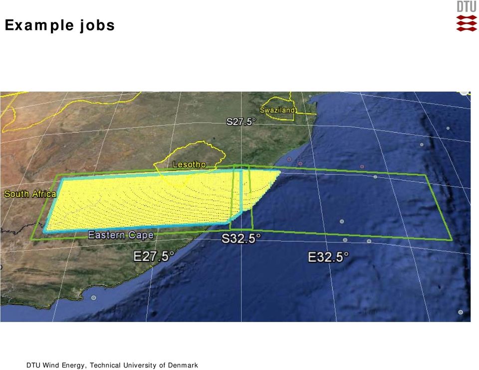
10 Example jobs

11 Example jobs
12 EUDP Global Wind Atlas Output Heights: 50, 100, 200 m Weibull A and k for 12 direction sectors Aggregated products based on calculations at 250 m grid spacing Verification against mesoscale existing national wind atlases Verification against SAR offshore resource estimation 12

13 Application of high resolution resource data Wind Atlas for South Africa (WASA) experience in planning Credit: Cornelius van der Westhuizen, CSIR, South Africa See also: Westhuizen-Methodolody-and-initial-results-of-the-DEA-wind-SEA.pdf 13

14 Application of high resolution resource data DTU PhD working on advanced GIS applications of Global Wind Atlas Conversion of high resolution wind climate data to technical potential incorporating optimization. EU JRC project developing technical potential data for TIMES-EU, derived from Global Wind Atlas Conversion and aggregation to formats for integrated assessment modelling (IAM). 14

15 Summary To discover the true global wind resource and make it available for all provide wind resource data accounting for high resolution effects use a unified methodology using newer higher reanalysis datasets verification and publication of the methodology are important be applied for aggregation and upscaling analysis and energy integration analysis for energy planners and policy makers Look out for 2 nd end-user workshop late

16 Thank you for listening Acknowledgement This work is undertaken in collaboration with the Danish Energy Agency and funded by grant EUDP 11-II, Globalt Vind Atlas,

17 Project overview 17

18 Calculation of local wind climates at microscale Job Management Console Job Creation Results Exporter WAsP Worker

Validation n 2 of the Wind Data Generator (WDG) software performance. Comparison with measured mast data - Flat site in Northern France
 software performance. Comparison with measured mast data - Flat site in Northern France") Validation n 2 of the Wind Data Generator (WDG) software performance Comparison with measured mast data - Flat site in Northern France Mr. Tristan Fabre* La Compagnie du Vent, GDF-SUEZ, Montpellier, 34967,
Validation n 2 of the Wind Data Generator (WDG) software performance Comparison with measured mast data - Flat site in Northern France Mr. Tristan Fabre* La Compagnie du Vent, GDF-SUEZ, Montpellier, 34967,
Very High Resolution Arctic System Reanalysis for 2000-2011
 Very High Resolution Arctic System Reanalysis for 2000-2011 David H. Bromwich, Lesheng Bai,, Keith Hines, and Sheng-Hung Wang Polar Meteorology Group, Byrd Polar Research Center The Ohio State University
Wind resources and wind turbine wakes in large wind farms. Professor R.J. Barthelmie Atmospheric Science and Sustainability
 Wind resources and wind turbine wakes in large wind farms Professor R.J. Barthelmie Atmospheric Science and Sustainability Overview Wind resource of Egypt Based on Wind Atlas for Egypt Wind turbine wakes
Global environmental information Examples of EIS Data sets and applications
 METIER Graduate Training Course n 2 Montpellier - february 2007 Information Management in Environmental Sciences Global environmental information Examples of EIS Data sets and applications Global datasets
118358 SUPERENSEMBLE FORECASTS WITH A SUITE OF MESOSCALE MODELS OVER THE CONTINENTAL UNITED STATES
 118358 SUPERENSEMBLE FORECASTS WITH A SUITE OF MESOSCALE MODELS OVER THE CONTINENTAL UNITED STATES Donald F. Van Dyke III * Florida State University, Tallahassee, Florida T. N. Krishnamurti Florida State
Virtual Met Mast verification report:
 Virtual Met Mast verification report: June 2013 1 Authors: Alasdair Skea Karen Walter Dr Clive Wilson Leo Hume-Wright 2 Table of contents Executive summary... 4 1. Introduction... 6 2. Verification process...
Application of Numerical Weather Prediction Models for Drought Monitoring. Gregor Gregorič Jožef Roškar Environmental Agency of Slovenia
 Application of Numerical Weather Prediction Models for Drought Monitoring Gregor Gregorič Jožef Roškar Environmental Agency of Slovenia Contents 1. Introduction 2. Numerical Weather Prediction Models -
Fremtidens vindenergi en magisters historie på Risø og DTU
 Downloaded from orbit.dtu.dk on: Oct 26, 2015 Fremtidens vindenergi en magisters historie på Risø og DTU Mortensen, Niels Gylling Publication date: 2015 Document Version Author final version (often known
Baudouin Raoult, Iryna Rozum, Dick Dee
 ECMWF contribution to the EU funded CHARME Project: A Significant Event Viewer tool Matthew Manoussakis Baudouin Raoult, Iryna Rozum, Dick Dee 5th Workshop on the use of GIS/OGC standards in meteorology
46200 Planning and Development of Wind Farms: Wind resource assessment using the WAsP software
 Downloaded from orbit.dtu.dk on: Jan 30, 2016 46200 Planning and Development of Wind Farms: Wind resource assessment using the WAsP software Mortensen, Niels Gylling Publication date: 2014 Document Version
The Role of Resource Assessment in Scaling Up Renewable Energy
 The Role of Resource Assessment in Scaling Up Renewable Energy Charging Ahead: Scaling Up Renewable Energy in the Developing World Nisha Thirumurthy October 27, 2015 NREL is a national laboratory of the
Integrating WAsP and GIS Tools for Establishing Best Positions for Wind Turbines in South Iraq
 Integrating WAsP and GIS Tools for Establishing Best Positions for Wind Turbines in South Iraq S.M. Ali Remote Sensing Research Unit, College of Science, Univ. of Baghdad, Baghdad, Iraq deanoffice {at}
White Paper. PlanetDEM 30. PlanetObserver 25/11/2014 - Update
 White Paper PlanetDEM 30 PlanetObserver 25/11/2014 - Update PlanetObserver France www.planetobserver.com msat@planetobserver.com Tel. +33 4 73 44 19 00 1. Introduction PlanetObserver presents PlanetDEM
REGIONAL CLIMATE AND DOWNSCALING
 REGIONAL CLIMATE AND DOWNSCALING Regional Climate Modelling at the Hungarian Meteorological Service ANDRÁS HORÁNYI (horanyi( horanyi.a@.a@met.hu) Special thanks: : Gabriella Csima,, Péter Szabó, Gabriella
Research and Education in the Field of Wind Energy at the Technical University of Denmark
 Research and Education in the Field of Wind Energy at the Technical University of Denmark Jens Nørkær Sørensen Head of Section of Fluid Mechanics DTU Wind Energy DTU Wind Energy The department, which was
Titelmasterformat durch Klicken. bearbeiten
 Evaluation of a Fully Coupled Atmospheric Hydrological Modeling System for the Sissili Watershed in the West African Sudanian Savannah Titelmasterformat durch Klicken June, 11, 2014 1 st European Fully
Impacts of a future city master plan on on thermal and wind environments in Vinh city, Vietnam
 Impacts of a future city master plan on on thermal and wind environments in Vinh city, Vietnam Satoru Iizuka, Nagoya University, Japan Tatsunori Ito, Nagoya University, Japan Masato Miyata, Mitsubishi
THE STRATEGIC PLAN OF THE HYDROMETEOROLOGICAL PREDICTION CENTER
 THE STRATEGIC PLAN OF THE HYDROMETEOROLOGICAL PREDICTION CENTER FISCAL YEARS 2012 2016 INTRODUCTION Over the next ten years, the National Weather Service (NWS) of the National Oceanic and Atmospheric Administration
Fire Weather Index: from high resolution climatology to Climate Change impact study
 Fire Weather Index: from high resolution climatology to Climate Change impact study International Conference on current knowledge of Climate Change Impacts on Agriculture and Forestry in Europe COST-WMO
A E O L I S F O R E C A S T I N G S E R V I C E S WIND FARM ENERGY ASSESSMENT - FEASIBILITY STUDY. Kees van Vliet
 A E O L I S F O R E C A S T I N G S E R V I C E S WIND FARM ENERGY ASSESSMENT - FEASIBILITY STUDY Kees van Vliet September 2007 K o n i n g s l a a n 11 2 3 5 8 3 G V U t r e c h t T h e N e t h e r l
2015 Global Risk Assessment. Sahar Safaie Program Officer, UNISDR Risk Knowledge Section
 2015 Global Risk Assessment Sahar Safaie Program Officer, UNISDR Risk Knowledge Section Outline Global Assessment Report (GAR) evolution Global Risk Assessment for GAR15 Objective Scope Audience/Users
Solar Resource Assessment
 Introduction to Resource Assessments Carsten Hoyer-Klick Folie 1 Solar Resource Assessment Folie 2 1 Global Horizontal Irradiation (GHI) Direct Horizontal Irradiation (DHI) Diffuse Irradiation (DIF) GHI
QUICK GUIDE - WASP-CFD IN WINDPRO. Draft 1 edition: 01.02.2013. Purpose: EMD International A/S, Aalborg February 1 st, 2013
 EMD International A/S, Aalborg February 1 st, 2013 QUICK GUIDE - WASP-CFD IN WINDPRO Draft 1 edition: 01.02.2013 Purpose: To purpose of the WAsP CFD model in WindPRO is to enable the WindPRO user to calculate
Working Group 1: Wind Energy Resource
 Wind Energy Technology Platform Working Group 1: Wind Energy Resource Presented by Ignacio Martí CENER imarti@cener.com Authors: wg1 participants WG1 Participants Erik Lundtang Petersen (Chairman) Risø
Complex terrain wind resource estimation with the wind-atlas method: Prediction errors using linearized and nonlinear CFD micro-scale models
 Downloaded from orbit.dtu.dk on: Jan 05, 2016 Complex terrain wind resource estimation with the wind-atlas method: Prediction errors using linearized and nonlinear CFD micro-scale models Troen, Ib; Bechmann,
The information in this report is provided in good faith and is believed to be correct, but the Met. Office can accept no responsibility for any
 Virtual Met Mast Version 1 Methodology and Verification January 2010 The information in this report is provided in good faith and is believed to be correct, but the Met. Office can accept no responsibility
Remote Sensing an Introduction
 Remote Sensing an Introduction Seminar: Space is the Place Referenten: Anica Huck & Michael Schlund Remote Sensing means the observation of, or gathering information about, a target by a device separated
GIS Initiative: Developing an atmospheric data model for GIS. Olga Wilhelmi (ESIG), Jennifer Boehnert (RAP/ESIG) and Terri Betancourt (RAP)
, Jennifer Boehnert (RAP/ESIG) and Terri Betancourt (RAP)") GIS Initiative: Developing an atmospheric data model for GIS Olga Wilhelmi (ESIG), Jennifer Boehnert (RAP/ESIG) and Terri Betancourt (RAP) Unidata seminar August 30, 2004 Presentation Outline Overview
GIS Initiative: Developing an atmospheric data model for GIS Olga Wilhelmi (ESIG), Jennifer Boehnert (RAP/ESIG) and Terri Betancourt (RAP) Unidata seminar August 30, 2004 Presentation Outline Overview
Database of measurements on the offshore wind farm Egmond aan Zee
 Database of measurements on the offshore wind farm Egmond aan Zee A.J. Brand J.W. Wagenaar P.J. Eecen M.C. Holtslag 1 1 TU Delft, Faculty Aerospace Engineering Presented at the the EWEA 2012 conference,
Coupling micro-scale CFD simulations to meso-scale models
 Coupling micro-scale CFD simulations to meso-scale models IB Fischer CFD+engineering GmbH Fabien Farella Michael Ehlen Achim Fischer Vortex Factoria de Càlculs SL Gil Lizcano Outline Introduction O.F.Wind
PE s Research activities and potential links to MM5. Red Ibérica MM5 Valencia 9th -10th June 2005
 PE s Research activities and potential links to MM5 Red Ibérica MM5 Valencia 9th -10th June 2005 PE and its R&D Area Puertos del Estado (PE) is a Public Institution that deals with the administration of
The University of Melbourne cyclone tracking software
 The University of Melbourne cyclone tracking software Kevin Keay August 26 2009 Introduction The University of Melbourne automatic cyclone tracking scheme (Murray and Simmonds 1991, and subsequent papers)
Research Objective 4: Develop improved parameterizations of boundary-layer clouds and turbulence for use in MMFs and GCRMs
 Research Objective 4: Develop improved parameterizations of boundary-layer clouds and turbulence for use in MMFs and GCRMs Steve Krueger and Chin-Hoh Moeng CMMAP Site Review 31 May 2007 Scales of Atmospheric
Development of an Integrated Data Product for Hawaii Climate
 Development of an Integrated Data Product for Hawaii Climate Jan Hafner, Shang-Ping Xie (PI)(IPRC/SOEST U. of Hawaii) Yi-Leng Chen (Co-I) (Meteorology Dept. Univ. of Hawaii) contribution Georgette Holmes
Selected Ac)vi)es Overseen by the WDAC
vi)es Overseen by the WDAC") Selected Ac)vi)es Overseen by the WDAC Some background obs4mips ana4mips CREATE- IP (in planning stage) Contribu)ons from: M. Bosilovich, O. Brown, V. Eyring, R. Ferraro., P. Gleckler, R. Joseph, J. PoQer,
Selected Ac)vi)es Overseen by the WDAC Some background obs4mips ana4mips CREATE- IP (in planning stage) Contribu)ons from: M. Bosilovich, O. Brown, V. Eyring, R. Ferraro., P. Gleckler, R. Joseph, J. PoQer,
Marine route optimization. Jens Olaf Pepke Pedersen Polar DTU / DTU Space www.polar.dtu.dk www.space.dtu.dk
 Marine route optimization Jens Olaf Pepke Pedersen Polar DTU / DTU Space www.polar.dtu.dk www.space.dtu.dk Early attempt at route optimization Jens Munk (1579-1628) Tries to find a way to India through
Parameterization of Cumulus Convective Cloud Systems in Mesoscale Forecast Models
 DISTRIBUTION STATEMENT A. Approved for public release; distribution is unlimited. Parameterization of Cumulus Convective Cloud Systems in Mesoscale Forecast Models Yefim L. Kogan Cooperative Institute
Satellite Altimetry Missions
 Satellite Altimetry Missions SINGAPORE SPACE SYMPOSIUM 30 TH SEPTEMBER 2015 AUTHORS: LUCA SIMONINI/ ERICK LANSARD/ JOSE M GONZALEZ www.thalesgroup.com Table of Content General Principles and Applications
Preliminary advances in Climate Risk Management in China Meteorological Administration
 Preliminary advances in Climate Risk Management in China Meteorological Administration Gao Ge Guayaquil,Ecuador, Oct.2011 Contents China Framework of Climate Service Experience in Climate/disaster risk
High-resolution Regional Reanalyses for Europe and Germany
 High-resolution Regional Reanalyses for Europe and Germany Christian Ohlwein 1,2, Jan Keller 1,4, Petra Friederichs 2, Andreas Hense 2, Susanne Crewell 3, Sabrina Bentzien 1,2, Christoph Bollmeyer 1,2,
Wide Area Persistent Scatterer Interferometry: Algorithms and Examples
 Wide Area Persistent Scatterer Interferometry: Algorithms and Examples Nico Adam, Fernando Rodriguez Gonzalez, Alessandro Parizzi, Werner Liebhart with contributions of Ramon Brcic and Xiao Ying Cong ca.
Towards an NWP-testbed
 Towards an NWP-testbed Ewan O Connor and Robin Hogan University of Reading, UK Overview Cloud schemes in NWP models are basically the same as in climate models, but easier to evaluate using ARM because:
UK Global Forest Monitoring Network: Forest Carbon Tracking
 UK Global Forest Monitoring Network: Forest Carbon Tracking Andy Shaw Director, Knowledge Exchange, NCEO Head of Strategic Business Development, ISIC GMES/GEO Forum, ISIC, 2011 What is happening to the
The Wind Integration National Dataset (WIND) toolkit
 toolkit") The Wind Integration National Dataset (WIND) toolkit EWEA Wind Power Forecasting Workshop, Rotterdam December 3, 2013 Caroline Draxl NREL/PR-5000-60977 NREL is a national laboratory of the U.S. Department
The Wind Integration National Dataset (WIND) toolkit EWEA Wind Power Forecasting Workshop, Rotterdam December 3, 2013 Caroline Draxl NREL/PR-5000-60977 NREL is a national laboratory of the U.S. Department
Guy Carpenter Asia-Pacific Climate Impact Centre, School of energy and Environment, City University of Hong Kong
 Diurnal and Semi-diurnal Variations of Rainfall in Southeast China Judy Huang and Johnny Chan Guy Carpenter Asia-Pacific Climate Impact Centre School of Energy and Environment City University of Hong Kong
Multisensor Data Integration in O&G Business Lutz Petrat Hélène Lemonnier Michael Hall
 Multisensor Data in O&G Business Lutz Petrat Hélène Lemonnier Michael Hall ESA Oil and Gas Workshop 15/09/2010, Frascati, Italy Satellite Products and Services during a typical O&G project Project Life
Armenian State Hydrometeorological and Monitoring Service
 Armenian State Hydrometeorological and Monitoring Service Offenbach 1 Armenia: IN BRIEF Armenia is located in Southern Caucasus region, bordering with Iran, Azerbaijan, Georgia and Turkey. The total territory
Information Contents of High Resolution Satellite Images
 Information Contents of High Resolution Satellite Images H. Topan, G. Büyüksalih Zonguldak Karelmas University K. Jacobsen University of Hannover, Germany Keywords: satellite images, mapping, resolution,
Data Management Framework for the North American Carbon Program
 Data Management Framework for the North American Carbon Program Bob Cook, Peter Thornton, and the Steering Committee Image courtesy of NASA/GSFC NACP Data Management Planning Workshop New Orleans, LA January
Distributed Computing. Mark Govett Global Systems Division
 Distributed Computing Mark Govett Global Systems Division Modeling Activities Prediction & Research Weather forecasts, climate prediction, earth system science Observing Systems Denial experiments Observing
On the CyberShARE site you will find this interpolated version (labeled SRTMv4_90m)
") SRTM Data on Cyber-ShARE The Shuttle Radar Topography Mission (SRTM) data collected by NASA represents the most up-to-date, globally collected topography data set of the Earth. It makes up the first globally
SRTM Data on Cyber-ShARE The Shuttle Radar Topography Mission (SRTM) data collected by NASA represents the most up-to-date, globally collected topography data set of the Earth. It makes up the first globally
Modelling the Marine Boundary Layer for Offshore Wind Power Utilisation
 Modelling the Marine Boundary Layer for Offshore Wind Power Utilisation Vom Fachbereich Physik der Universität Oldenburg zur Erlangung des Grades eines Doktors der Naturwissenschaften (Dr. rer. nat.) angenommene
Wind resources map of Spain at mesoscale. Methodology and validation
 Wind resources map of Spain at mesoscale. Methodology and validation Martín Gastón Edurne Pascal Laura Frías Ignacio Martí Uxue Irigoyen Elena Cantero Sergio Lozano Yolanda Loureiro e-mail:mgaston@cener.com
Climatological characterisation of the Ora del Garda wind in the Alps
 Climatological characterisation of the Ora del Garda wind in the Alps L. Giovannini 1, L. Laiti 1, D. Zardi 1, M. de Franceschi 1,2 dino.zardi@ing.unitn.it 1 Atmospheric Physics Group, Department of Civil,
SOUTH EAST EUROPE TRANSNATIONAL CO-OPERATION PROGRAMME
 SOUTH EAST EUROPE TRANSNATIONAL CO-OPERATION PROGRAMME 3 rd Call for Proposals Terms of reference Climate Change Adaptation: assessing vulnerabilities and risks and translating them to implementation actions
IMPACT OF SAINT LOUIS UNIVERSITY-AMERENUE QUANTUM WEATHER PROJECT MESONET DATA ON WRF-ARW FORECASTS
 IMPACT OF SAINT LOUIS UNIVERSITY-AMERENUE QUANTUM WEATHER PROJECT MESONET DATA ON WRF-ARW FORECASTS M. J. Mueller, R. W. Pasken, W. Dannevik, T. P. Eichler Saint Louis University Department of Earth and
TerraSAR-X Applications Guide
 TerraSAR-X Applications Guide Extract: Maritime Monitoring: Oil Spill Detection April 2015 Airbus Defence and Space Geo-Intelligence Programme Line Maritime Monitoring: Oil Spill Detection Issue As the
Urban Climatic Map of Arnhem City
 Urban Climatic Map of Arnhem City Renè Burghardt, Lutz Katzschner, Sebastian Kupski, University Kassel Ren Chao, Tejo Spit University Utrecht May 2010 1 1 INTRODUCTION In the framework of urban planning
Malcolm L. Spaulding Professor Emeritus, Ocean Engineering University of Rhode Island Narragansett, RI 02881
 Malcolm L. Spaulding Professor Emeritus, Ocean Engineering University of Rhode Island Narragansett, RI 02881 USACE Coastal and Hydraulics Laboratory(CHL) Data Infrastructure Workshop January 23, 2014 Overview
Comparison of Resource and Energy Yield Assessment Procedures
 Comparison of Resource and Energy Yield Assessment Procedures Niels G. Mortensen and Hans E. Jørgensen Wind Energy Division, Risø DTU EWEA Wind Resource Assessment Technology Workshop 2011 F Acknowledgements
Proposals of Summer Placement Programme 2015
 Proposals of Summer Placement Programme 2015 Division Project Title Job description Subject and year of study required A2 Impact of dual-polarization Doppler radar data on Mathematics or short-term related
Satellite'&'NASA'Data'Intro'
 Satellite'&'NASA'Data'Intro' Research'vs.'Opera8ons' NASA':'Research'satellites' ' ' NOAA/DoD:'Opera8onal'Satellites' NOAA'Polar'Program:'NOAA>16,17,18,19,NPP' Geosta8onary:'GOES>east,'GOES>West' DMSP'series:'SSM/I,'SSMIS'
Can latent heat release have a negative effect on polar low intensity?
 Can latent heat release have a negative effect on polar low intensity? Ivan Føre, Jon Egill Kristjansson, Erik W. Kolstad, Thomas J. Bracegirdle and Øyvind Sætra Polar lows: are intense mesoscale cyclones
Offshore wind potential in Europe and review of offshore resource modelling techniques
 Offshore wind potential in Europe and review of offshore resource modelling techniques Rebecca Barthelmie, Sten Frandsen & Sara Pryor (Risø National Laboratory, Wind Energy Department), Colin Morgan (Garrad
Notable near-global DEMs include
 Visualisation Developing a very high resolution DEM of South Africa by Adriaan van Niekerk, Stellenbosch University DEMs are used in many applications, including hydrology [1, 2], terrain analysis [3],
Climate Ready Tools & Resources
 August 2, 2013 Mission Statement To provide the water sector (drinking water, wastewater, and stormwater utilities) with the practical tools, training, and technical assistance needed to adapt to climate
Data Exploration with GIS Viewsheds and Social Network Analysis
 Data Exploration with GIS Viewsheds and Social Network Analysis Giles Oatley 1, Tom Crick 1 and Ray Howell 2 1 Department of Computing, Cardiff Metropolitan University, UK 2 Faculty of Business and Society,
Evaluating GCM clouds using instrument simulators
 Evaluating GCM clouds using instrument simulators University of Washington September 24, 2009 Why do we care about evaluation of clouds in GCMs? General Circulation Models (GCMs) project future climate
ESA Climate Change Initiative contributing to the Global Space-based Architecture for Climate Monitoring
 ESA Climate Change Initiative contributing to the Global Space-based Architecture for Climate Monitoring Pascal Lecomte Head of the ESA Climate Office ESA/ECSAT Global Space-based Architecture for Climate
AZ EGER-PATAK HIDROLÓGIAI VIZSGÁLATA, A FELSZÍNI VÍZKÉSZLETEK VÁRHATÓ VÁLTOZÁSÁBÓL ADÓDÓ MÓDOSULÁSOK AZ ÉGHAJLATVÁLTOZÁS HATÁSÁRA
 AZ EGER-PATAK HIDROLÓGIAI VIZSGÁLATA, A FELSZÍNI VÍZKÉSZLETEK VÁRHATÓ VÁLTOZÁSÁBÓL ADÓDÓ MÓDOSULÁSOK AZ ÉGHAJLATVÁLTOZÁS HATÁSÁRA GÁBOR KEVE 1, GÉZA HAJNAL 2, KATALIN BENE 3, PÉTER TORMA 4 EXTRAPOLATING
USING SIMULATED WIND DATA FROM A MESOSCALE MODEL IN MCP. M. Taylor J. Freedman K. Waight M. Brower
 USING SIMULATED WIND DATA FROM A MESOSCALE MODEL IN MCP M. Taylor J. Freedman K. Waight M. Brower Page 2 ABSTRACT Since field measurement campaigns for proposed wind projects typically last no more than
BIG DATA POSSIBILITIES AND CHALLENGES
 BIG DATA POSSIBILITIES AND CHALLENGES PROFESSOR AND CENTER DIRECTOR WHY BIG DATA? In God we trust - all others must bring data W. Edwards Deming (US engineer and statistician, 1900-1993) WHAT IS BIG DATA?
How To Forecast Solar Power
 Forecasting Solar Power with Adaptive Models A Pilot Study Dr. James W. Hall 1. Introduction Expanding the use of renewable energy sources, primarily wind and solar, has become a US national priority.
Real-time Ocean Forecasting Needs at NCEP National Weather Service
 Real-time Ocean Forecasting Needs at NCEP National Weather Service D.B. Rao NCEP Environmental Modeling Center December, 2005 HYCOM Annual Meeting, Miami, FL COMMERCE ENVIRONMENT STATE/LOCAL PLANNING HEALTH
Application of global 1-degree data sets to simulate runoff from MOPEX experimental river basins
 18 Large Sample Basin Experiments for Hydrological Model Parameterization: Results of the Model Parameter Experiment. IAHS Publ. 37, 26. Application of global 1-degree data sets to simulate from experimental
Pacific Catastrophe Risk Assessment and Financing Initiative. Better Information for Smarter Investments
 Pacific Catastrophe Risk Assessment and Financing Initiative Better Information for Smarter Investments Main Outputs Pacific disaster risk assessment Probabilistic assessment of major perils Pacific Risk
A Comparison Between Theoretically Calculated and Pratically Generated Electrical Powers of Wind Turbines: A Case Study in Belen Wind farm, Turkey
 M.ŞEKKELİ / APJES 1- (01) 41-47 41 A Comparison Between Theoretically Calculated and Pratically Generated Electrical Powers of Wind Turbines: A Case Study in Belen Wind farm, Turkey *1 Mustafa Şekkeli,
User Perspectives on Project Feasibility Data
 User Perspectives on Project Feasibility Data Marcel Šúri Tomáš Cebecauer GeoModel Solar s.r.o., Bratislava, Slovakia marcel.suri@geomodel.eu http://geomodelsolar.eu http://solargis.info Solar Resources
Group Session 1-3 Rain and Cloud Observations
 Group Session 1-3 Rain and Cloud Observations Targets in Science Plans CINDY Science Plan (Apr. 2009) DYNAMO SPO (Jul. 2009) Atmospheric Research a. Preconditioning processes b. Rossby wave c. Diabatic
IBM Big Green Innovations Environmental R&D and Services
 IBM Big Green Innovations Environmental R&D and Services Smart Weather Modelling Local Area Precision Forecasting for Weather-Sensitive Business Operations (e.g. Smart Grids) Lloyd A. Treinish Project
Project Title: Quantifying Uncertainties of High-Resolution WRF Modeling on Downslope Wind Forecasts in the Las Vegas Valley
 University: Florida Institute of Technology Name of University Researcher Preparing Report: Sen Chiao NWS Office: Las Vegas Name of NWS Researcher Preparing Report: Stanley Czyzyk Type of Project (Partners
Near Real Time Blended Surface Winds
 Near Real Time Blended Surface Winds I. Summary To enhance the spatial and temporal resolutions of surface wind, the remotely sensed retrievals are blended to the operational ECMWF wind analyses over the
CIESIN Columbia University
 Conference on Climate Change and Official Statistics Oslo, Norway, 14-16 April 2008 The Role of Spatial Data Infrastructure in Integrating Climate Change Information with a Focus on Monitoring Observed
Ruimtelijke planning in tijden van klimaatsverandering
 Ruimtelijke planning in tijden van klimaatsverandering Eric Koomen Vrije Universiteit Amsterdam/ Geodan Next Nascholingscursus Water, rivieren en GIS' 3 april 2008 Outline Climate change climate and land
EERA-DTOC Software. Amsterdam, 24 September 2014
 EERA-DTOC Software Amsterdam, 24 September 2014 Gregor Giebel, DTU Wind Energy, Risø, DK Igor Waldl, Felix Dierich, Overspeed, Oldenburg, DE Peter Stuart, RES, London, UK Support by Integration task 3
Testing and Evaluation of GSI-Hybrid Data Assimilation and Its Applications for HWRF at the Developmental Testbed Center
 214 Tropical Cyclone Research Forum (TCRF)/68th IHC, March 3-6, 214, College Park, MD Testing and Evaluation of GSI-Hybrid Data Assimilation and Its Applications for HWRF at the Developmental Testbed Center
Main ideas, methods, WPs and planned workshops. Henrik Madsen,
 CITIES Consortium Meeting, May 2014 Main ideas, methods, WPs and planned workshops Henrik Madsen, Center Manager Concepts Integration based on IT solutions leading to methods for operation and planning
How To Calculate Flood Damage Potential In European Landscape
 Background/Introduction RISK ANALYSIS MODULE 3, CASE STUDY 2 Flood Damage Potential at European Scale By Dr. Peter Burek There is good reason to be concerned about the growth of flood losses in Europe.
Using LIDAR to monitor beach changes: Goochs Beach, Kennebunk, Maine
 Geologic Site of the Month February, 2010 Using LIDAR to monitor beach changes: Goochs Beach, Kennebunk, Maine 43 o 20 51.31 N, 70 o 28 54.18 W Text by Peter Slovinsky, Department of Agriculture, Conservation
1 laser altimeter. Background & Instructions. exploration extension. Instructions. Background
 extension 1 laser altimeter Background & First 3-D view of the north pole of Mars from MOLA (Image credit: MOLA science Team/NASA/GSFC SVS) Background A laser altimeter is a device used aboard planet-orbiting
Prediction of Storm Surge using Space Data. Susanne Lehner German Aerospace Center
 Prediction of Storm Surge using Space Data Susanne Lehner German Aerospace Center Existing Crisis Information State of the Art of Satellite Crisis Information (ZKI) Mapping after the storm www.zki.de
Sub-grid cloud parametrization issues in Met Office Unified Model
 Sub-grid cloud parametrization issues in Met Office Unified Model Cyril Morcrette Workshop on Parametrization of clouds and precipitation across model resolutions, ECMWF, Reading, November 2012 Table of
Driving Earth Systems Collaboration across the Pacific
 Driving Earth Systems Collaboration across the Pacific Tim F. Pugh Centre for Australian Weather and Climate Research Australian Bureau of Meteorology What s our business? Earth System Science Study of
Catastrophe Bond Risk Modelling
 Catastrophe Bond Risk Modelling Dr. Paul Rockett Manager, Risk Markets 6 th December 2007 Bringing Science to the Art of Underwriting Agenda Natural Catastrophe Modelling Index Linked Securities Parametric
Intra-seasonal and Annual variability of the Agulhas Current from satellite observations
 Intra-seasonal and Annual variability of the Agulhas Current from satellite observations Marjolaine Krug Ecosystem Earth Observation (CSIR NRE) Pierrick Penven Laboratoire de Physique des Océans (IRD)
A Hybrid ETKF 3DVAR Data Assimilation Scheme for the WRF Model. Part II: Real Observation Experiments
 5132 M O N T H L Y W E A T H E R R E V I E W VOLUME 136 A Hybrid ETKF 3DVAR Data Assimilation Scheme for the WRF Model. Part II: Real Observation Experiments XUGUANG WANG Cooperative Institute for Research
LAND USE AND SEASONAL GREEN VEGETATION COVER OF THE CONTERMINOUS USA FOR USE IN NUMERICAL WEATHER MODELS
 LAND USE AND SEASONAL GREEN VEGETATION COVER OF THE CONTERMINOUS USA FOR USE IN NUMERICAL WEATHER MODELS Kevin Gallo, NOAA/NESDIS/Office of Research & Applications Tim Owen, NOAA/NCDC Brad Reed, SAIC/EROS
 Mesoscale re-analysis of historical meteorological data over Europe Anna Jansson and Christer Persson, SMHI ERAMESAN A first attempt at SMHI for re-analyses of temperature, precipitation and wind over
Optimized pathways towards ambitious climate protection in the European electricity system (EU Long-term scenarios 2050 II)
") Final report Optimized pathways towards ambitious climate protection in the European electricity system (EU Long-term scenarios 2050 II) Financed by the Federal Ministry for the Environment, Nature Conservation,
Final report Optimized pathways towards ambitious climate protection in the European electricity system (EU Long-term scenarios 2050 II) Financed by the Federal Ministry for the Environment, Nature Conservation,
Marin fornybar energi Prof Peter M Haugan, Geofysisk institutt, basert på materiale fra Prof II Finn Gunnar Nielsen, Geofysisk Institutt
 Ny fornybar energi del 3: Marin fornybar energi Prof Peter M Haugan, Geofysisk institutt, basert på materiale fra Prof II Finn Gunnar Nielsen, Geofysisk Institutt Outline General. Marine renewables Wind