Feuer und Eis: von den Tücken der
|
|
|
- Erika Mosley
- 7 years ago
- Views:
Transcription
1 Feuer und Eis: von den Tücken der Schneefallfernerkundung What happened Prof. Susanne Crewell after Institut für Geophysik und Meteorologie CLIWA-NET ? Prof. Susanne Crewell University of Cologne

2 First visit to Cabauw...

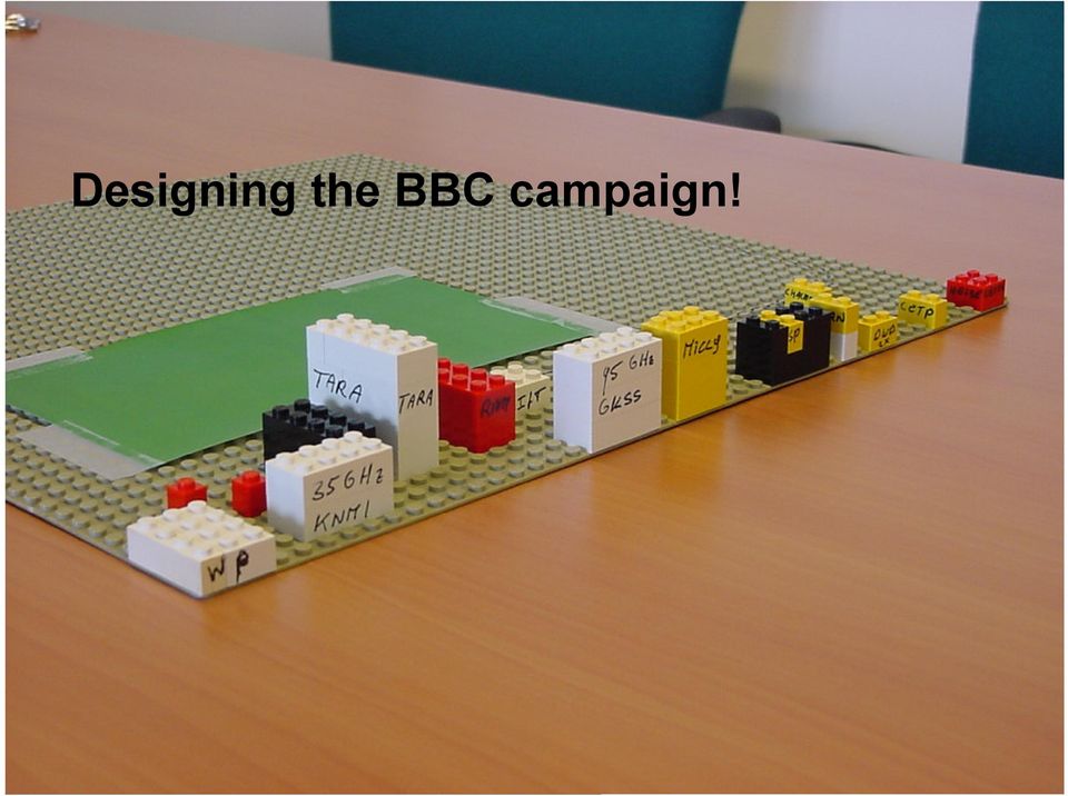
3 Designing the BBC campaign!
4 MICAM Microwave Radiometer Intercomparison Campaign

5 MICCY Microwave Radiometer for Cloud Carthography

6
7

8

9 Going South! Stefan Kneifel, Ulrich Löhnert, XinXin Xie Brief introduction to active and passive microwave remote sensing Environmental Research Station Schneefernerhaus TOSCA Campaign Implications for snow remote sensing

10 Motivation How does precipitation change in a changing climate?..but how to measure snow globally Peter Bauer, ECMWF, Earth Explorer Mission National Consultation Meeting

11 Thermal Emission of the Atmosphere Oxygen Simulation for a 3 km thick cloud: Optical depth Water vapor Liquid water Liquid water: 0.1 kg/m² What happens in case of snow? Frequency [GHz] HATPRO: 7 Channels GHz 7 Channels GHz DPR: 90 GHZ and 150 GHz (vertical/horizontal)

12 How does an ice particle look like?

 Frequency [GHz] HATPRO: 7 Channels 22.235 31.4 GHz 7 Channels 50.8 58.")
13 Thermal Emission of the Atmosphere Snow Simulation for a 3 km thick cloud: Optical depth total Liquid water Liquid water: 0.1 kg/m² Snow 0.3 kg/m² Sauerstoff Wasserdampf Snow Scattering for 3 different crystal types (Liu-Database, BAMS, 2008) Frequency [GHz] HATPRO: 7 Channels GHz 7 Channels GHz DPR: 90 GHZ and 150 GHz (vertical/horizontal)
 Frequency [GHz] HATPRO: 7 Channels 22.235 31.")

14 Scattering in the Microwaves Range TB depression snow scattering liquid water emission TB enhancement MWR Thermal surface emission snow layer with temperature T and emissivity e Ground?

15 Radiometer at Schneefernerhaus DPR 90/150 h,v GHz HATPRO K-Band: GHz V-Band: GHz Löhnert et al.,

16 Schneefernerhaus Löhnert et al.,

17 Sensor Synergy at Schneefernerhaus Löhnert et al.,

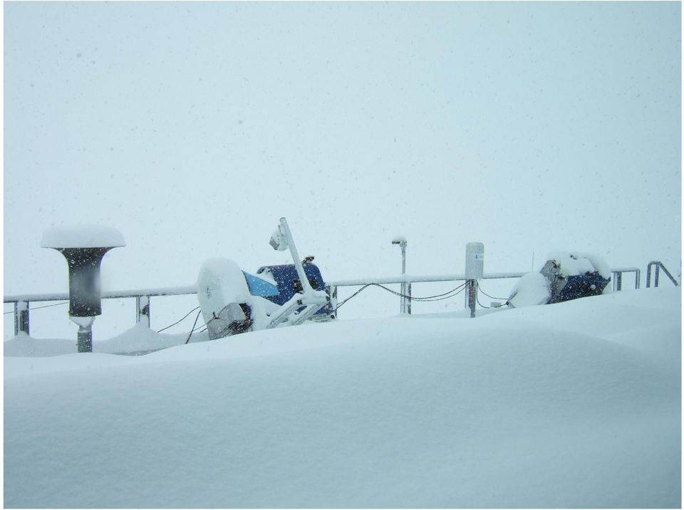
18 Challenges for observations Old Blower New Blower Monitoring!

19 Fire and Ice Feuer und Eis

20 Anforderungen an Beobachtungen
21 Risky business...
: Cloud radar - Ze in dbz -LDR - Doppler velocity Snow water path(swp) derived by radar Snow fall rate")
22 Sensor Synergy (08. Feb. 2009): Cloud radar - Ze in dbz -LDR - Doppler velocity Snow water path(swp) derived by radar Snow fall rate at the surface Size distribution at surface N(D) = N 0 exp( ΛD) (Kneifel et al., 2010)
23 Snow scattering effects In case of no snow the microwave signal is dominated by the emission of water vapor and cloud liquid During snow fall the additional TB 150 GHz enhancement is correlated with snow water path Radiative transfer calculations reveal that TB enhancement is twice as high as the TB depression seen from satellite (Kneifel et al., 2010)
24 How does polarization help? During snowfall negative Polarization Differences = TB v -TB h occur which are reduced when liquid water is present (Xie et al., 2012)

25 How does polarization help? Orientation increases Snow mass increases Larger snowflakes tend to fall with their longest axis oriented. (Xie et al., 2012)
26 Going back north-west..and to cloud carthography!
27 Jülich ObservatorY for Cloud Evolution Observation platform jointly operated by University of Cologne Research Centre Jülich SFB/TR 32 Patterns in Soil-Vegetation-Atmosphere-Systems Monitoring, Modelling and Data Assimilation continuously monitor winds, temperature, water vapor, clouds, and precipitation over many years geomet.uni-koeln.de/joyce
 resolution modelling over large domain and whole summer season Compile comprehensive observational data set for synthesis Supersites present key component for assessing small scale")
28 The Future High definition clouds and precipitation for advancing climate prediction HD(CP) 2 Improve representation of cloud and precipitation in climate simulation Perform high spatial (100m) resolution modelling over large domain and whole summer season Compile comprehensive observational data set for synthesis Supersites present key component for assessing small scale models
29 MICCY Microwave Radiometer for Cloud Carthography Team University of Bonn
30 MICCY Microwave Radiometer for Cloud Carthography Team University of Bonn
31 On the run for rain... Team University of Bonn
32 Warum Sensorsynergie? In situ Sensoren erlauben keine umfassende räumlich-/zeitliche Abdeckung Vielfältige Fernerkundungsmethoden -im sichtbaren, terrestrischen und Mikrowellenbereich - aktive und passive Sensoren - boden- und flugzeuggebundene Sensoren, Satelliten Kein einziger Sensor alleine kann die nötigen Informationen liefern für - wolkenmakro- und mikrophysikalische Eigenschaften - Umgebungsbedingungen Quelle: W. Mauser LMU
Passive and Active Microwave Remote Sensing of Cold-Cloud Precipitation : Wakasa Bay Field Campaign 2003
 Passive and Active Microwave Remote Sensing of Cold-Cloud Precipitation : Wakasa Bay Field Campaign 3 Benjamin T. Johnson,, Gail Skofronick-Jackson 3, Jim Wang 3, Grant Petty jbenjam@neptune.gsfc.nasa.gov
Summary Report on National and Regional Projects set-up in Russian Federation to integrate different Ground-based Observing Systems
 WORLD METEOROLOGICAL ORGANIZATION COMMISSION FOR INSTRUMENT AND METHODS OF OBSERVATION OPAG-UPPER AIR EXPERT TEAM ON REMOTE SENSING UPPER-AIR TECHNOLOGY AND TECHNIQUES First Session Geneva, Switzerland,
Combining Satellite High Frequency Microwave Radiometer & Surface Cloud Radar Data for Determination of Large Scale 3 D Cloud IWC 서은경
 11/21/2008 제9회 기상레이더 워크숍 Combining Satellite High Frequency Microwave Radiometer & Surface Cloud Radar Data for Determination of Large Scale 3 D Cloud IWC 서은경 공주대학교 지구과학교육과 Objective: To retrieve large
Temporal variation in snow cover over sea ice in Antarctica using AMSR-E data product
 Temporal variation in snow cover over sea ice in Antarctica using AMSR-E data product Michael J. Lewis Ph.D. Student, Department of Earth and Environmental Science University of Texas at San Antonio ABSTRACT
Cloud Profiling at the Lindenberg Observatory
 Cloud Profiling at the Lindenberg Observatory Ulrich Görsdorf DWD, Cloud Profiling with a Ka-Band radar at the Lindenberg Observatory Ulrich Görsdorf DWD, MIRA 35.5 GHz (8 mm) Radar (Ka-Band) Coherent
Radiometer Physics GmbH Discrimination of cloud and rain liquid water path by groundbased polarized microwave radiometry
 Radiometer Physics GmbH Discrimination of cloud and rain liquid water path by groundbased polarized microwave radiometry Harald Czekala RPG Radiometer Physics GmbH AOGS Meeting, Singapore, July 6, 2004
RPG MWR PRO TN03 2012 09 Page 1 / 12 www.radiometer physics.de Radiometer Physics GmbH +49 2225 99981 0
 Applications Tropospheric profiling of temperature, humidity and liquid water High resolution boundary layer temperature profiles, better resolution than balloons Input for weather and climate models (data
Development of an Integrated Data Product for Hawaii Climate
 Development of an Integrated Data Product for Hawaii Climate Jan Hafner, Shang-Ping Xie (PI)(IPRC/SOEST U. of Hawaii) Yi-Leng Chen (Co-I) (Meteorology Dept. Univ. of Hawaii) contribution Georgette Holmes
Estimating Firn Emissivity, from 1994 to1998, at the Ski Hi Automatic Weather Station on the West Antarctic Ice Sheet Using Passive Microwave Data
 Estimating Firn Emissivity, from 1994 to1998, at the Ski Hi Automatic Weather Station on the West Antarctic Ice Sheet Using Passive Microwave Data Mentor: Dr. Malcolm LeCompte Elizabeth City State University
Climatology of aerosol and cloud properties at the ARM sites:
 Climatology of aerosol and cloud properties at the ARM sites: MFRSR combined with other measurements Qilong Min ASRC, SUNY at Albany MFRSR: Spectral irradiances at 6 six wavelength passbands: 415, 500,
Proposals of Summer Placement Programme 2015
 Proposals of Summer Placement Programme 2015 Division Project Title Job description Subject and year of study required A2 Impact of dual-polarization Doppler radar data on Mathematics or short-term related
Dual-polarization radar and microwave radiometer observations of winter precipitation during LPVEx
 Dual-polarization radar and microwave radiometer observations of winter precipitation during LPVEx Susanna Lautaportti 1, Dmitri Moisseev 1, Pablo Saavedra 2, Alessandro Battaglia 3, V. Chandrasekar 1,4,5
High-resolution Regional Reanalyses for Europe and Germany
 High-resolution Regional Reanalyses for Europe and Germany Christian Ohlwein 1,2, Jan Keller 1,4, Petra Friederichs 2, Andreas Hense 2, Susanne Crewell 3, Sabrina Bentzien 1,2, Christoph Bollmeyer 1,2,
A Microwave Retrieval Algorithm of Above-Cloud Electric Fields
 A Microwave Retrieval Algorithm of Above-Cloud Electric Fields Michael J. Peterson The University of Utah Chuntao Liu Texas A & M University Corpus Christi Douglas Mach Global Hydrology and Climate Center
Towards an NWP-testbed
 Towards an NWP-testbed Ewan O Connor and Robin Hogan University of Reading, UK Overview Cloud schemes in NWP models are basically the same as in climate models, but easier to evaluate using ARM because:
Diurnal Cycle: Cloud Base Height clear sky
 Diurnal Cycle: Cloud Base Height clear sky Helsinki CNN I Madrid, 16 Dezember 2002 1 Cabauw Geesthacht Cabauw Geesthacht Helsinki Helsinki Petersburg Potsdam Petersburg Potsdam CNN I CNN II Madrid, 16
Microwave Radiometry for Atmospheric Remote Sensing. Harald Czekala, Thomas Rose, Gerrit Maschwitz RPG Radiometer Physics GmbH, Meckenheim, Germany
 for Atmospheric Remote Sensing Harald Czekala, Thomas Rose, Gerrit Maschwitz RPG Radiometer Physics GmbH, Meckenheim, Germany Topics in the next 15 minutes 1. Intro 2. Nature/Source of observed signal
A glance at compensating errors between low-level cloud fraction and cloud optical properties using satellite retrievals
 A glance at compensating errors between low-level cloud fraction and cloud optical properties using satellite retrievals Christine Nam & Sandrine Bony Laboratoire de Météorologie Dynamique Structure Overview
16 th IOCCG Committee annual meeting. Plymouth, UK 15 17 February 2011. mission: Present status and near future
 16 th IOCCG Committee annual meeting Plymouth, UK 15 17 February 2011 The Meteor 3M Mt satellite mission: Present status and near future plans MISSION AIMS Satellites of the series METEOR M M are purposed
Science Goals for the ARM Recovery Act Radars
 DOE/SC-ARM-12-010 Science Goals for the ARM Recovery Act Radars JH Mather May 2012 DISCLAIMER This report was prepared as an account of work sponsored by the U.S. Government. Neither the United States
The study of cloud and aerosol properties during CalNex using newly developed spectral methods
 The study of cloud and aerosol properties during CalNex using newly developed spectral methods Patrick J. McBride, Samuel LeBlanc, K. Sebastian Schmidt, Peter Pilewskie University of Colorado, ATOC/LASP
Developing Continuous SCM/CRM Forcing Using NWP Products Constrained by ARM Observations
 Developing Continuous SCM/CRM Forcing Using NWP Products Constrained by ARM Observations S. C. Xie, R. T. Cederwall, and J. J. Yio Lawrence Livermore National Laboratory Livermore, California M. H. Zhang
Microwave observations in the presence of cloud and precipitation
 Microwave observations in the presence of cloud and precipitation Alan Geer Thanks to: Bill Bell, Peter Bauer, Fabrizio Baordo, Niels Bormann Slide 1 ECMWF/EUMETSAT satellite course 2015: Microwave 2 Slide
WEATHER AND CLIMATE practice test
 WEATHER AND CLIMATE practice test Multiple Choice Identify the choice that best completes the statement or answers the question. 1. What role does runoff play in the water cycle? a. It is the process in
Glaciogenic Cloud Seeding to Increase Orographic Precipitation Bruce A. Boe bboe@weathermod.com Director of Meteorology
 Glaciogenic Cloud Seeding to Increase Orographic Precipitation Bruce A. Boe bboe@weathermod.com Director of Meteorology Weather Modification, Inc. Fargo, North Dakota, USA www.weathermodification.com Content
Long-term Observations of the Convective Boundary Layer (CBL) and Shallow cumulus Clouds using Cloud Radar at the SGP ARM Climate Research Facility
 and Shallow cumulus Clouds using Cloud Radar at the SGP ARM Climate Research Facility") Long-term Observations of the Convective Boundary Layer (CBL) and Shallow cumulus Clouds using Cloud Radar at the SGP ARM Climate Research Facility Arunchandra S. Chandra Pavlos Kollias Department of Atmospheric
Long-term Observations of the Convective Boundary Layer (CBL) and Shallow cumulus Clouds using Cloud Radar at the SGP ARM Climate Research Facility Arunchandra S. Chandra Pavlos Kollias Department of Atmospheric
6.3.2. Operate three cloud remote sensing stations. Work Package 2.
 6.3.2. Operate three cloud remote sensing stations. Work Package 2. Section 1 summarises the cloud net stations, section 2 lists the instruments operating at the various stations and their performance
Precipitation Remote Sensing
 Precipitation Remote Sensing Huade Guan Prepared for Remote Sensing class Earth & Environmental Science University of Texas at San Antonio November 14, 2005 Outline Background Remote sensing technique
Joint Polar Satellite System (JPSS)
") Joint Polar Satellite System (JPSS) John Furgerson, User Liaison Joint Polar Satellite System National Environmental Satellite, Data, and Information Service National Oceanic and Atmospheric Administration
Joint Polar Satellite System (JPSS) John Furgerson, User Liaison Joint Polar Satellite System National Environmental Satellite, Data, and Information Service National Oceanic and Atmospheric Administration
The ARM-GCSS Intercomparison Study of Single-Column Models and Cloud System Models
 The ARM-GCSS Intercomparison Study of Single-Column Models and Cloud System Models R. T. Cederwall and D. J. Rodriguez Atmospheric Science Division Lawrence Livermore National Laboratory Livermore, California
Passive Remote Sensing of Clouds from Airborne Platforms
 Passive Remote Sensing of Clouds from Airborne Platforms Why airborne measurements? My instrument: the Solar Spectral Flux Radiometer (SSFR) Some spectrometry/radiometry basics How can we infer cloud properties
Hong Kong Observatory Summer Placement Programme 2015
 Annex I Hong Kong Observatory Summer Placement Programme 2015 Training Programme : An Observatory mentor with relevant expertise will supervise the students. Training Period : 8 weeks, starting from 8
Blackbody radiation. Main Laws. Brightness temperature. 1. Concepts of a blackbody and thermodynamical equilibrium.
 Lecture 4 lackbody radiation. Main Laws. rightness temperature. Objectives: 1. Concepts of a blackbody, thermodynamical equilibrium, and local thermodynamical equilibrium.. Main laws: lackbody emission:
Evaluating GCM clouds using instrument simulators
 Evaluating GCM clouds using instrument simulators University of Washington September 24, 2009 Why do we care about evaluation of clouds in GCMs? General Circulation Models (GCMs) project future climate
Intra-seasonal and Annual variability of the Agulhas Current from satellite observations
 Intra-seasonal and Annual variability of the Agulhas Current from satellite observations Marjolaine Krug Ecosystem Earth Observation (CSIR NRE) Pierrick Penven Laboratoire de Physique des Océans (IRD)
ROAD WEATHER AND WINTER MAINTENANCE
 Road Traffic Technology ROAD WEATHER AND WINTER MAINTENANCE METIS SSWM WMi ROAD WEATHER STATIONS ADVANCED ROAD WEATHER INFORMATION SYSTEM MAINTENANCE DECISION SUPPORT SYSTEM WINTER MAINTENANCE PERFORMANCE
SAFNWC/MSG Cloud type/height. Application for fog/low cloud situations
 SAFNWC/MSG Cloud type/height. Application for fog/low cloud situations 22 September 2011 Hervé LE GLEAU, Marcel DERRIEN Centre de météorologie Spatiale. Lannion Météo-France 1 Fog or low level clouds?
http://www.isac.cnr.it/~ipwg/
 The CGMS International Precipitation Working Group: Experience and Perspectives Vincenzo Levizzani CNR-ISAC, Bologna, Italy and Arnold Gruber NOAA/NESDIS & Univ. Maryland, College Park, MD, USA http://www.isac.cnr.it/~ipwg/
Monitoring Soil Moisture from Space. Dr. Heather McNairn Science and Technology Branch Agriculture and Agri-Food Canada heather.mcnairn@agr.gc.
 Monitoring Soil Moisture from Space Dr. Heather McNairn Science and Technology Branch Agriculture and Agri-Food Canada heather.mcnairn@agr.gc.ca What is Remote Sensing? Scientists turn the raw data collected
II. Related Activities
 (1) Global Cloud Resolving Model Simulations toward Numerical Weather Forecasting in the Tropics (FY2005-2010) (2) Scale Interaction and Large-Scale Variation of the Ocean Circulation (FY2006-2011) (3)
TECHNICAL REPORTS. Authors: Tatsuhiro Noguchi* and Takaaki Ishikawa*
 Application and Evaluation of Observation Data by Advanced Microwave Scanning Radiometer 2 Achievement of World s Top-Class Microwave Radiometer AMSR Series Authors: Tatsuhiro Noguchi* and Takaaki Ishikawa*
Evaluation of the Effect of Upper-Level Cirrus Clouds on Satellite Retrievals of Low-Level Cloud Droplet Effective Radius
 Evaluation of the Effect of Upper-Level Cirrus Clouds on Satellite Retrievals of Low-Level Cloud Droplet Effective Radius F.-L. Chang and Z. Li Earth System Science Interdisciplinary Center University
Climate Models: Uncertainties due to Clouds. Joel Norris Assistant Professor of Climate and Atmospheric Sciences Scripps Institution of Oceanography
 Climate Models: Uncertainties due to Clouds Joel Norris Assistant Professor of Climate and Atmospheric Sciences Scripps Institution of Oceanography Global mean radiative forcing of the climate system for
Surface-Based Remote Sensing of the Aerosol Indirect Effect at Southern Great Plains
 Surface-Based Remote Sensing of the Aerosol Indirect Effect at Southern Great Plains G. Feingold and W. L. Eberhard National Oceanic and Atmospheric Administration Environmental Technology Laboratory Boulder,
Remote Sensing of Clouds from Polarization
 Remote Sensing of Clouds from Polarization What polarization can tell us about clouds... and what not? J. Riedi Laboratoire d'optique Atmosphérique University of Science and Technology Lille / CNRS FRANCE
IOMASA DTU Status October 2003
 IOMASA DTU Status October 2003 Leif Toudal Pedersen Dorthe Hofman-Bang Roberto Saldo LTP - 04/11/2003-1 DTU IOMASA Web site http://www.seaice.dk/iomasa LTP - 04/11/2003-2 OI-SAF products in browser LTP
Very High Resolution Arctic System Reanalysis for 2000-2011
 Very High Resolution Arctic System Reanalysis for 2000-2011 David H. Bromwich, Lesheng Bai,, Keith Hines, and Sheng-Hung Wang Polar Meteorology Group, Byrd Polar Research Center The Ohio State University
Clouds and the Energy Cycle
 August 1999 NF-207 The Earth Science Enterprise Series These articles discuss Earth's many dynamic processes and their interactions Clouds and the Energy Cycle he study of clouds, where they occur, and
Measurement of the effect of biomass burning aerosol on inhibition of cloud formation over the Amazon
 Supporting Online Material for Koren et al. Measurement of the effect of biomass burning aerosol on inhibition of cloud formation over the Amazon 1. MODIS new cloud detection algorithm The operational
Electromagnetic Radiation (EMR) and Remote Sensing
 and Remote Sensing") Electromagnetic Radiation (EMR) and Remote Sensing 1 Atmosphere Anything missing in between? Electromagnetic Radiation (EMR) is radiated by atomic particles at the source (the Sun), propagates through
Electromagnetic Radiation (EMR) and Remote Sensing 1 Atmosphere Anything missing in between? Electromagnetic Radiation (EMR) is radiated by atomic particles at the source (the Sun), propagates through
Cloud Thickness Estimation from GOES-8 Satellite Data Over the ARM-SGP Site
 Cloud Thickness Estimation from GOES-8 Satellite Data Over the ARM-SGP Site V. Chakrapani, D. R. Doelling, and A. D. Rapp Analytical Services and Materials, Inc. Hampton, Virginia P. Minnis National Aeronautics
Iden%fying CESM cloud and surface biases at Summit, Greenland
 Iden%fying CESM cloud and surface biases at Summit, Greenland Nathaniel Miller (CU- ATOC, CIRES) MaEhew Shupe, Andrew GeEleman, Jennifer Kay, Line Bourdages CESM Ice Sheet Surface Biases Cross Working
Daily High-resolution Blended Analyses for Sea Surface Temperature
 Daily High-resolution Blended Analyses for Sea Surface Temperature by Richard W. Reynolds 1, Thomas M. Smith 2, Chunying Liu 1, Dudley B. Chelton 3, Kenneth S. Casey 4, and Michael G. Schlax 3 1 NOAA National
TOPIC: CLOUD CLASSIFICATION
 INDIAN INSTITUTE OF TECHNOLOGY, DELHI DEPARTMENT OF ATMOSPHERIC SCIENCE ASL720: Satellite Meteorology and Remote Sensing TERM PAPER TOPIC: CLOUD CLASSIFICATION Group Members: Anil Kumar (2010ME10649) Mayank
SURFACE SOURCE OF ICE PARTICLES IN MOUNTAIN CLOUDS
 SURFACE SOURCE OF ICE PARTICLES IN MOUNTAIN CLOUDS Gabor Vali, Bart Geerts, David Leon and Jefferson R. Snider. Department of Atmospheric Science, University of Wyoming Laramie, WY USA.
Cloud Remote Sensing during VOCALS- REx: Selected U.S. Efforts
 Cloud Remote Sensing during VOCALS- REx: Selected U.S. Efforts Paquita Zuidema, U of Miami Qabs ~ 4xI{(m 2-1)/(m 2 +2)} Qscat ~ 8/3 x 4 (m 2-1)/(m 2 +2) 2 x=2 r/ VOCALS Educational Talk 10/31/08 1. Satellite
CHAPTER 6 THE TERRESTRIAL PLANETS
 CHAPTER 6 THE TERRESTRIAL PLANETS MULTIPLE CHOICE 1. Which of the following is NOT one of the four stages in the development of a terrestrial planet? 2. That Earth, evidence that Earth differentiated.
A SURVEY OF CLOUD COVER OVER MĂGURELE, ROMANIA, USING CEILOMETER AND SATELLITE DATA
 Romanian Reports in Physics, Vol. 66, No. 3, P. 812 822, 2014 ATMOSPHERE PHYSICS A SURVEY OF CLOUD COVER OVER MĂGURELE, ROMANIA, USING CEILOMETER AND SATELLITE DATA S. STEFAN, I. UNGUREANU, C. GRIGORAS
Cloud detection and clearing for the MOPITT instrument
 Cloud detection and clearing for the MOPITT instrument Juying Warner, John Gille, David P. Edwards and Paul Bailey National Center for Atmospheric Research, Boulder, Colorado ABSTRACT The Measurement Of
ABSTRACT INTRODUCTION
 Observing Fog And Low Cloud With A Combination Of 78GHz Cloud Radar And Laser Met Office: Darren Lyth 1, John Nash. Rutherford Appleton Laboratory: M.Oldfield ABSTRACT Results from two demonstration tests
Baudouin Raoult, Iryna Rozum, Dick Dee
 ECMWF contribution to the EU funded CHARME Project: A Significant Event Viewer tool Matthew Manoussakis Baudouin Raoult, Iryna Rozum, Dick Dee 5th Workshop on the use of GIS/OGC standards in meteorology
FORENSIC WEATHER CONSULTANTS, LLC
 NOTE: MOST TIMES, LOCATIONS & DATA HAVE BEEN CHANGED FOR THIS SAMPLE REPORT FORENSIC WEATHER CONSULTANTS, LLC Howard Altschule Forensic Meteorologist 1971 Western Avenue, #200 Albany, New York 12203 (518)
How To Understand The Climate Impact Of Aviation
 Aviation Climate Impact: Scientific Status Ulrich Schumann, DLR Institut für Physik der Atmosphäre Understanding of Aviation climate impact - History 1971/72: Johnston, Crutzen: NO x from super-sonic transport
MSG-SEVIRI cloud physical properties for model evaluations
 Rob Roebeling Weather Research Thanks to: Hartwig Deneke, Bastiaan Jonkheid, Wouter Greuell, Jan Fokke Meirink and Erwin Wolters (KNMI) MSG-SEVIRI cloud physical properties for model evaluations Cloud
Nowcasting: analysis and up to 6 hours forecast
 Nowcasting: analysis and up to 6 hours forecast Very high resoultion in time and space Better than NWP Rapid update Application oriented NWP problems for 0 6 forecast: Incomplete physics Resolution space
SIXTH GRADE WEATHER 1 WEEK LESSON PLANS AND ACTIVITIES
 SIXTH GRADE WEATHER 1 WEEK LESSON PLANS AND ACTIVITIES WATER CYCLE OVERVIEW OF SIXTH GRADE WATER WEEK 1. PRE: Evaluating components of the water cycle. LAB: Experimenting with porosity and permeability.
The NASA NEESPI Data Portal to Support Studies of Climate and Environmental Changes in Non-boreal Europe
 The NASA NEESPI Data Portal to Support Studies of Climate and Environmental Changes in Non-boreal Europe Suhung Shen NASA Goddard Space Flight Center/George Mason University Gregory Leptoukh, Tatiana Loboda,
A model to observation approach to evaluating cloud microphysical parameterisations using polarimetric radar
 A model to observation approach to evaluating cloud microphysical parameterisations using polarimetric radar Monika Pfeifer G. Craig, M. Hagen, C. Keil Polarisation Doppler Radar POLDIRAD Rain Graupel
Name Period 4 th Six Weeks Notes 2015 Weather
 Name Period 4 th Six Weeks Notes 2015 Weather Radiation Convection Currents Winds Jet Streams Energy from the Sun reaches Earth as electromagnetic waves This energy fuels all life on Earth including the
Remote Sensing an Introduction
 Remote Sensing an Introduction Seminar: Space is the Place Referenten: Anica Huck & Michael Schlund Remote Sensing means the observation of, or gathering information about, a target by a device separated
Outline. Case Study over Vale do Paraiba 11 February 2012. Comparison of different rain rate retrievals for heavy. Future Work
 Outline Short description of the algorithms for rain rate retrievals from passive microwave radiometers on board low-orbiting satellites (i.e., SSMI/S) Case Study over Vale do Paraiba 11 February 2012
Thoughts on Mobile Instrument Facilities/ Logistics of Remote Data Collection
 Thoughts on Mobile Instrument Facilities/ Logistics of Remote Data Collection Douglas Sisterson ARM Climate Research Facility Operations Manager DOE Permafrost Workshop February 14-15, 2011 ARM Facilities
A climatology of cirrus clouds from ground-based lidar measurements over Lille
 A climatology of cirrus clouds from ground-based lidar measurements over Lille Rita Nohra, Frédéric Parol, Philippe Dubuisson Laboratoire d Optique Atmosphérique université de Lille, CNRS UMR 8518 Objectives
Satellite Products and Dissemination: Visualization and Data Access
 Satellite Products and Dissemination: Visualization and Data Access Gregory Leptoukh GES DISC, NASA GSFC Dana Ostrenga GES DISC, NASA GSFC Introduction The Goddard Earth Sciences Data and Information Services
SATELLITE OBSERVATION OF THE DAILY VARIATION OF THIN CIRRUS
 SATELLITE OBSERVATION OF THE DAILY VARIATION OF THIN CIRRUS Hermann Mannstein and Stephan Kox ATMOS 2012 Bruges, 2012-06-21 Folie 1 Why cirrus? Folie 2 Warum Eiswolken? Folie 3 Folie 4 Folie 5 Folie 6
7613-1 - Page 1. Weather Unit Exam Pre-Test Questions
 Weather Unit Exam Pre-Test Questions 7613-1 - Page 1 Name: 1) Equal quantities of water are placed in four uncovered containers with different shapes and left on a table at room temperature. From which
Future needs of remote sensing science in Antarctica and the Southern Ocean: A report to support the Horizon Scan activity of COMNAP and SCAR
 Future needs of remote sensing science in Antarctica and the Southern Ocean: A report to support the Horizon Scan activity of COMNAP and SCAR Thomas Wagner (thomas.wagner@nasa.gov) Charles Webb NASA Cryospheric
MICROPHYSICS COMPLEXITY EFFECTS ON STORM EVOLUTION AND ELECTRIFICATION
 MICROPHYSICS COMPLEXITY EFFECTS ON STORM EVOLUTION AND ELECTRIFICATION Blake J. Allen National Weather Center Research Experience For Undergraduates, Norman, Oklahoma and Pittsburg State University, Pittsburg,
CALIPSO, CloudSat, CERES, and MODIS Merged Data Product
 CALIPSO, CloudSat, CERES, and MODIS Merged Data Product Seiji Kato 1, Sunny Sun-Mack 2, Walter F. Miller 2, Fred G. Rose 2, and Victor E. Sothcott 2 1 NASA Langley Research Center 2 Science and Systems
Assessing Cloud Spatial and Vertical Distribution with Infrared Cloud Analyzer
 Assessing Cloud Spatial and Vertical Distribution with Infrared Cloud Analyzer I. Genkova and C. N. Long Pacific Northwest National Laboratory Richland, Washington T. Besnard ATMOS SARL Le Mans, France
SNOWTOOLS RESEARCH AND DEVELOPMENT OF REMOTE SENSING METHODS FOR SNOW HYDROLOGY
 SNOWTOOLS RESEARCH AND DEVELOPMENT OF REMOTE SENSING METHODS FOR SNOW HYDROLOGY Tore Guneriussen 1, Rune Solberg 2, Sjur Kolberg 3, Martti Hallikainen 4, Jarkko Koskinen 4, Daniel Hiltbrunner 5, Christian
Monitoring a Changing Environment with Synthetic Aperture Radar. Alaska Satellite Facility National Park Service Don Atwood
 Monitoring a Changing Environment with Synthetic Aperture Radar Don Atwood Alaska Satellite Facility 1 Entering the SAR Age 2 SAR Satellites RADARSAT-1 Launched 1995 by CSA 5.6 cm (C-Band) HH Polarization
MCMC-Based Assessment of the Error Characteristics of a Surface-Based Combined Radar - Passive Microwave Cloud Property Retrieval
 MCMC-Based Assessment of the Error Characteristics of a Surface-Based Combined Radar - Passive Microwave Cloud Property Retrieval Derek J. Posselt University of Michigan Jay G. Mace University of Utah
What the Heck are Low-Cloud Feedbacks? Takanobu Yamaguchi Rachel R. McCrary Anna B. Harper
 What the Heck are Low-Cloud Feedbacks? Takanobu Yamaguchi Rachel R. McCrary Anna B. Harper IPCC Cloud feedbacks remain the largest source of uncertainty. Roadmap 1. Low cloud primer 2. Radiation and low
Precipitation forms from water droplets or ice crystals.
 KEY CONCEPT Water falls to Earth s surface as precipitation. BEFORE, you learned Water moves between Earth's surface and the atmosphere Water vapor condenses into clouds NOW, you will learn How precipitation
Lecture 7a: Cloud Development and Forms
 Lecture 7a: Cloud Development and Forms Why Clouds Form Cloud Types (from The Blue Planet ) Why Clouds Form? Clouds form when air rises and becomes saturated in response to adiabatic cooling. Four Ways
ENVIRONMENTAL MONITORING Vol. I - Remote Sensing (Satellite) System Technologies - Michael A. Okoye and Greg T. Koeln
 System Technologies - Michael A. Okoye and Greg T. Koeln") REMOTE SENSING (SATELLITE) SYSTEM TECHNOLOGIES Michael A. Okoye and Greg T. Earth Satellite Corporation, Rockville Maryland, USA Keywords: active microwave, advantages of satellite remote sensing, atmospheric
REMOTE SENSING (SATELLITE) SYSTEM TECHNOLOGIES Michael A. Okoye and Greg T. Earth Satellite Corporation, Rockville Maryland, USA Keywords: active microwave, advantages of satellite remote sensing, atmospheric
RESULTS FROM A SIMPLE INFRARED CLOUD DETECTOR
 RESULTS FROM A SIMPLE INFRARED CLOUD DETECTOR A. Maghrabi 1 and R. Clay 2 1 Institute of Astronomical and Geophysical Research, King Abdulaziz City For Science and Technology, P.O. Box 6086 Riyadh 11442,
Assignment Discovery Online Curriculum. Lesson title: Weather Maps. Grade level: 4-6. Subject area: Earth Science. Duration: Two class periods
 Assignment Discovery Online Curriculum Lesson title: Weather Maps Grade level: 4-6 Subject area: Earth Science Duration: Two class periods Objectives: Students will do the following: Understand basic information
Cloud Oxygen Pressure Algorithm for POLDER-2
 Cloud Oxygen ressure Algorithm for OLDER-2 1/7 Cloud Oxygen ressure Algorithm for OLDER-2 Aim of the : Determination of cloud gen pressure from arent pressure by removing the contribution. Date of the
Technical note on MISR Cloud-Top-Height Optical-depth (CTH-OD) joint histogram product
 joint histogram product") Technical note on MISR Cloud-Top-Height Optical-depth (CTH-OD) joint histogram product 1. Intend of this document and POC 1.a) General purpose The MISR CTH-OD product contains 2D histograms (joint distributions)
Technical note on MISR Cloud-Top-Height Optical-depth (CTH-OD) joint histogram product 1. Intend of this document and POC 1.a) General purpose The MISR CTH-OD product contains 2D histograms (joint distributions)
Day 2. Summary of Day One. and Introduction to Day Two. Florian Appel VISTA
 Day 2 Summary of Day One and Introduction to Day Two Florian Appel VISTA Summary Day 1 Introduction The European ESA and EUMETSAT long term evolution of snow services Science outlook What can be expected
Roelof Bruintjes, Sarah Tessendorf, Jim Wilson, Rita Roberts, Courtney Weeks and Duncan Axisa WMA Annual meeting 26 April 2012
 Aerosol affects on the microphysics of precipitation development in tropical and sub-tropical convective clouds using dual-polarization radar and airborne measurements. Roelof Bruintjes, Sarah Tessendorf,
Remote sensing of precipitable water vapour and cloud cover for site selection of the European Extremely Large Telescope (E-ELT) using MERIS
 using MERIS") Remote sensing of precipitable water vapour and cloud cover for site selection of the European Extremely Large Telescope (E-ELT) using MERIS H. Kurlandczyk 1 M.Sarazin 1 1 European Organisation for Astronomical
Remote sensing of precipitable water vapour and cloud cover for site selection of the European Extremely Large Telescope (E-ELT) using MERIS H. Kurlandczyk 1 M.Sarazin 1 1 European Organisation for Astronomical
Cloud seeding. Frequently Asked Questions. What are clouds and how are they formed? How do we know cloud seeding works in Tasmania?
 What are clouds and how are they formed? Clouds are composed of water droplets and sometimes ice crystals. Clouds form when air that is rich in moisture near the Earth s surface rises higher into the atmosphere,
The Balance of Power in the Earth-Sun System
 NASA Facts National Aeronautics and Space Administration www.nasa.gov The Balance of Power in the Earth-Sun System The Sun is the major source of energy for Earth s oceans, atmosphere, land, and biosphere.
RPG Radiometer Deployment Experience
 Radiometer Physics GmbH RPG Radiometer Physics GmbH - Birkenmaarstraße 10-53340 Meckenheim/Germany Tel.: +49-(0)2225/999810 Fax: +49-(0)2225/9998199 E-Mail: Dr. Thomas Rose rose@radiometer-physics.de Achim
Satellite Remote Sensing of Volcanic Ash
 Marco Fulle www.stromboli.net Satellite Remote Sensing of Volcanic Ash Michael Pavolonis NOAA/NESDIS/STAR SCOPE Nowcasting 1 Meeting November 19 22, 2013 1 Outline Getty Images Volcanic ash satellite remote
VALIDATION OF SAFNWC / MSG CLOUD PRODUCTS WITH ONE YEAR OF SEVIRI DATA
 VALIDATION OF SAFNWC / MSG CLOUD PRODUCTS WITH ONE YEAR OF SEVIRI DATA M.Derrien 1, H.Le Gléau 1, Jean-François Daloze 2, Martial Haeffelin 2 1 Météo-France / DP / Centre de Météorologie Spatiale. BP 50747.
SAC-D Data System and Data Distribution Lucas Bruno
 SAC-D Data System and Data Distribution Lucas Bruno 19-21 July 2010 Seattle, Washington, USA Agenda 1. What the CUSS is 2. Relations between SAC-D and CUSS. 3. Services and Interfaces between SAC-D and