Dale Rollins, Jason Brooks, Neal Wilkins and Dean Ransom, Jr.*
|
|
|
- Brian Gilbert
- 7 years ago
- Views:
Transcription
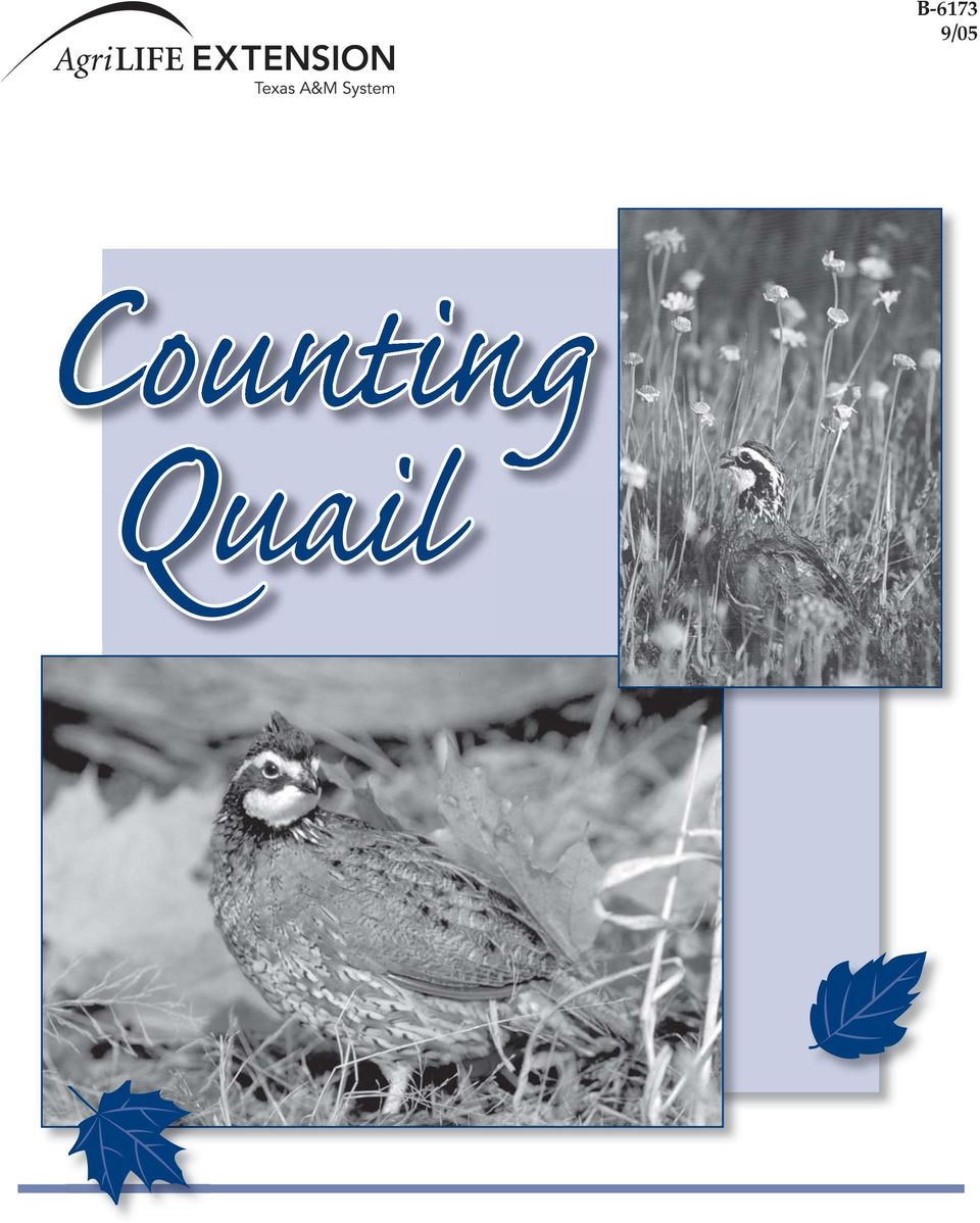
1 B /05 Quail
2

3 Dale Rollins, Jason Brooks, Neal Wilkins and Dean Ransom, Jr.* *Professor and Extension Wildlife Specialist; Graduate Research Assistant, Texas Agricultural Experiment Station; Associate Professor and Extension Wildlife Specialist; and Assistant Professor, Texas Agricultural Experiment Station; The Texas A&M University System.

4 Bobwhite and scaled quail populations have declined over much of their range in Texas during the last 30 years (Fig. 1). Those areas that still support good quail populations (generally northwest and south Texas) command top prices for quail leases and real estate value. Landowners and hunters are no longer taking the future of quail for granted. Habitat management techniques such as prescribed burning and brush sculpting are often used to try to increase quail abundance. But do such practices work? Do quail populations increase in response to our management efforts? Landowners and managers need a way of estimating quail populations on their properties and monitoring population fluctuations over time. Such estimates would allow managers to gauge the effectiveness of their management efforts. Quail populations in Texas are often irruptive; that is, they have distinct boom and bust trends (Fig. 2). The causes of such irruptions are not fully understood, but we know they are driven by precipitation. The goal of quail management should be to maximize quail abundance in good years and minimize the decline in bad years. Tracking the magnitude of fluctuations can aid in making management decisions. Managers have several options for assessing quail population trends. None of the techniques described are completely accurate, but when done consistently for several years the results can indicate the trend of a local quail population and how it responds to management. The survey methods vary in their degree of difficulty (Fig. 3). Some are very simple, while others are used only by trained personnel conducting research Figure 1. Bobwhite populations have declined over most of their range in Texas over the last 25 years. The darker areas indicate a greater abundance of bobwhites (adapted from Peterson et al. 2002). a. Northern bobwhite b. Scaled quail Texas Statewide Bobwhite Quail Trends Texas Statewide Scaled Quail Trends Mean # of quail seen per route Mean LTM Mean # of quail seen per route Mean LTM Year Year Figure 2. Statewide population trends for (a) bobwhite and (b) scaled ( blue ) quail from 1978 to 2004 illustrate the boom and bust nature of quail populations in Texas. These data are from the Texas Parks and Wildlife Department s annual roadside surveys. The dashed line is the long-term mean (LTM). 4

5 Increasing difficulty Direct Counts Covey flush rates Roadside counts Helicopter surveys Drive counts Line-transect counts Mark-recapture Indirect counts Call counts Age ratios Dummy nests Figure 3. Counting techniques require different amounts of time and skill. The techniques (with a few exceptions) are applicable to bobwhite and scaled ( blue ) quail throughout Texas. Before discussing actual survey techniques, some terms should be defined. Population a collection of individuals that occupies a defined area at a specific time. Abundance the number of individuals in the population. Increasing time investment Density the number of individuals per unit of area. Quail densities are often described as birds per 100 acres. A good management goal is one bird per acre. Index the measure of some aspect of a population that is assumed to fluctuate with actual population size. A call count is an index. It is assumed that as population size increases, the number of birds calling will increase. Indices should be used with caution because their relationship with actual population size is unknown. Trend a pattern of change in abundance or density over time or over several properties, pastures or even ecological regions. Direct count counts based on direct observation of quail. Indirect count counts based on observations of quail behavior such as whistles. Indirect counts are basically indices. Direct Counts Roadside counts This is the method used by the Texas Parks and Wildlife Department (TPWD) to index quail populations at an ecoregion-level. Roadside counts are usually conducted in August or September. A designated transect (20 miles long for TPWD counts, various distances for ranch counts; the Texas Quail Index uses a 10-mile route) is driven at no more than 20 miles per hour. The counts should be conducted in the 2 hours after sunrise or before sunset. Different starting and ending points should be used each time the transect is driven. If the transect lies mostly east to west, conduct counts (morning or evening) so that the sun will be mostly at your back. Count and record all quail observed. Conduct at least three counts. Helicopter surveys Aerial surveys (conducted from a helicopter or airplane) are commonly used to count deer and pronghorn antelope in Texas, and have been used recently to survey quail. Generally, a quail survey is conducted in conjunction with a deer survey. Helicopter surveys are a form of line-transect survey. 5 Helicopters fly approximately 75 to 150 feet above the vegetation at a speed of 30 to 40 miles per hour. Adjacent transects should be at least 1 /4 mile apart and can be up to 1 mile apart on larger properties. Although counting quail from helicopters is experimental, preliminary findings suggest that the results are similar to those from line-transect counts. Covey flush rates Hunting success is positively correlated to the population densities of bobwhites. When using hunting success to estimate population trends over the years, hunting methods should be standardized, including factors such as the presence or absence of dogs, the daily start and finish times, and whether or not hunting takes place on baited roads. Habitat conditions should remain relatively constant and the sample period should be short. In Texas, quail season lasts 4 months, but comparisons should be made only early in the season and from the same time period each year (e.g., during the month of November). The entire management unit should be hunted to generate an accurate estimate. Hunting only the best areas (i.e., honeyholes ) will bias estimates of abundance.

6 The important variable to be recorded is the number of coveys flushed per hour, not the number of birds harvested. This number can then be compared with the size of the area covered to generate an estimate of coveys per unit of area. Estimates obtained from flush rates are likely conservative, as several studies have found that bird dogs typically detect only about two-thirds of the quail on a property on any given day. Drive counts Drive counts are conducted by several observers walking abreast (sometimes with the aid of dogs) and counting all quail that flush. Observers must be careful not to count the same birds twice. This method assumes the unlikely premise that all coveys are flushed and counted. The more observers there are the less space there will be between them and the more accurate the count will be. At least 15 to 25 percent of the property should be sampled. These counts generally underestimate populations and may be considered to give an estimate of the minimum population. Line-transect counts Line-transect counts (sometimes referred to as distance sampling) are a labor-intensive method of estimating quail abundance, but they may yield the most accurate results. Accordingly, distance sampling is usually restricted to research projects. An observer walks along a straight line (or transect) and counts the number of birds flushed. The right-angle (perpendicular) distance from the transect line to the point where the quail flush is measured (Fig. 4). A laser range finder or measuring tape can be used to measure this distance. The measure must be taken from the point where the bird(s) were initially sighted. These distances allow the observer to determine the likelihood of a covey flush as the distance from the transect increases. A computer program, DIS- TANCE, can be used to make these calculations and produce a population estimate. Covey flush Measured distance Transect Observer Figure 4. During line-transect counts, flush distances should be measured perpendicularly from the flush site to the transect, not from the observer to the flush site. Assumptions that must be met when you conduct line-transect surveys are that all coveys on the line are observed, coveys are fixed in their initial position, measurements are exact, observations are independent events, and the probability of detecting a covey is independent of covey size. Here are some guidelines for making line-transect counts. Establish four transects, each 1 mile long, per square mile or section (640 acres) of habitat. Conduct counts during the first 3 hours of daylight. Record only the birds flushed by the observer(s). Do not count those flushed by other people, vehicles or animals (e.g., cattle). Sample each line equally and repeat the counts three to five times. An estimate of average covey size can be obtained from the birds counted on the transect as well as from the number of coveys flushed along roads or during incidental field activities. With the average covey size you can use the number of coveys per acre to estimate the number of birds per acre. Mark-recapture The most accurate method of estimating population is mark-recapture, which involves trapping and marking quail (generally with leg bands), and then recapturing birds at a later date. Birds can be recaptured in another trapping session or by hunting. This method is costly, labor intensive, and requires special permits from the Texas Parks and Wildlife Department; therefore, it is used exclusively in research settings. The method assumes a closed population, with no immigration or emigration, or births or deaths between captures. Program MARK is a computer software package that has several options for analyzing mark-recapture data. 6
 and counting all quail that flush.")
7 Indirect Counts Call counts Call counts are simply counts of whistling quail (Fig. 5). There are two types of call counts for bobwhites spring (mating) and fall (covey) call counts. Scaled quail do not have a fall covey call, so only spring call counts apply to them. To conduct these calls, permanent listening posts should be established at certain intervals (1-mile intervals are suggested). Calls may be heard up to 600 yards away, so all stations should be at least 1 /2 mile from each other. Data sheets with concentric circles are a helpful aid for recording the locations of calling cocks or coveys (Fig. 6). Counts should not be conducted when it is raining or when the wind is blowing more than 10 miles per hour. Listening posts should be positioned at least a mile away from highways, if possible, to lessen problems with traffic noise. bachelor males (those not paired) in the population, although this assumption has not been tested. Peak calling is typically observed in May and early June in Texas, so surveys should be conducted during this time period. Call counts should begin about sunrise and continue for 1 to 1 1 /2 hours after sunrise. Drive to a particular listening post, then turn off the engine of your vehicle and walk about 25 yards away in order to get away from the noises of the engine cooling down. Note the time (a stopwatch is recommended), and then count (a) the number of different cocks heard, and (b) the total number of calls heard. Marking the location of various cocks calling on the data sheet (Fig. 6) will help you determine if a bird you hear calling has been identified previously. Experience shows that spring call counts are fairly accurate until the number of calling cocks is greater than eight birds per listening post. Each station should be monitored for at least 3 minutes, preferably 5 (monitor for the same length of time at each listening station). Then proceed directly to the next station and repeat the procedure until all stations have been completed. The surveys should be conducted at least three times. These counts provide an index of breeding capital. County: Mile marker: Ranch: Date: Figure 5. Call counts are conducted in early morning. Record only the male bob-white whistles in the spring and the covey calls ( koi-lee ) in the fall. X X Spring call counts Spring call counts are conducted in spring and early summer. During this time, bobwhite cocks give the familiar poor-bob-white whistle to attract a mate. The mating call of the scaled quail is the whock call (see for recordings of quail whistles). Quail make other calls, such as the assembly call, but only the mating call is recorded for spring call counts. Cocks calling at this time are generally thought to represent the 5 roosters; 33 calls total IIIII IIIII IIIII IIIII IIIII IIIII III Figure 6. Data sheets with concentric circles aid in recording the locations of different coveys/cocks during whistle surveys. Your listening post should be at the center of the circle. Each ring represents a distance of 200 yards. An x is placed at the approximate location of the bird. Tick marks (lower left) record the total number of calls heard. X X X 7

8 Percent Rainfall (inches) Fall covey counts Covey calls of bobwhites are often called wake-up calls. Covey calls, given as koi-lee, are typically heard during the fall and winter (October to March) in the early morning, about 30 minutes before official sunrise. Calling sessions are generally brief, lasting from 30 seconds to several minutes. Go to a listening post at least 45 minutes before official sunrise and listen for a total of 20 minutes after you hear the first covey call, as sometimes calling commences a second time. There is usually a chorus effect as one covey begins to call and surrounding coveys join in. For fall counts, only one station can be sampled each day. Use the same permanent listening posts as for the spring call counts, but realize that you can record call counts at only one listening post per morning. You might enlist several observers to increase the number of listening points sampled on a given day. Use the same type of data sheet as for spring call counts to help locate individual calling coveys. This survey also should be conducted at least three times. Age ratios The increase in the annual quail population from reproduction is an indicator of management success and the influence of other environmental factors. Keeping stringent harvest records can give you an indication of population change over the years. The ratio of adult to juvenile quail in the hunter s bag is a measure of productivity and survival since the breeding season. More productive breeding seasons (in other words, cooler, wetter summers) yield a higher percentage of juveniles in the bag (Fig. 7). In Texas, adult:juvenile ratios for bobwhites have Percent juveniles in the bag Rainfall (April-August) Year Figure 7. Rainfall during the breeding season is correlated with production and the subsequent percentage of juveniles in the hunter s bag. These data are for scaled quail from southeastern New Mexico (from Campbell et al. 1973) Figure 8. Quail can be aged by comparing the primary coverts (small feathers located on the top of the wing). Coverts on adults (birds at least 1 year old, left) have uniform coloration, while those on juveniles (birds less than 1 year old, right) have white- or buffcolored tips. ranged from 1:0.6 (poor reproduction) to 1:11.8 (outstanding reproduction). In the Rolling Plains, adult:juvenile ratios average about 1:3.8, while in South Texas, the average is about 1:2.8. For scaled quail, adult:juvenile ratios have ranged from 1:0.2 (poor reproduction) to 1:7.0 (good reproduction). These data are easy to collect from harvested birds. Juveniles have buff-colored tips on their primary coverts, the small feathers on the upper side of the wing that cover the primary flight feathers (Fig. 8). Adult primary coverts are a uniform gray-brown color. These patterns apply to both bobwhite and scaled quail. Dummy nests Dummy nests are simulated quail nests (containing three chicken eggs in lieu of quail eggs) used to monitor nest survival. A group of simulated nests (e.g., 36 nests) are established and then monitored weekly for a given time period (28 days are recommended). Supplies needed for this technique include medium-sized chicken eggs, flagging tape, a permanent ink marker, latex gloves, metal washers (nickelto quarter-sized), and data sheets for recording the locations of the nests (Fig. 9). A small cooler is helpful for transporting supplies. If available, a hand-held GPS unit can be used to record waypoints for each nest and help in locating nests during monitoring. To begin, randomly select six of your listening posts. Once you arrive at a listening post, flip a coin to randomly select the side of the post (left or right) where you will establish your transect. At a right angle (90 degrees) to the road, count off 50 yards and flag the nearest tree. Identify this flag by writing on it with a permanent marker T1 N1 (transect one, nest one). From the tree, count off ten steps

9 Figure 9. Supplies necessary for establishing dummy nests include (from left to right) pencil, data sheets, flagging tape, permanent marker, medium-sized chicken eggs, and metal washers. A hand-held GPS unit is optional. Latex gloves should be worn when handling eggs. to the right. Select the nearest suitable bunchgrass (more than 12 inches in diameter) in which to situate the nest. Use the toe of your boot to hollow out a small bowl at the base of the grass clump. Place a small washer in the bowl and put three eggs in the bowl (handle the eggs with latex gloves to avoid contaminating them with human scent). The washer will identify the nest bowl in the event that all eggs are removed by a predator. Eggs should be well concealed to simulate an actual quail nest (Fig. 10).Take a GPS waypoint at the nest now (if available). Count the number of steps from the nest back to your flagging, and record the distance and a description of the location of the nest (e.g., 14 steps southwest in silver bluestem at the base of small mesquite ). The more descriptive you are, the more likely you are to find the nest in subsequent weeks. Now, resume your heading along your transect and count another 50 yards. Flag the nearest tree (label it as T1 N2 for transect one, nest two), but this time go 10 steps to the left of the transect. Create another simulated nest. If prickly pear is on the site, alternate between using grass clumps and prickly pear as nest sites (you might situate all odd-numbered nests in prickly pear). Repeat these procedures until there are six nests on the transect. As you return to the listening post, count and record all suitable bunchgrass (basketball-sized) and prickly pear (size of a hoola hoop) nesting clumps encountered along the transect. Hold out your arms and count all clumps that are rooted within your arm span (approximately 2 yards for a person who stands 6 feet tall) (Fig. 11). Multiplying the number of nest clumps encountered by a factor of 8 provides an estimate of the number of suitable nest sites per acre. Monitor simulated nests once a week for 4 weeks. Check the nests on the same day of the week if possible. Record whether each nest was intact or destroyed. If any nests survive for 2 weeks, replace the old eggs with new eggs. Do not replace eggs in the nests that were destroyed. Carry the old eggs back to your vehicle for disposal some distance away; do not discard them near your nest transects. Doing so could attract nest predators and bias your simulated nest survival. Figure 10. Dummy nests should be well concealed in order to properly simulate an actual quail s nest. The circle depicts the location of this dummy nest. 9 Figure 11. Nesting habitat is often the limiting factor for quail populations. Counting the number of bunchgrass clumps (size of a basketball) and prickly pear (size of a hoola hoop) rooted within the observer s arm span provides an estimate of nesting cover.
.")
10 Designing a monitoring system Surveying quail (perhaps with several of the methods described here) allows managers to gauge the effectiveness of their management practices. Consistency is important, both in the timing of surveys across the years and in the methods used. Here are some guidelines for designing a comprehensive population monitoring system. Use more than one survey method. This will help offset biases from one particular survey and allow you to compare results from different surveys. Divide your property into management units, especially if you have more than 3,000 acres. Using ecological or operational boundaries (pastures) is the best way to do this. Establish a permanent route using steel t-posts complete with permanent markers (Fig. 12). If the property is large enough (perhaps 2,000 acres or more), we recommend positioning listening posts at 1-mile intervals. Listening posts also can be used as photo points. Taking photos in these locations at the same time each year can demonstrate changes in habitat over time. Keep detailed management records. This includes the records from individual counts, but also precipitation records, harvest records (e.g., flush rates, percent juveniles in the bag), livestock grazing records, habitat manipulations, and management changes. Summarizing records across years may reveal patterns that aid in making management decisions. Consistency is key. Conduct surveys consistently; do not be afraid to try new techniques, but maintain at least one baseline survey across the years. Texas Quail Index The Texas Quail Index (TQI) is a long-term demonstration that began in It uses several of the methods described here to correlate these indices with the number of birds encountered during the hunting season (Fig. 13). Scent stations and forb diversity are two other techniques used in the TQI. The TQI Web site, TexasQuailIndex.htm, contains preliminary results and also has protocols and data sheets for each of the techniques described above. For more information on quail population surveys or the Texas Quail Index, contact your county Extension agent or local Texas Parks and Wildlife biologist, or visit one of the following Web sites: TeamQuail Texas Parks and Wildlife Tall Timbers Research Station research/gamebird.htm Resources Campbell, H., D. K. Martin, P. E. Ferkovich, and B. K. Harris Effects of hunting and some other environmental factors on scaled quail in New Mexico. Wildlife Monograph 34. Peterson, M. J., X. B. Wu and P. Rho Rangewide trends in land use and northern bobwhite abundance: an exploratory analysis. Proceedings of the National Quail Symposium 5: Figure 12. Permanent markers serve as references for photo points and listening posts for whistle counts. 10
 is the best way to do this.")
11 Figure 13. The ultimate goal of quail managers is being able to forecast the number of coveys that will be encountered during hunting season. 11

12 This publication was funded by the Quail Decline Initiative. See the TeamQuail website ( for online information on quail management. Produced by Agricultural Communications, The Texas A&M University System Extension publications can be found on the Web at: Visit Texas Cooperative Extension at Educational programs conducted by Texas Cooperative Extension serve people of all ages regardless of socioeconomic level, race, color, sex, religion, handicap or national origin. Issued in furtherance of Cooperative Extension Work in Agriculture and Home Economics, Acts of Congress of May 8, 1914, as amended, and June 30, 1914, in cooperation with the United States Department of Agriculture. Edward G. Smith, Director, Texas Cooperative Extension, The Texas A&M University System. 10M, New

A Method of Population Estimation: Mark & Recapture
 Biology 103 A Method of Population Estimation: Mark & Recapture Objectives: 1. Learn one method used by wildlife biologists to estimate population size of wild animals. 2. Learn how sampling size effects
Why Count Birds? (cont.)
") AVIAN CENSUS TECHNIQUES: Why count birds? Descriptive Studies = asks what types of birds occur in a particular habitat? - Provides gross overview of bird occurrence and perhaps a crude estimate of abundance
AVIAN CENSUS TECHNIQUES: Why count birds? Descriptive Studies = asks what types of birds occur in a particular habitat? - Provides gross overview of bird occurrence and perhaps a crude estimate of abundance
SP-472 AUGUST 2012. Feral Hog Population Growth, Density and Harvest in Texas
 SP-472 AUGUST 2012 Feral Hog Population Growth, Density and Harvest in Texas Photo courtesy Jared Timmons, Texas AgriLife Extension Service Feral hogs (Sus scrofa) are non-native, highly adaptable, and
A Rancher s Guide for Monitoring Elk, Deer and Pronghorn Antelope Populations
 M O N T G U I D E MT 9516 Agriculture A Rancher s Guide for Monitoring Elk, Deer and Pronghorn Antelope Populations by James E. Knight, Extension Wildlife Specialist Much emphasis is put on the positive
STANDARDS FOR RANGELAND HEALTH ASSESSMENT FOR SAGEHEN ALLOTMENT #0208
 STANDARDS FOR RANGELAND HEALTH ASSESSMENT FOR SAGEHEN ALLOTMENT #0208 RANGELAND HEALTH STANDARDS - ASSESSMENT SAGEHEN ALLOTMENT #0208 STANDARD 1 - UPLAND WATERSHED This standard is being met on the allotment.
Using Renewable Energy to Pump Water
 L-5457 6/04 Using Renewable Energy to Pump Water Juan Enciso and Michael Mecke* You can save money and help reduce air pollution by using renewable energy sources such as solar or wind power for your home,
Assume you have 40 acres of forestland that was
 A l a b a m a A & M a n d A u b u r n U n i v e r s i t i e s ANR-1371 Basal Area: A Measure Made for Management Assume you have 40 acres of forestland that was recently assessed by a natural resource
Financial maturity is when the rate of value
 Cutting at Financial Maturity: Maximizing the economic return of your woodland Woodland owners harvest trees for financial and personal reasons. Deciding when is the optimal time to harvest is difficult
The Polar Climate Zones
 The Polar Climate Zones How cold is it in the polar climate? Polar areas are the coldest of all the major climate zones The Sun is hardly ever high enough in the sky to cause the plentiful ice to melt,
Population Ecology. Life History Traits as Evolutionary Adaptations
 Population Ecology An Overview of Population Ecology Population ecology is the study of factors that affect population: Density Growth A population is a group of individuals of a single species that occupy
SAFE TURKEY HUNTING SAFETY FIRST
 TURKEY HUNTING SAFETY AND REGULATIONS SAFE TURKEY HUNTING Do not squeeze the trigger until you have positively identified your target. Do not wear red, white, black, or blue clothing in the woods. A hunter
PUSD High Frequency Word List
 PUSD High Frequency Word List For Reading and Spelling Grades K-5 High Frequency or instant words are important because: 1. You can t read a sentence or a paragraph without knowing at least the most common.
Skaguay Reservoir. FISH SURVEY AND MANAGEMENT DATA Greg A. Policky - Aquatic Biologist (Salida) greg.policky@state.co.
 greg.policky@state.co.") FISH SURVEY AND MANAGEMENT DATA (Salida) greg.policky@state.co.us / 719-530-5525 General Information: Skaguay Reservoir, a 114 acre impoundment, offers good fishing for rainbow and brown trout with an
FISH SURVEY AND MANAGEMENT DATA (Salida) greg.policky@state.co.us / 719-530-5525 General Information: Skaguay Reservoir, a 114 acre impoundment, offers good fishing for rainbow and brown trout with an
R E S T R I C T E D B R E E D I N G A N D R O T A T I O N A L G R A Z I N G
 R E S T R I C T E D B R E E D I N G A N D R O T A T I O N A L G R A Z I N G J O R G E L U I S S A N C H E Z B R I C E Ñ O H E R M O S I L L O S O N O R A M E X I C O The problem that is always faced in
Name That Adaptation. Background: Link to the Plan Read Section 5 (Whooping Crane Ecology and Biology) in the Management Plan
 in the Management Plan") Summary Students will explore structural, physiological, and behavioral adaptations of whooping cranes. Objectives: Students will be able to: Define an adaptation Describe several whooping crane adaptations
Summary Students will explore structural, physiological, and behavioral adaptations of whooping cranes. Objectives: Students will be able to: Define an adaptation Describe several whooping crane adaptations
Species-of-the-Week. Blanding s Turtle (Emydoidea blandingii) Species of Special Concern in Michigan
 Species of Special Concern in Michigan") Species-of-the-Week Blanding s Turtle (Emydoidea blandingii) Habitat Productive & clean shallow water (soft substrates) = ponds, marshes, swamps, bogs, wet prairies, slow rivers Spring & summer = terrestrial
Species-of-the-Week Blanding s Turtle (Emydoidea blandingii) Habitat Productive & clean shallow water (soft substrates) = ponds, marshes, swamps, bogs, wet prairies, slow rivers Spring & summer = terrestrial
How To Study The Horned Guan
 Distribution, Density and Population Status of the Horned Guan in México. Fernando González-García y Alejandro Abundis First report (Abril 1, 2005) INTRODUCTION The horned guan (Oreophasis derbianus) is
Ponds- Planning, Design, Construction
 United States Department of Agriculture Soil Conservation Service Agriculture Handbook Number 590 Ponds- Planning, Design, Construction This handbook describes the requirements for building a pond. It
CALCULATING AVAILABLE FORAGE
 CALCULATING AVAILABLE FORAGE Mindy Pratt and G. Allen Rasmussen Range Management Fact Sheet May 2001 NR/RM/03 An important part of calculating Stocking Rate is knowing the amount of available forage you
Mallee emu-wren Stipiturus mallee
 COMPLETE CASE STUDY 4.3 - TRENDS IN SIGNIFICANT SPECIES AND COMMUNITIES - SOUTH AUSTRALIA Mallee emu-wren Stipiturus mallee Description The mallee emu-wren is one of Australia s smallest birds, weighing
Small Scale Poultry Housing
 Small Scale Poultry Housing Phillip J. Clauer, Poultry Extension Specialist, Animal and Poultry Sciences Small scale poultry coops seem to be built in almost every possible shape and size. Those building
Commercial Hunt Area License
 Oklahoma Department of Wildlife Conservation 1801 N Lincoln, PO Box 53465, Oklahoma City, OK, 73152 Phone (405) 521-3719 Commercial Hunt Area License Important to Remember: Commercial Hunt Area License
San Jacinto County Appraisal District PO Box 1170 Coldspring, Texas 77331 936-653-1450 936-653-5271 (Fax)
") San Jacinto County Appraisal District PO Box 1170 Coldspring, Texas 77331 936-653-1450 936-653-5271 (Fax) (Referenced) Property Tax Code Section 23.51 Guidelines to Qualify for 1-d-1 Open Space Land Appraisal
San Jacinto County Appraisal District PO Box 1170 Coldspring, Texas 77331 936-653-1450 936-653-5271 (Fax) (Referenced) Property Tax Code Section 23.51 Guidelines to Qualify for 1-d-1 Open Space Land Appraisal
Business Plans for Agricultural Producers
 E-492 RM3-1.0 10-08 Risk Management Business Plans for Agricultural Producers Dean McCorkle and Stan Bevers* A business plan is a road map for a business. It describes the key functions of the business
Fayette County Appraisal District
 Fayette County Appraisal District Agricultural Guidelines July 7, 2010 A SUPPLEMENT TO THE STATE OF TEXAS PROPERTY TAX MANUAL FOR THE APPRAISAL OF AGRICULTUAL LAND AND WILDLIFE MANAGEMENT ACTIVITIES AND
Wildlifer 2013 Managing Wildlife on Private Lands
 Master Wildlifer 2013 Managing Wildlife on Private Lands Greg Yarrow, Chair and Professor Natural Resources School of Agricultural, Forest, & Environmental Sciences Clemson University Clemson, South Carolina,
MONITORING TOOLS AND METHODS. Michelle Buzalsky Rangeland Management Technician Shoshone National Forest
 MONITORING TOOLS AND METHODS Michelle Buzalsky Rangeland Management Technician Shoshone National Forest MONITORING TOOLS Tools for Monitoring Transect Stakes (PVC pipe, Rebar) 100 Tape Two Carpenter Rules
ADAPTATION: A WAY OF LIFE
 PLANT AND ANIMAL DESERT ADAPTATIONS Activities that show how desert plants and animals are welladapted to life in the desert and thrive with little moisture and high temperatures. ARIZONA SCIENCE STANDARDS
M O N T E R E Y B A Y A Q U A R I U M
 Topics Biodiversity, Measurement Grades K-2 Sites Schoolyard, Classroom Duration 15-30 minutes each month throughout the school year Materials Quadrats (see Teacher Preparation, page 2) Thermometer Tape
Desert Communities Third Grade Core: Standard 2 Objective 2 Describe the interactions between living and nonliving things in a small environment.
 Desert Communities Third Grade Core: Standard 2 Objective 2 Describe the interactions between living and nonliving things in a small environment. (Discovering Deserts NatureScope: page 40, 43, 44) Objective:
14.1. Every organism has a habitat and a niche. A habitat differs from a niche. Interactions in Ecosystems CHAPTER 14.
 SECTION 14.1 HABITAT AND NICHE Study Guide KEY CONCEPT Every organism has a habitat and a niche. VOCABULARY habitat ecological niche competitive exclusion ecological equivalent A habitat differs from a
4THE UNIVERSITY OF THE STATE OF NEW YORK
 4THE UNIVERSITY OF THE STATE OF NEW YORK GRADE 4 ELEMENTARY-LEVEL SCIENCE TEST WRITTEN TEST JUNE 6, 2011 Student Name School Name Print your name and the name of your school on the lines above. The test
Using Aerial Photography to Measure Habitat Changes. Method
 Then and Now Using Aerial Photography to Measure Habitat Changes Method Subject Areas: environmental education, science, social studies Conceptual Framework Topic References: HIIIB, HIIIB1, HIIIB2, HIIIB3,
Lesson 6: Measuring Trees
 Review and Introduction Lesson 6: Measuring Trees In Lesson 4 and Lesson 5, you learned how to establish either a fixed plot or a variable plot. With your plot established and your in trees tallied, now
Pandas in Peril. Game created by Amber Neilson, Education Coordinator Sequoia Park Zoo; SequoiaParkZoo.net
 Pandas in Peril Game created by Amber Neilson, Education Coordinator Sequoia Park Zoo; SequoiaParkZoo.net Goal: To introduce players to the many challenges of the lives of Red pandas. Grades: 2+ (reading
This material is based on work supported by the U.S. Department of Agriculture, Extension Service & the U.S. EPA
 Revised April 1992 (reformatted May 2000) A Workbook for Certified Pesticide Applicators To accompany the VHS tape "Pesticides in the Environment" Based on materials developed by: Colorado State University
Are My. Pine Trees. Ready To Thin?
 Are My Pine Trees Ready To Thin? ARE MY PINE TREES READY TO THIN? One question private forest landowners ask most frequently is, Are my pine trees ready to thin? There is no definite answer to this question,
Texas Wildlife Information Management Services (TWIMS) Texas Parks & Wildlife Department, Wildlife Division 2008 Present
 Texas Parks & Wildlife Department, Wildlife Division 2008 Present") Texas Wildlife Information Management Services (TWIMS) Texas Parks & Wildlife Department, Wildlife Division 2008 Present 2012 OFWIM Conference, Austin, Texas Stephen Lange, TWIMS Program Specialist Texas
Texas Wildlife Information Management Services (TWIMS) Texas Parks & Wildlife Department, Wildlife Division 2008 Present 2012 OFWIM Conference, Austin, Texas Stephen Lange, TWIMS Program Specialist Texas
Big Black Mesa Wildlife Water Development Plan
 Big Black Mesa Wildlife Water Development Plan The goal of the plan is establishing reliable sources of permanent water for wildlife on the Prescott National Forest lands on Big Black Mesa. This 100 square-mile
CORN IS GROWN ON MORE ACRES OF IOWA LAND THAN ANY OTHER CROP.
 CORN IS GROWN ON MORE ACRES OF IOWA LAND THAN ANY OTHER CROP. Planted acreage reached a high in 1981 with 14.4 million acres planted for all purposes and has hovered near 12.5 million acres since the early
Sullivan s Island Bird Banding and Environmental Education Program. Sarah Harper Díaz, MA and Jennifer Tyrrell, MS
 Sullivan s Island Bird Banding and Environmental Education Program Sarah Harper Díaz, MA and Jennifer Tyrrell, MS I. Introduction The Sullivan s Island Bird Banding and Environmental Education Program
CRP Mid-Contract Management Option: Integrated Wildlife Management (645)
") CRP Mid-Contract Management Option: Integrated Wildlife Management (645) Conservation Practice Job Sheet ID - CRP, JS-20 Revised August 2013 The purpose of mid-contract management activities is to enhance
CRP Mid-Contract Management Option: Integrated Wildlife Management (645) Conservation Practice Job Sheet ID - CRP, JS-20 Revised August 2013 The purpose of mid-contract management activities is to enhance
Living with Foxes and Skunks Goose Hunting: CWS
 Ministry of Natural Resources and Forestry Living with Foxes and Skunks Goose Hunting: CWS November 19 th, 2015 Town of Tecumseh Kathryn Markham, A/Management Biologist Steven Rowswell, A/Wildlife Technician
All members of the puma species carry their kittens the same way domestic cats do, and they can purr like housecats too.
 Florida Panther In spite of many, many attempts, I have not been able to discover let alone photograph a majestic Florida panther in the wild. The tawny cat is an endangered species. The panthers I have
Northern Long-eared Bat - Interim Final 4(d) Rule Questions and Answers
 Rule Questions and Answers") Northern Long-eared Bat - Interim Final 4(d) Rule Questions and Answers 1. What action is the Service taking? On January 15, 2015, the Service published a proposed rule under section 4(d) of the Endangered
Northern Long-eared Bat - Interim Final 4(d) Rule Questions and Answers 1. What action is the Service taking? On January 15, 2015, the Service published a proposed rule under section 4(d) of the Endangered
ACQUIRING MINERAL RIGHTS IN THE NORTHWEST TERRITORIES
 ACQUIRING MINERAL RIGHTS IN THE NORTHWEST TERRITORIES Introduction Establishing and maintaining strong working relationships between the mineral industry and Northwest Territories (NWT) residents and community
Pasture, Rangeland, and Forage Insurance: A Risk Management Tool for Hay and Livestock Producers
 October 2012 Pasture, Rangeland, and Forage Insurance: A Risk Management Tool for Hay and Livestock Producers Monte Vandeveer, Otoe County Extension Educator University of Nebraska-Lincoln Institute of
OUTREACH NOTICE Reply to outreach by October 17, 2014
 Wildlife INTERN, GS-0499-04 Kaibab National Forest, South Zone Williams, AZ Caring for the Land and Serving People OUTREACH NOTICE Reply to outreach by October 17, 2014 IF YOU RE LOOKING FOR A CHALLENGING
2015 BEAR HUNTING REGULATIONS
 2015 BEAR HUNTING REGULATIONS Please read the following regulations carefully. In addition, general hunting regulations, legal firearms, and bows and arrows allowed for big game hunting are described in
For a Better Quality of Life. The Resident Goose. A Newcomer to the Urban Landscape
 The Resident Goose A Newcomer to the Urban Landscape 3 The Resident Goose A Newcomer to the Urban Landscape This publication can be viewed on the Environment Canada Web site: www.qc.ec.gc.ca You can also
ARIZONA GAME AND FISH DEPARTMENT HABITAT PARTNERSHIP PROGRAM HABITAT ENHANCEMENT AND WILDLIFE MANAGEMENT PROPOSAL PROJECT INFORMATION
 ARIZONA GAME AND FISH DEPARTMENT HABITAT PARTNERSHIP PROGRAM HABITAT ENHANCEMENT AND WILDLIFE MANAGEMENT PROPOSAL Project Title: Houston Mesa, Tank Maintenance: PROJECT INFORMATION Project Type: Tank cleanout,
Managing of Annual Winter Forages in Southwest Texas
 r r r rr EDUCATION RESEARCH EXTENSION The Texas A&M University System Soil & Crop Sciences Managing of Annual Winter Forages in Southwest Texas Mr Charles Stichler Assocaite Professor and Extension Agronomist
KNOW THE BEAR FACTS FOR KIDS
 KNOW THE BEAR FACTS FOR KIDS New Jersey Department of Environmental Protection Black Bears in New Jersey Activity Guide Black bears live in New Jersey. They were here long before people were. About 100
Assessment For The California Mathematics Standards Grade 6
 Introduction: Summary of Goals GRADE SIX By the end of grade six, students have mastered the four arithmetic operations with whole numbers, positive fractions, positive decimals, and positive and negative
ELEMENTARY-LEVEL SCIENCE TEST
 4THE UNIVERSITY OF THE STATE OF NEW YORK SPRING 2008 GRADE 4 ELEMENTARY-LEVEL SCIENCE TEST WRITTEN TEST Student Name School Name Print your name and the name of your school on the lines above. The test
Are There Ways To Capture Value From Wildlife?
 Are There Ways To Capture Value From Wildlife? by James E. Knight, MSU Extension Wildlife Specialist Ranchers often look at wildlife as a liability and as an obstacle to maximizing economic efficiency
Maine Forest Service Interpretations of the Maine Forest Practices Act Statute and Rules (12 MRSA 8867-A to 8888 & MFS Rules Chapter 20)
") Maine Forest Service Interpretations of the Maine Forest Practices Act Statute and Rules (12 MRSA 8867-A to 8888 & MFS Rules Chapter 20) These interpretations take into account the full context, meaning,
Maine Forest Service Interpretations of the Maine Forest Practices Act Statute and Rules (12 MRSA 8867-A to 8888 & MFS Rules Chapter 20) These interpretations take into account the full context, meaning,
Zoner and the Drip Study Guide
 Zoner and the Drip Study Guide Objectives This study guide will emphasize the lessons taught in the Zoner and the Drip puppet show by the Great Arizona Puppet Theater and demonstrate how those lessons
Ulster GAA Sport Science Services Fitness Testing Procedures 2012 2016. Ulster GAA Fitness Testing Procedures For County Academy Squads 2012-2016
 Ulster GAA Fitness Testing Procedures For County Academy Squads 2012-2016 Introduction This document has been compiled by Kevin McGuigan (Ulster GAA, Sport Science Support Officer) following consultation
As is the case in many areas across Texas, feral hog numbers appear to be on the rise in the Plum Creek
 Corral Traps for Capturing Feral Hogs Chancey Lewis, Matt erg, James C. Cathey, Jim Gallagher, Nikki Dictson, and Mark McFarland Texas grilife Extension Service The Texas &M University System s is the
TRAPPER EDUCATION COURSE STUDENT EXAMINATION
 OHIO DIVISON OF WILDLIFE TRAPPER EDUCATION COURSE STUDENT EXAMINATION Student Name Address This test should be taken with a Number 2 pencil only. There are 50 questions in this test. You are given more
Techniques and Tools for Monitoring Wildlife on Small Woodlands
 Techniques and Tools for Monitoring Wildlife on Small Woodlands Fran Cafferata Coe, Cafferata Consulting, Hillsboro, OR Monitoring wildlife can provide many unique insights into the health and productivity
WVDNR / WVU BOBCAT ECOLOGY PROJECT October 15, 2015 TO: West Virginia Hunters and Trappers SUBJECT: Carcass Collection Information
 Earl Ray Tomblin Governor DIVISION OF NATURAL RESOURCES Wildlife Resources Section 324 4th Avenue South Charleston, West Virginia 25303-1228 Telephone (304) 558-2771 Fax (304) 558-3147 Robert A. Fala Director
LEAGUE NOTES ON APPROVED COMMUNITY WATER SUPPLY PLAN
 1 AUGUST 2011 LEAGUE NOTES ON APPROVED COMMUNITY WATER SUPPLY PLAN KEY ELEMENTS OF THE PLAN: 1. Replace the existing unsafe Ragged Mountain dam with a new dam and raise the reservoir pool level initially
FORMAK Pest Animal Transect Whakawhaaititanga Kararehe Orota Planning Instruction
 FORMAK Pest Animal Transect Whakawhaaititanga Kararehe Orota Planning Instruction Overview Why do it? What s involved? How long? How often? To allow trends in relative numbers of a variety of animal pests
MARCH OF THE PENGUINS
 MARCH OF THE PENGUINS S C I E N C E M O V I E N I G H T The Academic Support Center @ Daytona State College (Science 127 Page 1 of 33) The Academic Support Center @ Daytona State College (Science 127 Page
Factors Influencing Cotton Producers Choice of Marketing Outlet
 Factors Influencing Cotton Producers Choice of Marketing Outlet E-1036 Oklahoma Cooperative Extension Service Division of Agricultural Sciences and Natural Resources Oklahoma State University Texas A&M
Eastern Kentucky Meat Goat Budget Analysis
 Eastern Kentucky Meat Goat Budget Analysis Agricultural Economics Extension No. 2000-11 May 2000 By: ALIOUNE DIAW AND A. LEE MEYER University of Kentucky Department of Agricultural Economics 400 Charles
LESSON 2 Carrying Capacity: What is a Viable Population? A Lesson on Numbers and Space
 Ï MATH LESSON 2 Carrying Capacity: What is a Viable Population? A Lesson on Numbers and Space Objectives: Students will: list at least 3 components which determine the carrying capacity of an area for
Use this diagram of a food web to answer questions 1 through 5.
 North arolina Testing Program EO iology Sample Items Goal 4 Use this diagram of a food web to answer questions 1 through 5. coyotes 3. If these organisms were arranged in a food pyramid, which organism
Using the Futures Market to Predict Prices and Calculate Breakevens for Feeder Cattle Kenny Burdine 1 and Greg Halich 2
 Introduction Using the Futures Market to Predict Prices and Calculate Breakevens for Feeder Cattle Kenny Burdine 1 and Greg Halich 2 AEC 2013-09 August 2013 Futures markets are used by cattle producers
TRANSPORTATION MODELLING IN CALGARY
 TRANSPORTATION MODELLING IN CALGARY Why Do We Use Transportation Models? There are three approaches that can be used for proceeding to develop a transportation system for Calgary s future. One approach
Cash Flow Projection for Operating Loan Determination
 E-19 RM-7.0 02-09 Risk Management Cash Flow Projection for Operating Loan Determination Danny Klinefelter and Dean McCorkle* A cash flow statement can be simply described as a record of the dollars coming
CHAPTER I: INTRODUCTION. Background
 CHAPTER I: INTRODUCTION Background California State Law requires each county to adopt a General Plan for the physical development of the county and any land outside its boundaries which bears relation
Chapter 3. Alternatives
 Chapter 3. Alternatives 3.1 Introduction Alternatives are different approaches designed to achieve the refuge purpose(s), vision, and the goals identified in the CCP while helping to fulfill the System
POLICY ON THE RELOCATION OF WILDLIFE
 State of New Jersey Department of Environmental Protection Mail Code 501-03 Division of Fish and Wildlife PO Box 420 / 501 East State Street Trenton, NJ 08625-0420 POLICY ON THE RELOCATION OF WILDLIFE
FARM LEASE AGREEMENT
 Form 669 FARM LEASE AGREEMENT This form should be used as a guide. Any items in this lease which do not apply can be deleted when the agreement is executed. Each party should retain a copy of the lease.
Livestock Risk Protection
 E-335 RM4-12.0 10-08 Risk Management Livestock Risk Protection Livestock Risk Protection (LRP) insurance is a single-peril insurance program offered by the Risk Management Agency (RMA) of USDA through
HFQLG Project Evaluation Form
 HFQLG Evaluation Form Names: Watershed Restoration Defensible Fuel Profile Zone Loyalton Pines Wildland Urban Interface Fuels Reduction Types: Watershed Restoration - Implemented pond and plug restoration
How to make a Solitary Bee Box
 How to make a Solitary Bee Box **Note: The following instructions include the use of tools that may be dangerous. Ensure there is adult supervision with children. Time: 1 hour People: 1-2+ Materials: Wood
WESTFIELD-WASHINGTON ADVISORY PLAN COMMISSION December 7, 2015 1512-SPP-24 & 1512-ODP-24
 Petition Number: Subject Site Address: Petitioner: Request: East side of Oak Road, north of 151 st Street Langston Development Co. Primary Plat and Overall Development Plan amendment review for Mapleridge
Protecting Your Home from Wind Damage
 Protecting Your Home from Wind Damage During severe thunderstorms or hurricanes, homes may be damaged or destroyed by high winds. Debris flying through the air can break windows and doors, allowing high
Glen Dhu Power Wind Project Addendum to Glen Dhu Environmental Assessment and Registration Document
 Glen Dhu Power Wind Project Addendum to Glen Dhu Environmental Assessment and Registration Document APPENDIX C: SHEARWIND GLEN DHU MONITORING PROTOCOLS FOR MAINLAND MOOSE SHEARWIND GLEN DHU MONITORING
Great Crested Newt Habitat Suitability Index
 Great Crested Newt Habitat Suitability Index Background The Habitat Suitability Index (H) for the great crested newt was developed by Oldham et al. (2000). H scoring systems were originally developed by
Characterization of the Beef Cow-calf Enterprise of the Northern Great Plains
 Characterization of the Beef Cow-calf Enterprise of the Northern Great Plains Barry Dunn 1, Edward Hamilton 1, and Dick Pruitt 1 Departments of Animal and Range Sciences and Veterinary Science BEEF 2003
Biodiversity. http://esa.sdsc.edu/biodiv2.htm http://www.ea.gov.au/biodiversity/publications/series/paper1/ http://www.wri.
 Biodiversity In our first session we will be exploring biological diversity. This is an important concept to begin with. As conservation horticulturists we strive to conserve as much diversity as possible
AMAS 05.03. Mine/ERW Clearance Marking System. Third Edition April 2011
 AMAS 05.03 Mine/ERW Clearance Marking System Mine Action Coordination Centre of Afghanistan (MACCA) Post Box : 520 Kabul Afghanistan website: www.macca.org.af Page 1 of 7 CONTENTS 1. INTRODUCTION... 3
WILDFLOWER RESTORATION PROJECT. Experimental Design and Data Collection Guide
 1 Experimental Design and Data Collection Guide 2 INTRODUCTION This citizen science wildflower restoration project requires you to set up a study site, gather and plant seeds, and monitor changes in the
1. Passing on Your Assets. Photo courtesy of Sean Pollock
 To find out if an estate planning attorney has experience working with landowners and land assets, you can ask him or her to describe a typical client, how often he or she works with families and land
Curriculum links. Learning objective. Introduction
 enses Curriculum links cience c2:1b Life processes, animals (including humans) use their senses to understand the world. nglish 1b peaking, to choose words with precision Learning objective To explore
Grade Level Content Expectations addressed: Activities: Schedule of Field Trip Activities at the Detroit Zoo 8:15 am Board Bus at School
 Title: Comparing and Contrasting Ecosystem Biodiversity Submitted by: Tracy Ortiz Email: tracy.ortiz@att.net School: Coffey K-8 Educational Learning Community Date: May 12, 2010 Target Grade: 6 Duration:
Post-Construction Bat and Bird Mortality Survey Guidelines for Wind Farm Development in New Brunswick Fish and Wildlife October 2011
 Post-Construction Bat and Bird Mortality Survey Guidelines for Wind Farm Development in New Brunswick Fish and Wildlife October 2011 (Note: This guideline is adapted from guidelines of other Canadian jurisdictions
FWRC. Cooperators: Delta Wildlife, Inc. Forest and Wildlife Research Center, Mississippi State University
 Cooperators: Delta Wildlife, Inc. Forest and Wildlife Research Center, Mississippi State University Mississippi Department of Wildlife, Fisheries and Parks Mississippi Fish and Wildlife Foundation Mississippi
WEED MANAGEMENT PLAN FOR. (NAME of PROPERTY or MANAGED AREA) (TOWN or COUNTY, STATE) (TIME PERIOD; e.g. 1996-2000)
 (TOWN or COUNTY, STATE) (TIME PERIOD; e.g. 1996-2000)") (WEED MANAGEMENT PLAN OUTLINE FOR PUBLIC LAND MANAGERS) (Note: This outline is a modification of a weed management plan template produced by The Nature Conservancy) WEED MANAGEMENT PLAN FOR (NAME of PROPERTY
(WEED MANAGEMENT PLAN OUTLINE FOR PUBLIC LAND MANAGERS) (Note: This outline is a modification of a weed management plan template produced by The Nature Conservancy) WEED MANAGEMENT PLAN FOR (NAME of PROPERTY
Maintaining Cactus and Succulents
 Maintaining Cactus and Succulents Master Gardener Education February 22, 2011 Jack Kelly University of Arizona College of Agriculture and Life Sciences Pima County Cooperative Extension Tucson, Arizona
Annual Forage (AF) Pilot Program
 Pilot Program") Oklahoma Cooperative Extension Service AGEC-626 Annual Forage (AF) Pilot Program Jody Campiche Assistant Professor & Extension Economist JJ Jones Southeast Area Extension Agriculture Economist The Rainfall
Oklahoma Cooperative Extension Service AGEC-626 Annual Forage (AF) Pilot Program Jody Campiche Assistant Professor & Extension Economist JJ Jones Southeast Area Extension Agriculture Economist The Rainfall
Owls. Choose words from the list at the end of the page to fill in the blank spaces.
 Owls Choose words from the list at the end of the page to fill in the blank spaces. Owls are _ of prey. A bird of prey is one that catches its food in its Owls hunt for their at night. A bird that hunts
Wildlife for the Workforce Part II:
 Wildlife for the Workforce Part II: Turtles and Tortoises, Snakes, Bees, and Exotic Animals Sarasota County Parks and Recreation Turtles and Tortoises Common cooter Green sea turtle Gopher tortoise Terrapin
Fuels Treatments Reduce Wildfire Suppression Cost Merritt Island National Wildlife Refuge May 2012
 Fuels Treatments Reduce Wildfire Suppression Cost Merritt Island National Wildlife Refuge May 2012 Merritt Island National Wildlife Refuge Where Technology and Nature Intersect Authors Jennifer Hinckley
The Greater Sage-Grouse:
 The Greater Sage-Grouse: Hunter opinions regarding potential conservation strategies in Colorado For: National Wildlife Federation October 30, 2014 PO Box 6435 Fernandina Beach, FL 32035 Tel (904) 277-9765