Wetlands of British Columbia Order Form
|
|
|
- Evan Lewis
- 8 years ago
- Views:
Transcription
1 Wetlands of British Columbia Order Form Queen s Printer Government Publications Services PLEASE SUBMIT THIS FORM TO: Government Publications Services PO Box 9452 Stn Prov Govt Victoria, BC V8W 9V7 Telephone: or Fax: QPPublications@gems5.gov.bc.ca Queen s Printer # or LMH52 Pricing $28.95 ea. (Total: $37.40) includes Shipping and Applicable Taxes Contact Government Publications Services for volume discount pricing when ordering 15 or more copies. Wetlands and related ecosystems are vital components of British Columbia's ecological diversity. This useful and beautiful guide presents descriptions of more than 100 wetland, floodplain, estuarine, shallow-water, and "transitional" site associations and their plants, wildlife, and soils. It provides a common language to describe wetland ecosystems and also provides an ecological basis for the management of wetlands. Colour photographs illustrate each of the associations in the fact-sheet summary that outlines essential environmental and biological attributes. Organization Name: Organization Division or Branch: Recipient s Name: Position/Title: Mailing Address: City: Province: Postal Code: Phone Number: Fax Number: Address: ( ) ( ) Payment Method: Certified or Business Cheque Enclosed Money Order VISA and/or MasterCard # Expiry / Please enclose this form along with your certified/business cheque or money order made payable to the Minister of Finance. Check out our website at

2 52 LAND MANAGEMENT HANDBOOK Wetlands of British Columbia A GUIDE TO IDENTIFICATION Wetlands of British Columbia A GUIDE TO IDENTIFICATION Ministry of Forests Forest Science Program

3 Wetlands of British Columbia A GUIDE TO IDENTIFICATION William H. MacKenzie Jennifer R. Moran Ministry of Forests Forest Science Program

4 The use of trade, firm, or corporation names in this publication is for the information and convenience of the reader. Such use does not constitute an official endorsement or approval by the Government of British Columbia of any product or service to the exclusion of any others that may also be suitable. Contents of this report are presented as information only. Funding assistance does not imply endorsement of any statements or information contained herein by the Government of British Columbia. National Library of Canada Cataloguing in Publication Data MacKenzie, William H. Wetlands of British Columbia : a guide to identification (Land management handbook ; 52) Includes bibliographical references: p. ISBN Wetlands -- British Columbia - Identification. 1. Wetlands -- British Columbia - Classification. I. Moran, Jennifer R. II. British Columbia. Forest Science Program. III. Title. IV. Series. QH87.3.M '811'09711 C Citation MacKenzie, W.H. and J.R. Moran Wetlands of British Columbia: a guide to identification. Res. Br., B.C. Min. For., Victoria, B.C. Land Manage. Handb. No. 52. < For more information on Forest Science Program publications, visit our website at Province of British Columbia When using information from this or any Forest Science Program report, please cite fully and correctly. ii

5 ACKNOWLEDGEMENTS This field guide could not have been completed without the assistance of many. The silver-backs of the provincial ecology program (Jim Pojar, Del Meidinger, Dennis Lloyd, Ray Coupé, Allen Banner, Craig Delong) were as solid ground amid the quaking mires in support of this effort. The initial vision of Allen Banner sparked like a beacon on the misty moors of ignorance. Jim Pojar and Del Meidinger were wise men leading through the shin-tangle of classification. Fieldwork was assisted by many individuals including Candice Ford, Janice Hooge, Kristi Iverson, Larrisa Puls, Danielle Colbert, Arman Mirza, and Dennis Angels (Dan Bissonnette, Scott Black, Nicole Brand, Mona Doney, Shane Ford, Kim Johnston, Vanessa Larson, Jessica MacDonald, David Miège and Mike Ryan). Invaluable review comments and material were provided by Marty Kranabetter, Jim Pojar, Del Meidinger, Ray Coupé, Kristi Iverson, Carmen Cadrin, Lisa Mahon, and Reg Newman. The layout of this document was initially inspired by Harris et al. (1996) Field Guide to the Wetland Ecosystem Classification for Northwest Ontario. Paul Dwyer and others at Fractal Design assisted in the design of this document. Paul Nystedt and the staff of the Production Resources Section helped guide this project to completion. The book was designed by Anna Gamble, typeset by Donna Lindenberg of Newport Bay Publishing Limited, and edited and proofread by Steven Justin Smith. Funding was generously provided by Forest Renewal BC, the Ministry of Forests Research Branch, and the Ministry of Environment Habitat Inventory Branch. iii

6
7 CONTENTS Acknowledgements Introduction Other Sources of Information Guide Content and Limitations Ecology and Classification of Wetland Ecosystems Characteristics of Wetlands and Related Ecosystems A Synopsis of the Classification System Classification of Wetland and Riparian Soils Regional Classifications Summary of Sampling and Analysis Methods Procedures for Site Description and Identification Describing and Identifying Site Units Site Classes Key to Site Classes Brief Descriptions of Site Classes Site Associations Layout and Conventions for Site Class Descriptions Site Association Fact Sheet Taxonomic Considerations Bogs Wb01 Black spruce Creeping-snowberry Peat-moss Wb02 Lodgepole pine Bog rosemary Peat-moss Wb03 Black spruce Lingonberry Peat-moss Wb04 Western hemlock Cloudberry Peat-moss Wb05 Black spruce Water sedge Peat-moss Wb06 Tamarack Water sedge Fen moss Wb07 Lodgepole pine Water sedge Peat-moss Wb08 Black spruce Soft-leaved sedge Peat-moss Wb09 Black spruce Common horsetail Peat-moss Wb10 Lodgepole pine Few-flowered sedge Peat-moss Wb11 Black spruce Buckbean Peat-moss Wb12 Scheuchzeria Peat-moss Wb13 Shore sedge Buckbean Peat-moss Wb50 Labrador tea Bog-laurel Peat-moss iv v

8 Wb51 Shore pine Black crowberry Tough peat-moss Wb52 Common juniper Tufted clubrush Hoary rock-moss.. 71 Wb53 Shore pine Yellow-cedar Tufted clubrush Additional Bog Site Associations Fens Wf01 Water sedge Beaked sedge Wf02 Scrub birch Water sedge Wf03 Water sedge Peat-moss Wf04 Barclay s willow Water sedge Glow moss Wf05 Slender sedge Common hook-moss Wf06 Slender sedge Buckbean Wf07 Scrub birch Buckbean Shore sedge Wf08 Shore sedge Buckbean Hook-moss Wf09 Few-flowered spike-rush Hook-moss Wf10 Hudson Bay clubrush Red hook-moss Wf11 Tufted clubrush Star moss Wf12 Narrow-leaved cotton-grass Marsh-marigold Wf13 Narrow-leaved cotton-grass Shore sedge Wf50 Narrow-leaved cotton-grass Peat-moss Wf51 Sitka sedge Peat-moss Wf52 Sweet gale Sitka sedge Wf53 Slender sedge White beak-rush Additional Fen Site Associations Marshes Wm01 Beaked sedge Water sedge Wm02 Swamp horsetail Beaked sedge Wm03 Awned sedge Wm04 Common spike-rush Wm05 Cattail Wm06 Great bulrush Wm07 Baltic rush Wm50 Sitka sedge Hemlock-parsley Wm51 Three-way sedge Additional Marsh Site Associations Swamps Ws01 Mountain alder Skunk cabbage Lady fern Ws02 Mountain alder Pink spirea Sitka sedge Ws03 Bebb s willow Bluejoint vi

9 Ws04 Drummond s willow Beaked sedge Ws05 MacCalla s willow Beaked sedge Ws06 Sitka willow Sitka sedge Ws07 Spruce Common horsetail Leafy moss Ws08 Subalpine fir Sitka valerian Common horsetail Ws09 Black spruce Skunk cabbage Peat-moss Ws10 Western redcedar Spruce Skunk cabbage Ws11 Spruce Subalpine fir Skunk cabbage Ws50 Pink spirea Sitka sedge Ws51 Sitka willow Pacific willow Skunk cabbage Ws52 Red alder Skunk cabbage Ws53 Western redcedar Sword fern Skunk cabbage Ws54 Western redcedar Western hemlock Skunk cabbage Ws55 Yellow-cedar Mountain hemlock Skunk cabbage Additional Swamp Site Associations Shallow-waters Estuarine Associations Em01 Widgeon-grass Em02 Glasswort Sea-milkwort Em03 Seashore saltgrass Em04 Seaside plantain Dwarf alkaligrass Em05 Lyngbye s sedge Em06 Lyngbye s sedge Douglas water-hemlock Ed01 Tufted hairgrass Meadow barley Ed02 Tufted hairgrass Douglas aster Ed03 Arctic rush Alaska plantain Additional Estuarine Site Associations Flood Associations Fl01 Mountain alder Common horsetail Fl02 Mountain alder Red-osier dogwood Lady fern Fl03 Pacific willow Red-osier dogwood Horsetail Fl04 Sitka willow Red-osier dogwood Horsetail Fl05 Drummond s willow Bluejoint Fl06 Sandbar willow Fl07 Water birch Rose Fm01 Cottonwood Snowberry Rose Fm02 Cottonwood Spruce Red-osier dogwood Fm03 Cottonwood Subalpine fir Devil s club vii

10 Fl50 Sitka willow False lily-of-the-valley Fl51 Red alder Salmonberry Horsetail Fm50 Cottonwood Red alder Salmonberry Additional Flood Site Associations Transition Associations Gs01 Alkali saltgrass Gs02 Nuttall s alkaligrass Foxtail barley Gs03 Field sedge Gs04 Tufted hairgrass Sc01 Scrub birch Kinnikinnick Sc02 Grey-leaved willow Glow moss Sc03 Barclay s willow Arrow-leaved groundsel Conservation and Management Issues Livestock Management Timber Harvest Wetlands as Wildlife Habitat APPENDICES 1 Ordination of Site Associations Overlays of the Wetland Edatopic Grid Wetland Indicator Plant Species Crosswalk to Other Classifications Scientific names with common names Wildlife Species Affiliated with Wetlands and Related Ecosystems Glossary Literature Cited TABLES 3.1. Important site and soil features for identifying site units Summary of characteristics for wetland and related ecosystem Site Classes Distribution of Bog Site Associations by biogeoclimatic zone Bog Species Importance Table Distribution of Fen Site Associations by biogeoclimatic zone Fen Species Importance Table Distribution of Marsh Site Associations by biogeoclimatic zone Marsh Species Importance Table viii

11 5.4.1 Distribution of Swamp Site Associations by biogeoclimatic zone Swamp Species Importance Table Characteristics of water with different nutrient status Distribution of Estuarine Site Associations by biogeoclimatic zone Estuarine Species Importance Table Distribution of Flood Site Associations by biogeoclimatic zone Flood Species Importance Table Distribution of Transition Site Associations by biogeoclimatic zone Transition Species Importance Table Distribution and habitat use by adult pond-breeding amphibians Distribution and habitat use by dabbling ducks Distribution and habitat use by lake ducks Distribution and habitat use by cavity-nesting ducks A3.1 List of Obligate Hydrophytes A3.2 List of Facultative Hydrophytes Wetland Affiliated A3.3 List of Facultative Hydrophytes Upland Affiliated A4.1 Wetland and related ecosystem Site Associations with corresponding BEC site series A4.2 Wetland Site Associations corresponding to the Cariboo wetland classification A4.3 Wetland Site Associations corresponding with Klinka et al A4.4 Wetland Site Associations corresponding with coastal classifications in Washington and Alaska A4.5 Wetland Site Associations corresponding with classifications in Washington and Montana FIGURES 2.1 Site unit hierarchy Conceptual relationship between ecosystem Realms Examples of coding for Site Associations Biogeoclimatic zones of British Columbia Ecoprovinces of British Columbia Dichotomous key for the identification of Site Class Site Class distribution on the modified edatopic grid Example Site Association fact sheet ix

12 5.0.2 A modified edatopic grid showing ph and hydrodynamic index axes for Wet and Very Wet sites Environmental characteristics useful for determining nutrient status in wetlands Distribution of Site Classes relative to intertidal zone and salinity Position of bogs on the edatopic grid Position of fens on the edatopic grid Position of marshes on the edatopic grid Position of swamps on the edatopic grid Distribution of ecosystem classes of estuaries by elevation and salinity Position of flood ecosystems on the edatopic grid Position of transition ecosystems on the edatopic grid A1.1 NMS ordination of numbered wetland and related Site Associations including some shallow-water units A1.2 NMS ordination of numbered wetland Site Associations only A2.1 Edatopic grid position of vegetation physiognomy A2.2 Edatopic grid position of major bryophyte groups and peat-accumulating sites A2.3 Edatopic grid position of Classes from the British Columbia Vegetation Classification x

13 Introduction 1 Wetlands are relatively uncommon ecosystems throughout most of British Columbia and yet play an integral role. Montane ponds and fens, such as this one near Alice Arm, support highelevation wildlife populations and regulate headwater hydrology.

14 This guide presents a site classification and interpretative information for wetlands and related ecosystems of British Columbia. Site identification is based upon principles of Biogeoclimatic Ecosystem Classification (BEC) modified for wetland ecosystems. The objectives of the classification are: to provide a framework for organizing ecological information and management experience about ecosystems; to promote a better understanding of wetlands and related ecosystems; to provide users with a common language to describe wetland ecosystems; and to provide an ecological basis for management of wetlands. The Research Branch of British Columbia s Ministry of Forests initiated a program in 1994 to classify and describe the wetlands and riparian areas of British Columbia. Its central intent was to generate basic ecological information about these important ecosystems. This guide represents one aspect of the Wetland and Riparian Ecosystem Classification (WREC) initiative and has two principal goals: to assist users in describing and identifying wetland ecosystems; and to provide management interpretations to assist in conservation of wetlands ecosystems. OTHER SOURCES OF INFORMATION A more detailed description of the wetland classification framework can be found in Classification of Wetlands and Related Ecosystems in British Columbia (MacKenzie and Banner 2001). Explanations of the national wetland classification are presented in the Wetlands of Canada (NWWG 1988). Biogeoclimatic Ecosystem Classification in British Columbia (Pojar et al. 1987) outlines the methods and philosophy of BEC; descriptions of biogeoclimatic zones and representative ecosystems can be found in Ecosystems of British Columbia (Meidinger and Pojar 1991). For more detailed discussion of the standard methods used to describe ecosystems in British Columbia, refer to Describing Ecosystems in the Field (2nd edition) (Luttmerding et al. 1990), Field Manual for Describing Terrestrial Ecosystems (Province of British Columbia 1998), and A Wetland Sampling Methodology: Draft (MacKenzie and Shaw 1998). Regional treatments of wetland Site Associations have been published for the Cariboo (Steen and Roberts 1988), south Coast (Klinka et al. 2 Wetlands of British Columbia: A Field Guide to Identification

15 unpublished), and north Coast (Banner et al. 1986). Regional BEC fieldguides (e.g., Banner et al. 1993) also contain descriptions for some forested swamp, bog, and flood ecosystems. For a comparison to wetland units described in other classifications, refer to Appendix 4. For field identification of wetland plant species, refer to any of the Lone Pine series. For example, Plants of Northern British Columbia (MacKinnon et al. 1992) can be helpful for willow identification and Plants of the Western Boreal Forest and Aspen Parkland (Johnson et al. 1995) is good for sedges and mosses, especially Sphagnum species. The Illustrated Flora of British Columbia (Douglas et al ) provides formal botanical keys to vascular species identification. GUIDE CONTENT AND LIMITATIONS This guide describes common wetland ecosystems that occur in British Columbia. Related types of ecosystems that do not meet the strict definition for true wetlands are also presented. These include: Flood ecosystems, which occur on the floodplains of rivers and are inundated during the spring freshet but have well-drained and aerated soils; Transition ecosystems, which are often associated with wetlands and can have the vegetation structure similar to a wetland but have merely moist soils and few wetland indicator species; and tidal Estuarine ecosystems, which occur at the confluence of marine and fluvial environments. Alpine wetlands are not described in this guide. No guide can encompass all of the complexity and diversity of ecosystems that occur on the landscape. Although the described units include most of the common wetland and related ecosystems found in the province, users are likely to encounter sites that do not appear to fit the classification. Furthermore, wetlands are complex ecosystems that can change rapidly with hydrological modifications. This guide describes ecosystems that recur throughout the landscape and appear to be relatively stable in vegetation composition. An understanding of basic ecological factors and wetland processes is required to assess whether an equivocal site is in transition, represents a distinct ecological community not yet described, or is a variation of a described site association. This guide is just one tool to help describe and compare wetland and related Chapter 1 Introduction 3
 is good for sedges and mosses, especially Sphagnum species. The Illustrated Flora of British Columbia (Douglas et al.")
16 ecosystems and must be supplemented with practical knowledge, experience, and judgement. The guide consists of the following major sections: Chapter 2 provides an overview of the basic ecological features and environments of wetlands and related ecosystems and a summary of the classification systems underlying units in this guide. Chapter 3 explains the taxonomic conventions, format, and coding used throughout the guide and the process of site identification. Chapter 4 gives several tools for identifying the Site Class (broad functional groups of wetland ecosystems) including keys, tables of characteristics, and brief descriptive summaries. Chapter 5 constitutes the main body of the guide. This chapter provides basic ecological information for the recognition of different wetland ecosystem types that occur in British Columbia. In standardized fact sheet format, information is provided for all wetland Site Classes and Site Associations. The chapter is divided into eight sections, one for each Site Class or Group described in this guide. A description of the major ecological characteristics for each recognized Association is presented in a one-page fact-sheet format outlining site, vegetation, and environmental characteristics. Short descriptions are included at the end of each section for infrequently sampled or poorly known ecosystems. Chapter 6 summarizes conservation and management issues for wetlands and related ecosystems. This information will allow resource managers to make better-informed decisions on conservation and management of these ecosystems. The appendices provide background information for the guide, including details about the multivariate analysis used to create the classification, a crosswalk to similar previously described units, a list of hydrophytes, a list of wetland-affiliated wildlife species, a glossary, and interpretive overlays of the wetland edatopic grid. 4 Wetlands of British Columbia: A Field Guide to Identification
 including keys, tables of characteristics, and brief descriptive summaries.")
17 Ecology and 2 classification of wetland ecosystems The habitats surrounding wetlands are essential for a functioning wetland ecosystem. Most wildlife inhabiting this marsh near Lac La Hache will also use the adjacent grassland, aspen copse, or coniferous forest for some important part of their life cycle.

18 This section briefly describes the important ecological themes and principal concepts in ecosystem classification of wetland and related ecosystems. CHARACTERISTICS OF WETLANDS AND RELATED ECOSYSTEMS Wetland Ecosystems Wetlands are: areas where soils are water-saturated for a sufficient length of time such that excess water and resulting low soil oxygen levels are principal determinants of vegetation and soil development. Wetlands will have a relative abundance of hydrophytes in the vegetation community and/or soils featuring hydric characters. This wetland definition encompasses a wide range of ecosystems, from semi-terrestrial fens, bogs, and swamps to semi-aquatic marshes and shallow open water. Wetlands include a broad range of ecosystem types, from those permanently flooded by shallow water and dominated by aquatic organisms to forested sites with merely wet soils. The water-saturated environment of wetlands supports a unique group of plants called hydrophytes. These plants are adapted to grow in waterlogged soils. Excessive water and the low rate at which oxygen diffuses under these conditions leads to a complex of critical conditions that require specialized adaptations (Daubenmire 1959). Adaptations, such as leathery leaves (to reduce nutrient requirements and combat physiological drought) or specialized internal air compartments (to transport oxygen to the roots) are required for wetland plants. Obligate hydrophytes (such as great bulrush) are restricted to wetlands and semi-aquatic sites. Facultative hydrophytes (such as Labrador tea and many other members of the Heather family) occur commonly in wetlands but also appear on some upland sites. Wetland soils are subhydric or hydric and have one or more of the following features that reflect anaerobic soil conditions: 1. Peaty organic horizons greater than 40 cm thick. 2. Non-sandy soils with blue-grey gleying within 30 cm of the surface. 3. Sandy soils with prominent mottles within 30 cm of the surface or blue-grey matrix. 4. Hydrogen sulphide (rotten egg smell) in upper 30 cm. 6 Wetlands of British Columbia: A Field Guide to Identification

19 From an ecological perspective, either an abundance of hydrophytes or hydric soil conditions is generally sufficient to indicate a wetland ecosystem. The boundary of the wetland is identified by changes in vegetation structure, loss of hydrophytes, and absence of wetland soil characteristics. Environmental gradients in wetland ecosystems The stability, mobility, and chemical composition of the watertable are the major environmental variables at the site level that differentiate wetland ecosystems. The acidity/alkalinity of the watertable relates directly to base cation content and indirectly to nutrient availability in wetland ecosystems. Major floristic shifts occur over this gradient, particularly in peatlands (Vitt 1994). Ombrotrophic sites receive surface water from precipitation only and have few available base cations, high acidity, and very poor nutrient regime, and are dominated by Sphagnum mosses. Where the surface waters have been in contact with mineral materials, base cations in the surface water increase and the site becomes more alkaline, and peatlands become dominated by brown mosses (e.g., Campylium, Tomenthypnum, Calliergon, Drepanocladus species). Alkali are mineral soils that contain an excess of exchangeable sodium and ph >8.5. Alkali soils will often have impermeable clay horizons and dry to a dark crust. Saline soils do not occur in peatlands but in saline meadows where evaporation concentrates salts. Saline sites have excess soluable salts (Na +, Ca ++, Mg ++, Cl -, SO4 -- ) that impair site productivity, ph < 8.5, and dry to a white crust. Saline-alkali soils also occur. These sites have impermeable clay horizons, ph >8.5, and dry to a white crust (Richards 1969). Regional bedrock and surface geology, and site drainage and discharge, influence the base cation content of the groundwater supply. For example, groundwater percolation in the Rocky Mountains generally has very high content of base cation (calcium) because of contact with limestone parent materials. Rich fens and swamps are common in this area. The outer Coast is dominated by nutrient-poor bogs largely due to the sterile nature of the granitic bedrock that underlies this region. Water movement and seasonal water-level fluctuation (hydrodynamics) are as important as soil moisture regime in wetland ecosystems. Soil moisture regime can be difficult to assess in many wetland and flood Chapter 2 Ecology and classification of wetland ecosystems 7

20 sites because the watertable changes significantly over the growing season. As a general rule, sites with greater waterflow are richer. Increasing lateral movement of water improves nutrient availability by bringing additional supplies of minerals and improving oxygenation. Vertical movements of the watertable alternately flood and expose the surface of the wetland, improving aeration and increasing decomposition rates. Stable, high watertables (stagnant or sluggish hydrodynamics) promote peat formation and high bryophyte cover. Bogs and fens are ecosystems that form under these conditions. Peat accumulations on these sites can be very deep, are usually poorly decomposed, and are largely derived from mosses and sedges. Sites with more dynamic watertables experience surface flooding followed by late-season drawdown. These types of sites usually have few bryophytes because most mosses are intolerant of prolonged submergence. Marshes, swamps, and shallow-water ecosystems may be underlain with peat but it is usually well-humified, non-bryophytic material derived from sedges or wood. On these sites and on flood ecosystems, the length and depth of flooding and the degree of waterflow are primary factors determining community composition. Species composition depends on species flood tolerance and life history requirements. Sites with large fluctuations in watertable, such as pothole marshes or tidal marshes, represent some of the most hydrologically dynamic and nutrient-rich ecosystems. Regional climate is the broad environmental context for ecosystems. For wetlands, this influence is less pronounced than for upland ecosystems because of the overriding influence of wet site conditions. Still, climate is an important factor in wetland formation. In cool climates, where water inputs exceed evaporation rates, peatland formation is promoted. Small, water-collecting depressions and lake margins that would be marshes in regions with warm, dry climates are topogenous peatlands here. In these peatland regions, only the most hydrologically active areas adjacent to rivers and large lakes support marshes and shrub swamps. Peatlands occur even on sloping terrain in regions of cool climates with high summer precipitation, extensive groundwater seeps, or prolonged snowpack, where continual groundwater inputs maintain surface saturation. The dry and warm regions of the province typically have very limited peatland development because warm temperatures increase decomposition rates and high evaporation rates limit the extent of sites that have permanent saturation. 8 Wetlands of British Columbia: A Field Guide to Identification
 promote peat formation and high bryophyte cover. Bogs and fens are ecosystems that form under these conditions.")
Chapter 3 Communities, Biomes, and Ecosystems
 Communities, Biomes, and Ecosystems Section 1: Community Ecology Section 2: Terrestrial Biomes Section 3: Aquatic Ecosystems Click on a lesson name to select. 3.1 Community Ecology Communities A biological
Communities, Biomes, and Ecosystems
 Communities, Biomes, and Ecosystems Before You Read Before you read the chapter, respond to these statements. 1. Write an A if you agree with the statement. 2. Write a D if you disagree with the statement.
Environmentally Significant Areas of Alberta. Volume 3. Prepared by: Sweetgrass Consultants Ltd. Calgary, AB. for:
 Environmentally Significant Areas of Alberta Volume 3 Prepared by: Calgary, AB for: Resource Data Division Alberta Environmental Protection Edmonton, Alberta March 1997 EXECUTIVE SUMMARY Large portions
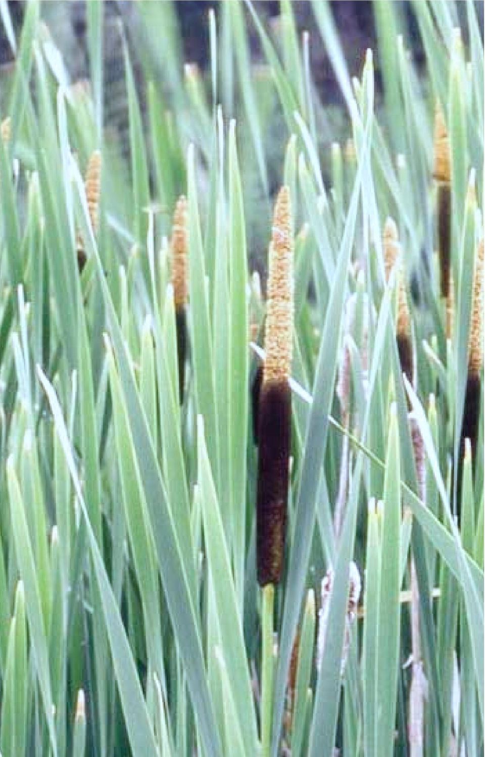
Recognizing Wetlands. For additional information contact your local U.S. Army Corps of Engineers office. Pitcher plant.
 US Army Corps of Engineers For additional information contact your local U.S. Army Corps of Engineers office. 1998 Edition Recognizing Wetlands Pitcher plant The information presented here will help you
Aquatic Biomes, Continued
 Aquatic Biomes, Continued Introduction Extent of Marine biomes Issues & challenges Factors influencing distribution Dynamics in time & space Depth Tour of marine biomes Issues (by biome) Freshwater biomes
WONDERFUL, WATERFUL WETLANDS
 WONDERFUL, WATERFUL WETLANDS OBJECTIVES The student will do the following: 1. List characteristics of wetlands. SUBJECTS: Science, Language Arts TIME: 60 minutes 2. Describe the functions of a wetland.
THE ECOSYSTEM - Biomes
 Biomes The Ecosystem - Biomes Side 2 THE ECOSYSTEM - Biomes By the end of this topic you should be able to:- SYLLABUS STATEMENT ASSESSMENT STATEMENT CHECK NOTES 2.4 BIOMES 2.4.1 Define the term biome.
GLOSSARY OF TERMS CHAPTER 11 WORD DEFINITION SOURCE. Leopold
 CHAPTER 11 GLOSSARY OF TERMS Active Channel The channel that contains the discharge Leopold where channel maintenance is most effective, sediment are actively transported and deposited, and that are capable
Although greatly MOUNTAINS AND SEA BRITISH COLUMBIA S AWIDE RANGE OF. Environment. Old Forests. Plants. Animals
 BRITISH COLUMBIA is Canada s westernmost province. From island-dotted Pacific coast to spectacular Rocky Mountain peak, and from hot dry grassland to moist and majestic coastal forest, British Columbia
4.2 Buena Vista Creek Watershed
 Buena Vista Creek Watershed 4.2 Buena Vista Creek Watershed Watershed Overview The Buena Vista Creek Watershed is the fourth-largest system within the Carlsbad Hydrologic Unit. The watershed extends approximately
Name Date Hour. Plants grow in layers. The canopy receives about 95% of the sunlight leaving little sun for the forest floor.
 Name Date Hour Directions: You are to complete the table by using your environmental text book and the example given here. You want to locate all the abiotic (non-living) and biotic (living) factors in
Create Your Own Soil Profile Ac5vity
 Create Your Own Soil Profile Ac5vity Middle School: 5-8 Task Overview: Soil profile refers to layers of soil. A typical soil profile takes nearly 1,000 to 100,000 years to form. The formation of the soil
Communities, Biomes, and Ecosystems
 Chapter Test A CHAPTER 3 Communities, Biomes, and Ecosystems Part A: Multiple Choice In the space at the left, write the letter of the term or phrase that best answers each question Part B: Matching 1
Bioregional Conservation Status for each BioEVC
 Bridgewater 3 Damp Sands Herb-rich Woodland Vulnerable Bridgewater 9 Coastal Saltmarsh Vulnerable Bridgewater 10 Estuarine Wetland Endangered Bridgewater 23 Herb-rich Foothill Forest Vulnerable Bridgewater
Biomes An Overview of Ecology Biomes Freshwater Biomes
 Biomes An Overview of Ecology Ecology is the scientific study of the interactions between organisms and their environments. Ecology can be divided into four increasingly comprehensive levels: Organismal
Restoration Planning and Development of a Restoration Bank
 Restoration Planning and Development of a Restoration Bank Black Creek Pioneer Village, South Theatre 8:30 a.m. to 3:30 p.m. Habitat Restoration and Environmental Monitoring Projects Section Restoration
Growth Intercept and Site Series Based Estimates of Site Index for White Spruce in the Boreal White and Black Spruce Biogeoclimatic Zone
 T E C H N I C A L R E P O R T 0 1 3 Growth Intercept and Site Series Based Estimates of Site Index for White Spruce in the Boreal White and Black Spruce Biogeoclimatic Zone 2 0 0 4 Ministry of Forests
WILLOCHRA BASIN GROUNDWATER STATUS REPORT 2009-10
 WILLOCHRA BASIN GROUNDWATER STATUS REPORT 2009-10 SUMMARY 2009-10 The Willochra Basin is situated in the southern Flinders Ranges in the Mid-North of South Australia, approximately 50 km east of Port Augusta
Prepared By: Tom Parker Geum Environmental Consulting, Inc.
 Prepared By: Tom Parker Geum Environmental Consulting, Inc. Topics covered: Definition of riparian and floodplain restoration Floodplain attributes as a basis for developing criteria for restoration designs
defined largely by regional variations in climate
 1 Physical Environment: Climate and Biomes EVPP 110 Lecture Instructor: Dr. Largen Fall 2003 2 Climate and Biomes Ecosystem concept physical and biological components of environment are considered as single,
1.7.0 Floodplain Modification Criteria
 1.7.0 Floodplain Modification Criteria 1.7.1 Introduction These guidelines set out standards for evaluating and processing proposed modifications of the 100- year floodplain with the following objectives:
4. Which choice below lists the biomes in order from lowest precipitation amounts to highest precipitation amounts?
 Ecosystems and Biomes 1. All of the living organisms in a forest plus their environment is an example of A. a biome. B. a community. C. a population. D. an ecosystem. 2. Which of the following best describes
DESCRIBING DESERT, TAIGA, AND TUNDRA BIOMES
 Lesson B5 1 DESCRIBING DESERT, TAIGA, AND TUNDRA BIOMES Unit B. Science and Technology in Wildlife Management Problem Area 5. Desert, Taiga, and Tundra Biomes National Academic Standard. NS.9-12.1 Science
Policy & Management Applications of Blue Carbon. fact SHEET
 Policy & Management Applications of Blue Carbon fact SHEET Policy & Management Applications of Blue Carbon Coastal Blue Carbon - An Important Wetland Ecosystem Service Coastal Blue Carbon refers to the
Earth Science. River Systems and Landforms GEOGRAPHY 1710. The Hydrologic Cycle. Introduction. Running Water. Chapter 14.
 Earth Science GEOGRAPHY 1710 River Systems and Landforms DAVID R. SALLEE Robert W. Christopherson Charlie Thomsen Chapter 14 Introduction Rivers and streams are dynamic systems that continually adjust
What is Soil Survey?
 What is Soil Survey? Soil Survey is a systematic examination, description, classification, and mapping of the soils in a given area. Brady and Weil. 1996 Who Produces Soil Survey Cooperative effort between
Climate, Vegetation, and Landforms
 Climate, Vegetation, and Landforms Definitions Climate is the average weather of a place over many years Geographers discuss five broad types of climates Moderate, dry, tropical, continental, polar Vegetation:
Global Water Resources
 Global Water Resources Highlights from assessment activities over the past two decades, which are used to establish present and future water trends, reveal that: 1. Freshwater resources are unevenly distributed,
In this lesson, students will identify a local plant community and make a variety of
 MAKING COMMUNITY MEASUREMENTS: ABIOTIC FACTORS Grades 3 6 I. Introduction In this lesson, students will identify a local plant community and make a variety of measurements, preferably during two different
Restoring Ecosystems. Ecosystem Restoration Services
 Restoring Ecosystems Ecosystem Restoration Services 2 Ecosystem Restoration Services AECOM s integrated approach sciencebased planning, with innovative design and execution delivers sustainable and cost-effective
6.4 Taigas and Tundras
 6.4 Taigas and Tundras In this section, you will learn about the largest and coldest biomes on Earth. The taiga is the largest land biome and the tundra is the coldest. The taiga The largest land biome
It s hard to avoid the word green these days.
 Going green : Environmental jobs for scientists and engineers Alice Ramey Alice Ramey is an economist in the Office of Occupational Statistics and Employment Projections, BLS. She is available at (202)
APPENDIX B CHARACTERIZATION OF SOILS AT TEST SITES
 APPENDIX B HARATERIZATION OF SOILS AT TEST SITES A.1 LAMBTON FAILITY 2015 ANNUAL LANDFILL REPORT BIOMONITORING PROGRAM pendix B haracterization of Soils at Test Sites pendix B HARATERIZATION OF SOILS
Natural Resources and Landscape Survey
 Landscape Info Property Name Address Information Contact Person Relationship to Landscape Email address Phone / Fax Website Address Landscape Type (private/muni/resort, etc.) Former Land Use (if known)
Michigan Wetlands. Department of Environmental Quality
 Department of Environmental Quality Wetlands are a significant component of Michigan s landscape, covering roughly 5.5 million acres, or 15 percent of the land area of the state. This represents about
Woodland caribou (Rangifer tarandus caribou) in the Far North of Ontario: Background information in support of land use planning
 in the Far North of Ontario: Background information in support of land use planning") Woodland caribou (Rangifer tarandus caribou) in the Far North of Ontario: Background information in support of land use planning The Far North Caribou Project (FNCP) was initiated in 2008 to support land
Woodland caribou (Rangifer tarandus caribou) in the Far North of Ontario: Background information in support of land use planning The Far North Caribou Project (FNCP) was initiated in 2008 to support land
Ground-Water-Level Monitoring and the Importance of Long-Term Water-Level Data U.S. Geological Survey Circular 1217
 Ground-Water-Level Monitoring and the Importance of Long-Term Water-Level Data U.S. Geological Survey Circular 1217 by Charles J. Taylor William M. Alley Denver, Colorado 2001 U.S. DEPARTMENT OF THE INTERIOR
Multi-scale upscaling approaches of soil properties from soil monitoring data
 local scale landscape scale forest stand/ site level (management unit) Multi-scale upscaling approaches of soil properties from soil monitoring data sampling plot level Motivation: The Need for Regionalization
LIMNOLOGY, WATER QUALITY
 LIMNOLOGY, WATER QUALITY PA RANI ET E R S, AN D c 0 IV D IT I 0 N S AND ECOREGIONS Water Quality Parameters Nutrients are important parameters because phosphorous and nitrogen are major nutrients required
BLACK/HARMONY/FAREWELL CREEK WATERSHED EXISTING CONDITIONS REPORT CHAPTER 12 - STORMWATER MANAGEMENT
 Harmony Creek subwatershed Harmony Creek subwatershed BLACK/HARMONY/FAREWELL CREEK WATERSHED EXISTING CONDITIONS REPORT CHAPTER 12 - STORMWATER MANAGEMENT April 2011 TABLE OF CONTENTS 1.0 INTRODUCTION...
Key Idea 2: Ecosystems
 Key Idea 2: Ecosystems Ecosystems An ecosystem is a living community of plants and animals sharing an environment with non-living elements such as climate and soil. An example of a small scale ecosystem
Briefing Paper on Lower Galveston Bay and Bayou Watersheds Lower Bay I: Armand Bayou to Moses Lake and Adjacent Bay Waters
 Briefing Paper on Lower Galveston Bay and Bayou Watersheds Lower Bay I: Armand Bayou to Moses Lake and Adjacent Bay Waters Jim Lester, PhD. and Lisa Gonzalez Houston Advanced Research Center Galveston
Biodiversity and Ecosystem Services: Arguments for our Future Environment
 Biodiversity and Ecosystem Services: Arguments for our Future Environment How have we advanced our understanding of the links between biodiversity, ecosystem functions and ecosystem services? The issue
APPENDIX D. EXAMPLES OF OTHER FORMATION-LEVEL CLASSIFICATIONS
 APPENDIX D. EXAMPLES OF OTHER FORMATION-LEVEL CLASSIFICATIONS Main World Terrestrial Biome Types (Box and Fujiwara 2005, Table 4.4,) The authors provide 18 major biome types recognized by most modern treatments
Curt Kerns, M.S., R.P.Bio., C.F.S. WetlandsPacific Corp. 250-722-7117 www.wetlandspacific.com
 Curt Kerns, M.S., R.P.Bio., C.F.S. WetlandsPacific Corp. 250-722-7117 www.wetlandspacific.com Presentation Historical perspectives Present perspectives How wetlands function Examples of natural wetlands
Ecological Restoration of a Brackish Marsh at Parcel 11, Estate Carolina, St. John
 Ecological Restoration of a Brackish Marsh at Parcel 11, Estate Carolina, St. John Gary Ray, Ph.D. Virgin Forest Restorations For Coral Bay Community Council Aerial of Parcel 11 Brackish Marsh Ecological
Most informed people realize that cumulative impacts have had
 Welcome to the First Issue of Rivers & Coast! The goal of the new Rivers & Coast newsletter is to keep readers well informed of current scientific understanding behind key environmental issues related
ECOSYSTEMS OF BRITISH COLUMBIA
 Special Report Series 6 ECOSYSTEMS OF BRITISH COLUMBIA FEBRUARY 1991 BC Ministry of Forests ISSN 0843-6452 Ecosystems of British Columbia Compiled and Edited by Del Meidinger 1 and Jim Pojar 2 1 Research
4. Priority Areas of Conservation
 4. Priority Areas of Conservation A. SIGNIFICANT RESOURCE AREAS This Open Space and Farmland Plan identifies the key issues facing open space and agricultural resources in the Town, highlights the location
Appendix B: Cost Estimates
 Appendix B: Estimates This appendix presents the estimated costs of the monitoring and supplemental research components presented in Section 3 of this document. A 20% quality assurance and quality control
Plants, like all other living organisms have basic needs: a source of nutrition (food),
,") LEARNING FROM LEAVES: A LOOK AT LEAF SIZE Grades 3 6 I. Introduction Plants, like all other living organisms have basic needs: a source of nutrition (food), water, space in which to live, air, and optimal
LEARNING FROM LEAVES: A LOOK AT LEAF SIZE Grades 3 6 I. Introduction Plants, like all other living organisms have basic needs: a source of nutrition (food), water, space in which to live, air, and optimal
CITY UTILITIES DESIGN STANDARDS MANUAL
 CITY UTILITIES DESIGN STANDARDS MANUAL Book 2 (SW) SW9 June 2015 SW9.01 Purpose This Chapter provides information for the design of open channels for the conveyance of stormwater in the City of Fort Wayne.
Geography affects climate.
 KEY CONCEPT Climate is a long-term weather pattern. BEFORE, you learned The Sun s energy heats Earth s surface unevenly The atmosphere s temperature changes with altitude Oceans affect wind flow NOW, you
Life Cycle Of A Plant Population
 Life Cycle Of A Plant Population Seed Rain n=3 Growth And Mortality n=7 Seedling Cohort n=22 Environmental Sieve Seed Bank n=5 Copyright G. Bonan 22 Suvivorship Of Seedlings In A Northern Hardwood Forest
3.1. Succession, Recovery, and Renewal in Natural Communities. A35 Starting Point. What Happens to a Vacant Lot?
 3.1 Succession, Recovery, and Renewal in Natural Communities Here is a summary of what you will learn in this section: Ecosystems change in predictable ways known as succession. Ecosystems can establish
Web of Water. Teacher s Guide Webisode 1 Blue Ridge
 Web of Water Teacher s Guide Webisode 1 Blue Ridge Table of Contents About Blue Ridge.... 3 South Carolina Science Standards.. 4 Discussion Questions.. 10 Knowitall Resources....... 13 Credits..... 14
PROCEDURE. See: Great Lakes Coastal Wetlands (http:// www.miseagrant.umich.edu/wetlands/index.html)
") Activity: Students review a selection of career profiles and play a lively classroom game to find out more about marine and aquatic science professionals. Grade Level: 4-8 Subjects: Science, social studies
Activity: Students review a selection of career profiles and play a lively classroom game to find out more about marine and aquatic science professionals. Grade Level: 4-8 Subjects: Science, social studies
AQUATIC ECOSYSTEMS & BIOMES
 AQUATIC ECOSYSTEMS & BIOMES A) Name three general types of aquatic ecosystems and describe the salinity for each. Give an example for each. 1) 2) 3) B) MATCHING In the space provided, write the letter
Biological Complexity
 Communities, Biomes, and Ecosystems Section 1: Community Ecology Section 2: Terrestrial Biomes Section 3: Aquatic Ecosystems Living organisms can be studied at different levels of complexity. From least
RESTORATION AND ENHANCEMENT OF SOUTHERN CALIFORNIA LAGOONS
 RESTORATION AND ENHANCEMENT OF SOUTHERN CALIFORNIA LAGOONS by Hany Elwany, Ph.D. Scripps Institution of Oceanography Headwaters to Oceans Conference 25 October 2003 CE Ref #03-22 San Diego County Lagoons
Using composting beds to treat acidity in saline drain water
 Government of Western Australia Department of Water Using composting beds to treat acidity in saline drain water Introduction Acidic saline water is common in drains used to manage shallow saline watertables
6. Base your answer to the following question on the graph below, which shows the average monthly temperature of two cities A and B.
 1. Which single factor generally has the greatest effect on the climate of an area on the Earth's surface? 1) the distance from the Equator 2) the extent of vegetative cover 3) the degrees of longitude
Climate Change Scenarios for the Prairies
 Climate Change Scenarios for the Prairies David Sauchyn and Suzan Lapp Prairie Adaptation Research Collaborative, University of Regina, 150-10 Research Drive, Regina, SK S4S 7J7; Email: sauchyn@uregina.ca
San Francisco Bay Area Wetlands Restoration Program Design Review Group. Project Summary Outline
 San Francisco Bay Area Wetlands Restoration Program Design Review Group Project Summary Outline The project proponent desiring to have a project considered by the Design Review Group (DRG) shall provide
EcoInformatics International Inc.
 1 von 10 03.08.2010 14:25 EcoInformatics International Inc. Home Services - solutions Projects Concepts Tools Links Contact EXPLORING BEAVER HABITAT AND DISTRIBUTION WITH GOOGLE EARTH: THE LONGEST BEAVER
Vulnerability Assessment of New England Streams: Developing a Monitoring Network to Detect Climate Change Effects
 Vulnerability Assessment of New England Streams: Developing a Monitoring Network to Detect Climate Change Effects National Water Quality Monitoring Council 2012 Meeting Britta Bierwagen, National Center
Appendix D Hydric Soils
 Appendix D Hydric Soils. This appendix consists of two sections. Section describes the basic procedure for digging a soil pit and examining for hydric soil indicators. Section 2 is a list of hydric soils
The concepts developed in this standard include the following: Oceans cover about 70% of the surface of the Earth.
 Name Date Grade 5 SOL 5.6 Review Oceans Made by SOLpass - www.solpass.org solpass100@comcast.net Reproduction is permitted for SOLpass subscribers only. The concepts developed in this standard include
Addendum. Use Attainability Analysis for Site Specific Selenium Criteria: Alkali Creek. February 23, 2009
 Addendum Use Attainability Analysis for Site Specific Selenium Criteria: Alkali Creek February 23, 2009 Prepared by MWH Americas, Inc. Prepared for EnCana Oil and Gas (USA) Inc. Page 2 Responses to Comments
Climate Change. Lauma M. Jurkevics - DWR, Southern Region Senior Environmental Scientist
 Climate Change A n o t h e r F a c t o r i n M a n a g i n g S o u t h e r n C a l i f o r n i a s W a t e r R e s o u r c e s Lauma M. Jurkevics - DWR, Southern Region Senior Environmental Scientist USEPA-Region
EFB 496.10/696.03 Online Wetland Restoration Techniques Class Syllabus
 EFB 496.10/696.03 Wetland Restoration Techniques Online Class Syllabus SUNY-ESF College of Environmental Science and Forestry Summer Session II 2015 Wetland Restoration Techniques is a graduate and undergraduate
WEATHERING, EROSION, AND DEPOSITION PRACTICE TEST. Which graph best shows the relative stream velocities across the stream from A to B?
 NAME DATE WEATHERING, EROSION, AND DEPOSITION PRACTICE TEST 1. The diagram below shows a meandering stream. Measurements of stream velocity were taken along straight line AB. Which graph best shows the
Avison Management Services Ltd. COMPANY PROFILE
 Avison Management Services Ltd. COMPANY PROFILE Providing resource management through environmental leadership. Mission Statement: We are committed to providing high quality, timely, and cost effective
Wetlands in MN: Resource, Regulation, Restoration
 in MN: Resource, Regulation, Restoration Ben Meyer, Wetland Specialist Hennepin County Natural Resources Partnership January 27, 2015 What is a wetland? Definition (Federal Register): Those areas inundated
General Permit for Activities Promoting Waterway - Floodplain Connectivity [working title]
![General Permit for Activities Promoting Waterway - Floodplain Connectivity [working title]](/thumbs/39/18645965.jpg "General Permit for Activities Promoting Waterway - Floodplain Connectivity [working title]") General Permit for Activities Promoting Waterway - Floodplain Connectivity [working title] Purpose These rules set forth the conditions under which a person may, without an individual removal-fill permit
General Permit for Activities Promoting Waterway - Floodplain Connectivity [working title] Purpose These rules set forth the conditions under which a person may, without an individual removal-fill permit
Subsidence Mitigation Through Rice Cultivation Research Project Goals:
 Twitchell Island rice growing area Subsidence Mitigation Through Rice Cultivation Research 1. Determine the viability of different rice growing methods within the Delta. 2. Determine the rates/amounts
Passive Restoration 101: Framework and Techniques Overview. Amy Chadwick, Great West Engineering August 26, 2015 Butte, America
 Passive Restoration 101: Framework and Techniques Overview Amy Chadwick, Great West Engineering August 26, 2015 Butte, America What Defines Passive Restoration? Process-based, nature-driven Minimal equipment
REPORT TO REGIONAL WATER SUPPLY COMMISSION MEETING OF WEDNESDAY, SEPTEMBER 4, 2013 LEECH WATER SUPPLY AREA RESTORATION UPDATE
 Making a difference... together Agenda Item #9 REPORT #RWSC 2013-17 REPORT TO REGIONAL WATER SUPPLY COMMISSION MEETING OF WEDNESDAY, SEPTEMBER 4, 2013 SUBJECT LEECH WATER SUPPLY AREA RESTORATION UPDATE
Revising the Nantahala and Pisgah Land Management Plan Preliminary Need to Change the Existing Land Management Plan
 Revising the Nantahala and Pisgah Land Management Plan Preliminary Need to Change the Existing Land Management Plan Throughout the Plan 1. There is a fundamental need for the revised plan to address how
Chapter D9. Irrigation scheduling
 Chapter D9. Irrigation scheduling PURPOSE OF THIS CHAPTER To explain how to plan and schedule your irrigation program CHAPTER CONTENTS factors affecting irrigation intervals influence of soil water using
COMPREHENSIVE PLAN SECTION B, ELEMENT 4 WATER RESOURCES. April 20, 2010 EXHIBIT 1
 COMPREHENSIVE PLAN SECTION B, ELEMENT 4 WATER RESOURCES April 20, 2010 EXHIBIT 1 ELEMENT 4 WATER RESOURCES TABLE OF CONTENTS 4.1 INTRODUCTION 4.2 GOALS AND POLICIES 4.2.A General Goals and Policies 1 4.2.B
Expert Panel Assessment. Snowy Precipitation Enhancement Trial (SPET) Executive Summary
 Executive Summary") Expert Panel Assessment Snowy Precipitation Enhancement Trial (SPET) Executive Summary In Summary Snowy Hydro Ltd proposes to undertake a six year cloud seeding trial in the Snowy Mountains region of New
Expert Panel Assessment Snowy Precipitation Enhancement Trial (SPET) Executive Summary In Summary Snowy Hydro Ltd proposes to undertake a six year cloud seeding trial in the Snowy Mountains region of New
3. The submittal shall include a proposed scope of work to confirm the provided project description;
 QIN Shoreline Master Program Project Summary The Shoreline Master Program (SMP) development process for the Quinault Indian Nation (QIN) includes the completion of inventory and analysis report with corresponding
OCEANS AND AQUATIC ECOSYSTEMS - Vol. I - Freshwater Wetland Resources and Biology - M. B. Jones FRESHWATER WETLAND RESOURCES AND BIOLOGY
 FRESHWATER WETLAND RESOURCES AND BIOLOGY M. B. Jones Trinity College, University of Dublin, Ireland Keywords: Carbon cycling, greenhouse gases, sustainability, wetlands, productivity, conservation, ecosystem
SOILS AND AGRICULTURAL POTENTIAL FOR THE PROPOSED P166 ROAD, NEAR MBOMBELA, MPUMALANGA PROVINCE
 REPORT On contract research for SSI SOILS AND AGRICULTURAL POTENTIAL FOR THE PROPOSED P166 ROAD, NEAR MBOMBELA, MPUMALANGA PROVINCE By D.G. Paterson (Pr. Nat. Sci. 400463/04) October 2012 Report No. GW/A/2012/48
NOTE TO TEACHER: It is appropriate to introduce the mitochondria (where energy is made) as a major structure common to all cells.
 as a major structure common to all cells.") 5.2.1 Recall the cell as the smallest unit of life and identify its major structures (including cell membrane, cytoplasm, nucleus, and vacuole). Taxonomy level: 1.1 and 1.2-A Remember Factual Knowledge
5.2.1 Recall the cell as the smallest unit of life and identify its major structures (including cell membrane, cytoplasm, nucleus, and vacuole). Taxonomy level: 1.1 and 1.2-A Remember Factual Knowledge
REVIEW UNIT 10: ECOLOGY SAMPLE QUESTIONS
 Period Date REVIEW UNIT 10: ECOLOGY SAMPLE QUESTIONS A. Sample Multiple Choice Questions Complete the multiple choice questions to review this unit. 1. All of the following are density-dependent factors
CRMS Website Training
 CRMS Website Training March 2013 http://www.lacoast.gov/crms Coastwide Reference Monitoring System - Wetlands CWPPRA Restoration Projects Congressionally funded in 1990 Multiple restoration techniques
Waterway Technote Drains
 Waterway Technote Drains Contents Benefits of good drain practice 1 Are your drains healthy? 2 The Sustainable Dairying Water Accord 3 Planning drain maintenance 3 Fencing and clearing 3 Bank shaping (battering)
NATURAL RESOURCES & NATURAL FEATURES
 A3 NATURAL RESOURCES & NATURAL FEATURES INTRODUCTION This chapter will discuss the topography, geology, soils, and other natural features found in Casco Township. The identification of the natural features
MULTI-AGENCY COMPENSATORY MITIGATION PLAN CHECKLIST 1
 MULTI-AGENCY COMPENSATORY MITIGATION PLAN CHECKLIST 1 Mitigation Goals and Objectives o Describe functions lost at impact site o Describe functions to be gained at mitigation site o Describe overall watershed
Forest Management Guidelines for the Protection of Four-toed and Spotted Salamander Populations Carol Hall & Bruce Carlson May 2004
 Forest Management Guidelines for the Protection of Four-toed and Spotted Salamander Populations Carol Hall & Bruce Carlson May 2004 Salamander Natural History Four-toed Salamanders: The Four-toed Salamander,
Wate. er- plantain. or historical sites. Creat. drawdown zone. smell of coriander. withh livestock. ain is still relatively. of pools.
 Creat ting ponds for Lesser Wate er- plantain 1. Lesser Water-plantain Lesser Water-plantain (Baldellia ranunculoides) is a beautiful plant. It can vary considerably in size, from diminutive plants with
Deserts, Wind Erosion and Deposition
 Deserts, Wind Erosion and Deposition By definition, a desert has less than 10 in (25 cm) of precipitation per year. Deserts occur at 30 o and 60 o in regions of descending air. Deserts can be hot or cold.
Fire, Forest History, and Ecological Restoration of Ponderosa Pine Forests at Mount Rushmore, South Dakota
 Fire, Forest History, and Ecological Restoration of Ponderosa Pine Forests at Mount Rushmore, South Dakota Restoration uses the past not as a goal but as a reference point for the future...it is not to
Sedimentary Rocks, Depositional Environments and Stratigraphy
 Sedimentary Rocks, Depositional Environments and Stratigraphy The Nature of Sedimentary Rocks Sedimentary rocks are composed of: Fragments of other rocks (detrital or clastic) Chemical precipitates Organic
Ecosystems. The two main ecosystem processes: Energy flow and Chemical cycling
 Ecosystems THE REALM OF ECOLOGY Biosphere An island ecosystem A desert spring ecosystem Biosphere Ecosystem Ecology: Interactions between the species in a given habitat and their physical environment.
How To Prepare A Geotechnical Study For A Trunk Sewer Project In Lincoln, Nebraska
 APPENDIX B Geotechnical Engineering Report GEOTECHNICAL ENGINEERING REPORT Preliminary Geotechnical Study Upper Southeast Salt Creek Sanitary Trunk Sewer Lincoln Wastewater System Lincoln, Nebraska PREPARED
TFL 55 CHANGE MONITORING INVENTORY SAMPLE PLAN
 TFL 55 CHANGE MONITORING INVENTORY SAMPLE PLAN Prepared for: Mike Copperthwaite, RPF Louisiana-Pacific Canada Ltd. Malakwa, BC Prepared by: Timberline Natural Resource Group Ltd. Kamloops, BC Project Number:
March 2008. Prepared by: Irvine Ranch Water District. 15600 Sand Canyon Avenue. Irvine, CA 92618. Contact: Natalie Likens (949) 453-5633
 453-5633") ADDENDUM TO THE MICHELSON WATER RECLAMATION PLANT PHASE 2 & 3 CAPACITY EXPANSION PROJECT FEBRUARY 2006 FINAL ENVIRONMENTAL IMPACT REPORT AND THE SAN JOAQUIN FRESHWATER MARSH ENHANCEMENT PLAN REVISED SEPTEMBER
ADDENDUM TO THE MICHELSON WATER RECLAMATION PLANT PHASE 2 & 3 CAPACITY EXPANSION PROJECT FEBRUARY 2006 FINAL ENVIRONMENTAL IMPACT REPORT AND THE SAN JOAQUIN FRESHWATER MARSH ENHANCEMENT PLAN REVISED SEPTEMBER