INTELLIGENT TRANSPORTATION SYSTEMS (ITS) USING TECHNOLOGY FOR THE SAFETY AND MOBILITY OF ALL MODES MARSHALL ELIZER, P.E., PTOE MAY 13, 2015
|
|
|
- Berenice Oliver
- 7 years ago
- Views:
Transcription
1 INTELLIGENT TRANSPORTATION SYSTEMS (ITS) USING TECHNOLOGY FOR THE SAFETY AND MOBILITY OF ALL MODES MARSHALL ELIZER, P.E., PTOE MAY 13,

2 FDOT Complete Streets Implementation Plan A project to implement FDOT s Complete Streets policy that promotes safety, quality of life, and economic development in Florida. Mission: Determine what modifications to FDOT policies, guidance, manuals, procedures and general practices are needed to put the FDOT Complete Streets Policy into action, and develop a Work Plan to accomplish identified document modifications.

3 FDOT s CS/M2D2 Program Objectives 1. Provide the project stakeholder group (PSG) with a state-ofthe practice understanding of the capabilities/requirements of each transportation mode and the opportunities/tradeoffs that exist in a multimodal system. 2. Review the current policies, guidance, manuals, procedures and practices of FDOT and identify ways Florida s state, regional and local government agencies can balance those needs and modes collectively when multiple modes coexist. 3. Identify/understand barriers, gaps, & opportunities that exist in current FDOT documents and practices to address the needs of all modes in a variety of contexts. 4. Complete an implementation plan and associated schedule for addressing the various actions and strategies needed to put FDOT Complete Streets Policy into everyday practice.

4 Today s ITS Workshop Topics Overview of ITS State of the ITS Practice in Florida ITS Strategies and Applications for All Modes Small Group Discussion - Advancing use of Multimodal ITS in FDOT Programs, Processes and Projects Key Actions & Next Steps

5 Today s Learning Objectives Understand all ITS has to offer and its potential benefit to the safety and mobility of all modes. Understand the past and future of ITS applications and strategies. Understand state-of-the-practice in FDOT and Florida, and Nationally. Identify how ITS is being applied to benefit multimodal transportation. Identify ITS technology & strategies that FDOT and its partners can advance to better serve multimodal interests today and into the future. Identify how to get those applications into FDOT policies, standards, practices and processes.

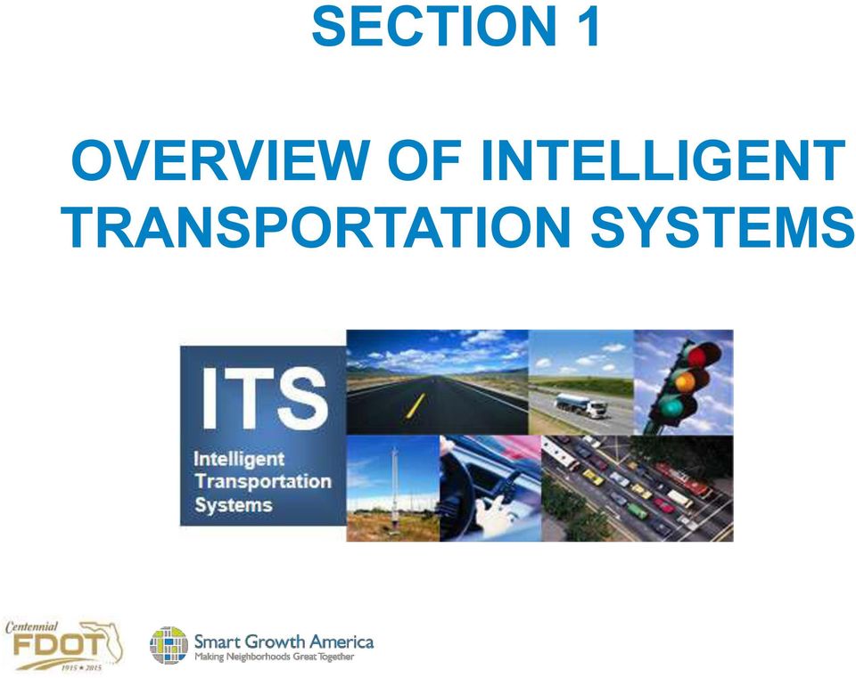
6 SECTION 1 OVERVIEW OF INTELLIGENT TRANSPORTATION SYSTEMS
7 ANYONE HEARD OF IVHS?

8 What is ITS? The application of electronics, communications, or information processing to improve the efficiency or safety of transportation systems.

9 Recognized ITS Service Areas ATMS Advanced Traffic Management Systems ATIS Advanced Traveler Information Systems APTS Advanced Public Transportation Systems CVO Commercial Vehicle Operations EM Emergency Management MCO Maintenance & Construction Management AVSS Advanced Vehicle Safety Systems AD Archived Data

10 ITS is...freeway traffic management Variable Message Signs CCTV Video Traffic Detection Ramp Metering Active Traffic Management

11 ITS is...surface road advanced traffic management Signal Coordination Real-time Adaptive Signal Timing Transit, Pedestrian, Bicycle controls

12 Traffic Management Services Network Surveillance Traffic Probe Surveillance Traffic Signal Control Traffic Metering HOV Lane Management Traffic Information Dissemination Regional Traffic Management Traffic Incident Management System Transportation Decision Support and Demand Management Electronic Toll Collection Emissions Monitoring and Management Roadside Lighting System Control Border crossing support

13 Traffic Management Services Standard and Advanced Railroad Grade Crossing Railroad Operations Coordination Parking Facility Management Regional Parking Management Reversible Lane Management Speed Warning and Enforcement Drawbridge Management Roadway Closure Management Variable Speed Limits Dynamic Lane Management and Shoulder Use Dynamic Roadway Warning VMT Road User Payment Mixed Use Warning Systems

14 ITS is...traveler information for all modes 511 Systems TMC Data collection/dissemination Roadway, transit, ferry information Multimodal trip-making support Service information for travelers Parking management Border crossing conditions

15 Traveler Information Services Broadcast Traveler Information Interactive Traveler Information Autonomous Route Guidance Dynamic Route Guidance ISP Based Trip Planning and Route Guidance Transportation Operations Data Sharing Travel Services Information and Reservation Dynamic Ridesharing In-Vehicle Signing Short Range Communications Traveler Information

16 ITS is...incident, emergency, freight management Incident Detection & Response Computer Aided Dispatch Goods Movement Management & Tracking Freeway Service Patrols Adaptive Traffic Signals Variable Message Signs Highway Advisory Radio, CCTV

17 ITS is...enforcement support Incident Support Red Light Running Systems Automated Speed Enforcement

18 Commercial Vehicle Operations Carrier Operations and Fleet Management Freight Administration Electronic Clearance CV Administrative Processes International Border Electronic Clearance Weigh-In-Motion Roadside CVO Safety On-board CVO Safety CVO Fleet Maintenance HAZMAT Management Roadside HAZMAT Security Detection and Mitigation CV Driver Security Authentication Freight Assignment Tracking

19 Emergency Management Services Emergency Call- Taking and Dispatch Emergency Routing Mayday and Alarms Support Roadway Service Patrols Transportation Infrastructure Protection Wide-Area Alert Early Warning System Disaster Response and Recovery Evacuation and Reentry Management Disaster Traveler Information

20 ITS is...transit management Automatic Vehicle Location Computer Aided Dispatch Electronic Payment Systems Real-Time Schedule Information Transit priority/preemption

21 Public Transportation Services Transit Vehicle Tracking Transit Fixed-Route Operations Demand Response Transit Operations Transit Fare Collection Management Transit Security Transit Fleet Management Multi-modal Coordination Transit Traveler Information Transit Signal Priority Transit Passenger Counting Multimodal Connection Protection
22 ITS is...maintenance/construction management Traveler Weather Information Snow & Ice Removal Systems Automated Vehicle Location
23 Maintenance & Construction Management Maintenance and Construction Vehicle and Equipment Tracking Road Weather Data Collection Weather Information Processing and Distribution Roadway Automated Treatment Winter Maintenance Roadway Maintenance and Construction Work Zone Management Work Zone Safety Monitoring Maintenance and Construction Activity Coordination Environmental Probe Surveillance Infrastructure Monitoring
24 ITS is...futuristic Connected Vehicles Vehicle-to-Vehicle communications Vehicle-to-Infrastructure communications Self-driving autonomous vehicles Automated highways
25 Vehicle Safety Systems Vehicle Safety Monitoring Driver Safety Monitoring Longitudinal Safety Warning Lateral Safety Warning Intersection Safety Warning Pre-Crash Restraint Deployment Driver Visibility Improvement Advanced Vehicle Longitudinal Control Advanced Vehicle Lateral Control Intersection Collision Avoidance Automated Vehicle Operations Cooperative Vehicle Safety Systems
26 ITS is really getting information processing information...sharing information to support safer, more efficient and more sustainable transportation.
27 Transportation System Management and Operations (TSM&O) in Portland OR
28 ITS Also Supports Sustainability & Livability Goals Provides information to support mode choices Multimodal traveler information Improves transit experience Transit signal priority, bus rapid transit Supports reliable, efficient movement of people & goods Incident/work zone management, signal timing, ramp management, managed lanes, active traffic management Manages Travel Demand Congestion pricing, variable priced tolling
29 Benefits of ITS Travelers are the primary beneficiaries as they experience improved safety of travel, including reduction in fatalities, injuries, and the costs associated with crashes. Travelers also benefit from real-time, multimodal information that leads to more efficient and eco-friendly choices regarding travel routes and modal choices. Transportation agencies benefit by being able to see and respond dynamically to manage conditions on the transportation network across all of the modes. Operators benefit from having tools to manage the multi-modal system more efficiently, saving fuel, and reducing environmental impact.
30 National Guidance & Standards The National ITS Architecture and Standards program ensures that States and jurisdictions have the framework they need to deploy interoperable ITS systems for seamless travel.
31 Current ITS Deployment Statistics USDOT 2013 Intelligent Transportation System (ITS) Deployment Tracking Survey Freeways Arterials Transit
32 Freeway Management Deployment Trends,
33 Technologies Adopted by Freeway Agencies, 2000, 2010 and 2013
34 Adoption of Probe Readers by Freeway and Arterial Agencies
35 Methods Used to Distribute Traveler Information on Freeways,
36 Arterial Management Deployment Trends,
37 Technologies Adopted by Arterial Agencies,
38 Types of Traveler Information Distributed by Arterial Agencies,
39 Media Used to Distribute Traveler Information by Arterial Agencies,
40 Performance Measures Used by Freeway and Arterial Agencies
41 Types of Information Distributed by Freeway and Arterial Agencies
42 Benefit Ratings Assigned to ITS Technologies by Freeway Agencies,
43 Benefit Ratings Assigned to ITS Technologies by Arterial Agencies,
44 Incident Management Deployment Indicators,
45 CURRENT USDOT DIRECTION IN ITS
46 Connected Vehicles Connected vehicle safety applications will enable drivers to have 360-degree awareness of hazards and situations they cannot even see. Through in-car warnings, drivers will be alerted to imminent crash situations, such as merging trucks, cars in the driver s blind side, or when a vehicle ahead brakes suddenly. By communicating with roadside infrastructure, drivers will be alerted when they are entering a school zone, if workers are on the roadside, and if an upcoming traffic light is about to change
47 Current USDOT ITS Research Activities Vehicle to Vehicle (V2V)Communications for Safety: investigates key questions such as whether vehicle-based safety applications using V2V communications are effective and do they have benefits. Vehicle to Infrastructure (V2I) Communications for Safety: investigates similar questions of effectiveness and potential benefits as that being conducted for V2V communications. The initial focus of the research is on applications that relay traffic signal phase and timing information to vehicles. Low-cost rural ITS safety countermeasures are included as part of this effort. Vehicle to Pedestrian (V2P): investigates V2P and Pedestrian to Infrastructure (P2I) technologies that help to eliminate or reduce pedestrian crashes. Road Weather Management: investigates how vehicle-based data on current weather conditions can be used by travelers and transportation agencies to enable decision-making that takes current weather conditions and future weather forecasts into account.
48 Other USDOT ITS Research Applications for the Environment: Real-Time Information Synthesis (AERIS) Dynamic Mobility Applications: Examines what technologies can help people and goods effortlessly transfer from one mode of travel (car, bus, truck, train, etc.) or route to another for the fastest and most environmentally friendly trip. The research seeks to make cross-modal travel truly possible for people and goods, and enable agencies and companies to manage their systems in light of the fact that people and goods will be changing modes often.
49 Accessible Transportation Technologies Research Initiative (ATTRI) Research to improve the mobility of travelers with disabilities through the use of ITS and other advanced technologies. Research, development, and implementation of transformative technologies, solutions, applications, or systems for people of all abilities to effectively plan their personal and independent travel. Goal: enhance the capability of travelers to reliably and safely execute independent travel. Goal: identify, develop, and deploy new transformative technologies, applications or systems, along with supporting policies and institutional guidance, to address mobility challenges of all travelers, in particular, travelers with disabilities. ATTRI will also develop technological solutions to lower or remove barriers to transportation according to four functional disabilities: visual, hearing, cognitive and mobility.
50 Discussion Based on what we ve just covered.. What are the best opportunities for ITS to benefit FDOT s multimodal customers?
51 SECTION 2 STATE OF THE ITS PRACTICE IN FDOT RUSSELL ALLEN INTELLIGENT TRANSPORTATION SYSTEMS TRAFFIC ENGINEERING/OPERATIONS
52 ITS-Related Plans/Documents/Processes Long Term Plans 2014 Update to ITS Strategic Plan Ten-Year ITS Cost Feasible Plan Connected Vehicle Initiative (FDOT website) Studies & Reports ITS Performance Measures Annual Report ITS Program Annual Report FY Integrated Corridor Management & Advanced Technologies for Florida 2012 Selecting the Most Effective ITS Application for Pedestrian Safety in Florida Procedures Removal of Unwarranted, Nonconforming or Unauthorized Traffic Control Signals Signalization Preemption Design Standard 511 website Manuals/Handbooks Florida Intersection Design Guide Florida s ITS Integration Handbook 2002 General Planning & Review Practices Traffic Engineering Manual
53 Other Plans/Documents that can Impact FDOT s ITS Program 2060 Florida Transportation Plan Florida Strategic Intermodal System Strategic Plan 2040 Multimodal Unfunded Needs Plan Florida Freight Mobility and Trade Plan Florida Rail System Plan Florida Strategic Highway Safety Plan Florida Transportation Trends and Conditions Report Florida TOD Guidebook
54 Good Example: Best Design Practices for Walking and Bicycling in Michigan includes ITS Signalized Intersection Improvements Fixed Time Signals or Pedestrian Push-Buttons Pedestrian Countdown Signal Leading Pedestrian Interval Pedestrian-Only Phase (Scramble) Exclusive Left (Leading/Lagging) Flashing Yellow Arrow Prohibited Left Turns (Florida Left) Prohibited Right Turn on Red Bicycle Signal Detection Bike Box Two-Stage Bike Left Turn Bicycle Signals Unsignalized Ped Crossing Improvements Rectangular Rapid Flash Beacon Pedestrian Hybrid Beacon Midblock Signal
55 Good Example: CalTrans Complete Intersections The Department views all transportation improvements as opportunities to improve safety, access, and mobility for all travelers in California and recognizes bicycle, pedestrian, and transit modes as integral elements of the transportation system. Policy Statement Implementation Action Plan Complete Intersections guide for how to design or redesign intersections to optimize safety for pedestrians and bicyclists Updates to all relevant department manuals, guides, policies, processes
56 Discussion - How does the current ITS program support and link to other FDOT programs?
57 Discussion Are there missed opportunities to take full advantage of what ITS has to offer for multimodal purposes in FDOT s planning, design, operations and management processes?
58 SECTION 3 ITS STRATEGIES AND APPLICATIONS FOR ALL MODES
59 Modal Applications of ITS Passenger vehicles Transit (road and rail) Freight/goods movement Pedestrians Bicycles and tying the modes together Traveler information services
60 ITS for Vehicles Primary focus of the ITS industry Vehicle applications dominate to address highway system efficiency and safety needs
61 ITS for Transit
62 Transit ITS Fleet Operations and Management implemented to facilitate transit operations and provide input to senior management Traveler Information customer-interface technologies that provide trip planning and real-time operational information Safety and Security improve safety and security of transit staff and passengers Automated Fare Payment fare collection and payment technologies Maintenance facilitate maintenance activities Other other technologies and systems, such as data management and the use of open data
63 Transit Management Deployment Indicators,
64 Technologies Adopted by Transit Agencies, 2000, 2010, and 2013
65 Media used by Transit Agencies to Distribute Dynamic and Static Traveler Information
66 Benefit Ratings Assigned to ITS Technologies by Transit Agencies,
67 Fleet Operations and Management Communications Technologies Depend on infrastructure and devices used to transmit voice and data Can transmit voice, text, data, and video over radio, cellular, or other wireless networks Types of wireless networks: Wide area wireless (WAW) Wireless local area network (WLAN) Dedicated short-range communications (DSRC) Land line and cellular telephone networks Internet and intranet
68 Fleet Operations and Management Automatic Vehicle Location (AVL) and Computer-aided Dispatch (CAD) For operations management-periodically receives real-time updates on vehicle locations and schedule/route status Onboard computer with Global Positioning System and mobile data communications Provides decisions support tools used by dispatchers and supervisors, allowing proactive management of operations Allows for "single point" logon for all onboard systems
69 Fleet Operations and Management Automatic Passenger Counters (APCs) Monitors passenger activity and uses algorithm to count number of boarding and alighting passengers Data can either be stored for downloading/uploading or transmitted in real-time Most common types are treadle mats and infrared technology Ability to "stamp" data with exact bus stop location and time of day through integration with AVL
70 Fleet Operations and Management Scheduling Software
71 Fleet Operations and Management Transfer Connection Protection (TCP) Triggered when vehicle operator of incoming vehicle makes a transfer request using a mobile data terminal (MDT) to enter outgoing route Central system determines whether outgoing vehicle can and should be held based on estimated arrival time of incoming vehicle Central system will notify: Incoming vehicle s operator whether outgoing vehicle will be held Outgoing vehicle s operator if it is to hold, until what time, and for what route Dispatcher reviews current pending transfers
72 Fleet Operations and Management Transit Signal Priority (TSP) Give authorized transit vehicles ability to automatically change the timing of traffic signals Can be limited to extending green cycle, but can result in red cycle truncation and phase insertion May be done conditionally based on passenger load, type of service (Bus Rapid Transit (BRT) vs. local), and schedule adherence
73 Fleet Operations and Management Yard Management Automatically locates vehicles within certain distance accuracy inside yard Allows yard attendants to adjust vehicle locations manually on a yard map Provides interface with CAD/AVL system to record pull-in and pull-out time, and assigned vehicle operators Can be interfaced with fixed-route scheduling software to access vehicle operator information in real-time
74 Fleet Operations and Management Intelligent Vehicle Technologies Rear Impact Collision Warning System Side Collision Warning/Object Detection System (aka Lane Change and Merge Collision Avoidance) Frontal Collision Warning System Intersection Conflict Warning System Lane Change/Merge Warning System Pedestrian Collision Warning
75 Fleet Operations and Management Intelligent Vehicle Technologies (continued) Lane Control Technologies Vehicle Assist and Automation (VAA): Lateral Guidance (aka lane keeping for operating on narrow rights-of-way, such as freeway shoulders) Vehicle Platooning Precision Docking Automated Operations
76 Transit Traveler Information Automatic Voice Announcements (AVA) Audio and visual announcements to onboard riders and those waiting to board As fixed-route vehicle approaches a stop or other designated location: Digitally recorded announcement automatically made over onboard public address system speakers Displayed on dynamic message signs inside vehicle to inform passengers about upcoming stops, major intersections landmarks Can make time-based, location-based, and vehicle operator-initiated announcements/displays
77 Transit Traveler Information En-route/Wayside Traveler Information
78 Transit Traveler Information Onboard Internet Access Being provided particularly on vehicles that service lengthy routes Some agencies leveraged onboard communications hardware that provides both data communication for the agency and Wi-Fi for passengers
79 Transit Traveler Information 511, 311, and 211 Systems On July 21, 2000, Federal Communications Commission (FCC) assigned 511 as nationwide telephone number for traveler information - provided statewide and/or regionally FCC designated 211 to be used for locally/regionally operated "community information and referral services" phone systems FCC designated 311 to be used for locally/regionally operated, staffed (live operator) phone systems for nonemergency policy and other government services information
80 Transit Traveler Information Google Transit
81 Transit Traveler Information Third-Party Smartphone Applications
82 Transit Safety and Security Mobile (onboard and exterior) and Fixed Video Surveillance Review recorded images Potential crime prevention Identify criminal activity and perpetrator(s) Identify improper passenger and driver behavior Incident/ insurance investigation
83 Transit Safety and Security Covert Emergency Alarm and Covert Live Audio Monitoring Allows dispatchers to listen in on what is happening inside vehicle while an incident is taking place Covert microphones are one-way communications in order not to alert person responsible for incident that dispatcher/police are listening in Driver in distress presses a covert switch that activates the covert microphone and monitor in dispatcher s office automatically displays the information for that vehicle and map display zooms in on that vehicle
84 Automated Fare Payment Automated fare media Magnetic stripe cards Smart cards - integrated circuit (or chip) card that has microprocessor and built-in logic: contact, contactless, and combi-card Accommodate options such as stored value, stored trip, various lengths of passes, and capped-trip passes Facilitates transfers
85 Automated Fare Payment Automated Fareboxes and Faregates
86 Technology Integration Opportunities for technologies to be integrated with systems that are external to transit agency, such as a regional traffic management center or an information services provider Integration, when implemented from enterprise-wide perspective and regional perspective when appropriate, improves overall usability of technology environment made up of products from different vendors on multiple platforms and data from different systems
87 Discussion Point What is FDOT s role in advancing the application of transit ITS in Florida? Integrating roadway ITS with transit ITS?
88 ITS for Freight/Goods Movement
89 Core ITS Freight Technologies Asset tracking "Where is my equipment?" enables better fleet management and supply chain visibility On-board status monitoring Vehicle condition sensors Cargo condition sensors Driver behavior sensors Gateway facilitation Ties in with CVO and CVISN Freight and network status info Requires major database access and management capabilities
90 Freight Signal Priority (FSP) Freight Signal Priority concept provides signal priority along an arterial corridor near a freight facility based upon current and projected freight movements into and out of the freight facility. The goal of freight signal priority application is to reduce delays and increase travel time reliability for freight traffic, and enhance safety at intersections around the freight facility.
91 ITS Applications for Freight Mobility Freight Advanced Traveler Information System (FRATIS) - provides traveler information to freight operators and drivers such as real-time travel estimates with route guidance to freight facilities, and basic incident alert, road closure and work zone information. Freight Dynamic Route Guidance - determines, in real-time, and potentially while a truck is already on a route, the best route (or re-routing, if applicable) between freight facilities for each carrier that subscribes to the service. Drayage Optimization: This application optimizes drayage operations so that load movements are coordinated between freight facilities.
92 ITS for Pedestrians
93 Available Pedestrian ITS Strategies Signalized Intersection Improvements Fixed Time Signals or Pedestrian Push-Buttons Pedestrian Countdown Signal Leading Pedestrian Interval Pedestrian-Only Phase Exclusive Left (Leading/Lagging) Flashing Yellow Arrow Prohibited Left Turns ADA Treatments Pedestrian detection Automated pedestrian counts
94 Available Pedestrian ITS Strategies Unsignalized Pedestrian Crossing Improvements Rectangular Rapid Flash Beacon Pedestrian Hybrid Beacon (HAWK) Midblock Signal
95 Pedestrian Sensors for Street Crossing Uses video camera technology to detect how many pedestrians are waiting at crossings Automatically adjusts the traffic signal timings to extend the signal for pedestrians to cross the road when it detects that large numbers of people are waiting to cross Also can cancel calls when a pedestrian who placed a call has either crossed before the signal goes green or walks away
96 GPS Mobile ITS for Pedestrian Safety This future application collects the position data of pedestrians by communicating with GPS mobile phones carried by pedestrians This information is then sent to the server where it is determined if the driver and/or pedestrian should be alerted Informs the driver of the presence of unseen pedestrians via navigation voice message and display
97 Pre-collision System (PCS) with Pedestrianavoidance Steer Assist Uses automatic steering in addition to increased pre-collision braking force and automatic braking to help prevent collisions with pedestrians An on-board sensor detects pedestrians and issues a visual alert on the dashboard if the system determines a risk of collision If the likelihood of a collision increases, an audio/visual alarm encourages the driver to take evasive action and pre-collision braking force and automatic braking functions are activated If the system determines that a collision cannot be avoided by braking alone and there is sufficient room for avoidance, steering assist is activated to steer the vehicle away from the pedestrian
98 Pedestrian Presence Sensors Detector/camera combination uses predefined detection zones for dynamic control of traffic signals and pedestrian warning lights As soon as a pedestrian enters the predefined zone, the sensor triggers the traffic light controller or activates a warning signal Detects pedestrians who are crossing the road, approaching or waiting at the crossing.
99 ITS for Bicycles
100 Available Bicycle ITS Strategies Bicycle Signal Detection Bicycle Signals Pre-green Queue Jumping Two-Stage Bike Left Turn Rectangular Rapid Flash Beacon Hybrid Beacon Crossing Midblock Signal Protected intersection Automated bicycle counting
101 Evolving Concept: Protected Intersection for Bicycles
102 Advanced Traveler Information for Modal Integration
103 Real-Time Travel Information Information types and impacts Pre-Trip Trip departure time Mode of travel Route choice En Route Change route Change mode (if alternate mode available) Expected arrival times
104 Real-Time Travel Information Dissemination Web State/Local traveler information Web sites Pre-trip information Wide geographic area coverage Images from CCTV cameras on real-time conditions 511 System More than systems in use today Highest usage under major events Extreme weather Major road closures/incidents
105 Real-Time Travel Information Dissemination Dynamic Message Signs Highway Advisory Radio (HAR) TV/Radio Kiosks Private Information Providers In-vehicle navigation Handheld devices Social Networking Media
106 Real-Time Travel Information: Methods Used to Distribute Traveler Information by Freeway and Arterial Agencies
107 Real-Time Travel Information Benefits Improved Traveler Decision Making Make accurate and timely decisions Routing Time of departure Mode Not make the trip Sense of self control to traveler Reduced Frustration and Irrational Behavior Improve perceived level of service
108 Real-Time Travel Information Benefits Spread or Reduce Peak Traffic Demand Over space: alternative routes Over time Alternative modes Eliminating discretionary trips Field Evaluation Results Traveler information users perceived time savings In-vehicle travel time savings are small
109 Parking Information Public Agencies/Operators Maps with Parking Facilities Information on the Web: location/characteristics Parking Lots Space Availability Private Service Providers Web/Mobile Applications Real-time Parking Availability Online Reservation/Payment
110 Parking Information Multimodal Information Driving Times Parking Availability at Transit Stations Transit Information Departure/Arrival Times Influences Mode Choice Travel Time Savings Perceived Congestion
111 Multimodal Electronic Payment Systems Regional multimodal electronic payment system - all modes of transportation addressed by single payment system While there may be one single payment system there may be different payment devices For example, vehicle-based payment can be achieved by transponder or tag while personal based payments such as ticketing for transit systems can be accomplished with a smartcard The same account can be used for both even if different payment devices are used
112 MTC s Transit.511.org Website (SF Region)
113 MTC 511 Transit App for Android Multiple-agency, nine-county public transit trip planner using GPS-based location tools for smartphones. It allows users to plan a trip on over 700 transit lines across the region including buses, trains and ferries. Door-to-door transit trip planning and scheduled departure times for transit routes near your location or from a location you specify. It includes information for over 30 agencies, 720 routes and more than 23,700 transit stops throughout the region. An interactive, dynamic San Francisco Bay Area map showing transit trip routes, nearby stops and major landmark locations. Personalization, including saved recently viewed locations and trips. Walking directions to and from stops. A listing of stops passed along the route to alert riders when their stop is approaching. Fares (including transfers). Current transit agency announcements on the itinerary that may affect the trip.
114 The 511 Transit App includes an interactive, dynamic San Francisco Bay Area map showing transit trip routes and stops.
115 Integrated Corridor Management What is ICM? Discussion Are there opportunities for FDOT to apply ICM to benefit multimodal goals? If yes, where?
116 Corridors Currently surface transportation systems are made up of several independent networks Freeways, including managed lanes Arterials Bus Routes Rail Transit Efforts to date to reduce congestion have focused on optimization of individual networks These adjacent network links overlay to form transportation corridors Corridors offer an opportunity to operate and optimize the entire system as opposed to the individual networks 116
117 Generic Corridor Local Jurisdiction 1 Traffic Signal System P Regional Rail Agency Train Management System State DOT Freeway Management System Bus Company AVL system Local Jurisdiction 2 Traffic Signal System 117
118 Missing Integration Technical Integration Lack of cross network device-to-device data, communication, and procedure integration Operational Integration Lack of integrated cross network operational strategies and analysis capabilities Institutional Integration Lack of operational capability and technology that supports cross network distribution of responsibilities and sharing of control 118
119 USDOT Integrated Corridor Management Initiative (ICM) Goal of Initiative to provide the institutional guidance, operational capabilities, and ITS technical methods needed for effective Integrated Corridor Management Systems. Purpose To demonstrate that ITS technologies can be used to efficiently and proactively manage the movement of people and goods in major transportation corridors by facilitating integration of the management of all the networks in a corridor. Future State Widespread use of integrated corridor management tools and strategies to improve mobility through integrated management of transportation assets. 119
120 I-75 Integrated Corridor Management Developed to improve mobility, safety, and optimize corridor capacity on the I 75 corridor from M 102 (8 Mile Road) to Baldwin Blvd. Led by FDOT in collaboration with many local stakeholders The project presents an opportunity for collaboration across jurisdictions to further integrate freeway and arterial networks under non incident conditions, as well as incident and weather conditions. Project purpose is to develop an integrated framework that creates a steady, constant traffic flow throughout the corridor.
121 Discussion Are there opportunities for FDOT to expand ICM to benefit multimodal goals? If yes, where and how?
122 SECTION 4 ESTABLISHING A MULTIMODAL ITS VISION FOR FDOT SMALL GROUP DISCUSSION
123 What barriers exist in FDOT s policies, standards, practices and guidance for ITS applications and strategies to better address the needs of all modes in a variety of contexts (urban core, suburban, small urban, rural)?
124 What gaps exist in FDOT s (and FHWA/FTA) ITS policies, standards, practices and guidance that could be filled to enhance the departments multimodal performance?
125 What other opportunities exist for FDOT ITS that should be explored within the context of the Complete Streets/M2D2 project?
126 Who should be at the table with FDOT as these issues are addressed?
127 Breakout Session 1. What barriers exist in FDOT s policies, standards, practices and guidance for ITS applications and strategies to better address the needs of all modes in a variety of contexts (urban core, suburban, small urban, rural)? 2. What gaps exist in FDOT s (and FHWA/FTA) ITS policies, standards, practices and guidance that could be filled to enhance multimodal performance? 3. What opportunities exist for FDOT ITS that should be explored within the context of the CS/M2D2 project? 4. Who should be at the table with FDOT as these issues are addressed?
128 RECAP OTHER THOUGHTS?
129 THANK YOU.
130 Multimodal Development and Delivery (M2D2) is a partnership between the Florida Department of Transportation (FDOT) and Smart Growth America to identify modifications to FDOT policies, guidance, manuals, procedures and general practices needed to implement FDOT s Complete Streets policy in order to promotes safety, quality of life, and economic development in Florida.
ITS eprimer Module 7: Public Transportation
 ITS eprimer Module 7: Public Transportation March 2016 ITS Professional Capacity Building Program ITS Joint Program Office Instructor Add a professional photo of yourself to the left-hand side of the slide.
APPENDIX A Dallas-Fort Worth Region Transportation System Management Strategies and Projects
 APPENDIX A Transportation System Management Strategies and Projects Transportation System Transportation System Management Projects Management Strategies Traffic Signalization and Control New Signal Installation
INTELLIGENT TRANSPORTATION SYSTEMS IN WHATCOM COUNTY A REGIONAL GUIDE TO ITS TECHNOLOGY
 INTELLIGENT TRANSPORTATION SYSTEMS IN WHATCOM COUNTY A REGIONAL GUIDE TO ITS TECHNOLOGY AN INTRODUCTION PREPARED BY THE WHATCOM COUNCIL OF GOVERNMENTS JULY, 2004 Whatcom Council of Governments 314 E. Champion
September 8th 8:30 AM 10:00 AM PL1: Reinventing Policy to Support the New ITS
 September 8th 8:30 AM 10:00 AM PL1: Reinventing Policy to Support the New ITS September 8th 10:30 AM 12:00 PM AM01: Sustainable Transportation Performance Measures: Best Practices September 8th 10:30 AM
CHAPTER 8: INTELLIGENT TRANSPORTATION STSTEMS (ITS)
") CHAPTER 8: INTELLIGENT TRANSPORTATION STSTEMS (ITS) Intelligent Transportation Systems (ITS) enables people and goods to move more safely and efficiently through a state-of-the-art multi-modal transportation
CHAPTER 8: INTELLIGENT TRANSPORTATION STSTEMS (ITS) Intelligent Transportation Systems (ITS) enables people and goods to move more safely and efficiently through a state-of-the-art multi-modal transportation
Intelligent Transportation Systems Technical Report Summary
 Intelligent Transportation Systems Technical Report Summary Background What is an Intelligent Transportation System? An Intelligent Transportation System (ITS) improves transportation safety and mobility
Intelligent Transportation System - I
 Chapter 48 Intelligent Transportation System - I 48.1 Overview Intelligent Transportation Systems (ITS) is the application of computer, electronics, and communication technologies and management strategies
OM-13: Transportation Management and Operations
 : Transportation and Operations 1-15 points Goal: Maximize the utility of the existing roadway network through use of technology and management of operations strategies. Sustainability Linkage Transportation
Appendix E Transportation System and Demand Management Programs, and Emerging Technologies
 Appendix E Transportation System and Demand Management Programs, and Emerging Technologies Appendix Contents Transportation System Management Program Transportation Demand Management Program Regional Parking
American Public Transit Association Bus & Paratransit Conference
 American Public Transit Association Bus & Paratransit Conference Intelligent Transportation Systems Integrating Technologies for Mobility Management & Transportation Coordination May 24, 2011 RouteMatch
Impact of Connected Automated Vehicles on Traffic Management Centers (TMCs)
") Impact of Connected Automated Vehicles on Traffic Management Centers (TMCs) Automated Vehicles Symposium 2015 Breakout Session Impact of Connected and Automated Vehicles on Traffic Management Systems and
Impact of Connected Automated Vehicles on Traffic Management Centers (TMCs) Automated Vehicles Symposium 2015 Breakout Session Impact of Connected and Automated Vehicles on Traffic Management Systems and
Table of Contents 1. INTRODUCTION...2 2. INVENTORY OF EXISTING ITS IN THE TULSA REGION...3
 Table of Contents 1. INTRODUCTION...2 2. INVENTORY OF EXISTING ITS IN THE TULSA REGION...3 3. DEVELOPMENT OF THE TULSA REGIONAL ITS ARCHITECTURE...4 3.1 CONFORMITY WITH THE ITS NATIONAL ARCHITECTURE...4
Appendix A - Cost Estimate Spreadsheet
 CCTV Camera, PTZ Per Each $18,500 $1,250 12 $33,500 Closed circuit television (CCTV) camera with pan, tilt, zoom (PTZ) functionality in a dome enclosure. CCTV Camera, Fixed Per Each $14,000 $1,250 12 $29,000
Space-Based Position Navigation and Timing National Advisory Board
 Space-Based Position Navigation and Timing National Advisory Board Intelligent Transportation System (ITS) Evolution GPS/GNSS Role in Emerging Vehicle Fleets and Highway Infrastructure Brian P. Cronin,
Lesson 2: Technology Applications Major Transit Technologies Grouped by Function
 Technology Tool Accounting Software Automatic Passenger Counters (APC) Automated Scheduling and Routing Software Automated Vehicle Location Systems (AVL) Communications Computer-Assisted Software for Demand
North Valley Market Packages (Transportation Services)
") s for Region North Valley Regional ITS Architecture North Valley s (Transportation Services) Caltrans Network Surveillance (ATMS01) -- Existing Chico Network Surveillance (ATMS01) -- Planned Caltrans Surface
s for Region North Valley Regional ITS Architecture North Valley s (Transportation Services) Caltrans Network Surveillance (ATMS01) -- Existing Chico Network Surveillance (ATMS01) -- Planned Caltrans Surface
USDOT Connected Vehicle Overview
 USDOT Connected Vehicle Overview RWM Stakeholder Meeting August 8, 2012 Dale Thompson, Intelligent Transportation Systems Joint Program Office, RITA, U.S. DOT 1 Overview NHTSA Decision Safety Pilot Policy-Architecture
(This page intentionally left blank.)
") (This page intentionally left blank.) BROWARD COUNTY TRANSIT Information Technology (IT) Systems Plan July 26, 2013 TRANSIT INFORMATION TECHNOLOGY SYSTEMS PLAN INTRODUCTION In order to develop an appropriate
(This page intentionally left blank.) BROWARD COUNTY TRANSIT Information Technology (IT) Systems Plan July 26, 2013 TRANSIT INFORMATION TECHNOLOGY SYSTEMS PLAN INTRODUCTION In order to develop an appropriate
Traffic Incident Management Enhancement (TIME) Blueprint Version 2.0 Executive Summary
 Blueprint Version 2.0 Executive Summary") Blueprint Version 2.0 Executive Summary Strategic Background The Southeastern Wisconsin region, which encompasses the following eight counties: Fond du Lac, Kenosha, Milwaukee, Ozaukee, Racine, Walworth,
Blueprint Version 2.0 Executive Summary Strategic Background The Southeastern Wisconsin region, which encompasses the following eight counties: Fond du Lac, Kenosha, Milwaukee, Ozaukee, Racine, Walworth,
Traffic Management Centers
 Traffic Management Centers IN A CONNECTED VEHICLE ENVIRONMENT Task 2. Investigation of Expected Changes in TMCs Final Report Prepared for: CTS Pooled Fund Study, University of Virginia Prepared By: November
Linking Planning and Operations Initiative A Data Driven Approach. Chris Francis Transportation Statistics
 Linking Planning and Operations Initiative A Data Driven Approach Chris Francis Transportation Statistics Data Symposium - Traffic Data, Orlando, FL, Oct 23-24, 2014 Outline 2 Emerging Transportation Scene
EFFORTS ACCOMPLISHED TO DATE
 12. Intelligent Transportation Systems The Dallas-Fort Worth (DFW) Metropolitan Area is currently involved in the planning, programming, and implementation of Intelligent Transportation System (ITS) programs
7.0 Transportation Management
 7.0 Transportation Management I. Introduction The Kansas City region has invested considerable effort and resources in the design and implementation of its regional multimodal transportation system. As
Channels of Delivery of Travel Information (Static and Dynamic On-Trip Information)
") Channels of Delivery of Travel Information (Static and Dynamic On-Trip Information) Index Purpose Description Relevance for Large Scale Events Options Technologies Impacts Integration potential Implementation
Channels of Delivery of Travel Information (Static and Dynamic On-Trip Information) Index Purpose Description Relevance for Large Scale Events Options Technologies Impacts Integration potential Implementation
Infrastructure and Growth Leadership Advisory Group Ideas and Approaches Survey
 Infrastructure and Growth Leadership Advisory Group Ideas and Approaches Survey In its second meeting, the Infrastructure and Growth Leadership Advisory Group expanded and refined the list of approaches/ideas
School-related traffic congestion is a problem in
 SCHOOL TRANSPORTATION Automated Vehicle Location for School Buses Can the Benefits Influence Choice of Mode for School Trips? TORI D. RHOULAC The author is Assistant Professor, Department of Civil Engineering,
22 nd ITS World Congress Towards Intelligent Mobility Better Use of Space. GPS 2: Big Data The Real Value of Your Social Media Accounts
 22 nd ITS World Congress Towards Intelligent Mobility Better Use of Space GPS 2: Big Data The Real Value of Your Social Media Accounts October 7, 2015 Kenneth Leonard Director, Intelligent Transportation
The Vision of Vehicle Infrastructure Integration (VII)
") The Vision of Vehicle Infrastructure Integration (VII) Ralph L. Robinson ITS Integration Office September, 2007 Cooperative Highways SAFETY MOBILITY Collision Avoidance Signal Control Emergency Alerts
The Vision of Vehicle Infrastructure Integration (VII) Ralph L. Robinson ITS Integration Office September, 2007 Cooperative Highways SAFETY MOBILITY Collision Avoidance Signal Control Emergency Alerts
Ahead of the Curve with Intelligent. Transportation
 Ahead of the Curve with Intelligent Transportation Advanced technologies to ensure the safe, efficient, and secure movement of passengers and freight. Intelligent transportation is changing the way America
CHAPTER 11: PEDESTRIAN SIGNS AND SIGNALS
 CHAPTER 11: PEDESTRIAN SIGNS AND SIGNALS Traffic signs and signals should be useful for all pedestrians. It is essential to provide signals that are phased and timed to allow senior citizens, children,
4. Technology Assessment
 4. Technology Assessment KAT Transit Development Plan A technology study for KAT was prepared in 2005. That work provides the basis for this chapter as much of the information is germane and tied to the
Staffing for NextGen ITS Operations. Bob Edelstein ITS Practice Leader
 Staffing for NextGen ITS Operations Bob Edelstein ITS Practice Leader Overview Traffic Operations Centers Transportation Management Centers TMCs are transforming to be more proactive in addressing recurring
GATEWAY CITIES TECHNOLOGY PROGRAM FOR GOODS MOVEMENT OVERVIEW OF EMERGING CONNECTED COMMERCIAL VEHICLES PROGRAM
 GATEWAY CITIES TECHNOLOGY PROGRAM FOR GOODS MOVEMENT OVERVIEW OF EMERGING CONNECTED COMMERCIAL VEHICLES PROGRAM Presented May 8, 2014 GATEWAY CITIES LOGISTICS CORRIDOR Anchored by Ports of Long Beach and
City of Auburn Americans with Disabilities Act (ADA) Transition Plan for Curb Ramps, Sidewalks, and Pedestrian Signals ADA TRANSITION PLAN
 Transition Plan for Curb Ramps, Sidewalks, and Pedestrian Signals ADA TRANSITION PLAN") Americans with Disabilities Act (ADA) Transition Plan for Curb Ramps, Sidewalks, and Pedestrian Signals ADA TRANSITION PLAN December 21, 2009 Public Works Department 171 N. Ross Street, Suite 200 Auburn,
Americans with Disabilities Act (ADA) Transition Plan for Curb Ramps, Sidewalks, and Pedestrian Signals ADA TRANSITION PLAN December 21, 2009 Public Works Department 171 N. Ross Street, Suite 200 Auburn,
Policy for the Design and Operation of Closed-Circuit Television (CCTV) in Advanced Traffic Management Systems September 4, 2001
 in Advanced Traffic Management Systems September 4, 2001") I. Introduction. Traffic Engineering and Highway Safety Division Policy for the Design and Operation of Closed-Circuit Television (CCTV) in Advanced Traffic Management Systems September 4, 2001 The New
I. Introduction. Traffic Engineering and Highway Safety Division Policy for the Design and Operation of Closed-Circuit Television (CCTV) in Advanced Traffic Management Systems September 4, 2001 The New
SMART TRANSPORT KEEPING STUDENTS CONNECTED AND SAFE WITH THE SMART SCHOOL BUS
 Practical thinking for a connected world. SMART TRANSPORT KEEPING STUDENTS CONNECTED AND SAFE WITH THE SMART SCHOOL BUS PRACTICAL THINKING FOR A TRULY CONNECTED WORLD We have an unprecedented opportunity
Using Freight Advanced Traveler Information Systems to Promote Urban Freight Mobility
 Using Freight Advanced Traveler Information Systems to Promote Urban Freight Mobility Randy Butler FHWA Freight Operations and Technology FRATIS Program Manager Freight Specific ITS Applications are Needed
ITS and IntelliDrive SM for the Environment: Cars and Trucks
 ITS and IntelliDrive SM for the Environment: Cars and Trucks Bob Ferlis Technical Director for Operations R&D Federal Highway Administration, Office of Operations R&D US Department of Transportation IntelliDrive
Smart Cities & Integrated Corridors: from Automation to Optimization
 Smart Cities & Integrated Corridors: from Automation to Optimization Presentation to the National Rural ITS Conference August 28, 2013 Cary Vick, Director of Business Development; Smart Mobility for Smart
CHAPTER 3 AVI TRAVEL TIME DATA COLLECTION
 CHAPTER 3 AVI TRAVEL TIME DATA COLLECTION 3.1 - Introduction Travel time information is becoming more important for applications ranging from congestion measurement to real-time travel information. Several
CHAPTER 2 TRAFFIC SIGNS AND HIGHWAY MARKINGS
 CHAPTER 2 TRAFFIC SIGNS AND HIGHWAY MARKINGS This chapter summarizes traffic signs, signals and road markings that control the flow of traffic, making streets and highways safer for motorists, bicyclists
V2X Next Steps. April 22, 2014. John Maddox
 V2X Next Steps April 22, 2014 John Maddox 3 Key Next Steps: Ready deployment for V2V and V2I Increase focus on V2M and V2P Test smart phones as nomadic seed devices Michigan Initial Deployment Michigan
Connected Vehicles as things on the Internet. big data, the cloud, and advanced automotive research
 Connected Vehicles as things on the Internet big data, the cloud, and advanced automotive research Clark Gaylord Chief Information Officer Virginia Tech Transportation Institute cgaylord@vt.edu Bingo card
OREGON TRANSPORTATION PLAN UPDATE Technology in Transportation. Table of Contents
 OREGON TRANSPORTATION PLAN UPDATE Technology in Transportation Table of Contents ITS BENEFITS...F-1 Traveler Information (Pre-trip and En-route)...F-2 Traveler Safety...F-3 Traffic and Incident Management...F-3
WYDOT Quick Facts TRAFFIC SIGNALS
 TRAFFIC SIGNALS WYDOT Quick Facts 2 Advantages of traffic signals WYDOT Quick Facts Traffic signals control vehicle and pedestrian traffic by assigning priorities to various traffic movements to influence
Technical Trends of Driver Assistance/ Automated Driving
 Technical Trends of Driver Assistance/ Automated Driving Presented by Tjark Kreuzinger Senior Manager, Safety research and Technical Affairs Toyota Motor Europe NV/SV TOYOTA MOTOR CORPORATION Topics 1.
I. Automatic Vehicle Location and the Potential for Pupil Transportation Applications
 I. Automatic Vehicle Location and the Potential for Pupil Transportation Applications Automatic vehicle location (AVL) is an automated vehicle tracking system made possible by navigational technologies
Parking Management. Index. Purpose. Description. Relevance for Large Scale Events. Options. Technologies. Impacts. Integration potential
 Parking Management Index Purpose Description Relevance for Large Scale Events Options Technologies Impacts Integration potential Implementation Best Cases and Examples 1 of 13 Purpose Parking planning
The Importance of Information Technology (IT) for Transportation Security
 for Transportation Security") The Importance of Information Technology (IT) for Transportation Security John C. Falcocchio and Rae Zimmerman WISSP10, Abu Dhabi, October 4, 2010 This presentation is for use at WISSP10, and not for further
The Importance of Information Technology (IT) for Transportation Security John C. Falcocchio and Rae Zimmerman WISSP10, Abu Dhabi, October 4, 2010 This presentation is for use at WISSP10, and not for further
Some questions. What s next? What is the TMA? Why a TMC? What will the Chicago TMC do? What s done so far? Existing systems Related projects
 Some questions What is the TMA? Why a TMC? What will the Chicago TMC do? What s done so far? Existing systems Related projects What s next? An Overview Signal systems Traveler information Transit and traffic
Rhode Island Department of Transportation ITS State Architecture Update
 Rhode Island Department of Transportation ITS State Architecture Update By: 2014 1 Table of Contents ITS Architecture Description: 1. Introduction - What is an ITS Architecture?... 3 2. Background ITS
Delaware Department of Transportation Transportation Management Program
 Delaware Department of Transportation Transportation Management Program Delmarva Freight & Goods Movement Task Force Meeting December 4, 2013 Overview ITMS Background Relationship to Freight and Goods
Performance Measures for a Sustainable Transportation Network Pasadena s Approach Frederick C. Dock, Ellen Greenberg, Mark Yamarone
 Performance Measures for a Sustainable Transportation Network Pasadena s Approach Frederick C. Dock, Ellen Greenberg, Mark Yamarone Abstract. As California cities move into the second decade of the 21st
INTELLIGENT TRANSPORT IN REAL TIME BUILDING CONFIDENCE, IMPROVING PERFORMANCE
 INTELLIGENT TRANSPORT IN REAL TIME BUILDING CONFIDENCE, IMPROVING PERFORMANCE ABOUT CONNEXIONZ THE SMART SOLUTION TO TRANSPORT MANAGEMENT S mart phones, smart grids, smart cars the list of smart technologies
Dallas ICM Conception to Implementation
 Dallas ICM Conception to Implementation Transit ITS Best Practices Workshop November 13-14, 2013 Agenda Background Conception Procurement -Deployment Q&A Background-DFW Region 5 th most congested region
INTELLIGENT TRANSPORTATION SYSTEMS. Urban and Rural Transit Providers Reported Benefits but Face Deployment Challenges
 United States Government Accountability Office Report to the Committee on Transportation and Infrastructure, House of Representatives June 2016 INTELLIGENT TRANSPORTATION SYSTEMS Urban and Rural Transit
GAO INTELLIGENT TRANSPORTATION SYSTEMS. Improved DOT Collaboration and Communication Could Enhance the Use of Technology to Manage Congestion
 GAO United States Government Accountability Office Report to the Committee on Science, Space, and Technology, House of Representatives March 2012 INTELLIGENT TRANSPORTATION SYSTEMS Improved DOT Collaboration
Stop The stop sign, a red octagon with white lettering, means come to a full stop and be sure the way is clear before proceeding.
 Tr a f f i c S i g n s 7 7. TRAFFIC SIGNS Many collisions and near crashes occur as a result of drivers who ignore or fail to respond appropriately to traffic signs. It is essential that the meaning of
6: LANE POSITIONS, TURNING, & PASSING
 6: LANE POSITIONS, TURNING, & PASSING BASIC LANE POSITIONS Traffic law says that slower vehicles should stay to the right. But where exactly should bicycles ride? Here are some basics. Never Ride Against
From: HDR Engineering & Oz Engineering Project: AZTech TM Transit Data Integration Concepts of Operation. Date: July 29, 2009 Job No: 105240
 To: Faisal Saleem, MCDOT James Book, RPTA Technical Memo From: HDR Engineering & Oz Engineering Project: AZTech TM Transit Data Integration Concepts of Operation CC: Tomas Guerra Saroja Devarakonda, File
The New Brunswick Intelligent Transportation Systems (ITS) Strategic Plan 2008-2018
 Strategic Plan 2008-2018") Being A Leader With ITS The New Brunswick Intelligent Transportation Systems (ITS) Strategic Plan 2008-2018 Table of Contents Executive Summary 1 Introduction 2 Background 3 The Vision 4 ITS Research and
Being A Leader With ITS The New Brunswick Intelligent Transportation Systems (ITS) Strategic Plan 2008-2018 Table of Contents Executive Summary 1 Introduction 2 Background 3 The Vision 4 ITS Research and
time and thought that the buses had a higher on-time arrival rate than the actual on-time arrival rate. 2
 TriMet Transit Tracker Implementation Summary Transit Tracker is a real-time bus arrival prediction system that provides information to riders at bus stops and light rail stations with a count down in
CHAPTER 3.6 INTELLIGENT TRANSPORTATION SYSTEMS & TECHNOLOGY
 CHAPTER 3.6 INTELLIGENT TRANSPORTATION SYSTEMS & TECHNOLOGY MAP-21 requires state freight plans to include evidence of consideration of innovative technologies and operational strategies, including intelligent
TABLE OF CONTENTS 5.0 RECOMMENDATIONS... 36
 ! TABLE OF CONTENTS 1.0 INTRODUCTION......................................................................................... 1 2.0 CURRENT CONDITIONS................................................................................................................
Traffic System for Smart Cities. Empowering Mobility Consulting Solutions Managed Services
 Traffic System for Smart Cities Empowering Mobility Consulting Solutions Managed Services About US Leading provider of Toll Collection and Intelligent Transport Management Systems (ITS) More than a decade
Quick-Starting Your. Regional ITS Architecture Update
 Personal Information Access Transit Management Traffic Management Communications Fixed Point-to-Fixed Point Communica Vehicle Roadway Quick-Starting Your Systems Engineering For ITS Regional ITS Architecture
Boston Traffic Management Center Activity Report for FY 2013 Real-time Traffic Signal Adjustments
 Boston Traffic Management Center Activity Report for FY 2013 Real-time Traffic Signal Adjustments The mission of the Traffic Management Center (TMC) within the Boston Transportation Department is to monitor,
Table of Contents. 1.1. Introduction 1. 1.2. System Needs 2. 1.3. Potential Projects 3. 2.1. Background 5. 2.2. Objectives 5
 Table of Contents Page 1. Executive Summary 1.1. Introduction 1 1.2. System Needs 2 1.3. Potential Projects 3 2. Introduction 2.1. Background 5 2.2. Objectives 5 2.3. Plan Development Process 6 2.4. TCC
Congestion Management Systems: A Federal Perspective. 7 Key CMS Components
 Congestion Management Systems: A Federal Perspective Brian Betlyon FHWA Resource Center brian.betlyon@fhwa.dot.gov 7 Key CMS Components 1. Area of Application 2. System Definition (modes & network) 4.
Intelligent Transportation Systems (ITS) Concept of Operations for Arterial Traffic Management
 Concept of Operations for Arterial Traffic Management") Intelligent Transportation Systems (ITS) Concept of Operations for Arterial Traffic Management Prepared for: Minnesota Department of Transportation (Mn/DOT) Prepared by: Athey Creek Consultants and Alliant
Intelligent Transportation Systems (ITS) Concept of Operations for Arterial Traffic Management Prepared for: Minnesota Department of Transportation (Mn/DOT) Prepared by: Athey Creek Consultants and Alliant
Student Tracking & Auto Relay Systems (STARS) Integrating student and transportation asset tracking with intelligent Geographic Information Systems
 Integrating student and transportation asset tracking with intelligent Geographic Information Systems") Student Tracking & Auto Relay Systems (STARS) Integrating student and transportation asset tracking with intelligent Geographic Information Systems Knowing where our children are empowers us to ensure
Student Tracking & Auto Relay Systems (STARS) Integrating student and transportation asset tracking with intelligent Geographic Information Systems Knowing where our children are empowers us to ensure
RouteMatch Fixed Route
 RouteMatch Fixed Route Computer aided Dispatch Intelligent Vehicles Analysis and Reporting Advanced Fixed Route ITS Solutions Fixed route operators are faced with challenges as to how to improve service
Integrated Data System Structure for Active Traffic Management - Planning and Operation
 Integrated Data System Structure for Active Traffic Management - Planning and Operation NATMEC 2010 Dr. Xiao-Yun Lu, Research Engineer California PATH, U. C. Berkeley J. Palen, Caltrans DRI 1 Outlines
Urban Mobility India 2011 The IBM Smarter Cities Solutions: Opportunities for Intelligent Transportation
 Urban Mobility India 2011 The IBM Smarter Cities Solutions: Opportunities for Intelligent Transportation Himanshu Bhatt Global Program Director, Market Strategy IBM Software Group Innovative leaders are
Metropolitan Intelligent Transportation Systems (ITS) Infrastructure 2010 Transportation Management Center
 Infrastructure 2010 Transportation Management Center") Metropolitan Intelligent Transportation Systems (ITS) Infrastructure 2010 Instructions This questionnaire is designed to obtain data measuring the level of Intelligent Transportation System (ITS) implemented
Metropolitan Intelligent Transportation Systems (ITS) Infrastructure 2010 Instructions This questionnaire is designed to obtain data measuring the level of Intelligent Transportation System (ITS) implemented
Federal Motor Carrier Safety Administration SAFETY AWARENESS. 2007 Kentucky Freight Conference
 Federal Motor Carrier Safety Administration SAFETY AWARENESS 2007 Kentucky Freight Conference FMCSA History Federal Highway Administration restructured in February, 1999 October 9, 1999 created a separate
Transportation Solutions
 Transportation Solutions Brochure Transportation Solutions Offering a Spectrum of Services Worldwide Contents Parking 4 We develop, customize and integrate the best available parking technologies, and
Connected Vehicles: New Directions and Opportunities. AASHTO Connected Vehicle Task Force December 3, 2014 Irvine, CA. Leidos. All rights reserved.
 Connected Vehicles: New Directions and Opportunities AASHTO Connected Vehicle Task Force December 3, 2014 Irvine, CA N A T I O N A L S E C U R I T Y E N G I N E E R I N G H E A L T H S O L U T I O N S
Impacts of Technology Advancement on Transportation Management Center Operations
 Impacts of Technology Advancement on Transportation Management Center Operations AN OVERVIEW Today s Presentation The Context More technology impacts TMC operations Need to make smart choices The Content
IIS Smart Roadside Takes the Lead in Roadside Safety and Enforcement
 IIS Smart Roadside Takes the Lead in Roadside Safety and Enforcement Smart Roadside is the leading law enforcement platform in commercial vehicle safety. Our success is defined by delivering real world
Staying alert A guide to passenger security
 Staying alert A guide to passenger security GO Safely GO Transit is one of the safest transit systems in North America. Still, we have to be prepared for unexpected incidents. Your safety and security
Los Angeles County Metropolitan Transportation Authority. (Metro) Advanced Transportation Management System (ATMS) Overview
 Advanced Transportation Management System (ATMS) Overview") Los Angeles County Metropolitan Transportation Authority Los Angeles County Metropolitan Transportation Authority (Metro) Advanced Transportation Management System (ATMS) Overview June, 2010 ATMS is Supported
Los Angeles County Metropolitan Transportation Authority Los Angeles County Metropolitan Transportation Authority (Metro) Advanced Transportation Management System (ATMS) Overview June, 2010 ATMS is Supported
SAFE Streets for CHICAGO
 Overview Each day, hundreds of thousands of Chicagoans walk or drive in the city. Ensuring their safety is the City s top priority. Over the past several years, Chicago has developed many successful strategies
CHAPTER 7 TRANSPORTATION MANAGEMENT/ INTELLIGENT TRANSPORTATION SYSTEMS
 CHAPTER 7 TRANSPORTATION MANAGEMENT/ INTELLIGENT TRANSPORTATION SYSTEMS Introduction Transportation Management is an integral part of managing the existing transportation system to enhance the capacity
City of Toronto. Congestion Management Plan OCTOBER 2013
 City of Toronto Congestion Management Plan 2014 2018 OCTOBER 2013 This report was prepared in 2013 by Delcan and Lura Consulting for the City of Toronto Transportation Division. TABLE OF CONTENTS The Need
7.0 TRANSPORTATION MANAGEMENT
 7.0 TRANSPORTATION MANAGEMENT The Kansas City region has invested considerable effort and resources in the design and implementation of its regional multimodal transportation system. As a result of this
Railway Crossing Information System
 Railway Crossing Information System ITS Canada Presentation June 2, 2014 Ian Steele, P.Eng Agenda Click to edit Master title style RBRC Program Project Background Concept of Operations Design Process Design
Connected Cities Research Program
 Connected Cities Research Program Intelligent Transportation Systems Joint Program Office (ITS JPO) NSF Workshop on Smart Cities Arlington, VA, November 10, 2015 Marcia Pincus Program Manager, Environment
Florida s Transportation Visioning Summit Summary
 Florida s Transportation Visioning Summit Summary Introduction The Florida Department of Transportation (FDOT) convened Florida s Transportation Visioning Summit on December 17, 2014 in Lake Buena Vista.
SAFETY AND SECURITY TECHNOLOGIES OF IMPORTANCE TO TRANSPORTATION-DISADVANTAGED POPULATIONS USING PUBLIC TRANSIT
 SAFETY AND SECURITY TECHNOLOGIES OF IMPORTANCE TO TRANSPORTATION-DISADVANTAGED POPULATIONS USING PUBLIC TRANSIT Tykey Truett and Bob Boundy Oak Ridge National Laboratory National Transportation Research
Development of V2I Safety Applications
 Development of V2I Safety Applications Carl Andersen Federal Highway Administration, USDOT SIS13: C-ITS for Traffic Accident Avoidance Application Development The CAMP V2I Consortium is developing three
Fleet Optimization with IBM Maximo for Transportation
 Efficiencies, savings and new opportunities for fleet Fleet Optimization with IBM Maximo for Transportation Highlights Integrates IBM Maximo for Transportation with IBM Fleet Optimization solutions Offers
CHARM. Advanced Traffic Management System.
 Kapsch TrafficCom EN CHARM. Advanced Traffic Management System. always one step ahead Advanced Traffic Management System. Kapsch TrafficCom was awarded two contracts by Highways England (HE) and Rijkswaterstaat
Central Regional Traffic Management Center
 Central Regional Traffic Management Center The Shift to Operations Rich Deen, RTMC Manager, District 8-0 October 5, 2009 ASHE Meeting Where we came from? Circa 1986 Someone in PENNDOT- We can t build our
I-29 Corridor ITS Architecture and Systems Engineering Analysis
 430 IACC Building Fargo, ND 58105 Tel 701-231-8058 Fax 701-231-1945 www.ugpti.org www.atacenter.org I-29 Corridor ITS Architecture and Systems Engineering Analysis Technical Memorandum December 2001 Prepared
Implementing a BRT Project: The Final Steps 10:10 11:30 a.m.
 TRB/APTA 2004 Bus Rapid Transit Conference Implementing a BRT Project: The Final Steps 10:10 11:30 a.m. Michael A. Sanders Chair, Connecticut Department of Transportation (Moderator) TRB/APTA 2004 Bus
12MAP-21, a funding and authorization bill to govern U.S. federal surface MONITORING IMPLEMENTATION AND PERFORMANCE
 MONITORING IMPLEMENTATION AND PERFORMANCE 12MAP-21, a funding and authorization bill to govern U.S. federal surface transportation spending, creates a data-driven, performance-based multimodal program
Integration of PTC and Ride Quality Data. Presented by: Wabtec Railway Electronics, I-ETMS PTC Supplier. and
 Integration of PTC and Ride Quality Data Presented by: Wabtec Railway Electronics, I-ETMS PTC Supplier and dfuzion, Inc., rmetrix Ride Performance Assessment System Supplier The FRA mandate to implement
Olympic Region Traffic Management Center. Olympic Radio
 Olympic Region Traffic Management Center Olympic Radio Six Regions - One DOT We work in close partnership with other TMCs 6 WSDOT Regions 6 Regional Traffic Management Centers Tacoma Seattle Vancouver
ITS Technical Presentation Series Newsletter
 ITS Technical Presentation Series Newsletter Upcoming ITS Technical Presentation Webinars May 10 th, 2012 12:00pm ET Jun. 19 th, 2012 12:00pm ET Systems & Application Software Freeway & Arterial Management