Contents. Figure Index. 1. Introduction Engineered solutions Conclusions 11
|
|
|
- Douglas Riley
- 7 years ago
- Views:
Transcription
1
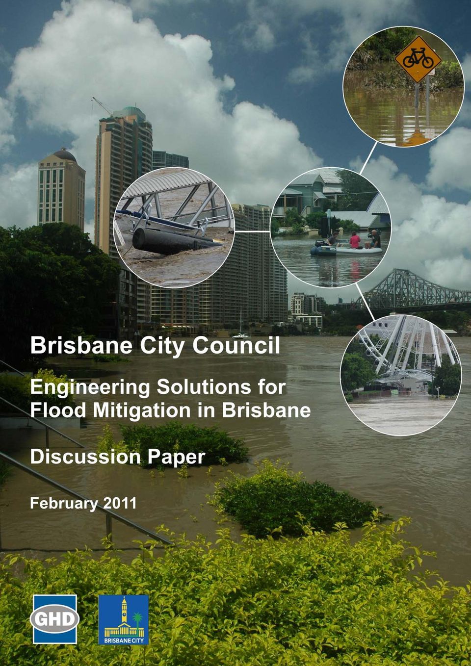
2 Contents 1. Introduction Background Overview Objective of this discussion paper 3 2. Engineered solutions River barriers Flood gates Levees and flood walls Backflow prevention valves Dredging Flood mitigation storages Conclusions 11 Figure Index Figure 1 Thames Barrier, London 4 Figure 2 Flood Walls - New Orleans 6 Figure 3 Flap Valves, Breakfast Creek 8 Figure 4 Rubber "Duck Bill" valves 8 \

3 1. Introduction 1.1 Background In January 2011, Brisbane experienced its worst flooding since Tens of thousands of properties were flooded and there were billions of dollars in damage to private and public infrastructure. One of the characteristics of the flood was that inundation largely occurred because of elevated water levels in the Brisbane River, with very limited flooding from local rainfall in the suburban area. Among other things, this has led to further consideration of measures that might exist to reduce "backflow" from the river and reduce or eliminate flooding in parts of the city that otherwise would not have been flooded. High tidal levels alone can also lead to localised "minor" inundation in low lying areas. These high levels also decrease the discharge of the Brisbane River at the outlet and push up river levels for some kilometres upstream. The same principles apply to all other Brisbane waterways discharging directly to Moreton Bay. The "backflow" flooding from high tide levels that occurs from time to time is similar in some ways to the 2011 flood and could be mitigated using similar strategies. 1.2 Overview Causes of flooding There are several causes of flooding that Brisbane can experience. These are described in some detail in the report Strategies to reduce the effect of significant rain events on areas of Brisbane prone to flooding 1 : heavy or sustained rainfalls over the catchments of Brisbane s creeks; overloaded stormwater systems as surface runoff makes its way into creeks (overland flow); heavy or sustained rainfalls over the catchments of the Brisbane River; storm surge in Moreton Bay; failure of one of the three dams in the City s environs, Gold Creek Dam, Lake Manchester and Enoggera Dam or the SEQ Water controlled Wivenhoe Dam; and a tsunami in the Pacific Ocean. In considering structural flood mitigation measures, in particular, each of these types of flooding needs to be taken into account. However the main flood risks to Brisbane are caused by heavy or sustained rainfall over the catchments of Brisbane s creeks, overland flows and heavy or sustained rainfalls over the catchments of Brisbane River. 1 Brisbane City Council (2005), "Strategies to reduce the effect of significant rain events on areas of Brisbane prone to flooding", Report of the Lord Mayor's Taskforce on Suburban Flooding, p(iv) 1

4 It should also be stressed that structural measures that provide a benefit in one set of flooding conditions will not necessarily provide a benefit in other conditions and may, in fact, worsen the impacts of flooding Structural versus non-structural measures Measures to mitigate the impact of flooding in suburban areas can largely be divided into two groups - structural and non-structural: Structural measures are those that involve physical works to lessen the effects of flooding, such as improvements to drainage infrastructure. These might otherwise be described as "engineered" solutions. Non-structural measures are typically linked with town planning policies and building codes and involve longer-term consideration. These might include, for example, restrictions on where construction can take place, limitations on fill in floodplains and specification of minimum habitable floor levels for buildings. This paper considers structural measures, or "engineered" works to mitigate the impacts of flooding Passive and active measures Structural measures can be further subdivided into active and passive measures. Passive measures require no operation whereas active measures are those that require some form of operation or movement to provide a benefit. Active measures add a layer of complexity when considering the costs and benefits, because they add a level of risk. If something needs to be operated, there must be an associated operating plan and consideration of "failsafe" mechanisms that will allow operation in highly adverse conditions. Mechanisms that are only occasionally operated - such as when there is a major flood - are inherently subject to an even greater risk during operation. Active measures should only be used where there has been a detailed risk assessment and there is an ongoing commitment to maintenance and operational reviews Costs and benefits Most strategies to mitigate the impact of flooding come with a cost. This can be a direct cost, such as the capital and operating costs associated with structural measures, or an indirect cost such as loss of social amenity or a reduction in property value. Inevitably, these costs need to be balanced against the benefits that are derived. This discussion paper does not seek to quantify the costs or benefits associated with any particular measure, but detailed consideration of the costs and benefits would need to be considered prior to any commitment. 2

5 1.3 Objective of this discussion paper The objective of this discussion paper is to provide an overview of the structural or "engineered" measures available to mitigate the impact of flooding, with particular reference to those mechanisms that may assist in reducing flooding from the Brisbane River. 3

6 2. Engineered solutions 2.1 River barriers A river barrier is a form of floodgate designed to prevent storm or tidal surges from flooding areas upstream. They permit water to pass in normal conditions but are closed in tidal flood conditions. They range significantly in size and scale. Construction is dependent on the presence of suitable foundation conditions and additional works are often necessary along the river banks downstream of the barrier. There are numerous installations in the Netherlands and in the UK. Possibly the most well-known example for Australians is the Thames Barrier, pictured below. Types of barriers include inflatable barriers and gates that rise from the floor the waterway. A set of gates is currently under construction in Venice. Figure 1 Thames Barrier, London Photo: David Iliff 2 In Brisbane, a river barrier could provide protection against a tidal or storm surge in Moreton Bay. It could also provide protection against particularly high tides and may have benefits in the longer term if sea levels rise as predicted by climate scientists. This type of structure would have no benefit, however, in the case of river flooding. If the river were in flood the gates would need to be kept open to maximise the flow of water from the mouth of the river. These structures are generally very expensive. The Thames Barrier was completed in 1984 at a cost of more than 500 million and it is likely that an equivalent structure for Brisbane in 2011 would be measured in the billions of dollars. The current impact of high tides in Brisbane would not appear to warrant an investment of this magnitude. Like all active structures, there also remains a risk of faulty operation. Failure of the structure or damage due to external impacts of shipping, for example, could lead to unexpected inundation and significant flood damage. This almost occurred in London in accessed 12 February Refer to for licence conditions. 4

7 2.2 Flood gates Flood gates are adjustable structures used to impede and control the movement of water in a waterway, similar to river barriers in some ways but at a smaller scale. The opening and closure of flood gates depends on a change in water level due to flooding, rainfall or tidal variation. As part of a storm or tidal surge system flood gates may be used to stop water flow entirely. In addition to flood management, flood gates and associated infrastructures can be used to improve water quality and address ecological issues within a water system. Flood gates are typically attached to a larger structure such as a barrier, dam wall, weir, culvert or headwall within a waterway. In smaller tributaries they may be constructed independently of other structures. Traditional flood gates include the following types: Hinged flap gate - self-operating gate typically attached to a headwall or culvert, suitable for tidal gating of channels when complete isolation is required. Minimal maintenance is required, but they restrict fish passage and are prone to blockage. Manually-operated flap gate similar to a hinged flap gate but with remote operational control via a winch, or mechanical sluice, to allow independent control of water movement. Self-regulating tidal gates as a variation of a hinged gate, self-regulating tidal gates allow automated tidal movements, but prevent flooding during high tides and flood events, primarily using a buoyancy mechanism. Flood gates may be applicable in Brisbane to control flooding in tributaries and creeks by controlling backflow from the Brisbane River. However, detailed modelling of the hydraulic and environmental impact of any flood gates would be necessary. Among other impacts, flood gates may cause: Increased flood levels upstream in the case of local flooding; Water stagnation and sedimentation upstream; A deterioration of water quality within the waterway; Obstruction of fish passages; Increased ecological and plant disturbance and increased weed growth; or Oxidisation of acid sulphate soils. A local example of a gated structure serving a similar purpose is the Fitzroy River Barrage at Rockhampton. Although slightly different in its functionality, the barrage provides a barrier which impounds fresh water upstream while preventing tidal saltwater downstream from intruding into the storage. The gates of the barrage are lowered to allow floods to pass. 2.3 Levees and flood walls A levee is a slope or embankment, typically but not always constructed parallel to the waterway, that prevents or reduces flooding on the landward side. Levees have been used for thousands of years to provide flood protection. 5

8 Levees are used to manage flooding from some inland rivers in Australia. Large riverine levee systems have also been constructed in many international locations, including along the Mississippi River in the USA and in Europe along the Danube and the Rhine. Prominent large coastal levee systems have been constructed in Canada (specifically Vancouver), throughout the Netherlands, and in New Orleans in the United States. Flood walls are similar to levees but tend to be constructed as concrete walls rather than as earthen structures. The same issues for both walls and levies need to be considered. Figure 2 Flood Walls - New Orleans Photo: US Army Corps of Engineers Levees can be a valuable flood protection measure and are often seen as an "obvious" solution to river flooding. However, there are many significant considerations where levees are constructed. Levees: typically need to be constructed over long distances; increase flood levels in the river because flood plain storage is no longer available; pose a significant safety hazard when they fail during a flood; remain prone to over-topping in the event of a flood that is larger than the "design" flood, and dangerous failures can result; impose a barrier on the operation of drainage systems upstream of the barrier; may need underground drainage structures across them to allow for normal drainage. 6

9 Despite these concerns, however levees can be a valuable option to protect specific areas - for example areas with a high population density, pieces of critical infrastructure or important industrial areas. In Brisbane, specific challenges with levees include: the river has a very flat longitudinal gradient, meaning that any levees along the river would need to extend for many kilometres; moving further up the river, flood events are significantly higher than the river banks, and levees would need to be of varying heights depending on the design flood level. These levees maybe impractically high; as the "River City", construction of levees or flood walls would have a significant adverse aesthetic impact on the city, effectively blocking any view of the river from ground level; construction of levees would also need to extend up several low-lying tributaries; levees would directly block any "overland flow paths" which form the basis of drainage design across the city, and without extensive investment in drainage systems would lead to a worsening of local flooding across the city. Nonetheless it may be appropriate to consider protection of specific limited areas of high value through the construction of levees. One example might be critical infrastructure such as the cold stores at the Brisbane Markets at Rocklea. Each case would require careful consideration of a range of design issues to confirm its viability and that the benefits outweigh the costs. 2.4 Backflow prevention valves A flood-tide and backwater valve is intended to ensure one-way flow downstream and prevent water from backing up into piped stormwater systems from downstream. Backwater valves are generally designed and constructed to minimise clogging. Flood tide and backwater valves are used specifically on sewer overflow pipes and stormwater pipes. A wide range of valve designs is available, varying in complexity from simple flap valves (see Figure 3) through to more complex valves actuated by high downstream water levels. The most common backflow prevention valves are the simple flap valve - used extensively in Australia - and the rubber "duck bill" valve. 7

10 Figure 3 Flap Valves, Breakfast Creek Photo: GHD Figure 4 Rubber "Duck Bill" valves Photo: Valvias 3 In both of these cases, the intention is that the valve will remain closed until there is flow from upstream. The valve will open to release flow from upstream, closing again when flow stops and the downstream water level is lower than the upstream level. Particular issues with these types of valve include the relatively high potential for valves to be stuck "open" (not uncommonly by debris or accumulated sediment downsteam), thereby rendered ineffectual, and the potential for increased pressure losses in the system leading to less effective drainage. Large urban centres in North America and Europe sometimes have a requirement for backwater valves within the wastewater and stormwater systems for specific buildings or areas prone to flooding. The City of Toronto provides a subsidy for residential and commercial installation of backwater valves. The City of New York promotes and monitors the installation of flood tide and backwater valves for all riverside 3 accessed 12 February

11 suburbs. Both of these cities have "combined sewers" where sewage and stormwater are mixed, and the circumstances are therefore a little different to Brisbane where sewerage and stormwater drainage are separated. In Brisbane, flap valves are already widely used in low-lying areas to prevent backflow. Flap valves are a practical means of reducing the impact of tidal backflow, but cannot generally be relied upon because of the relatively high risk that they will be blocked in an open position. If these are installed, they must be continually maintained to ensure effective operation. Installation is relatively simply on new drainage systems, but they can be more difficult to retrofit on existing drainage systems. 2.5 Dredging Dredging is the term given to excavation or removal of material to deepen waterways, create harbours, channels, locks, docks and berths, de-silt lakes and keep river entrances and approaches to boat ramps clear. The material removed during dredging can vary greatly and can be any combination of rocks, clays, silts or sands. Large Australian dredging projects included the dredging of the Port of Melbourne and the proposed dredging of the Port of Gladstone. Neither are flood related dredging activities. In the Netherlands, multiple parts of the major rivers are dredged annually to prevent the formation of river bars that restrict navigation and drainage. The Brisbane River has been dredged historically in order to improve navigability. Dredging of sand and gravel from the river for construction materials was carried out until The dredging has increased the length of the tidal estuary and the effects of each tide extend further upstream than occurred historically. Considerable dredging (and waterway straightening) was undertaken following recommendations arising from the enquiry into the 1974 floods in Brisbane, particularly in some of the tidal tributaries of the river and some of the tidal creeks that discharge to Moreton Bay. These included Breakfast Creek and Schultz Canal. Dredging provides a mitigating effect for flooding by increasing the cross-sectional area of the waterway and reducing friction losses along the river. Dredging will also increase the impact of tidal influences in the river, and cause an increased tidal variation upstream. An increase in tidal levels may reduce the flow benefits provided through dredging. Dredging has a number of other effects that need to be considered: impact on the environment in the areas dredged and where the dredged material is discarded; negative impact on water quality by increasing sediment and nutrient loads and through potential release of toxicants accumulated on the floor; 9

12 potential for increased erosion directly upstream of the limit of dredging due to changed flow conditions; ongoing costs of maintenance. The upstream benefits of dredging would require detailed analysis. The benefits can dissipate relatively quickly upstream depending on the hydraulic. 2.6 Flood mitigation storages Upstream flood storages along tributaries of the Brisbane River and upstream sections of the Brisbane River itself could potentially be used to reduce peak levels downstream. Brisbane already experiences the benefit of considerable flood storage in Wivenhoe Dam, but the dam is upstream of two major tributaries Lockyer Creek and the Bremer River. Dedicated flood mitigation storages would usually be left empty, becoming active only in the event of a major flow in the waterway. Flood mitigation dams can be designed with or without gates. They work by storing water from the initial peak of the flood, with the water released over a longer period of time thereby reducing peak flows and flood levels. Flood storages are widely used at a smaller scale in urban drainage systems ("detention" basins) and at a larger scale in some cities such as Glasgow. The North Para Flood Mitigation Dam near Gawler in South Australia is a more local example. A flood storage or series of smaller storages upstream of Ipswich on the Bremer River and/or Lockyer Creek may help to reduce peak levels in Ipswich and in Brisbane, however the timing of flows would require considerable detailed analysis. Part of the design strategy would be to delay parts of the flood so that peak flows from different parts of the catchment occurred at different times. The main disadvantage of flood storages is that large areas of land upstream of the structures will potentially be affected. This may necessitate land acquisition and will require development and other planning controls on land inundated in the event of a flood. Opportunity may also exist to increase the flood storage capacity of Wivenhoe Dam by raising the level of the dam wall. There have been some studies of this option over the past five to ten years. 10

13 3. Conclusions There are no "silver bullets" to mitigate flood levels in Brisbane. The 2011 flood was characterised by high flows and water levels in the Brisbane River at a time of minimal flows in urban tributaries, and most of the flooding was therefore caused by "backflow" from the river. This was more pronounced than in 1974, for example, where flooding of tributaries such as Oxley Creek was also significant. The major difficulty in planning for infrastructure to mitigate flooding in Brisbane is that flood events in the catchment and surrounds are rarely the same. A variety of structural measures exist that could potentially be used to reduce the impacts of "backwater" flooding in Brisbane, but none of these measures comes without other impacts and risks. "Engineered" or structural measures with the highest potential for application in Brisbane are: the use of flap valves and possibly "duck-bill" valves in tidally-affected areas, subject to implementation of suitable maintenance regimes (these are already used); the use of levees around specific, high-value infrastructure (such as the Brisbane Markets), but not along waterways; and possible implementation of flood mitigation dams on the Bremer River and Lockyer Creek upstream of Ipswich. The last two of these in particular would require further, more detailed, investigation to establish if they are viable and will provide a net benefit to the community. Non-structural measures have not been considered in this, but remain a strong longerterm option for mitigating the effects of flooding in Brisbane. 11

14 GHD 201 Charlotte Street Brisbane QLD 4000 GPO Box 668 Brisbane QLD 4001 T: (07) F: (07) E: GHD 2011 This document is and shall remain the property of GHD. The document may only be used for the purpose for which it was commissioned and in accordance with the Terms of Engagement for the commission. Unauthorised use of this document in any form whatsoever is prohibited. Document Status Rev No. Author Reviewer Approved for Issue Name Signature Name Signature Date 12

Flooding Fast Facts. flooding), seismic events (tsunami) or large landslides (sometime also called tsunami).
, seismic events (tsunami) or large landslides (sometime also called tsunami).") Flooding Fast Facts What is a flood? Flooding is the unusual presence of water on land to a depth which affects normal activities. Flooding can arise from: Overflowing rivers (river flooding), Heavy rainfall
Flooding Fast Facts What is a flood? Flooding is the unusual presence of water on land to a depth which affects normal activities. Flooding can arise from: Overflowing rivers (river flooding), Heavy rainfall
FLOOD INFORMATION SERVICE EXPLANATORY NOTES
 FLOOD INFORMATION SERVICE EXPLANATORY NOTES Part 1 About the flood maps Limitations of the mapping What the maps don t show Where to find more information Definitions of words used to describe flooding.
Outlet stabilization structure
 Overview of Sedimentation and Erosion Control Practices Practice no. 6.41 Outlet stabilization structure Erosion at the outlet of channels, culverts, and other structures is common, and can cause structural
Index. protection. excavated drop inlet protection (Temporary) 6.50.1 6.51.1. Block and gravel inlet Protection (Temporary) 6.52.1
 6.50.1 6.51.1. Block and gravel inlet Protection (Temporary) 6.52.1") 6 Index inlet protection excavated drop inlet protection (Temporary) 6.50.1 HARDWARE CLOTH AND GRAVEL INLET PROTECTION Block and gravel inlet Protection (Temporary) sod drop inlet protection ROCK DOUGHNUT
6 Index inlet protection excavated drop inlet protection (Temporary) 6.50.1 HARDWARE CLOTH AND GRAVEL INLET PROTECTION Block and gravel inlet Protection (Temporary) sod drop inlet protection ROCK DOUGHNUT
5.0 OVERVIEW OF FLOOD DAMAGE REDUCTION MEASURES
 5.0 OVERVIEW OF FLOOD DAMAGE REDUCTION MEASURES Flood damage reduction consists of two basic techniques structural and non-structural. Structural methods modify the flood and take the flood away from people
Flash Flood Science. Chapter 2. What Is in This Chapter? Flash Flood Processes
 Chapter 2 Flash Flood Science A flash flood is generally defined as a rapid onset flood of short duration with a relatively high peak discharge (World Meteorological Organization). The American Meteorological
Flood Emergency Response Planning: How to Protect Your Business from a Natural Disaster RIC005
 Flood Emergency Response Planning: How to Protect Your Business from a Natural Disaster RIC005 Speakers: Tom Chan, CEO, Global Risk Miyamoto Greg Bates, Principal, Global Risk Consultants Learning Objectives
General Insurance - Domestic Insurance - Home Contents Storm water damage policy exclusion flood damage
 Determination Case number: 227307 General Insurance - Domestic Insurance - Home Contents Storm water damage policy exclusion flood damage 4 April 2011 Background 1. The Applicants insured their home contents
Objective 4: Enhanced community education, flood awareness and preparedness
 Objective 4: Enhanced community education, flood awareness and preparedness Understanding the extent and full impacts of flooding is essential for planning for potential future pressures on the drainage
FLOOD RISK RECENT TRENDS AND POLICY RESPONSES
 FLOOD RISK RECENT TRENDS AND POLICY RESPONSES DEVELOPING WESTMINSTER S LOCAL PLAN Booklet No. 2 LDF Consultation - CMP Revision November 2013 INTRODUCTION CLLR ROBERT DAVIS Westminster is at risk of flooding
Presented by: Michael DePue, PE, CFM Annual Georgia Association of Floodplain Management Conference Lake Lanier Islands, Georgia March 23, 2010
 Flood Types and Characteristics Presented by: Michael DePue, PE, CFM Annual Georgia Association of Floodplain Management Conference Lake Lanier Islands, Georgia March 23, 2010 Agenda Why study flood types?
London Borough of Waltham Forest LOCAL FLOOD RISK MANAGEMENT STRATEGY. Summary Document
 LOCAL FLOOD RISK MANAGEMENT STRATEGY Summary Document October 2013 Local Flood Risk Management Strategy Summary 1 Introduction 2 Partner responsibilities 3 What do we know about flooding in the borough?
Climate Change and Infrastructure Planning Ahead
 Climate Change and Infrastructure Planning Ahead Climate Change and Infrastructure Planning Ahead Infrastructure the physical facilities that support our society, such as buildings, roads, railways, ports
Melbourne Water Flood Risk Assessment: How flood impacts are assessed in the Port Phillip and Westernport region
 Melbourne Water Flood Risk Assessment: How flood impacts are assessed in the Port Phillip and Westernport region INTRODUCTION Melbourne Water is the regional drainage and floodplain management authority
Planning for sea level rise. Assessing development in areas prone to tidal inundation from sea level rise in the Port Phillip and Westernport Region
 Planning for sea level rise Assessing development in areas prone to tidal inundation from sea level rise in the Port Phillip and Westernport Region Table of contents Introduction 1 New flood levels for
Lake Macquarie City Council Community and Stakeholder Consultation Program for Lake Macquarie Waterway Flood Management Plan
 Lake Macquarie City Council Community and Stakeholder Consultation Program for Lake Macquarie Waterway Flood Management Plan Report Community and Stakeholder Consultation Program for Lake Macquarie Waterway
INFORMATION BULLETIN BUSINESS FLOOD PLANNING AND MITIGATION GUIDE ACE GLOBAL RISK ENGINEERING. Flood risk assessment. Introduction
 ACE GLOBAL RISK ENGINEERING INFORMATION BULLETIN BUSINESS FLOOD PLANNING AND MITIGATION GUIDE Introduction The most common cause of flooding is due to established water storage areas (natural and man-made)
Emergency Spillways (Sediment basins)
") Emergency Spillways (Sediment basins) DRAINAGE CONTROL TECHNIQUE Low Gradient Velocity Control Short-Term Steep Gradient Channel Lining Medium-Long Term Outlet Control Soil Treatment Permanent [1] [1]
Emergency Spillways (Sediment basins) DRAINAGE CONTROL TECHNIQUE Low Gradient Velocity Control Short-Term Steep Gradient Channel Lining Medium-Long Term Outlet Control Soil Treatment Permanent [1] [1]
Lisgar District Basement Water Infiltration Investigation Answers to Residents Written Questions Received by Councillors Ward 10 Office
 Lisgar District Basement Water Infiltration Investigation Part A Answers to Technical Questions 1. There has been a tremendous amount of work done everywhere along the creek. If there was nothing wrong
Detention Ponds. Detention Ponds. Detention Ponds. Detention Ponds. Detention Ponds. Detention Ponds. CIVL 1112 Detention Ponds - Part 1 1/12
 CIVL 1112 - Part 1 1/12 The water cycle, also known as the hydrologic cycle, describes the continuous movement of water on, above and below the surface of the Earth. The water cycle, also known as the
Chapter 4. Flood Control
 Chapter 4. Flood Control As noted by their name, flood control measures control floodwaters and keep them from reaching damageable property. They are also called structural measures because they involve
SUSTAINABLE URBAN DRAINAGE SYSTEMS
 overflow can lead into a permeable conveyance system to increase further the benefit and reduce the need for pipe systems. Pollutant removal rates have been shown to be high, with some pollutants being
WET10 - THE CITY WATER DEBATE 2015. When Will London Flood? Introduction. Dr Paul Leinster, CBE
 WET10 - THE CITY WATER DEBATE 2015 When Will London Flood? Introduction Roger Hewitt, Past Master of the Water Conservators, opened the event by thanking the Worshipful Companies of the Glaziers and the
Standard Operating Procedures for Flood Preparation and Response
 Standard Operating Procedures for Flood Preparation and Response General Discussion Hurricanes, tropical storms and intense thunderstorms support a conclusion that more severe flooding conditions than
Flood Risk Assessment and Drainage Impact Assessment: Planning Guidance for Developers
 Flood Risk Assessment and Drainage Impact Assessment: Planning Guidance for Developers Development and Regeneration Services Glasgow City Council 229 George Street Glasgow G1 1QU May 2011 1. Introduction...-
Structural Damage Due to Floods
 Structural Damage Due to Floods By Craig D. Rogers, P.E. The Federal Emergency Management Agency (FEMA) reports that each year approximately 90 percent of all disaster-related property damage results from
Consultation on integrating flood defence consents into the Environmental Permitting regime in England and Wales
 www.gov.uk/defra www.wales.gov.uk Consultation on integrating flood defence consents into the Environmental Permitting regime in England and Wales Annex 2; Proposed exclusions Emergencies and licensable
Catchment Scale Processes and River Restoration. Dr Jenny Mant Jenny@therrc.co.uk. The River Restoration Centre therrc.co.uk
 Catchment Scale Processes and River Restoration Dr Jenny Mant Jenny@therrc.co.uk The River Restoration Centre therrc.co.uk 3 Main Catchment Elements Hydrology Energy associated with the flow of water affects
Flood Risk Management
 Flood Risk Management Value of Flood Risk Management Every year floods sweep through communities across the United States taking lives, destroying property, shutting down businesses, harming the environment
Flood Risk Management
 Flood Risk Management Value of Flood Risk Management Value to Individuals and Communities Every year floods sweep through communities across the United States taking lives, destroying property, shutting
List of Figures List of Abbreviations Executive Report
 Table of Contents List of Figures List of Abbreviations Executive Report (ii) (iii) (iv) 1. INTRODUCTION... 1 1.1 BACKGROUND TO THE GDSDS... 1 1.2 BACKGROUND INVESTIGATIONS... 1 1.3 REPORT OBJECTIVES...
Type of Sewer Systems. Solomon Seyoum
 Type of Sewer Systems Solomon Seyoum 0 Learning objectives Upon completion of this lecture, the participants will be able to differentiate between types of sewer systems and discuss different aspects of
FLOOD RISKS IN LONDON
 Environment Committee FLOOD RISKS IN LONDON Summary of findings April 2014 About this summary 2 This is a summary of the findings of the Environment Committee s investigation into flood risk. In January
Recommendations for future developments
 C Recommendations for future developments C.1 Reducing flood risk through site layout and design C.1.1 C.1.2 Flood risk should be considered at an early stage in deciding the layout and design of a site
City and County of San Francisco 2030 Sewer System Master Plan TASK 400 TECHNICAL MEMORANDUM NO. 405
 City and County of San Francisco 2030 Sewer System Master Plan TASK 400 TECHNICAL MEMORANDUM NO. 405 REGULATORY CONSIDERATIONS FOR WET WEATHER COLLECTION SYSTEM BACKUPS FINAL DRAFT August 2009 2700 YGNACIO
Summary: Introduction
 Summary: Melbourne Water has a range of responsibilities in the Port Phillip and Westernport region, including responsibilities for the protection and restoration of waterways and, in collaboration with
Swannanoa River Flood Risk Management Study
 Swannanoa River Flood Risk Management Study Measures Evaluated to Reduce Future Flood Damages City of Asheville U.S. Army Corps of Engineers Flooding History Part of the 132 square mile Swannanoa River
Flooding Hazards, Prediction & Human Intervention
 Page 1 of 10 EENS 3050 Tulane University Natural Disasters Prof. Stephen A. Nelson Flooding Hazards, Prediction & Human Intervention This page last updated on 19-Oct-2015 Hazards Associated with Flooding
3.4 DRAINAGE PLAN. 3.4.1 Characteristics of Existing Drainages. 3.4.2 Master Drainage System. Section 3: Development Plan BUTTERFIELD SPECIFIC PLAN
 3.4 DRAINAGE PLAN This section describes the existing onsite drainage characteristics and improvements proposed within this Specific Plan. Following this description, drainage plan development standards
CITY UTILITIES DESIGN STANDARDS MANUAL
 CITY UTILITIES DESIGN STANDARDS MANUAL Book 2 (SW) SW9 June 2015 SW9.01 Purpose This Chapter provides information for the design of open channels for the conveyance of stormwater in the City of Fort Wayne.
Lower Raritan Watershed Management Area Stormwater & Flooding Subcommittee Strategy Worksheet LRSW-S3C1
 Strategy Name: Reduce Existing Potential for Flood Damages LRSW-S3C1. Develop and implement a program to: Minimize flood damages through the use of structural measures. Minimize flood damages through the
Action plans for hotspot locations - Ash Study
 Appendix 9 Action plans for hotspot locations - Ash Study Ash Vale North 1. Local evidence indicates the culvert could not discharge during December 2013 because the outlet was blocked on the western side
Chapter 3 CULVERTS. Description. Importance to Maintenance & Water Quality. Culvert Profile
 Chapter 3 CULVERTS Description A culvert is a closed conduit used to convey water from one area to another, usually from one side of a road to the other side. Importance to Maintenance & Water Quality
Proposed Construction of Basement Flood Risk Assessment. 35 Edwardes Square London W8 6HH
 Proposed Construction of Basement Flood Risk Assessment 35 Edwardes Square London W8 6HH 1 Introduction This FRA has been carried out in accordance with the National Planning Policy Statement (NPPF), the
A guide to your rights and responsibilities of riverside ownership in Wales
 A guide to your rights and responsibilities of riverside ownership in Wales Natural Resources Wales is a Welsh Government Sponsored Body. Our purpose is to ensure that the natural resources of Wales are
The River Ribble is one of the longest rivers in the North West of England
 River Ribble The River Ribble is one of the longest rivers in the North West of England Did you know? The tidal limit of the Ribble is 11 miles inland (above Preston); The River Ribble is home to a variety
DISTRICT OF COLUMBIA WATER AND SEWER AUTHORITY. a guide to PREVENTING SEWER BACKUPS AND FLOODING
 DISTRICT OF COLUMBIA WATER AND SEWER AUTHORITY a guide to PREVENTING SEWER BACKUPS AND FLOODING Sewer backups and flooding can damage District homes and businesses. Sewer blockages are most commonly found
Council Strategy DOC/15/86752
 Council Strategy Council strategy title: Council strategy owner: Adopted by: Date adopted: July 2015 Document Reference no: Drainage Upgrade Strategy Director Infrastructure Services Bayside City Council
INFRASTRUCTURE, FLOOD PROTECTION AND REMEDIATION. Infrastructure Flood Protection Remediation Policies
 INFRASTRUCTURE, FLOOD PROTECTION AND REMEDIATION Infrastructure Flood Protection Remediation Policies DRAFT POOLBEG PLANNING SCHEME 196 FIGURE 9.1: UTILITIES WAYLEAVES Electricity Cables 8m Wayleave for
Flooding in London. Figure 1 New commercial and residential developments on the Thames floodplain
 Flooding in London Abstract London faces a major risk of flooding. London s floods are caused by a mixture of river processes, tidal flooding and drains/sewers unable to cope with the volume of water.
Melbourne Water s Submission. Draft Victorian Floodplain Management Strategy
 Melbourne Water s Submission Draft Victorian Floodplain Management Strategy Waterways, drainage and floodplains are essential to life and liveability. The rivers, creeks, estuaries, wetlands and floodplains
Initial Assessment of Potential Flood Mitigation for Communities Downstream of Googong Dam
 Initial Assessment of Potential Flood Mitigation for Communities Downstream of Googong Dam ICON WATER AND QUEANBEYAN CITY COUNCIL Summary Report 8006314 25 June 2015 Initial Asssessment of Potential Flood
CLACKAMAS COUNTY ZONING AND DEVELOPMENT ORDINANCE
 1008 STORM DRAINAGE (3/24/05) 1008.01 PURPOSE To minimize the amount of stormwater runoff resulting from development utilizing nonstructural controls where possible, maintain and improve water quality,
1 Introduction. 1.1 Key objective. 1.2 Why the South Esk
 1 Introduction 1.1 Key objective The aim of this study is to identify and assess possible options for improving the quality of the river channel and habitats in the River South Esk catchment whilst helping
Basements and Deep Building Construction Policy 2014
 Basements and Deep Building Construction Policy 2014 APPROVAL Council / CEO 27 October 2014 VERSION NO: Version 1.0 TRIM REF: 14/67838 REVIEW 30/10/2019 RESPONSIBLE EXECUTIVE General Manager City Assets
Types of flood risk. What is flash flooding? 3/16/2010. GG22A: GEOSPHERE & HYDROSPHERE Hydrology. Main types of climatically influenced flooding:
 GG22A: GEOSPHERE & HYDROSPHERE Hydrology Types of flood risk Main types of climatically influenced flooding: 1. Flash (rapid-onset) 2. Lowland (slow-rise) 3. Coastal (not covered here) But! Causal factors
BASEMENT FLOODING. Prevention Guide for. Homeowners
 BASEMENT FLOODING Prevention Guide for Homeowners 1 Did You Know? Floods are the most common hazards in Canada. Water damage is a common cause of loss for homeowner insurance. A heavy rainfall can result
Flooding in Brisbane
 Flooding in Brisbane A guide for residents photo provided by Conan Whitehouse Brisbane is a thriving, world-class city, enjoyed by residents and visitors. Like many cities around the world, Brisbane has
Tookany Creek Flood Damage Reduction Feasibility Study Section 205 Continuing Authorities Program
 Tookany Creek Flood Damage Reduction Feasibility Study Section 205 Continuing Authorities Program Field Inspection Notes 27 29 September 2012 Introduction The U.S. Army Corps of Engineers (Corps), in
HUDSON RIVER-BLACK RIVER REGULATING DISTRICT BOARD MEETING JUNE 10, 2014
 HUDSON RIVER-BLACK RIVER REGULATING DISTRICT BOARD MEETING JUNE 10, 2014 PRESENTATION TOPICS Analysis Objectives Analysis Dam Removal Plan Dam Remediation Plan Effects Analysis Permit Requirements Decision
4. Environmental Impacts Assessment and Remediation Targets
 4. Environmental Impacts Assessment and Remediation Targets 4.1 Environmental Impacts Significant additional development in the Alder Creek watershed is not anticipated at this time; however, there are
The Basics of Chapter 105 Waterways and Wetlands Permitting in PA
 The Basics of Chapter 105 Waterways and Wetlands Permitting in PA April 17, 2013 Goal To develop a basic understanding of PA Department of Environmental Protection (DEP) and US Army Corps of Engineers
ECONOMIC ANALYSIS FLOOD DAMAGE REDUCTION. Lower Carmel River Floodplain Restoration and Enhancement Project
 ECONOMIC ANALYSIS FLOOD DAMAGE REDUCTION Lower Carmel River Floodplain Restoration and Enhancement Project I. Description of the Project and its Relationship to Other Projects in the Proposal The Lower
Earth Science. River Systems and Landforms GEOGRAPHY 1710. The Hydrologic Cycle. Introduction. Running Water. Chapter 14.
 Earth Science GEOGRAPHY 1710 River Systems and Landforms DAVID R. SALLEE Robert W. Christopherson Charlie Thomsen Chapter 14 Introduction Rivers and streams are dynamic systems that continually adjust
Scheduling Maintenance for Infiltration Basins and Trenches
 Visual Inspection for Infiltration Practices Visual inspection is a rapid assessment procedure for qualitatively evaluating the functionality of a stormwater best management practice (BMP). Visual inspections
City of West Linn Public Works Design Standards 2010. Table of Contents
 City of West Linn Public Works Design Standards Table of Contents SECTION TWO STORM DRAIN REQUIREMENTS... 1 2.0000 STORM DRAINS... 1 2.0010 General Design Requirements...1 2.0011 Site Drainage Plans...2
The Flow Regulator. Flow regulation
 Flow regulation Overloading in sewerage works and drainage systems can be avoided by using an attenuation reservoir, or by directing flow to a less sensitive area. Automatic flow control in gravity fed
COMMUNITY CERTIFICATIONS
 National Flood Insurance Program Community Rating System COMMUNITY CERTIFICATIONS Public reporting burden for this form is estimated to average 4 hours for annual recertification, per response. The burden
Basement Flood Risk Reduction City of Winnipeg. Charles Boulet
 Basement Flood Risk Reduction City of Winnipeg Charles Boulet Outline Background Winnipeg Floodway Rain Events Winnipeg Sewer System Basement Flooding Flood Reduction Measures ICLR - BFRR Strategy 2 Where
FINAL TECHNICAL MEMORANDUM AWD-00002 FLOWS THROUGH FLOOD DAMAGE REDUCTION AREA July 16, 2012
 FINAL TECHNICAL MEMORANDUM AWD-00002 FLOWS THROUGH FLOOD DAMAGE REDUCTION AREA July 16, 2012 Table of Contents TABLE OF CONTENTS Table of Contents... 1 Executive Summary... 2 1 Objective... 4 2 Study Approach...
SANITARY SEWER BACKUP. Causes & Prevention
 SANITARY SEWER BACKUP Causes & Prevention A. PURPOSE The purpose of this publication is twofold: 1. It provides homeowners with basic information on the causes of sanitary sewer backups. 2. It provides
BANGKOK FLOOD PROTECTION SYSTEM Bangkok Metropolitan Administration (BMA)
") BANGKOK FLOOD PROTECTION SYSTEM Bangkok Metropolitan Administration (BMA) Catchment area of Chao Phraya River is 160,000 sq.km. or about 1/3 of the country The Chao Phraya River flows passing through Bangkok
BANGKOK FLOOD PROTECTION SYSTEM Bangkok Metropolitan Administration (BMA) Catchment area of Chao Phraya River is 160,000 sq.km. or about 1/3 of the country The Chao Phraya River flows passing through Bangkok
The Town of Lakeshore Basement Flooding Information to Residents
 The Town of Lakeshore Basement Flooding Information to Residents The following information is intended for residents that have homes connected to Municipal storm and sanitary sewers. However, rural residents
http://library1.municode.com/default/docview/10251/1/101/103
 Page 1 of 8 ARTICLE II. FLOOD DAMAGE PREVENTION* *Cross references: Buildings and building regulations, ch. 67; floor elevation standards, 67-32; flood damage prevention for utility systems, 67-34; drainage
APPENDIX 1 Floodplain Management Strategies & Guidelines
 APPENDIX 1 Floodplain Management Strategies & Guidelines A. Port Phillip Flood Management Plan (2012) B. Draft Flood Management Strategy Port Phillip and Westernport (2015) C. Revised Draft Victorian Floodplain
EPR Exempt Flood Risk Activities: descriptions and conditions
 EPR Exempt Flood Risk Activities: descriptions and conditions Version 1 April 2016 We are the Environment Agency. We protect and improve the environment. Acting to reduce the impacts of a changing climate
Fluvial non-tidal Fluvial tidal Coastal
 Location: Castleconnell, Co. Limerick Unique ID: 252889 (from PFRA database) Initial OPW Designation APSR AFRR IRR Co-ordinates Easting: 166,390 Northing: 162,679 River / Catchment / Sub-catchment River
8.1.3 General Design Guidelines. The following guidelines shall be used when designing inlets along a street section:
 . Introduction Presented in this chapter are the criteria and methodology for design and evaluation of storm sewer inlets located in Town of Castle Rock. The review of all planning submittals will be based
The 2011 Queensland Floods
 The 2011 Queensland Floods Bill Syme FMA Conference, San Diego September 2011 Why were Qld Floods Surprising? Different types Flash floods Long duration floods [The Chronicle] Repeat floods (Dalby 5 times!)
Report Tidal Power Generation Systems
 The American University in Cairo Engineering Department ENGR 318 Spring 2001 Report Tidal Power Generation Systems Submitted to: Prof. Dr. Mahmoud Gilany By: Sherif Masoud Maher Amer Mohamed Samir Introduction
Impact of July 8, 2013 storm on the City's Sewer and Stormwater Systems
 STAFF REPORT ACTION REQUIRED Impact of July 8, 2013 storm on the City's Sewer and Stormwater Systems Date: September 6, 2013 To: From: Wards: Reference Number: Public Works and Infrastructure Committee
Module 3. Irrigation Engineering Principles. Version 2 CE IIT, Kharagpur
 Module 3 Irrigation Engineering Principles Lesson 9 Regulating Structures for Canal Flows Instructional objectives On completion of this lesson, the student shall be able to learn: 1. The necessity of
Water Management all about networks
 Water Management all about networks TABLE OF CONTENTS 1. Message from the mayor. Sanitary and storm sewer networks 3. Environmental and economic repercussions 4. Flood-prevention measures 5. Protective
Rainwater is directed away from walls at surface. Any water infiltrating is captured in drains below foundation
 Ground Surface Rainwater is directed away from walls at surface. Any water infiltrating is captured in drains below foundation Ground Surface Soil Ground Water Level Basement Wall Groundwater drains to
Tropical Storm Allison
 Tropical Storm Allison June 13, 2003, 2:41PM Two years after Allison, Houston has reached a watershed moment By KEVIN SHANLEY Houston is exploding with growth. But city building can be a messy business,
Interim Technical Guidelines for the Development of Environmental Management Plans for Underground Infrastructure Revised - July 2013.
 Interim Technical Guidelines for the Development of Environmental Management Plans for Underground Infrastructure Revised - July 2013 Rationale Underground infrastructure may be at risk from valley, streambank
2011 HYDRAULICS MANUAL
 STATE OF LOUISIANA DEPARTMENT OF TRANSPORTATION AND DEVELOPMENT P.O. Box 94245 Baton Rouge, Louisiana 70804-9245 http://www.dotd.la.gov/ HYDRAULICS MANUAL Hydraulics (225) 379-1306 PREFACE The following
ENVIRONMENT AGENCY POLICY REGARDING CULVERTS
 ENVIRONMENT AGENCY POLICY REGARDING CULVERTS T E C H N I C A L G U I D A N C E O N C U L V E R T I N G P R O P O S A L S M A R C H 1 9 9 9 E N V I R O N M E N T 1.0 Purpose This leaflet provides technical
DESCRIPTION OF STORMWATER STRUCTURAL CONTROLS IN MS4 PERMITS
 DESCRIPTION OF STORMWATER STRUCTURAL CONTROLS IN MS4 PERMITS Phase I MS4 permits require continuous updating of the stormwater system inventory owned and operated by the MS4. They also include inspection
Bolton s Flood Risk Management Strategy
 Bolton s Flood Risk Management Strategy www.bolton.gov.uk Public Summary Bolton s Flood Risk Management Strategy Public Summary Introduction Over 5.5 million properties in England and Wales are at risk
Risk and vulnerability assessment of the build environment in a dynamic changing society
 Risk and vulnerability assessment of the build environment in a dynamic changing society Limnei Nie SINTEF Building and infrastructure, P.O.Box 124 Blindern, NO-0314 Oslo, Norway. linmei.nie@sintef.no
COMMONWEALTH OF KENTUCKY CITY OF LONDON ORDINANCE NO. 2006-19 AN ORDINANCE ESTABLISHING EROSION AND STORM WATER CONTROL
 COMMONWEALTH OF KENTUCKY CITY OF LONDON ORDINANCE NO. 2006-19 AN ORDINANCE ESTABLISHING EROSION AND STORM WATER CONTROL For health, safety and welfare reasons, particularly due to problems experienced
London Borough of Newham. Local Flood Risk Management Strategy
 London Borough of Newham Local Flood Risk Management Strategy Version 5, September 2015 Local Flood Risk Management Strategy for the London Borough of Newham Document Management: Version Control Title:
Storm Drain Inlet Protection
 Objectives EC Erosion Control SE Sediment Control TR Tracking Control WE Wind Erosion Control Non-Stormwater NS Management Control Waste Management and WM Materials Pollution Control Legend: Primary Objective
Adopted 9/23/98 CHATTAHOOCHEE CORRIDOR PLAN. The goals of the Chattahoochee Corridor Plan (hereinafter also referred to as the Plan ) are:
 are:") CHATTAHOOCHEE CORRIDOR PLAN Adopted 9/23/98 PART 1: GOALS. POLICY. COVERAGE. A. Goals The goals of the Chattahoochee Corridor Plan (hereinafter also referred to as the Plan ) are: 1. Preservation and protection
CHATTAHOOCHEE CORRIDOR PLAN Adopted 9/23/98 PART 1: GOALS. POLICY. COVERAGE. A. Goals The goals of the Chattahoochee Corridor Plan (hereinafter also referred to as the Plan ) are: 1. Preservation and protection
FLOOD PROTECTION BENEFITS
 IV. (340 points) Flood Protection Benefits A. Existing and potential urban development in the floodplain (50) 1. Describe the existing and potential urban development at the site and the nature of the
11.4 Voluntary Purchase. 11.5 House Raising and Flood Proofing
 11.4 Voluntary Purchase As mentioned in Section 10 in certain high hazard areas of the floodplain, it may be impractical or uneconomic to mitigate flood hazard to existing properties at risk, or flood
Minimizes sediment and debris from entering storm drains that lead to waterways and watercourses.
 4.5-p DRAIN INLET PROTECTION Alternative Names: DI protection, Drop Inlet Protection DESCRIPTION Storm drain inlet (DI) protection slows and ponds stormwater, and filters sediment and debris before it
Melbourne Water. Principles for Provision of Waterway and Drainage Services for Urban Growth
 Melbourne Water Principles for Provision of Waterway and Drainage Services for Urban Growth Contents About Melbourne Water 3 Principles for Creating Development Services Schemes 4 Preface 4 (Original)
House Code. House Code
 1 Application This Code will apply in assessing material change of use and/or building work for a house. 2 Using this Code In using this Code reference should also be made to Section 1.1 How to use the