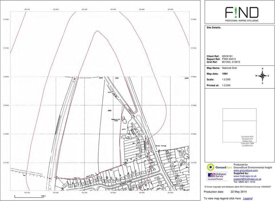
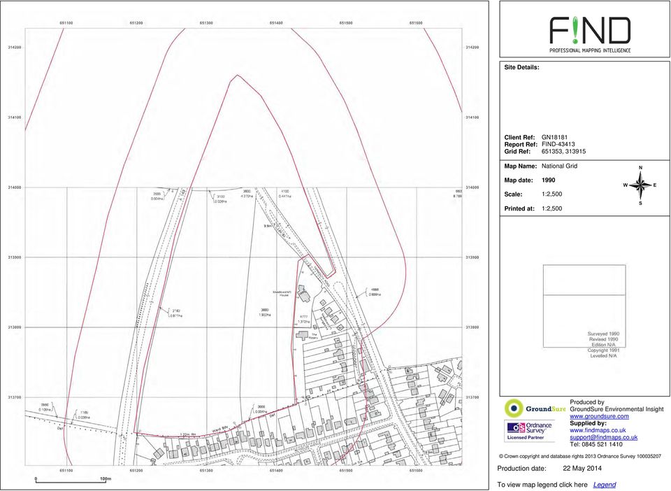
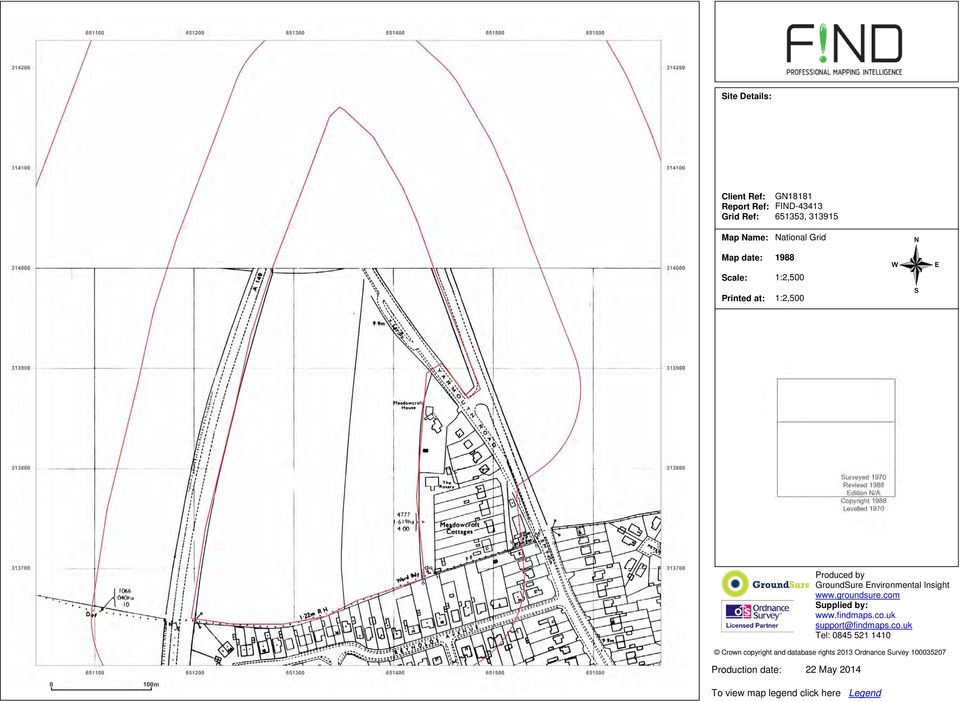
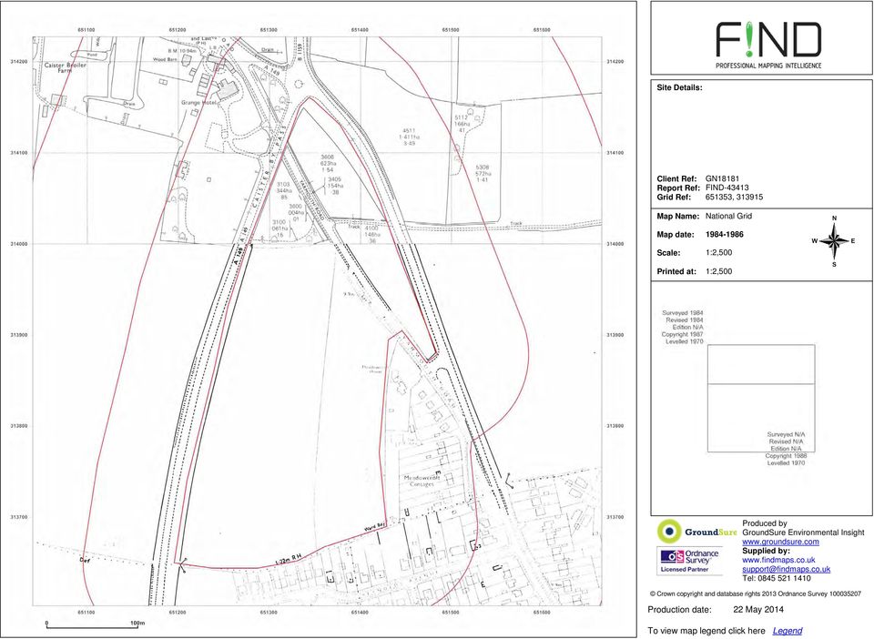
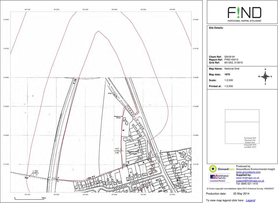
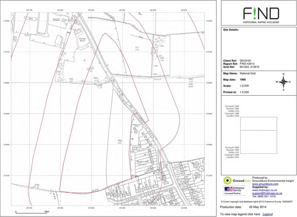
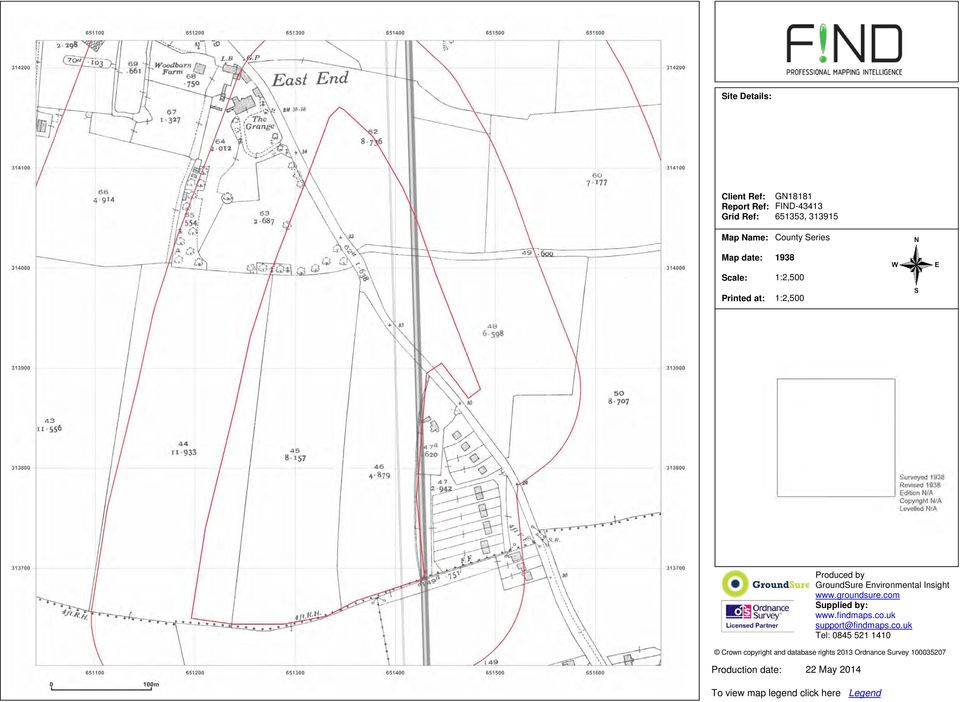
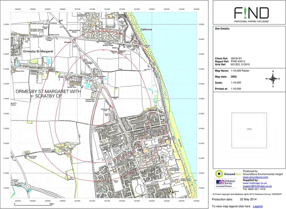
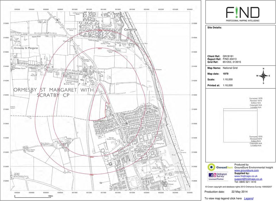
Production date: To view map legend click here Legend. Site Details: GN18181 FIND , Client Ref: Report Ref: Grid Ref: MasterMap
|
|
|
- Bryce York
- 7 years ago
- Views:
Transcription
1 MasterMap :1,250

2 National Grid 1995

3 National Grid 1994
4 National Grid 1990
5 National Grid 1988
6 National Grid
7 National Grid 1979

8 National Grid

9 National Grid 1970
10 National Grid 1966
11 County Series 1938
12 County Series 1928

13 County Series 1885

14 National Grid :10,000 1:10,000

15 1:10,000 Raster :10,000 1:10,000
16 National Grid :10,000 1:10,000

17 National Grid :10,000 1:10,000
18 National Grid :10,000 1:10,000

19 Provisional :10,560 1:10,560

20 County Series :10,560 1:10,560

21 County Series :10,560 1:10,560
22 County Series :10,560 1:10,560
23 County Series :10,560 1:10,560
24 County Series :10,560 1:10,560
25
26
Fig. 2: Location plan showing red-line boundary and cultural heritage assets assessed
 Historic Built Environment Appraisal University of Cambridge Land at North West Cambridge Fig. 2: Location plan showing red-line boundary and cultural heritage assets assessed AHC/9038 August 2011 Historic
Stanfords For Business. Price List. Stanfords For Business Price List - 1 -
 - 1 - Stanfords For Business Price List Stanfords Digital 29 Corn Street, BS1 1HT CONTENTS - Stanfords For Business Price List - 2 - OS Master Map in dxf/ dwg/ shp format 3 Planning Application Maps 4
Global Variables. However, when global variables are used in a function block or control modules, they must be declared as external
 Global Variables You can define global variables in the Application Editor. Global variables are available in all programs. It is only possible to declare global variables on application level. Global
Table of Contents. Ineligible Voter List. Introduction to the Ineligible Voter List... 2. Search from Ineligible Voter Dashboard...
 Table of Contents Introduction to the Ineligible Voter List... 2 Using the Ineligible Voter List Dashboard... 3 Enter Data... 3 Search from Ineligible Voter Dashboard... 5 Print Ineligible Voter List...
v Software Release Notice -. Acquired Software
 v Software Release Notice -. Acquired Software 1. Software Name: Software Version: ArcView GIs@ 3.3 2. Software Function: ArcView GIS 3.3, developed by Environmental Systems Research Institute, Inc. (ESRI@),
National Solutions with Experienced End Users
 National Solutions with Experienced End Users Great Britain Malahide, 6 th May 2004 Nick Macready - Ordnance Survey Niall Tyler Ordnance Survey Martin Rivas British Waterways Positional Accuracy Improvement
ALIGARH MUSLIM UNIVERSITY
 Page 1 /20 List of candidates provisionally called for reporting under Nomination (Admission will be offered through counselling vis-a-vis the availability of seats in the Nominated ) BC 6843031 CA040$
Ramsey County Supplier Portal Instuctions Aspen Supplier Contract Management (SCM) System
 System") Introduction: Ramsey County Professional Services Agreements ( PSA ) and Client Services Agreements ( CSA ) will now be electronically approved by both the Contractor and the appropriate Ramsey County
Introduction: Ramsey County Professional Services Agreements ( PSA ) and Client Services Agreements ( CSA ) will now be electronically approved by both the Contractor and the appropriate Ramsey County
WFP Liberia Country Office
 1 Oscar Gobbato oscar.gobbato@wfp.org oscar.gobbato@libero.it WFP Liberia Country Office GIS training - Summary Objectives 1 To introduce to participants the basic concepts and techniques in using Geographic
V1.8 0 - N ovember 2015. Distribution Network Asset Data Available To Third Parties
 V1.8 0 - N ovember 2015 Distribution Network Asset Data Available To Third Parties How To Request Data LinesearchBeforeUDig (http://www.linesearchbeforeudig.co.uk) This service is available 24/7 365 days
City: State: County: Zip:
 Advisory Board for Interpreters between Hearing Individuals and Individuals who are Deaf, Deafblind, Hard of Hearing or Oral Deaf Application for Licensure Name: Common Customer Number (if renewal): Address:
GEOGRAPHIC INFORMATION SYSTEMS Lecture 20: Adding and Creating Data
 Adding Existing Data Into ArcGIS - there are many different ways to get data into ArcGIS GEOGRAPHIC INFORMATION SYSTEMS Lecture 20: Adding and Creating Data Add Data - normally we use the Add Data button
Index. PUBLIC ACCESS (PAX) Quick Search Guide 1 SEARCHING. Register.2. Profile.3. Charge Account. 4. Account Login 5. Name/Legal Search 6
 Quick Search Guide 1 SEARCHING. Register.2. Profile.3. Charge Account. 4. Account Login 5. Name/Legal Search 6") Index Register.2 Profile.3 Charge Account. 4 History 5 Account Login 5 Name/Legal Search 6 Advanced Search..7 Name Search Results.8 Summary Search Results.9 Detail Search Results...10 Viewing Images...10
Index Register.2 Profile.3 Charge Account. 4 History 5 Account Login 5 Name/Legal Search 6 Advanced Search..7 Name Search Results.8 Summary Search Results.9 Detail Search Results...10 Viewing Images...10
Lesson 15 - Fill Cells Plugin
 15.1 Lesson 15 - Fill Cells Plugin This lesson presents the functionalities of the Fill Cells plugin. Fill Cells plugin allows the calculation of attribute values of tables associated with cell type layers.
Adult Services Registration and Certification Standards 5123:2-5- 01
 Registration and Certification Standards 5123:2-5- 01 What s going on with County Board Registration and Certification Standards? Why is the Adult Services rule being changed? How do the changes affect
LocatorHub Product Life Cycle Status
 LocatorHub Product Life Cycle Status The Product Life Cycle Policy is designed to help communicate to LocatorHub customers the technical support resources available during a product's life span and to
Educational Level Guide. Pros
 GIS software summary This information is based on an evaluation carried out on behalf of the RGS-IBG (please see disclaimer). Category* Cost E- learnin g credits Educational Level Guide Pros Cons Summary
WHAT IS GIS - AN INRODUCTION
 WHAT IS GIS - AN INRODUCTION GIS DEFINITION GIS is an acronym for: Geographic Information Systems Geographic This term is used because GIS tend to deal primarily with geographic or spatial features. Information
THE INTEGRATED SYSTEM (IS) IS NOW UP AND HIPAA 5010 COMPLIANT
 IS NOW UP AND HIPAA 5010 COMPLIANT") APRIL 2012 Fourth Edition, Issue 9 Network Providers A Publication of the Local Mental Health Plan of the County of Los Angeles Department of Mental Health IN THIS ISSUE 1) THE INTEGRATED SYSTEM (IS) IS
APRIL 2012 Fourth Edition, Issue 9 Network Providers A Publication of the Local Mental Health Plan of the County of Los Angeles Department of Mental Health IN THIS ISSUE 1) THE INTEGRATED SYSTEM (IS) IS
REPORT OF THE UNIFORM PERSONNEL CLASSIFICATION AND COMPENSATION PLAN SUBCOMMITTEE OF THE ARKANSAS LEGISLATIVE COUNCIL.
 REPORT OF THE UNIFORM PERSONNEL CLASSIFICATION AND COMPENSATION PLAN SUBCOMMITTEE OF THE ARKANSAS LEGISLATIVE COUNCIL June 21, 2013 Co-Chairs: The Uniform Personnel Classification and Compensation Plan
Automate G/L Consolidation User Guide
 Automate G/L Consolidation User Guide Important Notice TaiRox does not warrant or represent that your use of this software product will be uninterrupted or error-free or that the software product can be
APFO Data Provisioning and Services
 Who We Are APFO is the primary source of aerial imagery for the U.S. Department of Agriculture. Data Stewards for NAIP, and historical aerial photography collected for USDA dating back to 1955. Who We
Enhanced Search Results for Service Providers (SCR 8611A)
") The current structure when creating Service Provider information requires that an individual record is created for each unique address. This results in many duplicate and inaccurate data records and increased
The current structure when creating Service Provider information requires that an individual record is created for each unique address. This results in many duplicate and inaccurate data records and increased
RS/GIS Quick Start Guides Collaborative training materials available from the Biodiversity Informatics & Geospatial Innovation Facilities
 http://gif.berkeley.edu Collaborative training materials available from the Biodiversity Informatics & Geospatial Innovation Facilities http://biodiversityinformatics.amnh.org Using the ArcMap model builder
The development of a flood damage assessment tool for urban areas
 The development of a flood damage assessment tool for urban areas Michael Hammond, A. S. Chen, S. Djordjević, D. Butler, D. M. Khan, S. M. M. Rahman, A. K. E. Haque, O. Mark Urban Drainage Modelling Conference,
How to Read the New Preliminary Online Flood Zone Maps
 How to Read the New Preliminary Online Flood Zone Maps On the Hillsborough County website at www.hillsboroughcounty.org, select the Mapping the Risk: Flood Map Update link, next select the Proposed Flood
University of Arkansas Libraries ArcGIS Desktop Tutorial. Section 4: Preparing Data for Analysis
 : Preparing Data for Analysis When a user acquires a particular data set of interest, it is rarely in the exact form that is needed during analysis. This tutorial describes how to change the data to make
Section 1 Your Details. Your Postal Address. Your First Name * Sonia. Your Surname * Hawley
 Section 1 Your Details Your First Name * Sonia Your Surname * Hawley Your Company or Organisation Name * University of Wolverhampton The Name of your Department Offices of the Vice-Chancellor Your Contact
Renewable energies and their impact on local value added and employment
 Renewable energies and their impact on local value added and employment The german experience and a modelling approach -Economic Effects of Renewable Energy Modelling Regional Value Added- Ritsumeikan
INSPIRE in practice: Experiences with INSPIRE data and services
 INSPIRE in practice: Experiences with INSPIRE data and services Peter Parslow Principal Geographic Information Architect June 2014: ISO TC211 Standards in Practice workshop What s INSPIRE? European Commission
Final Project Wastewater Treatment Facility
 HUMBOLDT STATE UNIVERSITY GEOSPATIAL STUDIES GSP 270 - INTRODUCTION TO GIS Final Project Wastewater Treatment Facility Camila Ribeiro Matos Jéssica Sangiorgi Ricardo Jordan Adair Arcata - CA December 2014
The following services in any combination of options are sought:
 PERRY COUNTY SCHOOL DISTRICT E-RATE INTERNET SERVICE RFP RFP #13-14:1 The Perry County School District is accepting quotes for eligible services as defined by Schools and Libraries Division (SLD) of the
A Method Using ArcMap to Create a Hydrologically conditioned Digital Elevation Model
 A Method Using ArcMap to Create a Hydrologically conditioned Digital Elevation Model High resolution topography derived from LiDAR data is becoming more readily available. This new data source of topography
ICD-10. October 1, 2015
 ICD-10 October 1, 2015 Why is SSIS Changing to ICD-10 CM? Federal Health Insurance Portability and Accountability Act (HIPAA) law requires the use of the International Classification of Diseases, Tenth
A Tutorial for New Users of the Marine Data Model. Alyssa Aaby, Dawn Wright Oregon State University
 A Tutorial for New Users of the Marine Data Model Alyssa Aaby, Dawn Wright Oregon State University Tutorial Purpose Assist in simple data entry into MDM Starting point for project work or specific database
GIS Architecture and Data Management Practices Boone County GIS Created and Maintained by the Boone County Planning Commission GIS Services Division
 GIS Architecture and Data Management Practices Boone County GIS Created and Maintained by the Boone County Planning Commission June 2008 Background Boone County s GIS program has been in existence for
Spatially Enabling SharePoint
 www.environment.gov.au/ssd Spatially Enabling SharePoint Renee Bartolo Program Leader, Spatial Sciences and Data Integration Supervising Scientist - working to protect the environment from the impacts
UPPINGHAM TOWN COUNCIL PENSION LIABILITIES
 UPPINGHAM TOWN COUNCIL PENSION LIABILITIES The Finance and General Purposes Committee has been asked to look into two aspects of pension provision which will need to be decided upon and implemented in
Ag-Analytics Documentation
 Ag-Analytics Documentation Release 1.0 Joshua Woodard, Lin Xue February 11, 2016 Contents 1 1. What is Ag-Analytics? 3 2 2. Finding Data 5 2.1 2.1. Data Overview............................................
Henry County Fiber Network Initiative
 Henry County Fiber Initiative 15 Lake Street, Suite 270 Savannah, GA 31411 Contact: Allen Davis 912-598-9050 adavis@ruralbroadbandllc.com Henry County Fiber Participants City of Hampton City of Locust
LAWRENCE COUNTY SCHOOL DISTRICT E-RATE Request for Quotations for Internet Service
 LAWRENCE COUNTY SCHOOL DISTRICT E-RATE Request for Quotations for Internet Service The Lawrence County Mississippi Public School District is accepting quotations for eligible services as defined by Schools
ROADMAPS: WHAT WORKS FOR HEALTH?
 COUNTY HEALTH RANKINGS & ROADMAPS: WHAT WORKS FOR HEALTH? Obesity Prevention in New Jersey: Important Next Steps December 11, 2012 Abbey Cofsky, M.P.H. Robert Wood Johnson Foundation 2 TODAY S GOALS Introduce
AGENCY DEFINITION AND CRITERIA. A home help services provider is eligible to be approved as an agency when either of the following criteria are met:
 ASM 136 1 of 6 AGENCY PROVIDERS AGENCY DEFINITION AND CRITERIA A home help services provider is eligible to be approved as an agency when either of the following criteria are met: A Medicaid enrolled home
Countryside Access Management System Feature List
 Countryside Access Management System Feature List The Countryside Access Management System (CAMS) is a complete text data and map management system designed to simplify the task of managing and maintaining
ANALYSIS 3 - RASTER What kinds of analysis can we do with GIS?
 ANALYSIS 3 - RASTER What kinds of analysis can we do with GIS? 1. Measurements 2. Layer statistics 3. Queries 4. Buffering (vector); Proximity (raster) 5. Filtering (raster) 6. Map overlay (layer on layer
GIS Project Manager. Position #1
 Position #1 GIS Project Manager DataMap Intelligence is seeking a highly qualified GIS Project Manager to join our fast growing GIS team. You must have a strong, well rounded background in GIS and extensive
Institute of Natural Resources Departament of General Geology and Land use planning Work with a MAPS
 Institute of Natural Resources Departament of General Geology and Land use planning Work with a MAPS Lecturers: Berchuk V.Y. Gutareva N.Y. Contents: 1. Qgis; 2. General information; 3. Qgis desktop; 4.
Analysing Big Data in ArcGIS
 OIL & GAS Analysing Big Data in ArcGIS AIS based risk modelling Esri European Petroleum GIS Conference 2014 Karl John Pedersen 7th November 2014 1 DNV GL 2014 7th November 2014 SAFER, SMARTER, GREENER
ICAEW CERTIFICATE IN INSOLVENCY SYLLABUS JULY 2013
 ICAEW CERTIFICATE IN INSOLVENCY SYLLABUS JULY 2013 LEARNING OUTCOMES Module aim To ensure that students have a good grounding in the fundamentals of insolvency work to enable them to work effectively in
T5 CHARLOTTE REGION WEST DATA CENTER PARK
 Additional!Sites Up to 120+ MW available to site from Duke Energy Low cost reliable power - 3.9-4.6 /kilowatt hour Dual Circuit 100 KV Grid Connector Low natural disaster risk Multiple l fiber carriers
Oklahoma s Open Source Spatial Data Clearinghouse: OKMaps
 Oklahoma s Open Source Spatial Data Clearinghouse: OKMaps Presented by: Mike Sharp State Geographic Information Coordinator Oklahoma Office of Geographic Information MAGIC 2014 Symposium April 28-May1,
applicant's behalf) all correspondence, including the decision letter, will be sent to him/her.
 all correspondence, including the decision letter, will be sent to him/her.") Application for Removal or Variation of a Condition Following Grant of Planning Permission Town and Country Planning Act 1990 Planning (Listed Buildings and Conservation Areas) Act 1990 1. Applicant Name
Application for Removal or Variation of a Condition Following Grant of Planning Permission Town and Country Planning Act 1990 Planning (Listed Buildings and Conservation Areas) Act 1990 1. Applicant Name
Joint Planning and Commissioning Manager Milestone Training Plan
 Joint Planning and Commissioning Manager Milestone Training Plan Introduction This milestone training plan should be used in conjunction with the Job-Specific Competency Framework for your role. The milestone
NATIONAL FLEET DATABASE FLEET OWNER/MOTOR TRADER MANUAL. Page 1
 NATIONAL FLEET DATABASE FLEET OWNER/MOTOR TRADER MANUAL Page 1 1 T A B L E O F C O N T E N T S FLEET OWNER/MOTOR TRADER MANUAL... 1 1 TABLE OF CONTENTS... 2 2 PURPOSE... 3 3 NATIONAL FLEET DATABASE (NFD)-OVERVIEW...
National Fleet Database FLEET OWNERS MANUAL
 National Fleet Database FLEET OWNERS MANUAL Page 2 1 T ABLE OF C ONTENTS 1 TABLE OF CONTENTS... 3 2 PURPOSE... 4 3 NATIONAL FLEET DATABASE OVERVIEW... 4 3.1 UID... 4 4 FLEET OWNER FUNCTIONALITY OVERVIEW...
What is GIS. What is GIS? University of Tsukuba. What do you image of GIS? Copyright(C) ESRI Japan Corporation. All rights reserved.
 ESRI Japan Corporation. All rights reserved.") What is GIS University of Tsukuba Graduate School of Life and Environmental Science April 21 st, 2011 What is GIS? What do you image of GIS? Gas Insulated Switch Groupe Interventional Speciale Geographic
What is GIS University of Tsukuba Graduate School of Life and Environmental Science April 21 st, 2011 What is GIS? What do you image of GIS? Gas Insulated Switch Groupe Interventional Speciale Geographic
Debt Recovery Pricing Structure April 2013. Debtors Residing in Scotland
 Debt Recovery Pricing Structure April 2013 Debtors Residing in Scotland Letters before Action Standard letter before action (LBA): 2.00 (+VAT) Business to business (Late Payment of Commercial Debts (Interest)
Pima Regional Remote Sensing Program
 Pima Regional Remote Sensing Program Activity Orthophoto GIS Mapping and Analysis Implementing Agency Pima Association of Governments (Tucson, Arizona area Metropolitan Planning Organization) Summary Through
February 2016. Dear President Lynch-Bailey and Members of the Board of Trustees:
 THOMAS P. DiNAPOLI COMPTROLLER STATE OF NEW YORK OFFICE OF THE STATE COMPTROLLER 110 STATE STREET ALBANY, NEW YORK 12236 GABRIEL F. DEYO DEPUTY COMPTROLLER DIVISION OF LOCAL GOVERNMENT AND SCHOOL ACCOUNTABILITY
Objectives. Raster Data Discrete Classes. Spatial Information in Natural Resources FANR 3800. Review the raster data model
 Spatial Information in Natural Resources FANR 3800 Raster Analysis Objectives Review the raster data model Understand how raster analysis fundamentally differs from vector analysis Become familiar with
Frequently Asked Questions PWDES E-Review Service
 Frequently Asked Questions PWDES E-Review Service What is the electronic review (E-Review) service? Public Works Development Engineering Services (PWDES) will implement electronic review (e-review) of
Land Use/ Land Cover Mapping Initiative for Kansas and the Kansas River Watershed
 Land Use/ Land Cover Mapping Initiative for Kansas and the Kansas River Watershed Kansas Biological Survey Kansas Applied Remote Sensing Program April 2008 Previous Kansas LULC Projects Kansas LULC Map
Recent Population Growth in Texas (Population section)
") Lesson 39 Social Studies TEKS TEXAS ALMANAC TEACHERS GUIDE 7-9, 19, 21, 22, 23 Modern Economy of Texas Industry & Labor Employment Per Capita Income Banks, Savings & Loans, Savings Banks Insurance 4-7,
Lesson 39 Social Studies TEKS TEXAS ALMANAC TEACHERS GUIDE 7-9, 19, 21, 22, 23 Modern Economy of Texas Industry & Labor Employment Per Capita Income Banks, Savings & Loans, Savings Banks Insurance 4-7,
Applying MapCalc Map Analysis Software
 Applying MapCalc Map Analysis Software Using MapCalc s Shading Manager for Displaying Continuous Maps: The display of continuous data, such as elevation, is fundamental to a grid-based map analysis package.
VENDOR 4 Proposal Evaluation Grid Project
 VENDOR 4 Proposal Evaluation Grid Project IP-Based Audio & Video CommunicProject # Project manager Project artifacts Updated Excluding TOTAL BASE PRICE, rate each criteria as follows: 5 = EXCEEDS; 3 =
Geographic Information Systems (GIS) @ GIS at UCSD. Here to help you explore our world
 @ GIS at UCSD. Here to help you explore our world") Geographic Information Systems (GIS) @ GIS at UCSD Here to help you explore our world GIS at UCSD what it is and what it means to you Tracey Hughes UCSD GIS Coordinator 2006 Image from Google Earth An
Geographic Information Systems (GIS) @ GIS at UCSD Here to help you explore our world GIS at UCSD what it is and what it means to you Tracey Hughes UCSD GIS Coordinator 2006 Image from Google Earth An
Internal Audit Division
 County of Santa Clara Controller-Treasurer Department Internal Audit Division Bill Perrone, CIA Internal Audit Manager August 3, 2009 Assignment 10225 To: Distribution List Subject: Internal Audit Report
MAIN_SNP_TOPO.dgm_2m
 Seite 1 von 7 MAIN_SNP_TOPO.dgm_2m SDE Raster Dataset Tags dgm_2m, dgm_gr_snp, dgm1177bis1258, dtm4, lomb_dtm_20, dem2_5_apb, dhm10, dem20_apb, dsm2_voralberg, dsm10_tirol Summary There is no summary for
An Introduction to Open Source Geospatial Tools
 An Introduction to Open Source Geospatial Tools by Tyler Mitchell, author of Web Mapping Illustrated GRSS would like to thank Mr. Mitchell for this tutorial. Geospatial technologies come in many forms,
If there is a question about network providers; or
 January 2014 CD Process Instructions SCHA Chemical Dependency Treatment Continuum SCHA Working with Third Party Administrator (TPA): Mayo Clinic Health Solutions 1. All of the following chemical dependency
(cf. 4112.24 - Teacher Qualifications Under the No Child Left Behind Act)
") 1 Qualifications/Assignment of Special Education Teachers Any teacher assigned to serve students with disabilities shall possess an appropriate credential or other authorization that specifically authorizes
1 Qualifications/Assignment of Special Education Teachers Any teacher assigned to serve students with disabilities shall possess an appropriate credential or other authorization that specifically authorizes
Lecture 3: Models of Spatial Information
 Lecture 3: Models of Spatial Information Introduction In the last lecture we discussed issues of cartography, particularly abstraction of real world objects into points, lines, and areas for use in maps.
GOM 3D File Format. Version 1.1b GOM mbh, July 2010. GOM mbh Mittelweg 7-8 38106 Braunschweig E-Mail: info@gom.com http://www.gom.
 GOM 3D File Format Version.b GOM mbh, July 200 GOM mbh Mittelweg 7-8 3806 Braunschweig E-Mail: info@gom.com Germany http://www.gom.com Table of Contents Introduction...3. Hints for Interpreting the file
A Brief Explanation of Basic Web Services
 A Brief Explanation of Basic Web Services What is REST? REpresentational State Transfer (REST) is a way for software to work when distributed across a network. For example, if I want to view the Iowa Dept
Tessellations. Practice 1 Identifying Tessellations. In each tessellation, color the repeated shape. Example
 Name: Chapter Date: Practice 1 Identifying In each tessellation, color the repeated shape. Example 1. 2. 3. Lesson 14.1 Identifying 133 Is each pattern a tessellation of a single repeated shape? Write
MapInfo Pro Version 12.5.1. Data Directory
 MapInfo Pro Version 12.5.1 Data Directory MapInfo Pro comes with over 2GB of global data. In each directory, there is a wide variety of files including pre built work spaces for your convenience. These
Rasterization: Where the Term Comes From and What It Does:
 Rasterization: Rasterization is the term used to describe the process of converting a vector illustration (simple shapes) to a raster image (points and pixels). This is done in design software in order
MOUND BAYOU PUBLIC SCHOOL DISTRICT E-RATE Request for Quotations For Internet Service
 MOUND BAYOU PUBLIC SCHOOL DISTRICT E-RATE Request for Quotations For Internet Service The Mound Bayou Public School District is accepting quotations for eligible services as defined by Schools and Libraries
CLOUD-BASED GROUNDWATER SIMULATION AND MAPPING
 CLOUD-BASED GROUNDWATER SIMULATION AND MAPPING Arc Hydro Groundwater Norm Jones Brigham Young University/Aquaveo Gil Strassberg Aquaveo LLC Alan Lemon Aquaveo LLC Data model and tools for managing groundwater
About As. In a team with the best. ESRI Bulgaria is the exclusive distributor of Esri Inc. for Bulgaria. Esri Inc.
 About As ESRI Bulgaria is an IT company, leader in the field of Geographic Information Systems (GIS) on the Bulgarian market. Offering the most advanced high-tech products, solutions and services, ESRI
75 Hour Training and Home Care Aide Certification
 75 Hour Training and Home Care Aide Certification The following short presentation will help you understand: New terms you need to know. What classes make up the 75 hours of training. Who must take and
Spatial data models (types) Not taught yet
 Not taught yet") Spatial data models (types) Not taught yet A new data model in ArcGIS Geodatabase data model Use a relational database that stores geographic data A type of database in which the data is organized across
Spatial data models (types) Not taught yet A new data model in ArcGIS Geodatabase data model Use a relational database that stores geographic data A type of database in which the data is organized across
Embracing ArcGIS for Local Government. Robert Parsons Delaware County, Ohio Auditor s Office Steve Koenig Bruce Harris & Associates
 Embracing ArcGIS for Local Government Robert Parsons Delaware County, Ohio Auditor s Office Steve Koenig Bruce Harris & Associates Background Project began in April 2013 At that time ArcIMS 9.2 was the
CUMBERLAND COUNTY COLLEGE Advanced Placement for Licensed Practical Nurses
 CUMBERLAND COUNTY COLLEGE Advanced Placement for Licensed Practical Nurses LPN Transition Option A Licensed Practical Nurse (LPN), licensed in the state of New Jersey is eligible to enter the Registered
What is GIS? Geographic Information Systems. Introduction to ArcGIS. GIS Maps Contain Layers. What Can You Do With GIS? Layers Can Contain Features
 What is GIS? Geographic Information Systems Introduction to ArcGIS A database system in which the organizing principle is explicitly SPATIAL For CPSC 178 Visualization: Data, Pixels, and Ideas. What Can
Comparison of Programs for Fixed Kernel Home Range Analysis
 1 of 7 5/13/2007 10:16 PM Comparison of Programs for Fixed Kernel Home Range Analysis By Brian R. Mitchell Adjunct Assistant Professor Rubenstein School of Environment and Natural Resources University
Frequently Asked Questions: Transitioning to Licensure Updated April 29, 2013
 Frequently Asked Questions: Transitioning to Licensure Updated April 29, 2013 1. Will everyone have to renew this year, no matter if they are up for renewal? No, only those individuals who are up for renewal
The District s resource specialist program shall provide, but not be limited to: (Education Code 56362)
") AR 4112.23(a) Certificated Personnel SPECIAL EDUCATION STAFF Any teacher assigned to serve students with disabilities shall possess an appropriate credential or other authorization that specifically authorizes
AR 4112.23(a) Certificated Personnel SPECIAL EDUCATION STAFF Any teacher assigned to serve students with disabilities shall possess an appropriate credential or other authorization that specifically authorizes
MapWindow GIS ActiveX Control
 MapWindow GIS ActiveX Control Sample Project: Data Visualization Tool A step-by-step guide to creating a custom GIS-aware application with the MapWindow GIS ActiveX Control by Christopher Michaelis cmichaelis@happysquirrel.com
Importing ASCII Grid Data into GIS/Image processing software
 Importing ASCII Grid Data into GIS/Image processing software Table of Contents Importing data into: ArcGIS 9.x ENVI ArcView 3.x GRASS Importing the ASCII Grid data into ArcGIS 9.x Go to Table of Contents
National Levee Database Public Web Reporting Tool (NLD-WRT) User Manual
 User Manual") National Levee Database Public Web Reporting Tool (NLD-WRT) User Manual Version 0. Prepared by US (USACE) Cold Regions Research and Engineering Laboratory (CRREL) 06 May, 0 Document Change Record Version
National Levee Database Public Web Reporting Tool (NLD-WRT) User Manual Version 0. Prepared by US (USACE) Cold Regions Research and Engineering Laboratory (CRREL) 06 May, 0 Document Change Record Version
Professional Licensure Responsibilities
 Professional Licensure Responsibilities Minnesota Board of Social Work Academic Year 2012-2013 www.socialwork.state.mn.us Agenda Social work as a regulated profession Board s mission of public protection
PROGRAMS STUDY. Information Technology
 PROGRAMS STUDY of COMPUTER INFORMATION SYSTEMS 011 Associate in Applied Science degree (A.A.S.) 60 Credit Hours (CH) The study of basic business and technical principles used in programming and operating
FME 2007 Release Giving Raster the Vector Treatment. By Mary Jo Wagner
 FME 2007 Release Giving Raster the Vector Treatment By Mary Jo Wagner Giving Raster the Vector Treatment By Mary Jo Wagner Spatial extract, transform and load (ETL) tools such as Safe Software s FME have
MAPPING THE ST. FRANCIS DAM OUTBURST FLOOD WITH GEOGRAPHIC INFORMATION SYSTEMS
 MAPPING THE ST. FRANCIS DAM OUTBURST FLOOD WITH GEOGRAPHIC INFORMATION SYSTEMS J. David Rogers Kevin James Department of Geological Engineering University of Missouri-Rolla St. Francis Dam was a 200-ft
Fonville Morisey Leads Cary/Apex/Morrisville Resale Listings
 Leads Cary/Apex/Morrisville Resale Listings 17% Leads Cary/Apex/Morrisville Resale Under Contract 19% Chapel Hill Market Resale Listings Chapel Hill Market Resale Under Contract Leads Durham Co. Market
PARITY SOFTWARE S SAGE ERP X3 CASHBOOK USER MANUAL
 PARITY SOFTWARE S SAGE ERP X3 CASHBOOK USER MANUAL Introduction Parity s Cashbook allows for the efficient reconciliation of Bank Statements to Bank Entry transactions within Sage ERP X3. Parity s Cashbook
What do I do first in ArcView 8.x? When the program starts Select from the Dialog box: A new empty map
 www.library.carleton.ca/find/gis Introduction Introduction to Georeferenced Images using ArcGIS Georeferenced images such as aerial photographs or satellite images can be used in many ways in both GIS
APPLICATION FOR LICENSURE AS A NURSING HOME ADMINISTRATOR OF A FACILITY CARING PRIMARILY FOR PERSONS WITH HEAD INJURIES AND ASSOCIATED DISORDERS
 This form may be printed, completed and mailed to the address listed below ATTACHMENT G STATE OF NEBRASKA Department of Health and Human Services Division of Public Health - Licensure Unit P.O. Box 94986
Digitize All the Things
 Digitize All the Things Standards and Best Practices Gina Strack Utah State Archives Best Practices Exchange November 14, 2013 1 Source: Hyperbole and a Half 2 About Us The purpose of the State Archives