GEOCHEUICAL AND GEOLOGICAL REPORT ON THE BAND UINERAL CSAIUS. White River?uea Skeena Uining Division British Columbia
|
|
|
- Paul Page
- 8 years ago
- Views:
Transcription
1 GEOCHEUICAL AND GEOLOGICAL REPORT ON THE BAND UINERAL CSAIUS White River?uea Skeena Uining Division British Columbia NTS : 103P/l4W 'N 'W OWNER: RICHARD T. HEARD AUTHOR: N.C. CARTER, Ph.D. P.Eng. DATE : JANUARY 6,1997

2 TABLE OF CONTENTS Page INTRODUCTION Location and Access Mineral Property History Present Status GEOLOGY AND MINERALIZATION Physical Setting Regional Geological Setting Property Geology and Mineralization 1996 GEOLOGICAL AND GEOCHEMICAL PROGRAM Geology Geochemical Sampling CONCLUSIONS AND RECOMMENDATIONS COST STATEMENT REFERENCES STATEMENT OF QUALIFICATIONS AUTHOR'S QUALIFICATIONS APPENDIX I - Analytical Results List of Figures Figure 1 - Location Figure 2 - Location - BAND Property Figure 3 - BAND Mineral Claims Figure 4 - Geology and Sample Locations Following Page Frontispiece 1 1 in pocket

3
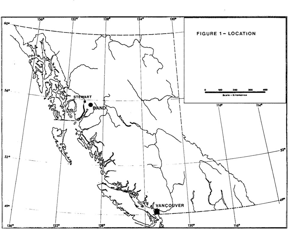
4 INWODUCTION Location and Access The BAND property is 35 km east-southeast of Stewart in northwestern British Columbia (Figure 1). The mineral claims are adjacent to the southeastern margin of the Cambria Icefield and are centred on Banded Mountain which is immediately north of the headwaters of the White River (Figure 2). The common Legal Corner Post for the four mineral claims is at latitude ' North and longitude ' West in NTS map-area 103P/14W. Access is by helicopter from Stewart or from a logging camp on highway 37 south of Meziadin Lake some 30 km northeast of the property. Active logging roads, extending up both White and Kinskuch Rivers, are presently within 12 km of the property. Uineral Property The BAND property consists of four 4-post mineral claims comprising 72 mineral claim units which are registered in the name of Richard T. Heard (Figure 3). Details of the mineral claims are as follows: maim Name L!.tl&L Record Numb= Date of Record BAND 11 BAND 12 BAND 1;3 BAND October 1, II II II n n

5 i IGUR E 2 - LOCATION - BAND PROPERTY

6 FIGURE 3- BAND MINERAL CLAIMS I

7 History Original documented exploratory work within the boundaries of the present BAND mineral claims was directed to the investigation of molybdenite mineralization associated with a granitic stock which intrudes Bowser Assemblage sediments on the southern slope of Banded Mountain. Claims were staked by Kennco Explorations (Western) Ltd. in 1966 following a reconnaissance stream sediment sampling program which yielded anomalous molybdenum values in all streams draining the southern slopes of Banded Mountain. Follow-up work by Kennco (Ney,1966) included geological mapping and stream sediment, soils and talus fines sampling. Subsequent work, by JMT Services Ltd. (Livingstone, 1980,1981), was also oriented toward the assessment of molybdenum potential and included prospecting, geological mapping and the collection of soil and rock samples which were analyzed for molybdenum, lead and zinc only. Banded Mountain was within a large block of claims extending from White Lake north to Willoughby Creek that was investigated by Bond Gold Canada Inc. in 1990 following the discovery of significant gold mineralization at Red Mountain. Work by Bond Gold within the boundaries of the present property included some geological mapping, reconnaissance VLF-EM and magnetometer surveys and the collection of rock
 included geological mapping and stream sediment, soils and talus fines sampling. Subsequent work, by JMT Services Ltd.")
8 samples, of which five samples, collected near the western margin of the granitic stock, yielded appreciable gold values (Vogt and Bray, 1991). The current BAND mineral claims were located by Richard T. Heard October 1,1993. Exploratory programs in 1994 and 1995, have included reconnaissance geology, prospectinq, one tr La1 1 ine of magnetometer readings and the collection and analyses of 28 stream sediment and 39 rock samples (Carter,1994,1996). Present Status A 1996 program, carried out between September 15 and 16, was designed to follow up and expand upon earlier work. The program, planned and conducted by the writer with the assistance of George Heard and John Martin, included the collection and subsequent analyses of 6 stream sediments and 16 rock samples and geological investigation of part of the contact between the granitic stock and enclosing sediments in the central property area. Access to the property was by helicopter from Smithers. GEOLOGY AND MINERALIZATION Physical Setting Banded Mountain, on the eastern flank of the Coast
. Present Status A 1996 program, carried out between September 15 and 16, was designed to follow up and expand upon earlier work.")
9 Mountains, is immediately adjacent to the southeastern margin of the Cambria Icefield. Elevations within the claims area range from about 700 metres above sea level at White Lake along the southern property boundary to 1707 metres at the summit of Banded Mountain (Figure 4). Vegetation, consisting of partial forest cover and locally dense alder growth, extends to about 1200 metres elevation. Above this is typical alpine terrain with locally steep slopes on the south and southeast flanks of Banded Mountain. Bedrock exposure is nearly continuous at higher elevations and in some of the major drainages, most notably the canyon between the South Flat and White glaciers in the western property area (Figure 4). Regional Geological Setting The BAND property, situated near the boundary between the Intermontane and Coast Plutonic tectonic belts, is principally underlain by Upper Jurassic clastic sediments characteristic of the southwestern margin of the Bowser Basin. According to Greig et a1(1994), both these late Jurassic and older intravolcanic clastic sequences form a less competent structural cover to a more massive basement complex which is exposed in structural culminations and consists of

10 lower to middle Jurassic (Hazelton Group) volcanic and volcaniclastic rocks. These and older (late Triassic) rocks underlie much of the area within and adjacent to the Cambria Icef ield. Hazelton Group stratigraphy is complex. Older units (Lower Jurassic) overlie late Triassic basalt flows and fragmental rocks and include maroon to dark green andesitic pyroclastic and epiclastic sequences which are gradational upward to more felsic volcaniclastic units, some of which may be of Middle Jurassic age. Layered rocks are cut by a variety of intrusions ranging in age from mid-jurassic to early Tertiary. The older intrusions are represented by small plutons and related dykes and sills of porphyritic granodiorite, the best example of which is the Goldslide pluton proximal to the Red Mountain gold deposit (Greig et al,l994). The most widespread of the younger (Eocene) intrusions include those comprising the eastern margin of the Coast Plutonic Complex and a number of small, satellitic granodiorite to quartz monzonite porphyry plutons. Basic dykes and sills are widespread throughout the general area. The general structural trend is north-northwest, parallel to the Coast Plutonic Complex contact and the southwestern margin of the Bowser Basin. Two structural

11 domains are separated by a major north-northeast fault through the centre of the Cambria Icefield (Greig et a1,1994). Southeast of this fault, southwest-verging structures are prevalent and polyphase folding of the Upper Jurassic clastic "cover" rocks is evident. The BAND property is midway between the Stewart and Allce Arm mineral districts. Major past producing mines of the region include the Premier and Big Missouri gold-silver deposits, Dolly Varden and Torbrit silver deposits, Granduc massive sulphide deposits and the Kitsault porphyry molybdenum deposit south of Alice Arm. The Red Mountain gold property, now owned by Barrick Gold Corp. and subject to an agreement with Royal Oak Mines Ltd., and situated 23 km northwest of the BAND claims, includes at least four en-echelon northwest trending zones of semi-massive sulphides. These are hosted by Hazelton Group felsic and pyritic volcanic rocks marginal to the middle Jurassic Goldslide granodiorite pluton which was investigated for molybdenum mineralization in the 1960's. A 1992 resource estimate for the Red Mountain gold deposits totals 2.5 million tonnes grading 12.8 g/t (0.371 oz/ton) gold and 38.1 g/t (1.1 oz/ton) silver (Rhys et a1, Red Mountain has the potential to host between 2 and 3 million ounces gold.

12 The Willoughby Creek gold-silver property, owned by Camnor Resources Ltd. and situated 15 km north of the BAND claims, has a geological setting similar to that at Red Mountain. Gold mineralization is associated with sulphide (pyrite-pyrrhotite) replacement lenses in altered Hazelton Group rocks and with shear zones in granitic rocks. These shears feature arsenic-antimony enrichment and contain silver-lead-zinc values in addition to locally high grade gold values. Property Geology and Mineralization The BAND property is mainly underlain by Upper Jurassic sediments which include dark grey to black, well-bedded mudstones and siltstones and subordinate greywackes. These overlie and are in thrust fault contact with undivided (Greig et a1,1994) Hazelton Group volcanic rocks in the extreme southwest and northern parts of the property (Figure 4). Field inspection in the southwestern property area in 1994 indicates these to be felsic fragmental rocks containing abundant pyrite, suggesting that this sequence may be near the upper part of the Hazelton Group. The more widespread Upper Jurassic sediments are intensely folded about west-northwest axes. A recumbent

13 syncline under1 ies the summit of Banded Mountain (Figure 4 ) with a west-northwest striking, moderately north-dipping homoclinal sequence underlying the southern slopes. That part of the sedimentary sequence immediately overlying the older volcanic rocks between South Flat and White glaciers (Figure 4) is highly contorted (Figure 4). The sedimentary sequence on the south slope of Banded Mountain is intruded by a granitic stock, elongate in a westnorthwest direction and occupying the trace of the thrust fault separating Hazelton Group volcanics and the Upper Jurassic sediments to the northwest (Figure 4). The stock, originally thought to measure 1.3 x 0.5 km, may be at least twice this areal extent geological mapping in this area by D. Alldrick of the BC Geological Survey (Alldrick - personal communication) indicates that it extends for a considerable distance in a southwesterly direction from the previously recognized northwestern limits (Figure 4). Several intrusive phases are evident within the stock which weathers to a distinctive orange to reddish-brown colour in marked contrast to the enclosing sediments which are variably hornfelsed. Near the previously determined western limits, the intrusion is comprised mainly of equigranular to seriate-textured, light to dark grey
. The stock, originally thought to measure 1.3 x 0.5 km, may be at least twice this areal extent.")
14 granodiorite to quartz diorite containing occasional oval 6-10 cm, partially resorbed, xenoliths of country rock. The eastern part of the stock features more leucocratic, subporphyritic quartz monzonite. Younger, 0.5 to 3 metres wide aplite dykes are ubiquitous but are most prevalent in the eastern stock area where they occur as northeast and northwest trending dyke swarms. The originally assumed Tertiary (Eocene) age for this intrusion is in some doubt. Apllte dykes and sills, associated with this intrusive event, are numerous in the southwestern property area where they are folded and boudinaged within the Upper Jurassic sedimentary sequence. The Banded Mountain granitic stock, like the Goldslide intrusion near Red Mountain which was also initially assumed to be Tertiary, may be of older (Jurassic?) age. Several stages of quartz veining and contained sulphide mineralization are evident within and adjacent to the intrusion. Early barren veins are present within hornfelsed sediments marginal to the contact. Two stages of quartzmolybdenite veining, particularly evident in the eastern, and more leucocratic part of the stock, include 1 cm wide veinlets with sericite-molybdenite selvages and later, 10 cm wide veins containing disseminated and selvage molybdenite. Molybdenite was also noted coating dry fractures within the
 age for this intrusion is in some doubt.")
15 intrusion (Livingstone,l980). The apparently youngest stage of quartz veining is represented by northeast-striking, moderately west-dipping 0.10 to 0.40 metre wide polymetallic veins containing appreciable pyrite, arsenopyrite, galena and sphalerite which are best developed in the central part of the intrusion where they are hosted by more dioritic phases. Previous limited bedrock and soil sampling reflects the above noted mineralization within the stock. Samples from the more leucocratic phases yielded Mo values exceeding 150 ppm from soils and t250 ppm (up to 4710 ppm) from rocks. Higher Cu (+I50 ppm) and Zn (t80 ppm) were noted in soils from the western stock area (Livingstone,l981). Initial indications of mineralization were detected by stream sediment samples from drainages on the southern slopes of Banded Mountain which contained anomalous Mo concentrations (Ney,1966). Reconnaissance stream sediment sampling of map-area 103P by the Provincial Government in 1978 included three samples within the boundaries of the present BAND property. Additional analyses (including gold) of archived sample pulps were released in Locations of these are shown on Figure 4 and significant results (in ppm- Au in ppb) are as follows:
 from rocks.")
16 SamDle No. C!A 22 Bs B% KQ hlu Note: Mo and W values in sample (from drainage originating in the central part of the granite stock) are above the 99th percentile of all samples collected within map-area 103P, As values are plus the 90th percentile; Au values t90th percentile. Limited previous bedrock sampling by Bond Gold Canada (Vogt and Bray,1991) near the summit of Banded Mountain and within and adjacent to the granite intrusion indicated anomalous gold values. These included five samples of polymetallic quartz veins (semi-massive pyrite, arsenopyrite, galena and sphalerite) collected in the northwestern part of the intrusion which returned significant results as follows: $amole No Five samples from this area were collected in 1994 from 0.10 to 0.40 metre wide polymetallic quartz veins hosted by granodiorite and exposed over a 60 metre accessible section in a creek (Figure 4). These veins contain semi-massive pyrite, arsenopyrite, galena and sphalerite. A sixth sample similar vein material was collected some 200 metres to the southeast (Figure 4). Partial results (in ppm except for Au in ppb) are as follows:
 near the summit of Banded Mountain and within and adjacent to the granite intrusion indicated anomalous gold values.")
17 These results confirm the gold values reported by Bond Gold Canada, the polymetallic nature of the veins, locally fair silver values plus arsenic-antimony enrichment. Additional sampling in 1995 (Carter,1996) included nine samples of quartz veins and veinlets hosted by hornfelsed sediments marginal to the granitic stock contact which were collected between 200 and 500 metres west (Figure 4) of the previously described area. Quartz veinlets occur as stockworks and contain locally coarse-grained pyrite, galena and sphalerite. Quartz veins, averaging 0.8 metre in width, also contain pyrite, galena and sphalerite. Better results (in ppm, except for Au in ppb) are as follows: The foregoing results arrest to the more widespread distribution of gold values associated with polymetallic

18 quartz veins and veinlets. Bedrock sampling in has also been directed to the southwestern property area where a window of Hazelton Group volcanic rocks is exposed immediately below highly contorted and iron-stained Upper Jurassic sediments (Figure 4). These fragmental volcanic rocks are felsic in composition and include lapilli to breccia size fragments. Disseminated to streaky pyrite is widespread and some barite stringers were noted. Six grab samples were collected over a distance of 200 metres immediately west of the drainage between the South Flat and White glaciers (Figure 4 ). Sample is a float sample of black siltstone containing wispy bands of finegrained pyrite and other sulphide minerals; was from felsic volcanics containing pyrite bands and some barite. Partial results (values in ppm except for Au which is in ppb) of rock samples collected from this area are as follows: samole No. Bs Cle eb

19 While several samples collected north of this area in 1995 (Figure 4 - Carter,1996) returned no significant values, original sampling results and the geological setting of this part of the property is suggestive of an Eskay Creek polymetallic environment. Samples B9526 and B9528 to B9532 inclusive, collected in 1995 from rusty fragmental volcanic rocks 300 metres north of a thrust fault contact near the northern property boundary (Figure 41, returned weakly anomalous gold, silver, arsenic and lead values. Twenty-eight stream sediment samples were collected from about twenty main and tributary drainages throughout the property area in 1994 and Locations are illustrated on Figure 4 and the more significant results are listed below: 23mLs BAND 94-I* BAND 94-2" BAND 94-3* BAND 94-4* BAND 94-5 BAND 94-6 BAND 94-7 BAND 94-8 BAND 94-9 BAND B951 B956 B9 57 B B9511 Moo * Partially panned concentrate.

20 Most of the foregoing sampless were collected from rapidly flowing streams which were at or near the yearly high water mark. This necessitated the collection of coarser material in several instances; extremely high rainfalls in September of 1994 and 1995 undoubtedly resulted in the flushing out of the finer silt resulting in lower trace metal values than anticipated. For example, strongly anomalous arsenic values indicated by previous Government sampling were not duplicated by the 1994 and 1995 programs GEOLOGICAL AND GEOCHBUICAL PROGRAM Geology The northeastern granitic stock contact, between the sampled area containing locally good gold values and the apparent eastern limits of the intrusive body, was examined in The contact is much more irregular than indicated by Bond Gold mapping (Vogt and Bray,1991). The modified contact is shown on Figure 4. This part of the stock contact features several areas of northerly trending, moderately to steeply east-dipping, 1 to 8 cm quartz stringers developed in both the equigranular granodlorite - quartz monzonite and bordering rusty, hornfelsed Bowser Assemblage sedimentary rocks.

21 White weathering 0.3 to 1 metre wide pegmatite and aplite dykes, intruding both the granitic and sedimentary rocks, are of similar orientation to, and can easily be mistaken for quartz veins and veinlets. Bedding in Bowser Assemblage sedimentary rocks crudely parallels the intrusive contact over much of the area examined. In the main, these dip gently to the north. The apparent eastern limits of the stock is characterized by injections of granodiorlte and aplite dykes into hornfelsed sedimentary rocks. Geocheml cal Sampling This phase of the program included the collection of 6 stream sediments and 16 rock samples. All samples were submitted to Min-En Laboratories in Smithers for sample preparation and subsequent analyses in Vancouver for 31 elements by inductively coupled argon plasma (ICP) techniques. Gold was determined on 15 gram splits of all samples by atomic absorption. Complete analytical results are included as Appendix I; sample locations and results for selected elements (Au, Ag, Mo, Pb, Zn) are shown on Figure 4. Rock samples were collected mainly from areas of quartz veining along the northeastern stock contact during the course of geological investigations. Samples were also
22 collected from pegmatite and aplite dykes to determine Mo and trace element concentrations. All were grab or character samples which consisted of 1 to 2 kg of material placed in plastic sample bags. Partial results (in ppm, except for Au in ppb) are as follows; complete analytical data are contained in Appendix I. Samples and 61416, collected from siltstone and quartz float near the eastern property boundary (Figure 41, returned no values of consequence other than 100 ppm As in the quartz float sample. Samples to inclusive, from quartz veins and veinlets and pegmatite and aplite stringers, contained no significant values other than slightly enhanced silver and arsenic in samples and Samples collected from the eastern stock contact area
23 ( ) contained the most interesting results. Obvious molybdenite on fractures and along selvages of narrow quartz veins is reflected by 5754 ppm Mo in sample and by sample (370 Mo) which consisted of aplite with quartz stringers. This sample also contained elevated silver and arsenic values. Samples and 61430, collected near two stream sediment sample sites (Figure 4), contained only low values for all elements. Stream sediment samples were collected from several drainages in the north-central property area; one sample was from a drainage near the eastern property boundary [Figure 4). Samples collected were placed in gussetted kraft paper bags and partially air dried prior to submission to the sample preparation lab in Smithers. Locations of most samples were determined with the aid of a Global Positioning System (GPS) instrument. Partial results, shown on Figure 4 are tabulated below; complete analytical results are contained in Appendix I. As indicated, nos significant values were obtained f rom
24 these samples other than an 11 ppb gold value from B96-2. Samples B96-3 through B96-6 contained between 42 and 107 ppm arsenic. CONCLUSIONS AND RECOIMENDATIONS The 1996 program provided a better understanding of the position and nature of the northeastern granitic stock contact and confirmed the presence of Mo mineralization near the eastern limits of the intrusion. Work to date suggests that polymetallic veins containing gold mineralization are best developed within granitic rocks marginal to the northern intrusive contact. As noted previously, the known extent of of this intrusion has been expanded significantly by recent work carried out on behalf of the BC Geological survey by D. Alldrick. Further confirming the incidence of gold-bearing quartz veins marginal to the contact areas are the results of several grab samples collected during the course of this work (D. Alldrick, personal communication) which include one from an 8 cm wide quartz-arsenopyrite-galena vein some 300 metres west of the Bond Gold sample site (sample numbers Figure 4) which yielded g/t gold. Two other samples of similar vein material, collected from contact areas along the southwestern extension of the granitic stock
25 more than 1 km southwest of the Bond Gold sample site, returned values of 1.48 and 2.05 g/t gold. Detailed prospecting, mapping and sampling in the area of the granitic intrusion is obviously warranted. This is the prime target for the next phase of work on the property which should be undertaken in more favourable weather consitions of mid-summer. Additional work is also recommended for other parts of the large property area. The potential of the erosional window exposing pyritic felsic fragmental rocks in the southwestern claims area remains unknown and and further investigation of this area is warranted. The thrust fault contact between sediments and volcanic rocks along the northern property boundary where abundant pyrite mineralization has also been noted is also worthy of additional work.
26 COST STATElIENT - September 15,16, days N.C. Carter $500 (tgst) $ G. Heard $400 (tgst etc.) $ J. Martin $300 (tgst etc.) $ $1, Helicopter - (Bell Long Ranger - hour 2 $1100/hour $2, Airfares (split) &ccomodation. Meals Smithers - September 15,16 (NCC,GH,JM) $ bnalvtical Costs 16 rock $ stream sediment $18.08 N.C. Carter $500 Word processing, duplicating,etc TOTAL EXPENDITURES $7,350.00
27 REFERENCES Carter,N.C.(1994): Geological, Geochemical and Geophysical Report on the Band Mineral Claims, White River Area, Skeena Mining Division, British Columbia, BCMEMPR Assessment Report (1996): Geochemical Report on the Band Mineral Claims, White River Area, Skeena Mining Divison, British Columbia, BCMEMPR Assessment Report Greig,C.J.,Anderson,R.G.,Daubeny,P.H.,Bu,K.F. and Hinderman,T.K.(1994): Geology of the Cambria Icefield: regional setting for Red Mountain gold deposit,northwestern British Columbia, Current Research 1994A;Geological Survey of Canada,p Livingstone,K.W.(1980): Easter Property-Prospecting,Report on Geology,BCMEMPR Assessment Report 8373 (1981): Geochemical Survey-Report on Easter Property,BCMEMPR Assessment Report 9635 Ney,Charles S.(1966): Geological and Geochemical Report, THM Claims,Skeena Mining Division,BCMEMPR Assessment Report 955 Rhys,D.A., Sieb,M., Frostad,S.R., Swanson,C.L., Prefontaine,M.A., Mortenson,J.K. and Smit,H.Q.(1995): Geology and setting of the Red Mountain gold-silver deposits, northwestern British Columbia Porphyry Deposits of the Northwestern Cordillera of North America, Edited by T.G. Schroeter. Canadian Institute of Mining, Metallurgy and Petroleum,Special Volume 46. Vogt,Andreas H. and Bray,Adrian D.(1991): Geological, Geophysical and Geochemical Exploration Program on the Bria-Wotan Property, Skeena Mining Division,BCMEMPR Assessment Report 21304
28 2 3 STATEMENT OF QUALIFICATIONS - Graduate in Mining Engineering, Montana Tech, MBA, University of Hawaii - Mining engineer - uranium and coal mines, southwestern U.S. - Mine manager - U.S. and Kalimantan, Indonesia - President and director - several junior exploration compan ies graduate - Haileybury School of Mines - United Keno Hill mine, Yukon - underground mining, manager of assay lab, mill manager - CIL Explosives - manager, northwest B.C., Labrador Retired as bulk explosives manager, ICI - Chief explosives director for federal government, Vancouver
29 24 AUTHOR'S QUALIFICATIONS I, NICHOLAS C. CARTER, of 1410 Wende Road, Victoria, British Columbia, do hereby certify that: 1. I am a Consulting Geologist, registered with the Association of Professional Engineers and Geoscientists of British Columbia since I am a graduate of the University of New Brunswick with B.Sc.(1960), Michigan Technological University with M.S.(1962( and the University of British Columbia with Ph.D.(1974). 3. I have practised my profession in eastern and western Canada and in parts of the United States for more than 25 years. 4. Field work on the BAND mineral claims, as described herein, was carried out by the writer, assisted by Messrs. Heard and Martin. I am personally familiar with the property and its geological setting. N.C. Carter, Ph.D. P.Eng. Victoria,B.C. January 6,1997
30 APPENDIX I Analytical Results
31
32
33 FIGURE 4 r3 1 Granodiorite,Aplite Sediments )1 vo'canics et:es I I I LO stream Sediment Samples (Geology after Greig et al 1994; Vogt & Bray 1991) -
2008-2009 PROSPECTING REPORT. Ghost Lake Serpentine Property. EVENT # 4282919 TENURE # 558949 Tenure Name: Ghost Lake Serpentine
 2008-2009 PROSPECTING REPORT Ghost Lake Serpentine Property EVENT # 4282919 TENURE # 558949 Tenure Name: Ghost Lake Serpentine New Westminster Mining Division Map 092H Central Coordinate Reference 121
For personal use only
 ANNOUNCEMENT TO THE AUSTRALIAN SECURITIES EXCHANGE: 18 March 2013 Update on Bunawan and Bahayan Permit Approvals. The Directors of Sierra Mining Limited ( Sierra ) are pleased to update shareholders on
Coquihalla Gold Belt Project Reconnaissance and Sampling
 Coquihalla Gold Belt Project Reconnaissance and Sampling Claim ID Number: 600070 New Westminster Mining Division NTS 092H06 Claim Location: UTM NAD 83: Zone 10, 629500 East 5477000 North Registered Owner:
PICTOU PROPERTY : ATLIN GOLD CAMP
 PICTOU PROPERTY : ATLIN GOLD CAMP EXECUTIVE SUMMARY The Pictou Property in the Atlin Gold Camp ( AGC ) is an example of a Motherlode- Bonanza, lode gold, quartz vein exploration target in the northern
RAINBOW AURORA INDIAN PROPERTIES Goodpaster Mining District, Alaska
 RAINBOW AURORA INDIAN PROPERTIES Goodpaster Mining District, Alaska Prepared by: Carl Schaefer CPG# 10834 Northern Associates, Inc. February, 2006 Tonogold Resources, Inc. 5771 La Jolla Boulevard La Jolla,
ROME RESOURCES LTD. 205 16055 Fraser Highway Surrey, B.C. V4N 0G2
 Page 1 of 6 ROME RESOURCES LTD. 205 16055 Fraser Highway Surrey, B.C. V4N 0G2 FAX# (604) 507-2187 TSX-VEN Symbol RMR; Frankfurt: 33R WEB: www.romeresources.com CH Valoren No 699 171 Email: info@romeresources.com
PROSPECTING SURVEY REPORT ON THE KLASK-INO #1 CLAIM NANALMO MJNXNG DXYXSION. NTS: 9245Elk5W Latitude: 5(P 18.9' Longitude: 127" 4-4.
 .........".,....- - PROSPECTING SURVEY REPORT ON THE KLASK-INO #1 CLAIM NANALMO MJNXNG DXYXSION.-e -.s z NTS: 9245Elk5W Latitude: 5(P 18.9' Longitude: 127" 4-4.3' LOGNO: ob27 Ri). I ACT I OM: -- _1 By
SILVERCORP INTERCEPTS 18.8 METRES TRUE WIDTH GRADING 368 G/T SILVER AND 1.78 PERCENT LEAD AT THE LM MINE WEST, YING MINING DISTRICT, CHINA
 NEWS RELEASE Trading Symbol: TSX: SVM NYSE: SVM SILVERCORP INTERCEPTS 18.8 METRES TRUE WIDTH GRADING 368 G/T SILVER AND 1.78 PERCENT LEAD AT THE LM MINE WEST, YING MINING DISTRICT, CHINA VANCOUVER, British
I+/' RD. 2 f.*rj GEOLOGICAL AND GEOCHEMICAL REPORT. on the SECOND CLAIM CROUP CLINTON MINING DIVISION, BRITISH COLUMBIA
 RD. I GEOLOGICAL AND GEOCHEMICAL REPORT on the SECOND CLAIM CROUP CLINTON MINING DIVISION, BRITISH COLUMBIA I+/' Latitude 51' k3' North Longitude 122' 03' West 2 f.*rj N.T.S. 920/1E by JOHN A, McCLINTOCK,
FORWARD LOOKING STATEMENTS
 MPH Ventures Corp. (MPS: TSX.V) Advancing Gold and Molybdenum Projects in Canada June 2013 1 FORWARD LOOKING STATEMENTS This presentation may contain forward-looking statements including but not limited
December 8, 2008. Visit www.ivanhoemines.com for pictures of the drill core and maps and sections of the new discovery.
 December 8, 2008 Ivanhoe Mines Makes Another High-Grade Discovery of Gold and Copper at the Oyu Tolgoi Project in Mongolia Discovery Remains Open to Expansion in All Directions ULAANBAATAR, MONGOLIA John
NEWS RELEASE NOT FOR DISSEMINATION IN THE UNITED STATES OR FOR DISTRIBUTION TO U.S. WIRE SERVICES
 Suite 250, 1075 West Georgia Street Vancouver, BC, Canada V6E 3C9 Tel: 1.778.373.0102 Fax: 1.604.434.1487 NEWS RELEASE NOT FOR DISSEMINATION IN THE UNITED STATES OR FOR DISTRIBUTION TO U.S. WIRE SERVICES
Queensland Mining Corporation L I M I T E D. Maiden JORC Resources Estimate for Horseshoe Copper Deposit, Duck Creek, South Cloncurry District
 ASX Release 12 October 2012 Maiden JORC Resources Estimate for Horseshoe Copper Deposit, Duck Creek, South Cloncurry District Total mineral resource at Duck Creek Project area of 960,000t @ 1.47% Cu (0.2%
INTERPRETATION ADDENDUM CANADIAN MINING COMPANY INC. SUITE 2300-1066 WEST HASTINGS STREET VANCOUVER, BC V6E 3X2 3D INDUCED POLARIZATION
 INTERPRETATION ADDENDUM FOR CANADIAN MINING COMPANY INC. SUITE 2300-1066 WEST HASTINGS STREET VANCOUVER, BC V6E 3X2 3D INDUCED POLARIZATION ON THE SAN BERNARDO PROJECT EL GOCHICO GRID Approximate Location:
SILVERCORP INTERCEPTS HIGH GRADE SILVER LEAD ZINC MINERALIZATION AT THE TLP MINE, YING MINING DISTRICT, HENAN PROVINCE, CHINA
 NEWS RELEASE Trading Symbol: TSX: SVM NYSE: SVM SILVERCORP INTERCEPTS HIGH GRADE SILVER LEAD ZINC MINERALIZATION AT THE TLP MINE, YING MINING DISTRICT, HENAN PROVINCE, CHINA VANCOUVER, BRITISH COLUMBIA,
IRONSIDE RESOURCES INC.
 For the Six Months Ended December 31, 2015 Overview The following management s discussion and analysis ( MD&A ) of the financial position and results of operations of Ironside Resources Inc. ( the Company
Chalice advances gold exploration initiatives in Australia and Canada
 ABN 47 116 648 956 ASX Announcement 4 July 2016 Chalice advances gold exploration initiatives in Australia and Canada Low-cost exploration planned to evaluate opportunities in two world-class gold provinces
Chalcophile and Key Element Distribution in the Eastern Goldfields: seismic traverse EGF01. Aleks Kalinowski Geoscience Australia, pmdcrc Y2 project
 pmd CR C Chalcophile and Key Element Distribution in the Eastern Goldfields: seismic traverse EGF01 predictive mineral discovery Aleks Kalinowski Geoscience Australia, pmdcrc Y2 project Aleks.Kalinowski@ga.gov.au
Highlights of selected high-grade mineralized zones exposed in drift tunnels include:
 NEWS RELEASE Trading Symbol: TSX: SVM SILVERCORP REPORTS NEWLY EXPOSED MINERALIZATION AT THE TLP MINE FROM ITS 2015 EXPLORATION TUNNELING PROGRAM - 1,414 METERS IN TOTAL LENGTH AND 0.70 METERS IN AVERAGE
For personal use only
 Investigator Resources Limited Date: 7 th February 2012 up to 2.25% Ag at the new Paris prospect in South Australia First assays received for new drilling on Paris Line 7 with all three holes assayed returning
How To Understand The History Of The American Gold Mine
 September 12, 2011 THE ATLANTA GOLD MINE, EASTERN NEVADA Gold Exploration in Nevada with Near-Term Production Potential TSXV: MAY OTCQX:MAYGF Atlanta Gold & Silver Mine, Nevada Atlanta is located in northeastern
SILVERCORP REPORTS RESULTS FROM ITS 2012 EXPLORATION PROGRAM AT THE SGX MINE, YING MINING DISTRICT, CHINA
 NEWS RELEASE Trading Symbol: TSX: SVM NYSE: SVM SILVERCORP REPORTS RESULTS FROM ITS 2012 EXPLORATION PROGRAM AT THE SGX MINE, YING MINING DISTRICT, CHINA VANCOUVER, British Columbia June 4, 2013 Silvercorp
NOVEMBER 2015. January 2013
 NOVEMBER 2015 President & CEO: Wayne Reid wreid@gtaresources.com 709-699- 1733 VP Exploration: Robert Duess rduess@gtaresources.com 613-453-7947 January 2013 TSXV: GTA www.gtaresources.com DISCLAIMER This
TSX-V: GLD. Corporate Presentation February 2016
 Corporate Presentation February 2016 GoldON Resources Ltd. 2 Caution Regarding Forward-Looking Information Certain of the statements made and information contained herein is forward-looking information
TSX-V: GEX. An International Mineral Exploration Company
 An International Mineral Exploration Company Cautionary Note Regarding Forward Looking Statements This presentation includes certain forward-looking statements within the meaning of Canadian securities
TSX.V: HSR Frankfurt: B6IH. Homestake Ridge Kinskuch Project
 TSX.V: HSR Frankfurt: B6IH Homestake Ridge Kinskuch Project CORPORATE PRESENTATION March 2014 Forward Looking Statement Some of the statements contained in this presentation may be deemed forward looking
Pacifico set to commence drilling at Borroloola West Project and co-funding secured from NT Government
 CORPORATE DIRECTORY Managing Director Simon Noon Directors Richard Monti (Chairman) Peter Harold (Non-exec.) Andrew Parker (Non-exec.) Company Secretary Joshua Ward Patrick Holywell Registered office Level
Galahad Gold plc (Galahad)
") 23 January 2007 Galahad Gold plc (Galahad) 2006 Drilling Expands Northern Dynasty's Pebble East Deposit Pebble East Deposit Now Over 7000 Ft By 4000 Ft With Grades Exceeding 1% Cueq Galahad sets out below
23 January 2007 Galahad Gold plc (Galahad) 2006 Drilling Expands Northern Dynasty's Pebble East Deposit Pebble East Deposit Now Over 7000 Ft By 4000 Ft With Grades Exceeding 1% Cueq Galahad sets out below
Gold. Grade. Infrastructure. CORPORATE PRESENTATION
 Gold. Grade. Infrastructure. CORPORATE PRESENTATION Disclaimer Certain statements in this presentation constitute forward looking statements or forward looking information within the meaning of applicable
RIDDARHYTTAN RESOURCES PRESS RELEASE August 11, 2003
 1 RIDDARHYTTAN RESOURCES PRESS RELEASE August 11, 2003 New drill holes in the Suurikuusikko area, Finland, have further intersected high gold grades over considerable widths, increasing the depth extent
Reservoir Minerals Reports Further High Grade Copper-Gold Drill Intercepts from the Upper Zone of the Cukaru Peki Deposit, Serbia
 CORPORATE OFFICE: 501 543 Granville Street Vancouver, BC, V6C 1X8 Canada Phone: +1 604 669 4854 Fax: +1 604 688 1157 TSX-V RMC www.reservoirminerals.com info@reservoirminerals.com News Release April 13,
CHALICE GOLD MINES AND SUB SAHARA RESOURCES ANNOUNCE PROPOSED MERGER TO CONSOLIDATE AND FUND ERITREAN GOLD PROJECT
 3 APRIL 2009 CHALICE GOLD MINES AND SUB SAHARA RESOURCES ANNOUNCE PROPOSED MERGER TO CONSOLIDATE AND FUND ERITREAN GOLD PROJECT Key Points Chalice Gold Mines and Sub Sahara Resources agree to merge by
2013 EXPLORATION REPORT Sowaqua Property Group. Report Date - November 18, 2013
 2013 EXPLORATION REPORT Sowaqua Property Group Report Date - November 18, 2013 EVENT # 5477447 Four Contiguous Tenures: 578998 - Sowaqua 3 579003 - Sowaqua 1 579004 - Sowaqua 1 579005 - Sowaqua 1 New Westminster
Sabina Gold & Silver Corp.
 Sabina Gold & Silver Corp. Creating precious metals opportunities in the Canadian North November 2011 Hackett River Camp, looking to west 1 Forward Looking Statements This presentation includes certain
For personal use only
 January, 202 Silver Swan Group Limited December 20 Quarterly Activities Report HIGHLIGHTS STAKEWELL Gold Project: Drilling intersected high and low grade gold mineralisation at Kohinoor, including surface
REPORT OF WORK GUIDELINES
 REPORT OF WORK GUIDELINES The following guidelines apply to a report of work submitted under section 56(1) of the Mining Act (http://laws.gnb.ca/en/showdoc/cs/m-14.1). 1 (1) A report of work shall be submitted
FINAL FURTHER HIGH GRADE COPPER RESULTS IN SURFACE FLOAT SAMPLES AT NAKRU
 5 June 2015 ASX Code: COY FINAL FURTHER HIGH GRADE COPPER RESULTS IN SURFACE FLOAT SAMPLES AT NAKRU Mineral explorer Coppermoly Limited (Coppermoly and the Company) is pleased to announce final assay results
Equitas Resources Corp. Intercepts Disseminated Sulphides over 69 Meters at the Garland Property
 BUILDING VALUE THROUGH DISCOVERY www.equitasresources.com Equitas Resources Corp. Intercepts Disseminated Sulphides over 69 Meters at the Garland Property December 16, 2015 - Equitas Resources Corp. (TSXv:
TSX-V: CDA WKN: A0M6U5
 TSX-V: CDA WKN: A0M6U5 Mill Village Gold Property, Nova Scotia MidTex Oil & Gas, Texas Cash flow Developing cash flow producing gas wells Texas, USA expansion of gas & oil wells Texas, USA Canuc-Nambija
Aurvista Gold Plans Significant Exploration Program at Douay
 NEWS RELEASE For Immediate Issue June 14, 2016 Aurvista Gold Plans Significant Exploration Program at Douay Ø The main gold target is the largely untested northwestern section of the Porphyry Zone; the
Rocks & Minerals. 10. Which rock type is most likely to be monomineralic? 1) rock salt 3) basalt 2) rhyolite 4) conglomerate
 rock salt 3) basalt 2) rhyolite 4) conglomerate") 1. Of the Earth's more than 2,000 identified minerals, only a small number are commonly found in rocks. This fact indicates that most 1) minerals weather before they can be identified 2) minerals have
1. Of the Earth's more than 2,000 identified minerals, only a small number are commonly found in rocks. This fact indicates that most 1) minerals weather before they can be identified 2) minerals have
MacDonald Mines VMS Discovery Leads Exploration Program to Larger Target and Provides Exploration Summary
 MacDonald Mines VMS Discovery Leads Exploration Program to Larger Target and Provides Exploration Summary (Toronto, Ontario) MacDonald Mines Exploration Inc. (TSX VENTURE: BMK) ("BMK") is pleased to provide
Lalor Project Base Metal Zones and Gold Mineralization January 2009
 Lalor Project Base Metal Zones and Gold Mineralization January 2009 1 Forward-Looking Statements All monetary amounts in Canadian dollars unless otherwise stated.. This presentation contains forward-looking
The El Centenario Au-Ag Project
 Municipality of Santiago Papasquiero State of Durango, Mexico By: Alain R. Charest President and CEO of Arcelia Gold Corp Thursday, 5 th of May 2011 El Centenario Location of the El Centenario Project
Exploration Update - Corunna
 ASX RELEASE 27 th August 2015 ASX: MGV Exploration Update - Corunna Anomalous lead, zinc and silver identified in aircore drilling at the Corunna project in South Australia Anomalous silver-lead-zinc zone
LUPAKA GOLD ANNOUNCES JOSNITORO GOLD PROJECT OPTION WITH HOCHSCHILD MINING PLC
 LUPAKA GOLD ANNOUNCES JOSNITORO GOLD PROJECT OPTION WITH HOCHSCHILD MINING PLC VANCOUVER, BRITISH COLUMBIA, November 26, 2013 -- Lupaka Gold Corp ("Lupaka Gold" or the Company") (TSX:LPK, BVL:LPK, FRA:LQP)
EXTENSIVE GOLD IN SOILS TARGET IDENTIFIED AT MOMBUCA GOLD PROJECT, SE BRAZIL
 9 July 2015 EXTENSIVE GOLD IN SOILS TARGET IDENTIFIED AT MOMBUCA GOLD PROJECT, SE BRAZIL Open ended target zone up to 1.5km long identified Key Points Prospectivity of Centaurus recently secured Mombuca
Falcon Minerals Ltd ACN 009 256 535 Company Announcement
 Falcon Minerals Ltd ACN 009 256 535 Company Announcement First Floor, 14 Outram Street, West Perth WA 6005 Telephone: +61 8 9481 3322 PO Box 913 West Perth WA 6872 Facsimile: +61 8 9481 3330 Date: 30 April
Introduction to Structural Geology
 Introduction to Structural Geology Workbook 3 Geological Maps BGS Introduction to geological maps 4 1. Outcrop patterns on geological maps 7 2. Cross sections 16 3. Structure contours 22 cknowledgements
Strategic Metals Ltd.
 Strategic Metals Ltd. Corporate Presentation June 2016 Forward Looking Statements Certain information regarding the Company contained herein may constitute forward-looking statements within the meaning
ALCYONE REPORTS JORC SILVER RESOURCES
 ASX ANNOUNCEMENT & MEDIA RELEASE 29 March 2010 ALCYONE REPORTS JORC SILVER RESOURCES +15Moz RESOURCE INVENTORY UNDERPINS PROGRAM TARGETING RESUMPTION OF SILVER PRODUCTION AT TEXAS PROJECT LATER THIS YEAR
How Did These Ocean Features and Continental Margins Form?
 298 10.14 INVESTIGATION How Did These Ocean Features and Continental Margins Form? The terrain below contains various features on the seafloor, as well as parts of three continents. Some general observations
Earth Materials: Intro to rocks & Igneous rocks. The three major categories of rocks Fig 3.1 Understanding Earth
 Earth Materials: 1 The three major categories of rocks Fig 3.1 Understanding Earth 2 Intro to rocks & Igneous rocks Three main categories of rocks: Igneous Sedimentary Metamorphic The most common minerals
PMR EXPLORATION, LLC CHERRY CLAIMS PROJECT MONARCH MINE GOLDEN IDOL MINE (HILLSIDE) CHERRY KING MINE GOLD EAGLE MINE
 CHERRY KING MINE GOLD EAGLE MINE") PMR EXPLORATION, LLC CHERRY CLAIMS PROJECT MONARCH MINE GOLDEN IDOL MINE (HILLSIDE) CHERRY KING MINE GOLD EAGLE MINE PMR EXPLORATION, LLC - ALL RIGHTS RESERVED - 2011 PMR EXPLORATION, LLC - property information
PMR EXPLORATION, LLC CHERRY CLAIMS PROJECT MONARCH MINE GOLDEN IDOL MINE (HILLSIDE) CHERRY KING MINE GOLD EAGLE MINE PMR EXPLORATION, LLC - ALL RIGHTS RESERVED - 2011 PMR EXPLORATION, LLC - property information
F January 20 Mar, c 2 h 01 1, 2 2 012
 F March 1, 2012 January 20, 2012 Forward Looking Statements This presentation contains forward looking statements that are subject to a number of known and unknown risks, uncertainties and other factors
CREAM MINERALS LTD. Suite 1400 570 Granville Street Vancouver, B.C. V6C 3P1
 CREAM MINERALS LTD. Suite 1400 570 Granville Street Vancouver, B.C. V6C 3P1 www.creamminerals.com TSX Venture Exchange Symbol: CMA November 10, 2011 U.S. 20-F Registration: 000-29870 OTC BB: CRMXF Frankfurt
HISTORIC INTERSECTIONS INCLUDE 19.8 G/T AU OVER 8.9 METRES AND 24.4 GT AU OVER 9 METRES
 65 Queen Street West Suite 825, P.O. Box 75 Toronto, Ontario M5H 2M5 Canada CROCODILE GOLD INITIATES DRILL PROGRAM AT UNION REEFS PROJECT AREA TARGETING HIGHH GRADE ZONES BELOW HISTORICAL OPEN PITS ADJACENT
2010-2011 PROSPECTING REPORT. Broken Hill Property. EVENT # 4844124 TENURE # 600988 Tenure Name: Broken Hill. New Westminster Mining Division Map 092H
 2010-2011 PROSPECTING REPORT Broken Hill Property EVENT # 4844124 TENURE # 600988 Tenure Name: Broken Hill New Westminster Mining Division Map 092H Central Coordinate Reference 121 24 06.2 W Longitude
2013 Exploration and Mining Overview
 2013 Skeena Regional Overview 2013 Exploration and Mining Overview Jeff Kyba Skeena Regional Geologist Smithers BC May 22 nd, 2014 Provincial highlights Outline Skeena highlights what s new and what s
JACQUES GOLD PROSPECT RETURNS 37.7g/t. Re-assay of 1m samples from initial drilling program at Jacques returns gold grades of up to 37.
 ASX Announcement 15 January 2013 JACQUES GOLD PROSPECT RETURNS 37.7g/t Re-assay of 1m samples from initial drilling program at Jacques returns gold grades of up to 37.7g/t Second phase drilling program
GOLD RESOURCE CORPORATION INTERCEPTS ADDITIONAL MULTIPLE HIGH-GRADE PARALLEL VEINS AT SWITCHBACK INCLUDING 6.32 METERS OF 5.
 FOR IMMEDIATE RELEASE JANUARY 26, 2016 NEWS NYSE MKT: GORO GOLD RESOURCE CORPORATION INTERCEPTS ADDITIONAL MULTIPLE HIGH-GRADE PARALLEL VEINS AT SWITCHBACK INCLUDING 6.32 METERS OF 5.87 G/T GOLD Colorado
MANAGEMENT S DISCUSSION AND ANALYSIS FOR THE YEAR ENDED MARCH 31, 2015
 GENERAL The purpose of this Management Discussion and Analysis ( MD&A ) is to explain management s point of view regarding the past performance and future outlook of NuLegacy Gold Corporation ( NuLegacy
FINANCIAL REVIEW. Third Quarter Ended September 30, 2014
 FINANCIAL REVIEW Third Quarter Ended September 30, 2014 CONDENSED INTERIM FINANCIAL STATEMENTS For the nine months ended September 30, 2014 (Unaudited Prepared by Management) NOTICE OF NO AUDITOR REVIEW
PRESS RELEASE CANADIAN ZINC REPORTS RESULTS FOR THIRD QUARTER 2015
 PRESS RELEASE CZN-TSX CZICF-OTCQB FOR IMMEDIATE RELEASE November 13, 2015 CANADIAN ZINC REPORTS RESULTS FOR THIRD QUARTER 2015 Successful drill program at Prairie Creek leads to new resource estimate with
HARTE GOLD CORP. Gold Exploration and Mine Development in White River, Ontario, Canada APRIL 2016 TSX : HRT
 HARTE GOLD CORP. Gold Exploration and Mine Development in White River, Ontario, Canada APRIL 2016 TSX : HRT Forward Looking Statements This presentation has been prepared by the Company and includes information
Geology 200 Getting Started...
 Geology 200 Getting Started... Name This handout should be completed and become a part of your Notebook for this course. This handout is intended to be a review of some important ideas from your introductory
Unprecedented Opportunities in Final Frontier of B.C. s Golden Triangle. Exploration and mineral resource development
 TSX.V:RG OTC-PK: RM IOF FRANKFURT: D4R Unprecedented Opportunities in Final Frontier of B.C. s Golden Triangle Exploration and mineral resource development in North America Romios Galore Project, BC Newmont
SALAZAR RESOURCES LTD.
 TSX-V: SRL SALAZAR RESOURCES LTD. CORPORATE PRESENTATION Q3-2013 Partnered to develop Latin America s next major VMS camp Disclaimer Forward-looking statements: This report includes certain statements
TECHNICAL REPORT QUARTER ENDED 31st MARCH 2007
 ADDRESS PHONE EMAIL PO Box 7996 +61 (07) 5592 2274 info@frontierresources.com.au Gold Coast Mail Centre FAX WEBSITE Qld 9726 Australia +61 (07) 5592 2275 www.frontierresources.com.au ABN 96 095 684 389
Gold Eagle Mines Ltd. GEA, TSX
 March 1, 2007 Gold Eagle Mines Ltd. GEA, TSX Taking Flight in Canada s Richest Gold District Share Statistics (all values in C$ unless otherwise noted) Close $9.50 12-Month High - Low: $10.37-$6.25 Previous
Leapfrog : new software for faster and better 3D geological modelling
 Leapfrog : new software for faster and better 3D geological modelling Paul Hodkiewicz, Principal Consultant (Geology), SRK Consulting, 10 Richardson Street, West Perth WA 6005, Australia, phodkiewicz@srk.com.au
Miocene Metals and Carube Resources Announce Start of Drilling on Bellas Gate Copper- Gold Joint Venture Project in Jamaica
 Miocene Metals and Carube Resources Announce Start of Drilling on Bellas Gate Copper- Gold Joint Venture Project in Jamaica Toronto, Ontario February 27, 2014 Miocene Metals Limited ( Miocene ) (TSXV:MII)
Hot tpot tproject A Demonstration of How Groundwater Chemistry is being Used to Discover a Gravel Covered Gold Deposit
 Hot tpot tproject A Demonstration of How Groundwater Chemistry is being Used to Discover a Gravel Covered Gold Deposit April 2, 2009 General Cautionary Statement Warning! The business of Gold Exploration
GEOLOGICAL REINTERPETATION LEADS TO MAJOR DRILL PROGRAM AT JUPITER
 GEOLOGICAL REINTERPETATION LEADS TO MAJOR DRILL PROGRAM AT JUPITER Dacian Gold Ltd ( Dacian or the Company ) (ASX:DCN) is pleased to announce that it has completed a major geological review and reinterpretation
Forward-Looking Statements
 Forward-Looking Statements Except for historical information, this presentation may contain certain forward-looking statements. These statements may involve a number of known and unknown risks and uncertainties
For AMAX Potash Limited Work was carried out during June 1 - July
 557 9 Percussion Drilling Report on the CALEDON~A PROPERTY Claims Caledonia 1-27 incl., 29, 31, 33, Cal 1-10 incl., and Cal 14 Located 9 miles SSW of Fraser Lake Latitude 53'56" Longitude 124'54'W Omineca
LABORATORY TWO GEOLOGIC STRUCTURES
 EARTH AND ENVIRONMENT THROUGH TIME LABORATORY- EES 1005 LABORATORY TWO GEOLOGIC STRUCTURES Introduction Structural geology is the study of the ways in which rocks or sediments are arranged and deformed
Geological Maps 1: Horizontal and Inclined Strata
 Geological Maps 1: Horizontal and Inclined Strata A well-rounded geologist must be familiar with the processes that shape the Earth as well as the rocks and minerals that comprise it. These processes cover
PANORO MINERALS LTD. Management s Discussion and Analysis For the three months ended March 31, 2008 May 12, 2008
 This management s discussion and analysis ( MD&A ) focuses on significant factors that affected Panoro Minerals Ltd. (the Company ) during the three months ended March 31, 2008 and to the date of this
Barkly Phosphate Project Tenement Granted
 MANTLE MINING ASX: MNM DIRECTORS Mr Martin Blakeman Non-Executive Chairman Mr Ian Kraemer Managing Director Mr Peter Anderton Non-Executive Director Mr Stephen de Belle Non-Executive Director ASX Release
The Geology of the Marginal Way, Ogunquit, Maine
 Geologic Site of the Month February, 2002 The Geology of the Marginal Way, Ogunquit, Maine 43 14 23.88 N, 70 35 18.36 W Text by Arthur M. Hussey II, Bowdoin College and Robert G. Marvinney,, Department
INVESTOR PRESENTATION
 BUREY GOLD LIMITED BYR INVESTOR PRESENTATION Klaus Eckhof, Mark Gasson August 2014 1 Disclaimer The Material in this presentation ( material ) is not and does not constitute an offer, invitation or recommendation
REPORT ON THE STREAM SEDIMENT AND SOIL FOLLOW-UP SURVEY AT ANOMALY 3A, KETTLE RIVCmEA BRITISH COLUMBIA FOR KELVIN ENERGY LIMITED CALGARY, ALBERTA
 REPORT ON THE STREAM SEDIMENT AND SOIL FOLLOW-UP SURVEY AT ANOMALY 3A, KETTLE RIVCmEA BRITISH COLUMBIA FOR KELVIN ENERGY LIMITED CALGARY, ALBERTA, P- t F' c I- REPORT ON THE STREAM SEDIMENT AND SOIL FOLLOW-UP
YAMANA GOLD ANNOUNCES SIGNIFICANT NEW DISCOVERIES AT CHAPADA AND EL PEÑÓN IMPROVE OPERATIONAL OUTLOOK
 YAMANA GOLD ANNOUNCES SIGNIFICANT NEW DISCOVERIES AT CHAPADA AND EL PEÑÓN IMPROVE OPERATIONAL OUTLOOK TORONTO, ONTARIO, December 15, 2014 YAMANA GOLD INC. (TSX:YRI; NYSE:AUY) ( Yamana or the Company )
MINES AND ENERGY MINISTRY OF COLOMBIA. Geological Survey of Colombia National Mineral Agency of Colombia
 MINES AND ENERGY MINISTRY OF COLOMBIA Geological Survey of Colombia National Mineral Agency of Colombia STRATEGIC MINING AREAS AN OPPORTUNITY TO INVEST IN COLOMBIA Toronto, March 2013 AGENDA 1. GEOLOGICAL
Pasinex Resources Limited Reports Large New Area of Surface Copper Mineralisation on its Golcuk Property in Turkey
 Pasinex Resources Limited Reports Large New Area of Surface Copper Mineralisation on its Golcuk Property in Turkey July 11, 2013 - Pasinex Resources Limited (CNSX : PSE) (FSE: PNX) is pleased to announce
How To Find Gold In Kukon
 Chief Executive Officer and President: Clynton R. Nauman Suite 1150, 200 Granville Street Vancouver, British Columbia V6C 1S4 Phone (604) 633-4888 Fax (604) 633-4887 E-mail info@alexcoresource.com Website
Copper. Canada s Yukon
 Canada s Yukon Copper Copper in Yukon occurs in a variety of deposit types. Skarn deposits related to mid-cretaceous plutons have been mined in the Whitehorse Copper Belt since the early 1900s; mine development
HIGH GRADE GOLD DRILL RESULTS MT EGERTON PROJECT
 July 7 th, 2015 Australian Securities Exchange Limited Via Electronic Lodgement 57 139 522 900 HIGH GRADE GOLD DRILL RESULTS MT EGERTON PROJECT RC Drilling has returned shallow high grades at the Gaffney
Quantum Minerals Corp. (QMC-TSX.V) www.qmcminerals.com
 www.qmcminerals.com") Site Visit: NA Published: Oct 17 th, 2012 Quantum Minerals Corp. (QMC-TSX.V) www.qmcminerals.com Investment Opportunity Results from a recent drill program on the Rocky Lake project have excited the management
Site Visit: NA Published: Oct 17 th, 2012 Quantum Minerals Corp. (QMC-TSX.V) www.qmcminerals.com Investment Opportunity Results from a recent drill program on the Rocky Lake project have excited the management
Ch6&7 Test. Multiple Choice Identify the choice that best completes the statement or answers the question.
 Ch6&7 Test Multiple Choice Identify the choice that best completes the statement or answers the question. 1. Which of the following does NOT change the form of existing rock? a. tremendous pressure c.
Barkerville Gold Mines Investor presentation q4 2015. Mines are found in the shadows of headframes
 Barkerville Gold Mines Investor presentation q4 2015 Mines are found in the shadows of headframes Forward Looking statement This presentation and the material contained herein are confidential and are
FALCO COMPLETES HORNE 5 CONFIRMATION DRILLING PROGRAM AND ANNOUNCES FINAL RESULTS
 For Immediate Release TSX.V - FPC FALCO COMPLETES HORNE 5 CONFIRMATION DRILLING PROGRAM AND ANNOUNCES FINAL RESULTS (November 23, 2015) Montreal, Québec Falco Resources (FPC: TSX-V) ( Falco ) is pleased
1. Base your answer to the following question on on the photographs and news article below. Old Man s Loss Felt in New Hampshire
 UNIT 3 EXAM ROCKS AND MINERALS NAME: BLOCK: DATE: 1. Base your answer to the following question on on the photographs and news article below. Old Man s Loss Felt in New Hampshire FRANCONIA, N.H. Crowds
For Immediate Release Date: February 3, 2016 #01-2016. Orvana Announces New Mineral Resources at El Valle Mine, Villar Zone and at La Brueva
 For Immediate Release TSX:ORV Date: February 3, 2016 #01-2016 Orvana Announces New Mineral Resources at El Valle Mine, Villar Zone and at La Brueva New Villar Zone discovered within 50m of existing reserves
FOR IMMEDIATE RELEASE NR15-19 November 10, 2015 RENAISSANCE GOLD REPORTS FIRST QUARTER 2016 RESULTS
 FOR IMMEDIATE RELEASE NR15-19 November 10, 2015 TSX: REN RENAISSANCE GOLD REPORTS FIRST QUARTER 2016 RESULTS Renaissance Gold Inc. (TSX: REN) ( RenGold or the Company ) reports financial results for the
USING RELATIVE DATING AND UNCONFORMITIES TO DETERMINE SEQUENCES OF EVENTS
 EARTH AND ENVIRONMENT THROUGH TIME LABORATORY- EES 1005 LABORATORY THREE USING RELATIVE DATING AND UNCONFORMITIES TO DETERMINE SEQUENCES OF EVENTS Introduction In order to interpret Earth history from
WILLAMAX PROJECT. TSX-V: DVN Reach us at 604 818 1706. Developing B.C. mining assets to create profitable gold production.
 WILLAMAX PROJECT Developing B.C. mining assets to create profitable gold production May 2014 Reach us at 604 818 1706 Management Team Akash Patel, President and CEO Mr. Patel has received a bachelor in
13 July 2015. Highlights
 Kibo Mining Plc (Incorporated in Ireland) (Registration Number: 451931) (External registration number: 2011/007371/10) Share code on the JSE Limited: KBO Share code on the AIM: KIBO ISIN: IE00B97C0C31
Akie and Kechika Regional Projects May 2012
 Akie and Kechika Regional Projects May 2012 Legal Disclaimer This presentation contains forward looking statements; including in particular, statements about Canada Zinc Metals Corp. s s plans, strategies