Satellite Monitoring of Urbanization in Megacities
|
|
|
- Stanley Greer
- 8 years ago
- Views:
Transcription
1 Satellite Monitoring of Urbanization in Megacities Yifang Ban Professor of Geoinformatics Department of Urban Planning & Environment KTH Royal Institute of Technology Stockholm, Sweden

2 Introduction In 2007, more than 50% of the world population live in cities Urbanization causes formation of megacities, population: > 10 million. 27 Megacities globally

3 Introduction World Urban Population 2025 Source: United Nations: World Urbanization Prospects, the 2011 Revision. New York 2012

4 Environmental Consequences Urban heat island (UHI) and heat waves UHI urban air temperatures higher than surrounding rural areas. The average air temperature in a city with 1 million inhabitants is 1-3 degrees warmer. Heat waves: In the afternoon, the difference can be 12 degrees warmer, no night time cooling. Death rate raise during heat waves.

5 Environmental Consequences High concentrations of aerosols, exhaust gases, pollution and dust Hazardous to health Increased smog, haze, fog, clouds Source: The Associated Press Source: Suicup via Wikimedia

6 Environmental Consequences Paved surfaces -> rainfall water -> flooding Water runs on the paved surface. Poor storm water systems, unable to prevent flooding from rains 79 people died in July 2012 Beijing flooding Source: rendezvous.blogs.nytimes.com Source: BBC News Source:

7 Environmental Consequences Internal wind climate Long streets generate jet effects with high speed winds Skyscrapers act as magnets for lightning Source: pittsburghskyline.com

8 Research Objectives To map and monitor urbanization in Megacities To develop effective classification and change detection methods To assess the environmental impact of urbanization Land Cover & Land Surface Temprature Landscape fragmentation Ecosystem Services

9 Study Areas LONDON MOSCOW LOS ANGELES NEW YORK BEIJING TOKYO MEXICO CITY DEHLI DHAKA SAN PAULO

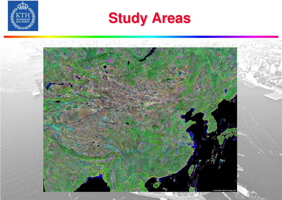
10 Study Areas
11 Study Areas Source: Taubenböck et al.,, Monitoring urbanization in mega cities from space. Remote Sensing of Environment 117 (2012)

12 Data Description Name Country Population Sattelite Sattelite (2011) imagery (old) imagery (new) Beijing China Delhi India Dhaka Bangladesh LA USA London UK 12, Mexico City Mexico Moscow Russia NYC USA Sao Paulo Brazil Shanghai China Tokyo Japan

13 Data Description Landsat MSS, TM and ETM images from 1970s to 2010 HJ-1B images from 2010

14 ESA Data ENVISAT ASAR archives ERS-1/2 archives

15 TPM Data TerraSAR-X/TanDEM-X data RADARSAR-2 Polarimetric SAR data

16 Methodology: Data Fusion FUSION SAR ENVISAT ASAR OPTICAL HJ-1B 16

17 Methodology: KTH-SEG Preprocessing Segmentation Optical data Coregistration Parameter selection Growing off edges Mutual merging Threshold merging SAR data Speckle filtering Edge detection Growing on edges Min size merging Classification Sample selection - > SVM - Training Land cover/use map Quality Assesment SVM- Prediction

18 Methodology: KTH-SEG (a) Grow off edges (b) Grow on edges (c) Mutual merging (d) Threshold merging (e) Min size merging Ban, Y. and A. Jacob, Object-based Fusion of Multitemporal Multi-angle ENVISAT ASAR and HJ-1 Multispectral Data for Urban Land-Cover Mapping. IEEE Transaction on GeoScience and Remote Sensing.

19 Methodology: Image Classification Niu, X., and Y. Ban Multitemporal RADARSAT-2 Polarimetric SAR Data for Urban Land Cover Classification using Object-based Support Vector Machine and Rule-based Approach, International Journal of Remote Sensing, 34(1):1-26. Niu X. and Y. Ban, 2013, Multitemporal Polarimetric RADARSAT-2 SAR Data for Urban Land Cover Mapping Through a Dictionary-based and a Rule-based Model Selection in a Contextual SEM Algorithm. Canadian Journal of Remote Sensing. Hu, H. and Y. Ban Multitemporal RADARSAT-2 Ultra-Fine-Beam SAR Data for Urban Land Cover Classification. Canadian Journal of Remote Sensing, 38(01): 1-11, /m

20 Methodology: Change Detection Ban, Y. and O. A. Yousif, Multitemporal Spaceborne SAR Data for Urban Change Detection in China. IEEE Journal on of Selected Topics in Applied Earth Observations and Remote Sensing, 5(4): Yousif, O. and Y. Ban, Improving Urban Change Detection from Multitemporal SAR Images Using PCA- NLM. IEEE Transaction on GeoScience and Remote Sensing.

21 Environmental Impact Assessment Maria Bobrinskaya, Remote Sensing for Analysis of Relationships between Land Cover and Land Surface Temperature in Ten Megacities. MSc thesis, Supervised by YifangBan, KTH Geoinformaitcs.
22 Environmental Impact Assessment Furberg, D. and Y. Ban, Satellite Monitoring of Urban Sprawl and Assessment of its Potential Environmental Impact in the GTA between 1985 and Environmental Management. Furberg, D. and Y. Ban, Satellite Monitoring of Urban Land Cover Change in Stockholm between 1986 and 2006 and Environmental Impact Assessment through the Use of Indicators. Earth Observation for Global Change 2011, Springer Book. Haas, J. and Y. Ban Remote Sensing of Bidecadal Urbanization and Its Impact on Ecosystem Service in the Yangtze River Delta, Proceedings, Dragon 2 Final Symposium.
23 Results & Discussion
24 Results & Discussion Shanghai Zhang, Q.,Ban, Y., Hu, Y.; Liu, J The Trajectories of Urban Land and Industrial Land in Shanghai over the Past 30 Years. Joint Urban Remote Sensing Event, , Shanghai. London London Source: Taubenböck et al.,, Monitoring urbanization in mega cities from space. Remote Sensing of Environment 117 (2012)
25 Results & Discussion Source: Taubenböck et al.,, Monitoring urbanization in mega cities from space. Remote Sensing of Environment 117 (2012)
26 LULC & LST HD built-up LD built-up Bare soil Agriculture Water Forest Beijing Change rate Area (sq.km) Area (sq.km) Urban High % Urban Low % Agriculture % Bare % Forest % Water %
27 1999 Beijing
28 Moscow 2010
29 Urbanization In China In China, urban areas increased from km2 in 1990s, to km2 in 2010s. Wang L et al, China s urban expansion from 1990 to 2010 determined with satellite remote sensing. Chinese Bulletin of Sciences.
30 Urbanization In China Wang L et al, China s urban expansion from 1990 to 2010 determined with satellite remote sensing. Chinese Bulletin of Sciences.
31 Urbanization on Air Temperature Shao, Q., C. Sun, J. Liu, Y. Ban, J. He and W. Kuang Impact of Urban Expansion on Meteorological Observation Data and Over-estimation to Regional Air Temperature in China. Acta Geographica Sinica (In Chinese).
32 Future Research GEO Global urban mapping and monitoring Very high resolution SAR &/or optical data fusion for urban analysis Novel methods for urban land cover mapping & change detection Quantitative representation of LULC-LST relationship Converting LULC change to pressure on biodiversity Wang L et al, China s urban expansion from 1990 to 2010 determined with satellite remote sensing. Chinese Bulletin of Sciences.
33 Acknowledgement This research is part of the Urbanization and Climate Project within the ESA-MOST Dragon 3 Program. Prof. Yifang Ban, KTH Royal Institute of Technology, Geoinformatics, European Lead PI Prof. Peng Gong, Tsinghua University & University of California, Berkeley, Chinese Lead PI Prof. Paolo Gamba, University of Pavia, Department of Electronics, Remote Sensing Group Prof. Peijun Du, Nanjing University, China Dr. Hannes Taubenböck, DLR Earth Observation Center German Remote Sensing Data Center Prof. Jing Li, Beijing Normal University
34 Acknowledgement This research is funded through research grants from the Swedish National Space Board, Formas and VR. Contributing researchers from KTH: Maria Bobrinskaya, MSc student Dr. Juan Deng, Visiting researcher Dorothy Furberg, PhD student Jan Haas, PhD student Hongtao Hu, PhD student Alexander Jacob, PhD student Dr. Xin Niu, Postdoctoral researcher Osama Yousif, PhD student
Geospatial intelligence and data fusion techniques for sustainable development problems
 Geospatial intelligence and data fusion techniques for sustainable development problems Nataliia Kussul 1,2, Andrii Shelestov 1,2,4, Ruslan Basarab 1,4, Sergii Skakun 1, Olga Kussul 2 and Mykola Lavreniuk
MULTI-SCALE ANALYSIS OF C-BAND SAR DATA FOR LAND USE MAPPING ISSUES
 MULTI-SCALE ANALYSIS OF C-BAND SAR DATA FOR LAND USE MAPPING ISSUES Tanja Riedel, Christian Thiel and Christiane Schmullius Friedrich-Schiller-University, Earth Observation, Jena, Germany; Tanja.Riedel@uni-jena.de
ROSA ESA - DLR Course 2009 RADAR REMOTE SENSING Day 4-5
 ROSA ESA - DLR Course 2009 RADAR REMOTE SENSING Day 4-5 Dr. Jan-Peter Mund, André Twele & Sandro Martinis German Remote Sensing Data Center (DFD) German Aerospace Center (DLR) RADAR REMOTE SENSING Introduction
Mega Cities. Introduction. Definition of Mega cities
 Mega Cities Introduction The purpose of this document is to propose an overview on what it is called mega-cities, and to try to give a comprehensive picture of what can be and will be the needs of these
Agricultural and Land Use: ENVISAT applications in Fujian Province
 Agricultural and Land Use: ENVISAT applications in Fujian Province Spatial Information Research Center, Fujian Province, Fuzhou University (http://www.sirc.) 2004-4-27 Main topics! About SIRC! The Chinese
A tiered reconnaissance approach toward flood monitoring utilising multi-source radar and optical data
 5 th International Workshop on Remote Sensing for Disaster Response A tiered reconnaissance approach toward flood monitoring utilising multi-source radar and optical data Anneley McMillan Dr. Beverley
Development of Method for LST (Land Surface Temperature) Detection Using Big Data of Landsat TM Images and AWS
 Detection Using Big Data of Landsat TM Images and AWS") Development of Method for LST (Land Surface Temperature) Detection Using Big Data of Landsat TM Images and AWS Myung-Hee Jo¹, Sung Jae Kim², Jin-Ho Lee 3 ¹ Department of Aeronautical Satellite System Engineering,
Development of Method for LST (Land Surface Temperature) Detection Using Big Data of Landsat TM Images and AWS Myung-Hee Jo¹, Sung Jae Kim², Jin-Ho Lee 3 ¹ Department of Aeronautical Satellite System Engineering,
Object-Oriented Approach of Information Extraction from High Resolution Satellite Imagery
 IOSR Journal of Computer Engineering (IOSR-JCE) e-issn: 2278-0661,p-ISSN: 2278-8727, Volume 17, Issue 3, Ver. IV (May Jun. 2015), PP 47-52 www.iosrjournals.org Object-Oriented Approach of Information Extraction
ANALYSIS OF FOREST CHANGE IN FIRE DAMAGE AREA USING SATELLITE IMAGES
 ANALYSIS OF FOREST CHANGE IN FIRE DAMAGE AREA USING SATELLITE IMAGES Joon Mook Kang, Professor Joon Kyu Park, Ph.D Min Gyu Kim, Ph.D._Candidate Dept of Civil Engineering, Chungnam National University 220
Example of an end-to-end operational. from heat waves
 Example of an end-to-end operational service in support to civil protection from heat waves Paolo Manunta pkt006-11-1.0 1.0_WEBGIS Athens, 8 June 2007 OUTLINE Heat Island definition and causes Heat Island
Let s SAR: Mapping and monitoring of land cover change with ALOS/ALOS-2 L-band data
 Let s SAR: Mapping and monitoring of land cover change with ALOS/ALOS-2 L-band data Rajesh Bahadur THAPA, Masanobu SHIMADA, Takeshi MOTOHKA, Manabu WATANABE and Shinichi rajesh.thapa@jaxa.jp; thaparb@gmail.com
Asia-Pacific Environmental Innovation Strategy (APEIS)
") Asia-Pacific Environmental Innovation Strategy (APEIS) Integrated Environmental Monitoring IEM) Dust Storm Over-cultivation Desertification Urbanization Floods Deforestation Masataka WATANABE, National
Asia-Pacific Environmental Innovation Strategy (APEIS) Integrated Environmental Monitoring IEM) Dust Storm Over-cultivation Desertification Urbanization Floods Deforestation Masataka WATANABE, National
Generation of Cloud-free Imagery Using Landsat-8
 Generation of Cloud-free Imagery Using Landsat-8 Byeonghee Kim 1, Youkyung Han 2, Yonghyun Kim 3, Yongil Kim 4 Department of Civil and Environmental Engineering, Seoul National University (SNU), Seoul,
PETROBRAS Orbital Sea Surface Monitoring
 PETROBRAS Orbital Sea Surface Monitoring Performed by : Contingency Control - Exploration & Production Area Technical support: R&D Center Cristina Bentz PETROBRAS R&D Center Environment Assessment and
The Future of Geospatial Big Data Giovanni Marchisio, Ph.D., Director Product Development
 The Future of Geospatial Big Data Giovanni Marchisio, Ph.D., Director Product Development Nuclear Power Plant, Doel, Belgium December 10, 2011 WorldView-2 Why Geospatial Big Data? We Are the Innovators
A remote sensing instrument collects information about an object or phenomenon within the
 Satellite Remote Sensing GE 4150- Natural Hazards Some slides taken from Ann Maclean: Introduction to Digital Image Processing Remote Sensing the art, science, and technology of obtaining reliable information
Geohazards: Minimizing Risk, Maximizing Awareness The Role of the Insurance Industry
 Geohazards: Minimizing Risk, Maximizing Awareness The Role of the Insurance Industry Prof. Dr. Peter Hoeppe Head of Geo Risks Research Munich Re International Year of Planet Earth, Paris, 13 February 2008
163 ANALYSIS OF THE URBAN HEAT ISLAND EFFECT COMPARISON OF GROUND-BASED AND REMOTELY SENSED TEMPERATURE OBSERVATIONS
 ANALYSIS OF THE URBAN HEAT ISLAND EFFECT COMPARISON OF GROUND-BASED AND REMOTELY SENSED TEMPERATURE OBSERVATIONS Rita Pongrácz *, Judit Bartholy, Enikő Lelovics, Zsuzsanna Dezső Eötvös Loránd University,
National Aeronautics and Space Administration NASA & GREEN ROOF RESEARCH. Utilizing New Technologies to Update an Old Concept. www.nasa.
 National Aeronautics and Space Administration NASA & GREEN ROOF RESEARCH Utilizing New Technologies to Update an Old Concept www.nasa.gov NASA Utilizes New Technologies to Update an Old Concept NASA s
Research On The Classification Of High Resolution Image Based On Object-oriented And Class Rule
 Research On The Classification Of High Resolution Image Based On Object-oriented And Class Rule Li Chaokui a,b, Fang Wen a,b, Dong Xiaojiao a,b a National-Local Joint Engineering Laboratory of Geo-Spatial
Research on Soil Moisture and Evapotranspiration using Remote Sensing
 Research on Soil Moisture and Evapotranspiration using Remote Sensing Prof. dr. hab Katarzyna Dabrowska Zielinska Remote Sensing Center Institute of Geodesy and Cartography 00-950 Warszawa Jasna 2/4 Field
The use of Earth Observation technology to support the implementation of the Ramsar Convention
 Wetlands: water, life, and culture 8th Meeting of the Conference of the Contracting Parties to the Convention on Wetlands (Ramsar, Iran, 1971) Valencia, Spain, 18-26 November 2002 COP8 DOC. 35 Information
CURRICULUM VITAE. Weidong Li
 CURRICULUM VITAE Weidong Li Contact Department of Geography Center for Environmental Sciences and Engineering (CESE) University of Connecticut 215 Glenbrook Rd., Unit 4148 Storrs, CT 06269-4148 Phone:
Operational Space- Based Crop Mapping Protocols at AAFC A. Davidson, H. McNairn and T. Fisette.
 Operational Space- Based Crop Mapping Protocols at AAFC A. Davidson, H. McNairn and T. Fisette. Science & Technology Branch. Agriculture and Agri-Food Canada. 1. Introduction Space-Based Crop Mapping at
WATER BODY EXTRACTION FROM MULTI SPECTRAL IMAGE BY SPECTRAL PATTERN ANALYSIS
 WATER BODY EXTRACTION FROM MULTI SPECTRAL IMAGE BY SPECTRAL PATTERN ANALYSIS Nguyen Dinh Duong Department of Environmental Information Study and Analysis, Institute of Geography, 18 Hoang Quoc Viet Rd.,
Land Use/Land Cover Map of the Central Facility of ARM in the Southern Great Plains Site Using DOE s Multi-Spectral Thermal Imager Satellite Images
 Land Use/Land Cover Map of the Central Facility of ARM in the Southern Great Plains Site Using DOE s Multi-Spectral Thermal Imager Satellite Images S. E. Báez Cazull Pre-Service Teacher Program University
Developments toward a European Land Monitoring Framework. Geoff Smith. Seminar 2 nd December, 2015 Department of Geography, University of Cambridge
 Developments toward a European Land Monitoring Framework Geoff Smith Specto Natura Limited Enable clients to deliver useful, accurate and reliable environmental information from EO. Positioned at the interface
An Assessment of the Effectiveness of Segmentation Methods on Classification Performance
 An Assessment of the Effectiveness of Segmentation Methods on Classification Performance Merve Yildiz 1, Taskin Kavzoglu 2, Ismail Colkesen 3, Emrehan K. Sahin Gebze Institute of Technology, Department
Multiscale Object-Based Classification of Satellite Images Merging Multispectral Information with Panchromatic Textural Features
 Remote Sensing and Geoinformation Lena Halounová, Editor not only for Scientific Cooperation EARSeL, 2011 Multiscale Object-Based Classification of Satellite Images Merging Multispectral Information with
COASTAL WIND ANALYSIS BASED ON ACTIVE RADAR IN QINGDAO FOR OLYMPIC SAILING EVENT
 COASTAL WIND ANALYSIS BASED ON ACTIVE RADAR IN QINGDAO FOR OLYMPIC SAILING EVENT XIAOMING LI a, b, * a Remote Sensing Technology Institute, German Aerospace Center (DLR), Oberpfaffenhofen, 82234, Germany
Remote Sensing Satellite Information Sheets Geophysical Institute University of Alaska Fairbanks
 Remote Sensing Satellite Information Sheets Geophysical Institute University of Alaska Fairbanks ASTER Advanced Spaceborne Thermal Emission and Reflection Radiometer AVHRR Advanced Very High Resolution
MODERN FOR CHINA. Multipurpose Market Forestry. based. Alfred Pitterle. Alfred Pitterle, Institute of Silviculture Walter Mayer, PROGIS Austria
 MODERN LAND Ecological MANAGEMENT and Socio-Cultural SYSTEM based FOR CHINA Multipurpose Market Forestry Universität für Bodenkultur Wien Department für Wald- und Bodenwissenschaften Alfred Pitterle, Institute
RESOLUTION MERGE OF 1:35.000 SCALE AERIAL PHOTOGRAPHS WITH LANDSAT 7 ETM IMAGERY
 RESOLUTION MERGE OF 1:35.000 SCALE AERIAL PHOTOGRAPHS WITH LANDSAT 7 ETM IMAGERY M. Erdogan, H.H. Maras, A. Yilmaz, Ö.T. Özerbil General Command of Mapping 06100 Dikimevi, Ankara, TURKEY - (mustafa.erdogan;
Global environmental information Examples of EIS Data sets and applications
 METIER Graduate Training Course n 2 Montpellier - february 2007 Information Management in Environmental Sciences Global environmental information Examples of EIS Data sets and applications Global datasets
China Earth Observation
 China High-resolution Earth Observation China Earth Observation System (CHEOS) and its Lastest Development The Earth Observation System and Data Center, CNSA 2014-2 Outlines 1 Introduction 2 The composition
Evaluation of Wildfire Duration Time Over Asia using MTSAT and MODIS
 Evaluation of Wildfire Duration Time Over Asia using MTSAT and MODIS Wataru Takeuchi * and Yusuke Matsumura Institute of Industrial Science, University of Tokyo, Japan Ce-504, 6-1, Komaba 4-chome, Meguro,
Automatic Change Detection in Very High Resolution Images with Pulse-Coupled Neural Networks
 1 Automatic Change Detection in Very High Resolution Images with Pulse-Coupled Neural Networks Fabio Pacifici, Student Member, IEEE, and Fabio Del Frate, Member, IEEE Abstract A novel approach based on
Global Real Estate Outlook
 Global Real Estate Outlook August 2014 The Hierarchy of Economic Performance, 2014-2015 China Indonesia India Poland South Korea Turkey Australia Mexico United Kingdom Sweden United States Canada South
Automatic land-cover map production of agricultural areas using supervised classification of SPOT4(Take5) and Landsat-8 image time series.
 and Landsat-8 image time series.") Automatic land-cover map production of agricultural areas using supervised classification of SPOT4(Take5) and Landsat-8 image time series. Jordi Inglada 2014/11/18 SPOT4/Take5 User Workshop 2014/11/18
Automatic land-cover map production of agricultural areas using supervised classification of SPOT4(Take5) and Landsat-8 image time series. Jordi Inglada 2014/11/18 SPOT4/Take5 User Workshop 2014/11/18
SMART CITIES And ENERGY. Finding new markets in a changing world
 SMART CITIES And ENERGY Finding new markets in a changing world 1 Today s Session Smart City introduction Growth Success Story - Smart Grid, Smart City Josh Gerber of SDG&E Growth Success Story - Blueprint
TERMS OF REFERENCE FOR THE RAPID EIA STUDY
 TERMS OF REFERENCE FOR THE RAPID EIA STUDY 1 SUMMARY OF EIA METHODOLOGY STEP I : SCOPING OF THE ASSESSMENT Own with prevailing regulatory setting and criteria Identification of Environmental Assessment
Remote Sensing and GIS Application In Change Detection Study In Urban Zone Using Multi Temporal Satellite
 Remote Sensing and GIS Application In Change Detection Study In Urban Zone Using Multi Temporal Satellite R.Manonmani, G.Mary Divya Suganya Institute of Remote Sensing, Anna University, Chennai 600 025
Earth remote sensing systems of middle and low resolution
 Earth remote sensing systems of middle and low resolution Serial on-line remote sensing satellites delivering data available on the world market V.I. Gershenzon (ScanEx R&D Center) In 1980, graduated from
Big Data Analytics for Detailed Urban Mapping. Mihai Datcu Daniela Molina Espinoza, Octavian Dumitru, Gottfried Schwarz
 Big Data Analytics for Detailed Urban Mapping Mihai Datcu Daniela Molina Espinoza, Octavian Dumitru, Gottfried Schwarz Big Data: The German EO Digital Library The data access Folie 2 Information vs. Data
Preliminary advances in Climate Risk Management in China Meteorological Administration
 Preliminary advances in Climate Risk Management in China Meteorological Administration Gao Ge Guayaquil,Ecuador, Oct.2011 Contents China Framework of Climate Service Experience in Climate/disaster risk
Selecting the appropriate band combination for an RGB image using Landsat imagery
 Selecting the appropriate band combination for an RGB image using Landsat imagery Ned Horning Version: 1.0 Creation Date: 2004-01-01 Revision Date: 2004-01-01 License: This document is licensed under a
NIGERIA EARTH OBSERVATION SATELLITE PROJECT
 NIGERIA EARTH OBSERVATION SATELLITE PROJECT By SIEDU ONAILO MOHAMMED, Ph.D. Director General National Space Research and Development Agency Presentation at the DMC and NovaSAR International Conference
Key contributions to GIScience and Geography (June 16, 2015)
") Key contributions to GIScience and Geography (June 16, 2015) Scholarship and Creative Accomplishments I am a broadly trained geographer with substantive interests in geographical information techniques.
Key contributions to GIScience and Geography (June 16, 2015) Scholarship and Creative Accomplishments I am a broadly trained geographer with substantive interests in geographical information techniques.
Modelling, Extraction and Description of Intrinsic Cues of High Resolution Satellite Images: Independent Component Analysis based approaches
 Modelling, Extraction and Description of Intrinsic Cues of High Resolution Satellite Images: Independent Component Analysis based approaches PhD Thesis by Payam Birjandi Director: Prof. Mihai Datcu Problematic
Prediction of Storm Surge using Space Data. Susanne Lehner German Aerospace Center
 Prediction of Storm Surge using Space Data Susanne Lehner German Aerospace Center Existing Crisis Information State of the Art of Satellite Crisis Information (ZKI) Mapping after the storm www.zki.de
The needs on big data management for Operational Geo-Info Services: Emergency Response, Maritime surveillance, Agriculture Management
 Copernicus Big-Data Workshop 2014, 13/14 March The needs on big data management for Operational Geo-Info Services: Emergency Response, Maritime surveillance, Agriculture Management Marco Corsi e-geos 1
1. Incredible India. Shade the map on the next page, to show India s relief. The correct shading is shown on the final page! Incredible India India
 1. Incredible India Shade the map on the next page, to show India s relief. The correct shading is shown on the final page! Incredible India India The DCSF supported Action plan for Geography is delivered
Methods for Monitoring Forest and Land Cover Changes and Unchanged Areas from Long Time Series
 Methods for Monitoring Forest and Land Cover Changes and Unchanged Areas from Long Time Series Project using historical satellite data from SACCESS (Swedish National Satellite Data Archive) for developing
SEMI-AUTOMATED CLOUD/SHADOW REMOVAL AND LAND COVER CHANGE DETECTION USING SATELLITE IMAGERY
 SEMI-AUTOMATED CLOUD/SHADOW REMOVAL AND LAND COVER CHANGE DETECTION USING SATELLITE IMAGERY A. K. Sah a, *, B. P. Sah a, K. Honji a, N. Kubo a, S. Senthil a a PASCO Corporation, 1-1-2 Higashiyama, Meguro-ku,
GLOBAL RETAIL TRENDS IMPLICATIONS FOR COMMERCIAL REAL ESTATE
 GLOBAL RETAIL TRENDS IMPLICATIONS FOR COMMERCIAL REAL ESTATE Q2 2013 GLOBAL ECONOMY 2013: Steady Relative to 2012 1.7% CANADA 1.6% U.S. 2.9% MEXICO 1.1% UK -0.5% FRANCE -1.8% SPAIN 0.5% GERMANY -2.0% ITALY
COASTAL MONITORING & OBSERVATIONS LESSON PLAN Do You Have Change?
 Coastal Change Analysis Lesson Plan COASTAL MONITORING & OBSERVATIONS LESSON PLAN Do You Have Change? NOS Topic Coastal Monitoring and Observations Theme Coastal Change Analysis Links to Overview Essays
MSc. - Environmental Modeling with GIS and Remote Sensing (with Prof.Dr. Dursun Şeker)
") A. Filiz SUNAR Professor of Remote Sensing Istanbul Technical University (ITU) Civil Engineering Faculty Geomatics Engineering Department Ayazaga Campus, Maslak 34469 Istanbul / TURKEY Office phone: (+90)
A. Filiz SUNAR Professor of Remote Sensing Istanbul Technical University (ITU) Civil Engineering Faculty Geomatics Engineering Department Ayazaga Campus, Maslak 34469 Istanbul / TURKEY Office phone: (+90)
Liberia Forest Mapping. World Bank January 2012
 Liberia Forest Mapping World Bank January 2012 Scope of presentation 1. Overview (5 min) 2. Service presentation (20 min) 3. Operational scenario (10min) 4. Service Utility Review (45 min) 5. Wrap-up and
The use of Satellite Remote Sensing for Offshore Environmental Benchmarking
 The use of Satellite Remote Sensing for Offshore Environmental Benchmarking Michael King Fugro NPA Limited Fugro NPA (Formerly Nigel Press Associates) World leading Satellite Remote Sensing & Geoscience
Climate of Illinois Narrative Jim Angel, state climatologist. Introduction. Climatic controls
 Climate of Illinois Narrative Jim Angel, state climatologist Introduction Illinois lies midway between the Continental Divide and the Atlantic Ocean, and the state's southern tip is 500 miles north of
ICSU/WMO World Data Center for Remote Sensing of the Atmosphere (WDC RSAT)
") ICSU/WMO World Data Center for Remote Sensing of the Atmosphere (WDC RSAT) Beate Hildenbrand (et al.) German Aerospace Center (DLR) GAW 2009, Geneva, 05 07 May 2009 http://wdc.dlr.de WDC RSAT overview
ICSU/WMO World Data Center for Remote Sensing of the Atmosphere (WDC RSAT) Beate Hildenbrand (et al.) German Aerospace Center (DLR) GAW 2009, Geneva, 05 07 May 2009 http://wdc.dlr.de WDC RSAT overview
The European Space Agency s Synthetic Aperture Radar Programme From Experiment to Service Provision
 The European Space Agency s Synthetic Aperture Radar Programme From Experiment to Service Provision Evert Attema ESA, Directorate of Earth Observation Programme! The idea of an independent European space
The Matsu Wheel: A Cloud-based Scanning Framework for Analyzing Large Volumes of Hyperspectral Data
 The Matsu Wheel: A Cloud-based Scanning Framework for Analyzing Large Volumes of Hyperspectral Data Maria Patterson, PhD Open Science Data Cloud Center for Data Intensive Science (CDIS) University of Chicago
EO Information Services in support of West Africa Coastal vulnerability - Service Utility Review -
 EO Information Services in support of West Africa Coastal vulnerability - Service Utility Review - Christian Hoffmann, GeoVille World Bank HQ, Washington DC Date : 24 February 2012 Content - Project background
Climate Change: A Local Focus on a Global Issue Newfoundland and Labrador Curriculum Links 2010-2011
 Climate Change: A Local Focus on a Global Issue Newfoundland and Labrador Curriculum Links 2010-2011 HEALTH Kindergarten: Grade 1: Grade 2: Know that litter can spoil the environment. Grade 3: Grade 4:
Meteorological Forecasting of DNI, clouds and aerosols
 Meteorological Forecasting of DNI, clouds and aerosols DNICast 1st End-User Workshop, Madrid, 2014-05-07 Heiner Körnich (SMHI), Jan Remund (Meteotest), Marion Schroedter-Homscheidt (DLR) Overview What
APPLICATION OF TERRA/ASTER DATA ON AGRICULTURE LAND MAPPING. Genya SAITO*, Naoki ISHITSUKA*, Yoneharu MATANO**, and Masatane KATO***
 APPLICATION OF TERRA/ASTER DATA ON AGRICULTURE LAND MAPPING Genya SAITO*, Naoki ISHITSUKA*, Yoneharu MATANO**, and Masatane KATO*** *National Institute for Agro-Environmental Sciences 3-1-3 Kannondai Tsukuba
China s Global Land Cover Mapping at 30 M Resolution
 Geospatial World Forum 2015 China s Global Land Cover Mapping at 30 M Resolution Jun Chen1,2 1 National Geomatics Center, 2ISPRS Lisbon, Portugal, May 28,2015 GlobeLand30 Video Contents Introduction Introduction
Universidad Nacional de Rosario Facultad de Ciencias Exactas, Ingeniería y Agrimensura Centro de Sensores Remotos CONICET CONAE NASA
 Monitoring Urban Night-Time Lights Related to Economic Activity (Gross Domestic Product), Urban Heat Island (UHI) and Fires detection in the Paraná Flooding Valley - Argentina using the Observatory SAC-
From Whitehall to orbit and back again: using space in government
 From Whitehall to orbit and back again: using space in government 18 th June 2014 Bristol 25 th June 2014 Liverpool 3 rd July 2014 -Newcastle Space for Smarter Government Programme (ssgp@sa.catapult.org.uk)
Mapping Land Cover Patterns of Gunma Prefecture, Japan, by Using Remote Sensing ABSTRACT
 1 Mapping Land Cover Patterns of Gunma Prefecture, Japan, by Using Remote Sensing Zhaohui Deng, Yohei Sato, Hua Jia Department of Biological and Environmental Engineering, Graduate School of Agricultural
SEMI-AUTOMATED CLASSIFICATION OF URBAN AREAS BY MEANS OF HIGH RESOLUTION RADAR DATA
 SEMI-AUTOMATED CLASSIFICATION OF URBAN AREAS BY MEANS OF HIGH RESOLUTION RADAR DATA T. Esch, A. Roth German Aerospace Center DLR, German Remote Sensing Data Center DFD, 82234 Wessling, Germany- (Thomas.Esch,
Outline. Multitemporal high-resolution image classification
 IGARSS-2011 Vancouver, Canada, July 24-29, 29, 2011 Multitemporal Region-Based Classification of High-Resolution Images by Markov Random Fields and Multiscale Segmentation Gabriele Moser Sebastiano B.
A KNOWLEDGE-BASED APPROACH FOR REDUCING CLOUD AND SHADOW ABSTRACT
 A KNOWLEDGE-BASED APPROACH FOR REDUCING CLOUD AND SHADOW Mingjun Song, Graduate Research Assistant Daniel L. Civco, Director Laboratory for Earth Resources Information Systems Department of Natural Resources
The Role of SPOT Satellite Images in Mapping Air Pollution Caused by Cement Factories
 The Role of SPOT Satellite Images in Mapping Air Pollution Caused by Cement Factories Dr. Farrag Ali FARRAG Assistant Prof. at Civil Engineering Dept. Faculty of Engineering Assiut University Assiut, Egypt.
climate science A SHORT GUIDE TO This is a short summary of a detailed discussion of climate change science.
 A SHORT GUIDE TO climate science This is a short summary of a detailed discussion of climate change science. For more information and to view the full report, visit royalsociety.org/policy/climate-change
Monitoring a Changing Environment with Synthetic Aperture Radar. Alaska Satellite Facility National Park Service Don Atwood
 Monitoring a Changing Environment with Synthetic Aperture Radar Don Atwood Alaska Satellite Facility 1 Entering the SAR Age 2 SAR Satellites RADARSAT-1 Launched 1995 by CSA 5.6 cm (C-Band) HH Polarization
Landsat Monitoring our Earth s Condition for over 40 years
 Landsat Monitoring our Earth s Condition for over 40 years Thomas Cecere Land Remote Sensing Program USGS ISPRS:Earth Observing Data and Tools for Health Studies Arlington, VA August 28, 2013 U.S. Department
Urban Ecosystem Analysis Atlanta Metro Area Calculating the Value of Nature
 August 2001 Urban Ecosystem Analysis Atlanta Metro Area Calculating the Value of Nature Report Contents 2 Project Overview and Major Findings 3 Regional Analysis 4 Local Analysis 6 Using Regional Data
The Future of Biogas in China
 The Future of Biogas in China Li Jingming Secretary-General, China Biogas Society Biogas World Berlin, Germany April 1, 2014 Outline Achievements on Biogas Development in China Why Biogas has been Chosen
Overview of NASA Applied Remote Sensing Training Program on Water Resources and Disaster Management
 Overview of NASA Applied Remote Sensing Training Program on Water Resources and Disaster Management ARSET Applied Remote SEnsing Training A project of NASA Applied Sciences Outline About ARSET ARSET Trainings
Satellite Snow Monitoring Activities Project CRYOLAND
 Satellite Snow Monitoring Activities Project CRYOLAND Background material for participants to the Workshop on European Snow Monitoring Perspectives, Darmstadt, 4-5 December 2012. CryoLand provides Snow,
mega- cities in Latin America & Infrastructure what its people think
 mega- cities & Infrastructure in Latin America what its people think the latin american reality For more information: Please contact us at: BIDinfraestructura@iadb.org with comments, questions, or for
Remote Sensing in Natural Resources Mapping
 Remote Sensing in Natural Resources Mapping NRS 516, Spring 2016 Overview of Remote Sensing in Natural Resources Mapping What is remote sensing? Why remote sensing? Examples of remote sensing in natural
Monitoring Soil Moisture from Space. Dr. Heather McNairn Science and Technology Branch Agriculture and Agri-Food Canada heather.mcnairn@agr.gc.
 Monitoring Soil Moisture from Space Dr. Heather McNairn Science and Technology Branch Agriculture and Agri-Food Canada heather.mcnairn@agr.gc.ca What is Remote Sensing? Scientists turn the raw data collected
Lessons from emerging economies. The view from overseas. Frazer MacDonald (BIS) and Sam Myers (FCO)
 and Sam Myers (FCO)") Lessons from emerging economies The view from overseas Frazer MacDonald (BIS) and Sam Myers (FCO) RAE PolicyNet Thursday 28 th June 2012 The UK Science and Innovation Network Mission Global influence To
Lessons from emerging economies The view from overseas Frazer MacDonald (BIS) and Sam Myers (FCO) RAE PolicyNet Thursday 28 th June 2012 The UK Science and Innovation Network Mission Global influence To
Hydrographic Surveying using High Resolution Satellite Images
 Hydrographic Surveying using High Resolution Satellite Images Petra PHILIPSON and Frida ANDERSSON, Sweden Key words: remote sensing, high resolution, hydrographic survey, depth estimation. SUMMARY The
THE INSTITUTE FOR ENVIRONMENTAL ANALYTICS
 THE INSTITUTE FOR ENVIRONMENTAL ANALYTICS Jon Blower Director of Science j.blower@the-iea.org 1 KEY FACTS 13m funding over initial 5-year period 2015 2020 (HEFCE Catalyst funding and founding partners)
Sentinel-1 Mission Overview
 Sentinel-1 Mission Overview Pierre Potin Sentinel-1 Mission Manager, ESA Advanced Course on Radar Polarimetry ESRIN, Frascati, 19 January 2011 Global Monitoring for Environment and Security GMES is established
Antenna Chetumal: Use of remote sensing data for environmental and civil security applications in Mexico. 22 nd to 24 th of April, 2008
 Antenna Chetumal: Use of remote sensing data for environmental and civil security applications in Mexico 22 nd to 24 th of April, 2008 Location: International Conference Center (ICC). Ciudad de México
Innovation and new land monitoring services for climate change, forests and agroforestry
 Innovation and new land monitoring services for climate change, forests and agroforestry Martin Herold Wageningen University Center for Geoinformation Current distribution of aboveground biomass Terrestrial
Trend in Land Use/Land Cover Change Detection by RS and GIS Application
 Trend in Land Use/Land Cover Change Detection by RS and GIS Application N. Nagarajan 1, S. Poongothai 2 1 Assistant Professor, 2 Professor Department of Civil Engineering, FEAT, Annamalai University, Tamilnadu,
Review for Introduction to Remote Sensing: Science Concepts and Technology
 Review for Introduction to Remote Sensing: Science Concepts and Technology Ann Johnson Associate Director ann@baremt.com Funded by National Science Foundation Advanced Technological Education program [DUE
Assessing Hurricane Katrina Damage to the Mississippi Gulf Coast Using IKONOS Imagery
 Assessing Hurricane Katrina Damage to the Mississippi Gulf Coast Using IKONOS Imagery Joseph P. Spruce Science Systems and Applications, Inc. John C., MS 39529 Rodney McKellip NASA Project Integration
The Urban Heat Island in Phoenix: Impacts on Neighborhoods
 The Urban Heat Island in Phoenix: Impacts on Neighborhoods Sharon L. Harlan Arizona State University April 25, 2012 Prepared for Mitigating the Urban Island Planning in the West Webinar hosted by Western
Climate Change. Lauma M. Jurkevics - DWR, Southern Region Senior Environmental Scientist
 Climate Change A n o t h e r F a c t o r i n M a n a g i n g S o u t h e r n C a l i f o r n i a s W a t e r R e s o u r c e s Lauma M. Jurkevics - DWR, Southern Region Senior Environmental Scientist USEPA-Region
sample The IPCC Special Report on Managing the Risks of Extreme Events and Disasters to Advance Climate Change Adaptation
 sample The IPCC Special Report on Managing the Risks of Extreme Events and Disasters to Advance Climate Change Adaptation A changing climate leads to changes in extreme weather and climate events 2 Impacts
Comparison of ALOS-PALSAR and TerraSAR-X Data in terms of Detecting Settlements First Results
 ALOS 2008 Symposium, 3-7 November Rhodes, Greece Comparison of ALOS-PALSAR and TerraSAR-X Data in terms of Detecting Settlements First Results Thomas Esch*, Achim Roth*, Michael Thiel, Michael Schmidt*,
DETECTING LANDUSE/LANDCOVER CHANGES ALONG THE RING ROAD IN PESHAWAR CITY USING SATELLITE REMOTE SENSING AND GIS TECHNIQUES
 ------------------------------------------------------------------------------------------------------------------------------- Full length Research Paper -------------------------------------------------------------------------------------------------------------------------------
Development of an Integrated Data Product for Hawaii Climate
 Development of an Integrated Data Product for Hawaii Climate Jan Hafner, Shang-Ping Xie (PI)(IPRC/SOEST U. of Hawaii) Yi-Leng Chen (Co-I) (Meteorology Dept. Univ. of Hawaii) contribution Georgette Holmes