Spatial Technology Supporting Collaboration in Endangered Species Recovery Efforts. Presenter: Martin Slimin New Zealand Department of Conservation
|
|
|
- Chester Little
- 8 years ago
- Views:
Transcription
1 Spatial Technology Supporting Collaboration in Endangered Species Recovery Efforts Presenter: Martin Slimin New Zealand Department of Conservation

2

3
4
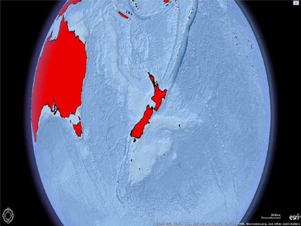
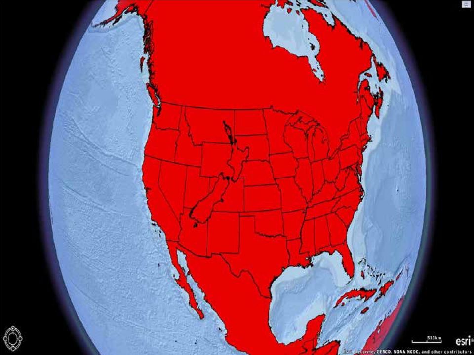
5 New Zealand Last major landmass to be colonised by humans as part of the Polynesian migration Isolation has led to a high level of endemism in its biodiversity (approx. 80%) Only 3 native terrestrial mammal species all bats one of which is extinct Arrivals of humans brought invasive predatory mammals (inc. rats, possums, mustelids, humans) Over 50% of New Zealand's native species are now extinct

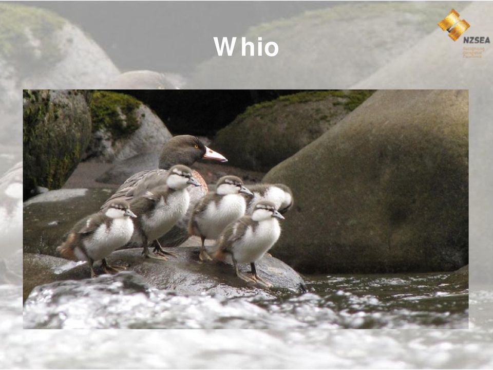
6 Whio Blue duck, kowhiowhio (Hymenolaimus malacorhynchos) Endemic to New Zealand 2500 left with IUCN classification of Endangered 1 of only 3 spp. Worldwide which lives year round on fast flowing rivers Ideally adapted to its high energy environment Main agent of decline is predation from mustelids in particular stoats Dependence on fast flowing rivers make it unsuitable for conservation in captivity or on predator free islands

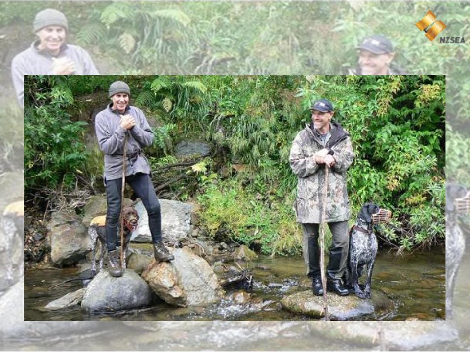
7 Whio
8 Whio Forever DOC no longer able to halt the decline in biodiversity on its own and is actively seeking partnerships with community, NGOs, business and tangata whenua (indigenous maori) Lead to partnership with Genesis Energy under the branding of Whio Forever Genesis recognised the value of whio as an indicator of the health of the river ecosystems on which it was dependant for hydro generation and as a taonga (treasure) to its staff and customers Not only did this enable Genesis to demonstrate social and environmental responsibility, but also make financial sense
 to its staff and customers Not only did this enable Genesis to demonstrate social and environmental responsibility, but also make")
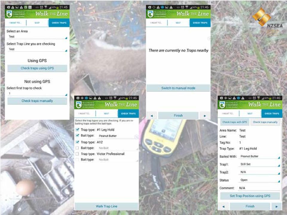
9 Whio Manager Application Whio Forever understood from the outset that having quality information on population and predator dynamics was key to species recovery Historically data was fractured with questionable accuracy and often anecdotal Led to the development of the Whio Manager app Whio is now the of New Zealand's endangered species with timely accurate and consistent picture of its managed population

10 Requirements Must be spatial Must be built in a way to minimise costs, to retain funds for predator control Must be openly accessible and free to all involved in whio conservation Must be able to utilise in filed data capture in a prolonged disconnected environment and be capable of accepting traditional paper records Must be intuitive to use and provide data of validated accuracy for research purposes

11 Data Supported Bird observation, survey, territory and recruitment data Bird capture, release and mortality events Nest inspection and egg lift data to support captive hatching programme Predator control management data Field worker tracking for auditing purposes

12 The Geeky Stuff Database ArcGIS SDE on SQL Server Served using ArcGIS Server / 10.3 Web application built on Latitude Geographics Geocortex Essentials and Viewer for Silverlight 1.10 ArcGIS for Windows Mobile 10.1 with custom trap check extension ArcGIS Runtime SDK for Android

13 Server Required a split between which aligns with the rest of infrastructure and 10.3 to support a combination of Windows Mobile and Android Dates, dates, dates aaaaaaaggghhhh!!!!!!

14 Geocortex Viewer wer=whio Enables a rich user experience with incorporated security, business logic and data validation, configurable without the need bespoke development Silverlight enabled a required richness not currently available through HTML5, but has limited browser / platform support

15 ArcGIS for Windows Mobile Largely configurable through Windows Mobile Project Centre Bespoke trap management extension easily incorporated and cheap as chips Windows Mobile devices flakey and unreliable, and managing a distributed fleet of devices Configurability and cheap development, enabled iterative development until application requirements were completely understood before committing to bespoke Android development

16 ArcGIS Runtime SDK for Android Bespoke developed native app Not cheap Improved user experience, device reliability / performance and self managing Only trapping at this stage

17 Spatial Intelligence Use of SQL geometries enable direct querying of SQL tables removing some limitations of ArcGIS server and rest services Form not map centric mobile apps with spatial brain increases field efficiency and business logic A spatial driven security model enables single central dataset nationally with permissions defined geographically not by attributes on a table

18
19
20

Kakapo Recovery Plan 1996-2005
 Kakapo Recovery Plan 1996-2005 Threatened Species Recovery Plan No.21 Kakapo Management Group Department of Conservation P.O. Box 10-420 Wellington New Zealand CONTENTS 1. Background 5 2. Distribution
BEECH MAST RESPONSE 2014
 BEECH MAST RESPONSE 2014 Heavy seeding in our native forests this year will drive high rodent and stoat numbers that prey on endangered birds. Battle for our Birds is a predator control response to protect
UNGIWG 14. Steve Maddison, George Davis, Latitude Geographics Friday, May 16 th 2014
 UNGIWG 14 Steve Maddison, George Davis, Latitude Geographics Friday, May 16 th 2014 GIS Challenges Today Spatial Application Infrastructure (SAI) The Geocortex Approach 2 1 Geocortex Essentials Web-based
Monitoring the Critically Endangered Bird Species (White-shouldered Ibis) in Western Siem Pang Important Bird and Biodiversity Area (IBA)
 in Western Siem Pang Important Bird and Biodiversity Area (IBA)") Monitoring the Critically Endangered Bird Species (White-shouldered Ibis) in Western Siem Pang Important Bird and Biodiversity Area (IBA) Transboundary Biodiversity Landscapes (TBLs) Knowledge Meeting
Monitoring the Critically Endangered Bird Species (White-shouldered Ibis) in Western Siem Pang Important Bird and Biodiversity Area (IBA) Transboundary Biodiversity Landscapes (TBLs) Knowledge Meeting
County of Los Angeles. Chief Information Office Preferred Technologies for Geographic Information Systems (GIS) September 2014
 September 2014") County of Los Angeles Chief Information Office Preferred Technologies for Geographic Information Systems (GIS) September 2014 CIO Preferred Technologies for GIS This document lists the preferred Geographic
County of Los Angeles Chief Information Office Preferred Technologies for Geographic Information Systems (GIS) September 2014 CIO Preferred Technologies for GIS This document lists the preferred Geographic
ArcGIS 10.1 Web Apps and APIs. John Hasthorpe & Kai Hübner
 ArcGIS 10.1 Web Apps and APIs John Hasthorpe & Kai Hübner Overview Options for leveraging ArcGIS Server using Esri s Web APIs Alternatives to the Web ADF application builder (Gone in 10.1) When and how
ArcGIS Web Mapping. Sam Berg, esri sberg@esri.com
 ArcGIS Web Mapping Sam Berg, esri sberg@esri.com Agenda ArcGIS and WebMaps The APIs ArcGIS for Flex Viewer ArcGIS for Silverlight Builder ArcGIS for Sharepoint ArcGIS Application Templates ArcGIS Runtime
ArcGIS Platform. An Integrated System. Portal
 Platform An Integrated System Portal An Integrated Web GIS Platform Knowledge Workers Executive Access Public Engagement Work Anywhere Enterprise Integration Providing Mapping, Analysis, Data Management,
Developing Fleet and Asset Tracking Solutions with Web Maps
 Developing Fleet and Asset Tracking Solutions with Web Maps Introduction Many organizations have mobile field staff that perform business processes away from the office which include sales, service, maintenance,
IBAT (Integrated Biodiversity Assessment Tool)
") IBAT (Integrated Biodiversity Assessment Tool) Martin Sneary, Manager Biodiversity Risk Assessment & Corporate Decision Support (based in Washington DC) Format of session Key sources of biodiversity information
IBAT (Integrated Biodiversity Assessment Tool) Martin Sneary, Manager Biodiversity Risk Assessment & Corporate Decision Support (based in Washington DC) Format of session Key sources of biodiversity information
SUMMER SCHOOL ON ADVANCES IN GIS
 SUMMER SCHOOL ON ADVANCES IN GIS Six Workshops Overview The workshop sequence at the UMD Center for Geospatial Information Science is designed to provide a comprehensive overview of current state-of-the-art
Off The Shelf Approach to ArcGIS Server & The Dashboard Approach to Gaining Insight to ArcGIS Server
 Off The Shelf Approach to ArcGIS Server & The Dashboard Approach to Gaining Insight to ArcGIS Server Robert Lenarcic Latitude Geographics rlenarcic@latitudegeo.co AGENDA Out of the box ArcGIS Server web-mapping
Mobile Solutions in ArcGIS. Justin Fan
 Mobile Solutions in ArcGIS Justin Fan Agenda Introducing Mobile GIS Esri Mobile GIS solutions Selecting the right Mobile GIS solution Resources Q&A Introducing Mobile GIS What is Mobile GIS? Extends the
ESRI Mobile GIS Solutions Overview. Shane Clarke ESRI
 ESRI Mobile GIS Solutions Overview Shane Clarke ESRI Agenda Overview of mobile GIS ESRI mobile GIS Solutions Selecting a mobile GIS solution Q & A 2 Mobile GIS Overview 3 What is mobile GIS? Extension
Intro to Web App Builder. Mark Scott, Solutions Engineer, Esri County Government Team mscott@esri.com
 Intro to Web App Builder Mark Scott, Solutions Engineer, Esri County Government Team mscott@esri.com The ArcGIS Platform enables Web GIS Enabling GIS Everywhere Desktop Web Device Simple Integrated Open
Required and Recommended Supporting Information for IUCN Red List Assessments
 Required and Recommended Supporting Information for IUCN Red List Assessments This is Annex 1 of the Rules of Procedure IUCN Red List Assessment Process 2013-2016 as approved by the IUCN SSC Steering Committee
BC Community Health Atlas An interactive mapping tool for population health data
 An interactive mapping tool for population health data Rita Zhang, MPH Epidemiologist Population & Public Health Program Provincial Health Services Authority Bob Nicholson, MA Business Analyst Strategic
Making Your Mobile Workforce More Efficient
 ArcGIS for Mobile Making Your Mobile Workforce More Efficient What Is Mobile GIS? Mobile geographic information system (GIS) technology extends GIS beyond the office and allows organizations to make accurate,
Portal for ArcGIS. Satish Sankaran Robert Kircher
 Portal for ArcGIS Satish Sankaran Robert Kircher ArcGIS A Complete GIS Data Management Planning & Analysis Field Mobility Operational Awareness Constituent Engagement End to End Integration Collect, Organize,
Small mammal monitoring report for Key Native Ecosystem sites. February 2016
 Small mammal monitoring report for Key Native Ecosystem sites February 2016 Small mammal monitoring report for Key Native Ecosystem sites February 2016 For more information, contact the Greater Wellington
CHAPTER 2: APPROACH AND METHODS APPROACH
 CHAPTER 2: APPROACH AND METHODS APPROACH Given Hawaii s biological uniqueness on a global scale, the Comprehensive Wildlife Conservation Strategy (CWCS) recognizes the importance of protecting all native
Facts on biodiversity
 Facts on biodiversity What is biodiversity? Biological diversity (biodiversity) comprises diversity of species and habitats as well as the genetic diversity within the individual species of fauna and flora.
ArcGIS. Server. A Complete and Integrated Server GIS
 ArcGIS Server A Complete and Integrated Server GIS ArcGIS Server A Complete and Integrated Server GIS ArcGIS Server enables you to distribute maps, models, and tools to others within your organization
Developing Business Intelligence and Data Visualization Applications with Web Maps
 Developing Business Intelligence and Data Visualization Applications with Web Maps Introduction Business Intelligence (BI) means different things to different organizations and users. BI often refers to
Spatially Enabling SharePoint
 www.environment.gov.au/ssd Spatially Enabling SharePoint Renee Bartolo Program Leader, Spatial Sciences and Data Integration Supervising Scientist - working to protect the environment from the impacts
Pest Toolkit. Pest proofing your land for a sustainable community. Help is at hand. Main topics: Pest Animal control. pest plant control
 Pest Toolkit Pg1 Main topics: RPMP Pest proofing your land for a sustainable community Pg2 Pg3 Pg4 Pest Animal control pest plant control weed control in retirement areas Pests are unwanted plants (invasive
Flora and Fauna. Section 4.9: Flora and Fauna
 Flora and Fauna Section 4.9: Flora and Fauna BACK OF TAB 81 4.9 Flora and Fauna Objectives Ensure protection of the significant natural environment in and around Sydney Airport Minimise the propagation
Marine Protected Areas Policy and Implementation Plan
 Marine Protected Areas Policy and Implementation Plan 1 Published by Department of Conservation and Ministry of Fisheries PO Box 10-420 Wellington, New Zealand www.biodiversity.govt.nz December 2005 Front
Developing Mapping Applications with ArcGIS Runtime SDK for Windows Mobile. Jay Chen Justin Colville
 Developing Mapping Applications with ArcGIS Runtime SDK for Windows Mobile Jay Chen Justin Colville Agenda What is ArcGIS Runtime for Windows Mobile Software Development Kit Application SDK - Introduction
Develop enterprise mobile applications with IBM Rational software
 Develop enterprise mobile applications with IBM software Providing comprehensive mobile application development and lifecycle management solutions Highlights Helps streamline and optimize the software
Longboat Dr Noeleen Smyth. Pitcairn 24 21 41 S, 128 18 58 W. UK Overseas Territories and Crown Dependencies: 2011 Biodiversity snapshot 87
 Longboat Dr Noeleen Smyth Pitcairn 24 21 41 S, 128 18 58 W 13 UK Overseas Territories and Crown Dependencies: 2011 Biodiversity snapshot 87 Pitcairn Author: Michele Christian, Division Manager Natural
Building Applications with the ArcGIS Runtime SDK for Windows Mobile
 Esri International User Conference San Diego, California Technical Workshops July 25th Building Applications with the ArcGIS Runtime SDK for Windows Mobile Jay Chen Justin Colville What we will cover today
Making Your Mobile Workforce More Efficient
 ArcGIS for Mobile Making Your Mobile Workforce More Efficient What Is Mobile GIS? Mobile geographic information system (GIS) technology extends GIS beyond the office and allows organizations to make accurate,
Note: Hands On workshops are Bring Your Own Laptop (BYOL), unless otherwise noted. Some workshops are Bring Your Own Mobile Device(BYOD).
, unless otherwise noted. Some workshops are Bring Your Own Mobile Device(BYOD).") 2015 MN GIS/LIS Consortium Pre Conference Workshops The Minnesota GIS/LIS Consortium is pleased to offer a diverse list of workshops on Wednesday, October 7th, 2015 at the DECC, Duluth, Minnesota Charting
2015 MN GIS/LIS Consortium Pre Conference Workshops The Minnesota GIS/LIS Consortium is pleased to offer a diverse list of workshops on Wednesday, October 7th, 2015 at the DECC, Duluth, Minnesota Charting
Progress in mammal pest control on New Zealand conservation lands
 Progress in mammal pest control on New Zealand conservation lands SCIENCE FOR CONSERVATION 127 Published by Department of Conservation P.O. Box 10-420 Wellington, New Zealand Science for Conservation presents
GCloud Application Development Service Definition. Application Development
 GCloud Service Definition GCloud Service Definition Contents 1.... 3 1.1. Overview... 3 1.2. Information Assurance... 6 1.3. Backup / Restore / Disaster Recovery... 6 1.4. On-boarding and Off-boarding
Considerations of Data Quality Assurance Framework. Sue Gordon Acting Chief Executive
 Considerations of Data Quality Assurance Framework Sue Gordon Acting Chief Executive Hangzhou Forum on UN GGIM, 24-25 May 2012 Content NZ general background Who is LINZ? NZ strategic context & data quality
3. Provide the capacity to analyse and report on priority business questions within the scope of the master datasets;
 Business Intelligence Policy Version Information A. Introduction Purpose Business Intelligence refers to the practice of connecting facts, objects, people and processes of interest to an organisation in
How To Manage Protected Areas
 ECHOES FROM BARILOCHE: Conclusions, Recommendations and Action Guidelines The Second Latin American Congress on National Parks and other Protected Areas aimed to asses, value and project the contribution
One solution, countless benefits
 www.exordia.co.za One solution, countless benefits exsam New generation strategic asset management PwC s exsam is built to empower the strategic management of diverse assets. 2 exsam One solution, countless
Current status and future directions of mobile GIS
 Current status and future directions of mobile GIS Markus U. Müller 1, David Medyckyj-Scott 2, Andrew Cowie 2, Tim-Hinnerk Heuer 2 and Pierre Roudier 2 1 Landcare Research Manaaki Whenua University of
A Decision Support System for pest control. Dave Morgan, Margaret Anderson, and Bruce Warburton
 A Decision Support System for pest control Dave Morgan, Margaret Anderson, and Bruce Warburton An internet-based system to assist in choosing the most appropriate pest control methods Presently possums,
PEST CONTROL Control vertebrate pests by shooting
 1 of 5 level: 3 credit: 6 planned review date: July 2006 sub-field: purpose: Pest Management This unit standard is for people involved with vertebrate pest control in rural environments. People credited
Building Applications with ArcGIS Runtime SDK for ios Part II. Eric Ito and Scott Sirowy
 Building Applications with ArcGIS Runtime SDK for ios Part II Eric Ito and Scott Sirowy Building Applications with ArcGIS Runtime SDK for ios Part II Eric Ito and Scott Sirowy 2011 Dev Summit Dodgeball
Chapter 1: Introduction to ArcGIS Server
 Chapter 1: Introduction to ArcGIS Server At a high level you can think of ArcGIS Server as software that helps you take your geographic information and make it available to others. This data can be distributed
Customizing ArcPad solutions
 Esri International User Conference San Diego, California Technical Workshops 25 July 2012 Customizing ArcPad solutions Marika Vertzonis, Gareth Walters, Stephen Quan Session Outline What can be customized?
Virginia Commonwealth University Rice Rivers Center Data Management Plan
 Virginia Commonwealth University Rice Rivers Center Data Management Plan Table of Contents Objectives... 2 VCU Rice Rivers Center Research Protocol... 2 VCU Rice Rivers Center Data Management Plan... 3
Introduction to Web AppBuilder for ArcGIS: JavaScript Apps Made Easy
 Introduction to Web AppBuilder for ArcGIS: JavaScript Apps Made Easy OKSCAUG Pamela Kersh September 22, 2015 The ArcGIS Platform enables Web GIS Enabling GIS Everywhere Desktop Web Device Simple Integrated
Enterprise and Standard Feature Compare
 www.blytheco.com Enterprise and Standard Feature Compare SQL Server 2008 Enterprise SQL Server 2008 Enterprise is a comprehensive data platform for running mission critical online transaction processing
Greater Wellington Regional Council
 Origen Technology Limited Case Study Greater Wellington Regional Council Integrated Environmental Management Database Version 1.0: March 2010 Presented by: Roy Simpson Case Study for Greater Wellington
PRODUCT BROCHURE SPATIAL ANALYZER. Powerful, traceable and easy-to-use metrology and analysis software
 PRODUCT BROCHURE SPATIAL ANALYZER Powerful, traceable and easy-to-use metrology and analysis software SPATIAL ANALYZER SpatialAnalyzer (SA) is a powerful, traceable and easy to use metrology and analysis
The Colorado River Delta
 The Colorado River Delta An Invaluable Resource for People and Wildlife the colorado river delta The Colorado River Delta and its waters support a rich and diverse treasure of plants and animals in an
Extending Enterprise GIS Into The Field with Mobile GIS Technology
 Extending Enterprise GIS Into The Field with Mobile GIS Technology A White Paper January 10, 2014 1525 Oregon Pike Suite 202 Lancaster, PA 17601-7300 Phone (717) 399-7007 Fax (717) 399-7015 www.geographit.com
Standard 5: Use a consistent data management framework in accordance with internal and partner organization data standards.
 Standard 5: Use a consistent data management framework in accordance with internal and partner organization data standards. [conceptualize]1 Rationale Establishing and using a consistent data management
The Marine Protected Area Inventory
 The Marine Protected Area Inventory New pictures Jordan Gass, Hugo Selbie and Charlie Wahle ESRI Ocean Forum November 6, 2013 Outline What is the MPA Inventory? Purpose Data How it s used Future directions
ArcGIS Viewer for Silverlight An Introduction
 Esri International User Conference San Diego, California Technical Workshops July 26, 2012 ArcGIS Viewer for Silverlight An Introduction Rich Zwaap Agenda Background Product overview Getting started and
Bespoke Cloud Software and Web Application Development
 G-Cloud: Special Cloud Services (Lot 4) Service Definition Bespoke Cloud Software and Web Application Development 17 th September 2013 Version 1 Contact: John Wiseman STCS Limited Gear House Saltmeadows
Developing Apps with the ArcGIS Runtime SDK for Android. Ben Ramseth Esri Inc. Instructor Technical Lead
 Developing Apps with the ArcGIS Runtime SDK for Android Ben Ramseth Esri Inc. Instructor Technical Lead Ben Ramseth Instructor Technical Lead Esri Inc USA, Charlotte, NC bramseth@esri.com @EsriMapNinja
Your Technology Partner Offshore and Onsite. Services Portfolio
 Services Portfolio OFFSHORE SOFTWARE DEVELOPMENT SERVICES Product Development for ISVs Custom Application Development for End-clients Application Development Application Maintenance & Support Application
100% NO CODING NO DEVELOPING IMMEDIATE BUSINESS -25% -70% UNLIMITED SCALABILITY DEVELOPMENT TIME SOFTWARE STABILITY
 100% UNLIMITED SCALABILITY TOTAL COST OF OWNERSHIP -25% +50% EFFICENCY INCREASE -70% +65% DEVELOPMENT TIME SOFTWARE STABILITY NO CODING NO DEVELOPING IMMEDIATE BUSINESS FlexyGo Rapid Application Builder
France s biodiversity at risk
 France s biodiversity at risk A call for action France hosts a large proportion of the species that are threatened at the European level, and has the important responsibility for protecting these species
Day 1 - Technology Introduction & Digital Asset Management
 SharePoint Developers Academy 2010 Course Syllabus Introduction Day 1 - Technology Introduction & Digital Asset Management 1. Kick Start a. Participant Introductions b. Course Overview c. Training Goals
CONNECTIVITY CONSERVATION AND ECOLOGICAL RESTORATION ADVENTURES IN A GLOBAL BIODIVERSITY HOTSPOT
 CONNECTIVITY CONSERVATION AND ECOLOGICAL RESTORATION ADVENTURES IN A GLOBAL BIODIVERSITY HOTSPOT A presentation addressing Aichi Targets: 5 By 2020, the rate of loss of all natural habitats, including
Spotfire and Tableau Positioning. Summary
 Licensed for distribution Summary Both TIBCO Spotfire and Tableau allow users of various skill levels to create attractive visualizations of data, displayed as charts, dashboards and other visual constructs.
Getting the best out of SharePoint
 Getting the best out of Training Unlike many other products, is not a collection of tools or a suite of applications; it is a platform providing a business solution that is 100% customisable. As a result,
IT Game Changers: How Cloud, Mobile, Social and Big Data are Redefining Your IT Environment
 cecmg Annual Meeting / March, 2015 IT Game Changers: How Cloud, Mobile, Social and Big Data are Redefining Your IT Environment Glenn Anderson IBM Lab Services and Training 2013 IBM Corporation 2 (c) Copyright
Spain s biodiversity at risk
 Spain s biodiversity at risk A call for action Spain hosts a large proportion of species that are threatened at the European level, and has an important responsibility for protecting these species within
SQL SERVER SELF-SERVICE BI WITH MICROSOFT EXCEL
 SQL SERVER SELF-SERVICE BI WITH MICROSOFT EXCEL JULY 2, 2015 SLIDE 1 Data Sources OVERVIEW OF AN ENTERPRISE BI SOLUTION Reporting and Analysis Data Cleansi ng Data Models JULY 2, 2015 SLIDE 2 Master Data
Pest Control Methods and Tips
 Waterway Technote Pest animals Contents Benefits of animal pest control 1 Common pest animal species found in riparian areas and control methods 2 Protecting plants from animal pests 3 Regional pest specific
Take Your Rocket U2 Apps Mobile with Rocket LegaSuite. Greg Mummah, Product Manager Rocket Software
 Take Your Rocket U2 Apps Mobile with Rocket LegaSuite Greg Mummah, Product Manager Rocket Software Greg Mummah Product Manager Managed application modernization team at municipal government software vendor
Key Attributes for Analytics in an IBM i environment
 Key Attributes for Analytics in an IBM i environment Companies worldwide invest millions of dollars in operational applications to improve the way they conduct business. While these systems provide significant
MAF Biosecurity New Zealand
 MAF Biosecurity New Zealand PEST MANAGEMENT NATIONAL PLAN OF ACTION February 2011 NEW ZEALAND. IT S OUR PLACE TO PROTECT. disclaimer While every effort has been made to ensure that information in this
ArcGIS 10.1 Geodatabase Administration. Gordon Sumerling & Christopher Brown
 ArcGIS 10.1 Geodatabase Administration Gordon Sumerling & Christopher Brown Key Improvements at ArcGIS 10.1 1. Easier Administration through Graphic Interfaces 2. Greater Seamless integration with Open
Protecting our Places INTRODUCING THE NATIONAL PRIORITIES FOR PROTECTING RARE AND THREATENED NATIVE BIODIVERSITY ON PRIVATE LAND
 Protecting our Places INTRODUCING THE NATIONAL PRIORITIES FOR PROTECTING RARE AND THREATENED NATIVE BIODIVERSITY ON PRIVATE LAND 1 Message from Ministers Private landowners have a crucial role to play
Data Center is the Foundation of Carrier ICT Transformation. The challenges of building a service driven data center
 P a g e 1 Data Center is the Foundation of Carrier ICT Transformation As we transform into the digital economy, the role of the Data Center has evolved from just being a container holding its individual
System requirements. Java SE Runtime Environment(JRE) 7 (32bit) Java SE Runtime Environment(JRE) 6 (64bit) Java SE Runtime Environment(JRE) 7 (64bit)
 7 (32bit) Java SE Runtime Environment(JRE) 6 (64bit) Java SE Runtime Environment(JRE) 7 (64bit)") Hitachi Solutions Geographical Information System Client Below conditions are system requirements for Hitachi Solutions Geographical Information System Client. 1/5 Hitachi Solutions Geographical Information
Hitachi Solutions Geographical Information System Client Below conditions are system requirements for Hitachi Solutions Geographical Information System Client. 1/5 Hitachi Solutions Geographical Information
Troubleshooting SQL Server Enterprise Geodatabase Performance Issues. Matthew Ziebarth and Ben Lin
 Troubleshooting SQL Server Enterprise Geodatabase Performance Issues Matthew Ziebarth and Ben Lin Troubleshooting SQL Server Enterprise Geodatabase Performance Issues AGENDA General configuration recommendations
How to Setup and Manage Spatial Assets with ArcGIS Online for a Mobile Workforce
 How to Setup and Manage Spatial Assets with ArcGIS Online for a Mobile Workforce W A U R I S A 2 0 1 4 Presented By Engineer Technician II Pierce County Public Works and Utilities Road Operations Division
Implementing and Maintaining Microsoft SQL Server 2008 Integration Services
 Course 6234A: Implementing and Maintaining Microsoft SQL Server 2008 Integration Services Length: 3 Days Language(s): English Audience(s): IT Professionals Level: 200 Technology: Microsoft SQL Server 2008
GIS Databases With focused on ArcSDE
 Linköpings universitet / IDA / Div. for human-centered systems GIS Databases With focused on ArcSDE Imad Abugessaisa g-imaab@ida.liu.se 20071004 1 GIS and SDBMS Geographical data is spatial data whose
Exploring GIS Integration Options for SAP BusinessObjects
 Exploring GIS Integration Options for SAP BusinessObjects Introduction In conversations with various individuals and businesses over the years, I hear a common question being raised: How do I integrate
ON THE RELOCATIO Division of
 New Jersey Department off Environmental Protection Division of Fish and Wildlife Mail l Code 501-03 PO Box 4200 / 501 East State St Trenton, NJ 08625-0420 POLICY ON THE RELOCATIO ON OF WILDLIFE As the
THOUGHT LEADERSHIP PAPER
 THOUGHT LEADERSHIP PAPER How to achieve competitive advantage with an enterprise mobile app In today s competitive business climate the pressure is on to make efficiency savings and improvements in customer
Esri Maps for Office, SharePoint & Dynamics CRM. Tony Howser Sentha Sivabalan Scott Ball
 Esri Maps for Office, SharePoint & Dynamics CRM Tony Howser Sentha Sivabalan Scott Ball Agenda Location Analytics Esri Maps for - SharePoint - Office - Dynamics CRM Pricing Road Map Q & A Evolving the
Cloud V/S On-Premise
 Business Solutions through Software Cloud V/S On-Premise 1 Introduction to SharePoint 2013: SharePoint 2013 comes with several features: Collaboration exists in every business. Everyday new tools and services
Welcome to the Force.com Developer Day
 Welcome to the Force.com Developer Day Sign up for a Developer Edition account at: http://developer.force.com/join Nicola Lalla nlalla@saleforce.com n_lalla nlalla26 Safe Harbor Safe harbor statement under
Microsoft Solutions and Applications
 Microsoft Solutions and Applications Portfolio Overview October 2008 Microsoft Solutions Group Norm Thomas Director of Business 10/7/2008 Development Microsoft Professional Services Industry Solutions
WORLD-CLASS FINANCIAL PERFORMANCE MANAGEMENT FOR GOVERNMENT & NON PROFIT ORGANISATIONS
 WORLD-CLASS FINANCIAL PERFORMANCE MANAGEMENT FOR GOVERNMENT & NON PROFIT ORGANISATIONS CONTENTS 2 SUMMARY 3 WHAT IS INFORMATION EDGE? 4 WHY WAS INFORMATION EDGE DEVELOPED? 4 A proven track record 5 WHAT
POLICY ON THE RELOCATION OF WILDLIFE
 State of New Jersey Department of Environmental Protection Mail Code 501-03 Division of Fish and Wildlife PO Box 420 / 501 East State Street Trenton, NJ 08625-0420 POLICY ON THE RELOCATION OF WILDLIFE
GIS: Transforming the Business. Presented by: Catherine Fitzgerald Manager, Information Services Municipality of Chatham-Kent
 GIS: Transforming the Business Presented by: Catherine Fitzgerald Manager, Information Services Municipality of Chatham-Kent Organization Overview Municipality of Chatham-Kent Single Tier Local Government
Comparison of HSESAP Revisions 2 and 3
 The structure of HSESAP Revision 3 is considerably modified from Revision 2. The following summary is provided to identify the comparative location of key information and any changes following the revision
Application Development at Congruent
 Application Services are the flagship of Congruent's service offerings. Our expertise in application development is signified by its completeness and excellence in delivery. Congruent covers the complete
YOUR MOBILE DEVELOPMENT ROUTE
 SELECTING YOUR MOBILE DEVELOPMENT ROUTE It s not an either/or choice, argues Ferry van der Vorst. One of the important decisions to be made when using mobile for learning and communications is your choice
G Cloud Services Definition Document. Property Management Service. Invigilatis Limited. Contents. Pages. Invigilatis Applications 1.
 G Cloud Services Definition Document Property Management Service Invigilatis Limited Contents Pages Invigilatis Applications 1 Modules 2 Business Intelligence 3 Service Definition 4-6 Service Levels Access
SCORPION TRACK.COM. Technologically Advanced Stolen Vehicle Tracking & Fleet Management System. Part of the Scorpion group
 SCORPION TRACK.COM Technologically Advanced Stolen Vehicle Tracking & Fleet Management System Award Winning Best Consumer Tracking System Best Security Product Best Fleet Management System Best British
Evaluating the use of 1080: Predators, poisons and silent forests. June 2011
 1 Evaluating the use of 1080: Predators, poisons and silent forests June 2011 2 Acknowledgements The Parliamentary Commissioner for the Environment would like to express her gratitude to those who assisted
The Conservation Data Centre: For the Greatest About the Least
 The Conservation Data Centre: For the Greatest About the Least Andrew P. Harcombe Resources Inventory Branch British Columbia Ministry of Environment, Lands and Parks Victoria, BC, V8W 9M1, Canada Andrew.Harcombe@gems2.gov.bc.ca
Guide to Automating Workflows Quickly and Easily
 Guide to Automating Workflows Quickly and Easily Part 3 Back to Contents 1 2012 Nintex USA LLC, All rights reserved. Errors and omissions excepted. Table of Contents Introduction... 3 Handling the Full
Comprehensive Guide to Moving a File Server to Google Drive
 Comprehensive Guide to Moving a File Server to Google Drive Brought to you by Google Gooru *To get notified of new updates to this Guide: Add us to your Circles on Google+ **For in-depth training on everything
Qualifying Microsoft Training for Software Assurance Training Vouchers (SATVs)
") Qualifying Microsoft Training for Software Assurance Training Vouchers (SATVs) Product Technology Product Number Title License Management, License Management 55071 Course 55071 : Microsoft Software Asset
Qualifying Microsoft Training for Software Assurance Training Vouchers (SATVs) Product Technology Product Number Title License Management, License Management 55071 Course 55071 : Microsoft Software Asset