NOAA Satellite Proving Ground Training and User Engagement
|
|
|
- Christian Boyd
- 8 years ago
- Views:
Transcription
1 NOAA Satellite Proving Ground Training and User Engagement Tony Mostek and Brian Motta (NWS) Wendy Abshire (COMET) Update September 2012
 Update")
2 VISIT Training Sessions in 2012 TROWAL Identification (winter weather satellite application) Morphed Total Precipitable Water Detection (MIMIC) Basic Satellite Principles Interpreting Satellite Signatures Satellite Interpretation of Orographic Clouds Utilizing GOES Imagery to Forecast Winter Storms Part 1, 2 CIMSS Regional Assimilation System Forecast Satellite Imagery in AWIPS Cyclogenesis: Analysis Using Geostationary Satellite Imagery POES and AVHRR Data in AWIPS Basic Satellite Interpretation in the Tropics UW Convective Initiation Products (GOES-based CI Algorithm) UW Nearcasting Product (for severe weather) Convective Downbursts GOES Imagery for Forecasting Severe Weather Water Vapor Imagery Analysis for Severe Weather Mesoscale Convective Vortices
 UW Nearcasting Product (for severe weather) Convective Downbursts GOES Imagery for Forecasting Severe Weather Water Vapor Imagery Analysis for Severe Weather Mesoscale Convective")
3 GOES Fog Low Stratus (FLS) Algorithm Products National Training is Ready Available on NWS Learning Center Coordinated with Chad, Amanda, and others in KC Including other regions Goal: Replace Old IR Difference Product on AWIPS Blazing AWIPS2 path with SEC and FOTE Sites

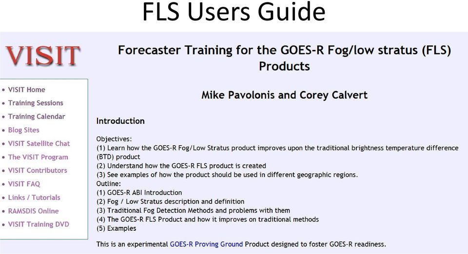
4 FLS Users Guide
5 GOES Synthetic Imagery Training CIRA has developed the following training sessions on synthetic satellite imagery from the NSSL WRF-ARW model: Synthetic Imagery in Forecasting Severe Weather CIRA is currently working on the development of an additional training session titled General Applications of Synthetic Satellite Imagery from the NSSL WRF-ARW Model. User Feedback from GOES Proving Ground, NWS Forecaster: In my 30 years in the NWS, these synthetic satellite images are in my list of most exciting/useful innovations to help with operational forecasting.

6 Training Modules from COMET that are Relevant to GOES and GOES-R + Atmospheric Dust (NEW) Creating Meteorological Products from Satellite Data Forecasting Dust Storms, Version 2 Satellite Meteorology: GOES Channel Selection, Version 2 (NEW) (Also in Spanish) See next slide GOES-R: Benefits of Next-Generation Environmental Monitoring (Now in Spanish too!) Introduction to Tropical Meteorology, 2 nd Ed: Tropical Remote Sensing Applications Chapter Monitoring the Climate System with Satellites (NEW) Multispectral Satellite Applications: Monitoring the Wildland Fire Cycle Multispectral Satellite Applications: RGB Products Explained Recognition and Impact of Vorticity Maxima and Minima in Satellite Imagery Remote Sensing Using Satellites, 2 nd Ed. (High School Audience, Coming Soon) Satellite Feature Identification: Atmospheric Rivers (NEW) Satellite Feature Identification: Blocking Patterns Satellite Feature Identification: Cyclogensis (NEW) Satellite Feature Identification: Deformation Zone Analysis Satellite Feature Identification: Deformation Zone Diagnosis Satellite Feature Identification: Deformation Zone Distribution Satellite Feature Identification: Ring of Fire Satellite Meteorology: Introduction to Using the GOES Sounder All available on demand at: 6

7 GOES Channel Selection, 2nd Ed. Most Popular GOES-related Module Includes examples and reviews imager channels and their use Improvements to GOES-N/O/P (13/14/15) 13.3 mm CO2 channel (GOES-14 & -15) Vis channel spectral response Radiometric performance Pixel geolocation Battery storage for shortened data outages shorter fall and spring eclipse periods ~1.5 hours long Available in English and Spanish 7
 Vis channel spectral response Radiometric performance Pixel")
8 COMET s Other New or Satellite Training Modules in Progress Recently published (and coming soon in Spanish): Suomi NPP: A New Generation of Environmental Monitoring Satellites Projects under development: GOES-R ABI: Satellite Imaging for the Next Generation (Coming soon) How Satellite Data inform NWP Nighttime Polar-Orbiting Applications (DNB) Satellite Feature ID: Three Dimensionality of Water Vapor And updates in FY13 to: Advanced Satellite Sounding: The Benefits of Hyperspectral Observation Multispectral Satellite Applications: Monitoring the Wildland Fire Cycle Imaging with VIIRS 3 rd, Ed. (will contain new imagery) 8

9 COMET s Other New or Satellite Training Modules in Progress Recently published (and coming soon in Spanish): Suomi NPP: A New Generation of Environmental Monitoring Satellites Projects under development: GOES-R ABI: Satellite Imaging for the Next Generation (Coming soon) Monitoring Atmospheric Composition with Satellites (Coming soon) How Satellite Data inform NWP Nighttime Polar-Orbiting Applications (DNB) Satellite Feature ID: Three Dimensionality of Water Vapor And updates in FY13 to: Advanced Satellite Sounding: The Benefits of Hyperspectral Observation Multispectral Satellite Applications: Monitoring the Wildland Fire Cycle Imaging with VIIRS 3 rd, Ed. (will contain new imagery) 9

10 Coming Soon WMO and EUMETSAT host RGB Imagery Workshop September US participants: NWS, NRL, SSEC, SPoRT NESDIS Blended Polar Precip. Rate available NWA Conference in Madison Eastern Region Virtual Workshop Oct 30 NPP Data for AWIPS Satellite Science Week Virtual March 2013

11 NPP Products

Brian Motta NOAA National Weather Service Office of Climate, Water, and Weather Services Forecast Decision Training Branch Boulder, Colorado
 Brian Motta NOAA National Weather Service Office of Climate, Water, and Weather Services Forecast Decision Training Branch Boulder, Colorado 1 1) Definitions: Outreach, Education, Training 2) GOES R Program
Ensuring the Preparedness of Users: NOAA Satellites GOES R, JPSS Laura K. Furgione
 Ensuring the Preparedness of Users: NOAA Satellites GOES R, JPSS Laura K. Furgione U.S. Permanent Representative with the WMO Deputy Director, NOAA s s National Weather Service WMO Executive Council 65
Joint Polar Satellite System (JPSS)
") Joint Polar Satellite System (JPSS) John Furgerson, User Liaison Joint Polar Satellite System National Environmental Satellite, Data, and Information Service National Oceanic and Atmospheric Administration
Joint Polar Satellite System (JPSS) John Furgerson, User Liaison Joint Polar Satellite System National Environmental Satellite, Data, and Information Service National Oceanic and Atmospheric Administration
Best practices for RGB compositing of multi-spectral imagery
 Best practices for RGB compositing of multi-spectral imagery User Service Division, EUMETSAT Introduction Until recently imagers on geostationary satellites were limited to 2-3 spectral channels, i.e.
NOAA/NWS Training to Prepare for GOES-R. (Submitted by NOAA) Summary and Purpose of Document
 Summary and Purpose of Document") WORLD METEOROLOGICAL ORGANIZATION COMMISSION FOR BASIC SYSTEMS OPEN PROGRAMME AREA GROUP ON INTEGRATED OBSERVING SYSTEMS INTER-PROGRAMME EXPERT TEAM ON SATELLITE UTILIZATION AND PRODUCTS SECOND SESSION
WORLD METEOROLOGICAL ORGANIZATION COMMISSION FOR BASIC SYSTEMS OPEN PROGRAMME AREA GROUP ON INTEGRATED OBSERVING SYSTEMS INTER-PROGRAMME EXPERT TEAM ON SATELLITE UTILIZATION AND PRODUCTS SECOND SESSION
GOES-R Product Training Document
 GOES-R Product Training Document for the GOES-R Proving Ground Aviation Weather Testbed 2012 Summer Experiment Chad Gravelle (UW-CIMSS / NWS PG) Amanda Terborg (UW-CIMSS / AWC) With contributions by: Bob
Denis Botambekov 1, Andrew Heidinger 2, Andi Walther 1, and Nick Bearson 1
 Denis Botambekov 1, Andrew Heidinger 2, Andi Walther 1, and Nick Bearson 1 1 - CIMSS / SSEC / University of Wisconsin Madison, WI, USA 2 NOAA / NESDIS / STAR @ University of Wisconsin Madison, WI, USA
NOAA Direct Broadcast Real-Time Network: Current Status and Plans for Delivering Sounder Data to DRARS
 NOAA Direct Broadcast Real-Time Network: Current Status and Plans for Delivering Sounder Data to DRARS Liam Gumley (NOAA DB Demonstration Technical Manager), Bruce Flynn, Heath Skarlupka, David Santek,
P1.21 GOES CLOUD DETECTION AT THE GLOBAL HYDROLOGY AND CLIMATE CENTER
 P1.21 GOES CLOUD DETECTION AT THE GLOBAL HYDROLOGY AND CLIMATE CENTER Gary J. Jedlovec* NASA/MSFC/Global Hydrology and Climate Center National Space Science and Technology Center Huntsville, Alabama and
Overview of Data Visualization Tools. (Submitted by the Secretariat) Summary and Purpose of Document
 Summary and Purpose of Document") WORLD METEOROLOGICAL ORGANIZATION COMMISSION FOR BASIC SYSTEMS OPEN PROGRAMME AREA GROUP ON INTEGRATED OBSERVING SYSTEMS EXPERT TEAM ON SATELLITE UTILIZATION AND PRODUCTS SCOPE-Nowcasting Ad-hoc Steering
WORLD METEOROLOGICAL ORGANIZATION COMMISSION FOR BASIC SYSTEMS OPEN PROGRAMME AREA GROUP ON INTEGRATED OBSERVING SYSTEMS EXPERT TEAM ON SATELLITE UTILIZATION AND PRODUCTS SCOPE-Nowcasting Ad-hoc Steering
The Benefits and Challenges in Global Meteorological Satellite Data Sharing
 The Benefits and Challenges in Global Meteorological Satellite Data Sharing Ninghai Sun and Fuzhong Weng Center for Satellite Applica0ons and Research Na0onal Oceanic and Atmospheric Administra0on Presented
NOAA and Its Role in Managing Satellite Data
 NOAA is dedicated to serving society by providing timely access to global environmental data from satellites and other sources to promote, protect, and enhance the Nation s economy, security, environment,
The Virtual Laboratory for Satellite Training and Data Utilization
 The Virtual Laboratory for Satellite Training and Data Utilization James F.W. Purdom Cooperative Institute for Research in the Atmosphere Colorado State University Fort Collins, Colorado purdom@cira.colostate.edu
How To Understand Cloud Properties From Satellite Imagery
 P1.70 NIGHTTIME RETRIEVAL OF CLOUD MICROPHYSICAL PROPERTIES FOR GOES-R Patrick W. Heck * Cooperative Institute for Meteorological Satellite Studies, University of Wisconsin-Madison Madison, Wisconsin P.
Overview of the IR channels and their applications
 Ján Kaňák Slovak Hydrometeorological Institute Jan.kanak@shmu.sk Overview of the IR channels and their applications EUMeTrain, 14 June 2011 Ján Kaňák, SHMÚ 1 Basics in satellite Infrared image interpretation
Nowcasting Thunderstorm Potential from Satellite
 Nowcasting Thunderstorm Potential from Satellite Robert M Rabin NOAA/National Severe Storms Laboratory Norman, OK USA Cooperative Institute for Meteorological Satellite Studies University of Wisconsin
McIDAS-V: An open source data analysis and visualization tool for multiand hyperspectral satellite data ITSC-XVI, Angra do Reis, Brazil, 7 May 2008
 McIDAS-V: An open source data analysis and visualization tool for multiand hyperspectral satellite data ITSC-XVI, Angra do Reis, Brazil, 7 May 2008 Tom Achtor, Tom Rink, Tom Whittaker, Dave Parker, Gail
Marcus A. Watkins Director of the Joint Agency Satellite Division, Science Mission Directorate, NASA HQ, Washington DC
 Marcus A. Watkins Director of the Joint Agency Satellite Division, Science Mission Directorate, NASA HQ, Washington DC Leads the Joint Agency Satellite Division (JASD) at NASA HQ in Washington, DC and
Advances in Cloud Imager Remote Sensing
 Advances in Cloud Imager Remote Sensing Andrew Heidinger NOAA/NESDIS/ORA Madison, Wisconsin With material from Mike Pavolonis, Robert Holz, Amato Evan and Fred Nagle STAR Science Symposium November 9,
Authors and Affiliations Kristopher Bedka 1, Cecilia Wang 1, Ryan Rogers 2, Larry Carey 2, Wayne Feltz 3, and Jan Kanak 4
 1. Title Slide Title: Analysis of the Co-Evolution of Total Lightning, Ground-Based Radar-Derived Fields, and GOES-14 1-Minute Super Rapid Scan Satellite Observations of Deep Convective Cloud Tops Authors
Options for filling the LEO-GEO AMV Coverage Gap Francis Warrick Met Office, UK
 AMV investigation Document NWPSAF-MO-TR- Version. // Options for filling the LEO-GEO AMV Coverage Gap Francis Warrick Met Office, UK Options for filling the LEO-GEO AMV Coverage Gap Doc ID : NWPSAF-MO-TR-
Outline of RGB Composite Imagery
 Outline of RGB Composite Imagery Data Processing Division, Data Processing Department Meteorological Satellite Center (MSC) JMA Akihiro SHIMIZU 29 September, 2014 Updated 6 July, 2015 1 Contents What s
GOES-R Advanced Baseline Imager (ABI) Algorithm Theoretical Basis Document For Low Cloud and Fog
 Algorithm Theoretical Basis Document For Low Cloud and Fog") NOAA NESDIS CENTER for SATELLITE APPLICATIONS and RESEARCH GOES-R Advanced Baseline Imager (ABI) Algorithm Theoretical Basis Document For Low Cloud and Fog Corey Calvert, UW/CIMSS Mike Pavolonis, NOAA/NESDIS/STAR
NOAA NESDIS CENTER for SATELLITE APPLICATIONS and RESEARCH GOES-R Advanced Baseline Imager (ABI) Algorithm Theoretical Basis Document For Low Cloud and Fog Corey Calvert, UW/CIMSS Mike Pavolonis, NOAA/NESDIS/STAR
Emergency Managers Weather Information Network (EMWIN) Service Transition 2016/2017
 Service Transition 2016/2017") EMWIN Stakeholder Meeting April 19, 2015 Emergency Managers Weather Information Network (EMWIN) Service Transition 2016/2017 Dissemination Systems Team, NWS Office of Dissemination Program Manager: Craig
EMWIN Stakeholder Meeting April 19, 2015 Emergency Managers Weather Information Network (EMWIN) Service Transition 2016/2017 Dissemination Systems Team, NWS Office of Dissemination Program Manager: Craig
Ground System as an Enterprise Software Architecture Considerations
 Ground System as an Enterprise Software Architecture Considerations Gerald Dittberner 1, Dennis Hansen 1, John Bristow 2, Satya Kalluri 3, Allan Weiner 1 Ground System Architectures Workshop (GSAW) Feb
McIDAS-V - A powerful data analysis and visualization tool for multi and hyperspectral environmental satellite data
 McIDAS-V - A powerful data analysis and visualization tool for multi and hyperspectral environmental satellite data Thomas Achtor, Thomas Rink, Thomas Whittaker, David Parker and David Santek Space Science
Comparison between current and future environmental satellite imagers on cloud classification using MODIS
 Remote Sensing of Environment 108 (2007) 311 326 www.elsevier.com/locate/rse Comparison between current and future environmental satellite imagers on cloud classification using MODIS Zhenglong Li a,, Jun
Clear Sky Radiance (CSR) Product from MTSAT-1R. UESAWA Daisaku* Abstract
 Product from MTSAT-1R. UESAWA Daisaku* Abstract") Clear Sky Radiance (CSR) Product from MTSAT-1R UESAWA Daisaku* Abstract The Meteorological Satellite Center (MSC) has developed a Clear Sky Radiance (CSR) product from MTSAT-1R and has been disseminating
Clear Sky Radiance (CSR) Product from MTSAT-1R UESAWA Daisaku* Abstract The Meteorological Satellite Center (MSC) has developed a Clear Sky Radiance (CSR) product from MTSAT-1R and has been disseminating
EUMETSAT Satellite Programmes
 EUMETSAT Satellite Programmes Nowcasting Applications Developing Countries Marianne König marianne.koenig@eumetsat.int WSN-12 Rio de Janeiro 06-10 August 2012 27 Member States & 4 Cooperating States Member
Studying cloud properties from space using sounder data: A preparatory study for INSAT-3D
 Studying cloud properties from space using sounder data: A preparatory study for INSAT-3D Munn V. Shukla and P. K. Thapliyal Atmospheric Sciences Division Atmospheric and Oceanic Sciences Group Space Applications
ADAGUC & PyTROLL. Maarten Plieger Ernst de Vreede. Application of polar orbiter products in weather forecasting Using open source tools and standards
 Application of polar orbiter products in weather forecasting Using open source tools and standards ADAGUC & PyTROLL Maarten Plieger Ernst de Vreede Royal Netherlands Meteorological Institute (KNMI) R&D
Suomi / NPP Mission Applications Workshop Meeting Summary
 Suomi / NPP Mission Applications Workshop Meeting Summary Westin City Center, Washington, DC June 21-22, 2012 Draft Report (updated March 12, 2013) I. Background The Suomi National Polar- orbiting Partnership
Geospatial Software Solutions for the Environment and Natural Resources
 Geospatial Software Solutions for the Environment and Natural Resources Manage and Preserve the Environment and its Natural Resources Our environment and the natural resources it provides play a growing
On the use of Synthetic Satellite Imagery to Evaluate Numerically Simulated Clouds
 On the use of Synthetic Satellite Imagery to Evaluate Numerically Simulated Clouds Lewis D. Grasso (1) Cooperative Institute for Research in the Atmosphere, Fort Collins, Colorado Don Hillger NOAA/NESDIS/STAR/RAMMB,
Nowcasting applications. putsay.m@met.hu Hungarian Meteorological Service
 Nowcasting applications Putsay Mária, M putsay.m@met.hu Hungarian Meteorological Service Principles of Satellite Meteorology, Online Course, 20 September 2011 Outlines Satellite images Derived products
USING THE GOES 3.9 µm SHORTWAVE INFRARED CHANNEL TO TRACK LOW-LEVEL CLOUD-DRIFT WINDS ABSTRACT
 USING THE GOES 3.9 µm SHORTWAVE INFRARED CHANNEL TO TRACK LOW-LEVEL CLOUD-DRIFT WINDS Jason P. Dunion 1 and Christopher S. Velden 2 1 NOAA/AOML/Hurricane Research Division, 2 UW/CIMSS ABSTRACT Low-level
Comparison of NOAA's Operational AVHRR Derived Cloud Amount to other Satellite Derived Cloud Climatologies.
 Comparison of NOAA's Operational AVHRR Derived Cloud Amount to other Satellite Derived Cloud Climatologies. Sarah M. Thomas University of Wisconsin, Cooperative Institute for Meteorological Satellite Studies
Active Fire Monitoring: Product Guide
 Active Fire Monitoring: Product Guide Doc.No. Issue : : EUM/TSS/MAN/15/801989 v1c EUMETSAT Eumetsat-Allee 1, D-64295 Darmstadt, Germany Tel: +49 6151 807-7 Fax: +49 6151 807 555 Date : 14 April 2015 http://www.eumetsat.int
Severe Weather & Hazards Related Research at CREST
 Severe Weather & Hazards Related Research at CREST (Lead Scientists) Z. Johnny Luo, Nir Krakauer, Shayesteh Mahani, Fabrice Papa, Marouane Temimi and Brian Vant Hull (NOAA Collaborators) Arnold Gruber,
http://www.isac.cnr.it/~ipwg/
 The CGMS International Precipitation Working Group: Experience and Perspectives Vincenzo Levizzani CNR-ISAC, Bologna, Italy and Arnold Gruber NOAA/NESDIS & Univ. Maryland, College Park, MD, USA http://www.isac.cnr.it/~ipwg/
THE STRATEGIC PLAN OF THE HYDROMETEOROLOGICAL PREDICTION CENTER
 THE STRATEGIC PLAN OF THE HYDROMETEOROLOGICAL PREDICTION CENTER FISCAL YEARS 2012 2016 INTRODUCTION Over the next ten years, the National Weather Service (NWS) of the National Oceanic and Atmospheric Administration
University of Wisconsin- Madison: Supporting Global Direct Broadcast Applications
 University of Wisconsin- Madison: Supporting Global Direct Broadcast Applications Kathleen Strabala, Liam Gumley, Allen Huang UW-Madison, Space Science and Engineering Center (SSEC) Lots of Others James
What is spectrum reallocation, and what does it have to do with weather satellites?
 FAQ ========= SPECTRUM REALLOCATION ========= What is spectrum reallocation, and what does it have to do with weather satellites? Because of increasing demand for wireless smartphones, tablets, and Wi-Fi
SECOND CIRCULAR. THE 19th INTERNATIONAL TOVS STUDY CONFERENCE
 SECOND CIRCULAR THE 19th INTERNATIONAL TOVS STUDY CONFERENCE Dear Colleague: In 8 months time the International TOVS Working Group (ITWG) will be meeting again (26 March 1 April 2014), this time at Jeju
University of Wisconsin SSEC Data Center. May 7, 2012
 University of Wisconsin SSEC Data Center May 7, 2012 SSEC Data Center SSEC Data Center - Activities Assist Satellite Operations Control Center and other agencies in satellite checkout and troubleshooting
GLOBAL FORUM London, October 24 & 25, 2012
 GLOBAL FORUM London, October 24 & 25, 2012-1 - Global Observations of Gas Flares Improving Global Observations of Gas Flares With Data From the Suomi NPP Visible Infrared Imaging Radiometer Suite (VIIRS)
CLASS Access. 2015 NOAA Satellite Conference, April 27 May 1, 2015
 NOAA s National Centers for Environmental Information CLASS Access 2015 NOAA Satellite Conference, April 27 May 1, 2015 NOAA Satellite and Information Service National Centers for Environmental Information
CLOUD CLASSIFICATION EXTRACTED FROM AVHRR AND GOES IMAGERY. M.Derrien, H.Le Gléau
 CLOUD CLASSIFICATION EXTRACTED FROM AVHRR AND GOES IMAGERY M.Derrien, H.Le Gléau Météo-France / SCEM / Centre de Météorologie Spatiale BP 147 22302 Lannion. France ABSTRACT We developed an automated pixel-scale
Synoptic assessment of AMV errors
 NWP SAF Satellite Application Facility for Numerical Weather Prediction Visiting Scientist mission report Document NWPSAF-MO-VS-038 Version 1.0 4 June 2009 Synoptic assessment of AMV errors Renato Galante
21st Education Symposium AMS 92nd New Orleans, LA 24 January 2012 With thanks to: Image Acknowledgements: ç The Leviathan, from friedpost.
 The Return of the Mini-Course: Online and Field-Based Applied Meteorology for Majors Paul Ruscher Department of Earth, Ocean and Atmospheric Science Florida State University Tallahassee Image Acknowledgements:
The STAR Algorithm Integration Team (AIT) Research to Operations Process
 Research to Operations Process") The STAR Algorithm Integration Team (AIT) Research to Operations Process Presented by Tom King 1 The Problem Scientists write code that needs to go to operations, but:» Many scientists often prefer interpreted
The STAR Algorithm Integration Team (AIT) Research to Operations Process Presented by Tom King 1 The Problem Scientists write code that needs to go to operations, but:» Many scientists often prefer interpreted
Satellite User Readiness Navigation portal: Status and Development. (Submitted by the Secretariat) Summary and Purpose of Document
 Summary and Purpose of Document") WORLD METEOROLOGICAL ORGANIZATION COMMISSION FOR BASIC SYSTEMS OPEN PROGRAMME AREA GROUP ON INTEGRATED OBSERVING SYSTEMS INTER-PROGRAMME EXPERT TEAM ON SATELLITE UTILIZATION AND PRODUCTS FIRST SESSION
WORLD METEOROLOGICAL ORGANIZATION COMMISSION FOR BASIC SYSTEMS OPEN PROGRAMME AREA GROUP ON INTEGRATED OBSERVING SYSTEMS INTER-PROGRAMME EXPERT TEAM ON SATELLITE UTILIZATION AND PRODUCTS FIRST SESSION
Satellite Remote Sensing of Volcanic Ash
 Marco Fulle www.stromboli.net Satellite Remote Sensing of Volcanic Ash Michael Pavolonis NOAA/NESDIS/STAR SCOPE Nowcasting 1 Meeting November 19 22, 2013 1 Outline Getty Images Volcanic ash satellite remote
Evaluation of VIIRS cloud top property climate data records and their potential improvement with CrIS
 Evaluation of VIIRS cloud top property climate data records and their potential improvement with CrIS Dr. Bryan A. Baum (PI) Space Science and Engineering Center University of Wisconsin-Madison Madison,
Climatology and Monitoring of Dust and Sand Storms in the Arabian Peninsula
 Climatology and Monitoring of Dust and Sand Storms in the Arabian Peninsula Mansour Almazroui Center of Excellence for Climate Change Research (CECCR) King Abdulaziz University, Jeddah, Saudi Arabia E-mail:
Environmental Monitoring of Lake Michigan Using CoastWatch Data and JAVA GIS
 Environmental Monitoring of Lake Michigan Using CoastWatch Data and JAVA GIS Page 1 of 12 Environmental Monitoring of Lake Michigan Using CoastWatch Data and JAVA GIS George A. Leshkevich and Songzhi Liu
TABLE OF CONTENTS EXECUTIVE SUMMARY...3
 Science & Technology Roadmap TABLE OF CONTENTS EXECUTIVE SUMMARY...3 1 INTRODUCTION...5 2 DRIVERS AND TRENDS FOR SOCD RESEARCH...5 3 CAPABILITIES...19 4 ROADMAPS AND LINKAGES...25 5 CURRENT RESEARCH...39
Training & Professional Development Opportunities in the NWS. April 9 2015 LeRoy Spayd Portfolio Manager NWS Office of the Chief Learning Officer
 Training & Professional Development Opportunities in the NWS April 9 2015 LeRoy Spayd Portfolio Manager NWS Office of the Chief Learning Officer Outline 1. Opportunities for all Employees - Individual
WV IMAGES. Christo Georgiev. NIMH, Bulgaria. Satellite Image Interpretation and Applications EUMeTrain Online Course, 10 30 June 2011
 WV IMAGES Satellite Image Interpretation and Applications EUMeTrain Online Course, 10 30 June 2011 Christo Georgiev NIMH, Bulgaria INTRODICTION The radiometer SEVIRI of Meteosat Second Generation (MSG)
Presented by Gary Davis, Director, Office of Systems Development NOAA/NESDIS/OSD. Fifty Years of Achievement
 NOAA s Environmental Satellite Program: Past, Present, and Future Presented by Gary Davis, Director, Office of Systems Development NOAA/NESDIS/OSD 1 Space-Based Remote Sensors Changed Way We See Our World
Environmental Data Services for Delaware:
 Environmental Data Services for Delaware: Serving Emergency Responders, Planners, and Researchers Network Delaware Day November 6, 2013 Overview Operational Data Services More than just research DEOS and
NOAA NESDIS CENTER for SATELLITE APPLICATIONS and RESEARCH ALGORITHM THEORETICAL BASIS DOCUMENT. ABI Cloud Mask
 NOAA NESDIS CENTER for SATELLITE APPLICATIONS and RESEARCH ALGORITHM THEORETICAL BASIS DOCUMENT ABI Cloud Mask Andrew Heidinger, NOAA/NESDIS/STAR William C. Straka III, SSEC/CIMSS Version 3.0 June 11,
Preliminary advances in Climate Risk Management in China Meteorological Administration
 Preliminary advances in Climate Risk Management in China Meteorological Administration Gao Ge Guayaquil,Ecuador, Oct.2011 Contents China Framework of Climate Service Experience in Climate/disaster risk
Hyperspectral Satellite Imaging Planning a Mission
 Hyperspectral Satellite Imaging Planning a Mission Victor Gardner University of Maryland 2007 AIAA Region 1 Mid-Atlantic Student Conference National Institute of Aerospace, Langley, VA Outline Objective
2A.4 COMET S INFLUENCE ON METEOROLOGICAL EDUCATION AND RESEARCH WITHIN UNIVERSITIES: THE SAINT LOUIS UNIVERSITY EXPERIENCE
 2A.4 COMET S INFLUENCE ON METEOROLOGICAL EDUCATION AND RESEARCH WITHIN UNIVERSITIES: THE SAINT LOUIS UNIVERSITY EXPERIENCE James T. Moore * and Charles E. Graves Saint Louis University St. Louis, Missouri
Satellite Snow Monitoring Activities Project CRYOLAND
 Satellite Snow Monitoring Activities Project CRYOLAND Background material for participants to the Workshop on European Snow Monitoring Perspectives, Darmstadt, 4-5 December 2012. CryoLand provides Snow,
Towards assimilating IASI satellite observations over cold surfaces - the cloud detection aspect
 Towards assimilating IASI satellite observations over cold surfaces - the cloud detection aspect Tuuli Perttula, FMI + Thanks to: Nadia Fourrié, Lydie Lavanant, Florence Rabier and Vincent Guidard, Météo
SAFNWC/MSG Cloud type/height. Application for fog/low cloud situations
 SAFNWC/MSG Cloud type/height. Application for fog/low cloud situations 22 September 2011 Hervé LE GLEAU, Marcel DERRIEN Centre de météorologie Spatiale. Lannion Météo-France 1 Fog or low level clouds?
Fog and low cloud ceilings in the northeastern US: climatology and dedicated field study
 Fog and low cloud ceilings in the northeastern US: climatology and dedicated field study Robert Tardif National Center for Atmospheric Research Research Applications Laboratory 1 Overview of project Objectives:
NOAA flight planning support and satellite aerosol and cloud retrieval validation during TORERO
 NOAA flight planning support and satellite aerosol and cloud retrieval validation during TORERO R. Bradley Pierce and Andrew Heidinger NOAA/NESDIS/STAR Allen Lenzen 1, Todd Schaack 1, Ryan Spackman 2,
NCDC s SATELLITE DATA, PRODUCTS, and SERVICES
 **** NCDC s SATELLITE DATA, PRODUCTS, and SERVICES Satellite data and derived products from NOAA s satellite systems are available through the National Climatic Data Center. The two primary systems are
A FOG DETECTING RGB COMPOSITE TECHNIQUE BASED ON THERMAL BANDS OF THE SEVIRI INSTRUMENT
 A FOG DETECTING RGB COMPOSITE TECHNIQUE BASED ON THERMAL BANDS OF THE SEVIRI INSTRUMENT 1 Humberto A. Barbosa, 2 Carlos S. Neto and 3 Leandro R. Macedo 1,2,3 Laboratory for Analyzing and Processing Satellite
Precipitation Remote Sensing
 Precipitation Remote Sensing Huade Guan Prepared for Remote Sensing class Earth & Environmental Science University of Texas at San Antonio November 14, 2005 Outline Background Remote sensing technique
Conference Report. 2008 NOAA SATELLITE DIRECT READOUT CONFERENCE: Transitioning into the Future
 Conference Report 2008 NOAA SATELLITE DIRECT READOUT CONFERENCE: Transitioning into the Future Prepared by the 2008 Direct Readout Conference Organizing Committee July 20, 2009 i ii 2008 NOAA Satellite
Review for Introduction to Remote Sensing: Science Concepts and Technology
 Review for Introduction to Remote Sensing: Science Concepts and Technology Ann Johnson Associate Director ann@baremt.com Funded by National Science Foundation Advanced Technological Education program [DUE
GOES-R AWG Cloud Team: ABI Cloud Height
 GOES-R AWG Cloud Team: ABI Cloud Height June 8, 2010 Presented By: Andrew Heidinger 1 1 NOAA/NESDIS/STAR 1 Outline Executive Summary Algorithm Description ADEB and IV&V Response Summary Requirements Specification
ECMWF Aerosol and Cloud Detection Software. User Guide. version 1.2 20/01/2015. Reima Eresmaa ECMWF
 ECMWF Aerosol and Cloud User Guide version 1.2 20/01/2015 Reima Eresmaa ECMWF This documentation was developed within the context of the EUMETSAT Satellite Application Facility on Numerical Weather Prediction
Building a Weather- Ready Nation. NWS Office of Dissemination Partners Meeting January 14, 2016 New Orleans, LA
 Building a Weather- Ready Nation NWS Office of Dissemination Partners Meeting January 14, 2016 New Orleans, LA Topics Chronology One-NWS Network Dissemination outages during severe weather events Responses
World Data Center for Remote Sensing of the Atmosphere, WDC-RSAT
 World Data Center for Remote Sensing of the Atmosphere, WDC-RSAT Michael Bittner http://wdc.dlr.de Folie 1 WDC-RSAT Mission Provide a portal for free and simplified access to atmosphere related satellite
NOWCASTING CONVECTIVE INITIATION AND THUNDERSTORM CHARACTERISTICS THROUGH THE USE OF REAL-TIME GEOSTATIONARY SATELLITE INFORMATION
 NOWCASTING CONVECTIVE INITIATION AND THUNDERSTORM CHARACTERISTICS THROUGH THE USE OF REAL-TIME GEOSTATIONARY SATELLITE INFORMATION K. M. Bedka 1 and J. M. Mecikalski 2 1 University of Wisconsin-Madison
SAMPLE MIDTERM QUESTIONS
 Geography 309 Sample MidTerm Questions Page 1 SAMPLE MIDTERM QUESTIONS Textbook Questions Chapter 1 Questions 4, 5, 6, Chapter 2 Questions 4, 7, 10 Chapter 4 Questions 8, 9 Chapter 10 Questions 1, 4, 7
GRWG Web Meeting Meeting Nov. 25, 2008 Postponed to Dec. 16, 2008
 GRWG Web Meeting Nov. 25, 2008 Postponed to Dec. 16, 2008 Agenda Tips and questions of Web Meeting (Uz) Highlights instead of demonstration or training Update on Hierarchical ATBD (Hewison) Action from
Meteorological Forecasting of DNI, clouds and aerosols
 Meteorological Forecasting of DNI, clouds and aerosols DNICast 1st End-User Workshop, Madrid, 2014-05-07 Heiner Körnich (SMHI), Jan Remund (Meteotest), Marion Schroedter-Homscheidt (DLR) Overview What
1. Title: Regional Satellite Cloud Composites from GOES
 1. Title: Regional Satellite Cloud Composites from GOES Good day! My name is Bernie Connell and I'll be presenting Regional Satellite Cloud Composites from GOES. This presentation reflects how one can
International coordination for continuity and interoperability: a CGMS perspective
 International coordination for continuity and interoperability: a CGMS perspective Peng Zhang, CGMS WG-III Co-Chair NSMC/CMA In Cooperation with Suzanne Hilding, CGMS WG-III Co-Chair OPPA/NESDIS/NOAA 1
STUDY ON FOREST FIRE DETECTION WITH SATELLITE DATA
 STUDY ON FOREST FIRE DETECTION WITH SATELLITE DATA Mathias Milz Avdelning Rymdteknik Institutionen för System- och rymdteknik (SRT) Luleå tekniska universitet Kiruna March 8, 2013 1 Introduction Countries
Implementation Guidance of Aeronautical Meteorological Forecaster Competency Standards
 Implementation Guidance of Aeronautical Meteorological Forecaster Competency Standards The following guidance is supplementary to the AMP competency Standards endorsed by Cg-16 in Geneva in May 2011. Implicit
ENVI THE PREMIER SOFTWARE FOR EXTRACTING INFORMATION FROM GEOSPATIAL IMAGERY.
 ENVI THE PREMIER SOFTWARE FOR EXTRACTING INFORMATION FROM GEOSPATIAL IMAGERY. ENVI Imagery Becomes Knowledge ENVI software uses proven scientific methods and automated processes to help you turn geospatial
Satellite Weather And Climate (SWAC) Satellite and cloud interpretation
 Satellite and cloud interpretation") Satellite Weather And Climate (SWAC) Satellite and cloud interpretation Vermont State Climatologist s Office University of Vermont Dr. Lesley-Ann Dupigny-Giroux Vermont State Climatologist ldupigny@uvm.edu
Satellite Weather And Climate (SWAC) Satellite and cloud interpretation Vermont State Climatologist s Office University of Vermont Dr. Lesley-Ann Dupigny-Giroux Vermont State Climatologist ldupigny@uvm.edu
Agenda Northeast Regional Operational Workshop XIV Albany, New York Tuesday, December 10, 2013
 Agenda Northeast Regional Operational Workshop XIV Albany, New York Tuesday, December 10, 2013 10:00 am Welcoming Remarks Raymond G. O Keefe, Meteorologist In Charge Warren R. Snyder, Science & Operations
University of Wisconsin SSEC Datacenter
 University of Wisconsin SSEC Datacenter 2015 McIDAS Users Group Meeting June 8, 2015 SSEC Data Center Mission Statement The SSEC Data Center mission is to create and maintain the facilities, human expertise
History of the NOAA Satellite Program
 History of the NOAA Satellite Program Gary Davis NOAA Satellite and Information Service 1335 East-West Highway, Silver Spring, Maryland, 20910, USA www.osd.noaa.gov Abstract For more than 50 years, NOAA
NOAA s National Weather Service Milwaukee/Sullivan
 NOAA s National Weather Service Milwaukee/Sullivan Marcia Cronce Meteorologist, Aviation Focal Point August 2014 weather.gov/milwaukee NWS Part of the Federal Government DOC - Department of Commerce NOAA
LATEST DEVELOPMENTS OF NEFODINA SOFTWARE IN THE FRAMEWORK OF HYDROLOGICAL SAF PROJECT
 LATEST DEVELOPMENTS OF NEFODINA SOFTWARE IN THE FRAMEWORK OF HYDROLOGICAL SAF PROJECT Davide Melfi 1, Francesco Zauli 1, Daniele Biron 1, Massimiliano Sist 1, Luigi De Leonibus 2 (1) Centro Nazionale di
How To Understand Space Weather
 GOES Data and Products in the Space Weather Prediction Center and National Geophysical Data Center Mary Shouldis Satellite Data Product Development Team Lead NGDC/University of Colorado/CIRES Putting Science
SYNERGISTIC USE OF IMAGER WINDOW OBSERVATIONS FOR CLOUD- CLEARING OF SOUNDER OBSERVATION FOR INSAT-3D
 SYNERGISTIC USE OF IMAGER WINDOW OBSERVATIONS FOR CLOUD- CLEARING OF SOUNDER OBSERVATION FOR INSAT-3D ABSTRACT: Jyotirmayee Satapathy*, P.K. Thapliyal, M.V. Shukla, C. M. Kishtawal Atmospheric and Oceanic
Real-time Ocean Forecasting Needs at NCEP National Weather Service
 Real-time Ocean Forecasting Needs at NCEP National Weather Service D.B. Rao NCEP Environmental Modeling Center December, 2005 HYCOM Annual Meeting, Miami, FL COMMERCE ENVIRONMENT STATE/LOCAL PLANNING HEALTH
RA II WIGOS Project Newsletter
 Vol. 4 No. 2, June 2013 RA II WIGOS Project Newsletter DEVELOPING SUPPORT FOR NATIONAL METEOROLOGICAL AND HYDROLOGICAL SERVICES IN SATELLITE DATA, PRODUCTS AND TRAINING Contents of this issue Page ² The
Clouds and the Energy Cycle
 August 1999 NF-207 The Earth Science Enterprise Series These articles discuss Earth's many dynamic processes and their interactions Clouds and the Energy Cycle he study of clouds, where they occur, and
A comparison of NOAA/AVHRR derived cloud amount with MODIS and surface observation
 A comparison of NOAA/AVHRR derived cloud amount with MODIS and surface observation LIU Jian YANG Xiaofeng and CUI Peng National Satellite Meteorological Center, CMA, CHINA outline 1. Introduction 2. Data