Towards a Planning portal for Sweden. Lars H. Backer Statistics Sweden
|
|
|
- Cecilia McKenzie
- 8 years ago
- Views:
Transcription
1 Towards a Planning portal for Sweden Lars H. Backer Statistics Sweden

2 A planning portal for Sweden A critical appraisal

3 Planning portal A portal It is not a portal production for market (the idea of an information supermarket. Products for a large amount of users) It is not a portal for production for a customer (to build an information system for a specific purpose, project) A portal for planning information This is a portal for customer in a specific field (as planning) To provide contact with data users To provide contact with data producers A portal for geographic information To develop an information system in the form of a series of qualified geographic layers.

4 The project? Conceptual and methodological development of a Geographical information system for national development (Statistics Sweden)

5 Work Packages DP1: Data users DP 2: Portal building DP 3: Case Study: Wind energy for municipal general plans DP 4: Data infrastructures DP 5: Data providers DP 6: Business modells

6 Another perspective The web pages The WMS & WMS (map services) Search engines (metadata)

7 Some critical issues The overriding project (objectives) No reflections on the overriding project and the portals role in this context We produce Information systems for sustainable development Data users / target group (DP 1) Method used by target group Data infrastructures (DP 4) Data & Data providers (DP 5) Business modell (DP 6) The Portal itself (DP 2)
 Data & Data providers (DP 5) Business modell (DP 6) The Portal")
8 1. Integrated Information systems We ar contributing to the building of integrated geographical information system for sustainable development.

9 1. GIS or CIS? GIS To support our efforts to pursue the ideal of sustainable development we need qualified models that describe the spatial and temporal interaction of humans and their environment Geography not Cartography Traditionally, geography as well as geographers has been viewed as the same as cartography and people who study place names. Although many geographers are trained in toponymy and cartography, this is not their main preoccupation. Geographers study the spatial and temporal distribution of phenomena, processes and feature as well as the interaction of humans and their environment.[4] As space and place affect a variety of topics such as economics, health, climate, plants and animals, geography is highly interdisciplinary. (Wikipedia 2007) Inspire & GeoDataRådet Are they building a catogrphic information system

10 2. The overriding project The nature and scope of the overriding project defines the structure and the components of the Information system

11 MES (Man- Environmental- System) (according to DPSIR) Impact (on natural systems) Pressure Impact (on artificial systems) Natural driving forces Natural Systems Artificial Systems Artificial Driving forces State (of natural systems) Response State (of artificial systems)
 Response State (of")
12 The environmentalists DPSIR (Eco-logical) Driving forces (from socio-economic system (and natural ecosystems)) Monitoring based on an integrated model of MES Pressures (on natural ecosystems) Impact (on natural ecosystems) State (on natural ecosystems) Spatial analysis based monitoring results Pressures (on natural ecosystems) Impact (on natural ecosystems) State (on natural ecosystems) Reporting based on spatial analysis Pressures (on natural ecosystems) Impact (on natural ecosystems) State (on natural ecosystems) Response (from socio-economic system (and natural ecosystems))
 Impact (on natural ecosystems) State (on natural ecosystems) Response (from socio-economic system (and natural")
13
14 The socio-economic DPSIR (Eco-nomical) Driving forces (From socio-economic system (and natural ecosystems)) Monitoring based on an integrated model of MES Pressures (on socio-economic system) Impact (on socio-economic system) State (of socio-economic system) Analysis based on qualified data (small area statistics) Pressures (on socio-economic system) Impact (on socio-economic system) State (of socio-economic system) Reporting based on qualified data (large area statistics) Pressures (on socio-economic system) Impact (on socio-economic system) State (of socio-economic system) Response (From socio-economic system (and natural ecosystems))
 Pressures (on socio-economic system) Impact (on socio-economic system) State (of socio-economic system) Response (From socio-economic system (and")
15
16 3. User needs Differerent user groups use fifferent parts of awailable Information systems

17 3. User needs (DP 1) We need to build efficient information systems The least possible information that gives the best possible result Depends on good knowledge of real user needs. The Deductive method Data supermarkets Production based on guesswork regarding user needs Suited for markets with many (rel. small) customers Results in heaps of unrelated components The Inductive method Information from experts to experts. Based on detailed understanding of users specific needs. Results in few ut well suited component, that are further developed in cooperation with users.
 customers Results in heaps of unrelated components The Inductive method Information from experts to experts.")
18 4. Methods
19 Långsamma processer (Strategier) Aktör/Pla Reference system Conceptual model Abstracted model Analys Synthesis: Plan Data capture Action (through legislation and funding) Observe T 1. T 2 Act T n... Time
 Observe T 1.")
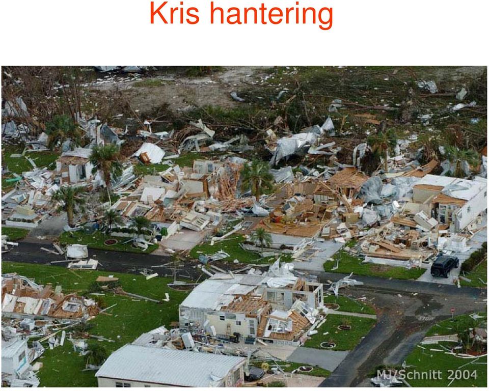
20 Kris hantering
21 Snabba processer (Taktik) Aktör/Pla Reference system Conceptual model Abstracted model Analys Synthesis: Plan Data capture Action (through legislation and funding) Observe T 1. T 2 Act Time
22 En Iterativ process Teorie / Praktik The Past Practical Assessment (Practical discourse) DEDUKTION Vision (changing) Theoretical Assessment (Theoretical discourse) INDUKTION The Future
23
24 5. Data & Data providers (DP 5)
25 High resolution data All analysis for both monitoring/reporting and programs/plans/projects for sustainable development require neutral harmonised, high resolution data for spatial analysis. We believe that statistical data used for analysis must preferably be point-based data or aggregated to the smallest possible system of irregular tessellations. Datasets should be suited to the scale of the project in question (See here the discussion on windows)
26 Hierarchial structure Frame:10mx10m Houses Frame: 100mx100m Urban Blocks Frame: 1000m x 1000m Urban Neighbourhoods Frame: 10 km Large Urban districts to small Urban system depicting object in the scale of min 10cm to max 1m. Collapsing point 10cm (use 10cm grids) depicting object in the scale of min 1m to max 10m Collapsing point 1m (use 1m grids) depicting object in the scale of min 10m to max 100m Collapsing point 10m (use 10m grids) depicting object in the scale of min 100m to max 1000m (1km) Collapsing point 100m (use 100m grids) The 1:100 Rule smaller (both grids and windows by powers of 10) 1m Grids for the 100m Window 10m Grids for the 1km Window 100m Grids for the 10km Window 1km Grids for the 100km Window 10km Grids for the 1000km Window 100km Grids for the 10000km Window and larger. (both by powers of 10) 10 5 Frame: 100 km Large Urban system to small national Region depicting object in the scale of min 1km to max 10km Collapsing point 1km (use 1km grids) 10 6 Frame: 1000 km International Region depicting object in the scale of min 1km to max 10km) Collapsing point 10km (use 10km grids)
27 Dag- och Natt- befolkningen på 100m rutor
28 Nattbefolkningen på 100m rutor
29 Dagbefolkningen på 100m rutor
30 Attribut information
31 5. Data infrastructures
32 Data infrastructures (Dp 4) Problems with access to the results of the data infrastructure group Inspire seems to be building an infrastructure for cartographic information. Especially problems with metadata, catalogues do not seem to fit statistical and other information.
33 8. Case Studies (DP 3)
34 Case studies One subproject dedicated to a case study to supply the user community with information to plan windmills for energy production. Information for a municipal general study for the implementation of windmill estates. Future studies planned for: Regional development planning Municipal general plans Detail plans or larger urban projects
35 7. Business modell (DP 6)
36 Business modells Data offered Services offered Agreements between parties Costs Confidentiality Problems related to international agreements (f.inst The Århus convention) Other.
37 9. The Portal (DP 2)
38 Two kinds of Portals Portals according to the data supermarket concept Here data providers publish their metadata and give access to WMS /WFS services according to situation..(one general portal for the general (nonspecialist?) user No contact with real user needs Portals according to the information system model Here real user needs are in focus Data provided according to professional knowledge on the kind of information system the customer uses. (A specialised series of subportals for specialist users) We seem to be building accorsding to a hybrid concept
39 Thank you!
Enabling embedded maps
 Enabling embedded maps Case: National geoportal of Finland Antti Rainio National Land Survey of Finland Trends: Web Services, Mapping Mashup, Open Source, Open Data Decentralised data s Service interfaces
Architectural Heritage Information System (S.I.P.A.)
") PECSRL 2008 - LANDSCAPES, IDENTITIES AND DEVELOPMENT Óbidos, Portugal, 1-5 September Architectural Heritage Information System (S.I.P.A.) Luís Marques (Geographer) Housing and Urban Rehabilitation Institute
PECSRL 2008 - LANDSCAPES, IDENTITIES AND DEVELOPMENT Óbidos, Portugal, 1-5 September Architectural Heritage Information System (S.I.P.A.) Luís Marques (Geographer) Housing and Urban Rehabilitation Institute
Distributed Data Management in Internet Map Services
 Distributed Data Management in Internet Map Services Experiences from Lounaispaikka Thematic Atlas Antti Vasanen Regional Council of Southwest Finland Lounaispaikka Lounaispaikka is a regional non-profit
A Statistical Spatial Framework to Inform Regional Statistics
 A Statistical Spatial Framework to Inform Regional Statistics Martin Brady & Gemma Van Halderen Australian Bureau of Statistics, Canberra, Australia Corresponding Author: m.brady@abs.gov.au Abstract Statisticians
THE SPATIAL DATA INFRASTRUCTURE OF SPAIN AS AN EXAMPLE OF SUCCESS IN EUROPE
 THE SPATIAL DATA INFRASTRUCTURE OF SPAIN AS AN EXAMPLE OF SUCCESS IN EUROPE Julio Mezcua-Rodríguez (jmezcua@fomento.es) Instituto Geográfico Nacional (National Geographic Institute). General Ibañez Ibero,
Statistical and Spatial Frameworks. Standards and Data Infrastructure
 Distr. GENERAL 01 May 2013 WP.11 ENGLISH ONLY UNITED NATIONS ECONOMIC COMMISSION FOR EUROPE CONFERENCE OF EUROPEAN STATISTICIANS EUROPEAN COMMISSION STATISTICAL OFFICE OF THE EUROPEAN UNION (EUROSTAT)
Inspired by new possibilities. Marie Haldorson Director, Statistics Sweden
 Inspired by new possibilities Marie Haldorson Director, Statistics Sweden The INSPIRE Directive The European INSPIRE Directive entered in force in May 2007 and will be fully implemented by 2020. An infrastructure
GEOGRAPHIC INFORMATION SYSTEMS
 GEOGRAPHIC INFORMATION SYSTEMS WHAT IS A GEOGRAPHIC INFORMATION SYSTEM? A geographic information system (GIS) is a computer-based tool for mapping and analyzing spatial data. GIS technology integrates
From Geoportal to Spatial Data Service Platform. Jani Kylmäaho National Land Survey of Finland Development Centre
 From Geoportal to Spatial Data Service Platform Jani Kylmäaho National Land Survey of Finland Development Centre 29.6.2012 Introduction National Land Survey of Finland - 1900 employees Development Centre
Development of a Dainish infrastructure for spatial information (DAISI) Brande-Lavridsen, Hanne; Jensen, Bent Hulegaard
 Brande-Lavridsen, Hanne; Jensen, Bent Hulegaard") Aalborg Universitet Development of a Dainish infrastructure for spatial information (DAISI) Brande-Lavridsen, Hanne; Jensen, Bent Hulegaard Published in: NORDGI : Nordic Geographic Information Publication
Aalborg Universitet Development of a Dainish infrastructure for spatial information (DAISI) Brande-Lavridsen, Hanne; Jensen, Bent Hulegaard Published in: NORDGI : Nordic Geographic Information Publication
Mapping Mashup/Data Integration Development Resources Teaching with Google Earth and Google Ocean Stone Lab August 13, 2010
 Mapping Mashup/Data Integration Development Resources Teaching with Google Earth and Google Ocean Stone Lab August 13, 2010 David Hart GIS Specialist University of Wisconsin Sea Grant Institute Virtual
DATA QUALITY AND SCALE IN CONTEXT OF EUROPEAN SPATIAL DATA HARMONISATION
 DATA QUALITY AND SCALE IN CONTEXT OF EUROPEAN SPATIAL DATA HARMONISATION Katalin Tóth, Vanda Nunes de Lima European Commission Joint Research Centre, Ispra, Italy ABSTRACT The proposal for the INSPIRE
MONITORING OF HABITATS AT THE LEVEL OF A NATURA 2000 SITE MOHANA MOBILE AND WEB APP. Francisco Gutierres 1. May of 2016
 MONITORING OF HABITATS AT THE LEVEL OF A NATURA 2000 SITE MOHANA MOBILE AND WEB APP Francisco Gutierres 1 May of 2016 1 Ph.D. in Physical Geography, Institute of Geography Spatial Planning of the University
National Inventory of Landscapes in Sweden
 Key messages Approaching the landscape perspective in monitoring experiences in the Swedish NILS program Johan Svensson, Future Forest Monitoring, 091112 Landscape level approaches are necessary to deal
Reading Questions. Lo and Yeung, 2007: 2 19. Schuurman, 2004: Chapter 1. 1. What distinguishes data from information? How are data represented?
 Reading Questions Week two Lo and Yeung, 2007: 2 19. Schuurman, 2004: Chapter 1. 1. What distinguishes data from information? How are data represented? 2. What sort of problems are GIS designed to solve?
A quick overview of geographic information systems (GIS) Uwe Deichmann, DECRG <udeichmann@worldbank.org>
 Uwe Deichmann, DECRG <udeichmann@worldbank.org>") A quick overview of geographic information systems (GIS) Uwe Deichmann, DECRG Why is GIS important? A very large share of all types of information has a spatial component ( 80
A quick overview of geographic information systems (GIS) Uwe Deichmann, DECRG Why is GIS important? A very large share of all types of information has a spatial component ( 80
Global Green MBA. MBA Program Overview
 Global Green MBA MBA Program Overview Israel is rated as one of the most advanced countries in the world for the management of water and renewable energy resources, and a leader in developing innovative
Geo-information in The Hague & National SDI hub PDOK
 Geo-information in The Hague & National SDI hub PDOK dr.ir. Friso Penninga senior advisor at Municipality of The Hague & tactical advisor at Geonovum Contents 1. Introduction 2. GI in The Hague a. Overview
The Use of Geographic Information Systems in Risk Assessment
 The Use of Geographic Information Systems in Risk Assessment With Specific Focus on the RiVAMP Methodology Presented by Nadine Brown August 27, 2012 Climate Studies Group Mona Climate Change Workshop Presentation
Advancement in Statistical Processes from Census 2005 to Census 2011
 Advancement in Statistical Processes from Census 2005 to Census 2011 Presented by: Mr. Ghanem Khalfan Ghanem Al Mehairbi Acting Dissemination Department Manager Statistics Centre Abu Dhabi (SCAD), Abu
REGULATIONS FOR THE DEGREE OF MASTER OF SCIENCE IN URBAN PLANNING (MSc[UrbanPlanning])
![REGULATIONS FOR THE DEGREE OF MASTER OF SCIENCE IN URBAN PLANNING (MSc[UrbanPlanning])](/thumbs/27/9755474.jpg "REGULATIONS FOR THE DEGREE OF MASTER OF SCIENCE IN URBAN PLANNING (MSc[UrbanPlanning])") 100 REGULATIONS FOR THE DEGREE OF MASTER OF SCIENCE IN URBAN PLANNING (MSc[UrbanPlanning]) (See also General Regulations) Any publication based on work approved for a higher degree should contain a reference
100 REGULATIONS FOR THE DEGREE OF MASTER OF SCIENCE IN URBAN PLANNING (MSc[UrbanPlanning]) (See also General Regulations) Any publication based on work approved for a higher degree should contain a reference
Programme Specifications for Bachelor of Science in Urban Planning and Architectural Design
 Programme Specifications for Bachelor of Science in Urban Planning and Architectural Design 1 Name of Degree Bachelor of Science (B.Sc.) in Urban Planning and Architectural Design Background and Rationale
GEO-SPATIAL-TECHNOLOGIES", a trans-university new integrative master degree
 GEO-SPATIAL-TECHNOLOGIES", a trans-university new integrative master degree Wolfgang Sulzer Institute for Geography and Regional Science University of Graz, Austria Heinrichstrasse 36 A-8010 Graz, Austria
Implementation of Recent Metadata Directives and Guidelines in Public Administration: the Experience of Sardinia Region
 Implementation of Recent Metadata Directives and Guidelines in Public Administration: the Experience of Sardinia Region Luisa Manigas, Michele Beneventi, Luca Corvetto, Rita Vinelli and Marco Melis Region
Master of Science in Geography
 Master of Science in Geography Specializations: Earth and Climate City, Society and Space GIS and Spatial Modelling INTERUNIVERSITY PROGRAMME Faculty of Science The Master of Science in Geography is a
Disaster Risk Assessment:
 Disaster Risk Assessment: Disaster Risk Modeling Dr. Jianping Yan Disaster Risk Assessment Specialist Session Outline Overview of Risk Modeling For insurance For public policy Conceptual Model Modeling
How To Govern Data Governance At The Australian Primary Health Care Research Institute
 GRAPHC Data Governance Policy Document Control Document Title: Data Governance Policy Summary: This document defines the policies of GRAPHC regarding GRAPHC s data governance management system. Date of
The Spatial Data Infrastructure of Spain as an example of success in Europe *
 UNITED NATIONS E/CONF.99/IP.16 ECONOMIC AND SOCIAL COUNCIL Ninth United Nations Regional Cartographic Conference for the Americas New York, 10-14 August 2009 Item 7(b) of the provisional agenda Best Practices
Technical and innovative tools and methods in support of CAP Geo referencing methods/lpis Polish experience Padova, May 27th 2015
 Technical and innovative tools and methods in support of CAP Geo referencing methods/lpis Polish experience This event is supported by the European Union Programme Hercule III (2014 2020). This programme
Building a SDI for small countries the Portuguese example
 Building a SDI for small countries the Portuguese example Rui Pedro Julião Instituto Geográfico Português Deputy Director-General rpj@igeo.pt Abstract Portugal was one of the SDI pioneers in the beginning
Accessibility Tool for Road and Public Transport Travel Time Analysis in Västra Götaland.
 Accessibility Tool for Road and Public Transport Travel Time Analysis in Västra Götaland. Anders Larsson, Erik Elldér Accessibility Tool for Road and Public Transport Travel Time Analysis in Västra Götaland.
The city of Malmö, Sweden
 The city of Malmö, Sweden 1. Introduction Malmö is a municipality of 280 000 inhabitants located in Southern Sweden. It is the third largest city in Sweden. It developed from a garrison town in the late
Norwegian Satellite Earth Observation Database for Marine and Polar Research http://normap.nersc.no USE CASES
 Norwegian Satellite Earth Observation Database for Marine and Polar Research http://normap.nersc.no USE CASES The NORMAP Project team has prepared this document to present functionality of the NORMAP portal.
GIS & Spatial Modeling
 Geography 4203 / 5203 GIS & Spatial Modeling Class 2: Spatial Doing - A discourse about analysis and modeling in a spatial context Updates Class homepage at: http://www.colorado.edu/geography/class_homepages/geog_4203
Data Integration and long-term planning of the Observing Systems as a cross-cutting process in a NMS
 Data Integration and long-term planning of the Observing Systems as a cross-cutting process in a NMS ECAC Zurich, Setpember 15 2020 Ch. Häberli Deputy Head Climate Division/Head Meteorological Data Coordination
Creating an integrated web-based geographic information renewable energy assessment toolkit. Philippa Wood (née Day)
") Creating an integrated web-based geographic information renewable energy assessment toolkit Philippa Wood (née Day) WSP Group WSP House, 70 Chancery Lane, London, WC2A 1AF Tel. 0044 (0)20 7314 4642, Philippa.Day@WSPGroup.com,
Creating an integrated web-based geographic information renewable energy assessment toolkit Philippa Wood (née Day) WSP Group WSP House, 70 Chancery Lane, London, WC2A 1AF Tel. 0044 (0)20 7314 4642, Philippa.Day@WSPGroup.com,
Course Outline MS Global Environmental Change candidates are required to complete the core module, as well as three compulsory modules:
 ISA Master s Degrees in Sustainability Degree Title Master of Science in Global Environmental Change University King s College University Overview King's College London, ranked among the top 25 universities
Managing Bathymetry in the Cloud with GIS
 Esri Maritime Professional Services GEBCO Science Day Tuesday, October 4, 2011 Managing Bathymetry in the Cloud with GIS Timothy Kearns & Beata Van Esch Overview The challenges of bathymetry in GIS - What
What s new in Carmenta Server 4.2
 What s new in Carmenta Server 4.2 A complete solution for cost-effective visualisation and distribution of GIS data through web services Carmenta Server provides cost-effective technology for building
GEOGRAPHIC INFORMATION SYSTEMS CERTIFICATION
 GEOGRAPHIC INFORMATION SYSTEMS CERTIFICATION GIS Syllabus - Version 1.2 January 2007 Copyright AICA-CEPIS 2009 1 Version 1 January 2007 GIS Certification Programme 1. Target The GIS certification is aimed
The hands-on session contains six exercises which are organized in three thematic blocks:
 Hands-on Exercises EO2HEAVEN Training Workshop, South Africa, November 2011 The hands-on session contains six exercises which are organized in three thematic blocks: 1. Cholera in Africa, 2. Air pollution
An Esri White Paper June 2011 ArcGIS for INSPIRE
 An Esri White Paper June 2011 ArcGIS for INSPIRE Esri, 380 New York St., Redlands, CA 92373-8100 USA TEL 909-793-2853 FAX 909-793-5953 E-MAIL info@esri.com WEB esri.com Copyright 2011 Esri All rights reserved.
SDI at Grontmij. Ronald van Lanen
 SDI at Grontmij Ronald van Lanen Content 2 Introduction Grontmij overview Metadata in the Netherlands Pause Case I Roles of organizations Asset management and SDI Case II Best practice in projects Discussion
Applications of Dynamic Representation Technologies in Multimedia Electronic Map
 Applications of Dynamic Representation Technologies in Multimedia Electronic Map WU Guofeng CAI Zhongliang DU Qingyun LONG Yi (School of Resources and Environment Science, Wuhan University, Wuhan, Hubei.
Standardized data sharing through an open-source Spatial Data Infrastructure: the Afromaison project
 Standardized data sharing through an open-source Spatial Data Infrastructure: the Afromaison project Yaniss Guigoz - University of Geneva/GRID-Geneva 1 EcoARM2ERA and AFROMAISON Why Afromaison in this
Landscale to Regional Scale Concerns About Human Well-Being in the Context of Global Change: Approaches to Problem Solving
 Landscale to Regional Scale Concerns About Human Well-Being in the Context of Global Change: Approaches to Problem Solving John Tenhunen Department of Plant Ecology, University of Bayreuth Institute of
UK Location Programme
 Location Information Interoperability Board Data Publisher How To Guide Understand the background to establishing an INSPIRE View Service using GeoServer DOCUMENT CONTROL Change Summary Version Date Author/Editor
Building & Developing the Environmental
 Building & Developing the Environmental Web Explorer for Riyadh City Authors: Engineer Yousef Bin Othman Al-Fariheedi Manager of Environmental Data Unit Environmental Management and Protection Department
Nevada NSF EPSCoR Track 1 Data Management Plan
 Nevada NSF EPSCoR Track 1 Data Management Plan August 1, 2011 INTRODUCTION Our data management plan is driven by the overall project goals and aims to ensure that the following are achieved: Assure that
Geospatial Literacy as Digital Literacy: Building GIS Program to Support and Engage with Interdisciplinary and Multidisciplinary Research Communities
 Submitted on: 16.06.2015 Geospatial Literacy as Digital Literacy: Building GIS Program to Support and Engage with Interdisciplinary and Multidisciplinary Research Communities Raymond Pun Reference and
A Strategy for Managing Freight Forecasting Data Resources
 A Strategy for Managing Freight Forecasting Data Resources Florida State University Rebecca Augustyniak, MS, Principal Investigator Amy Finley, MS, Project Director, Co Principal Investigator Brian Arsenault,
MAPPING DRUG OVERDOSE IN ADELAIDE
 MAPPING DRUG OVERDOSE IN ADELAIDE Danielle Taylor GIS Specialist GISCA, The National Key Centre for Social Applications of GIS University of Adelaide Roslyn Clermont Corporate Information Officer SA Ambulance
SPATIAL DATA WEB SERVICES PRICING MODEL INRASTRUCTURE
 SPATIAL DATA WEB SERVICES PRICING MODEL INRASTRUCTURE L.Ozmus 1,B.Erkek 2,S.Colak 3, I.Cankurt 4 and S.Bakıcı 5 1 General Directorate of Land Registry and Cadastre, Ankara, Turkey, lozmus@gmail.com 2 General
Next Generation Archives: The NC Geospatial Data Archiving Project
 Next Generation Archives: The NC Geospatial Data Archiving Project Jeff Essic North Carolina State University Libraries Zsolt Nagy North Carolina Center for Geographic Information and Analysis Coastal
PhD Program in Environmental Planning at EiABC, Addis Ababa University
 PhD Program in Environmental Planning at EiABC, Addis Ababa University Kumelachew Yeshitela (PhD) PhD Program Coordinator, EiABC, AAU IAU/ACUP International Seminar On Doctoral Education and Research Training
2012/2013 Programme Specification Data. Environmental Science
 2012/2013 Programme Specification Data Programme Name Programme Number Programme Award QAA Subject Benchmark Statements Environmental Science P02123 BSc Hons Earth Science, Environmental Science, Environmental
Digital Remote Sensing Data Processing Digital Remote Sensing Data Processing and Analysis: An Introduction and Analysis: An Introduction
 Digital Remote Sensing Data Processing Digital Remote Sensing Data Processing and Analysis: An Introduction and Analysis: An Introduction Content Remote sensing data Spatial, spectral, radiometric and
INSPIRE in practice: Experiences with INSPIRE data and services
 INSPIRE in practice: Experiences with INSPIRE data and services Peter Parslow Principal Geographic Information Architect June 2014: ISO TC211 Standards in Practice workshop What s INSPIRE? European Commission
Centre for Ecology & Hydrology, Bush Estate, Penicuik, Midlothian, EH26 0QB b
 International Environmental Modelling and Software Society (iemss) 2012 International Congress on Environmental Modelling and Software Managing Resources of a Limited Planet, Sixth Biennial Meeting, Leipzig,
Metadata for Data Discovery: The NERC Data Catalogue Service. Steve Donegan
 Metadata for Data Discovery: The NERC Data Catalogue Service Steve Donegan Introduction NERC, Science and Data Centres NERC Discovery Metadata The Data Catalogue Service NERC Data Services Case study:
DIABLO VALLEY COLLEGE CATALOG 2015-2016
 GEOGRAPHY GEOG Tish Young, Dean Physical Sciences and Engineering Division Physical Sciences Building, Room 263 Possible career opportunities Geography is an interdisciplinary study focusing on the spatial
Remote Sensing and GIS Application In Change Detection Study In Urban Zone Using Multi Temporal Satellite
 Remote Sensing and GIS Application In Change Detection Study In Urban Zone Using Multi Temporal Satellite R.Manonmani, G.Mary Divya Suganya Institute of Remote Sensing, Anna University, Chennai 600 025
Introduction to GIS. Dr F. Escobar, Assoc Prof G. Hunter, Assoc Prof I. Bishop, Dr A. Zerger Department of Geomatics, The University of Melbourne
 Introduction to GIS 1 Introduction to GIS http://www.sli.unimelb.edu.au/gisweb/ Dr F. Escobar, Assoc Prof G. Hunter, Assoc Prof I. Bishop, Dr A. Zerger Department of Geomatics, The University of Melbourne
Dynamic accessibility analysis using big data
 Dynamic accessibility analysis using big data Juan Carlos García Palomares Javier Gutiérrez María Henar Salas-Olmedo Borja Moya-Gómez tgis Departamento de Geografía Humana Universidad Complutense de Madrid
Level 3 Geography, 2015
 91429 914290 3SUPERVISOR S Level 3 Geography, 2015 91429 Demonstrate understanding of a given environment(s) through selection and application of geographic concepts and skills 9.30 a.m. Wednesday 25 November
CIESIN Columbia University
 Conference on Climate Change and Official Statistics Oslo, Norway, 14-16 April 2008 The Role of Spatial Data Infrastructure in Integrating Climate Change Information with a Focus on Monitoring Observed
European Soil Data Centre (ESDAC) Marc Van Liedekerke Land Management and Natural Harzards Unit
 Marc Van Liedekerke Land Management and Natural Harzards Unit") European Soil Data Centre (ESDAC) Marc Van Liedekerke Land Management and Natural Harzards Unit 1 Outline 1. What is ESDAC? 2. Requirements 3. Information providers; Inventory 4. ESDAC Repository 5. Implementation
European Soil Data Centre (ESDAC) Marc Van Liedekerke Land Management and Natural Harzards Unit 1 Outline 1. What is ESDAC? 2. Requirements 3. Information providers; Inventory 4. ESDAC Repository 5. Implementation
2. Look for a link to ODESI data portal. In the Key Links section in the left side and double click ODESI Data Retrieval.
 Guide to convert census data from ODESI into GIS data ODESI, acronym for Ontario Data Documentation, Extraction Service and Infrastructure, is a web-based data exploration, extraction and analysis tool
About As. In a team with the best. ESRI Bulgaria is the exclusive distributor of Esri Inc. for Bulgaria. Esri Inc.
 About As ESRI Bulgaria is an IT company, leader in the field of Geographic Information Systems (GIS) on the Bulgarian market. Offering the most advanced high-tech products, solutions and services, ESRI
Office of the Provost
 Office of the Provost Academic Change to an Existing Degree Program Form Proposed Academic Change to an Existing Degree: Academic Components Title of Degree: MA in Remote & Geospatial Sciences 1. Please
Center for Urban Ecology Strategic Plan
 January 2004 1 Center for Urban Ecology Strategic Plan Science and Service through Partnerships Mission The Center for Urban Ecology is an interdisciplinary team that provides scientific guidance, technical
Why Demographic Data are not Up to the Challenge of Measuring Climate Risks, and What to do about it. CIESIN Columbia University
 UN Conference on Climate Change and Official Statistics Oslo, Norway, 14-16 April 2008 Why Demographic Data are not Up to the Challenge of Measuring Climate Risks, and What to do about it CIESIN Columbia
Disaggregation of socioeconomic data into a regular grid and combination with other types of data
 Disaggregation of socioeconomic data into a regular grid and combination with other types of data CONTENT Introduction and methodology description. This section describes the background details and methodological
Remote Sensing in Natural Resources Mapping
 Remote Sensing in Natural Resources Mapping NRS 516, Spring 2016 Overview of Remote Sensing in Natural Resources Mapping What is remote sensing? Why remote sensing? Examples of remote sensing in natural
Quality Assessment for Geographic Web Services. Pedro Medeiros (1)
") Quality Assessment for Geographic Web Services Pedro Medeiros (1) (1) IST / INESC-ID, Av. Prof. Dr. Aníbal Cavaco Silva, 2744-016 Porto Salvo, pmelo.medeiros@gmail.com Abstract Being able to assess the
Quality Assessment for Geographic Web Services Pedro Medeiros (1) (1) IST / INESC-ID, Av. Prof. Dr. Aníbal Cavaco Silva, 2744-016 Porto Salvo, pmelo.medeiros@gmail.com Abstract Being able to assess the
DISMAR: Data Integration System for Marine Pollution and Water Quality
 DISMAR: Data Integration System for Marine Pollution and Water Quality T. Hamre a,, S. Sandven a, É. Ó Tuama b a Nansen Environmental and Remote Sensing Center, Thormøhlensgate 47, N-5006 Bergen, Norway
CDI/THREDDS Interoperability: the SeaDataNet developments. P. Mazzetti 1,2, S. Nativi 1,2, 1. CNR-IMAA; 2. PIN-UNIFI
 CDI/THREDDS Interoperability: the SeaDataNet developments P. Mazzetti 1,2, S. Nativi 1,2, 1. CNR-IMAA; 2. PIN-UNIFI Outline Interoperability Issues in SeaDataNet A broker solution for CDI/THREDDS interoperability
Centre for EcologicalNoosphere Studies NAS RA CENS
 SCOPES 2009-2012 Scientific Co-operation between Eastern Europe and Switzerland Accessing Armenian Environmental data through CENS Spatial Data Infrastructure Centre for EcologicalNoosphere Studies NAS
Master of Environmental Management and Sustainability
 Master of Environmental Management and Sustainability Detailed Course Requirements The 2016 Monash University Handbook will be available from October 2015. This document contains interim 2016 course requirements
Stéphane LOIGEROT CARMEN s project manager BRGM/DSI/ISTN/SDI INSPIRE Compliant Data and Services on the Cloud
 Stéphane LOIGEROT CARMEN s project manager BRGM/DSI/ISTN/SDI Who produces environmental data Producers say natural heritage data produce a lot of geographic data (scientific rigor that they produce quality
Doctor of Philosophy (Ph.D.), Major in. Geographic Information Science. Ph.D. Program. Educational Goal. Admission Policy. Advancement to Candidacy
, Major in. Geographic Information Science. Ph.D. Program. Educational Goal. Admission Policy. Advancement to Candidacy") Texas State University 1 Doctor of Philosophy (Ph.D.), Major in Geographic Information Science Ph.D. Program The course curriculum for the doctoral degree is designed to provide depth and breadth of knowledge
Texas State University 1 Doctor of Philosophy (Ph.D.), Major in Geographic Information Science Ph.D. Program The course curriculum for the doctoral degree is designed to provide depth and breadth of knowledge
REGULATIONS FOR THE DEGREE OF MASTER OF SCIENCE IN URBAN PLANNING (MSc[UrbanPlanning])
![REGULATIONS FOR THE DEGREE OF MASTER OF SCIENCE IN URBAN PLANNING (MSc[UrbanPlanning])](/thumbs/27/9938136.jpg "REGULATIONS FOR THE DEGREE OF MASTER OF SCIENCE IN URBAN PLANNING (MSc[UrbanPlanning])") REGULATIONS FOR THE DEGREE OF MASTER OF SCIENCE IN URBAN PLANNING (MSc[UrbanPlanning]) To be applicable to all students enrolled for 2012-13 academic year and thereafter. (See also General Regulations)
REGULATIONS FOR THE DEGREE OF MASTER OF SCIENCE IN URBAN PLANNING (MSc[UrbanPlanning]) To be applicable to all students enrolled for 2012-13 academic year and thereafter. (See also General Regulations)
Using Location Information For Better Planning and Decision Support: Integrating Big Data, Official Statistics, Geo-information
 Using Location Information For Better Planning and Decision Support: Integrating Big Data, Official Statistics, Geo-information Rapid Information for Public Policy Increasing demand for information in
Spatial Data Infrastructure of the Russian Federation: a new paradigm of openness
 Spatial Data Infrastructure of the Russian Federation: a new paradigm of openness Sergey Sapelnikov, Deputy Chairman of Rosreestr The Federal Service For State Registration, Cadaster and Cartography (ROSREESTR)
Open Source Business Intelligence
 Open Source Business Intelligence Location Intelligence when Business Intelligence meets Cartography Andrea Gioia (andrea.gioia@eng.it) Agenda Location Intelligence What is LI? Internal & external barriers
An Architecture for Integrated Intelligence in Urban Management using Cloud Computing
 An Architecture for Integrated Intelligence in Urban Management using Cloud Computing Zaheer Khan, David Ludlow and Richard McClatchey University of the West of England, BS16 1QY, Bristol, United Kingdom
DOCTORATE OF PHILOSOPHY
 DOCTORATE OF PHILOSOPHY ENGINEERING SCIENCE WITH CONCENTRATION IN CONSTRUCTION MANAGEMENT Course Requirements Ph.D. 54 credit hours (with a BS degree) The Construction Management concentration requirements
A Hybrid Architecture for Mobile Geographical Data Acquisition and Validation Systems
 A Hybrid Architecture for Mobile Geographical Data Acquisition and Validation Systems Claudio Henrique Bogossian 1, Karine Reis Ferreira 1, Antônio Miguel Vieira Monteiro 1, Lúbia Vinhas 1 1 DPI Instituto
COS AND LAND USE PLANNING: OPEN DATA TOWARDS PLANNING
 COS AND LAND USE PLANNING: OPEN DATA TOWARDS PLANNING EFFICIENCY R. Saraiva 1, B. M. Meneses 2, M. J. Vale 3, R. Reis 4 1) General Directorate for Territorial Development, Portugal rsaraiva@dgterritorio.pt
Optimal Parameters for Space- Time Cluster Detection of Infectious Disease. Evan Caten Masters Candidate Salem State College May 4, 2009
 Optimal Parameters for Space- Time Cluster Detection of Infectious Disease Evan Caten Masters Candidate Salem State College May 4, 2009 Presentation Outline Overview of masters thesis Introduction Objectives
BROKERAGES AND NETWORKS: AN APPROACH TO MAKING GEOINFORMATION MORE AVAILABLE IN AFRICA
 BROKERAGES AND NETWORKS: AN APPROACH TO MAKING GEOINFORMATION MORE AVAILABLE IN AFRICA Craig Schwabe Director: GIS Centre Human Sciences Research Council (HSRC) Sives Govender, Gina Weir-Smith and Jacob
PART 1. Representations of atmospheric phenomena
 PART 1 Representations of atmospheric phenomena Atmospheric data meet all of the criteria for big data : they are large (high volume), generated or captured frequently (high velocity), and represent a
Agenzia del Territorio - Largo Leopardi, 5-00185 Roma - THE ITALIAN CADASTRAL SYSTEM MANAGING BODY AGENZIA DEL TERRITORIO
 PLENARY SESSION 1 Knowledge to manage The Italian Cadastre and the Real Estate Taxation Franco Maggio Central Director for Cadastre and Cartography Agenzia del Territorio - Largo Leopardi, 5-00185 Roma
IT Developments Enabling Customer-Oriented Cadastre 1
 1 Bogdan NEY and Andrzej SAMBURA, Poland 1. ROAD FROM PRODUCER-ORIENTED TO CUSTOMER-ORIENTED CADASTRE 1.1 Current Situation The current situation in cadastre is characterized by three main factors. Firstly,
RESPONSE FROM GBIF TO QUESTIONS FOR FURTHER CONSIDERATION
 RESPONSE FROM GBIF TO QUESTIONS FOR FURTHER CONSIDERATION A. Policy support tools and methodologies developed or used under the Convention and their adequacy, impact and obstacles to their uptake, as well
NetCDF and HDF Data in ArcGIS
 2013 Esri International User Conference July 8 12, 2013 San Diego, California Technical Workshop NetCDF and HDF Data in ArcGIS Nawajish Noman Kevin Butler Esri UC2013. Technical Workshop. Outline NetCDF
Description and Testing of the Geo Data Portal: A Data Integration Framework and Web Processing Services for Environmental Science Collaboration
 Description and Testing of the Geo Data Portal: A Data Integration Framework and Web Processing Services for Environmental Science Collaboration Open-File Report 2011 1157 U.S. Department of the Interior
USING SELF-ORGANIZING MAPS FOR INFORMATION VISUALIZATION AND KNOWLEDGE DISCOVERY IN COMPLEX GEOSPATIAL DATASETS
 USING SELF-ORGANIZING MAPS FOR INFORMATION VISUALIZATION AND KNOWLEDGE DISCOVERY IN COMPLEX GEOSPATIAL DATASETS Koua, E.L. International Institute for Geo-Information Science and Earth Observation (ITC).
Teaching a Progression of Courses in Geographic Information Science at Higher Education Institutions
 Teaching a Progression of Courses in Geographic Information Science at Higher Education Institutions Michael A. McAdams, Ali Demirci, Ahmet Karaburun, Mehmet Karakuyu, Süleyman İncekara Geography Department,
How To Map Poverty
 ANNEX 4. ANNEX EXAMPLE: 5. MAPS RIGHTS-FOCUSED AS PRESENTATIONAL ASSESSMENT TOOLS IN AND MONITORING THE OF HUMAN SCHOOL RIGHT FEEDING TO ADEQUATE PROGRAMMES FOOD ANNEX 5. MAPS AS PRESENTATIONAL TOOLS IN