Open Source GIS. Open Source GIS. Agenda. Open Source. Typische GIS Funktionen. LOTS Bern
|
|
|
- Alberta Carson
- 8 years ago
- Views:
Transcription
1 Agenda LOTS Bern Pirmin Kalberer Sourcepole AG, Bad Ragaz Typische GIS Anwendungen Datenformate und GIS-Datenbanken Standards & Protokolle Bibliotheken & Applikationen Fragen & Live-Demo Open Source Typische GIS Funktionen GPL (GNU General Public License) Freedom to use/distribute/improve/study Linux Kernel, GNU-Tools, KDE, GRASS Andere OSS Lizenzen BSD (UMN MapServer) Apache Mozilla Public License (MPL) GIS: Geographische Informationssysteme Funktionen Karten-Anzeige / Visualisierung Informationen, Suchfunktionen Analyse Datenerfassung (Digitalisierung), Bearbeitung
 Apache Mozilla Public License (MPL) www.opensource.")
2 Datenformate und Datenbanken Geo-Datenbanken Rasterdaten Pixel-basiert, z.b. Satellitenbilder Formate: TIFF, jpeg Vektordaten Formate: Shape-Files und viele mehr GIS-Datenbanken Speicherung und Indizierung von Vektordaten PostgreSQL/PostGIS MySQL Kommerziell: Oracle Spatial, ArcSDE Geo-Datenbanken / PostGIS Von den Daten zur Karte im Browser Erweiterung PostgreSQL OpenGIS Simple Features Clients Browser create table baum (gid int4,baum_typ varchar); select AddGeometryColumn ('geodaten1','baum', 'the_geom','31493','point',2); insert into baum values ('1','Erle',GeometryFromText ('POINT( )',31493)); insert into baum values ('2','Linde', GeometryFromText ('POINT( )', 31493)); Server Apache Mapserver (CGI) Geodaten.map Template (DB, Shape, TIFF)

3 Von den Daten zur Karte im Browser Clients Browser Server Apache/PHP Viewer-App. Mapscript Geodaten (DB, Shape, TIFF) Datenquellen Frei erhältliche Daten vmap0 GEOnet Names Server (GNS) Kostenpflichtige Daten CH Landeskarten (Vektor, Raster) Luftbilder...
")
4 GIS-Standards GIS-Standards - GML Datenformate GML Interlis 1 und 2 Protokolle (Web Mapping Service) WFS & weitere OGC Standards Geography Markup Language Datenspezifikation: XML Schema Daten: XML Interlis OGC Web Services Amtliche Vermessung CH: Interlis 1 Aktuell: Interlis 2 Datenspezifikation: Interlis (Pascal-ähnliche Syntax) Daten (Transferformat): XML

5 Web Map Service () Web Map Service () HTTP-based communication HTTP GET or POST mechanism Operations GetCapabilities GetMap GetFeatureInfo (optional) REQUEST=GetMap&SRS=EPSG:4326& BBOX= ,24.913,78.794,36.358& WIDTH=560&HEIGHT=350& LAYERS=BUILTUPA_1M,COASTL_1M,POLBNDL_1M& STYLES=0XFF8080,0X101040,BLACK&FORMAT=image/png& BGCOLOR=0xFFFFFF& TRANSPARENT=TRUE& EXCEPTIONS=application/vnd.ogc.se_inimage Web Feature Service (WFS) Styled Layer Descriptors (SLD) Feature level access to spatial data Finer grained access and query Spatial and non-spatial query capability Attribute and / or geometry Returns GML Further transform with XSLT to SVG, style with SLD, etc. Transactional capability INSERT, UPDATE, DELETE, LOCK, Security considerations Symbolization to map data Styling Addresses lack of symbolization within current and past OGC services Cartographic design of GeoData Augments OpenGIS specifications Can custom style content Can custom style WFS content
 Styled Layer Descriptors (SLD) Feature level access to spatial data Finer grained access and query Spatial and non-spatial query capability Attribute and / or")
6 Applikations-Landschaft Applikationen OGC Web Desktop Jump Thuban TerraView Grass QGis Chameleon MapBender UMN Mapserver GeoServer/deegree Visualisation Query/Analysis Processing Function Product UMN MapServer PostGIS MapBuilder deegree GeoServer maplab Chameleon inline JUMP GEOS gml4j MySQL Spatial MapSurfer PyOGCLib Quick Studio OpenMap GeoTools URL OGC Specification(s),WFS,Context,SLD Filter,GML Simple Features for SQL,Context,WFS,WCS,WCAS WFS-G,WTS,WCTS WFS-T,Context,WFS GML Simple Features for SQL GML OGC Geometry Model SLD,Context, GML,SLD,Grid Coverages,WCTS,Filter Two Tribes C Tribe C Tribe UMN Mapserver GRASS OpenEV QGIS OGR/GDAL PROJ4 GEOS PostGIS OpenGIS /WFS JDBC Java Tribe GeoTools GeoServer DeeGree OpenMap JUMP udig OpenEV OSSIM GRASS Mapserver QGIS Thuban PostGIS GEOS OGR/GDAL Proj4 GMT

7 C Libraries C Servers GDAL Mapserver Raster Format Reader / Writer OGR Vector Format Reader / Writer PROJ4 Coordinate Reprojection GEOS Geometry Objects and Functions OpenGIS Web Map Server OpenGIS Web Feature Server OGR / GDAL / PROJ4 PostGIS / ArcSDE / OracleSpatial PostGIS OpenGIS Simple Features for SQL PROJ4 / GEOS UMN Mapserver TIFF PostGIS ArcSDE Oracle Shape WFS MapInfo

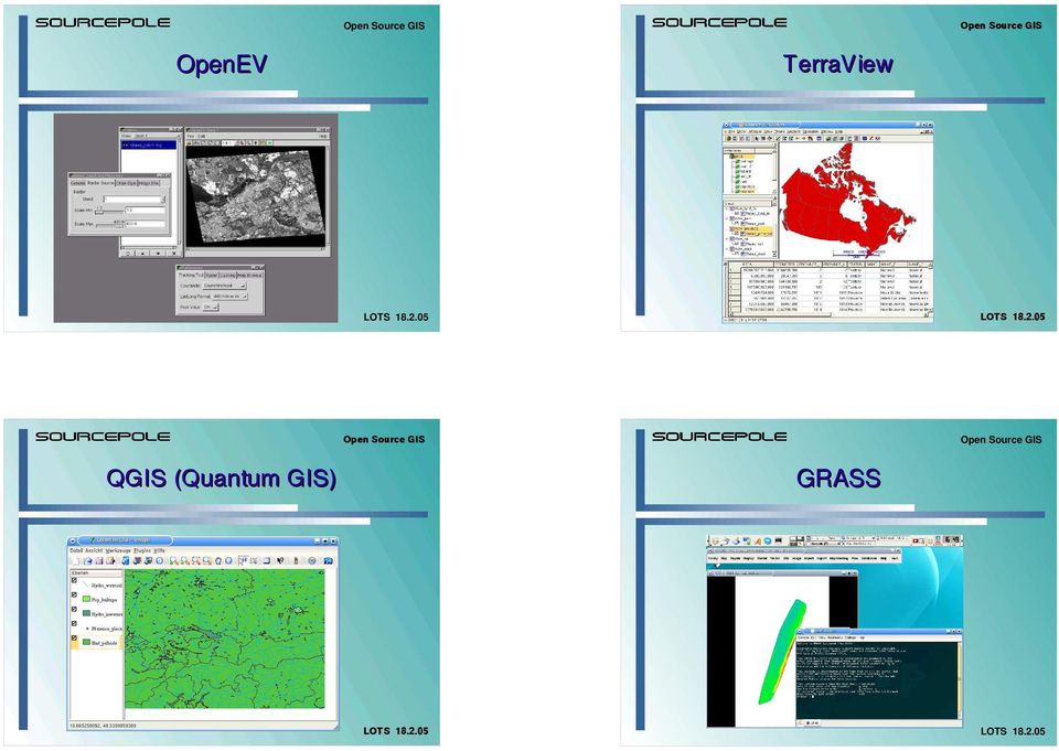
8 OpenEV GRASS
9 Java Tribe Java Libraries OpenMap DeeGree JUMP Unified Mapping Platform JTS Topology Suite udig / JUMP2 GeoTools GML4J GeoServer WKB4J JTS Topology Suite OpenGIS Geometries and Methods GeoTools Data Formats, Java GIS Toolkit WKB4J Java Well-Known Binary Reader / Writer GML4J Java GML Reader / Writer OpenMap

10 udig Weitere Links Credits: Paul Ramsey, Refractions Research Tom Kralidis, Jeff McKenna, Peter Pulsifer, Bart van den Eijnden Fragen? Live-Demo Danke! Pirmin Kalberer <pka at sourcepole.ch>

An Introduction to Open Source Geospatial Tools
 An Introduction to Open Source Geospatial Tools by Tyler Mitchell, author of Web Mapping Illustrated GRSS would like to thank Mr. Mitchell for this tutorial. Geospatial technologies come in many forms,
Neues vom QGIS Server und QGIS-Webclient
 FOSSGIS 2012 Neues vom QGIS Server und QGIS-Webclient Pirmin Kalberer Sourcepole AG, Pfäffikon SZ www.sourcepole.ch Über Sourcepole > QGIS > Core dev. & Project Steering Commitee > Printing, QGIS Server,
Open Source GIS The Future?
 Open Source GIS The Future? Daniel Morissette DM Solutions Group Inc. Open Source Licensing No licensing costs Unlimited rights to: Use the software View and analyse the source Copy, reuse in other systems
Institute of Computational Modeling SB RAS
 Institute of Computational Modeling SB RAS ORGANIZATION OF ACCESS TO OBSERVATIONAL DATA USING WEB SERVICES FOR MONITORING SYSTEMS THE STATE OF THE ENVIRONMENT Kadochnikov Aleksey A. Russia, Krasnoyarsk
Developing of A GIS Based Enviromental Monitoring System with Open Source Softwares
 L. Kottyán, G. Nagy, A. Szepes Developing of A GIS Based Enviromental Monitoring System with Open Source Softwares Developing of A GIS Based Enviromental Monitoring System with Open Source Softwares László
Open Source Geospatial Software. Bob Bruce, P.Eng Mapping and Lands Branch, Manitoba Conservation WWW.HWPS.CA Bob.Bruce@gov.mb.ca
 A Survey of Open Source Geospatial Software Bob Bruce, P.Eng Mapping and Lands Branch, Manitoba Conservation WWW.HWPS.CA Bob.Bruce@gov.mb.ca APEGM PD Breakfast Tuesday, 12 June 2007 access this presentation
Open Source tools for geospatial tasks
 Open Source tools for geospatial tasks Some alternatives to commercial software packages (ricardd@mathstat.dal.ca) Graduate Student Department of Biology Dalhousie University Workshop on Inshore Ecosystems
DISMAR implementing an OpenGIS compliant Marine Information Management System
 DISMAR implementing an OpenGIS compliant Marine Information Management System Éamonn Ó T uama, Coastal & Marine Resources Centre, ERI, University College Cork. DISMAR DISMAR (Data Integration System for
Open Source GIS Blitz!
 Open Source GIS Blitz! Startwiththisvideo http://vimeo.com/2598878 Openstreetmap.org Crown copyright no expiration all government map data in England. Rest of Europe not much better Volunteer mapping effort.
Web Mapping in Archaeology
 Non-invasive methods in the contemporary archaeological practice 25th February 2014 http://www.pborycki.pl/pdf/webmapping.pdf Plan of the presentation 1 Web Mapping General Idea History of Web Mapping
Analysis of the Free GIS Software Applications in respect to INSPIRE services and OGC standards
 Analysis of the Free GIS Software Applications in respect to INSPIRE services and OGC standards Authors: Francesco D'Alesio Peter Hopfgartner Paolo Viskanic June 2011 Executive Summary This document analyses
Design/build and visualization of political and social-statistics. statistics geodatabase by open source tools
 Design/build and visualization of political and social-statistics statistics geodatabase by open source tools Ferenc Speiser Post-graduate distance learning course in Geoinformatics Contents The goals
Introduction to OSGeo and QGIS
 Introduction to OSGeo and QGIS Arnulf Christl OSGeo President Emeritus ESTGIS Pühajärve, Estonia Arnulf Christl Geospatial Systems Architect OSGeo President Emeritus Director of the metaspatial Institute
Standards based spatial data management, GIS and web mapping. Spatial data management, analysis & sharing the free & easy way!
 or Spatial data management, analysis & sharing the free & easy way! Premise: Traditional GIS is inherently flawed, especially when it comes to many fisheries/maritime datasets Premise: Traditional GIS
Introduction to Spatial Data Management with Postgis. Spatial Data Management
 Introduction to Spatial Data Management with Postgis Content Introduction Managing Spatial Data with PostGIS PostGIS Data Model Creating a PostGIS enabled Database Insert Coordinates using SQL Uploading
Open Source Tools for Spatial Analysis and Geoprocessing
 Open Source Tools for Spatial Analysis and Geoprocessing on the Desktop Karsten Vennemann www.terragis.net Seattle, WA, USA karsten@terragis.net 206 905 1711 Workshop Outline Introduction to Free and Open
PostGIS Indexes. Geometries Require Special Index
 PostGIS Indexes 11 0 Geometries Require Special Index Sortable in two dimensions Cover range of values R-Tree Index (GiST Implementation) Linear Time Picksplit Algorithm http://postgis.refractions.net/rtree.pdf
GeoPackage, The Shapefile Of The Future
 FOSS4G 2013 GeoPackage, The Shapefile Of The Future @PirminKalberer Sourcepole AG, Switzerland www.sourcepole.com About Sourcepole > QGIS > Core dev. & Project Steering Commitee > QGIS Server, Printing,
DataTube: web services voor data
 DataTube: web services voor data Gerben de Boer Onno van de Akker Gerrit Hendriksen Deltares, Matroos Deltares, FEWS Deltares, NHI FEWS & Matroos: database > viewers VIEWER client 3 rd party viewer Matroos
Data Visualization Using Web GIS Software
 Data Visualization Using Web GIS Software Tuomas Peltonen Radiation and Nuclear Safety Authority (STUK), Finland NKS NordDSS Workshop, Copenhagen, 1.-2.10.2009 RADIATION AND NUCLEAR SAFETY AUTHORITY Preface
Frank Warmerdam President, OSGeo
 PostGIS: A Standards Based Geographic Extension for PostgreSQL Frank Warmerdam President, OSGeo 1 Overview Brief background PostGIS Details PostGIS Ex am ples Survey of Sim ple Features 1.1 Geom etries
Correspondence can be sent to: GeoConnections Natural Resources Canada 615 Booth Street Ottawa, Ontario K1A 0E9
 Quick Guide for CGDI Service Compliance Testing and Performance Optimization May 12, 2009 Correspondence can be sent to: GeoConnections Natural Resources Canada 615 Booth Street Ottawa, Ontario K1A 0E9
Introduction to the Mapbender OWS Security Proxy
 Introduction to the Mapbender OWS Security Proxy Arnulf Christl, WhereGroup GmbH & Co. KG, Bonn, Germany 1/16 Agenda 1 Introduction to the Architecture OWS from Bottom Up with the OSGeo SDI Software Stack
Open Source Software and Open Interoperability Standards at EDINA National Datacentre
 Open Source Software and Open Interoperability Standards at EDINA National Datacentre Joe Vernon November 25, 2009 Slide 1 of 18 Overview of Presentation Introducing EDINA national datacentre Our thoughts
About scope of OpenGIS technology in oceanographic data management and visualization Andrey V. Golik, Vitaly K. Fischenko, Stepan G.
 About scope of OpenGIS technology in oceanographic data management and visualization Andrey V. Golik, Vitaly K. Fischenko, Stepan G. Antushev V.I.Il ichev Pacific Oceanological Institute Far-Eastern Branch
DEVELOPMENT AND COMPARISON OF OPEN SOURCE BASED WEB GIS FRAMEWORKS ON WAMP AND APACHE TOMCAT WEB SERVERS
 DEVELOPMENT AND COMPARISON OF OPEN SOURCE BASED WEB GIS FRAMEWORKS ON WAMP AND APACHE TOMCAT WEB SERVERS Sonam Agrawal a, Rajan Dev Gupta b a GIS Cell, Motilal Nehru National Institute of Technology, Allahabad-211004,
OGC + Open Source: The keys for the Colombian National Geographic Institute Agustin Coddazzi development of Shared Geographic Services
 OGC + Open Source: The keys for the Colombian National Geographic Institute Agustin Coddazzi development of Shared Geographic Services Alexander Mogollón-Díaz 1, Lilia Patricia Arias 2, F. Javier Zarazaga-Soria
OPEN SOURCE CARTOGRAPHY: STATUS QUO, RECENT TRENDS AND LIMITATIONS OF FREE CARTOGRAPHIC SOFTWARE
 OPEN SOURCE CARTOGRAPHY: STATUS QUO, RECENT TRENDS AND LIMITATIONS OF FREE CARTOGRAPHIC SOFTWARE Pucher, A. Department of Geography and Regional Research, University of Vienna. Cartography and GIS, Universitaetstr.
Future Trends in Geospatial Data Management Process Squadron Leader Mudit Mathur
 VOL 2 ISSUE 5 24 TOWARDS A NATIONAL SPATIAL DATA INFRASTRUC- TURE (NSDI) Dr. Talal Al-Awadhi 28 GEODATABASE FOR URBAN DESIGN AND PLANNING Simon Yanuar PUTRA 34 FREE, CHEAP, AND POW- ERFUL POSTGIS, THE
Building a Spatial Database in PostgreSQL
 Building a Spatial Database in PostgreSQL David Blasby Refractions Research dblasby@refractions.net http://postgis.refractions.net Introduction PostGIS is a spatial extension for PostgreSQL PostGIS aims
Free and Open Source GIS Software for Building a Spatial Data Infrastructure
 Free and Open Source GIS Software for Building a Spatial Data Infrastructure Stefan Steiniger, Andrew J. S. Hunter Department of Geomatics Engineering, University of Calgary, 2500 University Drive NW,
OSGeo Web Mapping Typification: GeoMajas, Mapbender, MapFish and OpenLayers. Christoph Baudson Arnulf Christl FOSS4G 2010 Barcelona
 OSGeo Web Mapping Typification: GeoMajas, Mapbender, MapFish and OpenLayers Christoph Baudson Arnulf Christl FOSS4G 2010 Barcelona Disclaimer All information contained in this presentation has been compiled
Choosing the right GIS framework for an informed Enterprise Web GIS Solution
 13 ANNUAL INTERNATIONAL CONFERENCE AND EXHIBITION ON GEOSPATIAL INFORMATION TECHNOLOGY AND APPLICATIONS Epicentre; Gurgaon, India; 19-21 January, 2010 Choosing the right GIS framework for an informed Enterprise
CURSO Inspire INSPIRE. SPEAKER: Pablo Echamendi Lorente. JEUDI 23/ THURSDAY 23 rd W S V : G E O S P A T I A L D A T A A C C E S S
 CURSO Inspire JEUDI 23/ THURSDAY 23 rd SPEAKER: Pablo Echamendi Lorente WS 5 SCHEDULE WMS OVERVIEW ACTIONS OGC SPECIFICATIONS OTHER SERVICES OVERVIEW proposal: Member States shall establish and operate
UK Location Programme
 Location Information Interoperability Board Data Publisher How To Guide Understand the background to establishing an INSPIRE View Service using GeoServer DOCUMENT CONTROL Change Summary Version Date Author/Editor
Introduction to Web-based GIS
 1. Overview Introduction to Web-based GIS by Tara Athan tara_athan@alt2is.com 1-707-485-1198 Web-based GIS differs from traditional GIS or paper maps in several important ways that may at times be advantageous
Implementation of information system to respond to a nuclear emergency affecting agriculture and food products - Case of Morocco
 Centre National de l énergie des sciences et techniques nucléaires (CNESTEN-Morocco) Implementation of information system to respond to a nuclear emergency affecting agriculture and food products - Case
GIS AS A DECISION SUPPORT FOR SUPPLY CHAIN MANAGEMENT
 Paper Reference No.: PN-253 GIS AS A DECISION SUPPORT FOR SUPPLY CHAIN MANAGEMENT Sanjay Kumar 1 and Suneeta Agrawal 2 1. M. Tech. (GIS & Remote Sensing); GIS Cell; MNNIT, Allahabad, India (E-mail: saj.mnnit@gmail.com)
From a niche to a global user community: Open Source GIS and OSGeo
 From a niche to a global user community: Open Source GIS and OSGeo Opensource Geospatial Research Symposium Nantes, 8-10 July 2009 http://www.ogrs2009.org Markus Neteler Fondazione E Mach - CRI Italy,
Web and Mobile GIS Applications Development
 Web and Mobile GIS Applications Development Presented by : Aamir Ali Manager Section Head (GIS Software Customization) Pakistan Space and Upper Atmosphere Research Commission (SUPARCO) Geographical Information
Comparison of Open Source Virtual Globes
 FOSS4G 2010 Comparison of Open Source Virtual Globes Mathias Walker Pirmin Kalberer Sourcepole AG, Bad Ragaz www.sourcepole.ch About Sourcepole GIS-Knoppix: first GIS live-cd QGIS Core developer QGIS Mapserver
OPEN STANDARD WEB SERVICES FOR VISUALISATION OF TIME SERIES DATA OF FLOOD MODELS
 OPEN STANDARD WEB SERVICES FOR VISUALISATION OF TIME SERIES DATA OF FLOOD MODELS Barend Köbben FRMRC RPA 7 Workshop visualisations and flow simulations as flood risk communication tools
Standardized data sharing through an open-source Spatial Data Infrastructure: the Afromaison project
 Standardized data sharing through an open-source Spatial Data Infrastructure: the Afromaison project Yaniss Guigoz - University of Geneva/GRID-Geneva 1 EcoARM2ERA and AFROMAISON Why Afromaison in this
VISUAL INSPECTION OF EO DATA AND PRODUCTS - OVERVIEW
 WMS services from the EUMETSAT real-time Image Gallery Uwe Voges (1), Michael Schick (2), Udo Einspanier (1) (1) con terra GmbH Martin-Luther-King-Weg 24, 48155, Münster, Germany EMail: (U.Voges U.Einspanier)@conterra.de
An overview on current free and open source desktop GIS developments
 International Journal of Geographical Information Science Vol. 23, No. 10, October 2009, 1345 1370 Review Article An overview on current free and open source desktop GIS developments STEFAN STEINIGER*{
DEVELOPMENT OF THE INTEGRATING AND SHARING PLATFORM OF SPATIAL WEBSERVICES
 DEVELOPMENT OF THE INTEGRATING AND SHARING PLATFORM OF SPATIAL WEBSERVICES Lan Xiaoji 1,2 Lu Guonian 1 Zhang Shuliang 1 Shi Miaomiao 1 Yin Lili 1 1. Jiangsu Provincial Key Lab of GIS Science, Nanjing Normal
A Web services solution for Work Management Operations. Venu Kanaparthy Dr. Charles O Hara, Ph. D. Abstract
 A Web services solution for Work Management Operations Venu Kanaparthy Dr. Charles O Hara, Ph. D Abstract The GeoResources Institute at Mississippi State University is leveraging Spatial Technologies and
SQL SUPPORTED SPATIAL ANALYSIS FOR WEB-GIS INTRODUCTION
 SQL SUPPORTED SPATIAL ANALYSIS FOR WEB-GIS Jun Wang Jie Shan Geomatics Engineering School of Civil Engineering Purdue University 550 Stadium Mall Drive, West Lafayette, IN 47907 ABSTRACT Spatial analysis
The OSGeo Foundation. FOSS4G Korea 2011 Seoul. Professionally leveraging Open Source Geospatial. Arnulf Christl President
 The OSGeo Foundation Professionally leveraging Open Source Geospatial Arnulf Christl President FOSS4G Korea 2011 Seoul Arnulf Christl Works as Geospatial Systems Architect in his company metaspatial. President
Introduction to Using PostGIS Training Workbook Last Updated 18 June 2014
 Introduction to Using PostGIS Training Workbook Last Updated 18 June 2014 Prepared by: Simon Nitz, Senior Technical Consultant Digital Mapping Solutions NZ Limited 2nd Floor, 20 Bridge Street, Ahuriri,
System requirements. Java SE Runtime Environment(JRE) 7 (32bit) Java SE Runtime Environment(JRE) 6 (64bit) Java SE Runtime Environment(JRE) 7 (64bit)
 7 (32bit) Java SE Runtime Environment(JRE) 6 (64bit) Java SE Runtime Environment(JRE) 7 (64bit)") Hitachi Solutions Geographical Information System Client Below conditions are system requirements for Hitachi Solutions Geographical Information System Client. 1/5 Hitachi Solutions Geographical Information
Hitachi Solutions Geographical Information System Client Below conditions are system requirements for Hitachi Solutions Geographical Information System Client. 1/5 Hitachi Solutions Geographical Information
CentropeMAP - Information Infrastructure for a dynamic cross-border region in the heart of Europe Manfred Schrenk, Clemens Beyer, Walter Pozarek
 Manfred Schrenk, Clemens Beyer, Walter Pozarek (Dipl.-Ing. Manfred SCHRENK, CEIT Central European Institute of Technology, 2320 Schwechat, Austria, m.schrenk@ceit.at) (Dipl.-Ing. Clemens BEYER, CEIT ALANOVA
ARCHITECTURE OF INTEGRATED GIS AND GPS FOR VEHICLE MONITORING
 1 st Logistics International Conference Belgrade, Serbia 28-30 November 2013 ARCHITECTURE OF INTEGRATED GIS AND GPS FOR VEHICLE MONITORING Adela B. Crnišanin * State University of Novi Pazar, Department
Dr. Marco Hugentobler, Sourcepole Twitter: @sourcepole. QGIS from a geodata viewer to a GIS platform
 QGIS from a geodata viewer to a GIS platform Dr. Marco Hugentobler, Sourcepole Twitter: @sourcepole QGIS > Open source desktop GIS > License: GNU GPL, Version 3 > Founded in 2002 by Gary Sherman > C++,
The State of Open Source GIS
 The State of Open Source GIS Prepared By: Paul Ramsey, Director Refractions Research Inc. Suite 300 1207 Douglas Street Victoria, BC, V8W-2E7 pramsey@refractions.net Phone: (250) 383-3022 Fax: (250) 383-2140
GeoServer, The Open Source Solution for the interoperable management of geospatial data
 GeoServer, The Open Source Solution for the interoperable management of geospatial data Ing. Andrea Aime, GeoSolutions Ing. Simone Giannecchini, GeoSolutions Founded in Italy in late 2006 Expertise GeoSolutions
CentropeSTATISTICS a Tool for Cross-Border Data Presentation Manfred Schrenk, Clemens Beyer, Norbert Ströbinger
 Manfred Schrenk, Clemens Beyer, Norbert Ströbinger (Dipl.-Ing. Manfred Schrenk, Multimediaplan.at, 2320 Schwechat, Austria, schrenk@multimediaplan.at) (Dipl.-Ing. Clemens Beyer, CORP Competence Center
ONLINE VISUALIZATION OF SPATIAL DATA
 ONLINE VISUALIZATION OF SPATIAL DATA A PROTOTYPE OF AN OPEN SOURCE INTERNET MAP SERVER WITH BACKEND SPATIAL DATABASE FOR THE SWISS NATIONAL PARK Thomas Hächler Diploma Thesis Department of Geography University
County of Los Angeles. Chief Information Office Preferred Technologies for Geographic Information Systems (GIS) September 2014
 September 2014") County of Los Angeles Chief Information Office Preferred Technologies for Geographic Information Systems (GIS) September 2014 CIO Preferred Technologies for GIS This document lists the preferred Geographic
County of Los Angeles Chief Information Office Preferred Technologies for Geographic Information Systems (GIS) September 2014 CIO Preferred Technologies for GIS This document lists the preferred Geographic
Free and Open Source Geospatial Tools for Environmental Modeling and Management
 Free and Open Source Geospatial Tools for Environmental Modeling and Management A. Jolma a, D.P. Ames b, N. Horning c, M. Neteler d, A. Racicot e and T. Sutton f a Helsinki University of Technology, Espoo,
SuperGIS Server 3.2 Standard Edition Specification
 SuperGIS Server 3.2 Standard Edition Specification 20140826 Specification 1. All of the services support SOAP (Simple Object Access Protocol). 2. Use map file created by SuperGIS Desktop as map services
Geodatabase Programming with SQL
 DevSummit DC February 11, 2015 Washington, DC Geodatabase Programming with SQL Craig Gillgrass Assumptions Basic knowledge of SQL and relational databases Basic knowledge of the Geodatabase We ll hold
Interoperable Solutions in Web-based Mapping
 ISPRS SIPT IGU UCI CIG ACSG Table of contents Table des matières Authors index Index des auteurs Search Recherches Exit Sortir Interoperable Solutions in Web-based Mapping Marta Wojnarowska and Bridget
J9.6 GIS TOOLS FOR VISUALIZATION AND ANALYSIS OF NEXRAD RADAR (WSR-88D) ARCHIVED DATA AT THE NATIONAL CLIMATIC DATA CENTER
 ARCHIVED DATA AT THE NATIONAL CLIMATIC DATA CENTER") J9.6 GIS TOOLS FOR VISUALIZATION AND ANALYSIS OF RADAR (WSR-88D) ARCHIVED DATA AT THE NATIONAL CLIMATIC DATA CENTER Steve Ansari * STG Incorporated, Asheville, North Carolina Stephen Del Greco NOAA National
J9.6 GIS TOOLS FOR VISUALIZATION AND ANALYSIS OF RADAR (WSR-88D) ARCHIVED DATA AT THE NATIONAL CLIMATIC DATA CENTER Steve Ansari * STG Incorporated, Asheville, North Carolina Stephen Del Greco NOAA National
reviewed paper OpenGIS in action Field-tested Web Map Services (WMS) and experiences with Web Feature Services (WFS) Andreas FRITZSCHE & Markus SPRING
 and experiences with Web Feature Services (WFS) Andreas FRITZSCHE & Markus SPRING") 1 INTRODUCTION reviewed paper OpenGIS in action Field-tested Web Map Services (WMS) and experiences with Web Feature Services (WFS) Andreas FRITZSCHE & Markus SPRING Dipl.-Ing. (FH) Eur. Ing. Andreas FRITZSCHE
1 INTRODUCTION reviewed paper OpenGIS in action Field-tested Web Map Services (WMS) and experiences with Web Feature Services (WFS) Andreas FRITZSCHE & Markus SPRING Dipl.-Ing. (FH) Eur. Ing. Andreas FRITZSCHE
Oklahoma s Open Source Spatial Data Clearinghouse: OKMaps
 Oklahoma s Open Source Spatial Data Clearinghouse: OKMaps Presented by: Mike Sharp State Geographic Information Coordinator Oklahoma Office of Geographic Information MAGIC 2014 Symposium April 28-May1,
A Comparison of ArcIMS to MapServer
 A Comparison of ArcIMS to MapServer Brock Anderson Refractions Research www.refractions.net 1 Refractions Research Victoria, BC, Canada Spatial Systems Consulting Open Source Software PostGIS udig / GeoTools
Archival Challenges Associated with the Esri Personal Geodatabase and File Geodatabase Formats
 Geospatial Multistate Archive and Preservation Partnership (GeoMAPP) Archival Challenges Associated with the Esri Personal Geodatabase and File Geodatabase Formats December 6, 2011 Introduction Spatial
GeoKettle: A powerful spatial ETL tool for feeding your Spatial Data Infrastructure (SDI)
") GeoKettle: A powerful spatial ETL tool for feeding your Spatial Data Infrastructure (SDI) Dr. Thierry Badard, CTO tbadard@spatialytics.com Spatialytics http://www.spatialytics.com FOSS4G 2011 Workshop,
GeoKettle: A powerful spatial ETL tool for feeding your Spatial Data Infrastructure (SDI) Dr. Thierry Badard, CTO tbadard@spatialytics.com Spatialytics http://www.spatialytics.com FOSS4G 2011 Workshop,
Web Map Context Service for Adaptive Geospatial Data Visualization
 Web Map Context Service for Adaptive Geospatial Data Visualization Miloš Bogdanović, Danilo Vulović, Leonid Stoimenov INTRODUCTION Faculty of Electronic Engineering, University of Niš, Serbia {milos.bogdanovic,
Duke Riding the Geospatial Wave
 Duke Riding the Geospatial Wave Chris Holmes (OpenGeo) Steve Citron-Pousty (decarta) James Macgill (Google) Wilfred Springer (TomTom) @DukeSpatial PAN-5773 decarta 2008 JavaOneSM Conference java.sun.com/javaone
Documentation of open source GIS/RS software projects
 Contract no. Workpackage Delivery Delivery Date 030776 WP1 D1.6 2007-07-02 CASCADOSS Development of a trans-national cascade training programme on Open Source GIS&RS Software for environmental applications
A Hybrid Architecture for Mobile Geographical Data Acquisition and Validation Systems
 A Hybrid Architecture for Mobile Geographical Data Acquisition and Validation Systems Claudio Henrique Bogossian 1, Karine Reis Ferreira 1, Antônio Miguel Vieira Monteiro 1, Lúbia Vinhas 1 1 DPI Instituto
Statusreport MapServer
 Statusreport MapServer Version 7.0 Wir erschließen das räumliche Potenzial Ihrer Daten. Seit 1997 GIS- und WebGIS-Projekte mit freier Software Entwicklung Anpassung Support Schulungen Wir erschließen das
GEOENGINE MSc in Geomatics Engineering, Master Thesis Gina Campuzano
 Master Thesis Gina CAMPUZANO Gina Campuzano Development of a GIS web application as a tool for learning of environmental protection -Comparison between MapServer and GeoServer constructing a tool for not
Integrating AJAX Approach into GIS Visualization Web Services
 Integrating AJAX Approach into GIS Visualization Web Services Ahmet Sayar 1, 2, *, Marlon Pierce 1 1, 2, 3, 4 and Geoffrey Fox 1 Community Grids Lab, Indiana University, Bloomington, Indiana, 47404, USA
Managing a Geographic Database From Mobile Devices Through OGC Web Services
 Managing a Geographic Database From Mobile Devices Through OGC Web Services Nieves R. Brisaboa 1, Miguel R. Luaces 1, Jose R. Parama 1, and Jose R. Viqueira 2 1 Database Laboratory, University of A Coruña,
Use of Free and Open Source GIS in Commercial Firms
 Project Assignment Stud.techn. Atle Frenvik Sveen Use of Free and Open Source GIS in Commercial Firms Trondheim, December 18, 2008 NTNU Norwegian University of Science and Technology Faculty of Engineering
Personalized touristic routes implementing Semantic Web on GIS system (Itiner@ project)
") Personalized touristic routes implementing Semantic Web on GIS system (Itiner@ project) Laia Descamps-Vila Universitat Oberta de Catalunya, h7ux@uoc.edu Abstract. Nowadays, when a user is planning a touristic
Personalized touristic routes implementing Semantic Web on GIS system (Itiner@ project) Laia Descamps-Vila Universitat Oberta de Catalunya, h7ux@uoc.edu Abstract. Nowadays, when a user is planning a touristic
GIS Databases With focused on ArcSDE
 Linköpings universitet / IDA / Div. for human-centered systems GIS Databases With focused on ArcSDE Imad Abugessaisa g-imaab@ida.liu.se 20071004 1 GIS and SDBMS Geographical data is spatial data whose
GeoKettle: A powerful open source spatial ETL tool
 GeoKettle: A powerful open source spatial ETL tool FOSS4G 2010 Dr. Thierry Badard, CTO Spatialytics inc. Quebec, Canada tbadard@spatialytics.com Barcelona, Spain Sept 9th, 2010 What is GeoKettle? It is
The Virtual Database A Tool for Integrated Data Processing in a Distributed Environment
 EnviroInfo 2004 (Geneva) Sh@ring EnviroInfo 2004 The Virtual Database A Tool for Integrated Data Processing in a Distributed Environment Marcel Frehner 1, Martin Brändli 2, Jürg Schenker 3 Abstract Traditional
Free and Open Source Software for Geoinformatics - Present Status and Future Prospects -
 Free and Open Source Software for Geoinformatics - Present Status and Future Prospects - Venkatesh Raghavan 1, Shinji Masumoto 1 and David Hastings 2 1 Osaka City University 3-3-138 Sugimoto, Sumiyoshi-ku
Combining Drupal Content Management System with OGC Web Services
 Combining Drupal Content Management System with OGC Web Services By Terefe Hanchiso Sodango (Haramaya University, Ethiopia) Dr. U.D. (Ulanbek) Turdukulov & Drs. B.J. (Barend) Köbben(University of Twente,
Institute of Natural Resources Departament of General Geology and Land use planning Work with a MAPS
 Institute of Natural Resources Departament of General Geology and Land use planning Work with a MAPS Lecturers: Berchuk V.Y. Gutareva N.Y. Contents: 1. Qgis; 2. General information; 3. Qgis desktop; 4.
Design Requirements for an AJAX and Web-Service Based Generic Internet GIS Client
 11th AGILE International Conference on Geographic Information Science 2008 Page 1 of 6 Design Requirements for an AJAX and Web-Service Based Generic Internet GIS Client Edward Nash 1, Peter Korduan 1,
Creating a GIS based learning tool for the Faculty of Forest & Environment at the HNE Eberswalde
 Creating a GIS based learning tool for the Faculty of Forest & Environment at the HNE Eberswalde G. Singelnstein / H. Plesse University of Applied Sciences in Eberswalde 14.04.2011 Introduction I What
Accessing a 3D geo-dbms using Web technology
 Accessing a 3D geo-dbms using Web technology M.E. de Vries and J.E. Stoter Section GIS technology, Delft University of Technology Delft, The Netherlands Tel.: +31 15 2784268, Fax: +31 15 2782745 {m.e.devries
Spanish examples IPR: Up to Date & Zones
 Spanish examples IPR: Up to Date & Zones 1 Spanish IPR examples We have chosen the open source option: Python Why Python? Easy to learn and understand for not it people and code can be freely used and
Open Source Software Communities - Lessons Learnt
 1 Open Source Software Communities - Lessons Learnt Imed Hammouda, adjunct professor Alexander Lokhman, researcher Tampere University of Technology 25.2.2011 Open Source vs. Free Software 2 Free software
Access to ESPON Database by third- party applications An expertise on the potentialities of web services for accessing the ESPON metadata and data
 Access to ESPON Database by third- party applications An expertise on the potentialities of web services for accessing the ESPON metadata and data UNEP/GRID- Geneva 27/06/2013 ABOUT THIS DOCUMENT A technical
Spatial Data Management Development of e-learning Modules
 Spatial Data Management Development of e-learning Modules Antje Krüger and Thomas Brinkhoff Institute for Applied Photogrammetry and Geoinformatics (IAPG) FH Oldenburg/Ostfriesland/Wilhelmshaven (University
Study of GML-Based Geographical Data Visualization Strategy
 Study of GML-Based Geographical Data Visualization Strategy ZHANG LIN 1, CHEN SHI-BIN 2 1 College of Information Technology, ZheJiang University of Finance & Economics, HangZhou 310012, China 2 College
Secure your GIS. Protecting GIS applications suites. camptocamp / 9. septembre 2010 / www.camptocamp.com / info@camptocamp.com
 Secure your GIS Protecting GIS applications suites camptocamp / 9. septembre 2010 / www.camptocamp.com / info@camptocamp.com Outline - Camptocamp SA - Introduction Green field Heterogenous FOSS applications
A framework for a networkbased datastore for spatial and spatio-temporal geoscience data
 A framework for a networkbased datastore for spatial and spatio-temporal geoscience data Paul Gabriel, Jan Gietzel, Le Hai Ha, Helmut Schaeben Kommunikationsforum 3D 2011, Freiberg Mi, 23. März 2011 Outline
OSM-in-a-box A Ready-Made Highly Configurable Map Server
 OSM-in-a-box A Ready-Made Highly Configurable Map Server 1 Prof. Stefan Keller Computer Science Department University of Applied Sciences Rapperswil (CH) www.gis.hsr.ch Contents 2 Motivation The osm2gis
The ORIENTGATE data platform
 Seminar on Proposed and Revised set of indicators June 4-5, 2014 - Belgrade (Serbia) The ORIENTGATE data platform WP2, Action 2.4 Alessandra Nuzzo, Sandro Fiore, Giovanni Aloisio Scientific Computing and
ArcGIS 10.1 Geodatabase Administration. Gordon Sumerling & Christopher Brown
 ArcGIS 10.1 Geodatabase Administration Gordon Sumerling & Christopher Brown Key Improvements at ArcGIS 10.1 1. Easier Administration through Graphic Interfaces 2. Greater Seamless integration with Open
Paolo Zatelli. Dipartimento di Ingegneria Civile e Ambientale Università di Trento. WebGIS - Mapserver. WebGIS -- Mapserver
 -- - Paolo Zatelli Dipartimento di Ingegneria Civile e Ambientale Università di Trento 1/54 -- Geospatial Data Infrastructure (GDI) GDI is the framework of political, technical and economical infrastructures
gvsig: Open Source GIS client. Spatial Data Infrastructure Client.
 Séminaire gvsig Rennes, 31 Mars 2006 gvsig: Open Source GIS client. Spatial Data Infrastructure Client. Luis W. Sevilla Gabriel Carrión Rico Martín García Hernández Francisco J. Peñarrubia Alvaro A. Anguix