DEVELOPMENT OF AUTOMATED CADASTRAL DATABASE SELECTION AND VISUALIZATION SYSTEM TO SUPPORT THE REALIZATION OF MODERN CADASTRE IN MALAYSIA
|
|
|
- Chloe McCarthy
- 8 years ago
- Views:
Transcription
1 VOT DEVELOPMENT OF AUTOMATED CADASTRAL DATABASE SELECTION AND VISUALIZATION SYSTEM TO SUPPORT THE REALIZATION OF MODERN CADASTRE IN MALAYSIA ( PEMBANGUNAN SISTEM PEMILIHAN DAN VISUALISASI PANGKALAN DATA KADASTER BAGI MENYOKONG PERLAKSAAN KADASTER MODEN DI MALAYSIA) Dr Abdullah Hisam Omar Prof Dr Abd Majid A Kadir Mr Rosnizam Mudin Shah b Sidek IRPA VOTE NO : FAKULTI KEJURUTERAAN DAN SAINS GEOINFORMASI Universiti Teknologi Malaysia UTM SKUDAI, JOHOR 2006

2 ii ACKNOWLEDGEMENTS This report is the result of 2 years of research in the Department of Geomatics Engineering, Faculty of Geoinformation Science and Engineering, Universiti Teknologi Malaysia. The research was funded by the Ministry of Science, Technology and Inovation under the e-irpa (Intensification of Research Priority Area ) 8 h Malaysian Plan. The authors wish to express their sincere appreciation to all individuals involved during the preparation and execution of this research for their assistance, contribution and making this research a success. Throughout the duration of this research, assistance from research colleagues and staff members were received and acknowledge. Project Leader : Dr Abdullah Hisam Omar Researcher : 1. Prof Dr Abd Majid A Kadir 2. Mr.Rosni Zamuddin Shah Bin Sidek

3 iii DEVELOPMENT OF AUTOMATED CADASTRAL DATABASE SELECTION AND VISUALIZATION SYSTEM TO SUPPORT THE REALIZATION OF MODERN CADASTRE IN MALAYSIA ( Keyword: Cadastral Database, Automated Process, Modern Cadastre, NDCDB) The process of extracting land records information especially cadastral data for a large number of land title was tedious and time consuming. The development of State Digital Cadastral Database (SDCDB) by Department of Survey and Mapping Malaysia (DSMM) is one of the initiatives to shift to modern cadastral system. Cadastral data need to be adjusted in order to verify the network closure. In order to move to a new adjustment approach, a so-called Least Squares, an Intelligence Based Automated Cadastral Database Conversion System must be developed. The automated functions of the said system are;i) generate of zones and overlapping areas, ii)extracting cadastral information from existing SDCDB,iii) automatically conduct an intelligence cadastral survey concept self- checking procedure, iv) re-compute or rebuild the cadastral records based on mathematical cadastral survey rules, v) automatically prepare corrected data input files ( SDCDB and GPS) for a particular zone and vi) reformatting of data for input into least squares adjustment software. The advantages of automation can be exploited in order to solve or to minimize the needs of manual approach. In order to support the development of survey accurate cadastral system, an automatic programming approach will be adopted. Database selection system will conduct several outliers integrity checking, rebuild cadastral spatial topology (cadastral lot) and make selfcorrection procedures based on cadastral survey concepts and mathematical model respective to the cadastral lots selected. This is to ensure that all cadastral lots are kept in a closed polygon and provide accurate and "clean" cadastral information.. This system was developed in windows environment. Analyses show that the system is functional efficiently. This system is essential and important towards the implementation of computerized Coordinated Cadastral System in Malaysia and it is highly depends on the automated system.. Therefore an Intelligence Based Automated Cadastral Database Selection System is highly potential as a main system application for DSMM or private sector. Key Researcher : Dr. Abdullah Hisam Omar (Head) Prof. Dr. Abd Majid A Kadir En. Rosni Zamuddin Shah Bin Sidek a.hisham@fksg.utm.my Tel. No. : Vote No. : 74270

4 iv DEVELOPMENT OF AUTOMATED CADASTRAL DATABASE SELECTION AND VISUALIZATION SYSTEM TO SUPPORT THE REALIZATION OF MODERN CADASTRE IN MALAYSIA ( Keyword: Cadastral Database, Automated Process, Modern Cadastre, NDCDB) Proses pengekstrakan maklumat rekod berkaitan tanah terutamanya data kadaster bagi kawasan yang besar melibatkan tempoh masa yang lama serta tenaga yang banyak. Pembangunan Pangkalan Data Kadaster (PDUK) oleh Jabatan Ukur dan Pemetaan Malaysia (JUPEM) merupakan satu inisiatif kearah system kadaster moden di Malaysia. Kadaster data perlu dilaraskan bagi mempastikan tutupan jaringan. Bagi mengubah pendekatan pelarasan yang baru iaitu menggunakan pelarasan ganda dua terdikit, Sistem Pemilihan dan Visualisasi Pangkalan Data Kadastra Secara Automasi telah dibangunkan. Fungsi-fungsi automatic yang terlibat adalah: i)menjanakan zon dan kawasan tindihan, ii) mengekstrak maklumat kadaster fari PDUK, iii) melaksanakan prosedur penyemakan konsep ukur kadaster secara automatic, iv) mengira dan membangunkan rekod kadaster berasaskan model matematik ukur kadaster, v) menyediakan input data yang telah diperbetulkan (PDUK dan GPS) bagi zon terlibat, vi) memformat input data bagi perisian pelarasan ganda dua terdikit. Kelebihan-kelebihan automasi boleh diekploitasikan untuk menyelesaikan dan meminimakan keperluan pendekatan manual. Bagi menyokong pembangunan sistem ukur kadaster berketepatan tinggi, pendekatan pengaturcaraan automatik telah diaplikasikan. Sistem Pemilihan Pangkalan Data melaksanakan beberapa prosedur penyemakan integriti, membentuk topologi spatial ( lot kadaster) serta pembetulan cerapan berasaskan model matematik serta peraturan ukur kadaster bagi lot kadaster yang terlibat. Ini bagi memastikan kesemua lot kadaster disimpan didalam bentuk poligon tertutup dan menyediakan maklumat kadaster yang tepat dan bersih. Senario ini kritikal di dalam proses pelarasan. Sistem ini dibangunkan berasaskan persekitaran windows. Analisis-analisis menunjukkan sistem ini berfungsi secara efisyen. Sistem ini merupakan asas dan penting kearah implementasi Sistem Kadaster Berkoordinat berkomputer di Malaysia dan amat bergantung kepada sistem automasi. Oleh itu Sistem Pemilihan dan Visualisasi Pangkalan Data Kadastra Secara Automasi berpotensi sebagai sistem aplikasi utama bagi JUPEM atau sektor swasta. Penyelidik : Dr. Abdullah Hisam Omar (Ketua) Prof. Dr. Abd Majid A Kadir En. Rosni Zamuddin Shah Bin Sidek a.hisham@fksg.utm.my Tel. No. : Vot No. : 74270

5 v TABLE OF CONTENTS CHAPTER TITLE PAGE TITLE PAGE i ACKNOWLEDGEMENTS ii ABSTRACT iii ABSTRAK iv CONTENTS v LIST OF FIGURES viii LIST OF TABLES xi LIST OF ABREVIATIONS xii LIST OF APPENDICES xv 1 INTRODUCTION Introduction Research Objectives Problem Statement Research Scope Research Contributions Research Methodology Overview of The Report 10

6 vi 2 CADASTARL REFORM Introduction Factors of Cadastral Reform Common Aspects of Cadastral Reform and Trends Global Cadastral Reform Landonline in New Zealand Cadastral Electronic Field Book (CEFB) in Florida ArcCadastre System in Colombia Cadastral Reform in Canada Cadastral Reform in Asia Pacific Region Cadastral Reform in Malaysia Office Reforms Field Reforms DIGITAL CADASTRAL DATABASE Introduction Digital Cadastral Database (DCDB) DCDB Data Structure Overview 39 4 DEVELOPMENT OF AUTOMATED CADASTRAL DATABASE SELECTION AND VISUALIZATION SYSTEM 4.1 Introduction Database Selection and Visualization Design Arcview Map Object Visual Basic Mathematical Model Data Selection and Visualization Interfacing Program (CDSV) 4.4 NDCDB Converter

7 vii 5 ANALYSIS Introduction Data Quality Cleanliness of data Data Accuracy Cadastral Database Selection and Visualization Prototype 5.4 Analysis of Data Input: Adjusted Cadastral Network CONCLUSION AND RECOMMENDATIONS Introduction Details Findings State Digital Cadastral Database Cadastral Database Selection Application Recommendations 92 REFERENCES 93 APPENDICES A - B 100

8 viii LIST OF FIGURES FIGURE NO. TITLE PAGE 2.1 Landonline e-survey process Virtual Survey System Cadastral survey process before 70 s Three stages for cadastral survey workflow before 70 s Cadastral survey process during 80 s Cadastral survey process using earlier version of F2F 34 during 90 s. 3.1 Flowchart of NDCDB Development The Design Process of DCDB The Process of Building The E-R Diagram Example of Physical Database Model for DCDB Research Area The ArcView Screen ArcView Starts With An Empty Window Open Project Dialog Box The Title Project (qstart.apr) Appear In The Project Window 4.6 View of Project With Interactive Map And Various Features (Themes) 4.7 The MapObject Screen(a) and (b). MapObject Application The Visual Basic Screen Visual Basic Code Is Written In The Code Window Bearing Measurement 61
 Appear In The Project Window 4.")
9 ix FIGURE NO. TITLE PAGE 4.11 Northern Reference Orientation Relationship between Two Coordinate Systems Relationship Between Two Different Scale Factors Database Selection and Visualization System Overall Data Selection Unified Modeling Language Data Selection Methodology and Editing Spatial Properties Menu Main Menus of CDSV Reformating Menus Spatial Selection Identify Spatial Information Cadastral Network Record Creating Input File for NDCDB (Point File) Creating Input File for NDCDB (Boundary File) Creating Input File for NDCDB (Combine File) : Running Starnet Least Squares Adjustment Software From Prototype System NDCDB Implementation Methodology (a) StarNet TM Report (ndcdb.lst) (b) Input Data of Adjusted Coordinate (c) Input Data of Adjusted Observation StarNet Report (ndcdb.ref) Visual Basic interface to extract data from StarNet Report (ndcdb.lst and ndcdb.ref) Output for adjusted boundary line 77
 71 4.24 Creating Input File for NDCDB (Combine File) 72 4.25 : Running Starnet Least Squares Adjustment Software From Prototype System 72 4.")
10 x FIGURE NO. TITLE PAGE 4.31 Output for adjusted boundary mark Data entry (from Adjbdy.txt) Avenue programme of pl_ndcdb.txt for creating polyline 4.34 Avenue programme of cvtplply.txt for converting polyline to polygon 5.1 (a) The adjusted boundary line (ndcdb_bdy.dbf) file input in ArcView 5.1 (b) The adjusted boundary line (ndcdb_bdy.dbf) file input in ArcView (c) The adjusted boundary mark (ndcdb_sto.bdy) file View of a new Theme based on boundary line database (ndcdb_bdy.dbf) 5.3 Attributes of the GIS DCDB Identifying the attributes NDCDB for large cadastral network generated using CDSV Adjusted Coordinates for Boundary Mark Overlay Analysis Between Existing DCDB and NDCDB Cretaed by CDSV Prototype. 87

11 xi LIST OF TABLES TABLE NO. TITLE PAGE 3.1 DCDB Out-Source Format Out-Source ASCII file DCDB Master Data List Basic elements of the Logical Data Model Logical Scheme For DCDB Arc View Control Keys Example of Observation Statistic Summary of Adjustment Result 86

12 xii LIST OF ABREVIATIONS CP - Certified Plan CV - Calculation Volume CAD - Computer Aided Design CALS - Computer Assisted Land Survey System CAM - Computer Aided Mapping CCS - Coordinated Cadastral System CCI - Cadastral Control Infrastructure CCDB - Cadastral Control Database CDMS - Cadastral Database Management System CDSV - Data Selection and Visualization Interfacing Program CEFB - Cadastral Electronic Field Book CLRS - Computerised Land Registration System CMM - Cadastral Measurement Management CSS - Counter Service System DBMS - Database Management System DSMM - Department of Survey and Mapping Malaysia EDM - Electronic Distance Measurement E-R - Entity-Relationship FIG - International Federation of Surveyors F2F - Field-to-Finish

13 xiii LIST OF ABREVIATIONS GDM Geocentric Datum of Malaysia GIS - Geography Information System IGAC - Geographical Institute Agustin Codazzzi INAC - Northern Affairs Canada IT - Information Technology LINZ - Land Information New Zealand LIS - Land Information System LSA - Least Squares Adjustment MACGDI. - Malaysian Center For Geospatial Data Infrastructure NaLIS - National Infrastructure for Land Information System NDCDB - National Digital Cadastral Database NGDI - National Geospatial Data Infrastructure NRCan - Natural Resources Canada PDA - Personnel Digital Assistant QAS - Quality Assurance System RSO - Rectified Skew Orthormorphic RTK - Real Time Kinematic

14 xiv LIST OF ABREVIATIONS SAPD - District Survey Office Automation System SDCDB - State Digital Cadastral Database SKDK - Digital Cadastral Integrity System SPID - Image Document Management System SRIS - Survey Record Information System SUM - Virtual Survey System TSM - Total Survey Module VB - Visual Basic VRML - Virtual Reality Modeling Language

15 xv LIST OF APPENDICES APPENDIX. TITLE PAGE A CDSV 100 B NDCDB CONVERTER 123

16

17 CHAPTER I INTRODUCTION 1.1 Introduction Sustainable development has been, since not too long ago, the concern of most nations as it was accepted as one of the factors affecting human survival. In ensuring sustainable development, the cadastre has been widely recognised as having an important role to play and this had consequently imposed increasing demands on the traditional cadastral systems. As a result, the need then arises for cadastral systems to adapt to new expectations and standards and particularly to implement improved cadastral systems. This situation had, amongst other reasons, led to the many ongoing cadastral reforms throughout the world, over the last decade or so (Kaufmann, 1999). Cadastral reform has had a resurgence world-wide and interest in it has apparently been mounting as it was increasingly recognised to be of significance to economic development, social stability and the environment. This was very evident in the last decade or so, in all continents and in many United Nations member states, as observed by Williamson (1997(a)). An indication of this increased interest is the emphasis given to it in both the local as well as international conferences, seminars, meetings, workshops etc. One such congregation (of minds) was the United Nations sponsored joint meeting of cadastral experts in Bogor, Indonesia in March 1996, wherein substantial attention was conferred to the discussion on matters related to cadastral reforms. Another example is the XIX Congress of the International Federation of Surveyors (FIG) at Helsinki, Finland in June, 1990 where, as noted by
.")
18 2 Williamson (1991), arguably the largest number of papers presented, dealt with the common theme on cadastral reforms. Malaysia was not to be left behind in this progressive development. Spurred on by domestic demands and taking cue from developments overseas, it had unceasingly taken initiatives to continually and strategically implement cadastral reforms whenever and wherever appropriate. One fitting example was the introduction of computerised systems to the surveying component of the cadastre by the Department of Survey and Mapping, Malaysia (DSMM). According to Abdul Majid Mohamed (1994), the initiative was for the purpose of not only increasing the efficiency and productivity of computations and plan drawings, but also to introduce the concept of digital databases. That first step was then accompanied by other initiatives by the same department through the continuous and still on-going reforms of the cadastral surveying system. The most recent of these initiatives is the endeavour to introduce the Coordinated Cadastral System (CCS) for the purpose of further improving and increasing the efficiency of the cadastral surveying system (Abd Majid A. Kadir et.al., 1998). The desire and enthusiasm for this introduction arises out of the perception that the coordinated cadastre offers, in the midst of current technological advancements, numerous advantages with regard to various aspects of the cadastral operations. Furthermore, it was duly noted that other countries, notably Australia had already made headway in implementing the CCS and that the prospects of its introduction in Malaysia appeared to be potentially feasible. The optimism on the feasibility of introducing the system however emanated from the positive outcomes of the pilot studies conducted by research groups, as reported by Abd Majid A. Kadir, et.al (1999(a)).
, the initiative was for the purpose of not only increasing the efficiency and productivity of computations and plan drawings, but also to introduce the concept")
19 3 The benefits of CCS have been much talked about and these include the opening up of opportunities in coping with and in accruing benefits from the advances in technology. One example is its compatibility for use with modern survey equipments and systems. Since coordinates are the basic input/output of equipments such as Electronic Total Stations and systems such as the Global Positioning System (GPS), the introduction of CCS would thus be synergistic with the operations of such equipments and systems. Moreover, it will also facilitate the integration of cadastral and map-based information as well as the use of rapid data acquisition, storage, processing and management techniques. Apart from that, much of the developed world have also recognised that the CCS underpins the Land/Geographical Information System (LIS/GIS), and in considering that land/geographic information itself is a very valuable resource, it is evident that the CCS is of essence. In view of the above developments, it is consequently the intention of this study to look into the various aspects of the introduction and implementation of the CCS in Malaysia. Since the practises and operations of the cadastre in the states of Peninsular Malaysia are distinctly different from those of Sabah and Sarawak in East Malaysia, due to historical (and constitutional) reasons, this study is thus specifically confined to Peninsular Malaysia. The cadastral reform is inevitable in this new millennium to handle and manage the constant proliferation throughout the world. This is to some extent due to technological advancement in computerization, information acquisition and communication. Cadastral reform may relate to various aspects of cadastral system such as office automation, field measurement, and cadastral database development. These will lead to the concept and realization of the Coordinated Cadastral System (CCS) in some countries today. The cadastral reform is inevitable in this new millennium to handle and manage the constant proliferation throughout the world. This is to some extent due

20 4 to technological advancement in computerization, information acquisition and communication. Cadastral reform may relate to various aspects of cadastral system such as office automation, field measurement, and cadastral database development. These will lead to the concept and realization of the Coordinated Cadastral System (CCS) in some countries today. In the previous studies of CCS ( ), main input data for cadastral network adjustments are bearing and distance for boundary lots which have been keyed-in manually. This method is not practical to be implemented on the large cadastral network due to tedious task and time consuming. The existence of the State Digital Cadastral Database (SDCDB) that has been developed by DSMM has triggered the idea to develop one system that can be applied leading to automated system for data conversion. It has been realized from the previous studies that Coordinated Cadastral System could potentially be implemented in Malaysia. DSMM has taken a step to become leading organization in providing modern spatial data in the country. The increasing demand by the public and private sector on the digital spatial data leads to the formation of National Infrastructure for Land Information System (NaLIS). NaLIS was formed to fulfill the users demand for spatial data and functions as data bank for all land related data. Land Information Systems (LIS) comprise of four important elements: i) adequate geodetic reference system; ii) base map or topography map; iii) cadastral system and; iv) linking mechanism that integrate all the land related data. LIS concept employs a homogenous coordinate reference system for integrating and overlaying all land related information. According to DOL (1986), most advance countries realized that the coordinate-based cadastral is an important element in forming an efficient Land Information System.
, main input data for cadastral network adjustments are bearing and distance for boundary lots which have been keyed-in manually.")
21 5 1.2 Research Objectives i. To develop an Intelligence Based Database Integrity and Self Correction Mechanisms. ii. To develop an Intelligence Based Cadastral Database Selection and Visualization System. 1.3 Problem Statement The process of extracting land records information especially cadastral data for a large number of land title was tedious and time consuming. The development of State Digital Cadastral Database (SDCDB) by Department of Survey and Mapping Malaysia (DSMM) is one of the initiatives to shift to modern cadastral system. Cadastral data need to be adjusted in order to verify the network closure. Adjustment techniques used in the development of SDCDB are Transit and Bowditch. In order to move to a new adjustment approach, a so called Least Squares, a cadastral database selection must be developed. The functions of the system are; i) Execute an Intelligence database integrity mechanism (spatial and cadastral records). ii) Generate of zones and overlapping areas. iii) Extracting cadastral information from existing SDCDB. iv) Automatically conduct an intelligence cadastral survey concept selfchecking procedure. v) Re-compute or rebuild the cadastral records based on mathematical cadastral survey rules. vi) Automatically prepare corrected data input files ( SDCDB and GPS) for a particular zone. vii) Reformatting of data for input into least squares adjustment software
22 6 In order to support the adjustment process, data selection engine will filter out all the hanging lines respective to the occurred when cadastral lots selected. This is to ensure that all cadastral lots are kept in a closed polygon. This scenario is critical in the adjustment process. Cadastral information for a large number of land records can be extracted more efficient digitally than by a manual approach. The success of the development of National Digital Cadastral Database greatly depends on the efficiency of the integrity and extracting of cadastral information. This prototype system will give DSMM and other land authorities a guideline to shift to a modern cadastral system. 1.4 Research Scope i) Data input based on State digital cadastral database (SDCDB) from Department of Survey and Mapping Malaysia. ii) Development of interfacing software for database selection and visualization using object-oriented programming language (Visual Basic) and developer language (Map Object). iii) Mathematical models will be used such as misclosure determination, coordinate computation, bearing and distance computation, and filtering algorithms. iv) Integration of menu-driven interfacing program and spatial menus. 1.5 Research Contributions i. Algorithm such as Spatial Filtering Algorithm and survey-based intelligence algorithm
23 7 ii. Method/technique for automation in large scale cadastral data processing and manipulation towards development of National Digital Cadastral Database iii. Fully Developed an intelligent prototype application for DCDB data selection that include various software such as database integrity module, database selection module, spatial and attribute data computation and correction module, visualization module and data selection module. 1.6 Research Methodology The research methodology will encompass the following: i. Selection of the study area Two study areas covering an area of 10 km x 10 km will be selected for this study. These areas are located within a two different states. The selected area should consists of rural, semi-urban and urbanized areas. This is particularly important for the analysis of DCDB structure in the different states DCDB. ii. Modeling and Design of Interfacing Program A proper system design concept is needed in order to achieve research objectives. The conceptual model and unified modeling language are developed to guide the development and the implementation of the system. The interface design involved several tasks, as following; i) the overall amount of functionality including cadastral survey algorithms, filtering algorithm, navigation, configuration, analysis option; ii) tool appearance will involve types of the design elements such as map images, graphical icons, spatial editor; and iii) arrangement of interface elements means the arrangement of the focal point element (maps). Metadata design
24 8 iii. Development of Intelligence Based Automated Cadastral Database Selection and Visualization System a) Identifying problem/errors and the solutions. In previous study, there are some main issues have been identified. All this issues will be stored as the knowledge base with its solutions method. With an automation mechanism, the system will expert enough to identify the problem and searching the possible solutions to solve the problem. b) Closed Polygon Recognition In this system features, it includes the capability to identify a closed polygon in order to have a quality data for further adjustment. This can be defining as one of intelligence mechanism because to identify one closed polygon is require a human knowledge to identify a closed polygon and how to identify the features of closed polygon. c) Data Error Correction Identifying data error and how to solve it is also one of the characteristics of intelligence process. At initial stage of this research proposal there some error occurs at existing database due to human error and technical problem. By using intelligence mechanism, the system could be used to identify the data error, the type of data error and also can recognize the method to correct the data error without affecting the quality of data. d) Matching data from different table. Inconsistency of data in different tables also can be solving by using an intelligence implementation mechanism. Sometimes the mark identities in each table are different even each point is having same
25 9 location. By using intelligence-based process, the system systematically and automatically identifies the problems by searching the best method of corrections in various possibilities. e) Spatial and attribute computation based on survey concepts and Mathematical model Outliers and errors in the database must be corrected in order to provide a good data input for adjustment process. All computations will be done automatically and the use of survey mathematical model is to ensure the reliability of the cadastral records in the database f) Automated Automation in data selection, filtering and manipulation. iv. Intelligence Based Automated Cadastral Database Selection System Test- Bed Prior to make a commitment to a new technology like AI, it is important to consider testing concepts and physical designs for development of the such a system within survey communities. The purpose of a benchmark is to evaluate the performance and functionality of the developed system with the different datasets, hardware, software configurations in a controlled environment.
26 Overview of The Report This report is arranged in six Sections. Chapter 1 deals with the conceptual background and the objectives of the research. The scope as well as approach that have been utilized in undertaking the research are also reviewed. In Chapter 2, This chapter reviews the international trend of development and cadastral reform. It starts with the ideas and clear explanations of cadastral reform. Then, briefly introduces some significant cadastral system and reforms in certain countries. The last part of this chapter elaborates on the office and field reforms in Malaysia. Chapter 3 deals with the development of Digital Cadastral Database done by Department of Survey and Mapping Malaysia. Chapter 4 presents the development process of Automated Cadastral Database Selection And Visualization System which is divided into the following sub-modules for database selection application design: a. ArcView b. MapObject c. Visual Basic d. Interfacing program Each module explains the important elements of the function for the system that has been developed. Chapter 5 deals with the research analysis for this project. This section provides information on DCDB production process. This process includes development of Automated Cadastral Database Selection And Visualization System and National Cadastral Database (NDCDB).
27 11 Chapter 6 concludes the overall prototype development process. Recommendations for further research are also highlighted.
28 CHAPTER 2 CADASTRAL REFORM 2.1 Introduction Cadastral reform is concerned with improving the operation, efficiency, effectiveness and performance of the cadastral system in a state or jurisdiction. Cadastral reform is being undertaken in many and diverse parts of the world. Different countries have different needs for a cadastre at different stages of development. Due to their different stages of development, different countries have different capacities for the development of cadastral systems. In particular, human, technological and financial resources will determine the most appropriate form of cadastral system to meet the needs of individual countries. Thus, a simple low cost manual cadastre recording only private ownership rights may be appropriate for one country, while a sophisticated and relatively expensive fully computerized cadastre recording a wide range of ownership and land use rights may be appropriate for another country. In order to improve a cadastral system the importance of focusing on the cadastral processes to identify bottlenecks, inefficiencies and duplication was recognized. Once the processes have been fully documented and understood it is possible to re-engineer them to improve efficiency and effectiveness in the delivery
29 13 of cadastral services to the user. Such re-engineering often requires changes to legislation, modified institutional and administrative arrangements, and the use of different technologies. 2.2 Factors of Cadastral Reform Tang (2002) stated that the general trend of cadastral reforms can be seen from the change of demands of society in a country. First, the change is in regards to user needs in other words, the public is demanding better service. Secondly, the rapid improvement of new surveying and mapping technology is driving these changes. Thirdly, the need to trim down government expenditure helps to fuels the reform. Lastly, probably also a consequence of the above three, political decision of a government is perhaps the most important reason to effect a reform. Whilst, as mentioned by Williamson (2002), the global drivers for cadastral reform are: i. Technology ii. Micro-economic reform such as privatization, decentralization, downsizing iii. Urbanization iv. Globalization v. Sustainable Development Tremendous technological progress, social change, globalization, and the increasing interconnection of business relations with their legal and environmental consequences have also put a strain on the traditional systems. The traditional systems cannot adapt to all the new developments.
30 Common Aspects of Cadastral Reform and Trends Some countries may have a cadastral reform planned, in progress or accomplished. Although the purposes of the reforms differ from country to country, here are common aspects. According to Steudler and Kaufmann (1998), reform projects may focus to: i. Improve customer services with increased efficiency and an improved cost/benefit ratio; ii. Involve more of the private sector; iii. Provide more data in better quality; iv. Provide data that are sufficiently accurate; v. Have data available at the right time. The development trends of the cadastral systems are the: i. Introduction of digital cadastral maps based on national reference systems; ii. Transformation of land registry information into digital form; iii. Embedding of cadastre into land information systems by linking different databases; iv. Unification of real property and land property registration systems; v. Reduction of staff in the cadastral organizations and land management; vi. Introduction of cost recovery mechanisms to at least cover the processing costs or to recoup the investment costs.
31 Global Cadastral Reform Cadastral reform has been an international trend, starting with the United Nations Summit on Social Development in 1995, the United Nations City Summit in 1996, the Bogor Declaration on Cadastral Reform in 1996, and the multi-million dollar cadastral projects in Thailand, Indonesia, Malaysia, the Phillipines, South Korea, China, Australia, New Zealand, South Africa, most countries of Western Europe as well as Argentina and Brazil in recent years. These prove that great majority of the developed countries and many developing countries have entered cadastral reform program (Williamson, 1998). In developed countries, survey and mapping organization undergo various degrees of privatizing and budget cut. Most of them have their cadastral maps digitized. Few leading countries are now converting their cadastral map from map accuracy to survey-accuracy and developing internet data communication facilities. The Netherlands, Canada, Sweden and Singapore are the forerunners in these areas. The reforms are for better economics and efficiency. There are also cadastral system reforms. The force, which drives a cadastral system reform, always comes from political changes. Eastern European countries and South Africa are examples of this group (Tang, 2002). Commission 7 of FIG had set up a working group in 1994 to develop a vision for a modern cadastre 20 years into the future. The resulting research named Cadastre 2014 is an important document, which will impact on cadastral reform world-wide for many years. The cadastral vision developed fully recognizes the changing role of governments in society, the changing relationship of humankind to land, the dramatic influence of technology on cadastral reform, the changing role of
32 16 surveyors in society and the growing role of the private sector in the operation of the cadastre. Based on studies of existing cadastral systems all around the world, the working group agreed to six statements on the development of cadastre in the next twenty years. The statements are: i. Modern cadastres should encompass the entire legal status of the land including public rights and restrictions. ii. The separation between maps and registers will be abolished. Most countries have a land recording system consisting of cadastre and land registration components. The cadastral part is normally handled by surveyors, while notaries and lawyers take care of the land registration part. This subdivision has often resulted in two different organizational units dealing with the same matter. If future cadastral systems are to meet the requirements, the function of maps must be re-defined. Maps will lose the function of information storage. They will serve in future simply to represent information derived from data stored in databases. The abolition of paper and pencil. The traditional land recording procedures are increasingly computerized. Computer assisted work has proven to be much more efficient. That is why bookkeeping all over the world is handled with help of computer programs. There is no reason why land recording should not make use of this technology. Public systems tend to be less flexible and customer oriented than those of private organizations. Free economies demand flexibility in land markets, land planning and land utilization. Flexibility may be provided better by private institutions. For necessary security, however, public involvement is indispensable. Cadastral systems need considerable investment. The investment and operation costs have to be paid back at least partially by those who profit. Cost and benefit
33 17 analysis will be a very important aspect of cadastre reform and implementation. Surveyors will have to deal more with economic questions in future. The second statement indicates the separation between land registers and maps should be abolished, is gaining a continually increasing amount of support. Good examples of this approach are such as the Landonline in New Zealand and the best practices employed by Hungary, the Netherlands, and the Baltic States. The third and fourth statements; pertaining to cadastral modelling and the abolition of paper and pencil are of even greater importance. Of the 42 countries reviewed in UN/ECE/WPLA (2001), 20 countries have entirely digital land registers and 15 have entirely digital cadastral maps; the other countries are making progress in the introduction of digital systems. Privatization in fifth statement has been actively implemented in certain countries. In Australia, government tends to keep only policy and regulatory roles, and the service provision is open to competition amongst government and private sectors. While, in New Zealand, it is open solely for private sector competition for contracts. Looking into Malaysia itself, the recent introduction of JUPEM GeoPortal and CCS implementation by the DSMM is developed and assisted by private companies. As mentioned by Molen (2003), some 30 to 50 countries are either possess, or will shortly possess cadastral systems with an appropriate performance, and the other 140 to 160 that will not have implemented appropriate systems within the near future. Many countries still have a great deal of work to do before they can meet the challenges laid down in Cadastre 2014, although they could adopt its propositions as guiding principles. Below are some significant approaches done by certain countries.
34 Landonline in New Zealand Department of Survey and Land Information (DOSLI) in New Zealand have incrementally moved towards a total cost recovery policy. In 1996, a restructuring of DOSLI resulted in commercial activities and 25% of staff being transferred into a government owned commercial company named Terralink, and the remainder of DOSLI was renamed Land Information New Zealand (LINZ). Cadastral survey is provided by the private sector. Not all reforms are successful such as the recent commercial GIS production firm Terralink has been reported to be facing some financial difficulties. Landonline is an electronic system, which holds and manages land information in a national database. It is introduced to integrate all survey and title processes, to provide them in digital form, to reduce the costs of both provision and compliance, to utilise technological development, and to meet the growing community demand for improved quality and delivery. The existing DCDB which contain varying, unpredictable and unquantified errors has been replaced by Landonline and no longer available as a product. The system provides land professionals with secure access to New Zealand s only authoritative titles register and digital cadastre maintained by LINZ. The functionally smart system enables registered users to conduct secure electronic title and survey transactions in real time, automating and speeding up traditional (and sometimes prolonged and complex) manual processes. It allows remote digital lodgement for surveyors of e-surveys, and electronic registration of e-dealings for conveyancers. Besides, Landonline also allows comprehensive searching of the database.
35 19 e-survey in Landonline enables surveyors to undertake virtually all aspects of their surveys electronically. They can extract digital survey data from the system while a new survey will be able to be submitted on-line from a surveyor s office. The survey dataset is subject to a high degree of automated validation and processing against the existing record. The format for the transfer of the submitted data sets (LandXML) is being developed. As all the data that is transferred is textual, spatial transfer formats (eg. DXF) are not appropriate. LINZ has been collaborating with international survey software vendors and other interested agencies to extend the LandXML schema to enable submission of completed surveys. Development of this XML format is expected to overcome the problems that have commonly occurred with the transfer of survey data and should lead to acceptance by survey software vendors at the international level. Consequently, the system is flexible which allows surveyors to capture and process the survey dataset on any of their own survey software that support the format. Figure 2.1 below explains the Landonline e-survey process. Figure 2.1: Landonline e-survey process
36 20 As the core national land information repository, Landonline has also enabled LINZ to streamline its own business functions, resulting in faster processing of both manual and electronic survey and title lodgements and registration. Today, all lodgements are processed straight into Landonline. In conclusion, Landonline is an approach initiated by New Zealand, which provides full automation. e-survey has been designed to remove most if not all of a surveyor s manual workload. Surveyors found that e-survey allowed them to allocate resources that were previously engaged in the paper process to other more productive areas of their business Cadastral Electronic Field Book (CEFB) in Florida Florida is a state located in the southeastern United States. By 1988, PC s began going along with the field surveyor to remote projects. The first use of the PC in BLM was to assist in preparation of the official record field note returns required in cadastral work. This was enhanced by the emerging automation of the Field-to-Finish cycle. As a result of the testing and feedback, Cadastral Electronic Field Book EFB) is introduced. CEFB is an electronic survey data collector developed by the University of Maine in cooperation with the U.S. Bureau of Land Management. The design of CEFB is to provide cadastral surveyors with a tool with which they could more easily collect, analyze, and automate cadastral field surveying and computational processes. CEFB is not intended to be a collection package for all types of surveying. Specifically, CEFB is designed for cadastral surveys where large amounts of traverse data, evidentiary information, and geodetic computations are involved. Survey data collected using CEFB is stored in a binary field file.
37 21 In order to analyze this observational data it must first be transformed from binary to ASCII format and, secondly, it must also be reduced. Observation data is then transferred to Cadastral Measurement Management (CMM) analysis routine for verification and cadastral survey type geometry computations. The results of this process, new coordinates, may then be transferred back to CEFB for use with any ensuing field work. Thus, CEFB and CMM are mutually supportive of each other. CEFB provides easy data input for CMM and CMM provides CEFB with up-to-date coordinate information. The CEFB is a system of software, computer platform and surveying instrument, mainly the total station. The computer platform for field operations is a rugged, handheld personal computer (PC). The computer platform for office operations is a desktop PC. Both operate under DOS. Files may be transferred to any other operating system as desired. CEFB is freeware. Thus, the approved version can be downloaded from a site. Hintz told the author that CEFB is still in use ArcCadastre System in Colombia Recently, ESRI has won a contract with the Geographical Institute Agustin Codazzzi (IGAC) to replace its existing automated mapping and cadastre system. The new system is based on ESRI s ArcGIS software and ArcCadastre, which was developed by Lantmäteriet, the national land survey agency for Sweden, with the help of ESRI. It wanted to replace its existing INFOCAM system with a modern one that would provide a comprehensive GIS-based information management solution for the national cadastre. ArcCadastre is a cadastre workflow management software system that is used for capturing, processing, maintaining, and using survey and cadastre information. It consists of a core ArcGIS software-based product and customer/country-specific extensions.
38 22 The core product is the basic cadastral software that covers the majority of the functionality that is common to the cadastral workflow of different countries. The ArcCadastre system is built from the core technology of ESRI s ArcGIS desktop products and the ArcGIS Survey Analyst extension along with Feature Manipulation Engine (FME) data conversion software from Safe Software. ArcGIS Survey Analyst includes tools that allow professional surveyors and GIS technicians to work together in an integrated system. Surveyors can use ArcGIS Survey Analyst to store and manage survey measurements collected in electronic or paper field books Cadastral Reform in Canada Recently, Cadastre 2014 has been used as guidelines and measures for the extent of cadastral reform in Canada. Consequently, it is identified that Canada has no reform at the scale of the complete legal situation of land, including public rights and restrictions. However, there is movement towards integration with national geospatial data infrastructure (CGDI). There are trends of combining land survey and registration systems business processes and databases. Many provinces in Canada have started the INAC-NRCan Integration project where the Natural Resources Canada (NRCan) work together with Indian and Northern Affairs Canada (INAC) to integrate the survey and registry systems. Common IDs will be used by both organizations. Canada has adopted a national cadastral data model to support coordinated access to national information. However, it is not ready for giving legal status to coordinate. This cadastral model is now in transition to meet the changing needs and demands of society from a sustainable development perspective. The traditional land recording procedures have been fully computerized such as Survey Record Information System (SRIS). In addition, most of the province in Canada has been fully privatised where the government only provide policies and infrastructure.
39 23 Private sectors are such as AltaLIS, TeraNet and Service New Brunswick. Canada has a long-term vision to ensure all Canadians benefit from an integrated cadastral infrastructure on Canada Lands, including the offshore. This will facilitate decision-making that will ensure a sustainable economy and contribute to Canada's domination Cadastral Reform in Asia Pacific Region It can be categories to three main groups of countries from the point of view of cadastral development. Firstly, developed countries such as Australia, New Zealand, Singapore, Korea and Japan. These countries a strong economy and basically a wealthy country to afford the system therefore, they possess a very well established cadastral system supporting an efficient land market which ability to use the latest technology and in turn linked to a strong education system for the participants in the cadastral system primarily the government administrators, lawyers and surveyors. Then, the developing countries which can be divided into countries in transition and countries at an early stage of development. Malaysia, Thailand, Indonesia, China falls in the category of newly industrialized countries or in other words, countries which are in transition. These countries have the ability to use latest technologies and good education systems but insufficient graduates to serve market. They have good technician level operators of cadastral system. However, these countries face major environmental problems in both rural and urban. Vietnam, Laos, Burma and Cambodia are the countries that are at an early stage of development due to the agrarian societies. Cambodia is one of the poorest countries in Asia. The country is lack of land tenure security and restricted access to common property resources. The key factors of the land problems are the inadequate land law, weak governance in provinces and the wholesale privatization of common property forest and wetland.
40 24 Furthermore, the country uses outdated information for land use classification and planning. However, in recent years, Suon and Lor (2001) indicate that new Land Law is drafted and national commission have been established to resolve lands conflicts out of court. On March 2000, the sub-decree on the procedure of establishing cadastral index map and land register has been adopted. The German Government has been very supportive to Cambodia for the comprehensive reform developed. Based on the positive experiences by German and Finnish, together they formulate a comprehensive land policy framework and a national program for Systematic Land Registration. Cadastral in Thailand is very different from other countries. There is no private cadastral survey profession in Thailand, as all cadastral surveys being the sole responsibility of the Department of Lands. Thailand has continually re-assessed the performance of its cadastral survey system over the years and where the system has been found wanting, it has been flexible enough to change direction accordingly (Angus-Leppan and Williamson, 2001). In Taiwan, the ownership of a piece of land is considered to be of paramount importance. Cadastral maps were surveyed and georeferenced in land information system (LIS). A project namely e-taiwan has been undertaken with the ultimate objective of building a comprehensive Cadastral Information Database. According to Tien (2005), the foremost goal of this project is the creation of computerized cadastral data. Upon successful completion of this project, land authorities and other related governmental agencies can function with enhanced efficiency. One of the specialties of this system is the three dimensional (3D) building management system, which uses the existent cadastral map to produce the 3D building models. The system links the 3D building models to their information, and employs Geographic Information System (GIS) and Virtual Reality Modeling Language (VRML) to depict the 3D image of
41 25 building. Then, the web surfer can see the 3D virtual world, and simultaneously search the attribute data. 2.5 Cadastral Reform in Malaysia In Malaysia, cadastral survey is a responsibility of the federal government. However, land is exclusively a state matter. Therefore, although the DSMM is a federal department tasked with the responsibility for carrying out cadastral survey, land alienation and dealings remain a prerogative of the respective state governments (Abdul Majid Mohamed, 1998). DSMM has experienced the tide of technological advancement for more than a decade due to the advent of computer technology in the field of surveying and mapping. The Department s mission changes from issuing land titles basing on the Torrens System in the early days to providing efficient and high quality land survey and mapping services and geographical information dissemination system suitable for national requirements in recent years. In tandem with the cadastral reforms, DSMM has taken various steps to modernize both its field and office operations. The most significant technological reforms in the field of cadastral surveying are the shift from conventional analog data to digital data and consequently the introduction of the concept of digital database. This digital database forms the base component for a Land Information Systems (LIS), which plays an important role in national development as it aids the process of decision making in resource management and planning. Besides, cadastral reforms also give significant impact on the legal and organization.
42 Office Reforms In 1986, a system to accelerate the processing and draughting of survey work as well as at creating the digital cadastral database (DCDB) was started. Computer Assisted Land Survey System (CALS) has been initiated starting in Johor. CALS was the pioneer computerized land survey system in South East Asia to create a cadastral survey database and to produce base maps both in graphical and digital forms. Its success led to the introduction of the Mini-CALS system for all remaining states in peninsular Malaysia in The new Mini-CALS system differ from its pioneer sister in that it incorporates a decentralized client-server workstation configuration, boasts of a seamless database and hosts a GIS suite of software for future integration with information systems of clientele departments. Also of significance is the fact that the systems were additionally configured to accept direct digital input from electronic total stations. In this regard, observed field data using the said equipment are stored in a memory card in digital form and later downloaded into the system, hence eliminating the need for manual key-in of reduced data that used to be the norm some time back (Abdul Majid Kadir, 2003). Then, an Image Document Management System (SPID) is introduced. All Certified Plans (CP) have been scanned, indexed and stored in disk arrays located at every State DSMM. However, the CALS database later turned out to become a data source that is in demand by other government departments and private agencies. In addition, it also has become increasingly significant with the widespread proliferation of GIS and the inception of the MACGDI.
43 27 Thus, DSMM undertook initiatives to accelerate the populating of the DCDB. In order to make sure that the DCDB to have complete latest information, data capturing work was needed. Due to the department s shortage of manpower, it was contracted-out to the private sector surveying firms. Better DCDB means larger database and the need to process the large volume of out-sourced data submitted. In addition, existing surveyed data in certified plans, primarily in the form of bearings and distances between boundary marks have been keyed into the systems by the employees of DSMM, to complement the task of populating the DCDB. Ancillary to that, DSMM prompted to enhance and upgrade the Mini-CALS to the Cadastral Database Management System (CDMS). CDMS provides a network for the Department to access the DCDB and the Image Library from any Personal Computer within the network, with a single window and single point access. Apart from that, CDMS expedite the processing of cadastral activities of the department. The system also capable of receiving orders from clients through remote access, , dial-up and provide automatic invoicing, billing and accounting system. In 2006, DSMM has introduced JUPEM GeoPortal. This portal is an access point to a collection of spatial data and gathering all types of DSMM data from Cadastral and Mapping Divisions for the purpose of backing up and recovery, as well as for the purpose of public dissemination through the web or the new One-Stop Centre. DSMM is now implementing Prepaid E-Commerce where a customer could register with any state DSMM front counter, deposits some amount of money to enable downloading information through the web. The next step will be the full implementation the use of credit card e-wallet as mode of payment system, and Secure Electronic Transaction (SET) as a method to secure payment over open networks. Data dissemination over the internet would not only make DSMM s products and services known to a wider clientele but would also dramatically increase its revenue.
44 28 Besides DSMM, there are quite a number of computerized systems initiated and developed by related departments in Malaysia in order to capitalize on current Technologies as well as to meet the said needs. The land registration component of the cadastre has moved in tandem with the survey component in terms of automating related work processes. The Land Office has introduced Computerised Land Registration System (CLRS) since 1990 to cope with the reformation. MaCGDI (formerly NaLIS) has also been established in 1997 through a directive from the Secretary General of the Government to coordinate and facilitate the collection, production and dissemination of land related data among government agencies through the provision of technological and organizational infrastructure, on a national scale. Taking Cadastre 2014 as a reference, Malaysia still lack behind to achieve the second statement that is the abolition of the separation between maps and registers. Currently, separate systems are used where cadastral is handled by the DSMM using CDMS, while land registration is done by Land Office through CRLS. This subdivision has often resulted in two different organizational units dealing with the same matter. Efforts had been made to integrate them with a pilot project being initiated in Kuala Lumpur. In the recent Ninth Malaysia Plan (RM9), DSMM introduces ekadaster, which includes three main projects: Virtual Survey System (SUM), Digital Cadastral Integrity System (SKDK) and Coordinated Cadastral System (CCS). SUM will introduce a whole new method of cadastral survey using modern GPS equipment and techniques namely Real Time Kinematic (RTK). Survey data will be transmitted to the office and processed online. However, Malaysia is still far behind for the implementation compared to many developed countries such as Japan, Australia who have already implemented RTK techniques in cadastre. Figure 2.2 depicts the concept of SUM.
45 29 Figure 2.2: Virtual Survey System (DSMM, 2005) The SKDK project will involve the replacement of CDMS current infrastructure, upgrade Local Area Network (LAN) to broadband, upgrade of the Quality Assurance System (SPEK) as well as the development of 3D strata, stratum and marine database system. The system will be developed to support SUM, which allows surveyed data from the field to be transmitted to state office using near real time verification system. Coordinated Cadastral System (CCS) is one of the modern elements. Upon completion of a joint study with the Universiti Teknologi Malaysia to determine the feasibility of CCS for the country, the project is in the progress of preparing a basic dataset of CCS. Currently, DSMM has outsourced the CCS data collection to LLS to ensure faster implementation of CCS. Thus, by the end of RM9, the country will be expecting a basic dataset of CCS adjusted with respect to Geocentric Datum of Malaysia (GDM2000) that enriches and develops an effective GIS for Malaysia.
46 Field Reforms It is inevitable that equipment used changes to suit with the technological change introduced in the office. The equipment changes from vernier and optical theodolites to digital and total station. Due to rapid technological advancement in computerization and automation, Field-to-Finish (F2F) concept was practiced. The concept started with removable RAM-Cards, palm top, DCPS program to the current Title Survey Module (TSM), Tablet PC, PDA and GPS Card. Research had been done Wan Aziz et al. (2002) indicating that the GPS modern techniques such as Stop & Go, Rapid Static and Real Time Kinematic could efficiently increase productivity, reduce costs as well as producing results compatible with the conventional Total Station techniques and this technology can well accommodate the characteristic of cadastral survey Before The 70 s During early 1920 until the 70 s, mechanical survey instruments such as vernier theodolite was utilized to measure bearing and vertical angle. It was then being substituted by the optical theodolite with direct reading microscope, which made readings of both angles so much easier compared to vernier reading with magnifying glasses. Both instruments require steel chains for distance measurement and all collected data were recorded manually to field books. Surveyed data was then calculated using mechanical calculators namely Brund Viga, Curta together with trigonometry cipher books such as Short Ridge, Bruns and Chambers. Then, in the late 70 s, Arithmatic calculator is used. All calculations were then recorded in Calculation Volume (CV). The last output would be the hand-drawn Certified Plan (CP). Cadastral survey workflows before 70 s are shown in Figures 2.3 and 2.4 below.
47 31 Figure 2.3: Cadastral survey process before 70 s. (DSMM, 2005) Figure 2.4: Three stages for cadastral survey workflow before 70 s
48 During The 80 s The DSMM s modernization programme began in the early 1980 s. Electronic Distance Measurement (EDM) was introduced eliminating the usage of steel chains and expecting better accuracy for distance measurement. The trends kept going on until the introduction of Total Stations in the late 80 s. Although the instrument possessed elements of automation, surveyors still recorded their data to field books manually due to unfamiliarity. Yet, programmable electronic calculator was used for calculations without the reference of cipher book. CALS in 1985 was the first step towards computerization. Through CALS, digital Calculation Volume (CV) and Certified Plans (CP) were produced and stored in a database. Figure 2.5 depicts the survey process during 80 s. Figure 2.5: Cadastral survey process during 80 s. (DSMM, 2005)
49 During The 90 s In 1995, Total Stations were used in all District Survey Offices as well as private survey firm. The survey instruments came with on-board memory, removable RAM/Data Cards and cadastral on-board software. The integration of Total Station GTS 6A with RAM Card and DCPS 16 (Version 1) software was the first attempt for fieldto-finish concept during late 1998 to The on-board software was programmed for cadastral title survey, solar observation computation and refixation. In tandem with District Survey Office Automation System (SAPD), another configuration was introduced. DCPS16 was substituted by DCPS32 due to incompatibility with the new system. RAM Card was then realized to have deficiencies with insufficient storage for crucial cadastral project, on-board C and M correction. Consequently, it was replaced by Palmtop such as Jornada 545 and HP 2001x. It is a small general-purpose, programmable, battery-powered computer capable of handling both numbers and text, which can be operated comfortably while held in one hand. Although all data was recorded in memory card, field books were still needed as backup. The F2F concept has reformed concurrently with the technological enhancement. Many approaches have been done to fully actualize its F2F concept. The most recent one is the integration of surveying Total Survey Module (TSM), Tablet PC or Personnel Digital Assistant (PDA) and GPS Card for reconnaissance and coordinates assumption. While, Bluetooth enables wireless connection which eliminates cable running between Field Communicator and Total Station. The original field book has evolved to electronic field book. Insufficient storage is no longer a problem for the new integration.
50 Figure 2.6: Cadastral survey process using earlier version of F2F during 90 s. (DSMM, 2005) 34
51 CHAPTER 3 DIGITAL CADASTRAL DATABASE (DCDB) 3.1 Introduction The DCDB is a spatial representation of the legal land parcel boundaries within South Australia. It comprises approximately 920,000 land parcels, together with their legal identifiers. The DCDB was created to rationalize map based record maintenance within government and provide a single source of up-to-date mapping. The DCDB also provides a common and spatially consistent boundary framework for client use that promotes consistency among dependent data sets; thus facilitating improved data integration and analysis across government. The DCDB is the fundamental reference layer for spatial information systems in South Australia (Williamson, 1997). A complete Digital Cadastral Database (DCDB) that would depict all land parcels in its cadastral fabric, including all privately owned, leased and State lands, roads, rivers and reserves. The DCDB would be a key component of the nation s spatial data infrastructure and provide one of the core spatial data sets, which would be able to be integrated with other spatial data sets. The DCDB would provide the legal definition of land parcels, and the boundary coordinates that it maintains would serve as contributory evidence to that effect. Each parcel would have a unique identifier that links the parcel on the cadastral map to the land register, apart from
52 36 enabling cross-referencing to other information needed by. The DCDB is to be based on coordinates determined by ground survey. The storage of data in the DCDB would be in an appropriate form that will allow for easy creation and updating as well as the flexibility of the use of information, including for the creation of mapped products (Ahmad Fauzi, 2001). CCI HOUSE KEEPING & DATA INTEGRITY CHECKING MODUL II RECOORDINATION Data Cleaning Connection Line File Data Selection Adjustment DCDB MODUL I CLEANING Transformation MODUL III REPOPULATE REPOPULATE DCDB WITH SURVEY ACCURATE (RIGID) CASSINI AND RSO COORDINATES Quality Control Temp NDCDB Editing NDCDB Figure 3.1: Flowchart of NDCDB Development Figure 3.1 shows the conceptual model for National Digital Cadastral Database that based on the survey accurate database. Defining a database involves specifying the data types, structures and constraints for the data to be stored in the database. Constructing the database is the process of storing the data itself on some storage medium that is controlled by the DBMS. Manipulating a database includes such functions as querying the database to retrieve specific data, updating the database to reflect changes in the mini-world, and generating reports from the data. The advantages that can be identified can be summarized as follows:
53 37 i) Centralized Control A single Database Management System (DBMS) or GIS under control of one person or group can ensure that data quality standards are maintained, security restrictions are enforced, conflicting requirements are balanced, and the integrity of the data base is maintained. ii) Data can be shared efficiently Using a DBMS, the information in a database can be shared in a flexible manner. Also facilitate the development of new applications of the existing database. iii) Data Independent Application programs are independent of the physical form in which the data are stored. iv) Easy implementations of new data base applications. v) Redundancy can be controlled A DBMS can be used to monitor and reduce the level of redundancy and multiple copies of data are retained. vi) User views A GIS/DBMS can provide a convenient user interface to create and maintain multiple user views. 3.2 Digital Cadastral Database (DCDB) Information Technology (IT) has revolutionized our life. One of its impact is the shifting from conventional analogue data to digital data and consequently introducing the concept of digital database, which form the basic component for a Land Information Systems (LIS). This database plays an important roles for resource management and planning.
54 38 The DSMM modernisation programme began in the early 1980's. After a successful pilot project in computerizing its cadastral operation in the state of Johor, the initial phase of computerisation exercise was completed in 1995 with the Nationwide implementation of the Computer Assisted Land Survey (CALS) system. The CALS system not only enables electronic processing of cadastral surveys but also introduced the concept of a Digital Cadastral Data Base (DCDB). Eventually, the enhancement process was carried out with the upgrading of the Mini-CALS to the Cadastral Database Management System (CDMS). The CDMS was established for Quality Assurance of the outsourced data and optimising the performance of the entire system. Apart from that, it was also designed for enhancing the efficiency of the information dissemination mechanism. In short, the main elements of the said system as an addition to the existing Mini- CALS and CALS (of Johor and Pahang) could be summarised as follows: (a) Quality Assurance System (QAS) that checks and validate submitted outsourced data, before being posted to the DCDB. (b) Document Image Management System (DIMS) that creates and manages the library of scanned images of certified plans. This will consequently allow for the supply of CPs in digital form to be made to users. (c) Counter Service System (CSS), which uses state-of-the-art Information Technology for efficient dissemination of digital spatial data to end-users. Being the government agency organization responsible for cadastral survey activities in the country, DSMM has undertaken the initiative to create and maintain the National DCDB (NDCDB) as well as the dissemination of digital spatial information to the end users. With the widespread proliferation of Geographic Information Systems (GIS) and the recently launched National Infrastructure for Land Information System (NaLIS), the database that forms the basic building block of a GIS is becoming increasingly significant. It was estimated that about 5.5 million
55 39 cadastral lots need to be converted into digital form for the creation of the future NDCDB for the whole Peninsular Malaysia DCDB Data Structure Overview Overview of the DCDB data model are based on model developed by DSMM. We will explain how the DCDB was created in the GIS and DBMS environment. A data model is a formal definition of the data required in a GIS. The data model can take one of several forms namely, a structured list and an entityrelationship diagram. The purpose of the data model, and the process of specifying the model are to ensure that the data has been identified and described in a completely rigorous and unambiguous fashion. The data model will allow the formal specification for the entities, their attributes and all relationships between the entities for the GIS. There are four steps involved in the database development which are external assessment, conceptual modeling, logical design, and physical database. DSMM has undertaken the initiative to create and maintain the national DCDB as well as the dissemination of digital spatial information to the end-users. Due to the shortage of manpower the Department has planned to contracting-out the data capture process to populate its DCDB. DSMM has standardized the out-source format for data capture process to populate its DCDB. Table 3.1 and Table 3.2 show the standard Malaysian digital out-source format that need to be followed by the contractor or License Surveyor firms. The out-sourced datasets act as an input data in the Cadastral Data Management System (CDMS). CDMS will function as "mechanism" used to populate the DCDB and will provides a window as a single point of access from any PC within the network, to information in any of the database.
56 40 Table 3.1 : DCDB Out-Source Format Table 3.2 : Out-Source ASCII file
57 41 DCDB has utilized the relational data base approach for its development. DCDB consists of three main different files or layers which have been presented by three entities such as cadastral lot, boundary mark and boundary stone. All entities are represented by unique spatial object for geographic representation for example polygon for cadastral lot, point for cadastral mark and polyline is used for boundary mark. The design process of DCDB and CCDB consists of five phases as shown in Figure 3.2. Figure 3.2: The Design Process of DCDB DCDB conceptual model shown in Table 3.3 is used to identify data content and to describe data at an abstract, or conceptual level.
58 42 Table 3.3 : DCDB Master Data List ENTITY Boundary Mark Boundary Line Cadastral Lot ATTRIBUTES Pointkey, Apdate, Mark_desc, Serial, Coord_type, R_east, R_north, S_comment, Status, GID Apdate, Parcel_key, Bearing, Distance, Units, Class, Line_code, Line_type, Entry_mode, PA, Fnode,Tnode, AdjParcel, Status, GID Negeri, Daerah, Mukim, Seksyen, Lot, Svy_area, Area_unit, Apdate, Status,Lock_ID, GID SPATIAL OBJECT Point Polyline Polygon Spatial relationship (entity-relationship/ E-R) between entities in the DCDB is an explicit recognition of user defined objects, zero or more associated spatial objects and sets of attributes for each defined object. The process of building the E- R diagram involves taking entities from the master data list one at a time and placing each one on the diagram (Figure 3.3) ( Abdullah Hisam, 2004). For each new entity, any relationship to any previously entered entity should be entered. Relationships are found by examining the application requirement and determine if the DCDB require a specified operation. The DCDB E-R diagram shown in the Table 3.3 will be used to verify the data content. Once verified by the users, the E-R representation can be mapped into a detailed database design. Logical database design means translation of the conceptual database model into the data model of a specific software system. A logical data model is an abstraction of the objects that we encounter in a particular DBMS application. This abstraction is converted into database elements. These are the basic elements of the logical data model and their corresponding database elements. Table 3.4 shows the
59 43 basic elements of the logical data model while Table 3.5 shows the logical schema for existing DCDB (using logical concept shown in Table 3.5). Figure 17. Entity Relationship Model for DCDB Figure 3.3: The Process of Building The E-R Diagram ( Abdullah Hisam, 2004) Table 3.4: Basic elements of the Logical Data Model Logical elements Object Attribute Class Database elements Row Column, Field Table
60 44 Table 3.5: Logical Scheme For DCDB Boundary Line Cadastral Lot Boundary Mark Database implementation can be carried out after logical scheme was built. The process of physical database design is to represent the logical data model in the schema of the software. Example of the physical DCDB is shown in Figure 3.4. This example is based on the ArcInfo software used for DCDB management in the several states in Peninsular Malaysia. Figure 3.4: Example of Physical Database Model for DCDB
61 CHAPTER 4 DEVELOPMENT OF AUTOMATED CADASTRAL DATABASE SELECTION AND VISUALIZATION SYSTEM 4.1 Introduction Research area has been identified in this research which covering state of Melaka as shown in Figure 4.1. About 90% of the total lots are located in rural and semi urban areas and traditionally used for agricultural purposes, while in some areas the lots are used for residential purposes. The area of the lots varies from few hundreds square meters to more than tens of hectares. Figure 4.1 : Research Area Melaka
62 Database Selection and Visualization Design The designing of this database its using an integrated approach between ArcView, Map Object and Visual Basic software ArcView Figure 4.2 : The ArcView Screen ArcView is a desktop mapping program that makes it easy to: display GIS data, create maps, query GIS data, analyze GIS data and more ( Figure 4.2). The analytical techniques of ArcView are:
63 47 i. Display map information. ii. Visually overlay map layers. iii. Identify features on a map. iv. Load new information into ArcView. v. Create maps based on your data classifications. vi. Analyze spatial data. vii. Understand the tables that are the databases for ArcView. viii. Create charts to help interpret spatial data. ix. Create new variables from existing data. x. Print your maps. A few ArcView terms ( Figure 4.2 Figure 4.6) :- i) Project: A project is the file in which ArcView stores your work. You can keep all related work in a single project, including tables, charts, spatial views of your data, map layouts, etc. A project is saved with an.apr file extension. Thus, the file "xxx.apr" would have all material, such as maps and tables, related to that project. When you open that project file again, all its component parts will be just as you left them, ready to use again. Each project has a window. ii) Project Window: The project window is the smaller window on the left of the initial ArcView window. When you first open ArcView, the title of the Project window is "Untitled." After you save a project, this window contains the project file's name ( with an.apr extension). It lists all the components of the project, organized by type (Views, Tables, Charts, etc.). You use this window to add new components to a project or to open existing ones.
64 48 iii) View: A view is the interactive map that you use to display, query, and analyze data in ArcView. Several map layers called THEMES are normally displayed in a single view. You can have more than one view in a project (The name of each View will be listed in the Project Window). iv) Theme: "Theme" is the term used for a map layer in ArcView containing both spatial and attribute data (the latter are in database tables, which you do not see at first). A Theme is a file containing graphic information required to draw a set of geographic features together with information about those features. Themes are listed on the left side of the view window in the Table of Contents along with their legends that represent them on the map. Examples of themes are streets, buildings, cities, rivers, countries, railroads, etc. Themes can cover geographic phenomena at any scale, from small gardens to the entire world. v) Table: A Table is a data file that contains rows of information about items in a particular geographic category (such as hotels, cities, streets, counties, countries, etc.), with each row representing a different named item (ie, for states, one row could represent Virginia, another Alabama, etc.). Tables also have numerous columns, with each column representing a particular attribute (variable); for example, one column might represent income, another population size, etc.
65 49 Figure 4.3 : ArcView Starts With An Empty Window. Figure 4.4 : Open Project Dialog Box
66 50 Figure 4.5 : The Title Project (qstart.apr) Appear In The Project Window. Figure 4.6 : View of Project With Interactive Map And Various Features (Themes)
67 51 Table 4.1 : Arc View Control Keys Tables View Ctrl+S Save Project Ctrl+P Show Symbol Window Ctrl+S Save Project Ctrl+Z Undo Graphics Edit Ctrl+X Cut Selected Cell to Ctrl+Y Redo Graphics Edit Clipboard Ctrl+X Cut Selected Graphics to Ctrl+C Copy Selected Cell to Clipboard Clipboard Ctrl+V Pastes Contents of Clipboard Ctrl+Z Undo Last Edit on Table Ctrl+Y Redo Last Edit on Table Ctrl+A Add New Record to Table Ctrl+F Find Row in Table using Text String Ctrl+C Copy Selected Graphics to Clipboard Delete Delete Selected Graphics Ctrl+V Paste Contents of Clipboard Ctrl+P Show Symbol Window Ctrl+T Add Theme Ctrl+F Find Feature using Text Ctrl+Q Displays Query Builder String Dialogue Box Ctrl+J Joins Two Tables Ctrl+A Align Selected Graphics Ctrl+G Groups Selected Graphics Ctrl+U Un-groups Selected Graphics Ctrl+Q Displays Query Builder Dialogue Box Ctrl+L Auto Label Project Charts Ctrl+N Creates New Project Ctrl+S Save Project Ctrl+R Rename Project Delete Delete Selected Document Ctrl+S Save Project Ctrl+P Show Symbol Window Ctrl+F Find Row in Table using Text String Ctrl+P Show Symbol Window
68 52 Layout Ctrl+S Save Project Ctrl+P Show Symbol Window Ctrl+Z Undo Last Edit Ctrl+X Cut Selected Graphics to Clipboard Ctrl+C Copy Selected Graphics to Clipboard Delete Delete Selected Graphics Ctrl+V Paste Contents of Clipboard Ctrl+A Align Selected Graphics Ctrl+G Group Selected Graphics Ctrl+U Un-group Selected Graphics Scripts Ctrl+S Save Project Ctrl+P Show Symbol Window Ctrl+Z Undo Last Change to Script F3 Finds Next Occurrence of the String Ctrl+X Cut Selection to Clipboard Ctrl+C Copy Selected to Clipboard Ctrl+V Pastes Contents of Clipboard Ctrl+U Deletes Text from Cursor to Left Margin F8 Step Through the Compiled Script one Request at a Time F5 Run Script Ctrl+E Examine Variable Values An ArcView Project is simply a file that stores all of the information you work with in one location (i.e., the Project file). In this file, you will be working with GIS data, the components of ArcView (Views, Tables, Layouts, Charts), and Images and Graphics. An ArcView Project file has an.apr extension. When you save your ArcView Project, the.apr extension will automatically be placed at the end of your file name.
69 Map Object Figure 4.7 : The MapObject Screen MapObjects software ( Figure 4.7) provides application tools that have dynamic, interactive maps and Geographic Information System (GIS) capabilities. MapObject gives developers a powerful collection of mapping components that can be plugged into many standard development enviroment. With nearly 50 ActiveX automation objects, MapObject provides developers with all the tools they need to build customize mapping ang GIS application.
70 54 Key features of MapObjects include the following : i) Extensive Data Support MapObjects supports a wide variety of data sources such as:- Standard GIS formats - ArcInfo coverages, ESRI shapefiles, and ESRI GRID. Computer-aided design (CAD) formats (DGN, DXF, and DWG), CAD world files, and AutoCAD 2000 DWG files. Access to external databases through ActiveX Data Objects (ADO), Data Access Objects (DAO), and Open Database Connectivity (ODBC) Image catalogs as well as a variety of image formats such as GeoTIFF, TIFF, JPEG, GIF, ERDAS,and MrSID ESRI s ArcView StreetMap for geocoding ArcSDE (ESRI s spatial database engine) databases Common military formats such as Vector Product Format (VPF) and ASRP/USRP ii) Advanced Data Handling MapObjects provides powerful spatial and attribute filters to optimize performance. As an option, developers can access the ArcSDE application programming interface (API) directly from MapObjects applicationsn. MapObjects also supports image transparency, display, and output, as well as the rotation of both vector and raster data layers. iii) On-the-Fly Projection MapObjects users can quickly combine data from any projection into a common projection for viewing and analysis. In addition, any map layer can be exported into a new projection. To optimize your ability to create a wide variety of projections in a minimal amount of time, MapObjects is now integrated with ESRI s ArcInfo projection engine.
71 55 iv) Sophisticated Geocoding Capabilities MapObjects lets you do quick and accurate address matching including international addresses and reject processing. With StreetMap support, you can read, display, and geocode a street address from the highly compressed StreetMap database. StreetMap files cover the entire United States and include features such as local landmarks, streets, parks, and water bodies. v) Global Positioning System Management MapObjects supports dynamic tracking for points, lines, polygons, rectangles, and ellipses, making it easy to manage global positioning system (GPS) activities. vi) Run-Time Deployment Utility Once you have successfully built your application, deployment becomes the critical factor. The MapObjects run-time deployment utility helps you to distribute your applications easily and efficiently. vii) Versioning capabilities MapObjects supports versioning for ArcSDE layers; it can connect to any ArcSDE version and allow you to view it. In addition,you can identify and select versions based on version names. viii) Helpful Controls MapObjects offers a legend and scale bar control, including source code,designed to make it easier for you to develop your applications. These are based on the same controls that are used in ArcExplorer software, ESRI s GIS data browser distributed free of charge.
72 56 ix) Build Web-Based Mapping and GIS Applications MapObjects ( Figure 4.7 (a) and (b)) has built-in compatibility with ESRI s ArcIMS Web connectiv-ity middleware. This means you can use MapObjects to put dynamic,cus-tomizable maps on the Internet via the ArcIMS technology. Me/NT 4.0/2000. (a) (b) Figure 4.7 (a) and (b). MapObject Application
73 57 x) Add Mapping Components to User Software Development Tools MapObjects is built on the Microsoft ActiveX architecture, which allows robust software integration in desktop computing. The MapObjects ActiveX control can be plugged into a wide variety of development frameworks including Visual Basic, Visual Basic for Applications (VBA),Visual C++,Delphi,Borland C++Builder,VisualFoxPro,and PowerBuilder. xi) System Requirements MapObjects can be used with any development environment that supports custom controls. It requires a 32-bit Intel -based Windows operating system such as Windows 95/98/Me/NT 4.0/2000 xii) Plenty of Resources to Help User Get Started Quickly MapObjects includes a large collection of sample applications and source code that enable you to begin building applications immediately. MapObjects software s robust online help includes many examples that you can cut and paste directly into your applications. MapObjects also comes with excellent printed references including Building Applications with MapObjects,Getting Started with MapObjects,and MapObjects Programmer s Reference.Also,ESRI s Developer Connection pages at devconnection offer the most up-to-date resources for technical topics,downloads,samples,and online discussions. MapObjects also includes in-the-box ESRI Data &Maps, a multivolume CD ROM collection that contains more than 4 GB of ready-to-use data. This valuable resource consists of data for the entire world as well as detailed data for the United States.
74 Visual Basic Visual Basic ( Figure 4.8) is a highly popular language in the commercial world because it allows for the rapid development of Windows based programs. VB is particularly strong at creating front ends for databases. This can be done in amazing time through the use of wizards. Figure 4.8 : The Visual Basic Screen This page does not cover all aspects of VB, it does not show how to do the basics like layout a form, neither does it cover all the built in functions, as there is already plenty of help provided for these, and a lot of it is self-evident. A more limited version of Visual Basic is also included in several other Microsoft Applications such as MS Access. Most of the information here applies to that version. There is also VB Script for creating web pages. Much of the information on this page applies, but VB Script only has one basic data type - the Variant type.
75 59 Visual Basic is an object-oriented programming language that uses the Microsoft Windows platform. The programs that are created using Visual Basic will look and act like standard Windows programs. Visual Basic provides one the tools to create windows with elements such as menus, text boxes, command buttons, option buttons, list boxes and scroll bars. i) Procedural vs. Non-Procedural Languages a) Procedural Languages Programming languages that have a set plan that follow to execute a program. A series of statements that execute starting with the first statement. The statements are executed in order from beginning to end. The program terminates after the last statement is executed. Examples of Procedural Languages are FORTRAN, COBOL, BASIC, C and PASCAL b) Non-Procedural Languages Object-Oriented programming languages that are Event-driven. Only the code for that event is executed (Figure 4.9). Examples of Procedural Languages are Visual Basic, C++, DELPHI and JAVA.
76 60 Figure 4.9 : Visual Basic Code Is Written In The Code Window Mathematical Model This mathematical model acts as basic converter of bearing and distance (that is being extracted from DCDB using data selection module) into the RSO coordinate system. Transformation of bearing from one system into another is a changing of the orientation of the reference meridian/north between two systems. Even though the direction of reference north between Cassini and RSO is not related directly but their relation with respect to true north is known Bearing Transformation Bearing and distance transformation from one system into another is a process of converting meridian orientation or the north reference between two system. Even though the northern reference between the Cassini system and RSO did not have the
77 61 direct relationship, both systems sharing common direction to the true north. Bearing transformation can be done in two steps. First step involves correction on convergence in order to convert the Cassini bearing that refers to north grid to the true bearing. Second step involves the correction on meridian map by converting the true bearing into the RSO bearing that refer to the RSO north grid. For bearing transformation from Cassini system to RSO system, the following equation is used: where β RSO = β CS + γ R + µ β RSO = RSO bearing β CS γ R = Cassini bearing = map meridian convergence correction µ = convergence correction Reference North α B Bearing line AB = α Figure 4.10: Bearing Measurement
78 62 Reference North I Reference North II I α II B α I Bearing AB : coordinate system I = α I Coordinate system II = α II Figure 4.11: Northern Reference Orientation Relationship between Two Coordinate Systems Convergence is a correction that converts the Cassini bearing to the true north, which is the angle between true north and the Cassini grid north. The convergence correction for Cassini System, C, can be computed using the following formula : C = λ Sin ϕ i Where λ is the cadastral point longitude difference (ϕ i,λ i ) to the state origin (ϕ o,λ o ). Cadastral latitude point (ϕ i ) can be calculated by: where ϕ i = ϕ o + ϕ ϕ = ( U F 1 ) / 3600
79 63 U is the difference of northern coordinate between northern coordinate point with northern coordinate state origin in meter and F 1 = is the latitude conversion factor taken from solar observation form. By this, λ can be calculated as: λ = ( T F 2 ) / 3600 where F 2 = is the longitude conversion factor given in solar observation form. Map meridian convergence correction (γ R ) is an angle between the true north and the RSO grid north or the correction that convert reference bearing to RSO north grid. This correction equation is taken from Projection Table for Malaya : where γ R = γ + γ o Tan γ = Tanγ o SinB( ω ω)sinh(bψ + C) CosB( ω ω)cosh(bψ + C) o o with B, C = RSO projection constant ω o ω ψ = base longitude = station longitude = station latitude isometric π φ k 1+ ksinφ = log e Tan + log e ksinφ γ o = Sin -1 (-0.6) =
80 Distance Transformation Scale factor used in Cassini system is a full scale that is 1: 1, while the scale factor in RSO system begins with along the great circle that passed the point of origin and increasing further away from the circle. Hence, distance transformation from the Cassini system to the RSO can be done if the scale factor in RSO system is known. The distance in the RSO can be calculated by multiplying the distance in Cassini system with the scale factor calculated in RSO, that is: where D RSO = D Cassini m RSO D RSO = RSO distance D Cassini = Cassini distance m RSO = scale factor in RSO system Mathematic model used to calculate the scale factor in RSO system is as follows: m RSO = Am p o Bx Cos Amo CosB( ω + ω) o where Tan Bx Am O Cos γ O Sinh (B ψ + C ) - Sin γ O Sin B( ωo - ω) = Cos B( ω ω A & B = RSO projection constants m o = scale factor at origin x = oblique x grid coordinate γ o = Sin -1 (-0.6) ω o ω φ ψ = base longitude = station longitude = station latitude = station isometric latitude O )
81 65 k = eccentrically ellipsoid A D Cassini B D RSO = D Cassini x m RSO A B D Cassini = Distance in Cassini System D RSO = Distance in RSO System = Scale Factor m RSO Figure 4.12: Relationship Between Two Different Scale Factors 4.3 Data Selection and Visualization Interfacing Program (CDSV) This is the most important module in Cadastral Database Selection and Visualization system because result of the adjustment depends on the effectiveness of this module. This module has been developed in Windows environment by integrating the Visual Basic (VB) and ESRI Map Object Developer Software.
82 66 Figure 4.13: Database Selection and Visualization System Based on that purpose, a methodology for filtering algorithm has been developed. Figure 4.14 shows how the data selection process begin by supplying DCDB (stone.shp and boundary.shp) and CCDB (GPS.shp) files into the module and finally the user will identify the area that need to be adjusted (involving at least 4 cadastral control stations). A window (box) will be formed to show the selected area. The filtering process or rejection of hanging line that being shown in Figure 4.15 will be conducted and the closed lots will be formed.
83 67 Figure 4.14 : Overall Data Selection Unified Modeling Language ArcView Generate Features Coordinates in Boundary & Stone Files - Load shp files - Change Point Keys (unique IDs) based on features coordinates in stone,boundary& gps.shp - Data Selection -identify window Check Point key (sto.shp) exist in bdy.shp Y Check From Node whether exist in To Node column Filtering Process N Map Object Reject Line Reject Line N Filtering Algorithm ArcView Generate Features Coordinates Manual Operation Select Block CCDB SDCDB Data Selection Module Automation Operation Extraction of Features CCDB ID,N/S, E/W SDCDB: i) Stone: Point Key,N/S, E/W, ii) Boundary :Bearing, Distance Filtering Criterion - Overshoot boundary line - Open polygon Y Log file - New and Old Point Keys Unit Conversion Link - Meter Bearing Direction Check To Node whether exist in From Node column Y Check To Node & From Node whether exist in sto.shp N N Reject Line Reject Line Highlight Filtered Block Highlight Selected Block Data Input For Transformation Phase CCDB Point key, N/S, E/W SDCDB From Node, To Node, Bearing, Distance Figure 4.15 : Data Selection Methodology and Editing Figure 4.16 shows the layer properties for spatial features specifically DCDB, GPS layer and connection line layer. Layer property provides functionalities for changing features visualization.
84 68 Figure 4.16 : Spatial properties Menu While Figure 4.17-Figure 4.25 visualize the main menus of the system consisting tabular table, map control, legend, Navigator for browser, Layer information, identifying spatial features and database, graphics, and spatial selection. Figure 4.17: Main Menus of CDSV
85 69 Figure 4.18: Reformating Menus Figure 4.19: Spatial Selection
86 70 Figure 4.20: Identify Spatial Information Figure 4.21: Cadastral Network Record
 Figure 4.")
87 71 Figure 4.22: Creating Input File for NDCDB (Point File) Figure 4.23: Creating Input File for NDCDB (Boundary File)


88 72 Figure 4.24: Creating Input File for NDCDB (Combine File) Figure 4.25: Running Starnet Least Squares Adjustment Software From Prototype System
89 NDCDB Converter In this study, the works were divided to 3 levels, which are extracting data from StarNet report (ndcdb.lst and ndcdb.ref), data entry in dbase format using Microsoft Office Excel and developing GIS DCDB using ArcView 3.1 ( Figure 4.26 and Figure 4.27). The study area is around Melaka where CCS was implemented and consists of a small block of lots. Extracting data from StarNet report (ndcdb.lst and ndcdb.ref) is done by using Visual Basic version 6 Enterprise with MapObjects version 1.2. An interfacing Visual Basic programme was created to extract some data from that will be use in producing the database. The result will be in text files format (create as Adjbdy.txt for boundary line and Adjsto.txt for stone or boundary mark of a lot) The data entry in Microsoft Office Excel consists of the text file after from the extracting procedure. The data entry will be done using keyboard. Then the information will be save in dbase format as boundary line database (ndcdb_bdy.dbf) and boundary mark database (ndcdb_sto.dbf). By using ArcView 3.1 software, an interfacing programs Avenue was created to generate spatial entity of GIS DCDB from the boundary line database (ndcdb_bdy.dbf) and boundary mark database (ndcdb_sto.dbf) files. The result are a graphic view of the lots in Shape file (*.shp) format and its database encircle of all the information about the lot consists boundary mark, boundary line and lot.
90 74 Extract data Input data StarNet Report Visual Basic Interface - Adjustment using StarNet produce two (2) files which are *.lst and *.ref - Using VB interface programme to extract data from ndcdb.lst and ndcdb.ref. - Produce Adjbdy.txt and Adjsto.txt Generate spatial entity. Microsoft Office Excel ArcView 3.1 Interface - Input data from Adjbdy.txt and Adjsto.txt to create ndcdb_bdy.dbf and ndcdb_stone.dbf - Using an interfacing Avenue programme to generate spatial entity from ndcdb_bdy.dbf and ndcdb_stone.dbf. - Results are *.shp and a new *.dbf file. Figure 4.26: NDCDB Implementation Methodology. Figure 4.27 (a): StarNet TM Report (ndcdb.lst)
91 75 Figure 4.27 (b): Input Data of Adjusted Coordinate Figure 4.27 (c): Input Data of Adjusted Observation Figure 4.28: StarNet Report (ndcdb.ref) Figure 4.27 (a), Figure (b) and Figure (c) also Figure 4.28 show the some of the data of ndcdb.lst and ndcdb.ref file from the StarNet report after adjustment. These data s are use to develop the GIS DCDB. Based on the report (ndcdb.lst), the coordinate were adjusted referring to the new datum, GDM2000. By using StarNet TM software, the coordinate was adjusted rigorously with least square adjustment
92 76 technique. The software is capable to adjust a two-dimensional (2-D) and threedimensional (3-D) network. The output is in the form of adjusted coordinates (shows in Figure (b)) and adjusted observation (shows in Figure.(c)). Figure 4.29: Visual Basic interface to extract data from StarNet Report (ndcdb.lst and ndcdb.ref) Visual Basic v.6 interface programme was created to extract the data from ndcdb.list and ndcdb.ref of StarNet TM Report. The outputs from the extraction are adjusted boundary line (Adjbdy.txt) as shown in Figure 4.30 and adjusted boundary mark (Adjsto.txt) as shown in Figure 4.31.
93 77 Figure 4.30: Output for adjusted boundary line Figure 4.31: Output for adjusted boundary mark Figure 4.32: Data entry (from Adjbdy.txt)
94 78 After the data entry process completed, the two dbase IV files namely boundary line database (ndcdb_bdy.dbf) and boundary mark database (ndcdb_sto.dbf) files will be input into ArcView 3.1 software. The dbase files are added using the ArcView 3.1window interface. The Avenue program was created to create a new theme for NDCDB. The first programme is known as creating polyline (pl_ndcdb.txt) to read the boundary line database (ndcdb_bdy.dbf) and boundary mark database (ndcdb_sto.dbf) files. The second programme is known as polyline to polygon converter (cvtplply.txt) to convert polyline to polygon (Figure 4.33 and Figure 4.34). Polygon feature is needed in GIS environment for land parcel. Figure 4.33: Avenue programme of pl_ndcdb.txt for creating polyline Figure 4.34: Avenue programme of cvtplply.txt for converting polyline to polygon
95 CHAPTER 5 ANALYSIS 5.1 Introduction Analyses were carried out in term of accuracy of the input data and graphic visualization ( spatial and attribute). Data analysis is part of data manipulation approach using developed prototype Adjusted cadatral nework was analyzed in order to get survey accurate information. These information were used during the development of National Cadastral Database. Least sqaures adjustment output that contain related information such as adjusted observations and adjusted coordinates for each boundary marks also been analyzed The development of window-based Cadastral Database Selection and Visualization (CDSV) will ease and smooth the NDCDB development process. The users can interact without any need to have the knowledge on the codes and instructions that usually needed when using the DOS interface. Application of Visual Basic programming and developer tools (Map Object) were found to be very effective. The result from the NDCDB generated show that the prototype was functioning very well. A series of test and analysis was conducted to see the effectiveness and the suitability of the development of cadastral database selection application to support modern cadastral and Malaysian spatial data infrastructure.
96 Data Quality Data quality is the main issue in the DCDB development because it will influence the accuracy of the information. The quality of data in the DCDB is mostly related to the methods of data acquisition and data presentation. Four factors that determine the quality of the data: i) Cleanliness of data ii) Data accuracy iii) Data maintenance iv) Data transfer and format conversion Cleanliness of data Usually keyboard-entry method will not cause that much problem. Problems such as undershoots, overshoots, and slivers used to occurs into digitizing data entry method. Using the keyboard-entry method, all the information in CP will be entered manually Data Accuracy The accuracy of the data in DCDB developed by DSMM using keyboard-entry can be influenced by two factors; observation and data entry. i) Observation Data observation in the field is directly related to data quality. This is because the observation or the measurement on the field will be entered into CP. All data in the DCDB that being developed by DSMM is depending solely on the CP whereby each CP will have it own Class of Survey. Class of survey is determined by misclosure that have been fixed. KPUP 1/97 Circular has stated that for 1 st 80
97 81 class survey the misclosure must be not less than 1/8000 while for the second class the misclosure is in the range of 1/4000 to 1/8000. ii) Data entry The second factor that can influence the quality of data is the data entry. The development of DCDB comes from two different sources i.e: a) License land surveyor (out-sourcing) b) DSMM ( in-house) License surveyors will present the outsource work to DSMM that consist of three files of *.BDY, *.LOT, and *.NOT together with CP copies, CP graphic, and report. Data from the out-sourced mode will go through the inspection and certification process to make sure that the data confirms to the standard and the criteria that being fixed by DSMM. The inspection and certification process is conducted by Sistem Pengesahan Kualiti (SPEK). Assessment process on lot will be conducted based on the following criteria: i) The difference on area provided with the calculated system must not exceed 0.5%. For area less than 100 m square, the difference must not exceed 1.0%. ii) The difference on coordinate provided with the calculated system must not exceed 0.5%. iii) The misclosure difference for 1 st class must be above 1:8000 while the 2 nd class is within 1:4000 to 1:8000 and the 3 rd class must not less than 1:2000. If the difference exceeds the stated rules, the data reassessment process must be repeated. All the data that have been inspected must be error free before being sent to the server for the updating purposes.
98 Cadastral Database Selection and Visualization Prototype Based on the Data Selection process that have been conducted shown that it will take time to produce cadastral lots that have unique boundary marks, no hanging line, no outliers, and closed lot. The longer time consumed is because there are multiple of algorithms need to be entered in order to produce one perfect output. Processing time depend on the cleanliness of the data sets and the specifications of the computer. The analysis is a process to present the data to a new form either in form of graphic or table. In this study the result is a new theme encircles a new shape file and a new database known as NDCDB. Figure 5.1 (a): The adjusted boundary line (ndcdb_bdy.dbf) file input in ArcView Figure 5.1 (b): The adjusted boundary line (ndcdb_bdy.dbf) file input in ArcView 82
99 83 Figure 5.1 (c): The adjusted boundary mark (ndcdb_sto.bdy) file input in ArcView Based on Figure 5.1(a), Figure 5.1 (b) and Figure 5.1 (c), the Avenue programme (pl_ndcdb.txt and cvtplply.txt) will read from the dbase file to create a new theme. The programmes create a connection between ParcelkeyA to ParcelkeyB within its component. The result will be a new theme namely NDCDB view ( Figure 5.2 ) and attributes (Figure 5.3). Figure 5.2: View of a new Theme based on boundary line database (ndcdb_bdy.dbf) and boundary mark database (ndcdb_sto.dbf) files.
100 84 Figure 5.3: Attributes of the GIS DCDB Using ArcView 3.1 windows interface, identifying the attributes can be made. By using the Identify button, clicking on the theme (for an example shown in Figure Figure 5.4 and Figure 5.5) a result will be shown. Figure 5.4: Identifying the attributes. 84
101 85 Figure 5.5: N DCDB for large cadastral network generated using CDSV 5.4 Analysis of Data Input: Adjusted Cadastral Network Cadastral networks in study area have been adjusted using StarNet TM least squares software. Table 5.1 tabulates an example of the summary of the input data in the study area. Table 5.1 : Example of Observation Statistic Summary Total Cadastral Control 4 Number of Distance Observations 3094 Number of Bearing Observations 3094 Number of Stations 1781 Number of Observations 6150 Number of Unknowns 3554 Number of Redundant Observation 2596.
102 86 Table 5.2 : Summary of Adjustment Result Adjustment Statistical Summary Total Error Factor Total iteration converged 4 Chi Square Test 5.00% Level Passed Adjusted Observations and Residuals Residuals Station Coordinate Standard Deviations Bearing Distance E (m) N (m) Max Min Table 5.2 shows the adjustment statistic that reflect the quality of the input data that need to be used in the CDSV prototype. From the result ( Figure 5.6), is shows that the input data is having a good quality and can be used as input in the CDSV. The RMS (s) for northing and easting components are less than 5 cm, repectively. Figure 5.6 : Adjusted Coordinates for Boundary Mark Figure 5.7 visualize the overlapping area between existing DCDB and NDCDB created by CDSV ptototype. Based on this figure, its indicates that the geometry of the new NDCDB and attribute information is similar to the existing DCDB. NDCDB that created using survey accurate information is more accurate than existing. 86
103 87 Indicator Existing DCDB NDCDB (CDSV) Figure 5.7 : Overlay Analysis Between Existing DCDB and NDCDB Created by CDSV Prototype.
104 CHAPTER 6 CONCLUSION AND RECOMMENDATIONS 6.1 Introduction The study has been carried out to investigate the use of DCDB for developing the NDCDB. It has been shown that the use of DCDB as the main input for CCS is the most efficient and economical approach. A few aspects with regards to DCDB management need to be taken into consideration such as issue related to Data Integrity and DCDB Maintenance. In addition, the development of the Cadastral Database Selection and Visualization based on the object-oriented technology and GIS was found to be well functioning and can interact with DCDB effectively. 6.2 Details Findings State Digital Cadastral Database i) Data Quality Data quality in the DCDB is nearly related to the methods of data acquisition and data presentation. Mode of data entry used in DCDB populating process is keyboard-entry. The said method is the best method available.
105 89 Using keyboard-entry method, data cleanliness problem will not exist. This is because with keyboard-entry method, problems such as undershoots, overshoots, and slivers will not exist compared to digitizing data entry method. All the information in CP will be entered manually, while the graphic information produce is depending solely on the entered information. Data accuracy in DCDB developed by DSMM using keyboard-entry can be influence by two factors that is observation and data entry. Data observation in the field is important in gathering quality data. This is because the observation or the measurement on the field will be entered into CP. All the data in the DCDB that being developed by DSMM is depending solely on the CP, where each CP will have it own Class of Survey. Class of survey is determining by misclosure that have been fixed. Data from the out-source will go through the inspection and certification process to make sure the data are following the standard and the criteria that being fixed by DSMM. All of the inspection and certification process is conducted under Sistem Pengesahan Kualiti (SPEK). License surveyor will present the out-sourced work. These data will be reassessing to make sure it is free from mistake (random error). Assessment process on lot will be conducted based on the following criteria: a) The difference on wide provided with the calculated system must not exceed 0.5%. For area less than 100m2, the allowed difference will not exceed 1.0%.
106 90 b) The difference on coordinate provided with the calculated system must not exceed 0.5%. c) The misclose difference for 1 st CLASS must be above 1:8000 while the 2 nd CLASS is between 1:4000 to 1:8000 and the 3 rd CLASS must not less than 1:2000. If the difference stated above exceeding the stated rules, so the data reassessment must be done again. All the data that have been inspected must free from error before being sent to server for the updating process. iii) Data Maintenance Data Maintenance is needed if there are changes in the DCDB such as resurveying lot and updating boundary information, boundary marks, and lot. In the DCDB, if there are cases of resurveying then the original CP for the current lot will become history. History lot and current lot are identified by using approved date information Cadastral Database Selection Application The development of the Intelligence Based Cadastral Database Selection and Visualization System will ease the NDCDB development process. Data screening and cleaning is essential since outliers exist in the data input. Intelligence and automated self-correction mechanisms will execute during the data input screening and filtering process and it will minimize manual editing process. The application will handle the incomplete spatial features and solve the outliers in the DCDB. Execution time for data selection, screening, and filtering depend on several factors, as follows:
107 91 i) Outliers ii) Algorithm ii) Block size iii) Number of boundary mark vi) Density of the cadastral lot The result form the adjustment and new survey accurate NDCDB show that the Intelligence Based Cadastral Database Selection and Visualization prototype was functioning well and having a good reliability and integrity. The result form the adjustment show that the CDSA was functioning very well if the input data collect from DCDB is having a good integrity. Based on the Data Selection process that have been conducted shown that it will take time to produce cadastral lots that have unique boundary marks, no hanging line, no outliers, and closed lot. The longer time consumed is because there are multiple of algorithms need to be entered in order to produce one perfect output. Processing time depend on the cleanliness of the data sets and the specifications of the computer. There are definite trends occurring in the technology and management of cadastral systems. Establishing digital cadastral data based on adjusted coordinated will impact on the development of modern cadastres in each state and territory. The study has attempted to describe the vision for modern cadastres and associated coordinated cadastres which are evolving in Peninsular Malaysia through CCS approach. It is hoped that a better understanding of the development of GIS DCDB based on adjusted coordinated will produce a systematic, efficient and effective database as a reference for GIS application and can be a model for implementation of e-cadastre in Malaysia.
108 92 Results show that GIS DCDB can be as a model for large scale implementation for survey authority. This DCDB will facilitate many GIS applications that required survey accurate information. 6.3 Recommendations Recommendations for further study are as follows: i) Web based Cadastral Database Selection and Visualization system ii) Dynamic selection algorithms iii) Incorporated advanced mathematical algorithms iv) Develop dynamic least squares adjustment software in same prototype v) Automation and simulation approach
109 REFERENCES Abd Majid A Kadir, Kamaluddin Hj Omar, Kamaluddin Hj Talib and Mohd Nor Kamaruddin (1986). Map projection Used for the National Mapping of Peninsular Malaysia. Dept.of. Geod. Sci & Surv. The Ohio State University, Columbus, USA.: Term Paper, Abd Majid A Kadir, Tan Say Kee, Chia Wee Tong and Teng Chee Boo (1996). Report on the Feasibility Study of the Coordinated Cadastral System for Malaysia. Department of Survey and Mapping, Malaysia. Abdul Majid Mohamed, Chia Wee Tong and Chan Hun Seok (1998). Cadastral Reforms in Malaysia. FIG XXI Congree Proceeding, Commission 7. Brighton. Abd Majid A.Kadir, Shahrum Ses, Cross, P., Rizos, C. (1999(a)). Executive Summary Report on Contract Research for Feasibility Study on a Coordinated Cadastral System for Malaysia. Department of Survey and Mapping, Malaysia. Abd Majid A. Kadir and Shahrum Ses (1999(b)). Report on Contract Research for Feasibility Study on a Coordinated Cadastral System for Malaysia: The Adjustment of Large Cadastral Network with Reference to RSO Coordinate System. Department of Survey and Mapping, Malaysia. Abdul Majid Kadir, Shahrum Ses, Chia Wee Tong and Teng Chee Boo (2000). Towards the Implimentation of Coordinated Cadastral System in Malaysia: Large Cadastral Network Adjustments. Deakin: The Institute of Surveyor Australia.
110 94 Abd Majid A. Kadir and Kamaluddin Hj Omar (2001). Report on Definition And Realisation of A Geocentric Datum For Peninsular Malaysia. Department of Survey and Mapping, Malaysia. Abd Majid Kadir, Ghazali Desa and Abdullah Hisham Omar (2000). Sistem Maklumat Tanah: Prinsip dan Amalan. Fakulti Kejuruteraan & Sains Geoinformasi, Universiti Teknologi Malaysia : Monograph. Abd Majid Kadir and Ghazali Desa (2002). Report On The Institutional Issues On The Implementation of Coordinated Cadastral System. Department of Survey and Mapping, Malaysia. Abd Majid Kadir, Shahrum Ses and Abdullah Hisam Omar (2002). Methodology For The Development of National Digital Coordinated Cadastral Database, report submitted to the Licensed Land Surveyors Board of Peninsular Malaysia. Ahmad Fauzi Nordin (2002). Institutional Issues On The Implementation of The Coordinated cadastral System For Peninsular Malaysia: A Study on the legal and Organisational Aspects. Universiti Teknologi Malaysia, Skudai : Masters Degree Thesis. Dale, P.F and Mclaughlin, J.D. (1989). Land Information Management : An Introduction With Special Reference To Cadastral problems In Third World Countries. Oxford: Clarendon Press. Demers, M.N (1997). Fundamentals of Geographic Information Systems. New York: John Wiley & Sons.
111 95 DOL (1986). Feasibility Study into a Coordinated Cadastre for South Australia. Department of Lands (South Australia). DOLA. (1995). Technical Report: Digital Cadastral Database In Australia. Deakin: The Institute of Surveyor Australia : The Australian Surveyor. Vol 40, No.3. DSMM (1999). Anugerah Teknologi Maklumat Sistem Pengurusan Data Kadaster. Department of Survey and Mapping Malaysia, Kuala umpur. DSMM (2001). Malaysia DCDB Out-Sourced Format. Department of Survey and Mapping Malaysia, Kuala Lumpur Elmasri, R. and Navathe, S.B. (1994). Fundamentals of Database Systems. California : The Benjamin/Cummings Publishing Company. Environmental System research Institute (2001). ArcInfo 8. Featherstone, W. (1994). An Update Explanation of The Geocentric Datum of Australia (GDA) and it Effects Upon Future Mapping Cartography. Featherstone, W. (1998). The Geocentric Datum of Australia (GDA94). School of Spatial Sciences, Curtin University of Technology. Hessen, J.L.G (1995). Digital Cadastral Database In Australia. Deakin :, The Institute of Surveyor Australia : The Australian Surveyor. Vol 40, No.3, pp
112 96 Huber, B (2000). Reprojecting Geographic Features. Direction Magazine. Kanun Tanah Negara (1996). Kuala Lumpur: Percetakan Nasional Malaysia KPUP (1999). KPUP Circular 6/1999. Department of Survey and Mapping, Malaysia. Larsson, G. (1991). Land Registration And Cadastral Systems Tool For Land Information And Management. Essex: Longman Group UK Limited. Lodwick, G. (1999). Land Information System. School of Spatial Sciences, Curtin University of Technology, Curtin. Mc Laughlin, J.D. (1988). Land Information Management. 1 st Ed. Oxford: Oxford University Press. NRC (2004). Geomatics CofP Real Property: Cadastral Systems Trends and Benchmarking. Natural Resources Canada, Canada. Richardus, P. and Adler R.K. (1974). Map Projections. Netherland: North Holland Publishing Company. Rizos,C. and Abd Majid A. Kadir ( 1997). Preliminary Report: Feasibility Study On Coordinated Cadastre System in Malaysia. Legal Traceability Issues, Standards & Specifications for GPS Cadastral Surveys. Kuala Lumpur, Department of Survey and Mapping, Malaysia.
113 97 Rosly Abdul Kadir. (1982). Computer Assisted Mapping Requirements In Support of A Multipurpose Cadastre. A Technical Paper Presented to the Department of Geodetic Science and Surveying, Ohio State University, Ohio. Samad Abu (1998). Status of Existing Geodetic Networks and Future GPS Activities In Malaysia. The Surveyor. 33 (3) Samad Abu (2001). Definition and Realisation of A Geocentric Datum For Peninsular Malaysia. Universiti Teknologi Malaysia : Doctor of Philosophy Thesis. Suon, S. and Lor, D. (2001). Reforming Land Registration in Cambodia. Ministry of Land Management Urban Planning and Construction of the Kingdom of Cambodia, Cambodia. Spatial-Online (2001), nordertransform. Integration World System (IWS). STARPLUS (2002). StarNet : Least Squares Survey Adjustment Program. Oakland: Starplus Software, Inc. Tang, C (2002). Cadastral Survey System Enhancement in The Hong Kong Special Administrative Region of The People s Republic of China: A Study of Survey Law Reform in Hong Kong. The Hong Kong Polytechnic University: Doctor of Philosophy Thesis Tien Yin Chou (2005). e-taiwan with Cadastral Information Database. GIS Development Magazine. 9(3):
114 98 Tan, Say Kee. (1997). Pelarasan Jaringan Kadastra Bersaiz Besar Untuk Menyokong Sistem Kadastra Berkoordinat. Universiti Teknologi Malaysia : Tesis Sarjana. Taher Buyong. (1990). Model Konsep Sistem Maklumat Tanah Berdasarkan Kepada Ukuran. The Surveyor. 3 rd Quaterly '90. UN/ECE/WPLA. (2001). Inventory of land administration systems in Europe and North America. London Van der Molen, P. (2003). The Future Cadastres Cadastres after Proceedings of the FIG Working Week April Paris, France. Wan Abdul Aziz et al. (2002). Cadastral reform in Malaysia : a vision to the 2000s. Universiti Teknologi Malaysia: Research Paper Williamson,I and Hunter,G. (1996a). The Establishment of a Coordinated Cadastre For Victoria. Department of Geomatics, University of Melbourne, Melbourne: A Report for the Office of Surveyor General and the Office of Geographic Data Coordination Department of Treasury and Finance. Williamson, I. (1996b). Coordinated Cadastre: A Key To Building Future GIS. Information System For Success, Melbourne : Proceedings of the Regional Conference On Managing Geographic, pp Williamson, I. (1996c). Establishing Coordinated Cadastre - Australian Experiences. Presented to the International Conference on Cadastral Reform, Korea.
115 99 Williamson, I. (1990). Why Cadastral Reform?. Proceeding of National Conference on Cadastral Reform. Melbourne, Australia Williamson, I. (1998). Strategic Management of Cadastral Reform. FIG Commission 7 Symposium on Cadastral Systems in Developing Countries. Penang, Malaysia. Williamson, I. (2002). The Cadastral Tool Box A Framework for Reform. Proceedings of the FIG XXII International Congress. April Washington, USA. Wong Kok Siong. (1999). Kearah Perlaksanaan Sistem Koordinat Kadaster Homogen Untuk Semenanjung Malaysia. Fakulti Kejuruteraan dan Sains Geoinformasi. Universiti Teknologi Malaysia. Skudai : Tesis Ijazah Sarjana Sains (Ukur Tanah).

116 APPENDIX A Intelligence Cadastral Database Selection and Visualization System
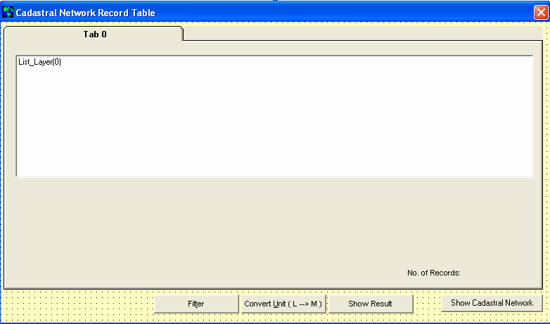
117 101
INTELLIGENCE BASED CADASTRAL DATABASE SELECTION AND VISUALIZATION SYSTEM: CONCEPTS AND PROTOTYPE
 INTELLIGENCE BASED CADASTRAL DATABASE SELECTION AND VISUALIZATION SYSTEM: CONCEPTS AND PROTOTYPE Abdullah Hisam Omar and Amran Bachok Department of Geomatic Engineering Faculty of Geoinformation Science
MASTER S PROJECT REPORT SUMMARY
 MASTER S PROJECT REPORT SUMMARY LEVEL OF SERVICE (LOS) FOR MULTILANE HIGHWAY AND ROAD ACCIDENT INFORMATION SYSTEM DEVELOPMENT OF BATU PAHAT AREA (LORIS) Prepared by: Mohd Ezree Bin Abdullah Master of Engineering
JOB AGENT MANAGEMENT SYSTEM LU CHUN LING. A thesis submitted in partial fulfillment of. the requirements for the award of the degree of
 JOB AGENT MANAGEMENT SYSTEM LU CHUN LING A thesis submitted in partial fulfillment of the requirements for the award of the degree of Bachelor of Computer Sciences (Software Engineering) FACULTY OF COMPUTER
HELP DESK SYSTEM IZZAT HAFIFI BIN AHMAD ARIZA
 HELP DESK SYSTEM IZZAT HAFIFI BIN AHMAD ARIZA A thesis submitted in fulfillment of the requirement for the awards of Bachelor of Computer Science (Computer Systems & Networking) with Honours Faculty of
DEVELOPING AN ISP FOR HOTEL INDUSTRY: A CASE STUDY ON PUTRA PALACE HOTEL
 DEVELOPING AN ISP FOR HOTEL INDUSTRY: A CASE STUDY ON PUTRA PALACE HOTEL A report submitted to the Graduate School in partial fulfillment of the requirement for the Degree Master of Science (Information
Car Rental Management System (CRMS) Lee Chen Yong
 Lee Chen Yong") Car Rental Management System (CRMS) Lee Chen Yong This report is submitted in partial fulfillment of the requirement for the Bachelor of Computer Science (Database Management) FACULTY OF INFORMATION AND
Car Rental Management System (CRMS) Lee Chen Yong This report is submitted in partial fulfillment of the requirement for the Bachelor of Computer Science (Database Management) FACULTY OF INFORMATION AND
Technology Trends In Geoinformation
 Technology Trends In Geoinformation Dato Prof. Sr Dr. Abdul Kadir Bin Taib Department of Survey and Mapping Malaysia (JUPEM) Email: drkadir@jupem.gov.my www.jupem.gov.my NGIS 2008 3 rd. National GIS Conference
SPAM FILTERING USING BAYESIAN TECHNIQUE BASED ON INDEPENDENT FEATURE SELECTION MASURAH BINTI MOHAMAD
 SPAM FILTERING USING BAYESIAN TECHNIQUE BASED ON INDEPENDENT FEATURE SELECTION MASURAH BINTI MOHAMAD A project report submitted in partial fulfillment of the requirements for the award of the degree of
IMPROVING SERVICE REUSABILITY USING ENTERPRISE SERVICE BUS AND BUSINESS PROCESS EXECUTION LANGUAGE AKO ABUBAKR JAAFAR
 IMPROVING SERVICE REUSABILITY USING ENTERPRISE SERVICE BUS AND BUSINESS PROCESS EXECUTION LANGUAGE AKO ABUBAKR JAAFAR A project report submitted in partial fulfillment of the requirements for the award
LIGHTNING AS A NEW RENEWABLE ENERGY SOURCE SARAVANA KUMAR A/L ARPUTHASAMY UNIVERSITI TEKNOLOGI MALAYSIA
 LIGHTNING AS A NEW RENEWABLE ENERGY SOURCE SARAVANA KUMAR A/L ARPUTHASAMY UNIVERSITI TEKNOLOGI MALAYSIA LIGHTNING AS A NEW RENEWABLE ENERGY SOURCE SARAVANA KUMAR A/L ARPUTHASAMY A project report submitted
DEVELOP AND DESIGN SHEMATIC DIAGRAM AND MECHANISM ON ONE SEATER DRAG BUGGY MUHAMMAD IBRAHIM B MD NUJID
 DEVELOP AND DESIGN SHEMATIC DIAGRAM AND MECHANISM ON ONE SEATER DRAG BUGGY MUHAMMAD IBRAHIM B MD NUJID A report in partial fulfillment of the requirements For award of the Diploma of Mechanical Engineering
THE FINGERPRINT IDENTIFICATION OF ATTENDANCE ANALYSIS & MANAGEMENT. LEE GUAN HENG (Software Engineering)
") THE FINGERPRINT IDENTIFICATION OF ATTENDANCE ANALYSIS & MANAGEMENT LEE GUAN HENG (Software Engineering) This project is submitted in partial fulfillment of the requirements for the degree of Bachelor of
THE FINGERPRINT IDENTIFICATION OF ATTENDANCE ANALYSIS & MANAGEMENT LEE GUAN HENG (Software Engineering) This project is submitted in partial fulfillment of the requirements for the degree of Bachelor of
Reporting Thailand Cadastral System in Cadastre 2014 Trends
 Reporting Thailand Cadastral System in Cadastre 2014 Trends Vuttinan UTESNAN, Thailand Key words: cadastre2014, land registration, title, digital mapping SUMMARY Cadastral System is defined to the limit
UNIVERSITI TEKNIKAL MALAYSIA MELAKA FAKULTI TEKNOLOGI MAKLUMAT DAN KOMUNIKASI
 UNIVERSITI TEKNIKAL MALAYSIA MELAKA FAKULTI TEKNOLOGI MAKLUMAT DAN KOMUNIKASI SEMESTER 2 2013/2014 PROJEK SARJANA MUDA 1 (BITU ) BITD REPORT PROJECT TITLE: UTeM SPORT CARNIVAL EVENT MANAGEMENT SYSTEM PREPARED
WEB-BASED PROPERTY MANAGEMENT SYSTEM SAFURA ADEELA BINTI SUKIMAN
 i WEB-BASED PROPERTY MANAGEMENT SYSTEM SAFURA ADEELA BINTI SUKIMAN A thesis submitted in fulfillment of the requirements for the award of the degree of Masters of Science (IT Management) Faculty of Computer
The Status of Geospatial Information Management in China
 The Status of Geospatial Information Management in China Submitted by the National Administration of Surveying, Mapping and Geoinformation of China 1. Administration System The National Administration
EXPLORING AND SHARING GEOSPATIAL INFORMATION THROUGH MYGDI EXPLORER
 EXPLORING AND SHARING GEOSPATIAL INFORMATION THROUGH MYGDI EXPLORER Subashini Panchanathan Malaysian Centre For Geospatial Data Infrastructure ( MaCGDI ) Ministry of National Resources and Environment
Program Learning Objectives
 Geographic Information Science, M.S. Majors in Computational Geosciences. 2012-201. Awase Khirni Syed 1 *, Bisheng Yang 2, Eliseo Climentini * 1 s.awasekhirni@tu.edu.sa, Assitant Professor, Taif University,
CLIENT SERVER APPLICATION FOR SERVER FARM PERFORMANCE MONITORING ABDIRASHID HASSAN ABDI
 ii CLIENT SERVER APPLICATION FOR SERVER FARM PERFORMANCE MONITORING ABDIRASHID HASSAN ABDI A project submitted in partial fulfillment of the requirements for the award of the degree of Master of Computer
GEOGRAPHIC INFORMATION SYSTEMS
 GIS GEOGRAPHIC INFORMATION SYSTEMS FOR CADASTRAL MAPPING Chapter 6 2015 Cadastral Mapping Manual 6-0 GIS - GEOGRAPHIC INFORMATION SYSTEMS What is GIS For a long time people have sketched, drawn and studied
Changing Minds in an Evolving Society
 Dipl.-Ing. Gerhard MUGGENHUBER, Chair of FIG Commission 3, Austria and Rob MAHONEY, FRICS FBCartS, Director of MahGeo Gerhard Muggenhuber Rob Mahoney Key words: 1. TRANSFORMATION PROCESSES IMPEDE OUR SOCIETY
sensors ISSN 1424-8220 www.mdpi.com/journal/sensors
 Sensors 2009, 9, 2320-2333; doi:10.3390/s90402320 OPEN ACCESS sensors ISSN 1424-8220 www.mdpi.com/journal/sensors Article An Integrated Photogrammetric and Spatial Database Management System for Producing
DEVELOPMENT OF DATA ACQUISITION SOFTWARE FOR CENTRALIZED RADIATION MONITORING SYSTEM
 DEVELOPMENT OF DATA ACQUISITION SOFTWARE FOR CENTRALIZED RADIATION MONITORING SYSTEM Nolida Yussup 1, Maslina Mohd Ibrahim 1, Mohd Fauzi Haris 2, Syirrazie Che Soh 1, Harzawardi Hasim 1, Azraf Azman 3
IT Developments Enabling Customer-Oriented Cadastre 1
 1 Bogdan NEY and Andrzej SAMBURA, Poland 1. ROAD FROM PRODUCER-ORIENTED TO CUSTOMER-ORIENTED CADASTRE 1.1 Current Situation The current situation in cadastre is characterized by three main factors. Firstly,
BEST PRACTICES FOR LAND ADMINISTRATION SYSTEMS IN DEVELOPING COUNTRIES
 INTERNATIONAL CONFERENCE ON LAND POLICY REFORM Jakarta, 25-27 July 2000 LAP-C Project Support for Long Term Development of Land Management Policies IRBD Loan No 3792-IND BEST PRACTICES FOR LAND ADMINISTRATION
Screen Design : Navigation, Windows, Controls, Text,
 Overview Introduction Fundamentals of GUIs - methods - Some examples Screen : Navigation, Windows, Controls, Text, Evaluating GUI Performance 1 Fundamentals of GUI What kind of application? - Simple or
GEOGRAPHIC INFORMATION SYSTEMS
 GIS GEOGRAPHIC INFORMATION SYSTEMS FOR CADASTRAL MAPPING Chapter 7 2015 Cadastral Mapping Manual 7-0 GIS - GEOGRAPHIC INFORMATION SYSTEMS What is GIS For a long time people have sketched, drawn and studied
Geospatial exploitation Products. GXP WebView. Powered by the GXP Platform
 Geospatial exploitation Products GXP WebView Powered by the GXP Platform Exploitation Capabilities GXP WebView Powered by the GXP Platform Detailed annotation (text, points, lines, and polygons) Distance,
Development of 3D Cadastre System to Monitor Land Value and Capacity of Zoning (Case study: Tehran)
") 8 th International Congress on Advances in Civil Engineering, 15-17 September 2008 Eastern Mediterranean University, Famagusta, North Cyprus Development of 3D Cadastre System to Monitor Land Value and
8 th International Congress on Advances in Civil Engineering, 15-17 September 2008 Eastern Mediterranean University, Famagusta, North Cyprus Development of 3D Cadastre System to Monitor Land Value and
UNIVERSITI TEKNOLOGI MARA THE EFFECTIVENESS OF MARKETING MIX STRATEGY CASE STUDY: SETIA ALAM
 UNIVERSITI TEKNOLOGI MARA THE EFFECTIVENESS OF MARKETING MIX STRATEGY CASE STUDY: SETIA ALAM HIZMA RAZLIATI BINTI ABDUL RAHIM SEPTEMBER 2011-JANUARI 2012 JABATAN PENGURUSAN HARTANAH FAKULTI SENIBINA PERANCANGAN
KEY WORDS: Geoinformatics, Geoinformation technique, Remote Sensing, Information technique, Curriculum, Surveyor.
 CURRICULUM OF GEOINFORMATICS INTEGRATION OF REMOTE SENSING AND GEOGRAPHICAL INFORMATION TECHNOLOGY Kirsi VIRRANTAUS*, Henrik HAGGRÉN** Helsinki University of Technology, Finland Department of Surveying
INTEGRATED STAFF ATTENDANCE SYSTEM (ISAS) WEE PEK LING
 WEE PEK LING") INTEGRATED STAFF ATTENDANCE SYSTEM (ISAS) WEE PEK LING A report submitted in partial fulfillment of the requirements for the award of the degree of Bachelor of Computer Science (Computer Systems & Networking)
INTEGRATED STAFF ATTENDANCE SYSTEM (ISAS) WEE PEK LING A report submitted in partial fulfillment of the requirements for the award of the degree of Bachelor of Computer Science (Computer Systems & Networking)
RFID BASED SYSTEMATIC STUDENT S ATTENDANCE MANAGEMENT SYSTEM HANISAH BINTI HAMID. Faculty of Electrical and Electronic Engineering
 ii RFID BASED SYSTEMATIC STUDENT S ATTENDANCE MANAGEMENT SYSTEM HANISAH BINTI HAMID This thesis is submitted as partial fulfilment of the requirement for the award of the Bachelor of Electrical Engineering
PRINCIPLES FOR EVALUATION OF DEVELOPMENT ASSISTANCE
 PRINCIPLES FOR EVALUATION OF DEVELOPMENT ASSISTANCE DEVELOPMENT ASSISTANCE COMMITTEE PARIS, 1991 DAC Principles for Evaluation of Development Assistance Development Assistance Committee Abstract: The following
Introduction Continuing Competence Framework Components Glossary of Terms. ANMC Continuing Competence Framework
 continuing competence framework february 2009 Introduction Continuing Competence Framework Components Glossary of Terms ANMC Continuing Competence Framework Component Requirement PROFESSIONAL PORTFOLIO
GUIDELINE ON THE ACQUISITION OF PROPERTIES
 GUIDELINE ON THE ACQUISITION OF PROPERTIES (Effective 1 March 2014) Economic Planning Unit, Prime Minister s Department CONTENTS I. INTRODUCTION... 1 II. APPLICATIONS... 1 III. CONDITIONS FOR ACQUISITION...
Harmonizing Survey Deliverables Emerging Standards and Smart Data Exchange
 Harmonizing Survey Deliverables Emerging Standards and Smart Data Exchange Andy Hoggarth and Karen Cove, CARIS, Fredericton, Canada Introduction When a survey company plans a project the deliverables are
A STUDY OF SECURITY LIMITATIONS IN VIRTUAL LOCAL AREA NETWORK IMPLEMENTATION
 A STUDY OF SECURITY LIMITATIONS IN VIRTUAL LOCAL AREA NETWORK IMPLEMENTATION By ARUMUGAM BALASUNDARAM Thesis Submitted to the School of Graduate Studies,, in Fulfillment of the Partial Requirements for
ISTANBUL DECLARATION ON CADASTRE IN THE WORLD CADASTRE SUMMIT 2015
 ISTANBUL DECLARATION ON CADASTRE IN THE WORLD CADASTRE SUMMIT 2015 Let us Cadastre the World... 1. INTRODUCTION Land had represented wealth and power from the first settlement to the end of 1700s. As a
GEOGRAPHIC INFORMATION SYSTEMS
 GEOGRAPHIC INFORMATION SYSTEMS WHAT IS A GEOGRAPHIC INFORMATION SYSTEM? A geographic information system (GIS) is a computer-based tool for mapping and analyzing spatial data. GIS technology integrates
WHITE PAPER IMPROVING PERFORMANCE WITH AN ADAPTIVE PLATFORM FOR ENTERPRISE OPERATIONAL INTELLIGENCE HIGHLIGHTS P1 P4 P5.
 WHITE PAPER IMPROVING PERFORMANCE WITH AN ADAPTIVE PLATFORM FOR ENTERPRISE OPERATIONAL INTELLIGENCE October, 2015 HIGHLIGHTS P1 P4 P5 Competitive companies that succeed are the ones that embrace change.
The Role and Effect of Private Sector on Turkish Cadastral System
 WORLD CADASTRE SUMMIT The Role and Effect of Private Sector on Turkish Cadastral System Okan Yıldız, Yakup Emre Çoruhlu, Osman Demir, Merve Özlem Murat Karadeniz Technical University, Faculty of Engineering,
Applications of Mobile GIS in Forestry South Australia
 Applications of Mobile GIS in Forestry South Australia D. T. Battad a, P. Mackenzie b a South Australian Forestry Corporation, Mt. Gambier, South Australia, Australia 5290 - battad.dionisio@forestrysa.com.au
1.0 INTRODUCTION 2.0 DATA MANAGEMENT IN CGIS PROJECT
 Data Update Device (DUDe) as a Mobile GIS for TNB s Corporate Geospatial Information System (CGIS) Ahmad Hafifi Yusof Geomatics Unit (CGIS Project), IT & Business Solutions Department, ICT Division, Tenaga
CAPITAL REGION GIS SPATIAL DATA DEMONSTRATION PROJECT
 CAPITAL REGION GIS SPATIAL DATA DEMONSTRATION PROJECT DRAFT January 2013 Prepared by: O2 Planning + Design, Inc. The information contained in this document has been compiled by O2 Planning + Design Inc.
Queensland recordkeeping metadata standard and guideline
 Queensland recordkeeping metadata standard and guideline June 2012 Version 1.1 Queensland State Archives Department of Science, Information Technology, Innovation and the Arts Document details Security
A FOREST LANDS INFORMATION SYSTEM IN SUPPORT OF SUSTAINABLE MANAGEMENT AND USE OF FORESTS
 A FOREST LANDS INFORMATION SYSTEM IN SUPPORT OF SUSTAINABLE MANAGEMENT AND USE OF FORESTS National Cadastre & Mapping Agency () Ministry of Environment 288 Mesogion Ave. Cholargos 15562 (Athens) Greece
TWX-21 Business System Cloud for Global Corporations
 TWX-21 Business System Cloud for Global Corporations 8 TWX-21 Business System Cloud for Global Corporations Hidenori Kiuchi Yasuyuki Suzuki Sho Obayashi Manabu Naganuma Seiichiro Hayashi Taku Tozawa OVERVIEW:
THE STATUS OF GEOSPATIAL TRAINING IN TANZANIAN UNIVERSITIES
 1 st Esri Eastern Africa Education UC Opening Session 17 September 2013 THE STATUS OF GEOSPATIAL TRAINING IN TANZANIAN UNIVERSITIES Dr. Job Asheri Chaula & Mr. Zakaria Ngereja School of Geospatial Sciences
An ESRI White Paper July 2009 Creating and Maintaining a Geoportal Management Considerations
 An ESRI White Paper July 2009 Creating and Maintaining a Geoportal Management Considerations ESRI 380 New York St., Redlands, CA 92373-8100 USA TEL 909-793-2853 FAX 909-793-5953 E-MAIL info@esri.com WEB
Note: This article is also published at Frost.com and Ehealth
 Laboratory s Opportunities in APAC 15th Jun 2007 By: Adam Chee W.S Note: This article is also published at Frost.com and Ehealth Laboratory s (LIS) is a suite of software applications that helps manages
Sincerely yours, Kathryn Hurford Associate Director, Policy
 8 July 2005 Malaysia FTA Taskforce Department of Foreign Affairs and Trade R. G. Casey Building, John McEwen Crescent BARTON ACT 0221 Dear Sir/Madam, Engineers Australia is the peak body for engineering
SWEDEN - VIETNAM COOPERATION ON LAND ADMINISTRATION REFORM IN VIETNAM
 SWEDEN - VIETNAM COOPERATION ON LAND ADMINISTRATION REFORM IN VIETNAM Prof. Dr. Sc. DANG Hung Vo, Vietnam and Gösta PALMKVIST, Sweden SUMMARY This paper has the purpose to present briefly in the FIG meeting
NATIONAL ENTERPRISE-WIDE STATISTICAL SYSTEM (NEWSS) IMPACT TO DEPARTMENT OF STATISTICS MALAYSIA. Mazlan bin Sulong
 IMPACT TO DEPARTMENT OF STATISTICS MALAYSIA. Mazlan bin Sulong") NATIONAL ENTERPRISE-WIDE STATISTICAL SYSTEM (NEWSS) IMPACT TO DEPARTMENT OF STATISTICS MALAYSIA Mazlan bin Sulong ABSTRACT The Department of Statistics, Malaysia (DOSM), as the official provider of statistical
NATIONAL ENTERPRISE-WIDE STATISTICAL SYSTEM (NEWSS) IMPACT TO DEPARTMENT OF STATISTICS MALAYSIA Mazlan bin Sulong ABSTRACT The Department of Statistics, Malaysia (DOSM), as the official provider of statistical
I D C V E N D O R S P O T L I G H T
 I D C V E N D O R S P O T L I G H T Workstyle Innovation with Mobile/Cloud, and Fuji Xerox Next Generation Managed Print Services December 2014 By Eiji Ishida, Atushi Kikuchi Sponsored by Fuji Xerox Co.,
INDIVIDUAL COURSE DETAILS
 INDIVIDUAL COURSE DETAILS A. Name of Institution NATIONAL INSTITUTE OF TECHNICAL TEACHERS TRAINING AND RESEARCH TARAMANI CHENNAI 600 113 [An Autonomous Institute under Ministry of Human Resource Development,
Activites in Survey Department. Data Development Progress
 Introduction Activites in Survey Department Data Development Progress Conclusion Data Development in Brunei Darussalam Presented by : Hj Mohd Jamil bin Hj Mohd Ali Hj Jali bin Hj Nudin Survey Department
Agilent Automotive Power Window Regulator Testing. Application Note
 Agilent Automotive Power Window Regulator Testing Application Note Abstract Automotive power window regulator tests require the use of accurate data acquisition devices, as they cover a wide range of parameters
Sybase Solutions for Healthcare Adapting to an Evolving Business and Regulatory Environment
 Sybase Solutions for Healthcare Adapting to an Evolving Business and Regulatory Environment OVERVIEW Sybase Solutions for Healthcare Adapting to an Evolving Business and Regulatory Environment Rising medical
Establishment of a Lease Management System and a Workflow Management System
 LAND TENURE CENTER University of Wisconsin - Madison Consultancy Services to The Government of the Republic of Trinidad & Tobago LAND USE POLICY AND ADMINISTRATION PROJECT (LUPAP) FINAL REPORT Establishment
Position Paper on Marine Cadastres
 Position Paper on Marine Cadastres PCGIAP Working Group on the Cadastre Prepared by Professor Ian Williamson, Dr Joe Leach and Mr Abbas Rajibifard, Department of Geomatics, University of Melbourne, Australia
BISKUT RAYA INVENTORY MANAGEMENT SYSTEM (BRIMS) NURUL AMIRAH BINTI ROSLAN THESIS SUBMITTED IN FULFILLMENT OF THE DEGREE OF COMPUTER SCIENCE
 NURUL AMIRAH BINTI ROSLAN THESIS SUBMITTED IN FULFILLMENT OF THE DEGREE OF COMPUTER SCIENCE") BISKUT RAYA INVENTORY MANAGEMENT SYSTEM (BRIMS) NURUL AMIRAH BINTI ROSLAN THESIS SUBMITTED IN FULFILLMENT OF THE DEGREE OF COMPUTER SCIENCE FACULTY OF COMPUTER SYSTEM & SOFTWARE ENGINEERING UNIVERSITI
BISKUT RAYA INVENTORY MANAGEMENT SYSTEM (BRIMS) NURUL AMIRAH BINTI ROSLAN THESIS SUBMITTED IN FULFILLMENT OF THE DEGREE OF COMPUTER SCIENCE FACULTY OF COMPUTER SYSTEM & SOFTWARE ENGINEERING UNIVERSITI
A Look at the Contribution and Future of IT in Customer Service for the Tokyo Waterworks
 A Look at the Contribution and Future of IT in Customer Service for the Tokyo Waterworks Toshitake Amano Tama Collection System Department,Waterworks Business System Division, Public Utility Services Center
Data access and management
 B Data access and management CONTENTS B.1 Introduction... B-1 B.2 Data requirements and availability... B-1 B.3 Data access... B-2 B.4 Overall procedures... B-2 B.5 Data tools and management... B-4 Appendix
Transnational education and engineering accreditation
 Transnational education and engineering accreditation Ian Harrison and Kay Bond Abstract In the higher education sector there is increasing incidence of transnational education, whereby student learning
CLINICAL MANAGEMENT SYSTEM (CMS)
") CLINICAL MANAGEMENT SYSTEM (CMS) YEO YEN PING This project is submitted in partial fulfillment of the requirements for the degree of Bachelor of Science with Honours (Cognitive Science) Faculty of Cognitive
CLINICAL MANAGEMENT SYSTEM (CMS) YEO YEN PING This project is submitted in partial fulfillment of the requirements for the degree of Bachelor of Science with Honours (Cognitive Science) Faculty of Cognitive
PRODUCTIVITY IMPROVEMENT VIA SIMULATION METHOD (MANUFACTURING INDUSTRY) HASBULLAH BIN MAT ISA
 HASBULLAH BIN MAT ISA") PRODUCTIVITY IMPROVEMENT VIA SIMULATION METHOD (MANUFACTURING INDUSTRY) HASBULLAH BIN MAT ISA Thesis submitted in fulfillment of the requirements for the award of the degree of Bachelor of Mechanical Engineering
PRODUCTIVITY IMPROVEMENT VIA SIMULATION METHOD (MANUFACTURING INDUSTRY) HASBULLAH BIN MAT ISA Thesis submitted in fulfillment of the requirements for the award of the degree of Bachelor of Mechanical Engineering
National Diploma in Surveying (Level 6) with an optional strand in Mine Surveying Level 6
 with an optional strand in Mine Surveying Level 6") NZQF Ref 0453 Version 7 Page 1 of 17 National Diploma in Surveying (Level 6) with an optional strand in Mine Surveying Level 6 Credits 250 This qualification has been reviewed. The last date to meet the
NZQF Ref 0453 Version 7 Page 1 of 17 National Diploma in Surveying (Level 6) with an optional strand in Mine Surveying Level 6 Credits 250 This qualification has been reviewed. The last date to meet the
An Esri White Paper June 2011 ArcGIS for INSPIRE
 An Esri White Paper June 2011 ArcGIS for INSPIRE Esri, 380 New York St., Redlands, CA 92373-8100 USA TEL 909-793-2853 FAX 909-793-5953 E-MAIL info@esri.com WEB esri.com Copyright 2011 Esri All rights reserved.
Aerial imagery and geographic information systems used in the asbestos removal process in Poland
 Towards Horizon 2020 Lasaponara R., Masini N., Biscione M., Editors EARSeL, 2013 Aerial imagery and geographic information systems used in the asbestos removal process in Małgorzata Krówczyńska 1, Ewa
GIS a Tool for Transportation Infrastructure Planning in Ghana A Case Study to the Department of Feeder Roads
 GIS a Tool for Transportation Infrastructure Planning in Ghana A Case Study to the Department of Stephen Yao FIATORNU, Ghana Key words: SUMMARY With the development of GIS technology, network transportation
TABLE OF CONTENTS. SUPERVISOR S DECLARATION ii STUDENT S DECLARATION iii DEDICATION ACKNOWLEDGEMENTS v ABSTRACT LIST OF TABLES
 ACKNOWLEDGEMENT I would like to express my gratitude and appreciation to all those who gave me the possibility to complete this report. A special thanks to our final year project coordinator, Mr. Zamri,
A GIS helps you answer questions and solve problems by looking at your data in a way that is quickly understood and easily shared.
 A Geographic Information System (GIS) integrates hardware, software, and data for capturing, managing, analyzing, and displaying all forms of geographically referenced information. GIS allows us to view,
E-conveyancing in New Zealand: Progress to Date and Future Developments
 E-conveyancing in New Zealand: Progress to Date and Future Developments Robbie Muir 1 Introduction The use of information technology and online service channels has been a dominant theme in land registration
Review of Best Practice in Road Crash Database and Analysis System Design Blair Turner ARRB Group Ltd email: blair.turner@arrb.com.
 Blair ARRB Group Ltd email: blair.turner@arrb.com.au Abstract Crash databases are an essential tool in analysing crash risk. Databases allow analysis of trends as well as the identification of high crash
Guidelines for the use of the OGP P6/11 bin grid GIS data model
 Guidelines for the use of the OGP P6/11 bin grid GIS data model Report No. 483-6g July 2013 This document is a companion document to the OGP P6/11 Seismic bin grid data exchange format description (2012)
Geocoding in Law Enforcement Final Report
 Geocoding in Law Enforcement Final Report Geocoding in Law Enforcement Final Report Prepared by: The Crime Mapping Laboratory Police Foundation August 2000 Report to the Office of Community Oriented Policing
360 o View of. Global Immigration
 360 o View of Global Immigration In a fast moving global economy, remaining compliant with immigration laws, being informed and in control is more challenging than ever before. We are a globally linked
Surveying and Land Administration Sustainable Education for Developing Countries
 Surveying and Land Administration Sustainable Education for Developing Countries Chris LUNNAY, Australia Key words: Education, land registration, capacity building, sustainability, Lao PDR, Lao Land Titling
Guideline. Records Management Strategy. Public Record Office Victoria PROS 10/10 Strategic Management. Version Number: 1.0. Issue Date: 19/07/2010
 Public Record Office Victoria PROS 10/10 Strategic Management Guideline 5 Records Management Strategy Version Number: 1.0 Issue Date: 19/07/2010 Expiry Date: 19/07/2015 State of Victoria 2010 Version 1.0
NJDEP GPS Data Collection Standards For GIS Data Development
 NJDEP GPS Data Collection Standards For GIS Data Development Bureau of Geographic Information Systems Office of Information Resource Management June 8, 2011 1.0 Introduction... 3 2.0 GPS Receiver Hardware
The Asian Bankers Association (ABA) And Formal Workout Regime
 And Formal Workout Regime") Position Paper PROVIDING THE LEGAL AND POLICY ENVIRONMENT TO SUPPORT EFFECTIVE INFORMAL WORKOUT REGIMES IN THE ASIA-PACIFIC REGION 1. The Asian Bankers Association (ABA) considers robust insolvency and
Position Paper PROVIDING THE LEGAL AND POLICY ENVIRONMENT TO SUPPORT EFFECTIVE INFORMAL WORKOUT REGIMES IN THE ASIA-PACIFIC REGION 1. The Asian Bankers Association (ABA) considers robust insolvency and
Mining Cadastre in Africa Lessons Learnt
 Bill FEAST, Jonathan DAVIDS and Toby MILLS, South Africa and Paul DeVRIES, Sweden Key words: SUMMARY Spatial Dimension and its international partner, Swedish Geological AB have a focus on the management
About As. In a team with the best. ESRI Bulgaria is the exclusive distributor of Esri Inc. for Bulgaria. Esri Inc.
 About As ESRI Bulgaria is an IT company, leader in the field of Geographic Information Systems (GIS) on the Bulgarian market. Offering the most advanced high-tech products, solutions and services, ESRI
THE RELATIONSHIP BETWEEN HUMAN RESOURCE INFORMATION SYSTEM (HRIS) AND HUMAN RESOURCE MANAGEMENT (HRM) ALFRED PUN KHEE SEONG
 AND HUMAN RESOURCE MANAGEMENT (HRM) ALFRED PUN KHEE SEONG") THE RELATIONSHIP BETWEEN HUMAN RESOURCE INFORMATION SYSTEM (HRIS) AND HUMAN RESOURCE MANAGEMENT (HRM) ALFRED PUN KHEE SEONG UNIVERSITI TEKNIKAL MALAYSIA MELAKA I / We * hereby declare that have read For
THE RELATIONSHIP BETWEEN HUMAN RESOURCE INFORMATION SYSTEM (HRIS) AND HUMAN RESOURCE MANAGEMENT (HRM) ALFRED PUN KHEE SEONG UNIVERSITI TEKNIKAL MALAYSIA MELAKA I / We * hereby declare that have read For
1 INTRODUCTION TO SYSTEM ANALYSIS AND DESIGN
 1 INTRODUCTION TO SYSTEM ANALYSIS AND DESIGN 1.1 INTRODUCTION Systems are created to solve problems. One can think of the systems approach as an organized way of dealing with a problem. In this dynamic
How To Design An Invoice Processing And Document Management System
 WIPRO CONSULTING SERVICES Business Methods Series Source to Pay: Transforming Processing and Document Management Paulo Jose Freixa Calhau Preto Senior Manager, Finance & Accounting Transformation Practice,
WEB-BASED REWARD AND REDEMPTION SYSTEM FOR SMART RECYCLE SYSTEM
 WEB-BASED REWARD AND REDEMPTION SYSTEM FOR SMART RECYCLE SYSTEM Mohd Helmy Abd Wahab 1, Aeslina Abdul Kadir 2, Mohd Razali Md Tomari 3, and Mohamad Hairol Jabbar 4 1,3,4 Faculty of Electrical and Electronic
Chapter 2 Organizational Structure and Staffing
 In This Chapter Enterprise-Wide Organizational Models Spotsylvania County GIS Organizational Structure GIS Organizational Structure Recommendations GIS Enterprise Staffing Functional Areas Coordination
Harmonizing Survey Deliverables Emerging Standards and Smart Data Exchange
 Harmonizing Survey Deliverables Emerging Standards and Smart Data Exchange Andy Hoggarth, CARIS 115 Waggoners Lane, Fredericton, New Brunswick, Canada andy.hoggarth@caris.com Karen Cove, CARIS 115 Waggoners
White Paper On Pilot Method Of ERP Implementation
 White Paper On Pilot Method Of ERP Implementation Rod Clarke Rod Clarke provides guidance, advice and support to businesses in successfully applying IS/IT in support of their business goals. He brings
Country Paper: Automation of data capture, data processing and dissemination of the 2009 National Population and Housing Census in Vanuatu.
 Country Paper: Automation of data capture, data processing and dissemination of the 2009 National Population and Housing Census in Vanuatu. For Expert Group Meeting Opportunities and advantages of enhanced
Universiti Teknologi MARA. Requirement Analysis Using UML Approach for Research Management System (RMS)
") C^tJ O19OO(^'J.Tfi^'i- Universiti Teknologi MARA Requirement Analysis Using UML Approach for Research Management System (RMS) Enamul Hasan Bin Rusly Thesis submitted in fulfillment of the requirements
C^tJ O19OO(^'J.Tfi^'i- Universiti Teknologi MARA Requirement Analysis Using UML Approach for Research Management System (RMS) Enamul Hasan Bin Rusly Thesis submitted in fulfillment of the requirements
Changes in educational and economic environment require continuing academic curriculum development
 Changes in educational and economic environment require continuing academic curriculum development Annika Mauno 1 Department of Forest Products Technology, Helsinki University of Technology, P.O. Box 6400,
Kingdom Of Bahrain Ministry of Works. Enterprise Asset Management System A Geocentric Approach. Presented By Hisham Y.
 Kingdom Of Bahrain Ministry of Works Enterprise Asset Management System A Geocentric Approach Presented By Hisham Y. Sater April 2012 Ministry Of Works Bahrain MOW The construction arm of the Kingdom of
People s Republic of China: Strategy and Transport Policy Study on Promoting Logistics Development in Rural Areas
 Technical Assistance Report Project Number: 48022 Policy and Advisory Technical Assistance (PATA) August 2014 People s Republic of China: Strategy and Transport Policy Study on Promoting Logistics Development
POLAR IT SERVICES. Business Intelligence Project Methodology
 POLAR IT SERVICES Business Intelligence Project Methodology Table of Contents 1. Overview... 2 2. Visualize... 3 3. Planning and Architecture... 4 3.1 Define Requirements... 4 3.1.1 Define Attributes...
Development, Acquisition, Implementation, and Maintenance of Application Systems
 Development, Acquisition, Implementation, and Maintenance of Application Systems Part of a series of notes to help Centers review their own Center internal management processes from the point of view of
A system is a set of integrated components interacting with each other to serve a common purpose.
 SYSTEM DEVELOPMENT AND THE WATERFALL MODEL What is a System? (Ch. 18) A system is a set of integrated components interacting with each other to serve a common purpose. A computer-based system is a system
DEPARTMENT OF ESTATE -MANAGEMENT FACULTY OF ARCHITECTURE, PLANNING AND SURVEYING UNIVERSITI TEKNOLOGI MARA
 DEPARTMENT OF ESTATE -MANAGEMENT FACULTY OF ARCHITECTURE, PLANNING AND SURVEYING UNIVERSITI TEKNOLOGI MARA FACILITY MANAGEMENT AT HOSPITAL SULTANAH BAHIYAH, ALOR STAR This dissertation is submitted in