Webservices Technological Evolutions. Peter Bogaert University of Ghent (Belgium) E Governement Academy 8 Geoservices 15 februari 2006 Kortrijk.
|
|
|
- Dwight Gabriel Stokes
- 8 years ago
- Views:
Transcription
1 Webservices Technological Evolutions Peter Bogaert University of Ghent (Belgium)

2 Van Mainframe naar een gedistribueerd GIS Geographic Informationsystems From mainframe to distributed systems by means of webservices. P. Bogaert

3 Platformevolution Time

4 Accessibility Advantages Actuality

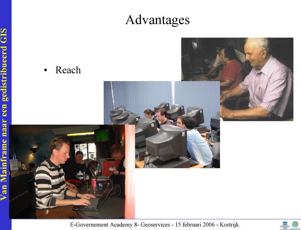
5 Reach Advantages
6 Arpanet TCP IP: communication protocol Reach Tim Brenners Lee and the WWW High Perfomance Act + Webbrowsers users

7 Users June 94 October 95 March 97 Reach July 98 December 99 Time April 01 September January 04 May 05 October 06 Source :CyberAtlas

8 Users July 98 December 99 Bereikbaarheid Belgium April 01 September 02 Time January 04 May 05 October 06 Bron: Insites BIM I XIII

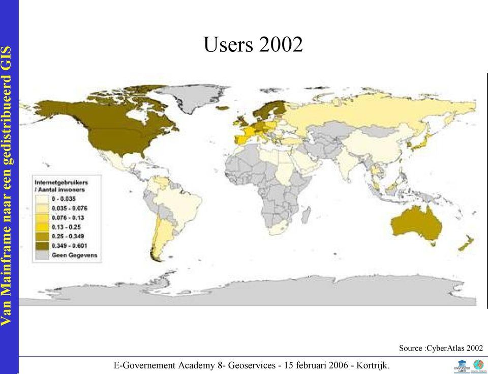
9 Users 2002 Source :CyberAtlas 2002
10 Relative number of users No Data Users 2005 Source :CyberAtlas 2005

11 Alsolute number of users No Data Users 2005 Source :CyberAtlas 2005

12 Van Mainframe naar een gedistribueerd GIS GIS and the Internet

13 Data Search and Download

14 Offer of Information

15 Data Services

16 Application Services

17 Distributed GI System Definition A distributed system is an application that runs on different computers, with different operating systems, at different locations and different connections but for the user it seems to be one system only

18 Client/Server architecture applied to a GIS Partitioning in software Presentation Logical Data

19 Client/Server architecture applied to a GIS Partitioning in software: Division point Presentation Logical Data Distributed Presentation Remote Data Access Remote presentation Distributed function Distributed database

20 Remote Presentation

21 Remote Data Acces
22 Client/Server architecture applied to a GIS Two, three, n tier systems
23 Van Mainframe naar een gedistribueerd GIS STANDARDS
24 Van Mainframe naar een gedistribueerd GIS XML
25 XML Van Mainframe Impacts naar of web een gedistribueerd services GIS XML? A language used to describe information Textual : easy to read
26 3 components Defining component XML
27 3 components Information component XML
28 3 components XML Read/Visualise component: Parser
29 Van Mainframe naar een gedistribueerd GIS Data Storage
30 GML Geography Markup Language An XML application for modelling and storing Geographic Information
31 GML Van Mainframe Impacts naar of web een gedistribueerd services GIS GML 2.0 GML 3.0 Simple features: point, line, polygon, no curves 2D GML D + Topology + complex features + temporal aspects + Reference systems + 8 times as big
32 Van Mainframe naar een gedistribueerd GIS Data Transmission
33 WMS (Web Map Service) Transmission via Images + + =
34 WMS (Web Map Service)
35 Functionalities WMS (Web Map Service) Client Data Server GetCapabilities Available Data and Metadata GetMap Image GetFeatureInfo Attribute Information
36 Client WFS (Web Feature Service) Instead of images, the data itself is sent Data Server GetCapabilities Available Data and Metadata DescribeFeatureType Data Description GetFeature Data
37 Others Catalog Service for the Web (Metadata)!!! Web Coverage Surface Web Terrain Service Styled Layer Description
38 Van Mainframe naar een gedistribueerd GIS Services Standards
39 Service Standards Van Mainframe Impacts naar of web een gedistribueerd services GIS UDDI : Universal Description, Discorvery and Integration Webservices Yellow Pages WSDL : Web Service Description Language Description of a webservice: available operations and parameters SOAP : Simple Object Acces Protocol Communication protocol for the communication between the client and the server of a webservice
40 Service Standards
41 Van Mainframe naar een gedistribueerd GIS For Free or For Fee?
42 For Free of For Fee? Webservices <> Free! Beveiliging mogelijk Copyrights en Privacy
43 Van Mainframe naar een gedistribueerd GIS Webservices : Users Professional / Non Professional?
44 Users Van Mainframe Impacts naar of web een gedistribueerd services GIS Professional Time A tailor made job Actuality Non Professional Inform Conversation Simple
45 Van Mainframe naar een gedistribueerd GIS The Medium
46 Considerations concerning the medium Client Server Architecture. Client Browser (Internet Explore, Netscape,...) Client Computer Communication Request Answer The connection Server Webserver (IIS, Apache,...) Serving Computer
47 Considerations concerning the medium Van Mainframe Impacts naar of web een gedistribueerd services GIS Client Computer: Plug ins (available / installed?) Avoid Plug ins Browsers (Netscape, Internet Explorer, Opera,?) Use Standards (HTML / DHTML) Online validation of the code via W3C Screen resolution (800x600 of 1024x768 ) Keep maps small Interactive maps can adapt to the users screen resolution Colours (256 colours or more?) Use with web save colours only (256 standard colours)
48 Considerations concerning the medium Van Mainframe Impacts naar of web een gedistribueerd services GIS The communication Does the client/server have a broadband/smallband connection How long does it take to use the service (5 seconds) World Wide Web <> World Wide Wait!!!
49 Considerations concerning the medium Van Mainframe Impacts naar of web een gedistribueerd services GIS The connection Keep the information to be sent as small possible Compression! Use interactivity! Send only the information which is asked for
50 Considerations concerning the medium Van Mainframe Impacts naar of web een gedistribueerd services GIS The serving computer: Do all systems that generate maps work on my system? (Windows, Unix, Linux, ) Do I have a strong enough computer to cope with: Number of visitors Memory Connection Maps to be generated Storage Memory
51 Conclusion Van Mainframe Impacts naar of web een gedistribueerd services GIS Technical possiblilities are available The Web : Multimedia Reach Actuality Metadata Privacy Copyrights
52 Van Mainframe naar een gedistribueerd GIS Geographic Informationsystems From mainframe to distributed systems by means of webservices Peter Bogaert Ghent University
DEVELOPMENT OF THE INTEGRATING AND SHARING PLATFORM OF SPATIAL WEBSERVICES
 DEVELOPMENT OF THE INTEGRATING AND SHARING PLATFORM OF SPATIAL WEBSERVICES Lan Xiaoji 1,2 Lu Guonian 1 Zhang Shuliang 1 Shi Miaomiao 1 Yin Lili 1 1. Jiangsu Provincial Key Lab of GIS Science, Nanjing Normal
TECHNOLOGY GUIDE THREE. Emerging Types of Enterprise Computing
 TECHNOLOGY GUIDE THREE Emerging Types of Enterprise Computing TECHNOLOGY GU IDE OUTLINE TG3.1 Introduction TG3.2 Server Farms TG3.3 Virtualization TG3.4 Grid Computing TG3.5 Utility Computing TG3.6 Cloud
DISMAR implementing an OpenGIS compliant Marine Information Management System
 DISMAR implementing an OpenGIS compliant Marine Information Management System Éamonn Ó T uama, Coastal & Marine Resources Centre, ERI, University College Cork. DISMAR DISMAR (Data Integration System for
WWW. World Wide Web Aka The Internet. dr. C. P. J. Koymans. Informatics Institute Universiteit van Amsterdam. November 30, 2007
 WWW World Wide Web Aka The Internet dr. C. P. J. Koymans Informatics Institute Universiteit van Amsterdam November 30, 2007 dr. C. P. J. Koymans (UvA) WWW November 30, 2007 1 / 36 WWW history (1) 1968
Internet Technologies_1. Doc. Ing. František Huňka, CSc.
 1 Internet Technologies_1 Doc. Ing. František Huňka, CSc. Outline of the Course 2 Internet and www history. Markup languages. Software tools. HTTP protocol. Basic architecture of the web systems. XHTML
Interoperable Solutions in Web-based Mapping
 ISPRS SIPT IGU UCI CIG ACSG Table of contents Table des matières Authors index Index des auteurs Search Recherches Exit Sortir Interoperable Solutions in Web-based Mapping Marta Wojnarowska and Bridget
Data interchange between Web client based task controllers and management information systems using ISO and OGC standards
 Data interchange between Web client based task controllers and management information systems using ISO and OGC standards Michael Nørremark 1*, Ole Jørgensen 1, Jens Bligaard 2 and Claus G. Sørensen 1
CISC 1600 Introduction to Multi-media Computing
 CISC 1600 Introduction to Multi-media Computing Spring 2012 Instructor : J. Raphael Email Address: Course Page: Class Hours: raphael@sci.brooklyn.cuny.edu http://www.sci.brooklyn.cuny.edu/~raphael/cisc1600.html
Data Visualization Using Web GIS Software
 Data Visualization Using Web GIS Software Tuomas Peltonen Radiation and Nuclear Safety Authority (STUK), Finland NKS NordDSS Workshop, Copenhagen, 1.-2.10.2009 RADIATION AND NUCLEAR SAFETY AUTHORITY Preface
3 CREATING A WFS SERVER
 APPIX A: INSTRUCTIONS MANUAL 3 CREATING A WFS SERVER 3.1 MAP-FILE FOR SINTANA The ARK system allows for some useful spatial features for the input data. For example the map view allows an overview of all
CURSO Inspire INSPIRE. SPEAKER: Pablo Echamendi Lorente. JEUDI 23/ THURSDAY 23 rd W S V : G E O S P A T I A L D A T A A C C E S S
 CURSO Inspire JEUDI 23/ THURSDAY 23 rd SPEAKER: Pablo Echamendi Lorente WS 5 SCHEDULE WMS OVERVIEW ACTIONS OGC SPECIFICATIONS OTHER SERVICES OVERVIEW proposal: Member States shall establish and operate
Enabling embedded maps
 Enabling embedded maps Case: National geoportal of Finland Antti Rainio National Land Survey of Finland Trends: Web Services, Mapping Mashup, Open Source, Open Data Decentralised data s Service interfaces
GIS AS A DECISION SUPPORT FOR SUPPLY CHAIN MANAGEMENT
 Paper Reference No.: PN-253 GIS AS A DECISION SUPPORT FOR SUPPLY CHAIN MANAGEMENT Sanjay Kumar 1 and Suneeta Agrawal 2 1. M. Tech. (GIS & Remote Sensing); GIS Cell; MNNIT, Allahabad, India (E-mail: saj.mnnit@gmail.com)
3-Tier Architecture. 3-Tier Architecture. Prepared By. Channu Kambalyal. Page 1 of 19
 3-Tier Architecture Prepared By Channu Kambalyal Page 1 of 19 Table of Contents 1.0 Traditional Host Systems... 3 2.0 Distributed Systems... 4 3.0 Client/Server Model... 5 4.0 Distributed Client/Server
Integrating AJAX Approach into GIS Visualization Web Services
 Integrating AJAX Approach into GIS Visualization Web Services Ahmet Sayar 1, 2, *, Marlon Pierce 1 1, 2, 3, 4 and Geoffrey Fox 1 Community Grids Lab, Indiana University, Bloomington, Indiana, 47404, USA
Open Source Visualisation with ADAGUC Web Map Services
 Open Source Visualisation with ADAGUC Web Map Services Maarten Plieger Ernst de Vreede John van de Vegte, Wim Som de Cerff, Raymond Sluiter, Ian van der Neut, Jan Willem Noteboom 1 ADAGUC project Cooperative
sessionx Desarrollo de Aplicaciones en Red Web Applications History (1) Content History (2) History (3)
 Content History (2) History (3)") sessionx Desarrollo de Aplicaciones en Red José Rafael Rojano Cáceres http://www.uv.mx/rrojano Web Applications 1 2 Content History (1) History Http CGI Web Tiers ARPANet Email, Ftp, IRC, news Explosive
sessionx Desarrollo de Aplicaciones en Red José Rafael Rojano Cáceres http://www.uv.mx/rrojano Web Applications 1 2 Content History (1) History Http CGI Web Tiers ARPANet Email, Ftp, IRC, news Explosive
Detailed Table of Contents
 Detailed Table of Contents Foreword Preface 1. Networking Protocols and OSI Model 1 1.1 Protocols in Computer Communications 3 1.2 The OSI Model 7 1.3 OSI Layer Functions 11 Summary 19 Key Terms and Concepts
How To Install The Arcgis For Inspire Server Extension On A Microsoft Gis For Inspire Server Extension (For Microsoft) On A Pc Or Macbook Or Ipa (For Macbook)
 On A Pc Or Macbook Or Ipa (For Macbook)") ArcGIS 10.2.1 for INSPIRE Server Extension Installation Guide Content 1 Introduction... 1 2 System Requirements... 1 3 Installation... 1 4 Software Authorization... 2 5 Changes to the System... 2 6 Performance
ArcGIS 10.2.1 for INSPIRE Server Extension Installation Guide Content 1 Introduction... 1 2 System Requirements... 1 3 Installation... 1 4 Software Authorization... 2 5 Changes to the System... 2 6 Performance
Lecture 2. Internet: who talks with whom?
 Lecture 2. Internet: who talks with whom? An application layer view, with particular attention to the World Wide Web Basic scenario Internet Client (local PC) Server (remote host) Client wants to retrieve
Managing a Geographic Database From Mobile Devices Through OGC Web Services
 Managing a Geographic Database From Mobile Devices Through OGC Web Services Nieves R. Brisaboa 1, Miguel R. Luaces 1, Jose R. Parama 1, and Jose R. Viqueira 2 1 Database Laboratory, University of A Coruña,
Web Development. Owen Sacco. ICS2205/ICS2230 Web Intelligence
 Web Development Owen Sacco ICS2205/ICS2230 Web Intelligence Brief Course Overview An introduction to Web development Server-side Scripting Web Servers PHP Client-side Scripting HTML & CSS JavaScript &
Oct 15, 2004 www.dcs.bbk.ac.uk/~gmagoulas/teaching.html 3. Internet : the vast collection of interconnected networks that all use the TCP/IP protocols
 E-Commerce Infrastructure II: the World Wide Web The Internet and the World Wide Web are two separate but related things Oct 15, 2004 www.dcs.bbk.ac.uk/~gmagoulas/teaching.html 1 Outline The Internet and
Developing a Web Service-Compatible Map Server for Geophysical Applications
 Developing a Web Service-Compatible Map Server for Geophysical Applications Ahmet Sayar Mehmet S. Aktas Galip Aydin Community Grids Lab and Department Community Grids Lab and Department Community Grids
Access to ESPON Database by third- party applications An expertise on the potentialities of web services for accessing the ESPON metadata and data
 Access to ESPON Database by third- party applications An expertise on the potentialities of web services for accessing the ESPON metadata and data UNEP/GRID- Geneva 27/06/2013 ABOUT THIS DOCUMENT A technical
IT3504: Web Development Techniques (Optional)
") INTRODUCTION : Web Development Techniques (Optional) This is one of the three optional courses designed for Semester 3 of the Bachelor of Information Technology Degree program. This course on web development
INTRODUCTION : Web Development Techniques (Optional) This is one of the three optional courses designed for Semester 3 of the Bachelor of Information Technology Degree program. This course on web development
OPEN STANDARD WEB SERVICES FOR VISUALISATION OF TIME SERIES DATA OF FLOOD MODELS
 OPEN STANDARD WEB SERVICES FOR VISUALISATION OF TIME SERIES DATA OF FLOOD MODELS Barend Köbben FRMRC RPA 7 Workshop visualisations and flow simulations as flood risk communication tools
LSD APC Part I Workshop Geographic Information System. Danny Yeung 14 November 2015
 LSD APC Part I Workshop Geographic Information System Danny Yeung 14 November 2015 Purposes To help LSD probationers to prepare for the LSD APC Part I Written Assessment to be held in December 2015. To
Introduction to Cloud Computing. Lecture 02 History of Enterprise Computing Kaya Oğuz
 Introduction to Cloud Computing Lecture 02 History of Enterprise Computing Kaya Oğuz General Course Information The textbook: Enterprise Cloud Computing by Gautam Shroff (available at bookstore). Course
Study of GML-Based Geographical Data Visualization Strategy
 Study of GML-Based Geographical Data Visualization Strategy ZHANG LIN 1, CHEN SHI-BIN 2 1 College of Information Technology, ZheJiang University of Finance & Economics, HangZhou 310012, China 2 College
smespire - Exercises for the Hands-on Training on INSPIRE Network Services April 2014 Jacxsens Paul SADL KU Leuven
 smespire - Exercises for the Hands-on Training on INSPIRE Network Services April 2014 Jacxsens Paul SADL KU Leuven These exercises aim at people who already have some basic knowledge of INSPIRE Network
Institute of Computational Modeling SB RAS
 Institute of Computational Modeling SB RAS ORGANIZATION OF ACCESS TO OBSERVATIONAL DATA USING WEB SERVICES FOR MONITORING SYSTEMS THE STATE OF THE ENVIRONMENT Kadochnikov Aleksey A. Russia, Krasnoyarsk
GetLOD - Linked Open Data and Spatial Data Infrastructures
 GetLOD - Linked Open Data and Spatial Data Infrastructures W3C Linked Open Data LOD2014 Roma, 20-21 February 2014 Stefano Pezzi, Massimo Zotti, Giovanni Ciardi, Massimo Fustini Agenda Context Geoportal
Web Map Context Service for Adaptive Geospatial Data Visualization
 Web Map Context Service for Adaptive Geospatial Data Visualization Miloš Bogdanović, Danilo Vulović, Leonid Stoimenov INTRODUCTION Faculty of Electronic Engineering, University of Niš, Serbia {milos.bogdanovic,
Building and Applying Geographical Information System Grids. 1. Introduction: Information Architecture for the Data Deluge
 Building and Applying Geographical Information System Grids Galip Aydin 1,2, Ahmet Sayar 1, 2, Harshawardhan Gadgil 1,2, Mehmet S. Aktas 1,2, Geoffrey C. Fox 1,2,3, Sunghoon Ko 1, Hasan Bulut 1,2,and Marlon
Geospatially Enabling the World: The Convergence of Geospatial and Architectural and Engineering Design
 Geospatially Enabling the World: The Convergence of Geospatial and Architectural and Engineering Design Geoff Zeiss Director of Technology Autodesk Map Middle East Dubai 2007 1 Overview Geospatial inflection
The ORIENTGATE data platform
 Seminar on Proposed and Revised set of indicators June 4-5, 2014 - Belgrade (Serbia) The ORIENTGATE data platform WP2, Action 2.4 Alessandra Nuzzo, Sandro Fiore, Giovanni Aloisio Scientific Computing and
Client/server is a network architecture that divides functions into client and server
 Page 1 A. Title Client/Server Technology B. Introduction Client/server is a network architecture that divides functions into client and server subsystems, with standard communication methods to facilitate
Chapter 4 IT Infrastructure and Platforms
 Chapter 4 IT Infrastructure and Platforms Essay Questions: 1. Identify and describe the stages of IT infrastructure evolution. 2. Identify and describe the technology drivers of IT infrastructure evolution.
Web-based spatio-temporal visualization and analysis of the Siberian Earth System Science Cluster (SIB-ESS-C)
") Web-based spatio-temporal visualization and analysis of the Siberian Earth System Science Cluster (SIB-ESS-C) Roman Gerlach Supervisor: Prof. C. Schmullius (Dept. of Geography, Friedrich-Schiller-University
Web-based spatio-temporal visualization and analysis of the Siberian Earth System Science Cluster (SIB-ESS-C) Roman Gerlach Supervisor: Prof. C. Schmullius (Dept. of Geography, Friedrich-Schiller-University
Web Design and Development ACS-1809
 Web Design and Development ACS-1809 Chapter 1 9/9/2015 1 Pre-class Housekeeping Course Outline Text book : HTML A beginner s guide, Wendy Willard, 5 th edition Work on HTML files On Windows PCs Tons of
IT3503 Web Development Techniques (Optional)
") INTRODUCTION Web Development Techniques (Optional) This is one of the three optional courses designed for Semester 3 of the Bachelor of Information Technology Degree program. This course on web development
INTRODUCTION Web Development Techniques (Optional) This is one of the three optional courses designed for Semester 3 of the Bachelor of Information Technology Degree program. This course on web development
Introduction to Web Technology. Content of the course. What is the Internet? Diana Inkpen
 Introduction to Web Technology Content of the course Diana Inkpen The Internet and the WWW. Internet Connectivity. Basic Internet Services. University of Ottawa School of Information Technology and Engineering
GIS Web Services. Acknowledgement: Thanks to Principal & Dr. (Mrs.) G.V. Rao, CRS-GIS, K.J.
 G.V. Rao, CRS-GIS, K.J.") GIS Web Services Presented By: Shivani Shukla Acknowledgement: Thanks to Principal & Dr. (Mrs.) G.V. Rao, CRS-GIS, K.J. Somaiya College Of Science & Commerce, Mumbai for the inspiration of poster making.
GIS Web Services Presented By: Shivani Shukla Acknowledgement: Thanks to Principal & Dr. (Mrs.) G.V. Rao, CRS-GIS, K.J. Somaiya College Of Science & Commerce, Mumbai for the inspiration of poster making.
DISMAR: Data Integration System for Marine Pollution and Water Quality
 DISMAR: Data Integration System for Marine Pollution and Water Quality T. Hamre a,, S. Sandven a, É. Ó Tuama b a Nansen Environmental and Remote Sensing Center, Thormøhlensgate 47, N-5006 Bergen, Norway
Introduction to Web Technologies
 Introduction to Web Technologies Tara Murphy 17th February, 2011 The Internet CGI Web services HTML and CSS 2 The Internet is a network of networks ˆ The Internet is the descendant of ARPANET (Advanced
Lecture 1. Lecture Overview. Intro to Networking. Intro to Networking. Motivation behind Networking. Computer / Data Networks
 Lecture 1 An Introduction to Networking Chapter 1, pages 1-22 Dave Novak BSAD 146, Introduction to Networking School of Business Administration University of Vermont Lecture Overview Brief introduction
Introduction to Geospatial Web Services
 Geospatial Web Services Introduction to Geospatial Web Services An introduction and inventory of geospatial web services and their importance to interoperability in the geospatial domain. vers. 20100604
Lesson Overview. Getting Started. The Internet WWW
 Lesson Overview Getting Started Learning Web Design: Chapter 1 and Chapter 2 What is the Internet? History of the Internet Anatomy of a Web Page What is the Web Made Of? Careers in Web Development Web-Related
Software Architecture Document
 Software Architecture Document Project Management Cell 1.0 1 of 16 Abstract: This is a software architecture document for Project Management(PM ) cell. It identifies and explains important architectural
--Preliminary-- Science Data Access Architectures Mike Martin, 11/20/06
 --Preliminary-- Science Data Access Architectures Mike Martin, 11/20/06 This paper presents a description and comparison of several architectures for providing access to distributed science data collections.
COLLEGE OF COMPUTER SCIENCE & INFORMATICS Information Technology Courses
 COLLEGE OF COMPUTER SCIENCE & INFORMATICS Information Technology Courses IT101 Introduction to Computer Applications The 20 th century not only brought us the dawn of Information Age, but continued to
Emerging Trends in SDI.
 Emerging Trends in SDI. Jeanne Foust ESRI gsdi 1 Spatial Data Infrastructure TRENDS GIS use continues to rapidly grow. Recognition Of GIS As Critical Infrastructure growing. Alignment of SDI and National
About scope of OpenGIS technology in oceanographic data management and visualization Andrey V. Golik, Vitaly K. Fischenko, Stepan G.
 About scope of OpenGIS technology in oceanographic data management and visualization Andrey V. Golik, Vitaly K. Fischenko, Stepan G. Antushev V.I.Il ichev Pacific Oceanological Institute Far-Eastern Branch
Web Hosting. Definition. Overview. Topics. 1. Overview of the Web
 Web Hosting Definition The World Wide Web (WWW), a web of worldwide servers connected to the Internet, provides an easily used and understood method of accessing electronic content. Accessing information
OGC at KNMI: Current use and plans Available products
 OGC at KNMI: Current use and plans Available products Maarten Plieger KNMI R&D Ernst de Vreede, John van de Vegte, Wim Som de Cerff, Ian van der Neut, Raymond Sluiter, Jan Willem Noteboom Contents 1. ADAGUC
Rich Web Map Applications HANNES JOHANSSON
 Rich Web Map Applications An assessment of performance, functionality and implementation of Rich Internet Application techniques in web-based GIS Master of Science Thesis in the Programme Software Engineering
How To Manage Technology
 Chapter 4 IT Infrastructure: Hardware and Software 4.1 2007 by Prentice Hall STUDENT OBJECTIVES Identify and describe the components of IT infrastructure. Identify and describe the major types of computer
Web Services for Environmental Informatics
 Web Services for Environmental Informatics Erick Arauco a and Lorenzo Sommaruga b a University of Piura - Engineering Department,Piura, Perú- earauco@udep.edu.pe b University of Applied Sciences of Southern
ArcGIS Framework Plug-In: Extending the ArcGIS Desktop for ANSI Standard Framework Data to Support Government Decision Making
 ArcGIS Framework Plug-In: Extending the ArcGIS Desktop for ANSI Standard Framework Data to Support Government Decision Making Final Project Report October 28, 2008 Agreement Number Organization Project
Web Foundations Series Internet Business Associate
 Web Foundations Series Internet Business Associate Internet Business Associate prepares students to work effectively in today's business environment. In this course, you will learn about the tasks involved
Web 3D Service (W3DS) in Geoserver
 in Geoserver") Jorge Gustavo Rocha jgr@di.uminho.pt Nuno Carvalho Oliveira nmco51845@gmail.com VI Jornadas SIG Libre, Girona, March 23, 2012 1 Motivation and Introduction 2 3 4 5 Motivation Motivation and Introduction
Jorge Gustavo Rocha jgr@di.uminho.pt Nuno Carvalho Oliveira nmco51845@gmail.com VI Jornadas SIG Libre, Girona, March 23, 2012 1 Motivation and Introduction 2 3 4 5 Motivation Motivation and Introduction
Network and Services (NETW-903)
") Network and Services (NETW-903) Dr. Mohamed Abdelwahab Saleh IET-Networks, GUC Fall 2015 Course Outline Introduction to Network Services. Web Services. Multimedia Services. Mobile Services Computation
Network and Services (NETW-903) Dr. Mohamed Abdelwahab Saleh IET-Networks, GUC Fall 2015 Course Outline Introduction to Network Services. Web Services. Multimedia Services. Mobile Services Computation
Technical Specification. Solutions created by knowledge and needs
 Technical Specification Solutions created by knowledge and needs The industrial control and alarm management system that integrates video, voice and data Technical overview Process Architechture OPC-OCI
IT Infrastructure and Emerging Technologies
 IT Infrastructure and Emerging Technologies Content IT Infrastructure Infrastructure Components Contemporary Hardware Platform Trends Contemporary Software Platform Trends Management Issues 2 IT infrastructure
Emerging Technologies Shaping the Future of Data Warehouses & Business Intelligence
 Emerging Technologies Shaping the Future of Data Warehouses & Business Intelligence Service Oriented Architecture SOA and Web Services John O Brien President and Executive Architect Zukeran Technologies
Fundamentals of Web Programming a
 Fundamentals of Web Programming a Software As A Service Teodor Rus rus@cs.uiowa.edu The University of Iowa, Department of Computer Science a Copyright 2009 Teodor Rus. These slides have been developed
VALLIAMMAI ENGINEERING COLLEGE SRM NAGAR, KATTANKULATHUR-603203 DEPARTMENT OF COMPUTER APPLICATIONS SUBJECT : MC7502 SERVICE ORIENTED ARCHITECTURE
 VALLIAMMAI ENGINEERING COLLEGE SRM NAGAR, KATTANKULATHUR-603203 DEPARTMENT OF COMPUTER APPLICATIONS QUESTION BANK V SEMESTER MCA SUBJECT : MC7502 SERVICE ORIENTED ARCHITECTURE PART A UNIT I 1. What is
Geospatial exploitation Products. GXP WebView. Powered by the GXP Platform
 Geospatial exploitation Products GXP WebView Powered by the GXP Platform Exploitation Capabilities GXP WebView Powered by the GXP Platform Detailed annotation (text, points, lines, and polygons) Distance,
DEVELOPING GIS VISUALIZATION WEB SERVICES FOR GEOPHYSICAL APPLICATIONS
 DEVELOPING GIS VISUALIZATION WEB SERVICES FOR GEOPHYSICAL APPLICATIONS A. Sayar a,b. *, M. Pierce a, G. C. Fox a,b,c a Community Grids Laboratory, Indiana University 501 N. Morton Suite 224, Bloomington,
OpenGIS web services architecture description
 Open Geospatial Consortium Inc. Date: 2005-11-17 Reference number of this document: OGC 05-042r2 Version: 0.1.0 Category: OpenGIS Best Practices Paper Editor: Arliss Whiteside OpenGIS web architecture
Release 1. ICAPRG604A Create cloud computing services
 Release 1 ICAPRG604A Create cloud computing services ICAPRG604A Create cloud computing services Modification History Release Release 1 Comments This version first released with ICA11 Information and Communications
Preparation Guide. EXIN Cloud Computing Foundation
 Preparation Guide EXIN Cloud Computing Foundation Edition June 2012 Copyright 2012 EXIN All rights reserved. No part of this publication may be published, reproduced, copied or stored in a data processing
National Geothermal Data System and Global Geosciences Data Integration
 National Geothermal Data System and Global Geosciences Data Integration Lee Allison, AZGS Stephen Richard, AZGS Arlene Anderson, US DOE David Cuyler, US DOE & Sandia Natl Lab NERC 2008 Outline Rational
Motivation Definitions EAI Architectures Elements Integration Technologies. Part I. EAI: Foundations, Concepts, and Architectures
 Part I EAI: Foundations, Concepts, and Architectures 5 Example: Mail-order Company Mail order Company IS Invoicing Windows, standard software IS Order Processing Linux, C++, Oracle IS Accounts Receivable
Computer Networks. Lecture 7: Application layer: FTP and HTTP. Marcin Bieńkowski. Institute of Computer Science University of Wrocław
 Computer Networks Lecture 7: Application layer: FTP and Marcin Bieńkowski Institute of Computer Science University of Wrocław Computer networks (II UWr) Lecture 7 1 / 23 Reminder: Internet reference model
Open Geospatial Consortium, Inc.
 Open Geospatial Consortium, Inc. Date: 2010-08-18 Reference number of this document: OGC 10-130 Category: OGC Public Engineering Report Editor: Debbie Wilson OGC OWS-7 Aviation FUSE Deployment Engineering
INTEROPERABLE IMAGE DATA ACCESS THROUGH ARCGIS SERVER
 INTEROPERABLE IMAGE DATA ACCESS THROUGH ARCGIS SERVER Qian Liu Environmental Systems Research Institute 380 New York Street Redlands, CA92373, U.S.A - qliu@esri.com KEY WORDS: OGC, Standard, Interoperability,
Configuring IBM HTTP Server as a Reverse Proxy Server for SAS 9.3 Web Applications Deployed on IBM WebSphere Application Server
 Configuration Guide Configuring IBM HTTP Server as a Reverse Proxy Server for SAS 9.3 Web Applications Deployed on IBM WebSphere Application Server This document is revised for SAS 9.3. In previous versions
Standardised Access to Geospatial Information and Services
 Department of Computing Science Umeå University Standardised Access to Geospatial Information and Services - Towards a European Infrastructure for Geospatial Information Master's Thesis Project, 20 Credits
M-GIS Mobile and Interoperable Access to Geographic Information
 M-GIS Mobile and Interoperable Access to Geographic Information Jorge Cardoso 1, Artur Rocha 1, João Correia Lopes 1,2 1 INESC Porto, R. Dr. Roberto Frias, 4200-465 Porto http://www.inescporto.pt/ {jcsc,artur.rocha,jlopes}@inescporto.pt
Lecture (02) Networking Model (TCP/IP) Networking Standard (OSI) (I)
 Networking Model (TCP/IP) Networking Standard (OSI) (I)") Lecture (02) Networking Model (TCP/IP) Networking Standard (OSI) (I) By: Dr. Ahmed ElShafee ١ Dr. Ahmed ElShafee, ACU : Fall 2015, Networks II Agenda Introduction to networking architecture Historical
Lecture (02) Networking Model (TCP/IP) Networking Standard (OSI) (I) By: Dr. Ahmed ElShafee ١ Dr. Ahmed ElShafee, ACU : Fall 2015, Networks II Agenda Introduction to networking architecture Historical
UK Location Programme
 Location Information Interoperability Board Data Publisher How To Guide Understand the background to establishing an INSPIRE View Service using GeoServer DOCUMENT CONTROL Change Summary Version Date Author/Editor
M3-R3: INTERNET AND WEB DESIGN
 M3-R3: INTERNET AND WEB DESIGN NOTE: 1. There are TWO PARTS in this Module/Paper. PART ONE contains FOUR questions and PART TWO contains FIVE questions. 2. PART ONE is to be answered in the TEAR-OFF ANSWER
reviewed paper Proceedings REAL CORP 2009 Tagungsband 22-25 April 2009, Sitges. http://www.corp.at
 reviewed paper Public Participation and Urban Planning supported by OGC Web Services Joachim Benner, Thomas Eichhorn, Andreas Geiger, Karl-Heinz Häfele, Kai-Uwe Krause (Dr.-Ing. Joachim Benner, Andreas
Preparation Guide Content. EXIN Cloud. 1. Overview 4 2. Exam Requirements 6 3. List of Basic Concepts 9 4. Exam Literature 13. Computing Foundation
 Preparation Guide Content EXIN Cloud 1. Overview 4 2. Exam Requirements 6 3. List of Basic Concepts 9 4. Exam Literature 13 Computing Foundation Edition December 2015 Copyright 2015 EXIN All rights reserved.
Arts Image Database - Specifications
 Arts Image Database - Specifications Sean Dooley June 6, 2007 Contents Introduction 4 2 Project Outline 5 3 User Requirements 6 3. User Types...................................... 6 4 Functional Requirements
B.Sc. in Computer Information Systems Study Plan
 195 Study Plan University Compulsory Courses Page ( 64 ) University Elective Courses Pages ( 64 & 65 ) Faculty Compulsory Courses 16 C.H 27 C.H 901010 MATH101 CALCULUS( I) 901020 MATH102 CALCULUS (2) 171210
A Flexible Services Architecture Based Translator Web Services
 A Flexible Services Architecture Based Translator Web Services Phill Miller, Sushil K. Sharma, Fred L. Kitchens 1 Made2Manage Inc., Indianapolis, Indiana, USA pmiller@made2manage.com 2 Department of Management,
Publishing Geospatial Data through Geospatial Web Service and XML Database System
 American Journal of Applied Sciences 5 (10): 1358-1368, 2008 ISSN 1546-9239 2008 Science Publications Publishing Geospatial Data through Geospatial Web Service and XML Database System Pouria Amirian and
EBONE. European Biodiversity Observation Network: Design of a plan for an integrated biodiversity observing system in space and time
 EBONE European Biodiversity Observation Network: Design of a plan for an integrated biodiversity observing system in space and time D7.2: Tested web portal for data access based on technical and functional
Connecting with Computer Science, 2e. Chapter 5 The Internet
 Connecting with Computer Science, 2e Chapter 5 The Internet Objectives In this chapter you will: Learn what the Internet really is Become familiar with the architecture of the Internet Become familiar
Jozef Matula. Visualisation Team Leader IBL Software Engineering. 13 th ECMWF MetOps Workshop, 31 th Oct - 4 th Nov 2011, Reading, United Kingdom
 Visual Weather web services Jozef Matula Visualisation Team Leader IBL Software Engineering Outline Visual Weather in a nutshell. Path from Visual Weather (as meteorological workstation) to Web Server
SWE 444 Internet and Web Application Development. Introduction to Web Technology. Dr. Ahmed Youssef. Internet
 SWE 444 Internet and Web Application Development Introduction to Web Technology Dr. Ahmed Youssef Internet It is a network of networks connected and communicating using TCP/IP communication protocol 2
INSPIRE in practice: Experiences with INSPIRE data and services
 INSPIRE in practice: Experiences with INSPIRE data and services Peter Parslow Principal Geographic Information Architect June 2014: ISO TC211 Standards in Practice workshop What s INSPIRE? European Commission
GEOGRAPHIC INFORMATION SYSTEMS CERTIFICATION
 GEOGRAPHIC INFORMATION SYSTEMS CERTIFICATION GIS Syllabus - Version 1.2 January 2007 Copyright AICA-CEPIS 2009 1 Version 1 January 2007 GIS Certification Programme 1. Target The GIS certification is aimed
13.2 THE INTEGRATED DATA VIEWER A WEB-ENABLED APPLICATION FOR SCIENTIFIC ANALYSIS AND VISUALIZATION
 13.2 THE INTEGRATED DATA VIEWER A WEB-ENABLED APPLICATION FOR SCIENTIFIC ANALYSIS AND VISUALIZATION Don Murray*, Jeff McWhirter, Stuart Wier, Steve Emmerson Unidata Program Center, Boulder, Colorado 1.
The World Wide Web: History
 The World Wide Web: History - March, 1989, Tim Berners-Lee of Geneva s European Particle Physics Laboratory (CERN) circulated a proposal to develop a hypertext system for global information sharing in
GIS Databases With focused on ArcSDE
 Linköpings universitet / IDA / Div. for human-centered systems GIS Databases With focused on ArcSDE Imad Abugessaisa g-imaab@ida.liu.se 20071004 1 GIS and SDBMS Geographical data is spatial data whose