Triad Characterization of Soil Contamination at Former Small Arms Training Ranges
|
|
|
- Imogene Cunningham
- 8 years ago
- Views:
Transcription
1 Triad Characterization of Soil Contamination at Former Small Arms Training Ranges Kira P Lynch, MS USACE, Seattle District National Site Assessment Symposium San Diego, CA, June 28,

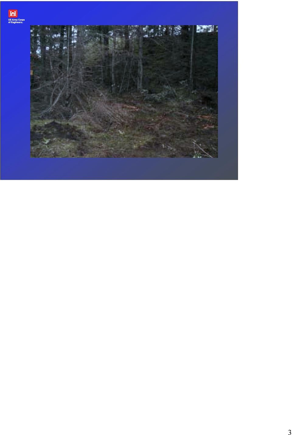
2 Site Background Site Fort Lewis, Tacoma, WA Two former small arms ranges and a skeet range Miller Hill active Evergreen Infiltration Range active Overgrown with trees and grasses Investigation and remediation performed under RCRA Agree Order (AO) Introduction -A good understanding of the extent of lead contamination is critical to the evaluation of potential remediation techniques. -Expedited site characterization with dynamic work plans was used as the framework for lead explorations at the former small arms ranges at Fort Lewis. -The objectives of these investigations were to evaluate the horizontal and vertical extent of lead contamination in a cost effective manner. -These explorations utilized a strategic investigative process rather than the more traditional phased approach. -The foundation of the strategic process is an integrated triad consisting of Systematic Planning, Dynamic Work Plans, and Real-time Measurement Technologies. 2

3 3
4 Project Team Fort Lewis Public Works Seattle District Corps WA Department of Ecology Core Technical Team Project Chemist/Technical Lead Project Data Coordinator (SADA) XRF Analyst Sampling Staff 4
 XRF Analyst")
5 Conceptual Site Model (CSM) Fixed or stationary targets and impact berms Miller Hill berm 180 long Evergreen berm 300 long and 40 tall Lead expected to be the primary contaminant of concern (COC) 45 caliber cartridge 97% lead, 2% antimony, trace arsenic, copper, tin, and zinc Potential human and ecological receptors Bullet pockets result in significant fragmentation and ricochet Soil primary matrix of concern and COCs not expected to have impacted groundwater Systematic Planning -Relies on a team of multi-disciplinary experienced technical staff to translate the project goals into realistic technical objectives. -Identifies decisions, develop decision logic and manages decision uncertainties. -A powerful planning tool is a conceptual site model (CSM) that crystallizes what is already knows about the site and helps the team focus on what must be learned to make decisions to achieve project objectives. -The team uses the CSM to direct fieldwork, allowing it to evolve as site work progresses and data gaps are filled. 5

6 Systematic Planning Aerial photo review Develop GIS maps with range layout Risk pathway evaluation and identification of potential action levels 50 ppm,, 250 ppm,, 400 ppm,, and 1000 ppm Field recon to identify impact berms and firing points No vegetation on the impact zone Develop data management & communication strategy 6

7 7

8 Refine Project Objectives Confirm the presence of soil contamination Confirm lead is the primary COC for defining extent of contamination Delineate the vertical and horizontal extent of lead contamination above 50 ppm Manage uncertainty around contaminant volume estimates greater than 250 ppm,, 400 ppm,, and 1000 ppm Collect data to determine if contaminated soil would be a RCRA characteristic waste 8

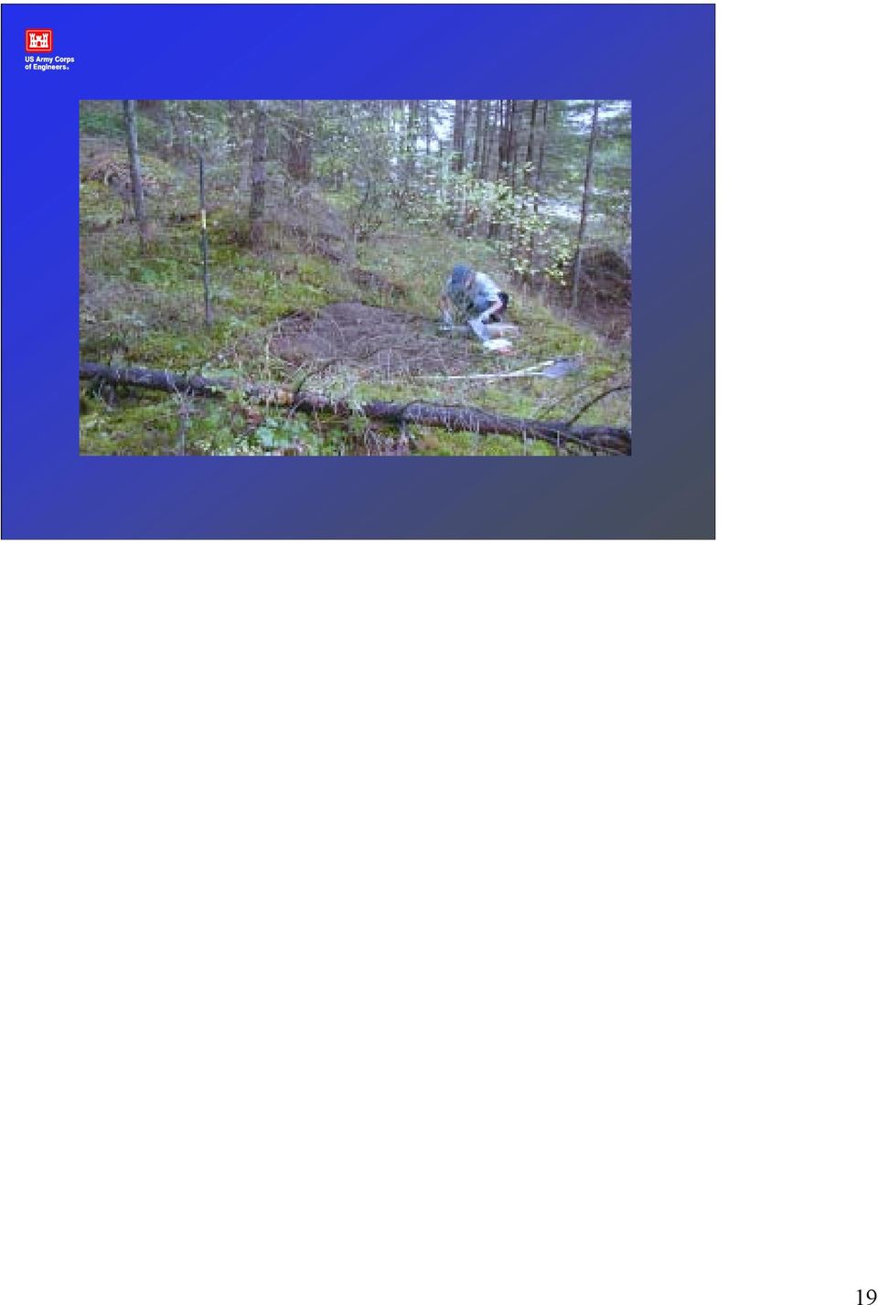
9 Dynamic Work Plan Strategy Sample location density initially driven by process knowledge and site usage 10 foot intervals lengthwise along berm face from and 1-22 foot depth Additional sample location determined real-time to define vertical and horizontal boundaries Sample support driven by potential remedies Institutional controls, dig and haul, or treatment Soil sieved with number 10 (<2mm) One gallon zip-lock bag filled with soil that was archived Data visualization using Spatial Analysis & Decision Assistance (SADA) to maintain close communication with team members as work progressed, and evaluate statistical uncertainty Dynamic Work Plan -Success of the exploration hinges on the presence of a senior technical staff in the field to call the shots based on the decision logic developed during the planning stage and to cope with unanticipated issues as they develop. -Utilized data visualization to maintain close communication with technical experts and project manager as work progressed. -Creates opportunities for real-time decision making to save significant time and money. 9

10 On-Site Analytical Tools A Niton 300 Series XRF was used to generate real time data. Collaborative samples were verified by laboratory analysis by ICP or ICP-MS methods. A statistical correlation between the XRF measurements and the collaborative laboratory samples was established during the demonstration of method applicability (DMA). On-Site Analytical Tools - A Niton 300 Series XRF was used to generate real time data. - Collaborative samples were verified by laboratory analysis by ICP or ICP-MS methods. -A statistical correlation between the XRF measurements and the collaborative laboratory samples was established during the demonstration of method applicability (DMA). -Metals tested for: arsenic, lead, copper, antimony, iron, tin, zinc to determine if lead was driver. -Results: there were exceedances of antimony (several > 32), copper ( 1 > 2960), arsenic (1 > 20) but only when lead was > 250 ppm. Lead is driver. 10

11 11

12 Communication Strategy Daily meetings with core technical team Weekly update meetings to include project support team Data and daily activity summary report posted daily to eroom Written documentation and meetings with regulators on major decision points (i.e. after the demonstration of methods applicability study) 12
 12")
13 Demonstration of Method Applicability (DMA) 40 samples collected from the impact berm at Evergreen 14 samples from impact area, 14 from below impact area, and 12 from bottom of berm Evaluate site-specific specific heterogeneities Sampling Design (bag vs. cup) Refine CSM confirm lead primary COC Evaluate XRF performance on site matrices Confirm 45 ppm XRF lead detection level Evaluate bias of the field-based instrument technology The DMA was planned and accomplished several goals: Initial evaluation of site specific heterogeneities that will support further design of the data collection program Sampling design (how many samples to collect and where to collect them) Refinement of the conceptual site model Evaluation of analytical performance on site specific sample matrices Determine whether and how to modify methods to improve performance and/or cost-effectiveness Evaluate the inherent bias of the field-based instrument technology such that an adequate safety factor can be built into the overall decision uncertainty limits 13

14 DMA Develop uncertainty intervals where it is judged that data can be confidently trusted to declare areas as Clean No further investigation Dirty Remedial action needed Ambiguous Further data required 14

15 Recommendations from the DMA Analyze precision samples when primary result near action levels, if average within uncertainty region next step Below detection to 100 ppm,, ppm,, and ppm Collect and measure an XRF cup sample for comparison, if matrix variability is appreciably different, then collect a co-located field duplicate within 2 feet from primary If both precision average and XRF cup fall within the uncertainty region, send a collaborative sample for fixed laboratory analysis 15

16 Uncertainty Reduction Collaborative samples were collected within the ambiguous window of uncertainty Co-located field duplicate sites to assess impact of site heterogeneity Precision samples to assess impact of within sample heterogeneity Collection of additional samples by immediate step-out QC samples Co-located field duplicate samples will be collected to assess combined sampling and field variability. The co-located field duplicate will be collected from 0.5 to 3 feet way from the primary sampling point. The relative percent difference (RPD) is calculated for the primary and replicate sample results. Field duplicate samples shall be collected for XRF analysis at a minimum frequency of one per every 10 samples during the DMA. The frequency of XRF field duplicates for the remainder of the project will be determined by the ranges seen in the DMA but will not exceed 10 percent. The RPD criteria for XRF results for field duplicates will be less than 50 percent. Precision. Measure within sample heterogeneity. A 1-gallon baggie of soil. For FPXRF samples, a precision sample will be measured at a frequency to be determined by the DMA. A precision sample will be a sample that has been analyzed seven times in replicate. If possible, samples near the action level will be selected as the precision sample. 16
 is calculated for the primary and replicate sample results.")
17 17

18 18

19 19
20 Project XRF vs. ICP Correlation for Lead XRF Analysis (mg/kg) y = x R 2 = ICP Analysis (mg/kg) DMA: 40 XRF bag measurements/40 collaborative 100%/20 precision 50%/6 field duplicates 15% Frequency of QC Collaborative 11% Precision 20% Duplicates 5% 20
 DMA: 40 XRF")
21 The initial sampling strategy will be evaluated once real time data from XRF results have been obtained to determine if increased sampling density is required. Software programs such as Spatial Analysis and Decision Assistance (SADA) provides a number of tools for the visualization of data, geospatial analysis, statistical analysis, sampling design and decision analysis (TIEM 2003). Secondary sampling design applications assists in determining additional sample locations, such as placing new sample locations in areas where there is the greatest uncertainty about exceeding the action level, delineating the boundaries of the area of concern. 21
22 22
23 23
24 24
25 Evergreen Berm, Plan View 12 Samples Probability > 250 ppm 25
26 Evergreen Berm, Plan View 12 Samples Probability > 1000 ppm 26
27 Evergreen Berm, Plan View 24 Samples Probability > 250 ppm 27
28 Evergreen Berm, Plan View 24 Samples Probability > 1000 ppm 28
29 Lead Distribution at the Evergreen Infiltration Range Berm by Depth Interval 0-12 (inches/bgs) (inches/bgs) Number of Samples Lead Concentration (mg/kg) 29
30 Lead Distribution in the Dark Side of the Berm by Depth Interval (inches/bgs) (inches/bgs) N umber of Sam ples Lead Concentration (mg/kg) 30
31 Volume changes with respect to Action Levels 6000 Volume (cubic yards) Action Level (mg/kg) 31
32 Action Level (mg/kg) 250 Volume (Yards 3 ) 5000 Excavation Effort Maximum Moderate Minimal 32
33 Conclusions Dynamic work plan strategies and field measurement technologies can guide sampling locations based on an evolving CSM allowing for rapid delineation of extent of contamination Reductions in analytical per sample costs result in increased data density allowing for management of decision uncertainty Statistically valid conclusions require both sampling and analytical uncertainties to be managed Sufficient data was generated to proceed with feasibility study with reliable contaminated soil estimates 33
34 Software Sources Spatial Analysis and Decision Assistance (SADA) tiem.utk.edu 34
Deana M. Crumbling, M.S. Technology Innovation Program U.S. Environmental Protection Agency Washington, D.C. USA (703) 603-0643
 603-0643") Wrap-Up & Questions Deana M. Crumbling, M.S. Technology Innovation Program U.S. Environmental Protection Agency Washington, D.C. USA (703) 603-0643 0643 crumbling.deana@epa.gov Triad Training, EPA National
Wrap-Up & Questions Deana M. Crumbling, M.S. Technology Innovation Program U.S. Environmental Protection Agency Washington, D.C. USA (703) 603-0643 0643 crumbling.deana@epa.gov Triad Training, EPA National
3-D Data Visualization Taking the Next Step in Data Presentation
 3-D Data Visualization Taking the Next Step in Data Presentation Stephen Dyment USEPA Office of Superfund Remediation and Technology Innovation dyment.stephen@epa.gov 15 th Annual OSC Readiness Training
Risk Management Procedure For The Derivation and Use Of Soil Exposure Point Concentrations For Unrestricted Use Determinations
 Risk Management Procedure For The Derivation and Use Of Soil Exposure Point Concentrations For Unrestricted Use Determinations Hazardous Materials and Waste Management Division (303) 692-3300 First Edition
DRAFT. GROUNDWATER REMEDY COMPLETION STRATEGY: Moving Forward with Completion in Mind
 GROUNDWATER REMEDY COMPLETION STRATEGY: Moving Forward with Completion in Mind Table of Contents 1. Introduction...2 1.1 Purpose and Scope...2 1.2 Background...3 2. Elements of a Groundwater Remedy Completion
Developing Quality Assurance Project Plans using Data Quality Objectives and other planning tools. Developing QAPPs 5/10/2012 1
 Developing Quality Assurance Project Plans using Data Quality Objectives and other planning tools 1 Introductions 2 Agenda I. Developing a QAPP II. Systematic Planning using Data Quality Objectives III.
Quality Assurance Guidance for Conducting Brownfields Site Assessments
 United States Office of Solid Waste and EPA 540-R-98-038 Environmental Protection Emergency Response OSWER 9230.0-83P Agency (5102G) PB98-963307 September 1998 Quality Assurance Guidance for Conducting
Preliminary Estimate Distribution of Exide s Lead Emissions in Soil
 Preliminary Estimate Distribution of Exide s Lead Emissions in Soil Department of Toxic Substances Control Kate Burger, P.G., Ph.D Senior Engineering Geologist Clean-up August 13,2015 1 Preface Goal: Assess
1.0 XRF Analyses Performance Evaluation
 1.1 Scope and Application 1.0 XRF Analyses Performance Evaluation Due to the time and monetary costs associated with conventional analytical methods for measuring the concentrations of inorganic elements
Current Perspectives in Site Remediation and Monitoring
 United States Environmental Protection Agency Office of Solid Waste and Emergency Response (5102G) EPA 542-R-01-016 October 2001 www.epa.gov www.clu-in.org Current Perspectives in Site Remediation and
Risk-Based Decision Making for Site Cleanup
 July 2013 Risk-Based Decision Making for Site Cleanup The Oklahoma Department of Environmental Quality (DEQ) has adopted a risk based decision making process to provide a framework for determining cleanup
CORRECTIVE ACTION AT OUTDOOR SHOOTING RANGES GUIDANCE DOCUMENT
 CORRECTIVE ACTION AT OUTDOOR SHOOTING RANGES GUIDANCE DOCUMENT Hazardous Materials and Waste Management Division Colorado Department of Public Health and Environment (303) 692-3300 Version Two May 2012
U. S. Army Corps of Engineers Ground Water Extraction System Subsurface Performance Checklist
 U. S. Army Corps of Engineers Ground Water Extraction System Subsurface Performance Checklist Installation Name Site Name / I.D. Evaluation Team Site Visit Date This checklist is meant to aid in evaluating
State of Rhode Island Department of Environmental Management Division of Site Remediation. Policy Memo 95-01
 State of Rhode Island Department of Environmental Management Division of Site Remediation Policy Memo 95-01 Guidelines for the Management of Investigation Derived Wastes 1.0 Purpose The purpose of this
Metals in Soil Analysis Using Field Portable X-ray Fluorescence
 Metals in Soil Analysis Using Field Portable X-ray Fluorescence A guideline to using portable XRF according to EPA Method 6200, basic overview of the technique of x-ray fluorescence (XRF), appropriate
Visual Sample Plan (VSP): A Tool for Balancing Sampling Requirements Against Decision Error Risk
: A Tool for Balancing Sampling Requirements Against Decision Error Risk") Visual Sample Plan (VSP): A Tool for Balancing Sampling Requirements Against Decision Error Risk B.A. Pulsipher, R.O. Gilbert, and J.E. Wilson Pacific Northwest National Laboratory, Richland, Washington,
Visual Sample Plan (VSP): A Tool for Balancing Sampling Requirements Against Decision Error Risk B.A. Pulsipher, R.O. Gilbert, and J.E. Wilson Pacific Northwest National Laboratory, Richland, Washington,
APPENDIX N. Data Validation Using Data Descriptors
 APPENDIX N Data Validation Using Data Descriptors Data validation is often defined by six data descriptors: 1) reports to decision maker 2) documentation 3) data sources 4) analytical method and detection
WATER SUPPLY WELL RECEPTOR SURVEY GUIDANCE DOCUMENT
 STATE OF CONNECTICUT DEPARTMENT OF ENERGY AND ENVIRONMENTAL PROTECTION WATER SUPPLY WELL RECEPTOR SURVEY GUIDANCE DOCUMENT Bureau of Water Protection and Land Reuse Remediation Division September 2009
New Cumberland Army Depot Formerly Used Defense Site (FUDS) Marsh Run Park Site Restoration Community Meeting
 Marsh Run Park Site Restoration Community Meeting") New Cumberland Army Depot Formerly Used Defense Site (FUDS) Marsh Run Park Site Restoration Community Meeting Fairview Township, York County, Pennsylvania April 23, 2013 N US Army Corps of Engineers Depot
New Cumberland Army Depot Formerly Used Defense Site (FUDS) Marsh Run Park Site Restoration Community Meeting Fairview Township, York County, Pennsylvania April 23, 2013 N US Army Corps of Engineers Depot
DATA QUALITY ASSESSMENT AND DATA USABILITY EVALUATION TECHNICAL GUIDANCE
 New Jersey Department of Environmental Protection Site Remediation Program DATA QUALITY ASSESSMENT AND DATA USABILITY EVALUATION TECHNICAL GUIDANCE Version 1.0 April 2014 Preamble The results of analyses
FINAL PLAN OF REMEDIAL ACTION
 FINAL PLAN OF REMEDIAL ACTION 1000 FRENCH STREET SITE Wilmington, Delaware DE 1115 June 1999 Department of Natural Resources and Environmental Control Division of Air and Waste Management Site Investigation
Technical/Regulatory Guidelines. Technical and Regulatory Guidance for the Triad Approach: A New Paradigm for Environmental Project Management
 Technical/Regulatory Guidelines Technical and Regulatory Guidance for the Triad Approach: A New Paradigm for Environmental Project Management December 2003 Prepared by The Interstate Technology & Regulatory
N00164.AR.002425 NSA CRANE 5090.3a
 N00164.AR.002425 NSA CRANE 5090.3a TRANSMITTAL LETTER REGARDING FINAL TECHNICAL MEMORANDUM SUPPLEMENTAL SOIL SAMPLING RESULTS AND PROPOSED ADDITIONAL SAMPLING PLAN ROUND 2 UNEXPLODED ORDNANCE 7 (UXO 7)
Scene Detection and Processing
 Scientific Working Group for Forensic Anthropology (SWGANTH) Scene Detection and Processing Issue Date: 01/23/2013 Revision: 0 Scene Detection and Processing 1.0 Principle, Spirit, and Intent A scene is
Environmental Site Assessments
 TRP Site Specific Activities Environmental Site Assessments Blase Leven KSU TAB Program Mickey Hartnett MAP/Envirofields Mary Ahlstrom MAP/MA Environmental May 21-23, 2012 Site Inventory to Cleanup Cleanup
EPA OSWER Data Management Current Efforts and Issues. Jean M Balent US EPA Technology Innovation & Field Services Division Balent.jean@epa.
 EPA OSWER Data Management Current Efforts and Issues Jean M Balent US EPA Technology Innovation & Field Services Division Balent.jean@epa.gov 703-603 603-9924 Overview Data in OSWER TIFSD s Experience
San Mateo County Environmental Health Characterization and Reuse of Petroleum Hydrocarbon Impacted Soil
 INTRODUCTION San Mateo County Environmental Health Characterization and Reuse of Petroleum Hydrocarbon Impacted Soil This guidance relates to the on-site reuse of non-hazardous petroleum hydrocarbon impacted
Gathering and Managing Environmental Quality Data for Petroleum Projects ABSTRACT
 Gathering and Managing Environmental Quality Data for Petroleum Projects Dr. David W. Rich, President, Geotech Computer Systems, Inc., Englewood, CO ABSTRACT Petroleum environmental projects face special
UNITED STATES CONSUMER PRODUCT SAFETY COMMISSION DIRECTORATE FOR LABORATORY SCIENCES DIVISION OF CHEMISTRY 5 RESEARCH PLACE ROCKVILLE, MD 20850
 UNITED STATES CONSUMER PRODUCT SAFETY COMMISSION DIRECTORATE FOR LABORATORY SCIENCES DIVISION OF CHEMISTRY 5 RESEARCH PLACE ROCKVILLE, MD 20850 Test Method: CPSC-CH-E1001-08.2 Standard Operating Procedure
FDEP Soil Cleanup Target Level Residential soil = 400 ppm Industrial soil = 920 ppm. Arsenic is a known human carcinogen EPA regulation
 Environmental Impacts of Lead Pellets at Shooting Ranges in Florida Lena Q. Ma, Ming Chen, and Willie G. Harris Soil & Water Science Department University of Florida Acknowledgment Principle investigators
Chapter 22: Overview of Ecological Risk Assessment
 Chapter 22: Overview of Ecological Risk Assessment Ecological risk assessment is the process of gaining an understanding of the likelihood of adverse effects on ecological receptors occurring as a result
N00639.AR.002001 NSA MID SOUTH 5090.3a STATEMENT OF BASIS SOLID WASTE MANAGEMENT UNIT 63 FORMER UNDERGROUND WASTE TANK MILLINGTON SUPPACT TN
 N639.AR.21 NSA MID SOUTH 59.3a STATEMENT OF BASIS SOLID WASTE MANAGEMENT UNIT 63 FORMER UNDERGROUND WASTE TANK MILLINGTON SUPPACT TN Statement of Basis Solid Waste Management Unit 63 Former Underground
Inventory of Performance Monitoring Tools for Subsurface Monitoring of Radionuclide Contamination
 Inventory of Performance Monitoring Tools for Subsurface Monitoring of Radionuclide Contamination H. Keith Moo-Young, Professor, Villanova University Ronald Wilhelm, Senior Scientist, U.S. EPA, Office
REDUCING UNCERTAINTY IN SOLAR ENERGY ESTIMATES
 REDUCING UNCERTAINTY IN SOLAR ENERGY ESTIMATES Mitigating Energy Risk through On-Site Monitoring Marie Schnitzer, Vice President of Consulting Services Christopher Thuman, Senior Meteorologist Peter Johnson,
Cost Estimating Concepts
 Cost Estimating Concepts Goal to provide an overview of cost estimating (CE) concepts in order to review CEs prepared by others or to create alternative CEs Why? financial assurance provision based upon
CHAPTER 4 TYPES OF COST ESTIMATES
 CHAPTER 4 TYPES OF COST ESTIMATES 1. INTRODUCTION All projects, both construction and environmental restoration, require cost estimates to plan and budget the project efficiently. Numerous estimates are
The Proposed Plan and Proposed Plan Fact Sheet are available in the NCBC Gulfport ERP Administrative Record File.
 The World War II Landfill (Site 2) Proposed Plan Public Meeting was held from 2-4 pm on December 2, 2014 at the Gulfport Public Library. The Public Meeting marked the opening of a 30-day Public Comment
GUIDELINES FOR INVESTIGATING AND REMEDIATING NITRATE/AMMONIA CONTAMINATION FROM AGRICULTURAL CHEMICAL RELEASES!
 BUREAU OF ENVIRONMENTAL REMEDIATION/REMEDIAL SECTION POLICY GUIDELINES FOR INVESTIGATING AND REMEDIATING NITRATE/AMMONIA CONTAMINATION FROM AGRICULTURAL CHEMICAL RELEASES! BER POLICY # BER-RS-050 DATE:
New Jersey Department of Environmental Protection (NJDEP) Site Remediation Program INSTRUCTIONS FOR NJDEP ONLINE REMEDIAL INVESTIGATION REPORT SERVICE
 Site Remediation Program INSTRUCTIONS FOR NJDEP ONLINE REMEDIAL INVESTIGATION REPORT SERVICE") New Jersey Department of Environmental Protection (NJDEP) Site Remediation Program INSTRUCTIONS FOR NJDEP ONLINE REMEDIAL INVESTIGATION REPORT SERVICE Applicability Use these instructions when submitting
New Jersey Department of Environmental Protection (NJDEP) Site Remediation Program INSTRUCTIONS FOR NJDEP ONLINE REMEDIAL INVESTIGATION REPORT SERVICE Applicability Use these instructions when submitting
Appendix B: Monitoring Tool Matrices
 Appendix B: Monitoring Tool Matrices Content: This appendix provides a detailed description of the ISRAP matrix organization and an explanation of each field of the monitoring tool matrices (www.israp.org).
Street Address (number and street): City: County: ZIP Code: B. CURRENT SITE PRIORITY INFORMATION Was free product present this quarter?
: City: County: ZIP Code: B. CURRENT SITE PRIORITY INFORMATION Was free product present this quarter?") QUARTERLY MONITORING REPORT (QMR) COVER SHEET AND REPORT FORMAT State Form 56087 (6-16) 329 IAC 9-5 Indiana Department of Environmental Management Office of Land Quality Leaking Underground Storage Tank
QUARTERLY MONITORING REPORT (QMR) COVER SHEET AND REPORT FORMAT State Form 56087 (6-16) 329 IAC 9-5 Indiana Department of Environmental Management Office of Land Quality Leaking Underground Storage Tank
Sample Management SOP 2v8 Page 1 STANDARD OPERATING PROCEDURE NO. 2 SAMPLE MANAGEMENT REVISION LOG. Revision Number Description Date
 Sample Management SOP 2v8 Page 1 STANDARD OPERATING PROCEDURE NO. 2 SAMPLE MANAGEMENT REVISION LOG Revision Number Description Date 2.0 Original SOP 2.1 Revisions by McLemore after field testing 1/3/04
Technical Guidance Manual for the Implementation of the Hawai`i State Contingency Plan. Interim Final SECTION 10
 Technical Guidance Manual for the Implementation of the Hawai`i State Contingency Plan SECTION 10 DATA QUALITY ASSURANCE AND QUALITY CONTROL (QA/QC) Hawai`i HEER TGM 10-1 December 31, 2008 CONTENTS Acronyms
Portable X-ray fluorescence Spectroscopy. Michael A. Wilson Research Soil Scientist USDA-NRCS National Soil Survey Center Lincoln, NE
 Portable X-ray fluorescence Spectroscopy Michael A. Wilson Research Soil Scientist USDA-NRCS National Soil Survey Center Lincoln, NE OBJECTIVES Background of the method Features of the instrument Applications
Matt Harris, Golder Associates (NZ) Ltd. The value of geophysics as a non-intrusive method for site characterisation
 Ltd. The value of geophysics as a non-intrusive method for site characterisation") Matt Harris, Golder Associates (NZ) Ltd. The value of geophysics as a non-intrusive method for site characterisation Presentation Outline What is geophysics and how can it help me? Electrical Resistivity
Matt Harris, Golder Associates (NZ) Ltd. The value of geophysics as a non-intrusive method for site characterisation Presentation Outline What is geophysics and how can it help me? Electrical Resistivity
ATTACHMENT 8: Quality Assurance Hydrogeologic Characterization of the Eastern Turlock Subbasin
 ATTACHMENT 8: Quality Assurance Hydrogeologic Characterization of the Eastern Turlock Subbasin Quality assurance and quality control (QA/QC) policies and procedures will ensure that the technical services
Basic Tools for Process Improvement
 What is a Histogram? A Histogram is a vertical bar chart that depicts the distribution of a set of data. Unlike Run Charts or Control Charts, which are discussed in other modules, a Histogram does not
ASSURING THE QUALITY OF TEST RESULTS
 Page 1 of 12 Sections Included in this Document and Change History 1. Purpose 2. Scope 3. Responsibilities 4. Background 5. References 6. Procedure/(6. B changed Division of Field Science and DFS to Office
APPLICATION OF ICP-MS TECHNOLOGY FOR TRACE METALS ANALYSIS
 MR. TELLIARD: Our next speaker is Paula Hogg. Paula is currently a lab manager at Hampton Roads Sanitation District s Central Environmental Laboratory. We would like to also thank Hampton Roads for sending
Quality Assurance/Quality Control in Acid Deposition Monitoring
 Quality Assurance/Quality Control in Acid Deposition Monitoring Acid Deposition and Oxidant Research Center (Network Center of EANET) Introduction Wet deposition data are used for -assessments of spatial
Secondary Lead Smelting
 Secondary Lead Smelting Secondary Lead Smelting Objectives Describe the basic smelting process terms: smelting, refining, and alloying List key chemicals associated with secondary lead smelting Define
Frequently Asked Questions on the Alberta Tier 1 and Tier 2 Soil and Groundwater Remediation Guidelines. February 2008
 Frequently Asked Questions on the Alberta Tier 1 and Tier 2 Soil and Groundwater Remediation Guidelines February 2008 Frequently Asked Questions on the Alberta Tier 1 and Tier 2 Soil and Groundwater Remediation
APPENDIX D RISK ASSESSMENT METHODOLOGY
 APPENDIX D RISK ASSESSMENT METHODOLOGY There are numerous human-health and ecological issues associated with the construction and operation of any large coal-fueled electric power generation facility.
SPCC Plan - Calculation Guidance
 SPCC Plan - Calculation Guidance The following example compares two different design criteria: one based on the volume of the tank and one based on precipitation. Scenario: A 20,000-gallon horizontal tank
APPENDIX F Data Validation Program Memorandum
 APPENDIX F Data Validation Program Memorandum 2100 Main Street, Suite 150 Huntington Beach, California 92648 GEOSYNTEC CONSULTANTS (714) 969-0800 Fax (714) 969-0820 M E M O R A N D U M TO: cc: FROM: Brian
4 PROJECT PLAN DOCUMENTS
 1 4 PROJECT PLAN DOCUMENTS 2 3 4 5 6 7 8 9 10 11 12 13 14 15 16 17 18 19 20 21 22 23 24 25 26 27 28 29 30 31 32 33 4.1 Introduction The project plan documents are a blueprint for how a particular project
REGIONAL SEDIMENT MANAGEMENT: A GIS APPROACH TO SPATIAL DATA ANALYSIS. Lynn Copeland Hardegree, Jennifer M. Wozencraft 1, Rose Dopsovic 2 INTRODUCTION
 REGIONAL SEDIMENT MANAGEMENT: A GIS APPROACH TO SPATIAL DATA ANALYSIS Lynn Copeland Hardegree, Jennifer M. Wozencraft 1, Rose Dopsovic 2 ABSTRACT: Regional sediment management (RSM) requires the capability
Pierre VOC Ground Water Investigation and MTBE Remediation Pilot Study
 Pierre VOC Ground Water Investigation and MTBE Remediation Pilot Study Joint Meeting of 2007 Eastern South Dakota Water Conference and the 52 nd Annual Midwest Ground Water Conference October 30, 2007
Appendix D.1. Testing Requirements for Infiltration, Bioretention and Sand Filter Subsoils
 Appendix D.1 Testing Requirements for Infiltration, Bioretention and Sand Filter Subsoils General Notes Pertinent to All Testing 1. For infiltration trench (I-1) and basin (I-2) practices, a minimum field
Site Description and History
 1300 Northwest 31 st Avenue Fort Lauderdale, Florida County: Broward District: Southeast Site Lead: EPA Placed on National Priorities List: October 4, 1989 HWC # 085 Site Description and History The Wingate
APLS 2011. GIS Data: Classification, Potential Misuse, and Practical Limitations
 APLS 2011 GIS Data: Classification, Potential Misuse, and Practical Limitations GIS Data: Classification, Potential Misuse, and Practical Limitations Goals & Objectives Develop an easy to use geospatial
USE OF REFERENCE MATERIALS IN THE LABORATORY
 USE OF REFERENCE MATERIALS IN THE LABORATORY What is a reference material? A general definition of a reference material is a material or substance one or more of whose property values are sufficiently
Site Description and History
 3130 Southwest 17 th Street Pembroke Park, Florida County: Broward District: Southeast Site Lead: EPA Placed on National Priorities List: July 22, 1987 HWC # 023 Site Description and History The Petroleum
DOCUMENTATION OF ENVIRONMENTAL INDICATOR DETERMINATION Interim Final 2/5/99 RCRA Corrective Action Environmental Indicator (EI) RCRIS code (CA750)
 RCRIS code (CA750)") ... DOCUMENTATION OF ENVIRONMENTAL INDICATOR DETERMINATION Interim Final 2/5/99 RCRA Corrective Action Migration of Contaminated Groundwater Under Control Facility Name: Facility Address: Facility EPA
... DOCUMENTATION OF ENVIRONMENTAL INDICATOR DETERMINATION Interim Final 2/5/99 RCRA Corrective Action Migration of Contaminated Groundwater Under Control Facility Name: Facility Address: Facility EPA
QUALITY ASSURANCE PROJECT PLAN FOR BROWNFIELDS/VOLUNTARY CLEANUP PROGRAM SITES
 QUALITY ASSURANCE PROJECT PLAN FOR BROWNFIELDS/VOLUNTARY CLEANUP PROGRAM SITES Prepared by the Missouri Department of Natural Resources Division of Environmental Quality Hazardous Waste Program Brownfields/Voluntary
SLIDE XRF-1 XRF SLIDE XRF-2 Compatibility with the Triad Approach SLIDE XRF-3 Environmental Applications
 X-Ray Fluorescence (XRF) MODULE AT A GLANCE Overview SLIDE XRF-1 XRF SLIDE XRF-2 Compatibility with the Triad Approach SLIDE XRF-3 Environmental Applications Operating Principles Advantages Limitations
DOCUMENTATION OF ENVIRONMENTAL INDICATOR DETERMINATION
 DOCUMENTATION OF ENVIRONMENTAL INDICATOR DETERMINATION Interim Final 2/5/99 RCRA Corrective Action Environmental Indicator (El) RCRIS code (CA725) Current Human Exposures Under Control Facility Name: Formosa
Characterizing Beauty Salon Wastewater for the Purpose of Regulating Onsite Disposal Systems
 Characterizing Beauty Salon Wastewater for the Purpose of Regulating Onsite Disposal Systems Fred Bowers 1,2, Ph.D. New Jersey Department of Environmental Protection Division of Water Quality August 14,
Alternate Concentration Limits/Groundwater Cleanup Levels. Title slide
 Alternate Concentration Limits/Groundwater Cleanup Levels Title slide 1 Alternate Concentration Limits (ACL) Terms and Definitions 40 CFR 264 Subpart F Definitions Regulated Unit Ground Water Protection
Quality Assurance Project Plan Performance Assessment Model Version 2 Clive, Utah. Prepared by Neptune and Company
 Quality Assurance Project Plan Performance Assessment Model Version 2 Clive, Utah Prepared by Neptune and Company 1505 15 th St Suite B Los Alamos, NM 87544 Document No: 06245-001 APPROVALS Paul Black
NRC INSPECTION MANUAL
 NRC INSPECTION MANUAL INSPECTION PROCEDURE 88001 LLUR ON-SITE CONSTRUCTION PROGRAM APPLICABILITY: 2600, 2801 88001-01 INSPECTION OBJECTIVES 01.01 To determine by direct observation if on-site construction
DRY CLEANING PROGRAM QUALITY ASSURANCE MANAGEMENT PLAN
 DIVISION OF ENVIRONMENT QUALITY MANAGEMENT PLAN PART III: DRY CLEANING PROGRAM QUALITY ASSURANCE MANAGEMENT PLAN Revision 3 January 8, 2013 Kansas Department of Health and Environment Division of Environment
D où vient le plomb? :
 D où vient le plomb? : L utilisation de l environmental forensics pour la fixation des objectifs de dépollution du site d une ancienne unité de traitement des métaux précieux à Vienne dans l Isère Yvan
APPENDIX 7-B SUGGESTED OUTLINE OF A QUALITY ASSURANCE PROJECT PLAN
 APPENDIX 7-B SUGGESTED OUTLINE OF A QUALITY ASSURANCE PROJECT PLAN This outline is recommended for use by UST consultants/contractors in preparing a generic Quality Assurance Project Plan (QAPP) for use
Milltown Redevelopment Project Triad Investigation: Data Management Program
 Milltown Redevelopment Project Triad Investigation: Data Management Program James Mack New Jersey Institute Of Technology Newark, New Jersey 973 596 5857 mack@adm.njit.edu Milltown Redevelopment Project
MEMORANDUM. Further discussion regarding the Community s solid waste facility is described further in this memorandum.
 MEMORANDUM File: Sanikiluaq Improvement of the Existing Wastewater Treatment Facility To: Government of Nunavut Department of Community and Government Services Attention: Mr. Grigor Hope,, Project Officer
Federal Remediation Technologies Roundtable (FRTR) May 14, 2014. Marc R. Ferries, P.E. G2 Partners
 May 14, 2014. Marc R. Ferries, P.E. G2 Partners") Strategic t Management of fcomplex Sites Federal Remediation Technologies Roundtable (FRTR) May 14, 2014 Marc R. Ferries, P.E. VP V.P. Environment & Water Resources G2 Partners Topics for Discussion 2
Strategic t Management of fcomplex Sites Federal Remediation Technologies Roundtable (FRTR) May 14, 2014 Marc R. Ferries, P.E. VP V.P. Environment & Water Resources G2 Partners Topics for Discussion 2
ROADMAP TO LONG-TERM MONITORING OPTIMIZATION MAY 2005
 ii EPA 542-R-05-003 www.cluin.org/optimization May 2005 ROADMAP TO LONG-TERM MONITORING OPTIMIZATION NOTICE This information represents the views of the authors and has undergone EPA and external review
Soil Cleanup Goals. Minnesota Department of Agriculture Pesticide and Fertilizer Management Division. Guidance Document 19
 This document is made available electronically by the Minnesota Legislative Reference Library as part of an ongoing digital archiving project. http://www.leg.state.mn.us/lrl/lrl.asp Minnesota Department
Maine DEP s Dry Cleaner Initiative
 Maine DEP s Dry Cleaner Initiative Becky Blais, Environmental Specialist Division of Remediation Protecting Maine s Air, Land and Water Goals of the Dry Cleaner Initiative (DCI) Identify current or former
N00164.AR.002564 NSA CRANE 5090.3a
 N00164.AR.002564 NSA CRANE 5090.3a LETTER AND ATTACHED RESPONSE TO THE U S EPA REGION V COMMENTS ON THE TECHNICAL MEMORANDUM FOR SOIL DELINEATION SAMPLING AT (SWMU 3) AMMUNITION BURNING GROUNDS/OLD JEEP
Inlets Online: A Tutorial for Evaluating Inlet/Beach Processes Using Aerial Photography
 Inlets Online: A Tutorial for Evaluating Inlet/Beach Processes Using Aerial Photography by Mark R. Byrnes, Feng Li, and Julie D. Rosati PURPOSE: This Coastal and Hydraulics Engineering Technical Note (CHETN)
A GIS helps you answer questions and solve problems by looking at your data in a way that is quickly understood and easily shared.
 A Geographic Information System (GIS) integrates hardware, software, and data for capturing, managing, analyzing, and displaying all forms of geographically referenced information. GIS allows us to view,
Case Study: Habitat Restoration
 Case Study: Habitat Restoration RCRA Corrective Action Site Oil Refinery E-Pond SWMU Lima, Ohio B-1 Introduction: In January 2001, the U.S. EPA issued additional RCRA Cleanup Reforms to accelerate the
Data Management Implementation Plan
 Appendix 8.H Data Management Implementation Plan Prepared by Vikram Vyas CRESP-Amchitka Data Management Component 1. INTRODUCTION... 2 1.1. OBJECTIVES AND SCOPE... 2 2. DATA REPORTING CONVENTIONS... 2
Colorado Natural Heritage Program
 CNHP s mission is to preserve the natural diversity of life by contributing the essential scientific foundation that leads to lasting conservation of Colorado's biological wealth. Colorado Natural Heritage
3.3 Data Collection Systems Design... 22 3.4 Planning Documents... 23 3.4.1 Work Plan... 23 3.4.2 Field Sampling Plan (FSP)... 24 3.4.
... 24 3.4.") TABLE OF CONTENTS 1 INTRODUCTION... 1 1.1 Commitment to Quality... 1 1.2 QA Program Principles... 1 1.2.1 Client Satisfaction... 1 1.2.2 Employee Participation... 2 1.2.3 Problem Prevention... 2 1.2.4
TABLE OF CONTENTS 1 INTRODUCTION... 1 1.1 Commitment to Quality... 1 1.2 QA Program Principles... 1 1.2.1 Client Satisfaction... 1 1.2.2 Employee Participation... 2 1.2.3 Problem Prevention... 2 1.2.4
STATEMENT OF BASIS HYPERGOL SUPPORT BUILDING SWMU 65 NATIONAL AERONAUTICS AND SPACE ADMINISTRATION KENNEDY SPACE CENTER BREVARD COUNTY, FLORIDA
 STATEMENT OF BASIS HYPERGOL SUPPORT BUILDING SWMU 65 NATIONAL AERONAUTICS AND SPACE ADMINISTRATION KENNEDY SPACE CENTER BREVARD COUNTY, FLORIDA PURPOSE OF STATEMENT OF BASIS This Statement of Basis (SB)
PREDICTIVE MODELLING AND MONITORING NATURAL ATTENUATION TO SAVE REMEDIAL COSTS
 PREDICTIVE MODELLING AND MONITORING NATURAL ATTENUATION TO SAVE REMEDIAL COSTS A.Aziz Shaikh, Brian Tsang, Greg Sutor and Thomas Dance Abstract This paper describes the multidisciplinary components of
University Lands THE UNIVERSITY OF TEXAS SYSTEM
 University Lands THE UNIVERSITY OF TEXAS SYSTEM Soil Remediation Guidance for Crude Oil, Condensate, and Produced Water Releases A. Crude Oil 1) Report all spills by email or phone to the University Lands
Spill Plan Reviewer s Guidance
 Spill Plan Reviewer s Guidance WSDOT Hazardous Materials Program May 2013 2 Overview Purpose: Spill prevention planning is a key element for protecting the environment during construction. The Spill Plan
Spill Prevention, Control and Countermeasure (SPCC) Rule
 Rule") Spill Prevention, Control and Countermeasure (SPCC) Rule Code of Federal Regulations Title 40 CFR Part 112 Training Guide for Oil and Fuel handlers on Farms 1 Purpose of SPCC Rule To prevent oil discharges
Spill Prevention, Control and Countermeasure (SPCC) Rule Code of Federal Regulations Title 40 CFR Part 112 Training Guide for Oil and Fuel handlers on Farms 1 Purpose of SPCC Rule To prevent oil discharges
Health Consultation. Arkansas Plating Company Remediation Review
 Health Consultation Arkansas Plating Company Remediation Review ARKANSAS PLATING COMPANY 3021 NORTH ALBERT PIKE ROAD FORT SMITH, SEBASTIAN COUNTY, ARKANSAS 72904 EPA FACILITY ID: ARD046139770 Prepared
Answers to Commonly Asked Questions
 County of San Diego, Planning & Development Services FIRESTORM POLICY AND GUIDANCE DOCUMENT BUILDING DIVISION Answers to Commonly Asked Questions The County of San Diego understands the confusion and frustration
Great Lakes National Program Office and Office of Water Quality Management Training Modules
 GLOSSARY Assessment - the evaluation process used to measure the performance or effectiveness of a system and its elements. As used here, assessment is an all-inclusive term used to denote any of the following:
Remediation of Sodium Contaminated Sites
 Remediation of Sodium Contaminated Sites Environmental Challenges and Innovations Conference: Gulf Coast 2007 Mark Landress P.G. Project vigator, Ltd. 10497 Town & Country Way Suite 830 Houston, TX 77024
Highlights of selected high-grade mineralized zones exposed in drift tunnels include:
 NEWS RELEASE Trading Symbol: TSX: SVM SILVERCORP REPORTS NEWLY EXPOSED MINERALIZATION AT THE TLP MINE FROM ITS 2015 EXPLORATION TUNNELING PROGRAM - 1,414 METERS IN TOTAL LENGTH AND 0.70 METERS IN AVERAGE
QUALITY ASSURANCE / QUALITY CONTROL POLICY BREG SOIL AND WATER QUALITY LABORATORY UNIVERSITY OF DELAWARE
 QUALITY ASSURANCE / QUALITY CONTROL POLICY BREG SOIL AND WATER QUALITY LABORATORY UNIVERSITY OF DELAWARE Department of Bioresources Engineering Rm 111 Worrilow Hall 531 S. College Ave. Newark, DE 19716-2140
APPENDIX F. RESIDENTIAL WATER QUALITY PLAN: ALLOWABLE BMP OPTIONS
 APPENDIX F. RESIDENTIAL WATER QUALITY PLAN: ALLOWABLE BMP OPTIONS The following section provides descriptions, advantages, limitations, and schematics of allowable best management practices (BMPs) for
DOCUMENTATION OF ENVIRONMENTAL INDICATOR DETERMINATION RCRA Corrective Action Environmental Indicator (EI) RCRIS code (CA750)
 RCRIS code (CA750)") DOCUMENTATION OF ENVIRONMENTAL INDICATOR DETERMINATION RCRA Corrective Action Migration of Contaminated Groundwater Under Control Facility Name: Former Allentown Paint Manufacturing Company, Inc. Facility
DOCUMENTATION OF ENVIRONMENTAL INDICATOR DETERMINATION RCRA Corrective Action Migration of Contaminated Groundwater Under Control Facility Name: Former Allentown Paint Manufacturing Company, Inc. Facility
Incorporating Greener Cleanups into Remedy Reviews
 Association of State and Territorial Solid Waste Management Officials (ASTSWMO) Incorporating Greener Cleanups into Remedy Reviews Prepared by the Greener Cleanups Task Force Under the Sustainability Subcommittee